|
|
Bristol
Bristol on Wikipedia.
The
Gloucestershire
Places of Worship, and Phil Draper's
Church
Crawler websites are particularly valuable resources for Bristol, as
is also the
Bristol Libraries Loxton Collection
Carole Sage has been trying to find the
exact location of a vanished Wesleyan Chapel which stood on College
Green. It was destroyed by bombing in WWII. Old maps she has access to fail
to show it. Can you advise where it was?
Churches in
Arno's Vale,
Ashton Gate and Ashton Vale,
Barton Hill, Bedminster
and Bedminster Down, Bishopston,
Bishopsworth, Brandon Hill,
Brentry,
Brislington (including St. Anne's, Sandy Park, Broom Hill and
Kensington Park), Broad Plain, Clifton and Clifton Wood,
Coombe Dingle, Cotham,
Crew's Hole, Durdham Down, Easton & Eastville (including Baptist
Mills, Upper and
Lower Easton, Greenbank and Upper Eastville),
Fishponds and Hillfields
(including Clay Hill and Oldbury Court),
Golden Hill,
Hartcliffe, Headley Park,
Henbury,
Hengrove, Henleaze,
Horfield,
Ashley Down and Ashley Vale,
Hotwells,
Kingsdown,
Knowle, Knowle West, Inns Court, and Upper
and Lower Knowle,
Lawrence Hill and Barton Hill (including Russell
Town and Moorfields),
Lockleaze,
Montpelier,
Old Market, St. Jude's and Broad Plain,
Redcliffe (including Temple),
Redfield,
Redland, St. Andrews,
St. George, Redfield and Whitehall,
St. Jude's,
St. Paul's
(including St. Agnes),
St. Philip's, St. Philip's Marsh and The Dings,
St. Werburgh's,
Sea Mills, Sneyd Park and Stoke Bishop,
Southmead, Southville,
Speedwell, Crofts End and Two
Mile Hill,
Spike Island,
Stapleton
(including Broomhill),
Stockwood, Stokes Croft,
Totterdown, Tyndall's
Park, Westbury-on-Trym,
Westbury Park,
Whitchurch,
Whitehall,
Windmill Hill,
Withywood. Some links will open another page.
The former
All Saints on Corn Street.
Closed for worship in 1978, it's now used as a Diocesan Resource Centre
and Offices of the Diocesan Board of Education. Two additional views -
1,
2, and the
bell-tower. ST 58880 73026. All ©
Carole Sage (2016 and 2017).
Link,
which has numerous interior photos. The Loxton Collection has
numerous drawings, including interiors -
1,
2,
3,
4,
5,
6.
Grade II listed.
The site of
the Baptist
Chapel which stood on Old King Street (now Merchant Street). Built
in 1815, it was closed in 1955, and demolished to make way for the
Broadmead Shopping Centre redevelopment. ST 59167 73413.
© Carole Sage (2016). A photo is available
here, and Loxton made a
drawing.
Bristol's
original Bishop's Palace stood close to the cathedral. It's inclusion
here is somewhat speculative, as it's not known with certainty as to
whether it had a private chapel, but by analogy with others, it seems
likely. It was severely damaged in a fire in 1831, and the
Cathedral School now
stands on the site. Another
view. ST 58330 72635. Both
© Carole Sage (2017).
The site of
Bridge Street Chapel
(Congregational, 1786-1868). Originally known as Bridge Street
Meeting, it was formed by a congregation from Tucker Street
Presbyterian Chapel in Redcliffe, for which, see the
Redcliffe page. The congregation moved to Clifton Down
Congregational Church (for which see the
Clifton page). The area suffered badly from bombing in WWII, and the
area was subsequently cleared. The site is now a private car park. An
illustration of the church is available
here, from the Loxton Collection. ST 59001 72989.
© Carole Sage (2016).
The
site of the Bridewell
Prison Chapel, on Bridewell Street. The prison itself dated from 1507,
and was closed in the 1870's. An office block now occupies the site. ST
58861 73296.
© Carole Sage (2016).
Bristol Beacon - see Colston Hall
below.
Bristol Haematology and Oncology
Centre on Horfield Road, which is part of Bristol Royal Infirmary,
has a multi-faith space called ‘The Quiet Room’ on Level B. ST 58562
73436.
© Carole Sage (2017).
What is now
the foyer building of Bristol
Old Vic theatre (more properly the Theatre Royal) on King Street was
in use as a Congregational Chapel from 1849 (for how long is not, at the
moment, apparent). It had originally been a guildhall called Cooper's
Hall, and dates from 1743-4. ST 58814 72733. Photo by Jon Craig. A
Loxton
drawing - note that the comment beneath the drawing is inaccurate -
it was the buildings at left which were demolished. Another old
illustration.
Grade I listed.
Bristol Royal Hospital for
Children has a
"multi-faith space" called The Prayer Room. ST
58602 73380. © Carole Sage (2016). The hospital
website has some interior photos.
Bristol
Royal Infirmary Chapel. ST 58808 73519. © Janet Gimber (2014). Three
additional views - 1,
2,
3, all © Carole Sage
(2016), who advises that the chapel is no longer used, and has an
uncertain future. There is also a "multi-faith space" called
The
Sanctuary (©
University Hospitals Bristol NHS Foundation Trust)
in King Edward VII Memorial Building
(©
Carole Sage (2018))
on Upper Maudlin Street. ST 58719 73535.
The former
Bristol 8 Salvation Army Corps Hall in St. Georges. © Rob
Kinnon-Brettle.
Bristol 8 Corps had previously used a building on the corner of Castle
Street and Tower Hill. The church only ran from 1886 to 1895, but the
Social Services side, called the Coffee Palace, continued up until about
1924. This drawing of
the latter (from memory) was made in 1999, and is now © Trustees of the
Estate of Joseph Brettle. The
site has been
redeveloped,
© Carole Sage (2017).
The modern
Broadmead Baptist Church on Union Street.
ST 59002 73335. © Jim Parker.
Two interior views -
1,
2, both ©
Carole Sage (2016).
A photo of the old church building is available
here, and
another shows it just prior to demolition. Loxton made a
drawing of the interior.
Link1.
Link2.
Carmelite Friary - see Colston Hall, below.
Another victim
of WWII bombing, and post-war clearances, was Castle Green Independent
Chapel (later Congregational). Built in 1604 (one of the earliest
non-conformist chapels in Bristol), it was replaced on
the same site in 1815, and this is probably the building shown in two of Loxton's drawings -
1,
2. This building seems to have been sold in 1901, and the church
re-located to a new building in Greenbank (and for which, see
Greenbank Masjid entry on the Easton page). The site now lies beneath Castle Park,
at ST 59305 73148. A nearby chapel, the
site
now also beneath the park, was the Castle Green Methodist New Connexion
Chapel. It had a relatively short life of 1855-1884. Whether the
building survived until WWII is not certain, and illustrations have
proved elusive.
ST 59322 73187. Both © Carole Sage (2016).
Cathedral Church of the Holy and Undivided Trinity on College Square.
Another view, and the
main door.
ST 58349 72689. All © Jim Parker.
Another view, and an
interior view, both © Simon Edwards,
and an old postcard view,
from Carole Sage's Collection. The following are all © Carole Sage
(2016 and 2018) - another view,
the Abbey Gate,
chapter house,
a friendly-looking dragon
grotesque,
cloisters, the
beautiful rose window, the glass of which survived the war (outside
and inside),
five interiors - 1,
2,
3,
4,
5, two tombs -
1,
2,
the Choristers' Memorial,
pulpit of 1903; much of
the cathedral's glass was blown out in the war, so the present glass is
mostly modern - some examples -
1,
2,
3. Link1.
Link2.
Grade I listed. A 1734
illustration shows the cathedral and teeming docks.
Another (1804, by Samuel Lysons) shows the cathedral and cloister.
And a 1750
illustration from John Roque's map shows the cathedral and High
Cross. The High Cross was subsequently moved to College Green, then
later moved again to the Stourhead Estate, where it remains. Here are a
few of Loxton's -
1,
2,
3,
4,
5.
A
chapel shows on
the O. S. maps of 1855 and 1874 on St. George's Road, near the junction
with Anchor Road.
The 1880's map has it as United Free Methodist. It had gone before 1900,
and the Read Dispensary built on the site in 1907. It's now used as
offices. ST 57914 72588. © Carole Sage (2016).
The former
Chapel of St. Nicholas
with Burton's Almshouses on King Street. The almshouses date from
1656, with a C19 extension, and the
chapel itself is
on the first floor, above the entrance. Damaged by WWII bombing, much of
the interior had to be re-built, and the building is now used for
housing students. ST 58841 72735.
Both © Carole Sage (2016). There is an old drawing of the
interior of the almshouses in the Loxton Collection.
Grade II* listed.
The Chapel of the Assumption of the Blessed Virgin Mary used to stand on
Bristol's medieval bridge. Closed at the Reformation, the bridge itself
was replaced in the 18th century, but an illustration
of the chapel exists - see
here.
ST 59010 72904. © Carole Sage (2016).
Chapel of the
Three Kings of Cologne (a unique dedication, Jim tells me) on Colston Street.
It dates from 1504, with restoration in the mid-C19. Another view
showing the top of a steep path now called Christmas Steps, but
originally Queene Street.
The change (in the late 19th century) is said to been made to reflect
the nativity scene in the stained glass window of the chapel. ST 58586 73186. Both © Jim Parker. Two further views -
1,
2, and a photo of a
plaque which gives a
little history, all © Carole
Sage (2016), which also shows Foster's Almshouses, which the chapel was
built to serve. These date from 1483, and were re-built in the C19.
Link.
Loxton made a drawing of the
exterior and
interior.
Grade II* listed.
Christ Church
with St. Ewen on Broad Street. ST 58899 73076. © Graeme Harvey.
Christ Church was of 12th century foundation, originally dedicated as Holy
Trinity. It was re-dedicated as Christ Church in the 15th, and the congregation
merged with that of the nearby (now demolished) St. Ewen in 1790 (for which, see below). Interior view of Christ Church,
from an old postcard (dated ca. 1920) from Andrew Ross's Collection.
Three additional views - 1,
2,
3, two photos of the memorials in
the entrance lobby - 1,
2, the splendid
dragon weather-vane, and
the clock, all © Carole Sage
(2016 and 2017).
Link1. Link2, with many
more photos, exterior and interior. An early C19
illustration is available
here, and this
illustration shows Christ Church (to the left) and All Saints.
An interior photo is available
here.
Grade II* listed, which says that many of the memorials came from St. Ewen.
C.E.M.S House
on St. Stephen's Street was
home to the Church of England Men's Society. At the moment, Carole
doesn't know exactly where the building stood, or indeed even if it
survives or has been demolished, so the grid reference is just for the
street - ST 58723 72970.
Loxton made a drawing of the
chapel. © Carole Sage (2017).
Colston Hall (recently re-named as Bristol
Beacon) stands on the site of a
Carmelite Friary (ST 58532 73032), and Salem Christian Brethren Chapel
(ST 58531 72995). The friary was
C13, and stretched from Colston Street to Trenchard Street, now
corresponding to the front
(another view), and
back of the hall
respectively. A victim to Henry VIII, a mansion was built on the site,
and this in turn was succeeded by a school, and the present Colston Hall
(opened 1867). Salem Christian Brethren Chapel also stood on Colston
Street, and that site has been covered by extensions to the hall
complex. It was built circa 1830, perhaps replacing an earlier Lady
Huntingdon's Chapel - or was it the same building? It was also home to the Salvation Army
(Bristol No. 5 Corps) from 1882 to 1908. It was demolished to make way
for Bristol Gas Works Offices, which were in turn demolished to build
the extensions to Colston Hall. An old
sketch and
postcard of Salem are both
from Rob Kinnon-Brettle's Collection. All
© Carole Sage
(2016).
The site of the
Earl Street Mission Hall
(Wesleyan). Founded in 1892, it closed in the early 1930's, and was
subsequently re-developed as part of the road in front of the
magistrate's court. ST 58876 73571.
© Carole Sage
(2016).
The site of
Ebenezer Chapel
(Wesleyan Methodist) on Merchant Street (which was Old King Street).
Although it survived WWII, and it dated from 1794, it was demolished in
the 1950's to make way for the Broadmead Shopping Centre redevelopment. ST 59110 73429.
© Carole Sage
(2016).
A Loxton drawing is available
here, and there's a photo
here.
The
site of Ecclesia Chapel
(Christadelphian) on Rupert Street and Narrow Lewins Mead, part of
Oddfellows Hall. The chapel opened in the late C19. The date of closure
is not presently known, but the building seems to have survived the war.
Offices were built on the site in 1983. Oddfellows Hall was also used by
the Swedenborgians before they had the church on Terrell Street (see
below). The land was originally part of the C13 St. Bartholomew's
Monastery. ST 58667 73221. © Carole Sage
(2016).
A congregation
used to meet in the Elim Fellowship Centre on the 4th floor of Fairfax
House, a department store in Broadmead. Fairfax House opened in 1962,
and was demolished in 1988, and the present
multi-storey car park
subsequently built on the site. A photo of Fairfax House is available
here, and Carole's photo was taken from a similar location. ST 59147
73195.
© Carole Sage
(2017).
God's House International Centre
on Canon Street. It stands on the site of a Unitarian Mission Hall. The
plaque visible between the two windows reads "ST. JAMES SCHOOL,
INSTITUTED BENEVOLENT SCHOOL 1790, SUNDAY SCHOOL 1801, RECONSTRUCTED
1913, RESITED AND REBUILT 1971". Carole advises that until recently, the
building was occupied by Jesus Kingdom City, part of the Redeemed
Christian Church of God, which has since moved to Stokes Croft, and for
which, see below. ST 58947 73512.
© Carole Sage
(2016). Link.
Of Greyfriars
Franciscan Friary, very little remains.
The
Abbot's House off Deep
Street is a replica of the original building, which was demolished in
1989, the small oval window near the roofline was incorporated in the
new building, and is perhaps the only surviving part of the medieval
original. It's currently home to a local charity.
Another view. ST 58710
73390. Both © Carole Sage
(2016). Some history
here.
These two illustrations show the area of Greyfriars -
1,
2, and are from the Loxton Collection.
John Wesley's Chapel
(The New Room) on Broadmead and The Horsefair, the world's oldest Methodist Chapel.
ST 59092 73386. From an old postcard in Steve Bulman's
Collection. A modern view, and a
close-up of
the statue. Both © Andrew Ross. Another view, © Jim Parker. A
plaque describes some of its history, © Jim Parker.
Two interior views - 1, 2. both © Gerard Charmley (2011).
Another statue of
Wesley has him on horseback, © Carole Sage
(2016). The two-tier pulpit,
© Carole Sage (2017). The
entrance to the chapel from the Horsefair side, and the
font, both © Paul. E.
Barnett (2026). Link.
Grade I listed.
The
site of the former
Huguenot Chapel on Orchard Street and Orchard Lane. Huguenots arrived in
Bristol in the 17th century, and were granted permission to worship in
St. Mark's in 1687. From that congregation a French Episcopal Church was
formed, and it was they who founded and built the Orchard Street Chapel. Originally dating
from the 1720's, it was in the possession of the Christian Brethren by the
late 19th century - one source says that the Huguenot Chapel closed in
1807. The Christian Brethren Hall seems to have closed between the wars. The office block
now on the site dates from 1938.
ST 58456 72938. © Carole Sage (2016).
The former
Lewins Mead Unitarian Church, on
Narrow Lewins Mead. Although the congregation dates from 1662, when a
Presbyterian chapel was built on the site, this building was built in 1787
(because the original building had been badly damaged by a mob), closed in
1987 and was subsequently converted into offices. For the successor
building, see the Unitarian Meeting Hall in the St. Paul's
section, below. A condition of the change of use was
that they had to allow public access. A sign asks that you telephone to
arrange a viewing. ST 58669 73299. © Jim Parker.
Interior view, the
pulpit and some
of the surviving pews,
all
© Carole Sage (2016).
Link.
A Loxton
drawing.
Grade II* listed.
The
site of the demolished
Lewins Mead Unitarian Domestic Mission, which stood on Beaufort Place.
It was mentioned in a directory of 1914. The site is now home to parts
of a student accommodation block, and of the bus station.
ST 58951 73566.
© Carole Sage (2016).
The
site of Lodge Street Chapel
(Lady Huntingdon's Connexion, 1775, later Congregational) is now
occupied by a car park. ST 57487 73052. ©
Carole Sage (2016).
The Lord Mayor's Chapel
- see St. Mark, below.
The
Merchant Venturers Almshouses
are an uncertain addition here. On King Street, they date from 1696, and
were built for old and sick sailors. Originally in a quadrangle, much
was destroyed in the war. Almshouses very typically included a chapel,
and a plaque says that
they were to pray for the blessing of an “endless Sabbath” for their
benefactors, but Carole has been unable to find any documentary evidence
that a chapel was part of the almshouses complex.
ST 58704
72710. Both ©
Carole Sage (2016).
Grade II* listed.
The
Methodist Centre on
Midland Road. © Janet Gimber (2014).
Link.
The
site of Milk Street
Methodist Chapel (United Free). It was founded in 1853 and closed in 1929,
when the congregation joined that of the Wesleyan Chapel on Old King
Street nearby. The Milk Street Chapel was subsequently used as a Gospel
Temple, but when the site was acquired for demolition (1954) they
relocated to Jamaica Street in Stokes Croft - see also the Elim entry in
that section below. The site now lies beneath a camera shop in the Broadmead
Shopping
Centre, on what is now Horsefair. ST 59152 73490.
© Carole Sage (2016). An interior photo is available
here.
The site of the Mission
Hall from Tyndale Baptist Church (for which, see Redland, below). It was
built on Deanery Road in 1888, and survived to appear on the O.S. map
edition of 1949. It was demolished in the late 1960's to allow an
extension from the adjacent library. ST 58219 72674. © Carole Sage
(2016).
The site of a
Mission Room. It shows on the
O.S. map of 1880 on a site between Anchor Road and Lower College Green. It had
gone by 1900 when the area was re-developed, and the new buildings demolished
more recently to allow for the widening of Anchor Road - the area is now called
College Square. ST 58224 72575. © Carole Sage (2016).
The site of a
Moravian Church
on Upper Maudlin Street. The church closed in 1971, and the site
subsequently re-developed for offices. Loxton
made drawings of the
front and
rear of the church. ST 58701 73437. ©
Carole Sage (2016).
A mystery
here. One of
Loxton's drawings of the interior of a building is labelled as "Old
Chapel, Back Hall, Welsh Back". Carole has been researching this, and
hasn't been able to find any references to a chapel on this site, which
is now occupied by the rear
service area of a hotel and other premises.
Another view. She suspects that the
drawing shows Spicer's Hall, built by Richard le Spicer in the 14th
century. It survived a fire in 1906 which destroyed most of the
buildings at Back Hall, but finally succumbed to Hitler's bombers in
1940. The doorway survived that however, and is now in the Bristol
Museum; Loxton
drew this too, as well as a
selection of other elements. Can you confirm that the first drawing
is of Spicer's Hall, and whether it, or another nearby building, was
ever used as a chapel? ST 58928 72877.
Both ©
Carole Sage (2016).
The
site of Pithay Baptist
Chapel was built in 1650, one of the earliest (and possibly the
earliest) non-conformist place of worship in Bristol. Re-built on a
larger scale in 1791-2, this too became too small, and a new chapel was
built on Old King Street (see the Baptist Chapel entry, above).
An
illustration is available of Pithay (presumably the 1791 version) in
the Loxton Collection. The site of Pithay now stands beneath the
Broadmead Shopping Centre, to be precise, beneath an amusement arcade.
ST 58980 73155. © Carole Sage (2016).
An early
Presbyterian congregation met in a room in a building in St. James Back
from 1672. They didn't remain here for very long, as by the 1680's they
had moved Tucker Street - for which see
Tucker Street Presbyterian Meeting Room on the
Redcliffe page.
The
buildings are long gone, and only part of St. James Back survives, now
re-named Silver Street. The exact location of the building is not known,
and the following grid reference is just to Silver Street itself. ST
58956 73277.
© Carole Sage (2017).
Prince's Hall on Prince
Street was used as a place of worship by the Bristol Evangelistic Centre
from 1957, for about thirty years. ST 58643 72507.
© Carole Sage
(2016).
Quakers Friars Meeting House
(1747)
on Broadmead stands on part of the site of the former Dominican Friary,
established in 1227.
Another view, and the
doorway. A
plaque says the the
Friends had met on the same site since 1670. The present building
replaced a 1670 building which had fallen into disrepair, and continued
in use until 1956, when it was sold to the council, and used by them as
a Register Office until roughly the turn of the century. ST 59274 73318.
All
© Carole Sage (2016). Grade I
listed. The Loxton Collection has an illustration of the
interior. Some adjacent buildings include
Bakers' Hall, a mid-C16 guildhall, built on the site of the C13
monastery infirmary (and incorporating some of its fabric (grade
II* listed, ST 59265 73299) and New Hall
(grade
II listed, ST 59264 73314) shown at the left, with Bakers' Hall to the right.
Cutlers' Hall (or Smiths'
Hall,
grade II* listed, ST 59522 73323) is of the C13, originally the monastery dormitory,
was for a time home to a congregation of Calvinistic Methodists (see
Whitefield Tabernacle, below). The corner of the Friends Meeting House
can be seen at left. A plaque
mentions the Friary. All © Janet Gimber (2014).
An
illustration from the Loxton Collection shows the interior of
Bakers' Hall.
A Quaker
Meeting Room once stood on Callowhill Street. Of 18th century
foundation, it became Bristol's first Blind Asylum in 1792. In 1895
it became the People's Bethel Mission. It's exact position is slightly
uncertain, but the site
is now part of the Cabot Circus development. ST 59340 73438.
© Carole Sage (2016). The
Loxton Collection has an
illustration.
A former
Merchants House on Queen
Square was a one-time Sailors' Home, from the 1850's right up to the
1980's. There was a reading/meeting room, also used for prayer meetings
and scripture readings by people from the Mission to Seamen.
Accommodation was at the rear of the building in a former warehouse,
fronting onto The Grove, and shown
here in a Loxton drawing. A
modern view. A Seaman's
Church was built nearby just off Queen Square in 1873, and it's possible
that prayer meetings ceased in the Merchants House at that time. ST 58826
72451. Both
© Carole Sage (2016).
Grade II* listed.
Listed as a
former place of worship
here,
St. Augustine's Hall off
Orchard Lane and Gaunts Lane has every appearance of being the warehouse
it once was, though now it is in use as offices. Not marked as a church
or former church on any maps either Carole or I have access to, can you
provide any confirmatory evidence as to its former status?
Another view.
ST 58488 72923. Both © Carole Sage (2016).
The site of
St. Augustine the Less
on College Green. Dating back to the 13th century, it was re-built in
the 15th, and demolished in the 1960's to allow for an extension to the
adjacent hotel. Another
view. ST 58483 72737.
Both © Carole Sage (2016). A photo from shortly before the demolition,
is available
here. An
illustration of the early nineteenth century (by T. H. Shepherd)
shows the church at the left, with the cathedral in the background. Here
are three of Loxton's drawings-
1,
2,
3.
The
site of St.
Bartholomew, which stood on Union Street. Relatively short-lived,
on-line sources suggest dates of 1861-1890. The church was succeeded by
St. Bartholomew in the St. Andrew's area, funds for the building of
which at least partly came from the sale of the old site. The site now
forms part of the Broadmead Shopping Centre. ST 59006 73237.
© Carole Sage (2016).
Some
fragments remain of St. Bartholomew's Monastery,
though most of the site is occupied by a modern office development (see
Ecclesia Chapel, above). The
Hospital Gateway survives
as part of a row of C17 townhouses on Christmas Steps. Two additional
views - 1,
2. ST 58656 73200. A
Norman doorway
(at ST 58349 72689) also survives, this
now part of Abbey House (the Cathedral School) behind the cathedral. All ©
Carole Sage (2016 and 2018). Here are four of Loxton's drawings -
1,
2,
3,
4, and
one from J. S. Prout, showing the medieval statue which once stood
at the entrance.
The medieval
chapel of St. Clement used to stand beside the Marsh Gate in the city
walls. An 1831 charity report mentions it as follows -
“... the chapel or hall, theretofore
called or known by the name of St. Clement’s Chapel, and then called by
the name of the Merchants hall, and used as the common hall for meetings
of the company of Merchants within the said city of Bristol ...” .
The site is now an open
space in front of an office block. Note the Merchant Venturers'
Almshouses (for which see above) in the background.
Another view. This
old illustration on Wikipedia shows the building as it was in 1673.
ST 58684 72677. Both ©
Carole Sage (2016).
St. Ewen used
to stand on the corner of Corn Street and Broad Street. Of 12th century
foundation, the old church was replaced in the mid 15th century. The
parish was joined with Christ Church in 1790, and the church demolished
in 1820. The Register Office for Bristol now stands on the site.
Another view, also showing
Christ Church. ST 58865 73052. Both ©
Carole Sage (2016).
Old
illustrations are available
here and
here.
St. Giles was
another church built into the city walls. Demolished before 1750, an
office block now stands on the
site, at the junction of Small Street and Quay Street. ST 58716
73105.
© Carole Sage (2016).
St. James on
Whitson Street and St. James Parade is the oldest surviving building in
Bristol. The church is on a cramped site. It
was founded in 1129 as a Benedictine Priory, of which the church is the
only survivor, and that smaller than the original. It closed in 1984,
but was subsequently taken over (in 1993) by the Little Brothers of
Nazarene as a catholic and monastic church.
Another view. ST 58893
73458. Both © Jim Parker. The
tower, two
interiors - 1,
2, a
window,
altar, the
tomb of Robert
(son of Henry I), the
pulpit and the
font. The
churchyard is
now a small public park. All © Carole Sage (2016).
Link.
Here are two of Loxton's drawing -
1,
2.
A
rotatable and walk-through view.
Grade I listed.
The
site of the demolished
St. James Mission Hall (non-conformist). It shows on the 1880's O.S. map
as standing on Great James Street and West Street, but it had gone by
1914. Redevelopment of the area means that even these streets no longer
exist,
and the site of the Mission now lies underneath the rear of the Bristol
Magistrates Court.
ST 58871 73535.
© Carole Sage (2016).
The site of
St. James the Less
(1867) on Upper Maudlin Street. Still shown on the O.S. maps of 1949
and 1971 (though by then probably disused), it was demolished later in
the 1970's
to allow for expansion of the Dental
Hospital. The Church Crawler website says that it was originally the
church of Bristol Female Penitentiary. ST 58714 73466. © Carole Sage (2016).
St. John the Baptist
is built into the city walls at the end of Broad Street.
There were originally five such churches, but St. John is the only to
survive to the present day. St. John's was closed in 1984, and is now
looked after by the
Churches Conservation Trust. ST 58752 73167. © Graeme Harvey. Interior view, © Simon Edwards.
Another view (from
outside the walls), the
entrance steps,
cockerel weather-vane,
two interiors - 1,
2,
stone pulpit, and
the font, Small (and
unimpressive) fragments of
wall paintings
survive. More was re-discovered by workmen in 1828, though sadly this
was covered over again, but not before an artist made a record. Here's a
photo of that copy
painting, the original of which was on the wall above the West door,
whereby the congregation would have left the church after services, and
shows sinners descending to hell. The crypt (doorway)
used to be a private church for some of Bristol's Merchants, dedicated
to The Child of the Holy Rood, and Carole advises that the
merchants who used it referred to themselves as the Brotherhood of
the Holy Rood.
Interior view, and two of its tombs -
1,
2. In the crypt
are the scant remains
of a splendid eagle lectern, dating from 1683, and which used to be in
Bristol Cathedral. In 1802 the cathedral proposed to sell it for scrap,
which caused an uproar, and it was sold to a private buyer instead, who
presented it to St. Mary-le-Port Church. It remained there until the
Luftwaffe bombed and destroyed the church and lectern, the fragment of
which was recovered from the ruins. An illustration of the complete
lectern can be seen
here. All © Carole Sage (2016 and 2017).
Link. These
illustrations are all from the Loxton Collection -
1,
2,
3,
4,
5,
6.
A
rotatable and walk-through view.
Grade I listed.
The site of the
medieval St. John's Chapel,
which stood on Crow Lane. As early as the late 17th century the chapel
had gone, and the site was used as Rackhay Burial Ground. A former
office block stands on the site, and has been converted to be used as
student accommodation. ST 58887 72793.
© Carole Sage
(2016).
St. Jordan's
Chapel once stood on what is now
College Green. A Saxon
chapel, it stood in what was the graveyard of St. Augustine's Abbey -
now Bristol's Cathedral. It is known to have been still standing in
1673, but the exact position of it is not known. Circa ST 58337 72776.
© Carole Sage
(2016).
St. Joseph's (or
Trenchard Street Chapel) was the first Catholic church to be built in
Bristol in the modern era.
Founded in the
1740's, it closed in 1871, following the building of the larger and
nearby St. Mary on the Quay (see below). It became a school and meeting
room, and was sold for redevelopment in 1978. The street-fronting facade
and end-wall with apse survive from the chapel. Now called Chapel House,
it is now flats. Three additional views -
1,
2,
3. ST 58564
73148. All © Carole Sage (2016 and 2017).
Grade II listed.
St. Lawrence was another of the
churches built into the city walls, and stood next to St. John the
Baptist. Demolished in the 16th century, a cafe now occupies the
site.
ST 58739 73148. © Carole Sage (2016). Some
surviving fabric of the church was revealed during building work in the
1960's - see
here
for more details, and a photo.
St. Leonard
also stood on the city walls, and was demolished in the mid-18th
century. The site is shown in this
photo - the line of the
city wall ran across the road just behind where the traffic cone is. The
gateway, with church above, blocked the main road at this point. ST
58732 72955.
© Carole Sage
(2016).
Link.
St. Mark,
better known as The Lord Mayor's Chapel, on College Green.
Originally this was the chapel for St. Mark's Hospital, founded in 1220, and
also sometimes known as the Hospital of the Gaunts. Carole Sage advises
that this is the only church in Britain to be owned and controlled by the local
authority. ST 5839 7284. © Aidan McRae Thomson. Two further views -1, 2, both © Jim Parker.
Another view, © Paul. E. Barnett
(2025). Interior view, © Simon Edwards.
The cockerel weather vane, tree further interiors - 1,
2,
3, a fine
window, and a selection of the
many monuments - 1,
2,
3, all © Carole Sage
(2016 and 2018). Loxton made a number of drawing -
1,
2,
3,
4,
5,
6,
7. Link.
Grade I listed.
The site of
St. Mark's Priory
stands adjacent to St. Mark (above) on Unity Street.
The present building dates from the late C19, and is now in commercial
use (ground floor) with flats above. ST 58391 72868. © Carole Sage
(2016).
The remains of
St. Mary-le-Port,
in Castle Park, which was destroyed by bombing in 1940. ST 58978 73017. © Andrew Ross.
Another view,
© Carole Sage (2016).
More on this church
here,
including pre-war exterior and interior photos.
Link1.
Link2.
Link3.
Two post-bombing photos -
1,
2.
Grade II listed.
The
approximate
site of St. Mary
Magdalene Nunnery (C12 -C16).
An inn was built on the site (or part of the site) at some point - King
David's Inn, which was later replaced by St. David's Hotel,
which still stands on Upper Maudlin Street. No longer a hotel, it was bought by the local
hospital trust, and is used for temporary accommodation for hospital
staff. An illustration of the old inn is available
here. Circa ST 58573 73296. © Carole Sage
(2016).
St. Mary on
the Quay (R.C.) on Colston Avenue. © Graeme Harvey.
Link1. Link2.
A Loxton
drawing.
The
site of St.
Matthias-on-the-Weir, which stood at the junction of Stratton Street and
Victoria Street, and was opened in 1851. A photo of the church is
available
here. It was closed in the years
following WWII, and was demolished in 1952. The site now stands under
the Cabot Circus development and adjoining roadway. The new road on the site of the church is called Bond Street South, and
a nearby building, St. Matthias House (flats), and St. Matthias Park, are
reminders that the church used to stand nearby. ST 59494 73391.
© Carole Sage (2016).
The former
St. Nicholas, built in 1769 atop the crypt of the old St. Nicholas. Since it was closed in
the 1950's it has had several occupants, but
has latterly been home to Bristol and Region Archaeological Services.
However, it has been announced (2018, news items -
1,
2,) that the church is to re-open. ST 58940 72941. © Graeme Harvey.
Another view, and a
photo showing damage sustained in
WWII, both
© Carole Sage (2016), and another, © Carole Sage (2017).
The church is said to be unique in having a
clock with an inset seconds
dial. The additional dial was added during restoration work in the 1870's. ©
Carole Sage (2017).
Link.
Grade II* listed. It was successor to the medieval St. Nicholas, which was
built into the city walls, and demolished in the 1760's to make way for the
re-building of Bristol Bridge. Part of the old church still survives, as the
crypt of the present-day church, and an illustration of the crypt is available
here, part of the Loxton Collection.
The ruins of
St. Peter in Castle Park,
a victim of WWII bombing. ST
5912 7310. © Andrew Ross. Another view,
© Carole Sage (1999), and five additional views -
1,
2,
3,
4,
5, and a
monument to
Richard Savage the poet (more on him
here), all
© Carole Sage (2016).
Another view,
© Paul. E. Barnett (2025).
Link1.
Link2. Again,
the Loxton Collection has some illustrations -
1,
2,
3.
A post-bombing
photo
(scroll down).
Grade II* listed.
St. Philip & St. Jacob dates from the early 13th century, but stands on
the site of a small priory, known to have existed in the year 900. The full
dedication is St. Philip and St. Jacob with Emmanuel the Unity, and this
dates from the early 1960's when a daughter church (Emmanuel Church in St.
Philip's Marsh) had to be closed for structural reasons, and the
congregations were united. ST 59488 73005. © Andrew Ross. Two additional views -
1,
2, both
© Carole Sage (2017). Link.
Link2. Link3.
Grade II* listed. Three Loxton drawings -
1,
2,
3.
St.
Stephen, on St. Stephen's Street. ST 58681 72984. © Graeme Harvey.
Another view, © Jim Parker. Two
further views - 1,
2, the
cockerel weather-vane,
gargoyles and grotesques - 1,
2,
3,
4, the
interior,
altar, reredos and East window,
carved stone pulpit (detail),
side altar,
eagle lectern, the
font, and a selection of the
tombs and monuments - 1 (detail),
2,
3, and of the windows -
1,
2,
3, all
© Carole Sage (2016, 2017 and 2018). Link.
Grade I listed.
The
site of St. Werburgh on
Corn Street and Small Street, notable as the church in which John Wesley
first preached. Founded in 1190, it was closed in 1877,
taken down stone by stone, and subsequently re-erected on Mina Road (see
the St. Werburgh's section, below).
It's still there, though no longer in use as a church. A photo of the
church, in its original position, is available
here. The building on the site, although built as a bank, is now
used as offices and a restaurant. ST 58801 73010.
© Carole Sage (2016).
Salem Christian Brethren Chapel - see
Colston Hall, above.
The first
Salvation Army presence in Bristol (Bristol No. 1 Corps) was in 1881 in
a building known as The Circus
in Backfields, off Stokes Croft. The illustration is a contemporary
drawing. It burned down in 1895, and was succeeded by the
Salvation Army Citadel on Ashley Road, in St. Paul's, for which see
St. Paul's.
From
Rob Kinnon-Brettle's collection.
Pope's Parade once held a Salvation
Army Slum Post. According to the information
here, Slum Posts were manned by paid staff and volunteers, and
religious meetings were held in them on most days.
The site now lies
beneath what is currently a gym, part of the Cabot Circus development.
ST 59228 73270. © Carole Sage (2016). The Loxton Collection has
an
illustration.
The former
Seaman's church and Institute
on Royal Oak Avenue. ST 58652 72505. © Andrew Ross. Originally
on the site as an Unknown, Jane McCredie
suggested that it may be the Seamen's Church, and Phil Draper has confirmed
the identification. Built in 1873, the building originally had the institute on
the ground floor, with church above. Damaged by bombing in WWII, it
closed as a result. It's subsequent history is, at the moment, unknown,
though it has stood empty for a good number of years.
Another view,
© Carole Sage (2016).
The Seamen's
Friend and Bethel Union met for many years in a large old ship moored at
The Grove. In use from 1821, it was colloquially known as the
Seamen's Chapel. Its date of closure is at present unknown, but it
was capable of seating 1000 people, and was well attended for many
years. If the ship survived to this date, it will be one of the ships at
the centre of this
1871 photo of the docks. A
modern view shows the site as it is today. ST 58798 72389.
© Carole Sage (2016).
Severn
Vineyard Church meet at The
Station (a former fire station) on Silver Street. They also hold
week-day services at The Power House on Feeder Road in St. Philip's,
for which see that section, below. See also ST
58908 73335.
© Carole Sage (2017).
Link.
Sri Chinmoy Prayer and Meditation
Centre occupies the 2nd floor of No.1 Unity Street. ST 58344 72874.
© Carole Sage (2016).
Link.
The
approximate site of
the former Stratton Street Wesleyan Mission. Short-lived, it is
mentioned a directory of 1902, but not mentioned in the 1914 edition.
Its apparent absence from any maps means that its exact position is
uncertain, but the site must lie beneath the Cabot Circus development,
and Carole's photo shows Stratton Lane. ST 59480 73506.
© Carole Sage (2016).
A
Swedenborgian Church (site of)
was built on Bedford Road in 1878. Later re-named Terrell Street, the
church was sold to Bristol Royal Infirmary in 1898, and the area was
cleared for the expansion of the hospital in the 1960's. The
congregation then moved to Immanuel Church in Redland (see Holy Celtic
Church in Redland, below). According to this
site (which has
a short history of the Swedenborgian church in Bristol), it was a tin
church, later clad in stone. A piece of Terrell Street
remains, behind the
Queen's Building. Also on Terrell Street was an Elim Church in the
1950's, and Pembroke Hall, a Mission Hall founded in 1936. The exact
placement of these buildings is difficult to trace, but will also now be
under the hospital. ST 58616 73453. Both
© Carole Sage (2016).
Bristol's
Jewish community used a room in a building on Lower College Green (now
called College Square) as a temporary synagogue, after their old
building in Redcliffe was demolished in the 1860's, and before the
present-day synagogue was built on Park Row in
Tyndall's Park
(for which see the
Tyndall's Park
section, below), which opened in 1871. As Carole doesn't know the exact
location of the building, she has sent two general views -
1,
2, the latter also
showing the Cathedral. The grid reference (ST 58257 72620) is for the
centre of the square.
Both
© Carole Sage (2017).
The
site of the United
Jewish Christian Church, which stood at 7 St. James Churchyard.
Mentioned in a directory of 1914, it had closed by 1931 when they moved
to new premises in Milk Street.
The site was eventually redeveloped as part of the Broadmead Shopping
Centre, and now lies beneath Primark.
The site of the Milk
Street church now lies beneath the Cabot Circus development, under a
retail unit at the rear of the cinema. When the church was closed in the
1950's, the congregation moved to St. Paul's - that building is now
Wesleyan Holiness Church (not yet on this website). ST 59337 73499. Both © Carole Sage (2016).
The site of the
former Welsh Baptist
Chapel (1820, Capel y Beddwyr) on Upper Maudlin Street. Closed in
1964, the site was redeveloped as an NHS education and research centre.
ST 58680 73402. © Carole Sage
(2016). A photo is available
here (scroll down).
The former
Welsh Congregational Church on St. James's
Parade. Originally built in 1859 as St. James Presbyterian Church, it
was partially destroyed in WWII. The surviving fabric, including the
tower (which had had its spire removed in 1957) was built into the Welsh
church. This closed in 1988 and converted into offices. ST 58948 73476. © Jim Parker.
Another view,
© Carole Sage
(2017). Here's a Loxton
drawing,
another shows this church, and St. James Priory Church. A 1908
postcard shows the church in a much more spacious environment.
A Welsh
Independent Chapel stood on Lower Castle Street. Built in about 1823, an
illustration is available in the Loxton Collection. Another victim
of the Luftwaffe, the site now lies beneath the eastern end of Castle
Park. ST 59414 73190.
© Carole Sage
(2016).
The site of
Whitefield Tabernacle
(Calvinistic Methodist) on Penn Street. It was built in 1753 by the
supporters of
George Whitefield after his break with the Wesleyans. They had
previously met in Cutlers' Hall, for which see the Quakers Friars
Meeting Hall entry, above. The Calvinistic Methodist became the
Congregational movement in the 19th century. The then Congregational
Chapel was closed in the 1950's, and the site later re-developed as part
of the Broadmead shopping centre, and again more recently as the Cabot
Circus development. Many of the fixtures and fittings were moved to
Horfield U.R.C. (for which see Horfield, below). Old photos of the building are available
here and
here, ST 59381 73354.
© Carole Sage
(2016). The Loxton Collection has a number of illustrations -
1,
2,
3,
4.
Arno's Vale
Arno's Vale Cemetery has two chapels -
Anglican (another
view), and the
Non-Conformist (another view). The cemetery was closed in 1998. It was saved from
redevelopment, and is now open to the public. A third chapel also existed at one
time in a different part of the cemetery, and is last marked on O.S.
maps of the 1970's. The
site of it is now part of the gardens. The remaining chapels are now
used for a variety of purposes, but memorial services are still held
occasionally. A display board includes a reproduction of a
Victorian lithograph
showing the two existing chapels. ST 60471 71303 (demolished chapel), ST
60847 71491 (Anglican), ST 60739 71533 (Non-Conformist). All © Carole Sage (2011).
Cemetery link. The Anglican Chapel is
Grade II* listed, as is the
Non-Conformist. Link. A
rotatable and walk-through view of the Non-Conformist Chapel.
Another is available for the
cemetery itself.
Holy Souls Roman Catholic Cemetery stands adjacent to the above
cemetery. It's chapel
is at ST 60961 71586. © Carole Sage (2016).
St. Mary Redcliffe Cemetery is on Bath Road, opposite the main entrance
to Arno's Vale Cemetery. Closed for many years, it fell into disrepair,
and a local man subsequently decided to look after it, but was asked to
desist by the Bristol Diocese. The
Chapel. ST 60866 71730. © Carole Sage (2016).
Of the former Chapel
of the Convent of the Good Shepherd on Bath Road, all that remains
is one wall. Damaged by bombing in WW2, the convent moved to Henbury
circa 1950, and for which see Henbury, below. The
convent itself (Arnos Court, 1859) has been converted into a hotel,
and the chapel wall now forms part of its restaurant. ST 61121 71549.
Both © Carole Sage (2016).
Link (scroll down to the notes).
Ashton Gate and Ashton Vale
The former Ashton Gate Bethany Chapel (Independent Methodist, 1895) on Bath
Street and North Road has been converted to residential use. ST 57119
71566.
© Carole Sage (2016).
Ashton Gate Chapel
stood on the corner of Ashton Gate Road and Greenway Bush Lane. ST 57408
71765. Founded as a mission from Hebron Church on Hebron Road, it was
later a Free United Methodist Chapel. Closed perhaps in the 1960's, it's
now a school garden and play area.
© Carole Sage (2016).
Ashton Gate Mission
Room was founded in the 1880's, and took over a pre-existing school
building on Ashton Road. It stood approximately where the road junction
is now. ST 57175 71734.
© Carole Sage (2016).
Ashton
Vale Church on Risdale Road. ST 56651 70498. © Carole Sage (2016).
St. Francis of Assisi
(consecrated 1953) on North Street is the third church on the site. The
first is marked on the 1874 OS map as Iron Church, which was
succeeded by a handsome 1886-7 church, destroyed during WWII.
Another view. The
East window. ST
57363 71659. All © Carole Sage (2016 and 2017). Some illustrations of the
Victorian and present churches are available
here.
Bedminster and Bedminster Down.
Bishopston
The
Amitabha Buddhist
Centre is in the former vicarage of St. Michael and All Angels on
Gloucester Road. It opened in 2006. ST 59143 75550. © Carole Sage
(2016). Link.
Belmont Road Spiritualist
Centre, on Belmont Road. ST 591 752. © Andrew Ross.
Bishopston Methodist Church,
on Gloucester Road. ST 59169 75658. © Andrew Ross.
Another view,
© Carole Sage (2016). Next door is previous
Methodist Church, which is
now used as a Gymnastics School. One internet source says that the foundation
stone was laid in 1883, and another that it opened in 1890. Originally
Wesleyan, it was successor to Ebenezer Chapel on Old King Street, for
which see the entry in the main Bristol section, above. The building
eventually became too expensive to maintain, and the in 1988 the church
bought the adjoining residential property, which is the present church.
ST 59168 75645. © Andrew Ross.
Another view, © Carole Sage (2016). Another building, further to the right, was
presumably the church hall.
Another view, ©
Carole Sage (2016) who advisees that the church hall is now used by a
theatre company. Thanks to Phil Draper for confirming some of these
identifications, and for providing this
link. © Andrew Ross.
Link.
The site of
Horfield Gospel Hall (Christian Brethren, 1884) on Gloucester Road.
Later known as Bishopston Gospel Hall, it was still marked as such on
the 1970 O.S. map, it had closed by 1990's, when the congregation from
St. Michael and All Angels took up temporary residence here, after their
church closed. They moved into their new church in 2002, whereupon the
site was sold to a developer who built offices and flats on the site. ST
59084 75494. © Carole Sage (2016). Photos from just before demolition
are available
here.
There is another former United Free Methodist Church on Gloucester Road
Berkeley Road at ST 59028 75322. Opened in 1865, it was closed in 1959,
and following its sale in the 1960's has been in various commercial
uses. © Andrew Ross.
Another view,
© Carole Sage (2016).
Link.
The former Plymouth
Brethren Meeting Hall (1925- late 1990's ) on Prince's Road is now
Princes Hall Meeting Room. It has also commonly been referred to in the
past as Princes
Room and Denmark Hall (from the adjacent Denmark Place).
Another view. ST
59139 75397. Both © Carole Sage (2016).
St. Bonaventure (R.C., circa 1900), on Egerton Road.
Interior view. ST 58591 75592. Both © Graeme
Harvey. Another view
(which also shows the monastery building to the left), and a
statue of
the saint above the entrance to the monastery, both © Carole Sage
(2016). The statue is evidently a later addition, as this Edwardian-era
Loxton
drawing shows the niche as empty.
Link1.
Link2.
Link3.
St. Michael and All Angels, on
Gloucester Road. The church is in partnership with The Church of the Good
Shepherd on Bishop Road (see next entry), and St. Bartholomew in St.
Andrews (for which see St. Andrew's, below). ST 59109 75572. © Andrew Ross.
Another view, ©
Carole Sage (2016). It was preceded by an earlier church of the same
name (1858) on the opposite side of the road. Structural problems caused
its closure in the 1990's, and the congregation moved to the former
Horfield Gospel Hall (see above) until what had been the St. Michael's
Sunday School was re-opened as the new church in 2002. Despite
opposition, the old church was demolished and
flats built
on the site. ST 59145 75521. © Carole Sage (2016).
Link. A photo of
the old church is available
here;
more photos
here.
The Church of the
Good Shepherd (1935) on Bishop Road. The church is in partnership
with St. Michael and All Angels on Gloucester Road (see previous entry),
and St. Bartholomew in St. Andrews. The congregation of Emmanuel
Bishopston (formerly Emmanuel Ashley Down) also meet here.
Another view. ST
58336 75916. Both © Carole Sage (2016).
Link.
Triratna Buddhist
Centre on Gloucester Road occupies a former shop. ST 59111 75592.
©
Carole Sage (2016). Link.
Bishopsworth
Bishopsworth Hall,
on Church Road, a community hall dating from the 1970's, was home to a
Brethren Meeting. Dates are uncertain, but the building was converted
for residential use in or soon after 1999. ST 57190 68899. ©
Carole Sage (2017).
Kingdom Hall of
Jehovah's Witnesses (2011) on Whitchurch Road stands on the site of
an earlier Kingdom Hall, which can be dated to no earlier than the 1970's,
as St. Peter's church
hall stood on the site prior to that. ST 57218 68747.
© Carole Sage (2016).
The medieval church for the area was the chapel of St. Peter and St.
Paul, which stood on Chapel Lane. Dating from the late twelfth century,
it was converted into three cottages in the 1840's after the current St.
Peter was built. Like the U.R.C. in the next entry, it was demolished to
make way for the swimming pool. Carole Sage's photo (©
2016) shows the site.
An old photo of the
cottages is available
here. ST 57177 68700. The present
St. Peter was built in 1841-3 on Church Road, and extended in 1877
with the addition of a vestry and porch. It was originally intended to
have a tower, but this was never built. Two additional views -
1,
2.
ST 57061 68667.
All © Carole Sage (2016).
Link. Two Loxton drawings -
1,
2.
Grade II* listed.
The former U.R.C.
on Church Road was built in 1930 as Congregational, and closed in 2012.
ST 56989 68512.
Its predecessor stood across the road, at ST 57154 68713, and it and the
adjacent buildings were demolished in the 1960's to make way for a
swimming pool, which now occupies the
site. The
chapel stood approximately where the two furthest drainpipes on the
right hand wall. A photo is available
here. Both © Carole Sage (2016).
Brandon Hill
The former St. George
on Great George Street.
Built in the years following Waterloo, from a national fund to
commemorate Wellington's victory in that battle, it was known locally
(unsurprisingly) as Waterloo Church. It closed in the 1980's, and is now
a well known music and performance venue. Two further views -
1,
2. ST 58138 72985.
All © Carole Sage (2016).
Link.
A
rotatable and walk-through view.
Grade II* listed.
The former St. Mary's
Hospital had its own chapel. The hospital was built between the
wars, and originally run by
the Charity of the Poor Servants of the Mother of God. Currently
disused, demolition is likely. An old photo of the hospital is available
here.
ST 57886 73103. © Carole Sage (2017).
The site of
Bethesda
Christian Brethren Chapel on Great George Street and Charlotte Street
South. Dating from the 1820's, it was another victim of WWII bombing,
and demolished a few years later. An illustration is available
here. ST 58070
72900. © Carole Sage (2016).
The site of the
Catholic Apostolic Church on Byron Place (previously called Upper
Berkeley Place). Built in the 1860's as a "small iron structure", it
only lasted until circa 1891, when a successor church elsewhere replaced
it (for which, see the Clifton page,
Eastern Orthodox Church of the Nativity of the Mother of God). A short terrace of red-brick houses now occupy the site. ST 57848
73111. © Carole Sage (2016).
The 1900's and 1949 O.S. maps both show a small
Primitive Methodist
Chapel (1899) on
York Place. It survives as part of a nearby primary school.
Another view. ST
58045 72684. Both © Carole Sage (2016).
Brentry
The site of the
chapel of Brentry Hospital. Although first marked as a chapel on maps of
the 1930's, map evidence shows that the building itself was older than
that. The hospital, founded in 1898
as Brentry Certified Inebriate Reformatory, underwent several
changes of purpose and name before it became part of the N.H.S. in 1948.
The hospital was closed in 2000, and most of the buildings, including
the chapel, were cleared to make way for housing. The chapel stood where
the parking area is in the photo. Despite all her best efforts, Carole
has been unable to find an on-line photo of the chapel. ST 57656 78749. ©
Carole Sage (2017).
The site of Ebenezer
Wesleyan Methodist Chapel on Lower Knowle Lane. Built in the early years
of the 20th century, it was closed by 1957, when Brentry Methodist
Church, built adjacent to the old chapel, replaced it. This too was
closed by 2010, and the area redeveloped as sheltered housing, called
Barstaple Almshouses. Both can be seen on Streetview -
Ebenezer,
ST 57371 79126,
Methodist, ST 57377 79118. © Carole Sage (2017).
The site of St. Mark
(CoE), which stood at the junction of Okebourne Road and Menhyr Grove.
Dating from the early 1950's, it seems to have closed in the late
1980's. It was used as a school for some years after that, but
ultimately it was demolished to make way for a housing development. ST
57987 79369. © Carole Sage (2017).
St. Peter's Hospice
(1998) on Charlton Road. Although it's not confirmed whether the hospice
has a chapel or not, it does offer a chaplaincy service. ST 57677
78628. © Carole Sage (2017).
Link.
Brislington,
including St. Anne's, Sandy Park, Broomhill and Kensington Park.
Clifton and Clifton Wood
Coombe Dingle
The site of the
demolished Wesleyan Methodist tin tabernacle. Built some time between
1890 and 1903, it survived until the 1990's, when it was demolished to
make way for housing.
ST 55763 77195. © Carole Sage (2017). A photo is available
here
(scroll down).
Cotham
Christ Church on
Redland Road. The preceding church on the same site was Cotham Wesleyan
Chapel, which was built in 1877-8, and only lasted until 1896 when it
was burned down by a burglar. Its successor, Cotham Chapel, was built in
1897, and continued as such until 1967 when the congregations of
Cotham Grove Baptist Church (see next entry) and Arley Hill
Chapel (see
Our Lady of Ostrabrama, below)
joined with Cotham Chapel, whereupon it was re-named Christ Church.
The church closed in 1988, and was in the process of being turned into
offices when the developer's money ran out. It subsequently reverted to being a church - and is now known as
Cornerstone Church, for which see this
link.
ST 58745 74481. © Graeme Harvey.
Interior view, ©
Neil Floyd (1988). Two additional views -
1,
2, two interiors -
1,
2, and the fine
East window, all ©
Carole Sage (2016).
The site of Cotham
Grove Baptist Church, on Elmgrove Road. Founded in 1872, it closed in
1967 when the congregation, along with that of Arley Congregational
Chapel (see Our Lady of Ostrabama, below), joined with Cotham Chapel,
which was then re-named as Christ Church (see above). Housing was
subsequently built on the site. Photos of the church is available
here (scroll down). ST 58601 74375. © Carole Sage (2016).
Cotham
Parish Church on Cotham Road serves the parish of St. Saviour with St. Mary. Built as
Highbury Congregational (1843) and designed by
William Butterfield (his only Non-Conformist chapel, and his first major work) it was extended in
1863 and 1893. ST 58215 73854. © Graeme Harvey. Another view, and two interior views -
1, 2, all © Gerard Charmley (2011).
Another view, ©
Carole Sage (2016), and
another © Carole
Sage (2017). Link1.
Link2.
Three Loxton drawings date from the time when it was still Highbury
Chapel -
1,
2,
3.
Grade II* listed.
The Elmgrove Centre
(Christian Community Centre) on Elmgrove Road and Redland Road, which
at the time of Graeme's photograph housed the Fellowship of the King church.
It was originally St. Nathanael (1875), which closed in 1988 when the
congregation merged with St. Matthew in Kingsdown (for which, see
Kingsdown, below). It became Elmgrove
Centre in 1995. ST 58660 74512. © Graeme Harvey. Before 2016, when Carole Sage visited,
the King Church has been replaced by City Church.
Link1.
Link2
(with more photos).
The former Meeting Room
and Chapel on Hillside. Not an obvious former place of worship, but
it is listed here
as having had a congregation belonging to the Christian Community.
ST 58120 73911. © Carole Sage (2016).
What is obviously now a private residence on Sydenham Hill was
registered (according to this
link) as a
Lutheran Church
in 1953. ST 58903 74224. © Carole Sage
(2016).
Our Lady of Ostrabrama (Polish Catholic). Built as Congregational in 1855, it was usually known as Arley Chapel,
which closed in 1968. As a Polish Catholic Church, it opened as Polish
Church of Our Lady of Mercy, but has since been re-named to what it is
today. See also Christ Church, above. ST 59043 74290. ©
Gerard Charmley (2011). Three further views -
1,
2,
3, all
© Carole Sage
(2016).
Link1.
Link2 (scroll
down) Loxton made a
drawing.
Grade II listed.
St. Joseph's Home for the
Elderly (Little Sisters of the Poor) has a chapel (1876). Sited at
the rear of the home, the chapel is very difficult to see from public
land - this is the
best that can be achieved. Carole mentions that the Bird's Eye
option in Bing maps gives a much better view. ST 58018 73949. Both
© Carole Sage
(2016).
A Salvation Army Slum
Post operated at 116 Cheltenham Road in the 1920's. It's the
left-most of the scaffolded buildings. © Rob Kinnon-Brettle
(1997).
A Seventh-day Adventist
Church once stood on Arley Hill. Dating from 1929, it closed in 1955
when the a new church was built in Montpelier (for which see Montpelier,
below). The church was
demolished, and a garage built on the site. But this only lasted a few
years until the area was redeveloped with a block of flats being built
on the site. The flats cover approximately four times the land area of
the church. ST 58950 74396. © Carole Sage (2016).
Crew's Hole
The former
Crew's Hole Methodist
Church stands at the junction of Crew's Hole Road and Trooper's Hill
Road. Built as United Free Methodist in 1853, it was closed in 1988, and
the congregation transferred to Summerhill Methodist Church in St.
George (for which see the St.
George page). Crew's Hole Methodist Church, and its adjoining Sunday
School (at left) were subsequently converted to residential use.
ST 62876 72815. © Carole Sage (2018).
Link
(scroll down).
The former Wesleyan
Methodist Chapel on Crew's Hole
Road. From available map evidence, it seems to have been built in the
1840's or very early 1850's. Maps also provide a closure date of between
1938 and 1955. It stands fairly close to the Crew's Hole Methodist
Church, so the congregations probably merged at the time of closure. It
was subsequently used by an engineering firm, but was later converted to
residential use. ST 62624 73065.
© Carole Sage
(2018).
Durdham Down
The
supposed site of St.
Lambert's Chapel, which was also known as Holy Cross Chapel. The site is
marked on old O.S. maps, but there seems to be remarkably little
information about it on-line. ST 57228 74924. © Carole Sage
(2018).
Easton & Eastville (including Baptist
Mills, Upper and
Lower Easton, Greenbank and Upper Eastville.
Fishponds and Hillfields
(including Clay Hill and Oldbury Court).
Golden Hill
A former Mission Room,
formed from two semi-detached houses in the rural Golden Hill district,
shows on O.S. maps from the turn of the 20th century. As the area was
connected by better roads to neighbouring districts, it became
unnecessary, and it closed sometime between 1915 and 1935. At some point
it was converted back into two houses. ST 58537 76263.
© Carole Sage
(2017).
Hartcliffe
The site of the
demolished Hartcliffe Pentecostal Church on Murford Avenue. Replaced by
housing, the church (which Carole tentatively dates to the 1960's from
map evidence) stood where the end house now stands. Maps from the early
1990's still show the church. ST 57728 68057.
© Carole Sage
(2016).
The River of Life
Christian Centre on Bishport Avenue. ST 58981 67550.
© Carole Sage
(2016). Link.
The parish church is St.
Andrew on Brocks Road, and dates from 1956.
Another view. ST
58380 67409. Both
© Carole Sage
(2016).
Link.
The site of St.
Pius X (R.C.) on Hareclive Road. Built in 1956, it was replaced by St.
Pius X in Withywood in 1987, and subsequently demolished to make way for
the care home which now occupies the site. ST 58679 67722.
© Carole Sage
(2016).
A Salvation Army Hall once stood on Hareclive Road, at ST 57665 68221.
The site is now
occupied by St. John's Hall, used by the St. John's Ambulance, though
the S.A. hall stood nearer to the camera, on the grassed area.
© Carole Sage
(2016).
South Bristol
Methodist Church on Mowcroft Road opened in 1958. The flats on the
left of the photo stand on the site of the church hall, demolished
relatively recently.
ST 58525 67833. © Carole Sage
(2016).
Link.
Headley Park
Headly Park Church on
St. Peter's Rise. Another view. The
church hall was the original church, dating from the 1940's - it was
then known as Crossways Tabernacle. The current church dates from about
10 years later. ST 57264 69049.
All © Carole Sage
(2016).
Link.
Henbury
Emmanuel Chapel
(Evangelical) on Satchfield Crescent was built in the late 1950's as
Christian Brethren. ST 57078 78626.
© Carole Sage (2017).
Link.
Henbury Village Hall
on Church Close hosts services for the Junior Church of the Church of
St. Mary, and Messy Church.
The present building is an 1830 re-build of a Charity School of 1624. ST
56314 78851.
© Carole Sage (2018).
Link.
Grade II listed.
New Kingsland U.R.C.
on Passage Road. Dating from 1952, it was originally New Kingsland
Congregational Chapel. Its name derives from Kingsland Congregational
Chapel on Kingsland Road in St. Philip's, which was damaged by bombing
in WW2. The old church survived until 1952; the sale of the land cleared
by its demolition helped to provide funds for the building of the new
chapel. Another view.
ST 57024 79370.
Both © Carole
Sage (2017).
The site of the
short-lived Pentecostal Holiness Church, behind houses on Richeson Walk.
Founded in 1968 (perhaps as an off-shoot
of Pentecostal
Holiness Church at Southmead, for which see Southmead, below) it
had closed by 1980 and was subsequently demolished. ST 56936 78748. ©
Carole
Sage (2017).
St. Anthony (R.C.) on
Keinton Walk. It was founded in 1956 from Sacred Heart at Westbury-on-Trym. ST
57039 78823.
© Carole
Sage (2017).
Link.
St. Mary the Virgin. Two
further views -
1,
2. What appears to
be a small mortuary chapel
stands in the churchyard. All © Carole Sage (2016). In the graveyard
stands the memorial markers to Scipio Africanus, an African, and slave
to the 7th Earl of Suffolk. More on Scipio
here.
ST 56331 78787. © Carole Sage (2017).
Link1.
Link2. Three Loxton drawings -
1,
2,
3.
Grade II* listed.
The site of The Convent
of the Good Shepherd,
which was built in the grounds of Severn House on Windmill Lane, between
1949 and 1951, replacing the Convent of the Good Shepherd at Arnos Court
at Arno's Vale (for which see Arno's Vale, above) which had been bomb
damaged during the WW2.
Severn House itself was run as St. Raphael's Mother and Baby Home. The
convent closed in 1976, and although Severn House survives, the
free-standing chapel was demolished to make way for housing. ST 55638 79235.
© Carole Sage (2017).
The former
Wesley Methodist Theological College on College Park Drive was built in
stages during the late 1940s and early 1950's. Originally the chapel was
in the main block, but was later moved into a new building called the
Headingley Building, dating from circa 1970, and which also served for
holding tutorials. The Headingley Building is closest to the camera in
this photo. The
college closed in 2011, was sold, and subsequently converted into a care
home. The Headingley building has since been altered and extended, but
the chapel as it was before closure can be seen
here. ST
56893 78248.
© Carole Sage (2017).
Hengrove
Carmel City Church meet in
Cineworld in
Hengrove Leisure Park off Hengrove Way.
Another view.
This is one of five places where the church meets in Bristol - they call
this one the South Campus. ST 59292 68657. Both
© Carole Sage
(2017).
Link.
Christ Church (1934) on
Petherton Road was built as a Mission from St. Christopher in
Brislington (for which see Brislington).
ST 60925 69292.
© Carole Sage
(2016). Link1.
Link2.
The one-time Kingdom Hall
of Jehovah's Witnesses on Hengrove Lane. In use from circa 1958 to
2007, it's now in use as a dance studio. ST 60595 69708. © Carole Sage
(2016).
Oasis Church meet in
Oasis Academy John Williams school on Petherton Road. ST 60863
69219. © Carole Sage (2017).
Link.
Henleaze
Christian Science
Society (The First Church of Christ, Scientist) on North View has a
date-stone for 1986, and it replaced an earlier church of the 1930's, on
the same site. Two further views -
1,
2. ST 57570 75827.
Both
© Carole Sage
(2016). Link.
The Royal School for the Blind was established in what was then
Westbury-on-Trym in 1911. The school closed in 1968, and the
site was
subsequently cleared for a housing development. The school had a chapel
- though its precise location among the complex of buildings is not
currently known. The view shows what would have been the rear of the
school, and the following grid reference is for the main school
building. ST 58083 77110. © Carole Sage (2017). These two old photos
show the school -
1,
2, and Loxton made drawings of the exterior of the
school and interior of the
chapel.
St. Peter on The Drive
and St. Peter's Walk is pre-war. Three further views -
1,
2,
3. ST 57913 76470. All © Carole Sage
(2016). Link.
Trinity-Henleaze United
Reformed Church
on Waterford Road and Henleaze Road. Built
as Henleaze Congregational Church in 1906, it later became U.R.C., and
in 2004 the congregation was joined by Trinity U.R.C. in Redland (and
for which, see Trinity Church in Redland, below) when the name was
changed to what it is today. An
extension - Bradbury Church Hall - was added in 2010. Loxton made two
drawings -
exterior and
interior. ST 57725 76576. © Carole Sage (2016).
Link (scroll
down).
Horfield,
Ashley Down and Ashley Vale
Hotwells
Kingsdown
The
site of the Allen
Memorial Chapel on Southwell Street, off St. Michael's Hill. Dedicated
in 1912 to serve what was then known as the "Lying-in Hospital" (later
Bristol Maternity Hospital, and later yet, when the Maternity hospital
moved elsewhere, the Children's Hospital), it was demolished sometime after 2001 when
developments elsewhere meant it was surplus to requirements. Carole
thinks that the two walls in the far corner of the car park may have
been part of the chapel. ST 58375 73597. © Carole Sage (2017).
The
site of the
former Brethren Mission Hall on Eugene Street. Dating from the later
19th century, it was closed in 1963, and a car park now occupies the
site. ST 58828 73668. © Carole Sage (2016).
Bristol 10 Salvation
Army Corps met in Victoria Buildings on Portland Street (the white
building in the photo) from 1886 to 1908. ©
Rob Kinnon-Brettle.
Dating from 1962, Bristol Institute for the Deaf on King Square has an integral
chapel. It replaced an earlier Deaf and Dumb Institute on the same site,
which Loxton
drew. The modern building was re-named as Centre for the Deaf at some point, and
has recently moved to new premises in Fishponds. A nearby Elim
Pentecostal Church has taken the building over as Community and
Conference Centre, and re-named it as King Centre. Services still seem
to be held in the chapel.
Another view. ST
58951 73825.
Both © Carole
Sage (2016).
The Chapel of
Colston's Almshouses (on St. Michael's Hill) stands in the centre of the
range (with gable above). Built in 1691 by wealthy merchant
Edward Colston
- a controversial figure these days, for his involvement with the slave
trade - the almshouses are still run as supported housing for the
elderly. Another
view, from the rear. ST 58518 73390. Both © Carole
Sage (2016). Two Loxton drawings -
1,
2.
Grade I listed.
The former Christian
Mission to the Deaf and Dumb on King Square. ST 58905 73767.
© Carole Sage
(2016).
Loxton's
drawing.
Portland Street Chapel (Wesleyan) opened in 1792 and
was extended in 1883 with the construction of the Lutton Memorial Hall.
The original chapel was demolished in the 1970's but the
Memorial Hall
survived, and was incorporated into the development of
flats which
were built on the site. The chapel’s burial ground became a
car park for
the flats. ST 58514 73821. © Carole Sage (2016).
Link1.
Link2.
A Loxton
drawing.
St. Matthew with
St. Nathanael on Clare Road and Cotham Side was originally St.
Matthew, built in 1835. The parish boundaries were altered in 1988
to include that of St. Nathanael’s Church in Cotham. St. Nathanael was
closed (later to re-open as The Elmgrove Centre, and for which, see
Cotham, above). St. Matthew was renamed as St. Mathew with St.
Nathanael. Two further views
- 1,
2. ST 58756
74073. All © Carole Sage (2016).
Link.
Loxton made a
drawing of the church.
Originally a school (mid-C19),
St. Matthew's
Parish Hall was reconstructed (complete or partial re-build?) and
enlarged from the school building in 1912, and served as the parish hall
and Sunday School. By the late 1970's it was in commercial use as a
hot-air balloon factory, but by the mid 1980's the building had been
acquired by the Bristol Christian Fellowship. Re-named The Ark,
three local churches used to meet here, but in recent years the building
has been converted into flats. Two further views -
1,
2. ST 58579
73822. All © Carole Sage (2016).
St. Michael's Hospital
(on St. Michael's Hill) has a "multi-faith space" called The Quiet
Room. A large site, the photo may not show the wing that the Quiet
Room is actually in. ST 58448 73524. © Carole Sage (2017).
The site of
Salmon Street Mission Room. Built circa 1860, the date of closure is
uncertain, but maps show the building was still extant in 1951 (as a
hall), but had been demolished by 1970, and the site is now occupied
by a block of flats and part of Little Paul Street. ST 58427
73710. © Carole Sage (2016).
The former Sisters of
Mercy Convent (1846) on Dighton Street. O.S. maps show it as a
convent until at least 1951 - it has since been converted into flats.
The convent chapel stood behind the building shown in the photo, but it
is no longer extant. ST 58860 73689 (for the chapel). © Carole Sage
(2016).
Knowle, Knowle West, Inns Court, and Upper
and Lower Knowle
Lawrence Hill and Barton Hill including Russell Town and
Moorfields
Barton Hill Congregational Church was built in 1882 at the junction of
Day's Road and the now-vanished Bridge Street. The congregation dated
from 1873, and the church was built with support from Pembroke Chapel in
Clifton. It was closed in 1968, and the area subsequently much
redeveloped; the site of the church now lies beside a commercial property. No
photographs of the church have been located (so far). See also the entry
for Charlton Street Gospel Hall (below). ST 60514 72892.
© Carole Sage (2017).
Barton Hill Settlement
on Ducie Road is a community centre used by several church groups. For
example New Birth Ministry were holding meetings at the time
Carole took her photos, and Peacemakers Prayer Patrols and
Bristol Multi-Faith Forum also use the building. There may be
others. Another view.
ST 60924 73183. Both
© Carole Sage (2017).
Bristol Baha'i Centre
occupies a former shop on Church Road, Lawrence Hill. The Baha'i faith
has had a presence in Bristol since 1948. ST 60917 73351.
© Carole Sage
(2017). Link.
Bristol City Mission once stood on Dean Lane in Moorfields; the road has
since been re-named as Russell Town Avenue. Built circa 1902, replacing
four terraced houses, map evidence shows that it subsequently re-built
or enlarged. It still shows on the 1951 O.S. map, but by 1970 it had
been demolished and replaced by light industrial premises, now used as a
vocational training centre. The
site of the church
lies below right hand part of the building seen in Carole's photo. ST
60976 73507. © Carole Sage
(2017).
Another Bristol City Mission Chapel stood on Barton Street in Barton
Hill. Built circa 1850 to serve workers from a nearby factory, it was
still active after WWII, but probably closed in the late 1960's when the
factory was closed and the area subsequently redeveloped. Housing now
stands on the site.
ST 61099 72861. © Carole Sage
(2017).
The site of
Charlton Street Gospel Hall (Christian Brethren). When founded (1895)
the congregation set up in a former Congregational Chapel which had been
opened in 1873. The Congregationalists had left their church to move to
the newly-built
Barton Hill
Congregational Church (see above).
The Gospel Hall was closed in 1971, and until very recently the site had
been part of a car park, but housing has since been built there. ST
60601 73366.
© Carole Sage (2017). An old photo is available
here.
Christ Church - see the Lawrence Hill
Church entry, below.
Covenant Church on
Salisbury Street occupies what had originally been a Friends' Meeting
House and Adult School. Dating to the early years of the last century,
the Friends closed their Meeting Room in 1980. Carole suspects that
other church groups may have also used the building. Two additional
views - 1,
2. ST 60921 72782.
All © Carole Sage (2017).
Factory Street Mission Hall was allegedly created by knocking together
two buildings at the junction of Factory Street and Maze Street and was
another Mission created to serve factory workers. It can be seen at the
extreme left,
here, in a Loxton drawing (the building at right, with bell cote was
a school). Built some time after 1915, it was still open in the early
1950's. Like the Barton Street Mission (above) it may well have closed
around the same time as the factory (late 1960's), and will have been
demolished as part of the redevelopment of the area in the 1970's. The
site is now a
grassed area next to a block of flats. ST 60909 72898. © Carole Sage
(2017).
Hebron Chapel (Primitive Methodist) used to stand on Barrow Lane (now
Barrow Road) at the junction with Robert Street. The
date-stone for
1868 from the chapel was incorporated into the
industrial building
that was built on the site, following the chapel's closure (1968) and
subsequent demolition. The old wall in Carole's photo may be a
survival from the chapel. ST 60549 73097. © Carole Sage (2017).
The former
Lawrence Hill Church on Lincoln Street was successor to Russell Town
Congregational Church (for which see below). It was built in 1968 on the
site of Christ Church (Anglican, 1883). A photo (with history) of that
building is available
here, and
another here (scroll down to "Lawrence Hill, Glass House Hotel,
demolished 1969"). Lawrence
Hill Church was latterly shared by Methodist and U.R.C. congregations,
and closed around 2013/14. In 2015, Bristol Methodist Centre re-located
here from Midland Road in Old Market (for which, see the Old Market
section, below). ST 60786 73293.
© Carole Sage
(2017).
Link. Christ Church
hall was used by a Brethren Mission from 1902-1914, at which time
it was known as Ducie Road Mission Hall. Demolished at the same time as
the church, the site
now lies partly beneath the later church and some adjoining housing.
ST 60796 73286. © Carole Sage (2017).
Between between 1874 and 1881, Morley Chapel
(United Free Methodist) stood on Beaufort Road and Morley Street in
Russell Town. It was in use until the 1950's, but was eventually
demolished in connection with the redevelopment of the area in the
1960's. The site where the chapel stood in now beneath the access road
for blocks of flats. ST 60953 73164. © Carole Sage (2017). A photo is
available
here (scroll down).
The site of
Russell Town Congregational Church, at the junction of Church Road and
Cobden Street. Opening in 1868, it was replaced about 100 years later by
Lawrence Hill Church (see above) on Lincoln Street, and demolished in
1976. ST 60995 73336.
© Carole Sage (2017). A photo is available
here.
The eponymous church of St. Lawrence was founded in 1885, and damaged
during WWII. It was repaired, only to be closed in 1954 and demolished
in 1956. The site
now lies beneath a cycle lane by Lawrence Hill. ST 60551 73436.
© Carole Sage (2017). It can be (just) seen in an old photo
here.
A Mission Hall from
St. Luke was built Avonvale Road and Great Western Lane in the early
years (pre-WWI) of the last century. Still open in 1970, its date of
closure is not at present known. Carole advises that the building is in
a poor state of repair.
Another view. ST
60999 72976. Both © Carole Sage (2017).
St. Luke stands
on Church Street. Founded in 1843, the building was completed in 1850,
and the short spire it once had was taken down in 1982.
Another view
(the abutting church hall is unfortunate, to say the least). ST 60909
72982. Both © Carole Sage (2017). There's a good history with photos
here, and an
old photo
here. The church
website wasn't working when I tried it.
Grade II listed.
The former St. Matthew
on Church Road and Cowper Street. Opening in 1873, it was closed in the
late 1990's and converted into flats. The church founded two missions -
St. Chad in Whitehall, and St. Saviour in Moorfields (see the next entry
for the latter). ST 61221 73391. ©
Carole Sage (2017). More photos, including the interior, and a history,
are available
here.
St. Saviour was built at the junction of
Chapter Street and Canon Street, as a Mission from St. Matthew (see
above entry) soon after 1915. It was closed during, or soon after WWII,
and was used as a Youth Club for some years after. Accidentally damaged
during demolition of an adjacent property in the 1960's, the church had
to be demolished too. A
nursery now stands on the site. ST 61045 73690. © Carole Sage
(2018). A photo of the damaged building can be seen
here.
Bristol's Salvation Army No. 7 Corps met at a building
known as the Rag Shop
(interior view) on Rich's Lane, Lawrence Hill, from 1883 - 1908.
From
Rob Kinnon-Brettle's collection.
It stood
on the now-vanished Rich's Lane, a short street which linked Lawrence
Hill with the also now-vanished Charlton Street. Much of the area was
cleared in the redevelopments of the 1960's, and the
site of the
building now lies beneath an open space between blocks of flats. ST
60542 73375. © Carole Sage (2017).
Tawfiq Masjid and
Centre (or Barton Hill Mosque) stands on Aiken Street and Great
Western Lane. Carole says that it opened in the last few years, and
seems to occupy a former industrial building.
Another view. ST
60983 72868. Both © Carole Sage (2017).
Link.
Trinity Tabernacle (Assemblies of God) used to meet in premises on
Lawrence Hill from circa 1957. Closed in 1974, it was subsequently
demolished to make way for a major road scheme. The
site now lies
beneath the road shown in Carole's photo. ST 60506 73442. © Carole Sage
(2017).
Lockleaze
House of Grace (Pentecostal, Assemblies of God) meet in
The Cameron Centre
on Cameron Walk. ST 61103 76981.
© Carole Sage (2016).
St. James' Christian
Fellowship (commonly just St. James) on Romney Avenue. This was built in 1953 as a replacement
church for the bomb-damaged St. James' Presbyterian Church on St. James'
Parade in central Bristol.
In 1972 the congregation joined with that
of another former Presbyterian church, Trinity United Reformed Church at
Cranbrook Road in Redland, and the church in Lockleaze was sold to its
present owners. The church works in partnership with Ebenezer Church at
Filton Avenue in Horfield.
ST 61139 76944. Another view.
Both ©
Carole Sage (2016).
St. Mary Magdalene with
St. Francis (CoE) on Gainsborough Square, on a site adjacent to
where the old church had been, and was a conversion from what had been
the parish hall.
Another view. ST 60957 76899. The previous church of the same dedication
was built in 1956, and demolished in 1997 because of structural
problems. The
site was
redeveloped for housing. It was successor to St. Francis' Mission Church in Horfield. ST 60922 76920. All © Carole Sage (2016).
Link1.
Link2,
which has photos of the old church..
Unity Chapel on
Romney Avenue was originally an Open Brethren chapel, built circa 1960.
ST 60396 76060.
© Carole Sage (2016).
Link.
Montpelier
The site of Albany
Street Baptist Chapel. The road has since been re-named as
Shaftesbury Avenue. Built before the 1880's O.S. map was published, by
1901 it was Primitive Methodist. The 1971 O.S. map labels it as
Albany Methodist Church, but it was subsequently closed and
demolished. The adjacent
Sunday School
survives, and is now in use as a circus and theatre skills and rehearsal
centre. ST 59577 74355. Both © Carole Sage (2016).
The site of a
Church of Jesus Christ of Latter-day Saints. First registered in 1955,
it occupied the ground floor of a building called Mowbrick House on
Cheltenham Road. It seems to have been closed in 1970, and the building
was eventually demolished and the present school building erected on the
site. ST 59050 74408.
A former Full
Gospel Mission stands on Lower Cheltenham Place. Built in 1938, it
was originally a Mission from the nearby Ivy Full Gospel Church in St.
Werburgh's. It didn't survive long as a church after WW2, and was used
for light industrial and commercial purposes, but it has recently been
refurbished as flats. ST 59720 74515. © Carole Sage (2016).
The Hazrat Bilal
Centre occupies a terraced house on Lower Cheltenham Place. Founded
in 1967, it's days are probably numbered as a new and larger Hazrat
Bilal Centre is nearing completion in St. Werbugh's. That it is
the successor is at present just an assumption - so can you confirm
this? Another view.
ST 59655 74478. Both © Carole Sage (2016).
Link.
Montpelier Mission Hall stood on York Road, and was founded circa 1880.
The post-war O.S. map of 1951 labels it as Ruin, but whether this
was as a result of enemy action or the ravages of time is not at present
known. A site is
now covered by a row of 1990's houses. ST 59309 74361.
© Carole Sage (2016).
The site of New Testament Church
of God, on Upper Cheltenham Place. Founded in the mid-1960's, it was
closed in 1979, and the site subsequently redeveloped for housing.
The church re-located to the former St. Thomas the Apostle in Eastville
(for which, see here). Neither Carole or I have been able to find an on-line photo of the
building. ST 59361 74352.
© Carole Sage (2016).
The site of the
demolished St. Andrew. Built on St. Andrew's Road in 1845, it was closed
in 1961 when the congregation was merged with that of St. Bartholomew in
St. Andrew's (for which, see St. Andrew's, above). It was demolished in
1969, and the site sold to the council, who created Montpelier Park. The
only fabric which survives is the
entrance and
walls to the church grounds. A photo of the church is available
here.
ST 59233 74420. Both © Carole Sage (2016).
Link, with
interior photos.
Old Market, St.
Jude's and Broad Plain
Al-Baseera Bristol
Centre on Wade Street occupies a former pub. ST 59810 73514. ©
Carole Sage (2018). Link.
The site of Brick
Street Mission Chapel (Congregational), which was built sometime between
1855 and 1874. It seems to have closed in the mid-20th century - the
1951 O.S. map has it marked as Club - and been demolished to make
way for the area redevelopment in the 1970's. ST 59922 73400.
© Carole Sage (2017).
The former
Ebenezer Primitive Methodist Chapel (1849) on Midland Road. Supposedly the first Primitive Methodist Chapel in Bristol, it closed in 1938. Between
1952 and 1985 it was in use as a Christadelphian Hall. Since then in secular use, Janet advises that demolition looks very likely.
Another view. Both © Janet Gimber (2014).
Link (redevelopment proposals).
Great George Street Church
stands at the junction of Great George Street and New Street. It was
built as Bristol City Mission in 1959, and seems to have been a
replacement for an earlier mission on Great Ann Street and Pennell
Street nearby. At least two other churches meet here - Lighthouse
Chapel International and Agape Church.
Another view. ST
59650 73384. Both
© Carole Sage (2017). Link.
The Guild Heritage
Building on Braggs Lane was used as a church during WWII, possibly
because a church had been put out of use by bombing.
Another view. ST
59818 73295. Both
© Carole Sage (2017). An old photo is available
here, and a detailed history of the building
here (scroll down).
The site of the
demolished Highbury Mission, which operated in Broad Plain House. It
stood at the junction of Broad Plain, and the now vanished John Street.
Built before WWI, it seems to have closed in the early years of WWII.
The name suggests that it may have been a mission from Highbury Chapel
in Cotham (and for which see the entry for
Cotham
Parish Church in Cotham, above).
Where it stood is now a patch of land between the Temple Way Underpass
and an office block at the junction of Broad Plain and Temple Way. ST
59582 72980. © Carole Sage (2017).
The former Methodist Central Hall on Old Market Street, built as a
Methodist Mission in 1924. It was closed in 1982. The surviving facade
was effectively a foyer, leading to a large meeting hall behind. Flats
have now been built on the site.
Another view.
ST 59630 73171. An old photo is available
here, and more including an interior
here,
and a history and more photos
here. It looks to have been a grand building - it's a shame it's
gone.
The site
was a large one, extending back as far as Redcross Street, and that part
of the site fronting onto that street had been an earlier chapel, called
Old Market Street Wesleyan Chapel (1817). The
site of this chapel
also has flats built on it. ST 59619 73228. All
© Carole Sage (2017).
The
former
Methodist Centre on
Midland Road. It was closed in the early 2010's, and the congregation
relocated to Lawrence Hill church, for which see the Lawrence Hill
section, above. © Janet Gimber (2014).
Link.
A Mission Chapel once stood near the junction of Great Ann Street and
Wade Street. A mission from St. Jude, it was built sometime around 1880,
and either re-built or extended before WWI. It still shows as a Mission
Hall on the 1951 O.S. map, but the area was redeveloped for housing in
the 1960's and 1970's. The
site is now a play
area behind some flats. ST 59817 73442.
© Carole Sage (2017).
The site of a
demolished Mission Chapel which stood on John Street, near its junction
with Narrow Plain and Broad Plain. It pre-dated a map of 1880, and was
possibly the predecessor of the nearby Highbury Mission (see
above). The site now lies beneath part of the carriageway of Temple Way.
ST 59535 72984.
© Carole Sage (2017).
The building called New
Street Flats dates from the late 17th century. Various old maps call
it a "Quaker Workhouse" in 1750, and "Friends' Almshouse" in the 19th
century. By the time of the 1880's O.S. map, it is shown as a school,
and the 1903 map as a Mission Hall. A directory of 1914 describes it as
Friend' New Street Mission Hall. There is contradictory evidence
for the date of closure, but by 1951 it had been converted into flats.
Two additional views -
1, 2. ST 59615
73382. All
© Carole Sage (2017).
Grade II listed.
The site of a
Mission Hall which stood near the junction of Great Ann Street and
Pennell Street. Opened in the early 1900's, it was closed in 1959, and
succeeded by the Great George Street Mission (see above). It stood where
the grassy area is in the photo. ST 59732 73356.
© Carole Sage (2017). Carole has been unable to find any photos of the
building, but Loxton made some drawings of the interior -
1,
2,
3.
It was clearly a sizeable building.
The site of
St.
Clement on Newfoundland Road and Houlton Street. Built in 1855, it fell
victim to Hitler's bombers and was subsequently demolished. A
dual-carriageway now covers the site.
ST 59664 73665.
© Carole Sage (2016).
Photos of the church are available
here
and here.
The former
St. Jude the Apostle with St. Matthias-on-the-Weir on Braggs
Lane, Old Market. Originally just St. Jude the Apostle, the current
dedication was presumably the result of the closure of St.
Matthias-on-the-Weir in the 1940's. Built in 1844, it was closed in
1982, and was allowed to deteriorate to a poor condition before being
rescued and converted to flats in the mid-2000's. ST 59806 73321. © Janet Gimber (2014).
Two additional views - 1,
2, the latter also showing
the former Sunday school, and two examples of gargoyles -
1,
2, all
© Carole Sage (2017).
Grade II listed.
St.
Matthias-on-the-Weir
- see the main section, above.
The
Society of Friends’ Central
Meeting Hall on River Street
opened in 1962, and was successor
to Bristol’s earliest Quaker Meeting House at Quakers Friars, which
closed in the 1950s. ST
59632 73404.
© Carole Sage (2017).
Link.
The former
Trinity Hospital Almshouses Chapel
stands at the junction of Old Market Street and Jacob Street, now converted to residential use. Founded in the late
C14, the present building effectively dates from Victoria's reign. Another view.
ST 59772 73185. Both © Janet Gimber (2014).
Another view,
© Carole Sage (2017).
The site of
Unity Chapel
(Brethren, 1862) which stood on the corner of what was then Whipping Cat
Hill (now Midland Road) and Unity Street. It was closed in the 1950's,
and was subsequently in commercial use until at least the 1990's. Since
demolished, the site is now part of a store's car park. ST 59848 73097.
© Carole Sage (2017).
A photo is available
here.
Redcliffe
(including Temple).
Redland
St. Andrews
The former David Thomas
Memorial Church on Belmont Road, now "David Thomas House" (flats).
It was founded in 1878 as Congregational, and was closed in 1981, by
which time it was U.R.C. ST 59108 74885. Thanks to Phil Draper for the
identification this
link. © Andrew Ross.
Another view of
this uncooperative church, and two stone-carved animal heads -
1,
2, all
© Carole Sage (2018).
Link (scroll
down). Much of the church was demolished to make way for the flats, only
the spire and facade were retained, and a good photo of these is
available here.
Taken just before demolition, this
photo shows
flying buttresses and rose windows,
© Neil Floyd
(1986), who says
he has never seen another photo from this viewpoint.
St. Bartholomew
(1894) on Maurice Road and Sommerville Road has a startlingly truncated
appearance - the intended spire was never built. It's in partnership
with St. Michael and All Angels (for which see Bishopston, above).
Another view. ST
59478 75033. Both
© Carole Sage (2016).
Link1.
Link2.
Sakya Buddhist Centre
on Sommerville Road commenced in a former residential property in 1977,
the first Buddhist centre in the city. ST 59525 75058.
© Carole Sage (2016).
Link.
Zetland Evangelical Church
(1957) on North Road was successor to Stokes Croft Chapel (Christian
Brethren). Known as Zetland Hall when first opened, it was re-named
following the building of an extension in 1963. ST 58948 74703.
© Carole Sage (2016).
Link.
St. George, Redfield and Whitehall
St. Paul's, including St. Agnes
St. Philip's, St. Philip's Marsh and The Dings
St. Werburgh's
The site of
the demolished Brookland Methodist Church on Conduit Place. Built in 1888 as an
Independent Wesleyan Methodist Church, it joined the United Methodist
Church in 1914, and was closed in 1971. Subsequently demolished for
works in association with the construction of M32 access roads, the land
was later released, and Brookland Hall (a community mental health
facility) built on the site. See also Parkway Methodist Church
(below). ST 60147 74341.
© Carole Sage (2016).
A photo of the interior is available
here.
The church
football team in 1909/10, a family photograph from Carole Sage's
Collection..
From 1958-1967 the ground floor of 12 Ashley Hill (now called Milverton
House) was used as the
Catholic Church of
the Three Magi. The building has since been converted into flats.
Another view. ST
59832 74704.
Both © Carole Sage (2016).
Grade II listed.
The site of a
Gospel Mission Hall on Durham Road. Built before 1881, a 1914 directory
notes it as an un-denominational Gospel Mission Hall. The 1951 O.S. map
has it just as Hall, and by the time of the 1970 O.S. map it had
been demolished, and flats were later built on the site. ST 60081 74663.
© Carole Sage (2016).
Hazrat Bilal Centre
(still under construction in 2016) on Sevier Street. Building work
commenced in 2015, and is due to be completed in 2017, though parts of
it are already in use for prayer meetings. It may be connected
with the Hazrat Bilal Centre on Lower Cheltenham Place in Montpelier. ST
59966 74608. © Carole Sage (2016).
Link.
Ivy Pentecostal Church
on Ashley Hill. The church itself was founded in 1938 as
Ivy Full Gospel Church (Assemblies of God) in Montpelier (see above), but it occupies a building
which was built in 1791 as the chapel of Blue Maids Orphanage at Hook’s
Mills on Ashley Hill (also known as the Asylum for Poor Orphan Girls).
It's the only part of the orphanage (which closed between the wars) to
have survived.
Another view. ST 59857 74579. Both
© Carole Sage (2016).
A Loxton
drawing of the orphanage - the chapel was to the right of the main
building, and is seen in context
here, by a different artist. As can be seen, the spire has been much
altered, or perhaps re-built, at some point.
Link.
The
site of a Mission Room on Mina Road. Mentioned in a 1902 directory,
it was later taken over as the church hall for St. Werburgh, the
parishioners having been unable to raise sufficient funds to have a
purpose-built hall. It seems to have been demolished in the 1970's. The
site is now occupied by a block of flats. ST 60085 74809.
© Carole Sage (2016).
Parkway Methodist
Church (1971)
on Conduit Place
was built to replace three churches demolished to make
way for new roads connected with the M32
- Brookland Church, Salem Chapel and Wesley Chapel.
Another view. ST
60100 74384. © Carole Sage (2016).
Link.
The site of a
Primitive Methodist Mission Room on Mina Road and Treefield Road (since
renamed as Mercia Drive). Founded in 1881, it had become a Unionist Club
before WW1, and in recent years, the area has been redeveloped as
housing. ST 60104 74750.
© Carole Sage (2016).
St. Werburgh,
re-located stone by stone from Corn Street in central Bristol (for which
see St. Werburgh, in the main section at the top of the page). Closed in
1988, it's now in use as a climbing centre.
Another view.
ST 60069 74916.
Both © Carole Sage (2016).
News item about the final service.
A
rotatable and walk-through view.
The ground floor of what is now a house on St. Werburghs Park was
originally a Methodist Church, and latterly a
Salvation Army hall.
©
Rob Kinnon-Brettle.
The
Seymour Christian
Spiritualist Temple occupied a house on Sussex Place. Carole has
found documentary evidence that they were active at least from 1939
until 1950, but nothing that gives founding and closing dates. It is now
in residential use. ST 59847 74402. © Carole
Sage (2016).
The Potter's House
Christian Centre on Sussex Place. How long the congregation had been
here is not at present known, although Carole knows that they were here
from at least 2008. Although the signage is still in place, the
congregation moved from these premises in 2013 to an industrial unit on
Wilson Street in St. Paul's (for which, see
St. Paul's). ST 59844 74351.
© Carole Sage (2016).
Grade II listed.
Sea Mills
Highgrove Church,
on High Grove. ST 54839 77013. © Carole Sage
(2016). Link.
St. Edyth on Avonleaze.
Two additional views - 1,
2. ST 54931 76446. All
© Carole Sage (2016). Link.
Sea Mills Methodist
Church, on Shirehampton Road, Sea Mills.
ST 55129 76839. © Carole Sage (1999).
Link.
Sneyd Park & Stoke Bishop
Christ Church
(Congregational, 1877) on Julian Road, Sneyd Park was demolished in 1961.
ST 56908 75714. From Neil Floyd's Collection. A block of flats now
stands on the site. Two views of the site -
1,
2, the first taken from
about the same position as Neil's photo. Both © Carole Sage (2017).
Link. A Loxton
drawing.
The private Monica Wills
Chapel stands within the grounds of Wills
Hall, one of Bristol University’s Halls of Residence. Built circa
1930, it was given to Bristol University as a place of worship for
students. ST 56908 75714. © Carole Sage (2017).
The site of Nazareth
House Orphanage for Boys, which stood in extensive grounds in Sneyd
Park, and it had its own chapel. The photo shows some remaining walls
from the building. The home, which was opened in 1929 in the
pre-existing Sneyd Park House, was ran by the Poor Sisters of Nazareth.
It closed in 1970. There was a terrible fire there, also in 1970,
although whether the fire caused the closure, or came after it, is not
at present known. ST 55389 75668. © Carole Sage (2017). This old
photo
shows Sneyd Park House, and probably pre-dates the orphanage.
St. Mary Magdalene
on Mariner's Drive.
ST 5596 7551. © Graeme Harvey (2010).
Another view, ©
Carole Sage (2016). Link.
Loxton's drawings are available
here and
here.
Grade II listed.
The Chapel of
Trinity College. The Chapel is strictly private. Established
as Clifton College in the mid-17th century Stoke House (grade
II* listed), between the wars, it was re-named as Trinity College in
1971 when it merged with Dalton House with St. Michael, and Tyndale
Hall. The chapel itself was built to include the remaining parts of an
18th century
orangery (grade
II listed). ST 56355 75534. © Trinity College.
Link.
Southmead
Southville
The former Gospel Hall
(Christian Brethren) on Merrywood Road (founded 1889).
Another view. It
has been converted into flats. ST 58226 71616. Both © Carole Sage
(2016).
Holy Cross (R.C.,
1922)
on Dean Lane, successor to Holy Cross in Redcliffe, for which see
here. Another
view. ST 58406 71757. Both © Carole Sage (2016). An old photo of the
rear of the church (with presbytery to its left) is available
here. The presbytery has since been replaced by a modern house.
The former Methodist
Church on Stackpool Road was originally United Free.
Another view.
The original building (the first photo) is of the 1890's, and the second
shows the later 1930's building. Carole advises that there is a lot of
local disquiet at the closing of this church in 2015, and notes that the
graffiti is only on the shuttering, not the fabric of the building.
Apparently the Methodist Church plans to sell. ST 58049 71783. Both ©
Carole Sage (2016). Added in 2019 - the church having been sold, Mar
Thoma Church are now the occupants (link).
They had previously met at St. Anne's in Greenbank, and for which see
the Easton page.
The former St.
David's Mission Church, on Beauley Road and Park Road, was a mission
from St. Paul (see next entry), and has been converted to flats.
Another view.
ST 57851 72000. Both © Carole Sage (2016).
Link, which
says it was no longer used as a church from before WWII, but was a
church hall for many years subsequent to closure.
St. Paul, on Coronation Road,
destroyed in WWII. ST 58494 71966. © Andrew Ross.
Link.
The former St.
Paul's Mission Room (1881) on Dean Lane is now used as a bar. ST 58401
71817. © Carole Sage (2016).
The former Salvation Army
Mission House on Greville Road (1890's), now in residential use. © Rob
Kinnon-Brettle
(1997).
Speedwell, Crofts End and Two Mile Hill
Bourne Christian
Centre on Two Mile Hill Road and Waters Road.
The date-stone
in the gable end is for 18?3. This is for 1873, as mentioned
here
(it also has some interior photos). It was built as Bourne Primitive
Methodist Chapel, replacing an earlier Bourne Chapel on the same site,
which was from 1841. Closed in 1980, it was subsequently in secular use,
but in 1995 it became a place of worship once more when the upper floor
became Bourne Community Church, later re-named to what it is today. ST
64284 73907.
Both © Carole
Sage (2018). Link.
Crofts End Church
developed from an earlier Mission Church. The
foundation stone for
1895 is somewhat misleading, as it refers to the foundation of the
congregation, and not the date of the building, which maps imply is
post-WWI. In its early days it was known both as Crofts End Mission and
the Miners' Mission, from its association with a nearby colliery. The
1949 O.S. map shows a second separate Mission Hall on an adjoining site
- perhaps a Sunday School. This was subsequently re-developed as the
Crofts End Church, but it was demolished recently (2016/2017) and a new
church is being built on the same site. This is the one shown in
Carole's photo. The original
Mission Church
survives. ST 62452 74365. All © Carole Sage (2018).
Link. The website also includes
a photo of the demolished church
here.
Evangel Mission Hall
(Independent) on King Street was founded in 1881. ST 63802 73899. ©
Carole Sage (2018).
Link.
Kingswood
Methodist Church on Two Mile Hill Road and Grantham Road. It was
built as Zion Chapel (United Free Methodist) in 1854.
Another view.
ST 64443 73967. Both © Carole Sage (2018).
Link1.
Link2
(scroll down to Zion).
A Primitive Methodist Chapel used to stand
at what is now the junction of Speedwell Road and Whiteway Road. It
seems to have been built between 1881 and 1903, closed in the 1930's, and
demolished by 1949, to be replaced by Speedwell Methodist Church (see
below). The site now
lies beneath the road in front of the house. ST 63622 74337. © Carole
Sage (2018).
The former Primitive
Methodist Chapel on Two Mile Road was acquired by the Salvation Army
in 1879, and has been in their continued possession ever since.
The left-hand building of the two is the original P.M. Chapel of 1841.
The right-hand building is dated 1879, so presumably was added by the
Army after they bought the chapel. An O.S. map of the 1880's marks the
older building as Sunday School, and the newer one as Gospel
Hall. ST 64115 73868. ©
Rob Kinnon-Brettle.
Another view,
© Carole
Sage (2018).
Link.
St. Michael the
Archangel
(1848) on Two Mile Hill Road. Two additional views -
1,
2, and the
cockerel
weather-vane. ST 63894 73788. All © Carole Sage
(2018). Link.
A
Loxton drawing. This
link
includes some photos of the interior.
Grade II listed. The
Church Hall
was for a time used as the home for Lighthouse
Church, before they moved to St. George Baptist Church (for which
see the St. George page).
ST 63876 73739. © Carole Sage
(2018).
Speedwell Chapel
(Christian Brethren Gospel Hall) on Speedwell Road dates from the
mid-1960's. ST 62653 74329.
© Carole Sage (2018).
Speedwell Methodist
Church on Speedwell Road opened in the 1930's, replacing the
Primitive Methodist Chapel listed above.
Carole advises that an O.S. map of 1951 shows part of the site labelled
as "Ruin", and she speculates that the building may have been bombed in
WWII. ST 63700 74315.
© Carole Sage (2018).
Spike Island
The demolished Bristol Gaol on Cumberland Road had a chapel, though no
images seem to survive showing it. The gaol, built as a replacement for Newgate Gaol in the early years of the 19th century, was of the
Panopticon design, and only lasted until 1883, when it was sold to
G.W.R., who demolished all of it except for the outer walls and
gatehouse. Most of the
site today is in use as a car park, but part of it is currently being
redeveloped for flats. An information board shows an
old engraving of
the gaol as it was in 1821. ST 58505 72128.
Both
© Carole Sage (2016).
The House of Charity was a boys' orphanage
on Cumberland Road, on a site adjoining St. Raphael's Church. It had its
own chapel, and it, and the orphanage building, can be seen
here in an illustration of 1879. It had a relatively short life, as
a map of 1915 labels the former orphanage as "Mill". A 1951 map
shows it as "Ruin", and it seems likely that the former orphanage
was severely damaged or destroyed in the same bombing raid that affected
St. Raphael. A warehouse was built on the site, but that too has now
gone, making way for the flats seen in
Carole's photo. ST
58340 72148. ©
Carole Sage (2018).
The only remaining fragment of
St. Raphael (1859).
This was Bristol's main Seaman's Church, and was connected to a row of
six almshouses for elderly seamen. Damaged by WWII bombing, it was
eventually demolished in 1954.
Another view, also
showing the flats built on the site of the church. Loxton made a
drawing, and the remaining fragment of the church seems to be an
archway (seen end-on) connecting the church and almshouses, immediately
to the left of the aisle seen at the right hand side of the church. A
photo of the almshouses is available
here. Some photos of the furnishings of the church are available
here. ST 58295
72138. Both
© Carole Sage (2016), who advises that the pulpit and font from St.
Raphael were saved, and are now in St. Andrew's in Avonmouth, for which
see the Bristol (county) page.
Stapleton
(including Broomhill)
The site of
Beechcroft Methodist Church on Alberton Road. Relatively short-lived
(1950-circa 1973), the site has been redeveloped for housing. ST 62665
76899. © Carole Sage (2017).
The site of the
chapel of Colston's School. It would have been visible near the centre
of photo. The main building of the school, Stapleton House, was used as
the Bishop's Palace from 1840 to 1856. It had a private chapel which
became the school chapel when the school took over in about 1860. The
chapel was re-built in 1933, but it's not known at present whether that
was on the same site, and whether it, or any subsequent chapel survives. The grid reference - ST 61543 75899 -
refers to the old chapel. © Carole Sage (2017).
Holy Trinity Church on Bell Hill.
It was built in 1856/7 on the site of earlier churches, the earliest of
which was dedicated as St. Giles. See also St. Mary the Virgin in Fishponds. ST 61566 75981. © Paul. E. Barnett (2014).
Four additional views -
1, 2,
3,
4, two of the
interior - 1,
2, the
chancel,
altar, the
impressive stone
pulpit, the font,
a nicely carved bench
end, and two windows -
1,
2. All © Carole
Sage (2017).
Link.
Grade II* listed.
The site of St.
Giles Mission Church, which was built in the late 1940's on what was
then Curlew Close. It closed circa 1981, and the area was redeveloped
for housing and a park. The church itself stood across the corner of the
bowling green. ST 62879 77013. © Carole Sage (2017).
Stapleton Baptist
Church (1885) on Broom Hill. ST 62141 76590. © Carole Sage (2017).
Link1.
Link2.
The former Stapleton
Methodist Church (1886) on River View, which closed circa 2010.
Although it looks as if it's a conversion from a cottage, it was built
as a Methodist Chapel. ST 62211 76493. © Carole Sage (2017).
Link
(scroll down), with interior photo.
Waterbrook Church meets at
Begbrook School
on Begbrook Drive. ST 62824 76651. © Carole Sage (2017).
Link.
Stockwood
Church of Christ the
Servant (1971) on Stockwood Road.
Another view. ST 62050
68088. Both
© Carole Sage (2016).
Link.
Stockwood Free Church
(Baptist) on Ladman Road.
Another view. ST
62437 68361.
Both ©
Carole Sage (2016). Link.
Stokes Croft
Bristol Elim
Church and Conference Centre on Jamaica Street. Built in the 1970's,
it replaced an only slightly earlier building (City Temple) on the same
site. See also the Institute for the Deaf in Kingsdown (above).
Another view.
ST 59008 73853.
Both © Carole Sage (2016).
An old cinema building was taken over as a
Christadelphian
Hall in 1955. They moved out in 1998, and the building has since had
a variety of uses, but it has been empty since 2011. Its present state
is a shame, as it was a rather handsome building, as can be seen
here in 2002 when it was in use as a bar. ST 59088 74131. © Carole
Sage (2016).
City Road Baptist Church
(1861), on City Road was built as a replacement for the Pithay Baptist
Chapel in central Bristol, for which see the main section at the top of
this page. ST 59129 73842. © Gerard Charmley (2011). Two additional
views - 1,
2, both © Carole
Sage (2016).
Link1.
Link2 (scroll down).
The site of the
vanished First Church of Christ, Scientist, which occupied a former
Baptist College on Stokes Croft from circa 1916 until not long before
demolition in 1972. The church (a photo of which is available
here) occupied
about a third of the area of the office block which replaced it. ST
59142 73934. © Carole Sage (2016).
The former Stokes
Croft Chapel (Christian Brethren, 1879) on Stokes Croft. It was a
conversion of a pre-existing (roller) skating rink. Badly damaged by
bombing in WW2, it went out of use in 1958 when the congregation moved
to Zetland Hall - for which see Zetland Evangelical Church in St.
Andrew's, above.
Another view showing the car park to the rear of the property, where
the main body of the church used to be. The building is currently not in
use. ST 59130 73888. Both
©
Carole Sage (2016).
The Redeemed
Christian Church of God on Stokes Croft is a former commercial
property. ST 59026 73775. © Carole Sage (2016).
Temple -
see Redcliffe (including Temple).
Totterdown
Bristol Jamia Mosque
on Green Street and Pylle Hill Crescent. This was previously St.
Katherine's Mission Church (1889-1962). The disused church was bought in
1968, and converted into Bristol's first mosque.
Another view. ST
59676 71624. Both © Carole Sage (2016).
Link.
The site of a
terraced house wherein a Mission Church, and Chapel of the Holy
Redeemer, met in 149 Bath Road. The buildings were demolished in the
1970's for a road-widening scheme. ST 60206 71680. © Carole Sage (2016).
The former
Holiness Mission Hall on Summer Hill was built in the 1920's, and
later became a Church of the Nazarene. Still in use until the 1990's, it
has since been converted into flats. ST 60230 71633. © Carole Sage
(2016).
A former Kingdom Hall
of Jehovah's Witnesses used one of the houses in this terrace on
William Street from 1953-6. ST 59717 71742. © Carole Sage (2016).
The site of the
Primitive Methodist Chapel on Anjers (now Angers) Street. Built
before or about the 1880's, it was demolished by 1952 and the site
redeveloped as a a garage. This too was demolished in the 1970's to
allow for a road scheme which never happened. Housing was built instead,
though the site of the chapel was left as part of a landscaped area. ST 60061
71688. © Carole Sage (2016).
Former Salvation Army Hall at
Stanley Hill. © Rob Kinnon-Brettle.
Totterdown Methodist Church
(1875) at
Bushy Park. ST 59905 71499. © Andrew Ross.
Another view, ©
Carole Sage (2016).
Link.
Totterdown Gospel Hall on
Bellevue Road. ST 59811
71839. © Andrew Ross.
Another view, © Carole Sage (2016), who advises that it was built by
the United Bethesda Church in 1880. In more recent years it has been
used by a Christian Asian congregation, but the chapel closed in 2011,
and has since been converted for residential use.
The site of the
demolished United Methodist Free Church on Oxford Street. Built in 1875,
it fell victim to the same road scheme as the Primitive Methodist Chapel
(above). A photo of the chapel can be seen
here,
listed as Oxford Street, Totterdown. ST 59879 71617. © Carole
Sage (2016).
The site of
Wycliffe Congregational Chapel, which stood on Windsor Terrace and St.
Luke's Crescent. It was built in the late Victorian period, and was
demolished in the 1970's. Housing now stands on the site. ST 59620
71577. © Carole Sage (2016).
Tyndall's Park
The chapel of the
demolished Blind Asylum stood on Queens Road. The site is now covered by
Wills Memorial Building of
Bristol University. Built in 1838, the Blind Asylum moved here from
premises on Lower Maudin Street in central Bristol, and was demolished
from 1915. The chapel was also a chapel of ease to St. Michael the
Archangel (see below). A
closer view of the site. ST 58100 73185. © Carole Sage (2016). This
old photo shows part of the chapel. Two drawings by Loxton,
showing the demolition in progress -
1,
2.
Bristol Hebrew
Congregation Synagogue (1869-71) on Park Row is also commonly known as Park
Row Synagogue.
It stands on the site of a convent of the Little Sisters of the Poor. Some
of the fittings were transferred from the Weavers' Hall Synagogue in Redcliffe (for which see the entry beginning "The
site of a
synagogue" on the Redcliffe page. ST 58407 73150. © Andrew Ross.
Another view, which Carole
explains, serves to illustrate the size of the building; the building to
the right of the entrance is a block of flats, and the synagogue is
"L"-shaped, and wider than the combined width of the entrance plus
flats. © Carole Sage (2017).
Link. Loxton made two
drawings -
1,
2, the latter of the interior, as is this
photo.
Grade II listed.
According to this
website, a room or rooms in what is now the
Bristol Lodge of the
Theosophical Society on Tyndall's Park Road was used as Christ
Chapel. No denomination is given, and it closed in or before 1995, when
the Theosophists moved in. ST 57968 73644. © Carole Sage (2017).
Bristol University
Multi-faith Chaplaincy occupies the ground floor of The Grange, No.
1 Woodland Road. ST 58081 73804. © Carole Sage (2016).
The former Children’s
Hospital on St. Michael’s Hill used to have its own chapel and
chaplaincy service. Founded in 1866, only part of the hospital buildings
survive, and whether the chapel survives is not at present known. The
site has been acquired by Bristol University. ST 58378 73494. © Carole
Sage (2017). An old engraving of the hospital is available
here.
Church of
the Nativity of the Mother of God (Eastern Orthodox),
on University Road was originally a late-Victorian Catholic Apostolic Church. It
has been in Orthodox use since it was leased in 1967. ST
57992 73256. © Graeme Harvey.
Another view, © Carole Sage (2016).
Another view, © Paul. E.
Barnett (2025). Link.
St. Michael
the Archangel on the Mount Without
(1777) on St. Michael's Hill is now derelict. It was declared redundant
in 1999, and has suffered the attentions of vandals since then. ST 58519 73301. © Andrew Ross.
Two additional views - 1,
2, both © Carole Sage
(2016), who advises that just days after taking the photos, the
church was very badly damaged in an arson attack -
news item.
Interior view,
six months after the fire,
© Janet Gimber (2018).
Link. A Loxton
drawing of the churchyard.
Grade II* listed.
Westbury-on-Trym
Westbury Park
Cairns Road Baptist
Church was originally known as Old King Street Baptist Church, and
was built as a replacement for the Old King Street Baptist Chapel in
central Bristol (and for which see the "Baptist Chapel" entry in the
main Bristol section above).
Another view.
ST 58153 75891. Both
© Carole Sage (2016). Link.
Etloe Evangelical Church on
Cossins Road. Before the church moved in in the 1970's, the building is
marked as Hall on O.S. maps.
Another view. ST 57780
75394. It was successor to
Etloe Evangelical Church on Etloe Road, at ST 57542 75580, which is
now in use as a day nursery. This building too is marked on older maps
as Hall, and on a late 19th century map it is marked as St.
Alban's Hall, implying a link with the nearby St. Alban's church. ©
Carole Sage (2016). Link.
Freehold Church met in a
Hall on
Cairns Road, but details about it are thin on the ground. It had closed
by 2012, and the building is now in use as a dance school.
Another view.
ST 58115 75819.
Both
© Carole Sage (2016).
The site of a
Plymouth Brethren Meeting Room, on Devonshire Road. Dates have proved
impossible to establish, except to say that the site was cleared June
2014, when Google Streetview passed by. Housing is still in the process
of being built here. ST 57620 75779. © Carole Sage (2016).
St. Alban the Martyr
on Coldharbour Road (1909). The church is in an ecumenical partnership
with Westbury Park Methodist Church (see below). ST 57676 75410.
Originally founded in 1891 as a mission church (a tin tabernacle) from the parish church
(Holy Trinity) at Westbury-on-Trym (for which, see the Westbury-on-Trym
section, above). This was replaced the following year by the building
which now serves as the
church hall. Two
additional views -
1, 2. ST
57676 75410. All
© Carole Sage (2016).
Link.
Grade II listed. A good history
here,
including many photos. Two Loxton drawing of the second church -
1,
2.
Westbury Park
Methodist Church on Berkeley Road and Etloe Road dates from
the 1890's. The 1903 O.S. map shows it as Trinity Chapel (Wes. Meth.).
It's supposed to have been successor to a tin tabernacle on Berkeley
Road, but firm evidence for this is not so far available. The church is
in an ecumenical partnership with St. Alban's (see above). Two further
views - 1,
2. ST 57431
75740. The
Church Hall stands on North View. All
© Carole Sage (2016).
Link. A Loxton
drawing.
Westbury Park
Spiritualist Church on Cairns Road. Dating from the 1950's, it was
successor to a shop on Kellaway Avenue which the congregation of the
Redland National Spiritualist Church used for meetings from 1947 to
1955. ST 58126 75920.
© Carole Sage (2016).
Link.
Whitchurch
Catholic Church of St.
Bernadette (R.C., 1968) on Wells Road. Two additional views -
1,
2. ST 61131 68539.
All
© Carole Sage (2016).
Celestial Church of
Christ (Evangelical) meet in a house on
Witch Hazel Road. The church was founded in 2003. ST 59217 67339.
© Carole Sage (2017). Link.
Church of Jesus Christ
of Latter-day Saints (founded 1966) on Wells Road. ST 61106 68645.
© Carole Sage (2016).
Counterslip Baptist
Church (1957) on Wells Road was built as a replacement for an
earlier church of the same name on Victoria Street in central Bristol,
which had been badly damaged in the war.
Another view. ST
61169 68814.
Both
© Carole Sage (2016).
St. Augustine on
Whitchurch Lane and East Dundry Road. This is the second St. Augustine.
The first was
built in 1971-2 and was a shared Anglican/Methodist church. It had
structural problems, and was closed in 2007 and demolished in 2014.
Another view. The
site of the
first church (ST 60338 67701) - the new church can be seen at the
extreme left. Services were held in the nearby
Bridge Farm Primary School until the new church and community centre was opened in late 2015.
It was
built on an adjacent piece of land to that of the old church. Some photos of the old church are
available
here - although none show the tower which it once had, and had had
to be removed for safety reasons. ST 60383 67690. © Carole Sage (2016
and 2017).
Link.
Windmill Hill
The former Baptist
Chapel on St. John's Lane and Maidstone Street has been converted
into flats. How much of the original fabric has been retained is
uncertain. ST 59591 71232.
© Carole Sage (2016).
The site of Bethel
Congregational Chapel on Windmill Hill Road (now known just as Windmill
Hill). Built in 1855, its closure date is uncertain, though it seems
(from map evidence) to have closed sometime in the 1930's, 1940's or
1950's. It was being used as a builder's yard in the 1970's, and was
demolished probably in the 1980's when the area was redeveloped for
housing. The site now forms part of a cul-de-sac. ST 58871 71257. © Carole
Sage (2016).
Brendon Hall was licensed for worship in
1939 as a Plymouth Brethren Mission Hall. Not identified as such on any map Carole has access to,
this building is
the only one on Brendon road which is obviously not one of the terraced
houses.
Assuming this was Brendon Hall, its grid reference is ST 58852 71004.
Current use is uncertain, as are the affiliations of the church.
Additional information would be welcome!
© Carole Sage (2016).
The former
Christian Brethren Meeting Room (the 2 flat-fronted houses) on
Fraser Street. Built in the 1870's or thereabouts, it seems from map
evidence to have still been active into the 1970's. ST 58852 71391. © Carole
Sage (2016).
Church of Christ
(Independent) on St. John's Lane was originally St. John's Independent
Methodist Chapel (1903). ST 58786 70961.
© Carole Sage (2016).
The former Methodist
Chapel on Vivian Street and Algiers Street has been converted into
flats. ST 58931 71329.
© Carole Sage (2016).
The former St.
Michael-the Less Mission Room on Hill Avenue and Marmaduke Street
looks as if it won't be standing for much longer.
Another view. It
was a mission from St. Michael (see below). ST 59576 71476. Both
© Carole Sage (2016).
Link.
St. Michael and All
Angels on Vivian Street.
Another view. ST 58983 71396.
Both
© Carole Sage (2016).
An
old postcard shows the
previous church (1886), which was seriously damaged in a fire in 1926.
The present church was built the following year. The postcard can be
dated as prior to 1901, as a nave and aisles were added in that year.
From Reg Dosell's Collection.
Link.
The former
St. Michael's Mission
on Vivian Street later became Vivian Street Chapel (Wesleyan), and is
now Windmill Hill Community Centre. ST 58988
71353.
© Carole Sage (2016).
Withywood
St. Pius X (R.C.,
1987) on
Gatheouse Avenue is successor to another church of the same name in Hartcliffe, for which, see above. ST 57045 68080.
© Carole Sage (2016).
Link.
Withywood Church at
the Withywood Centre on Queen’s Road opened in 2007, serving combined
Anglican and Methodist congregations. The church and community centre
are owned and managed by South Bristol Church and Community Trust. ST
56835 67824.
© Carole Sage (2016). Link.
The site of the
demolished Withywood Methodist Church (1958) on Four Acres. A
partnership was formed with the local Anglican community in 1975 to
share the church. Eventually a new church and community centre was built
(see above entry), and the Methodist church was subsequently demolished.
Housing has since been built on the site. ST 56445 67996. © Carole Sage
(2016).
|
|
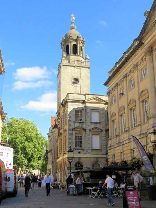
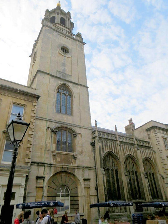
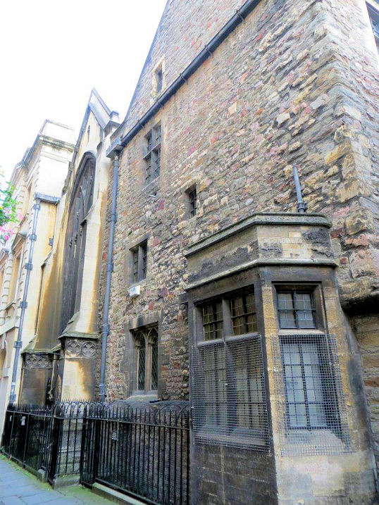
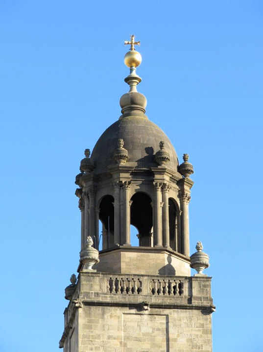
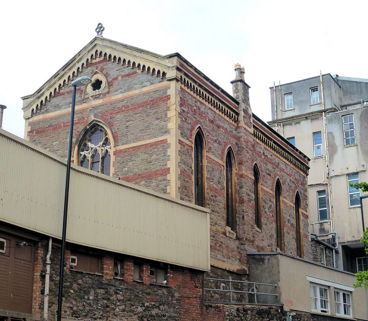
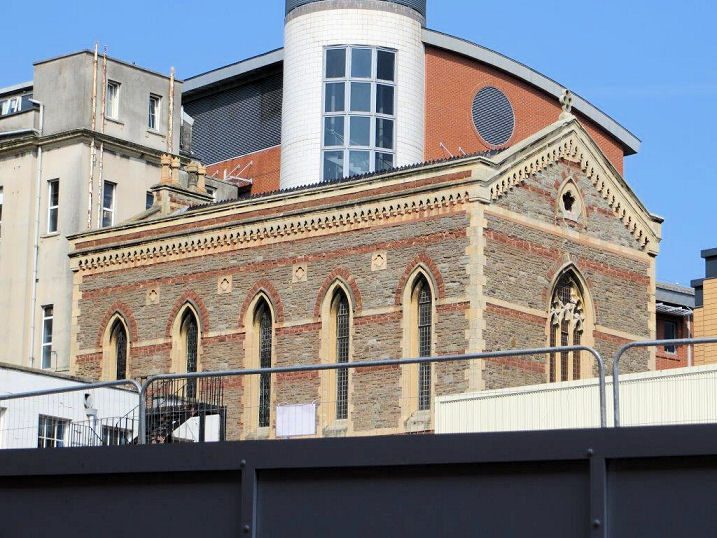
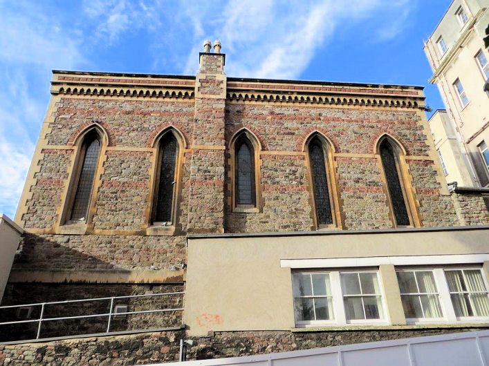
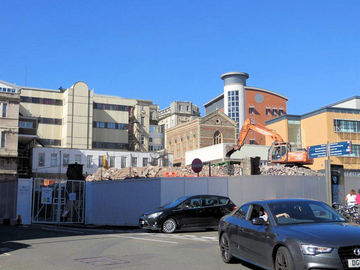
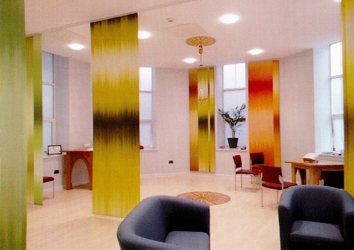
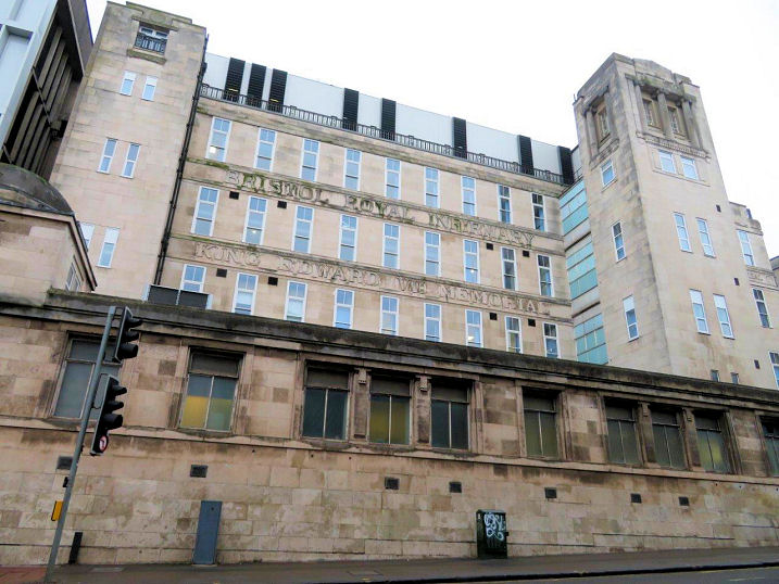
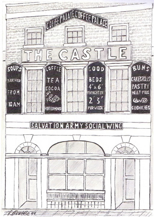
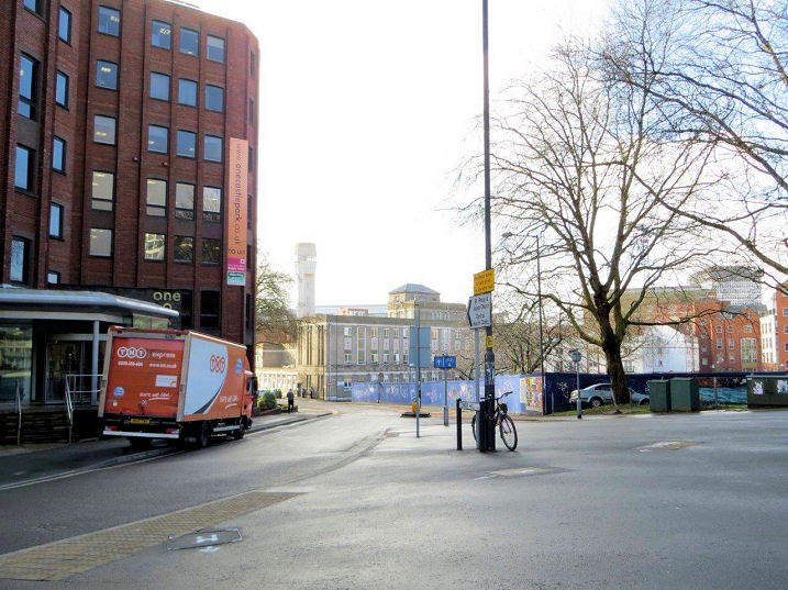
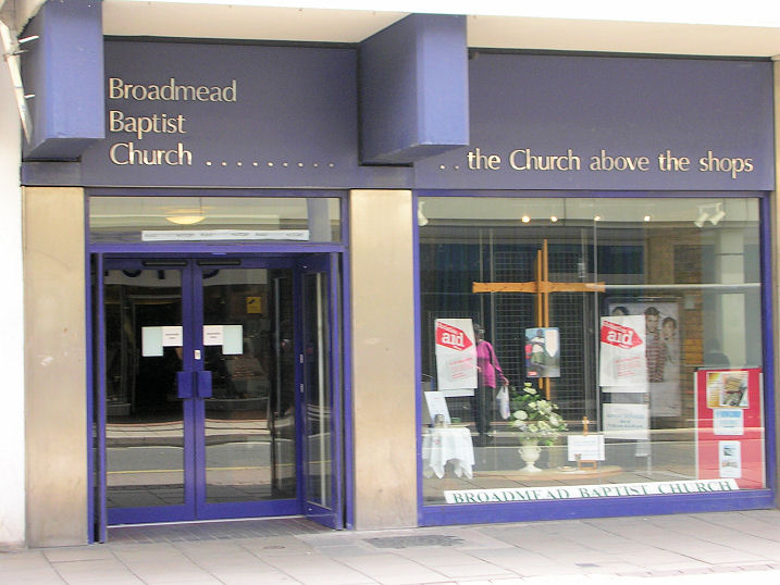
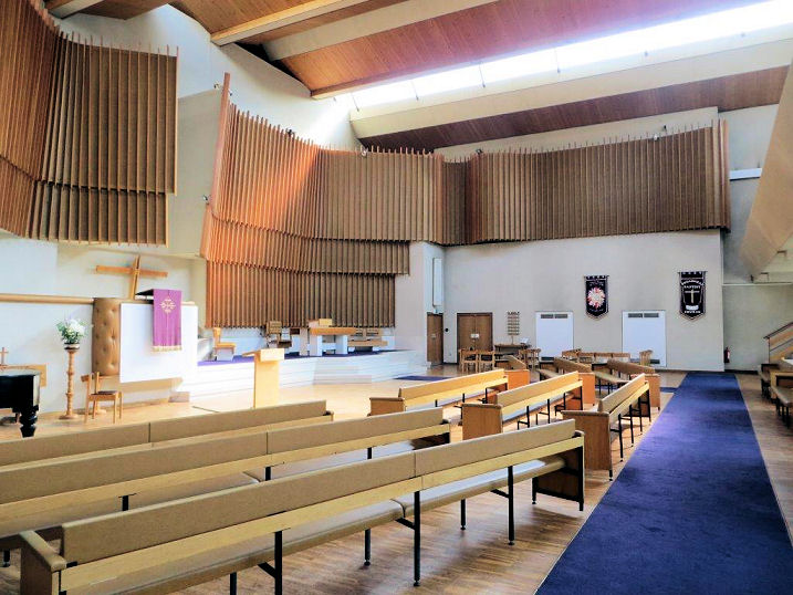
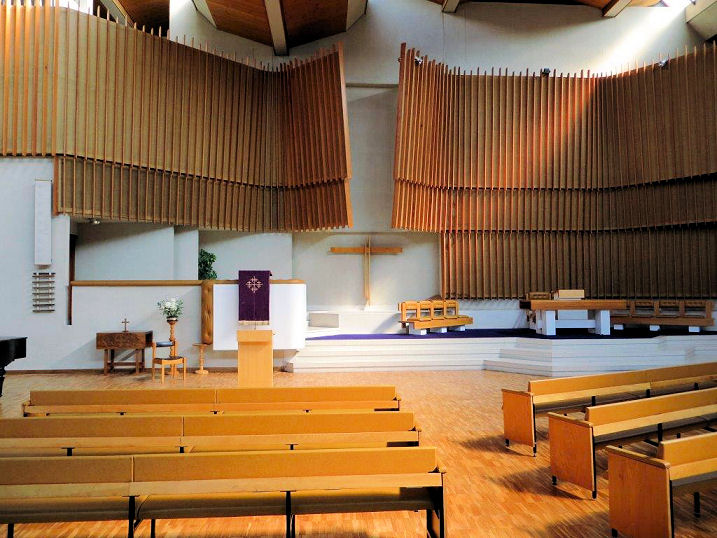
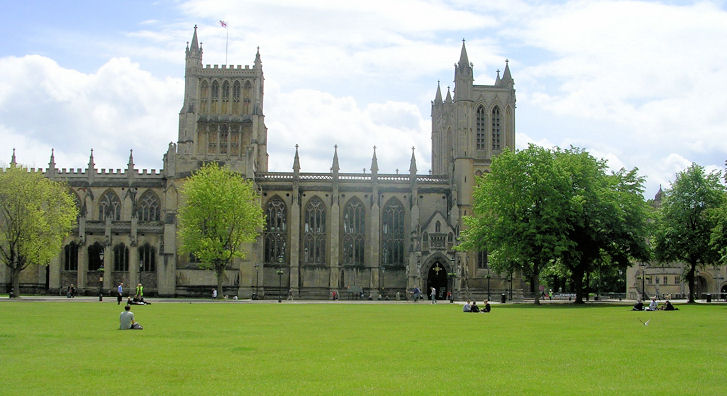
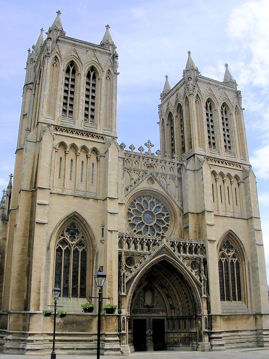
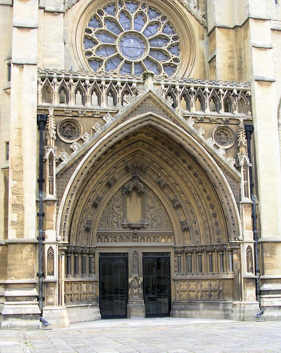
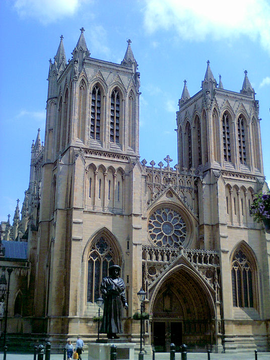
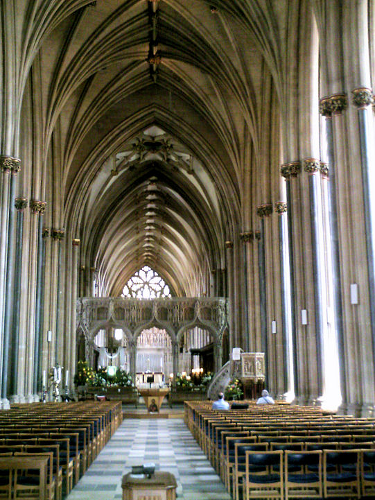
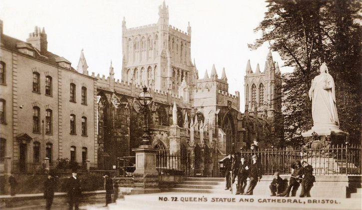
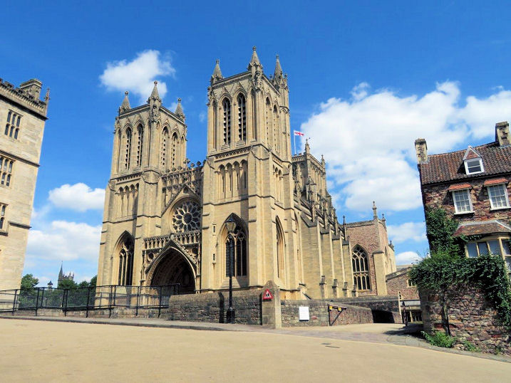
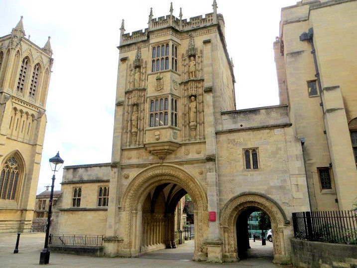
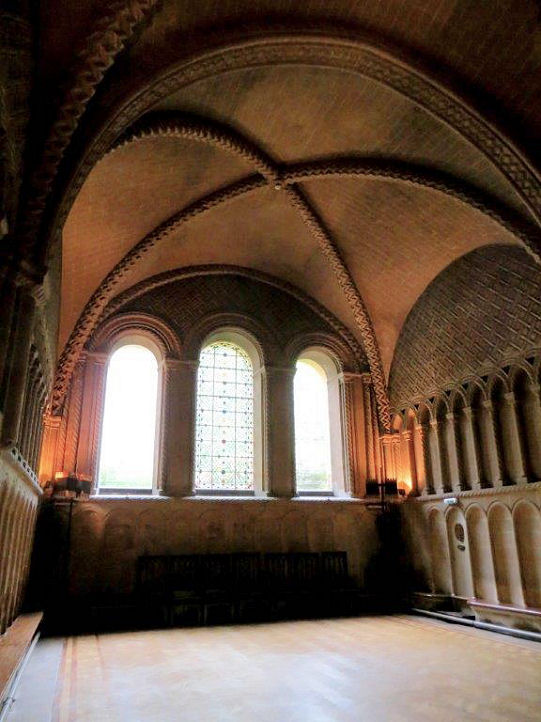
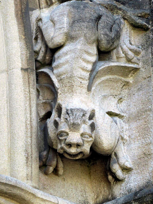
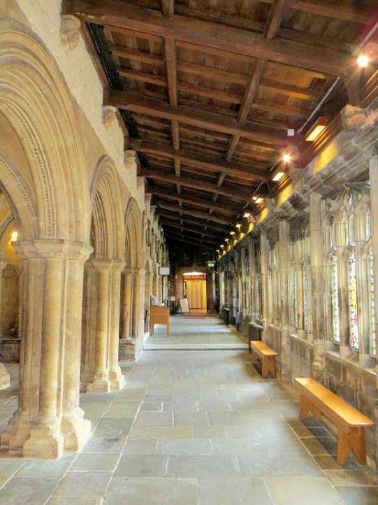
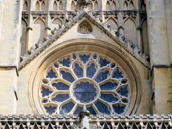
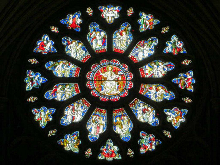
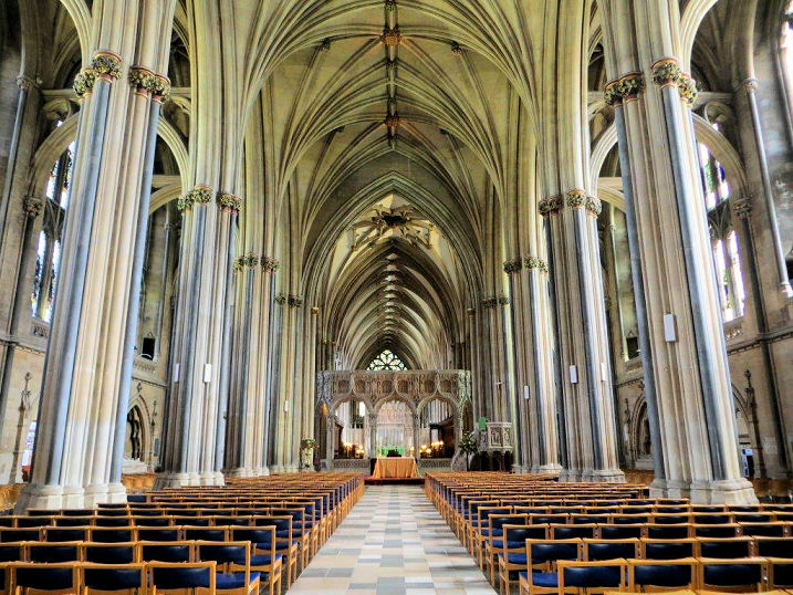
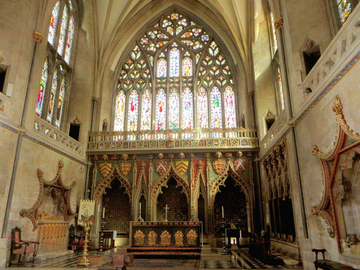
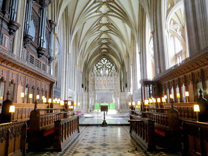
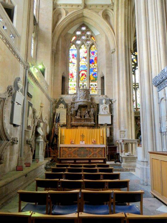
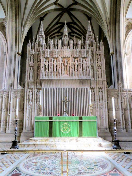
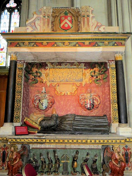
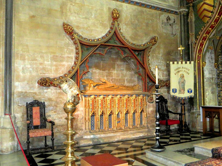
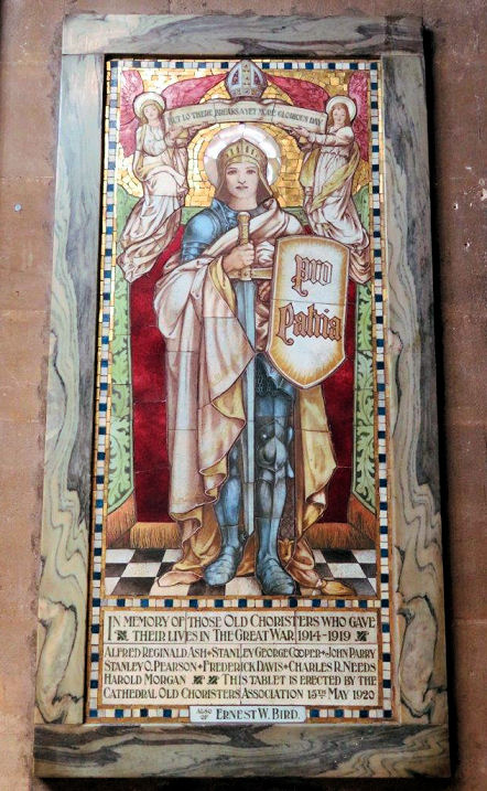
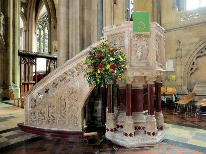
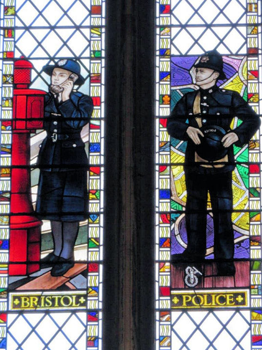
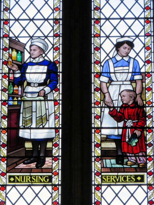
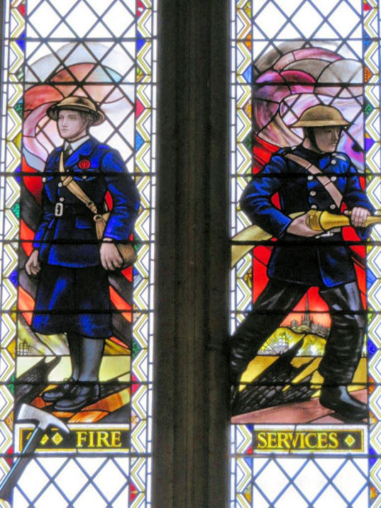
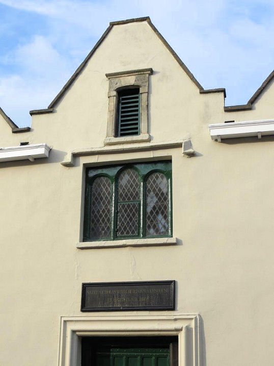
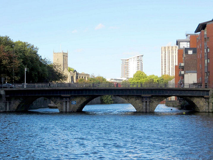
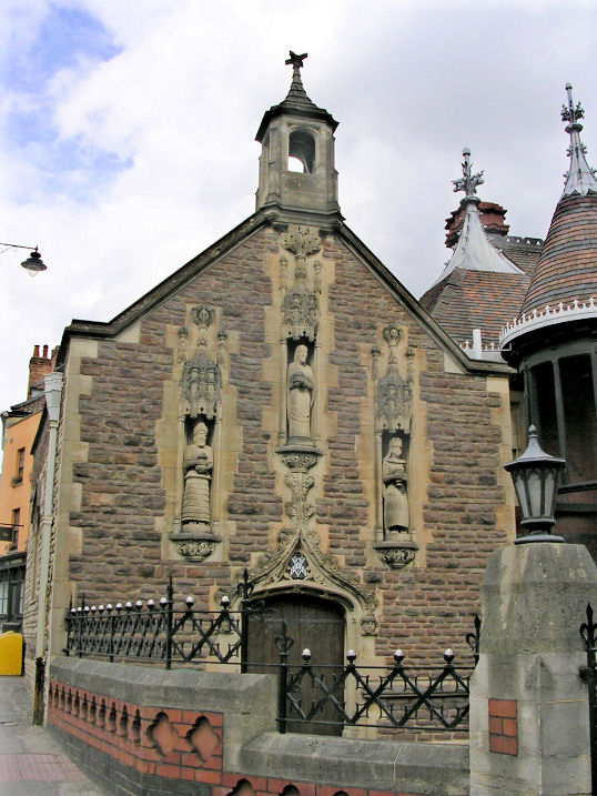
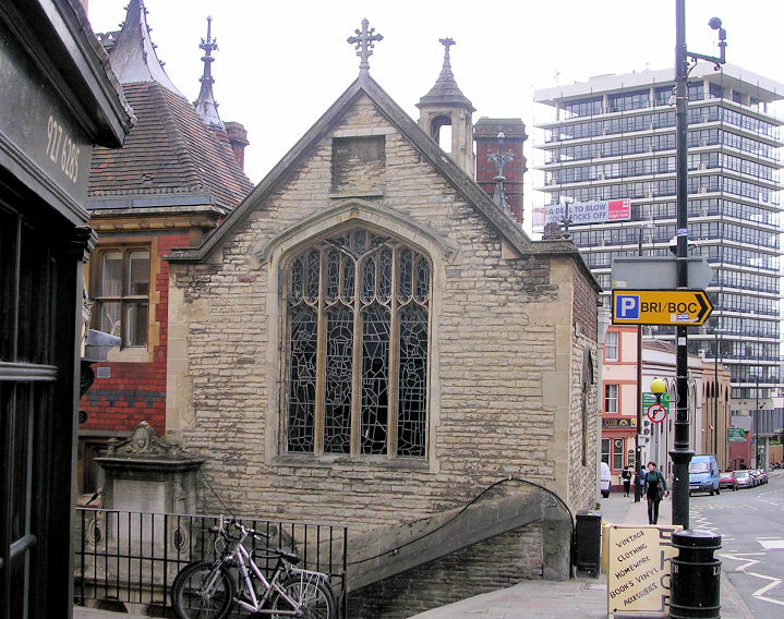
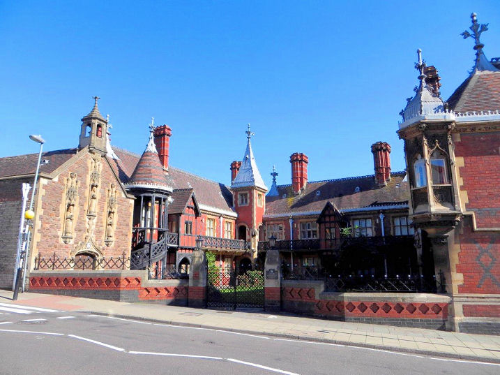
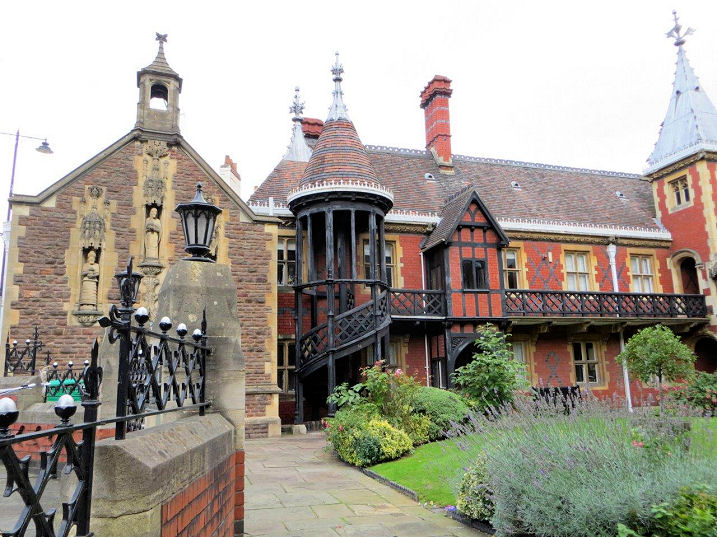
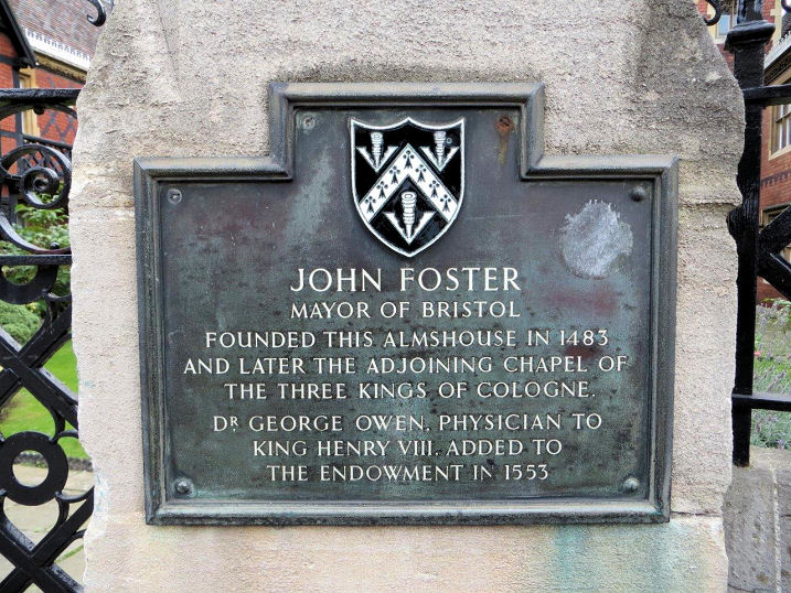
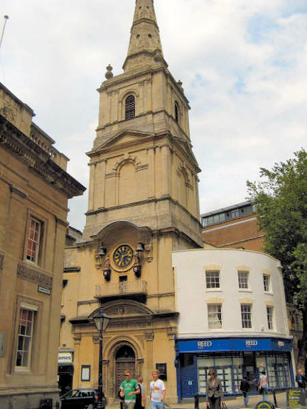
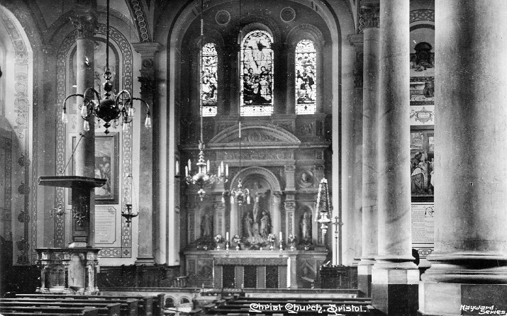
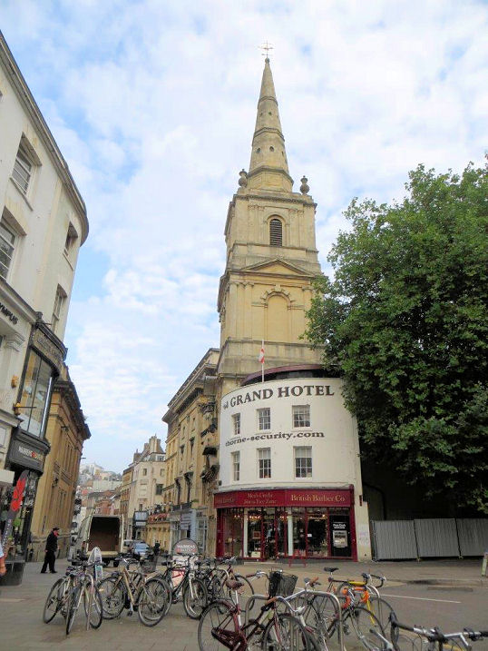
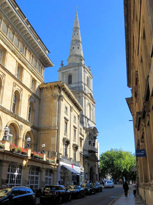
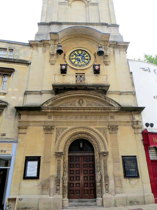
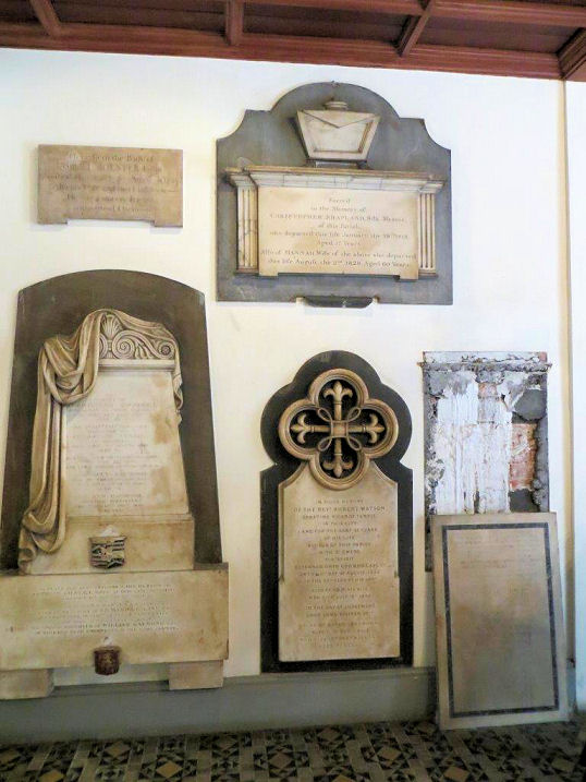
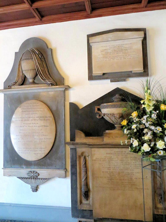
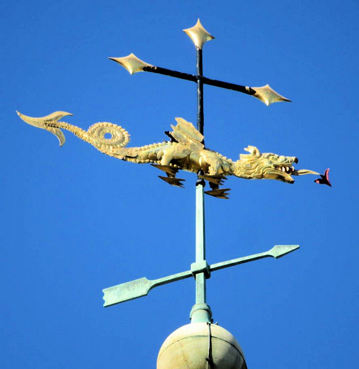
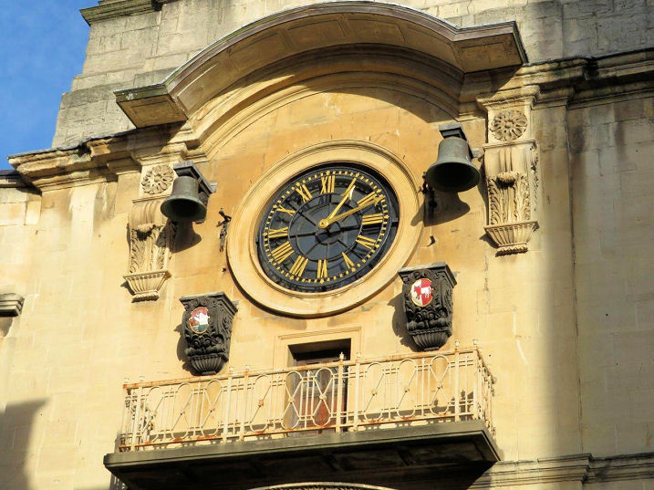
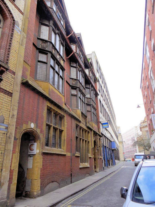
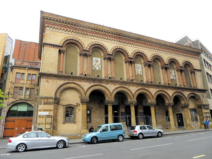
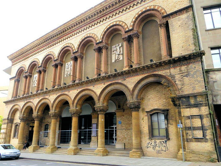
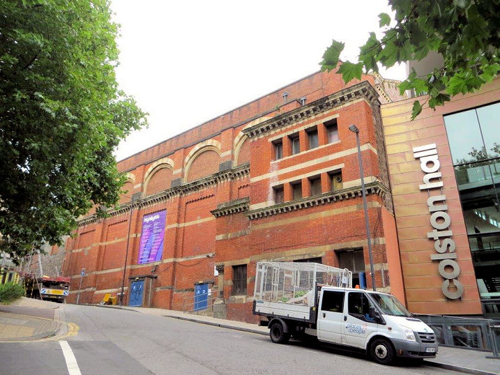
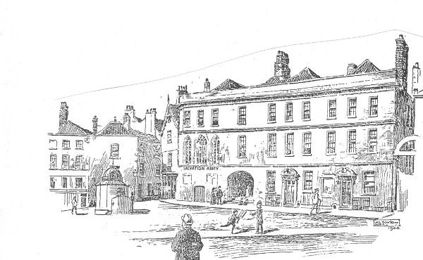
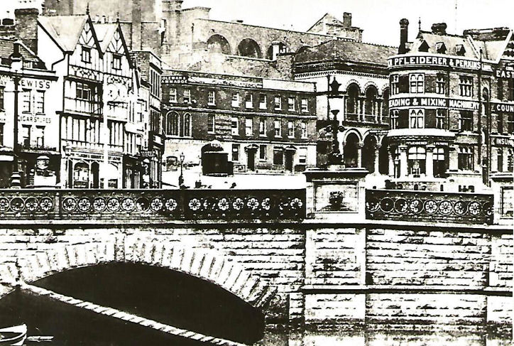
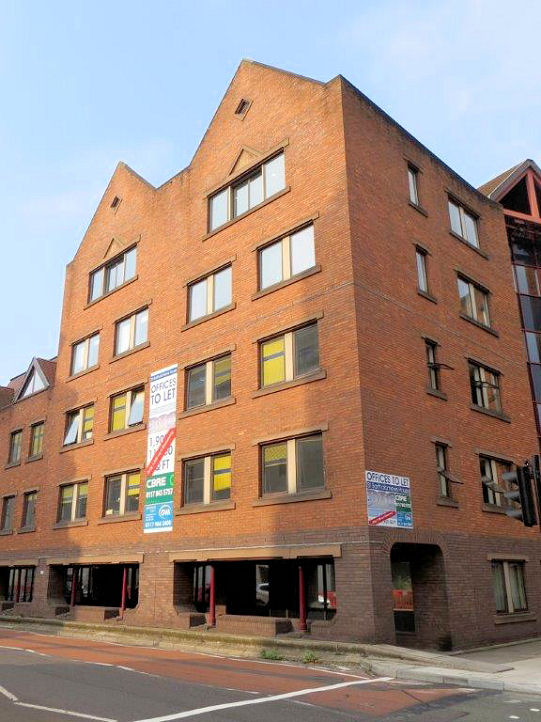
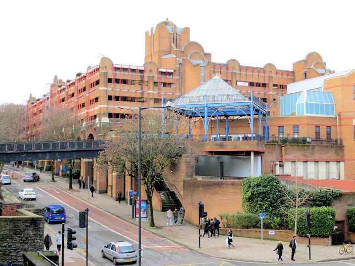
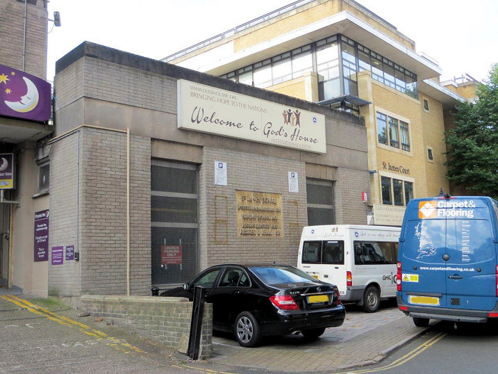
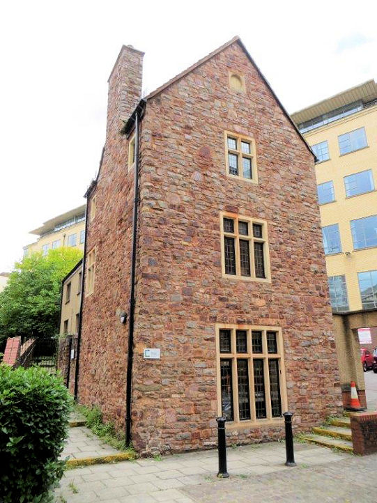
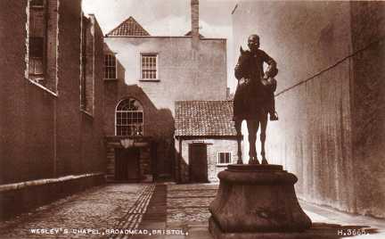
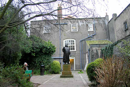
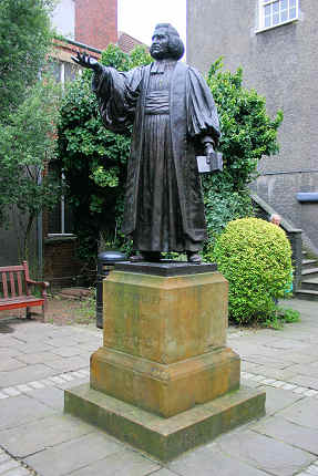
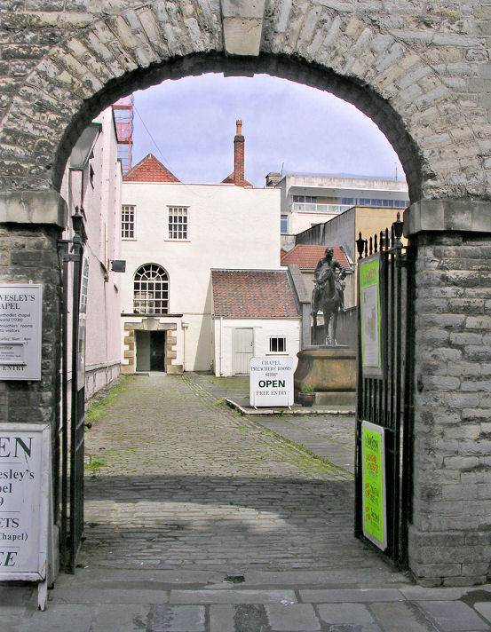
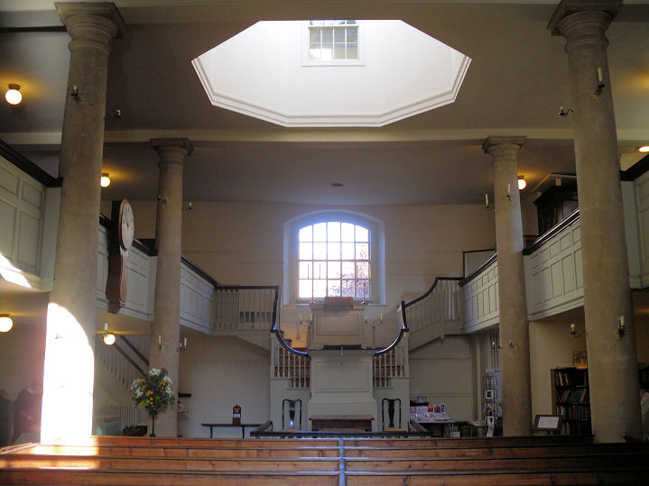
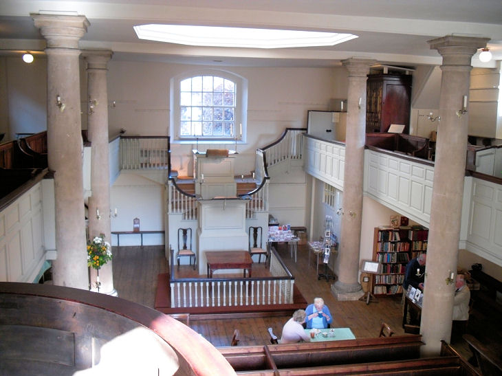
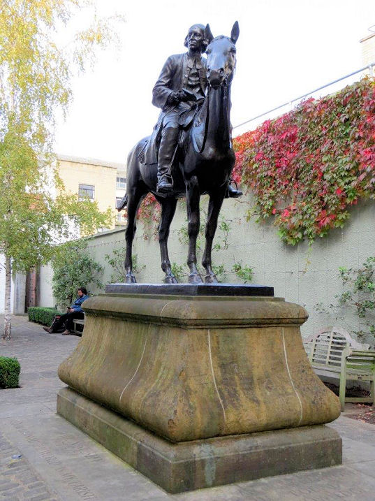
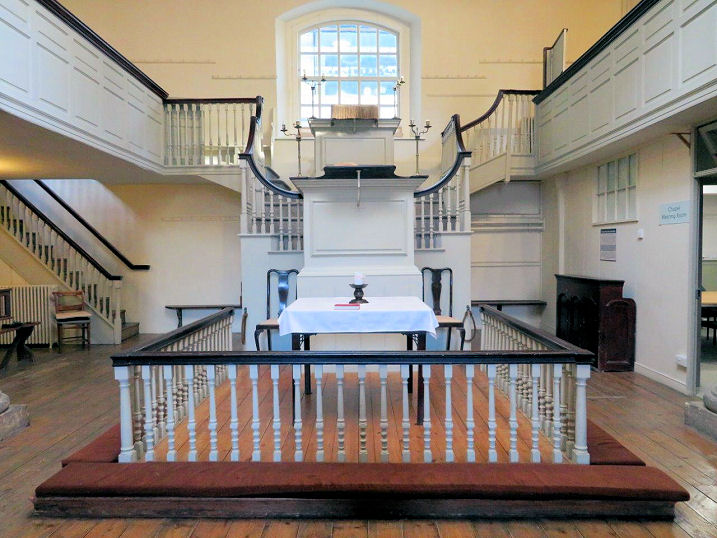
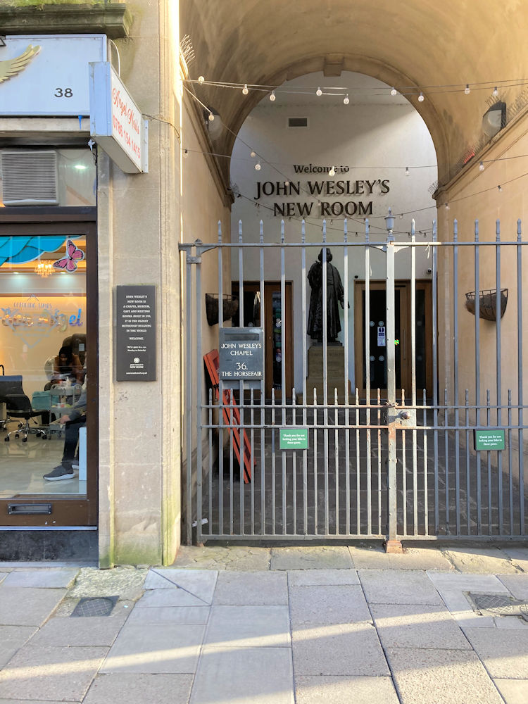
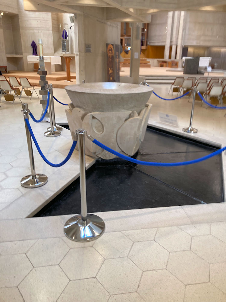
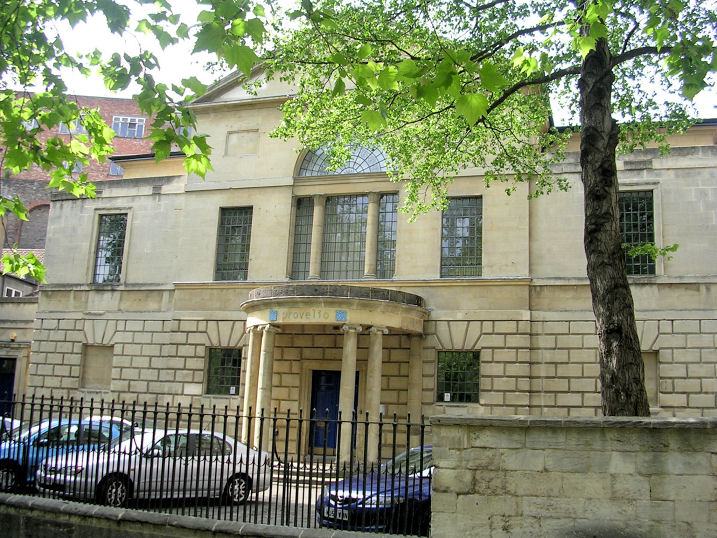
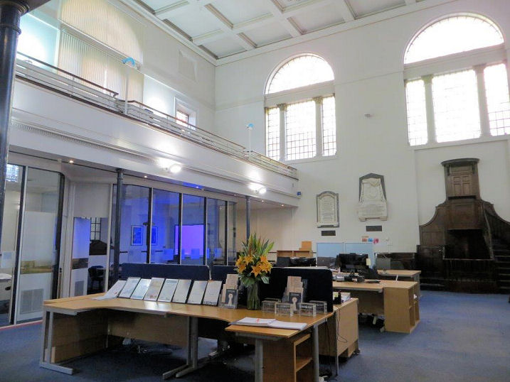
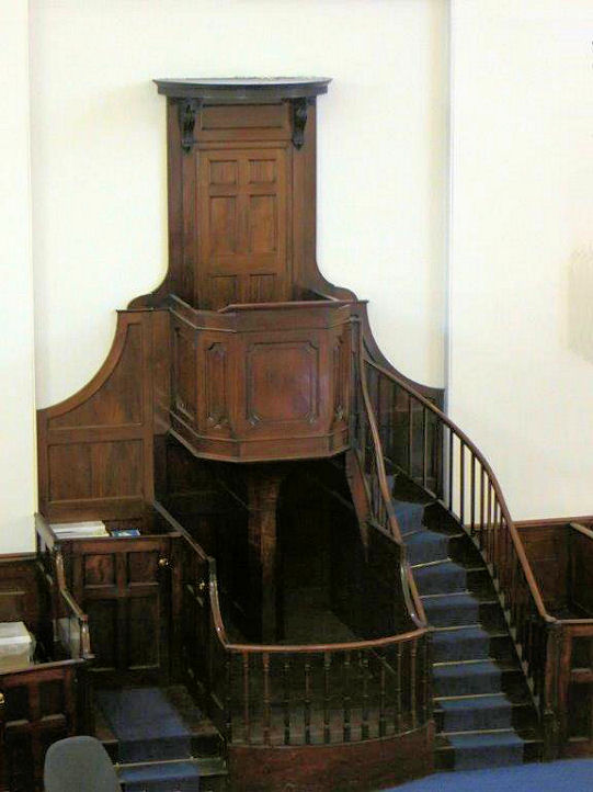
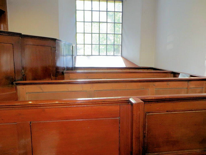
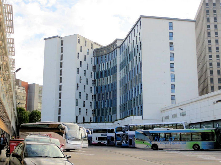
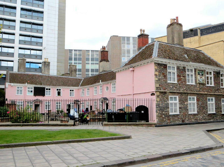
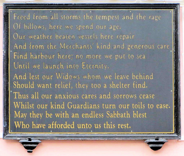
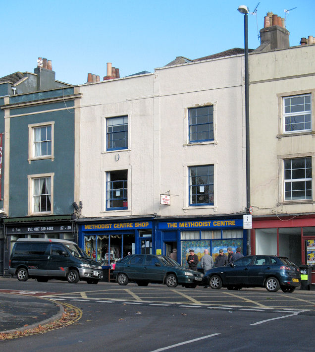
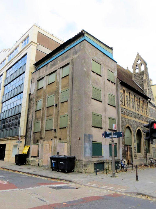
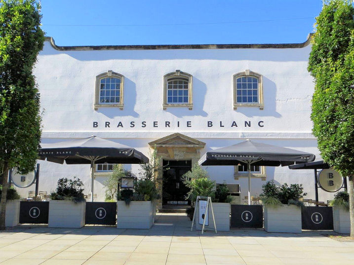
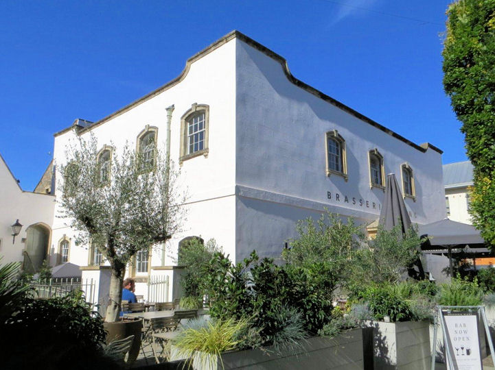
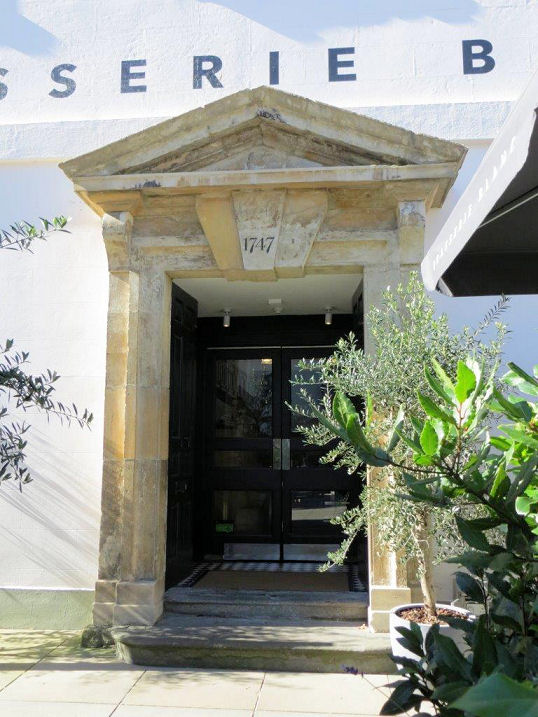
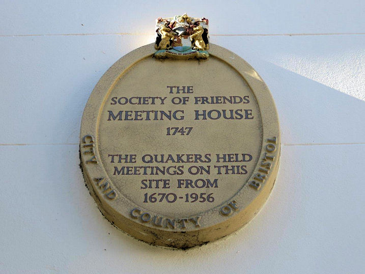
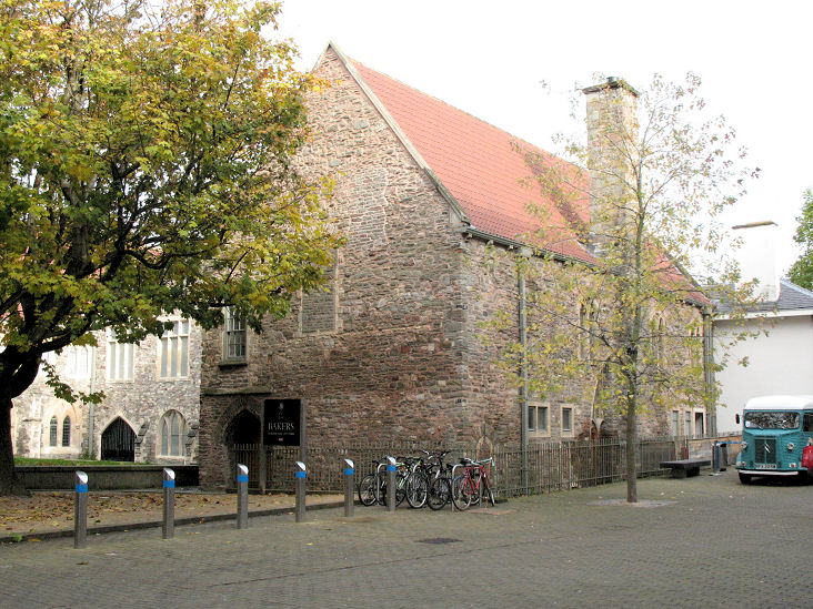
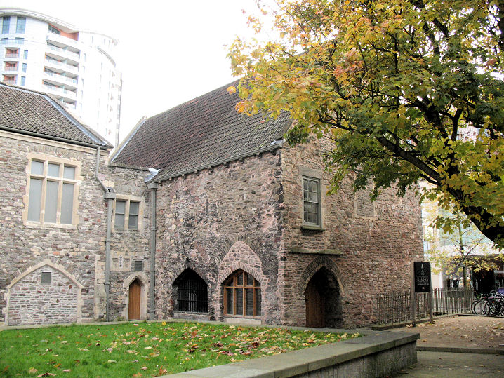
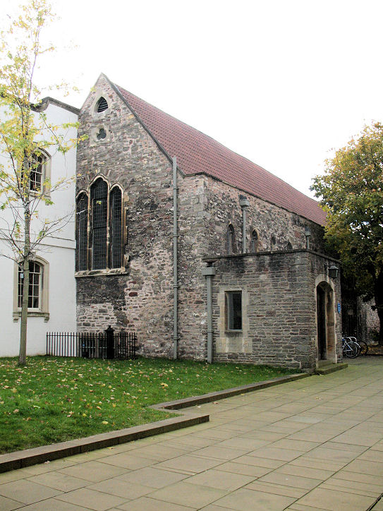
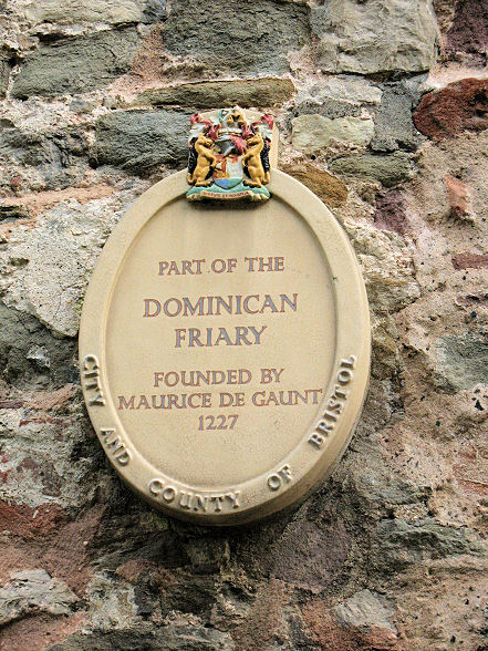
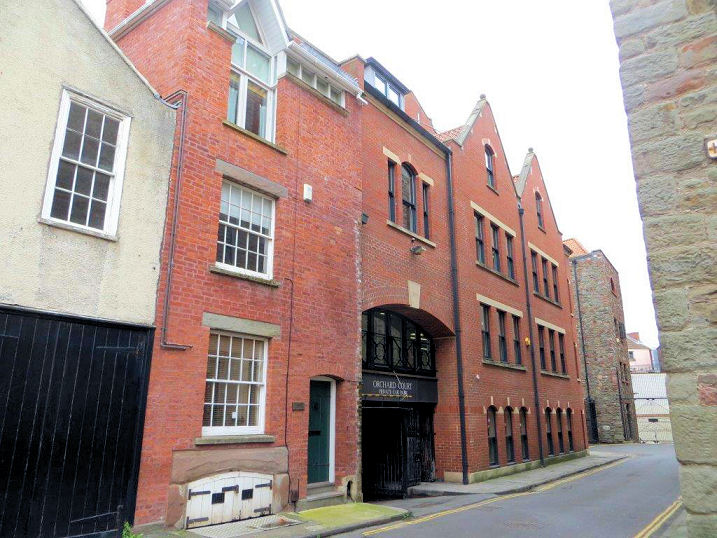
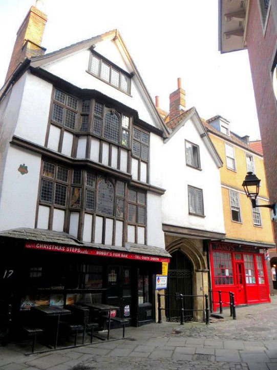
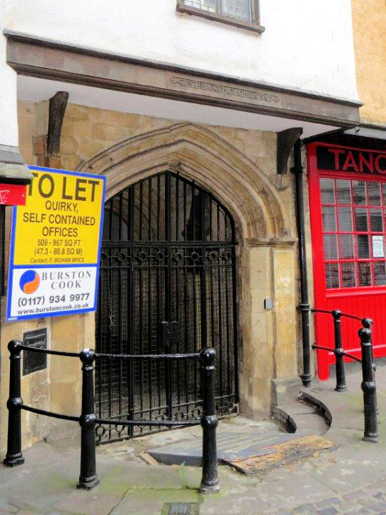
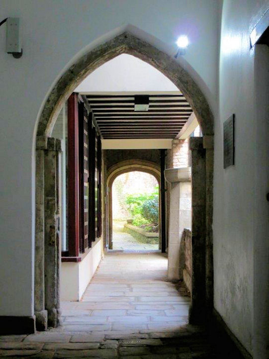
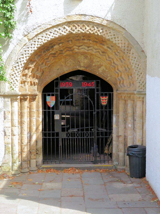
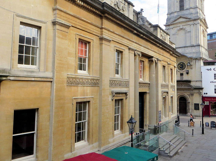
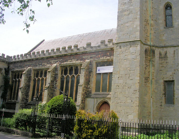
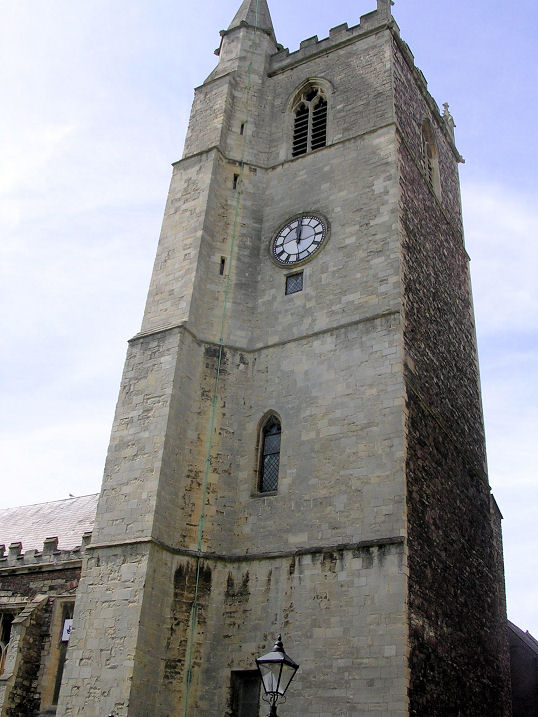
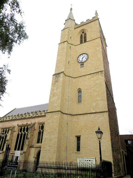
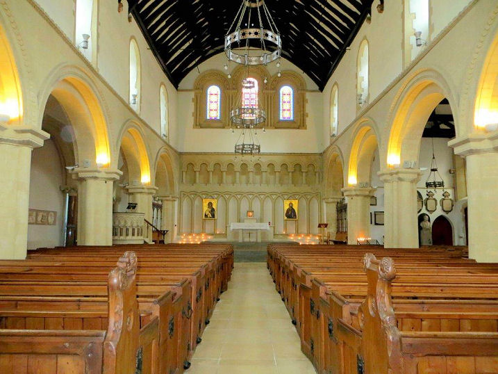
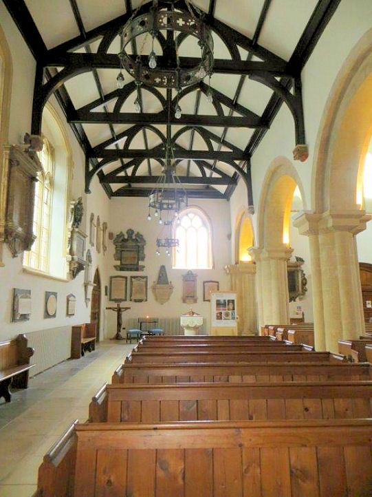
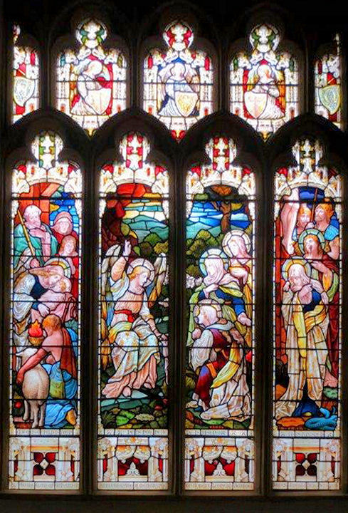
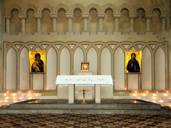
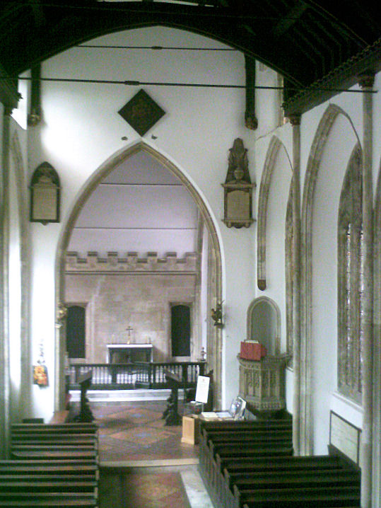
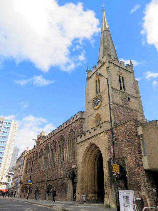
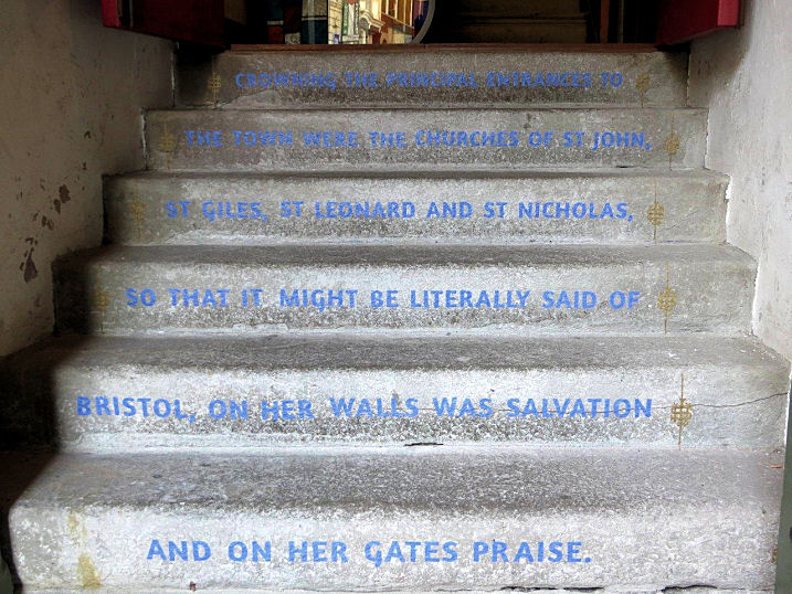
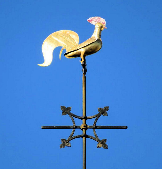
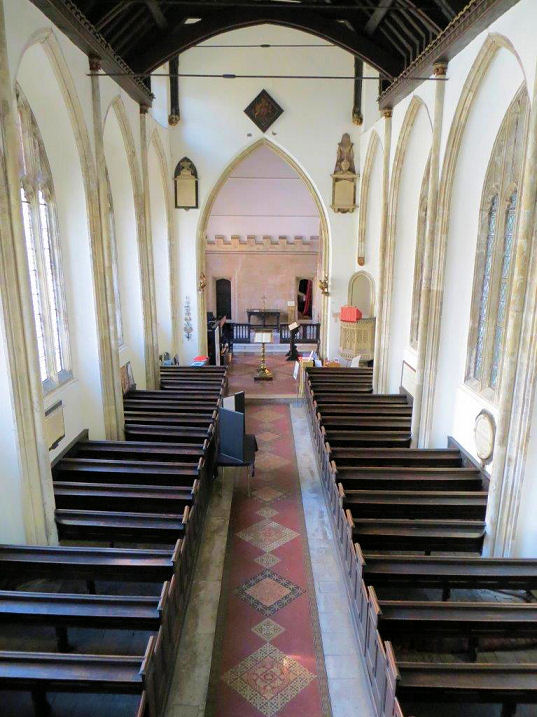
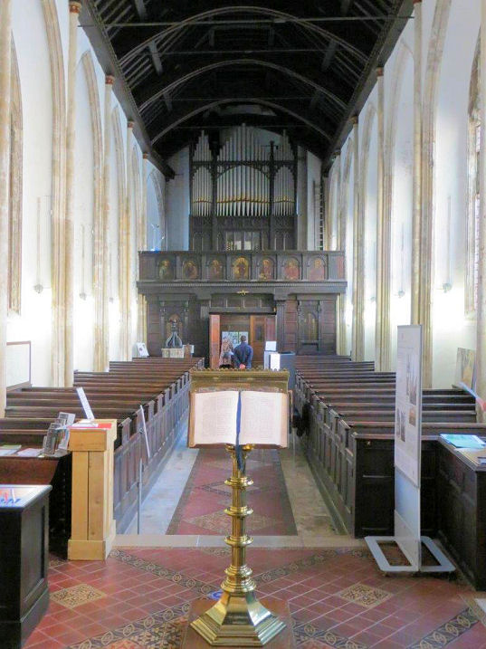
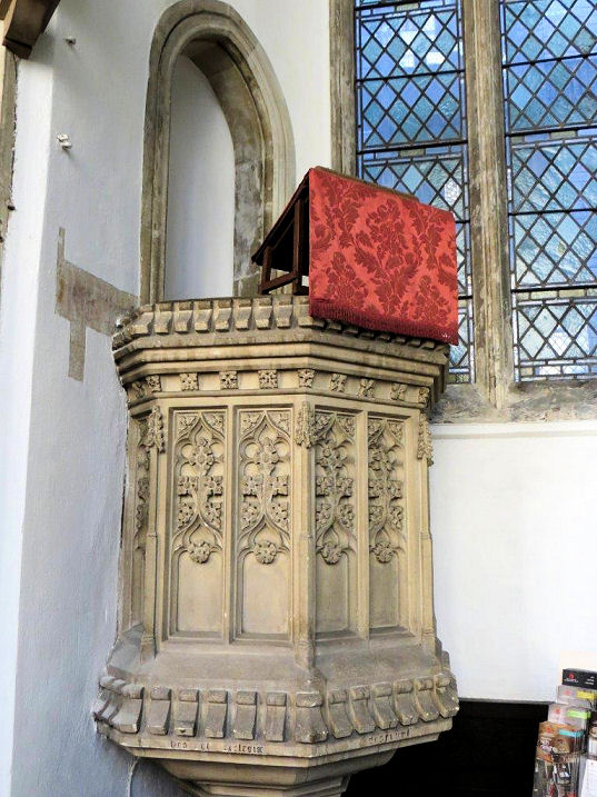
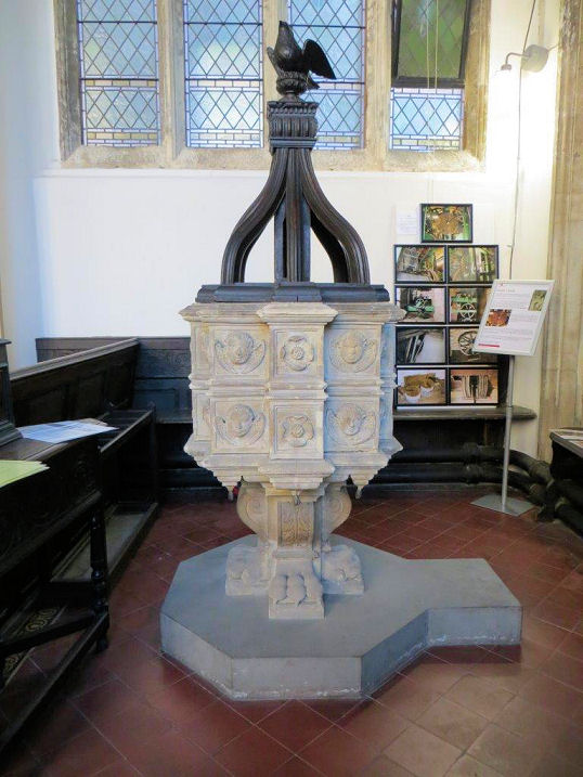
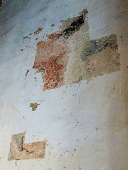
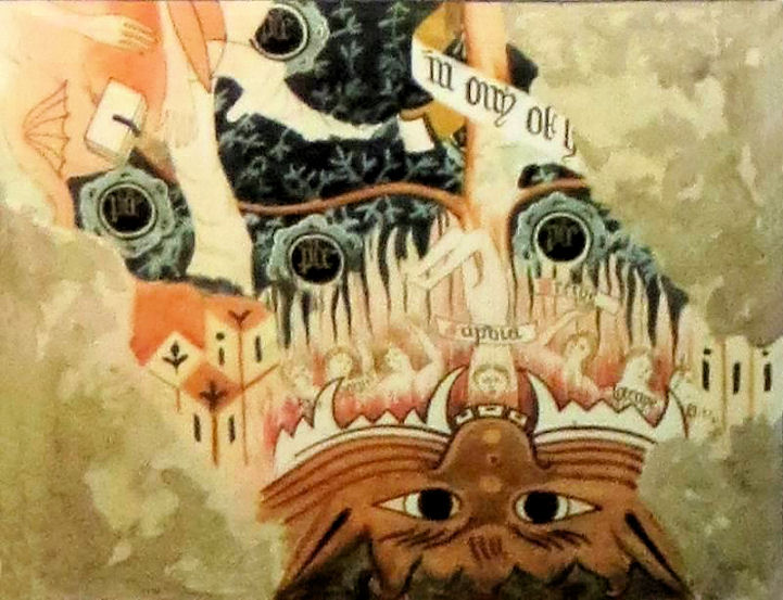
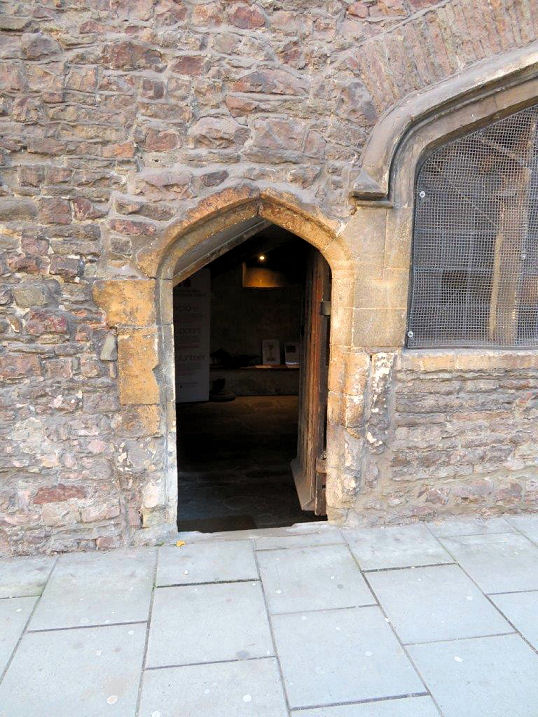
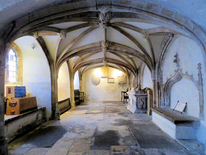
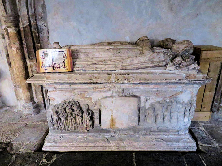
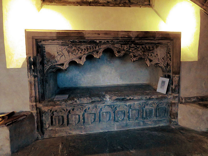
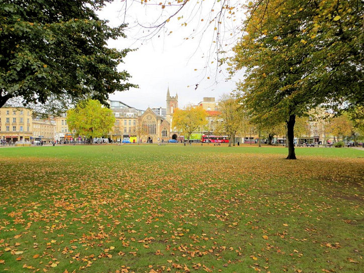
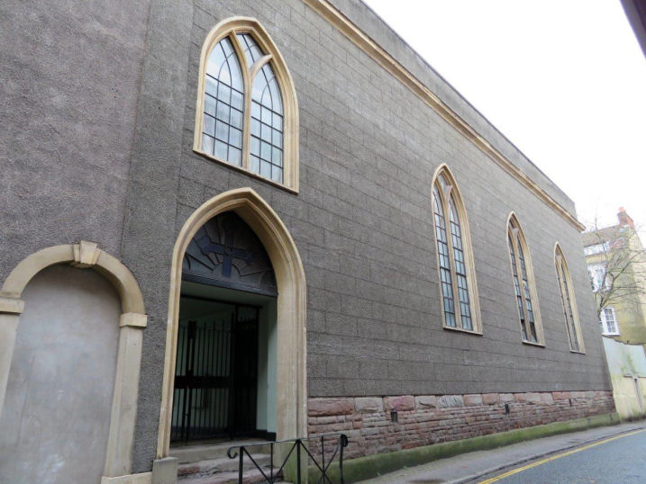
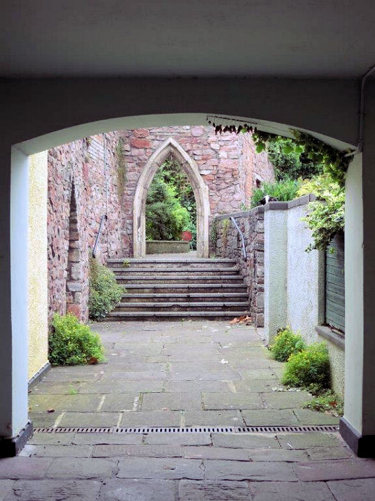
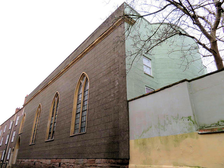
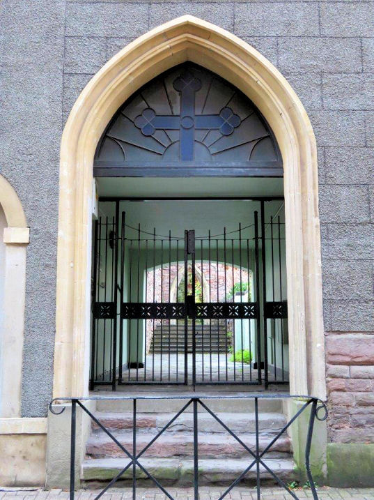
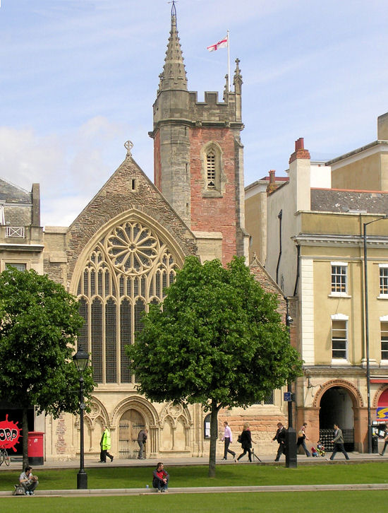
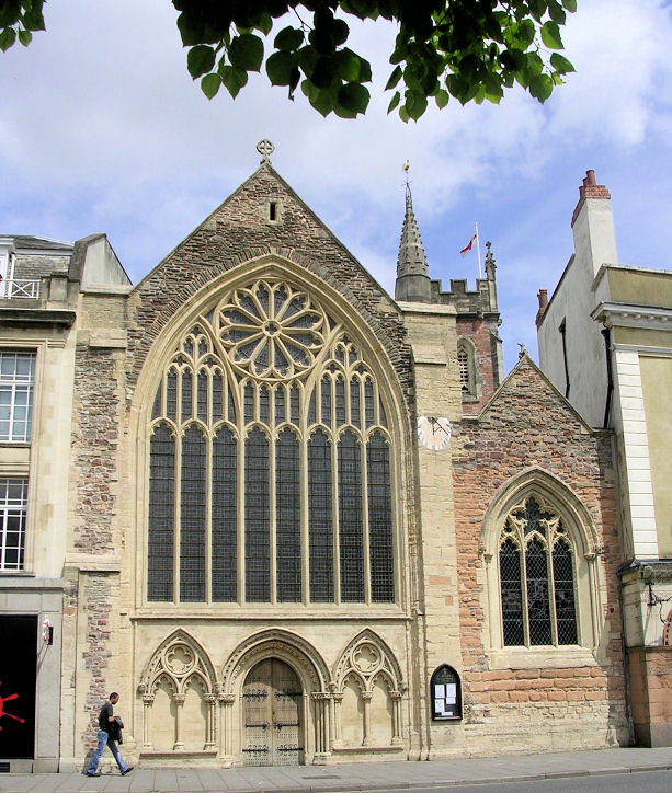
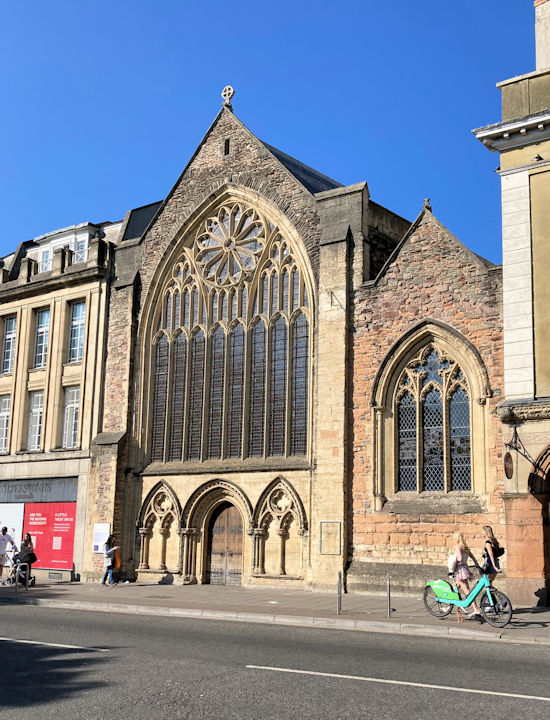
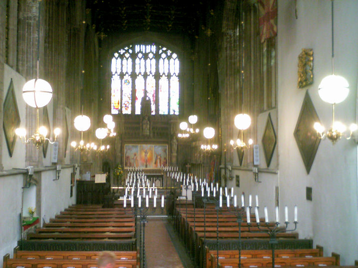
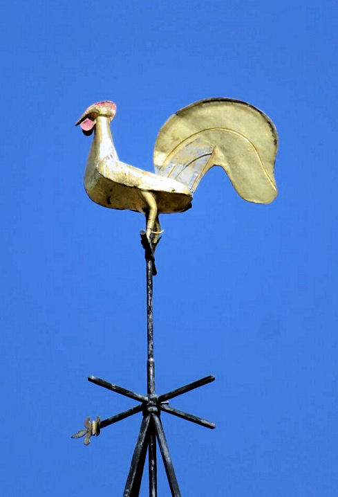
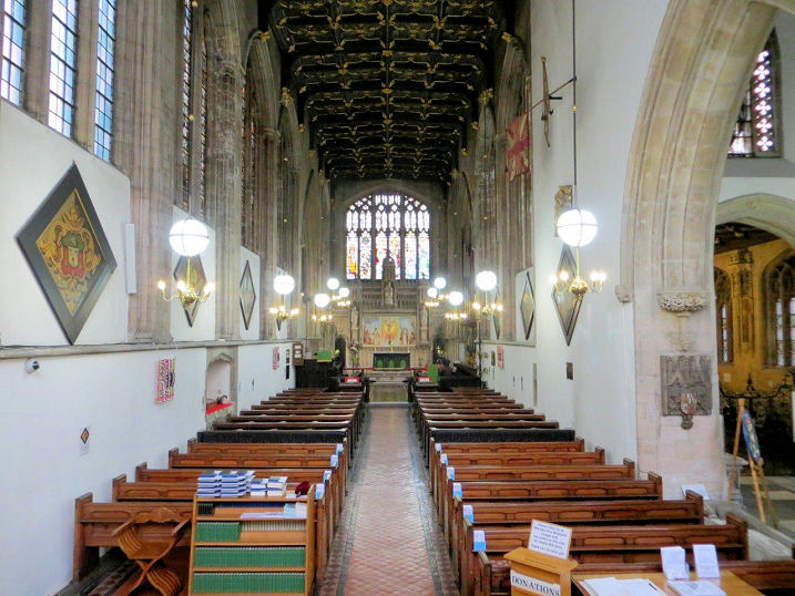
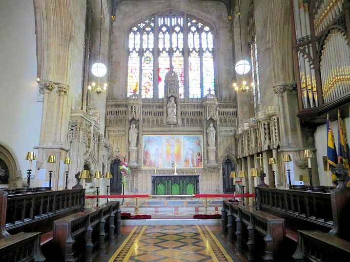
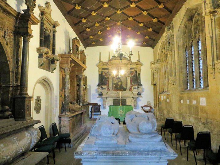
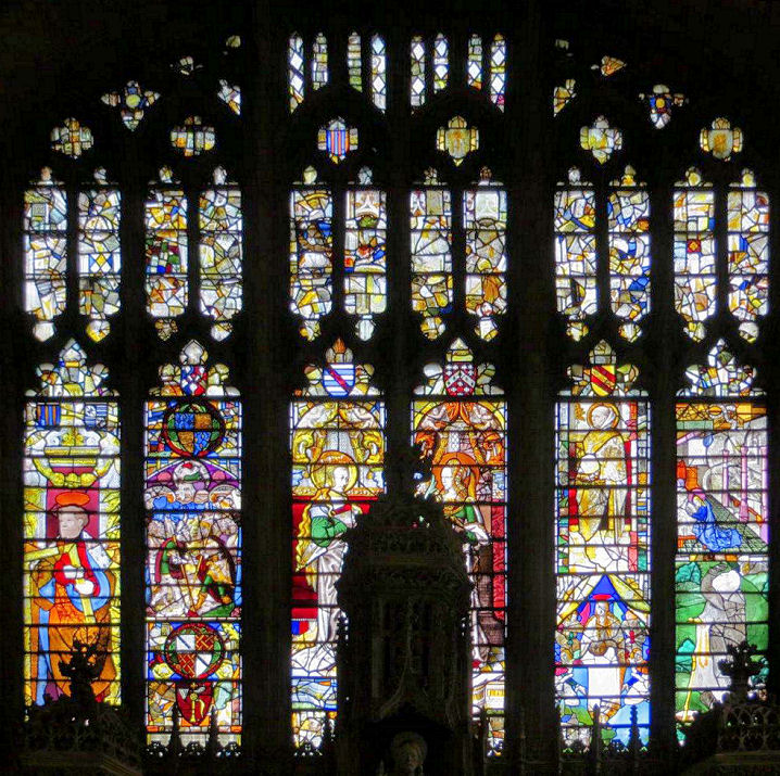
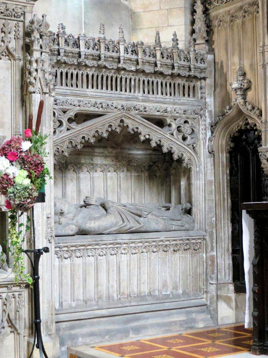
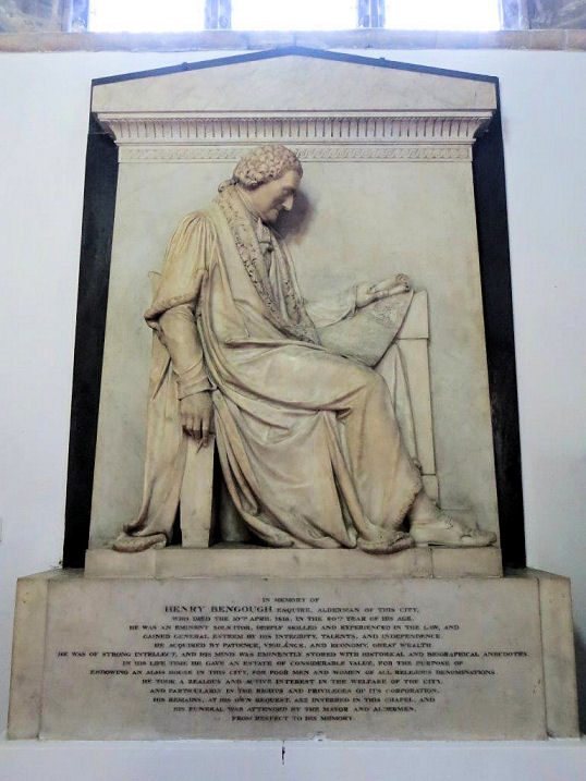
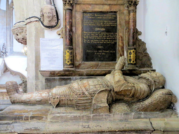
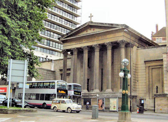
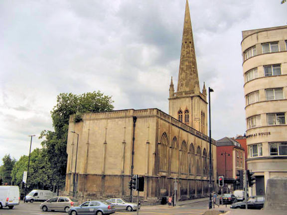
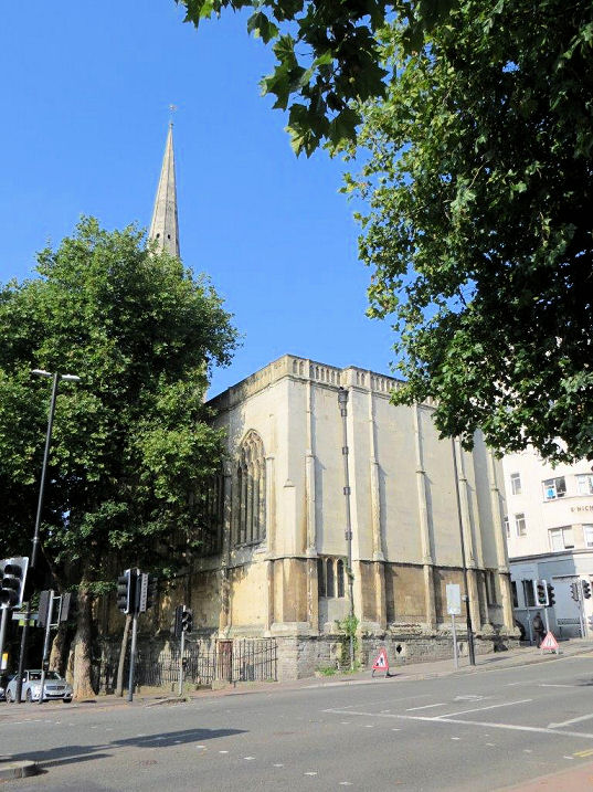
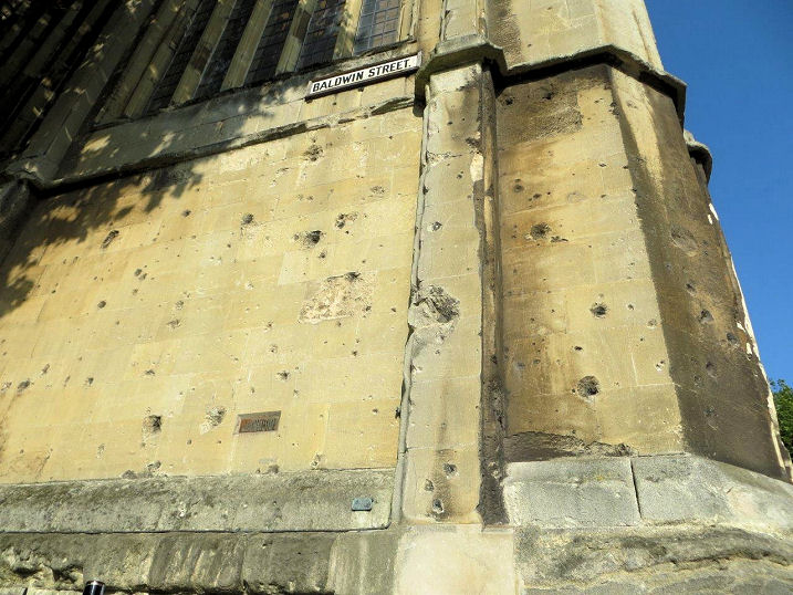
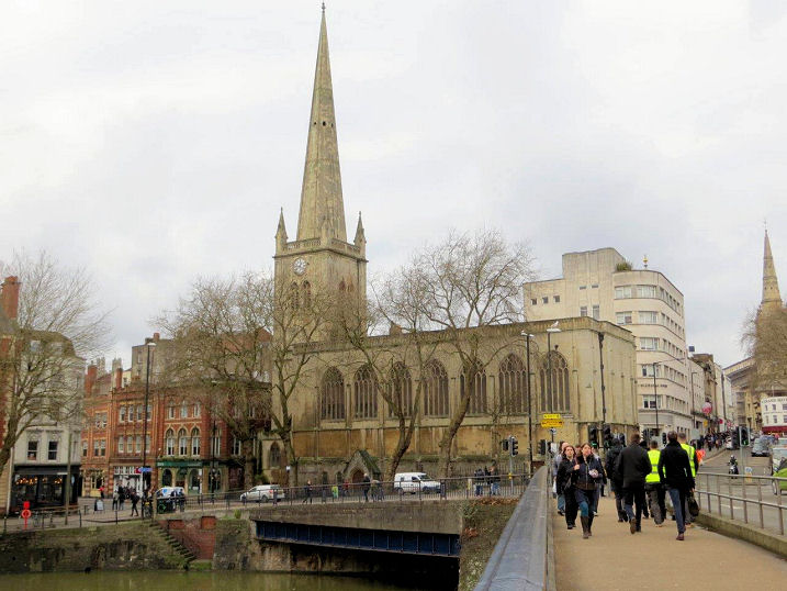
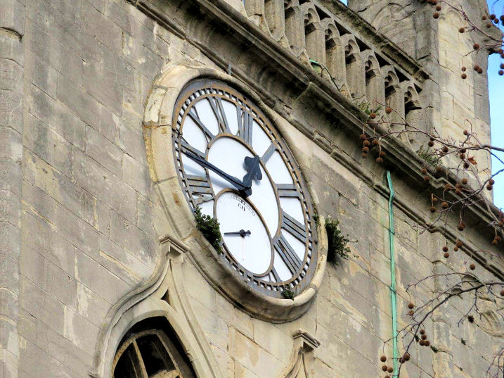
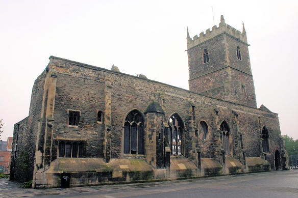
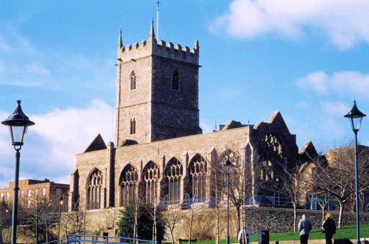
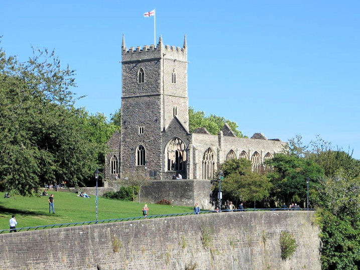
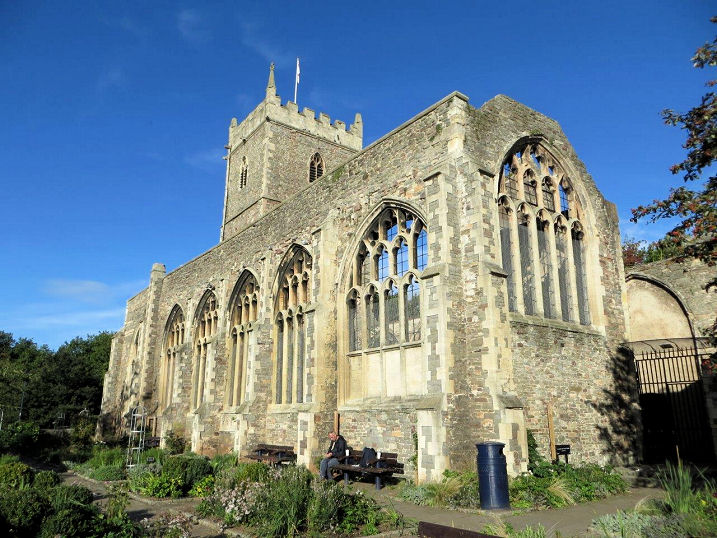
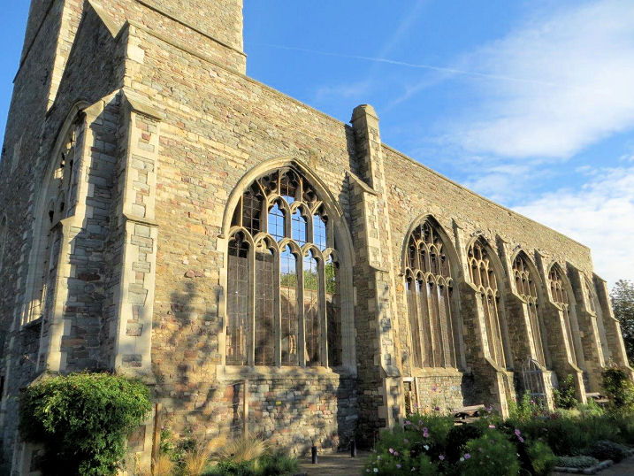
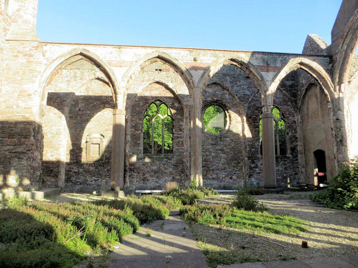
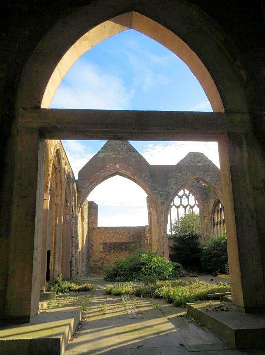
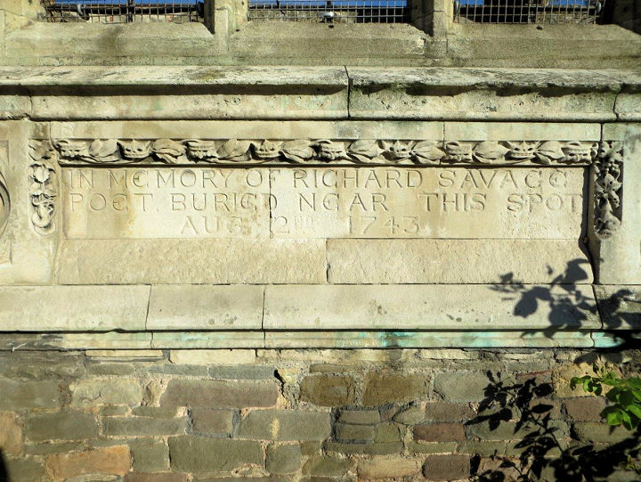
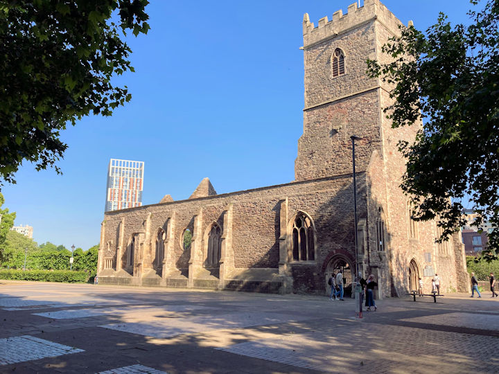
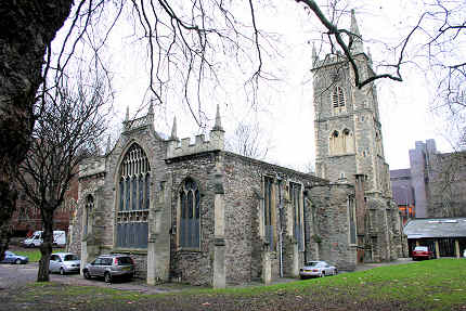
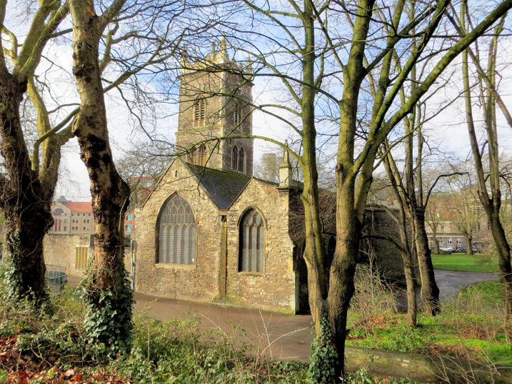
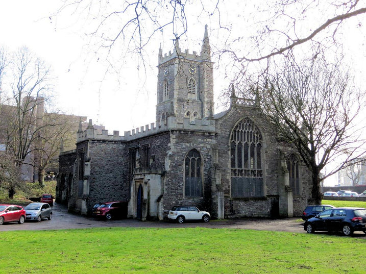
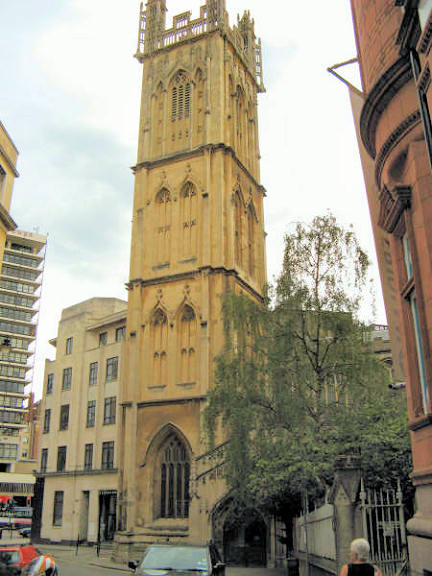
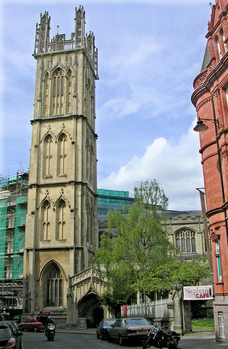
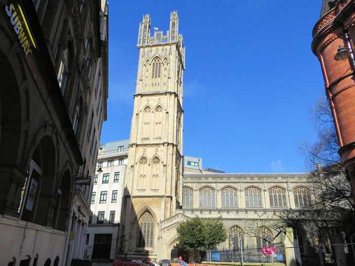
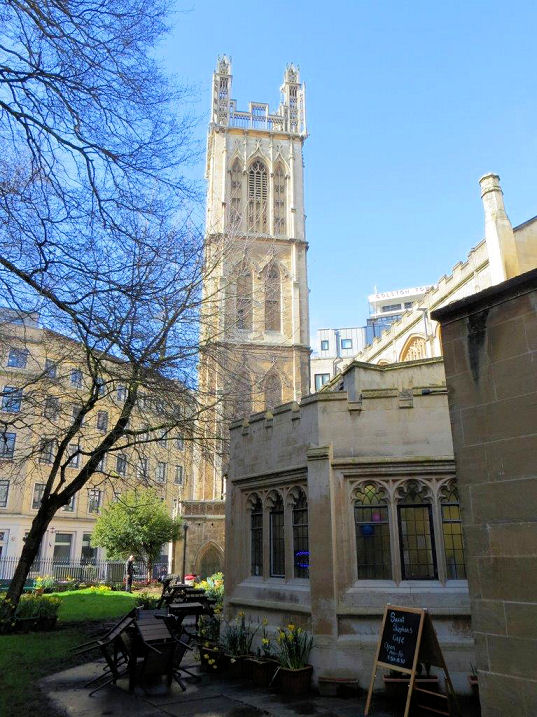
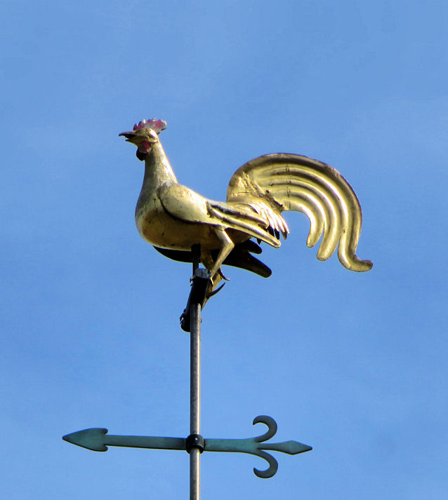
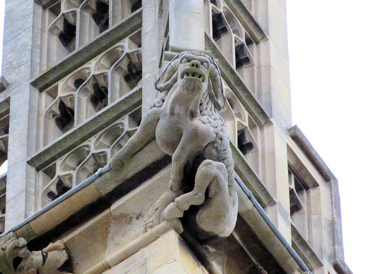
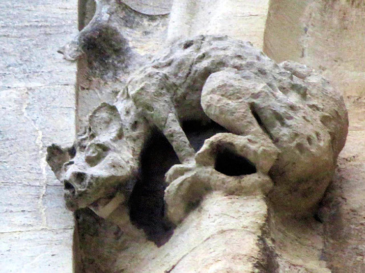
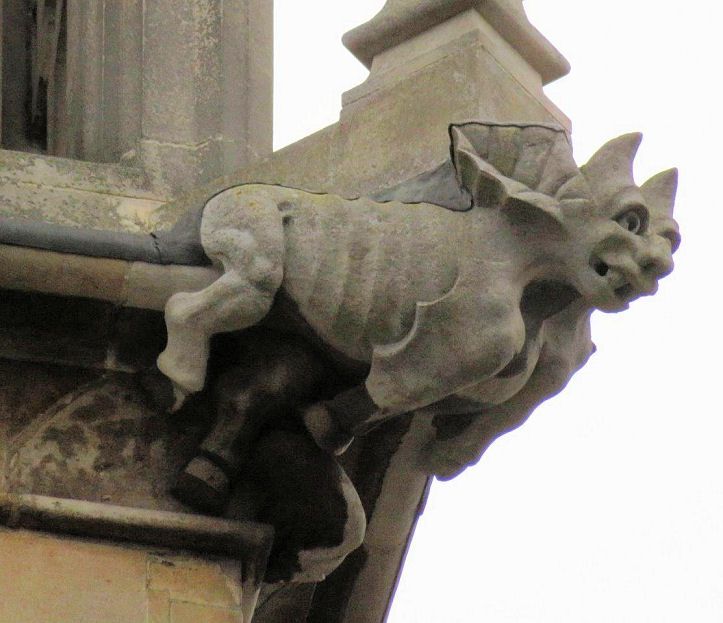
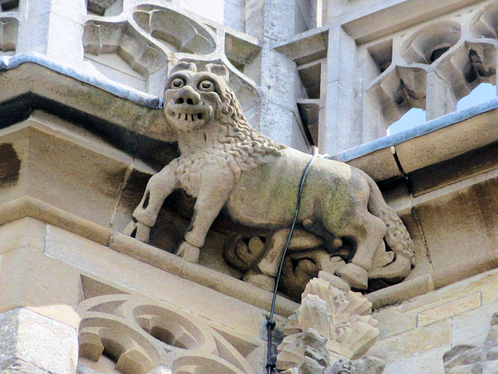
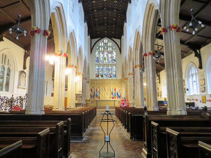
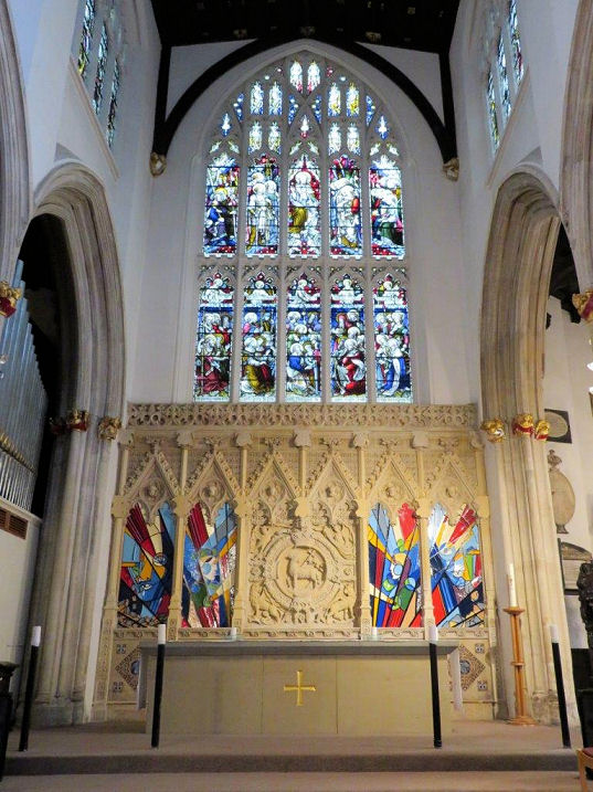
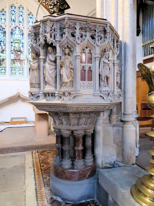
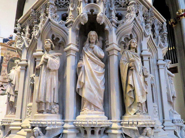
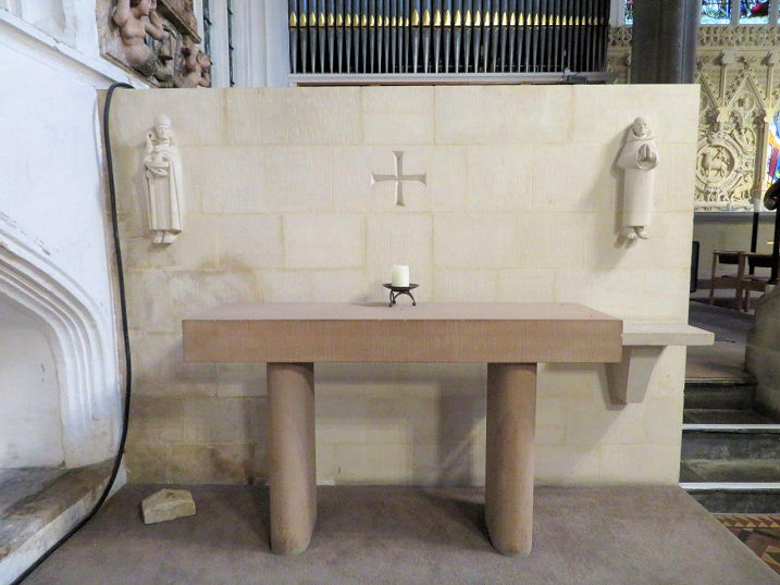
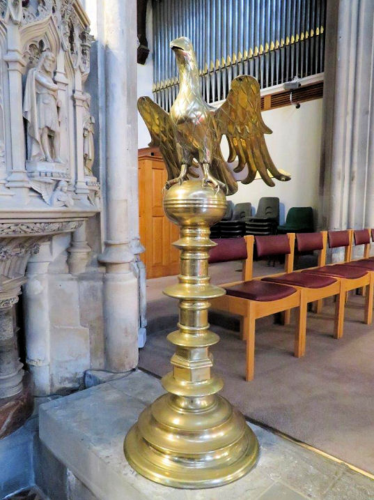
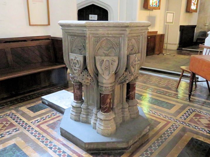
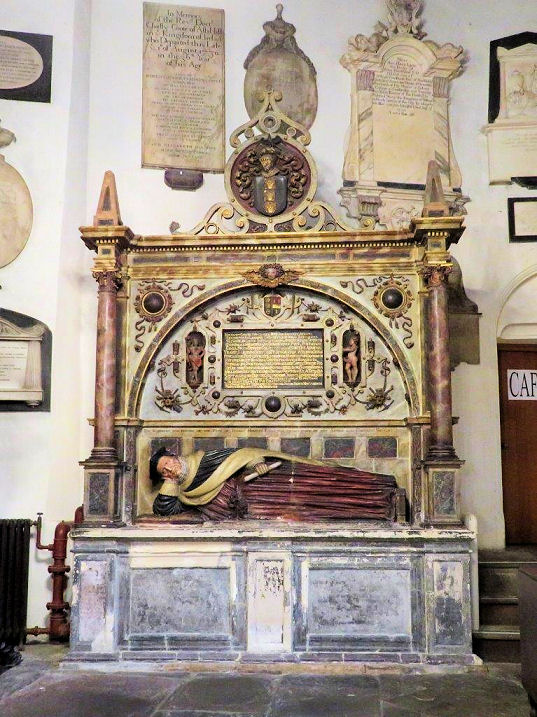
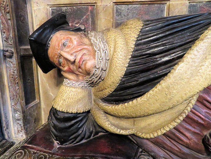
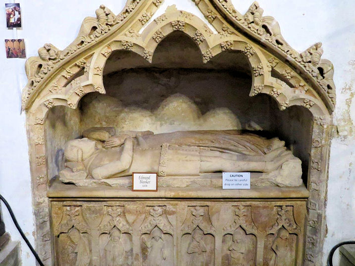
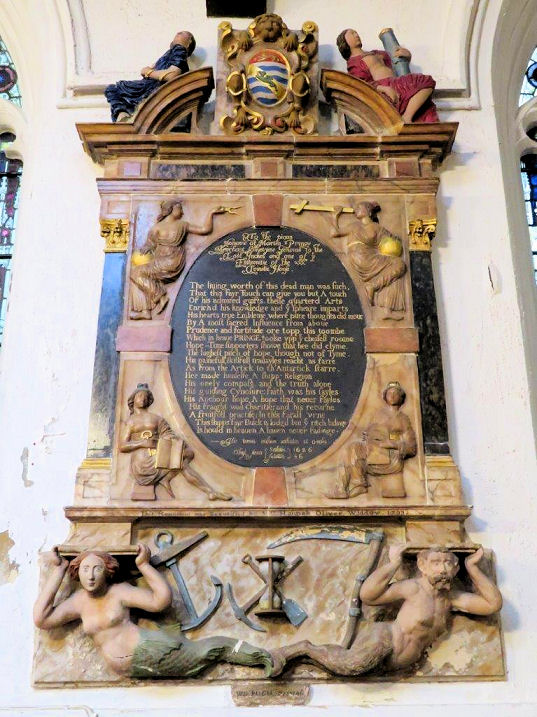
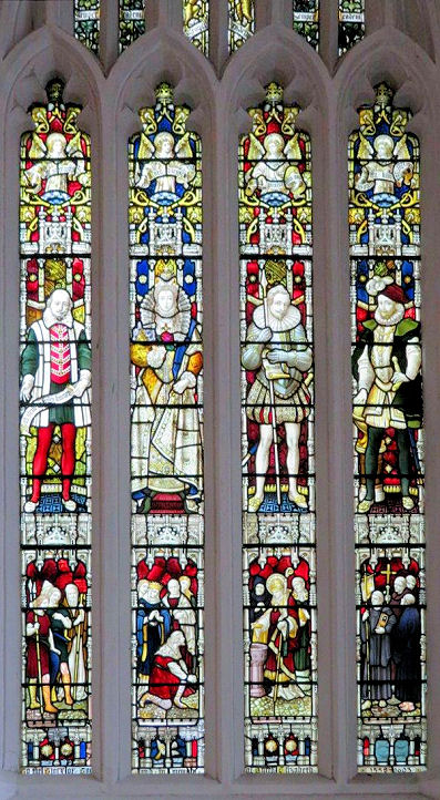
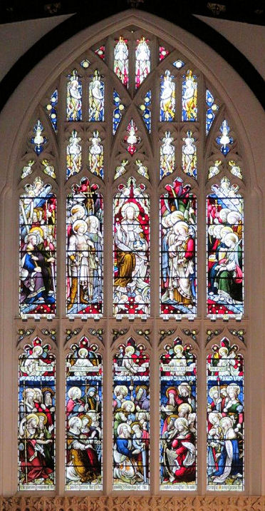
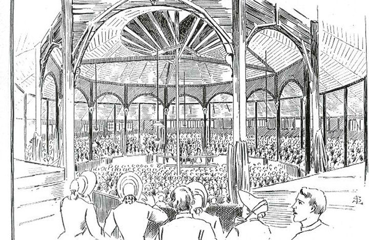
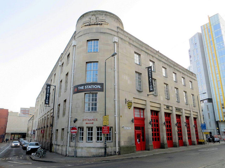
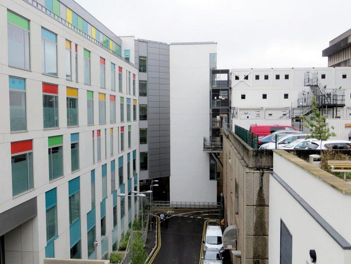
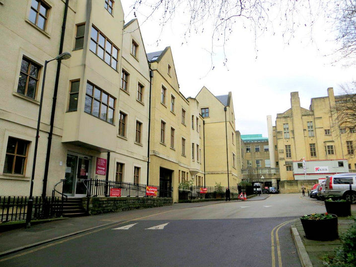
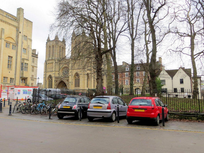
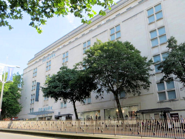
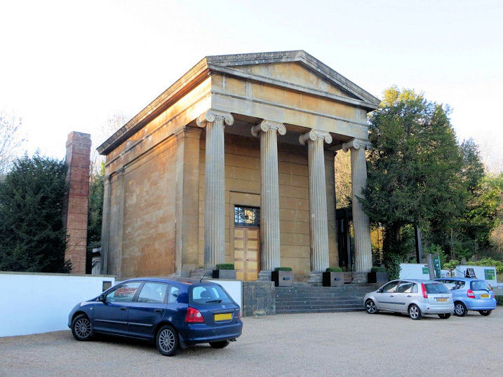
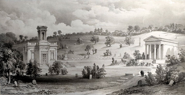
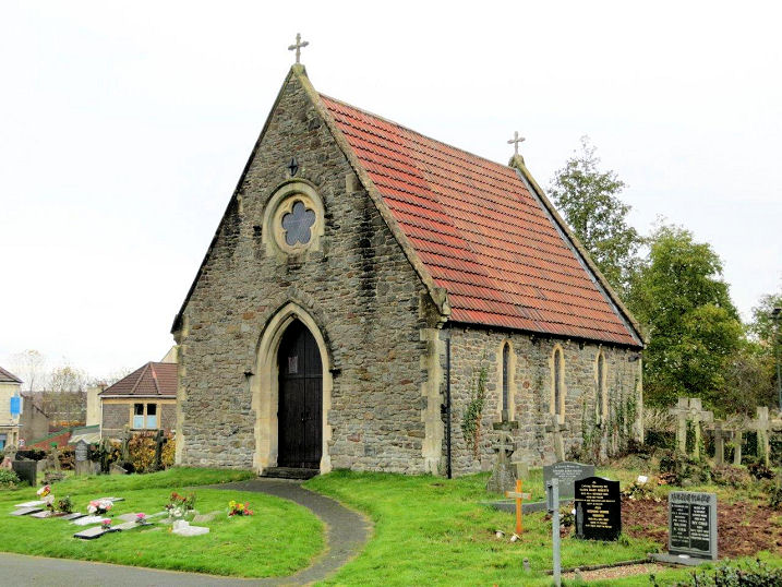
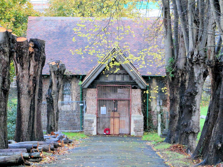
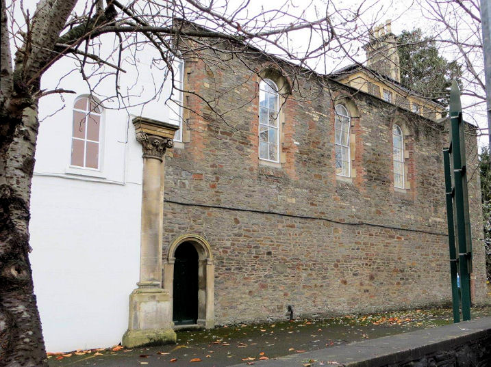
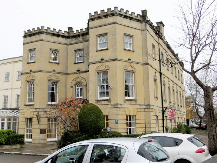
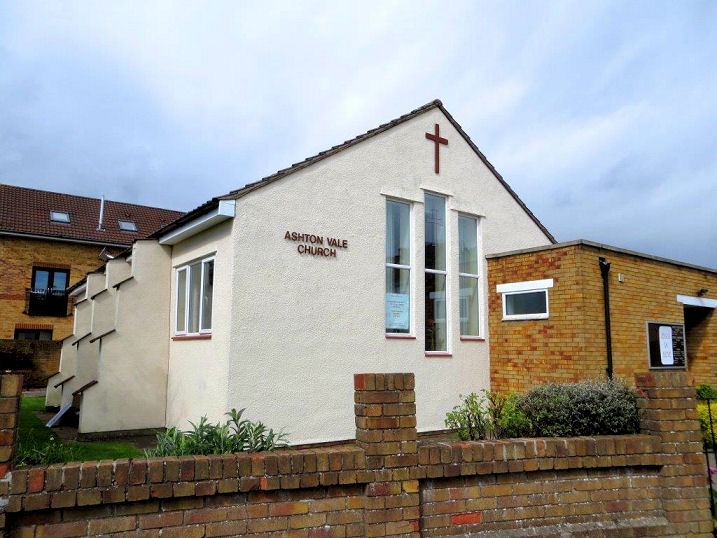
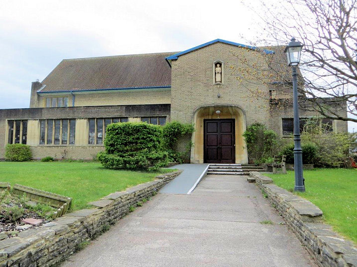
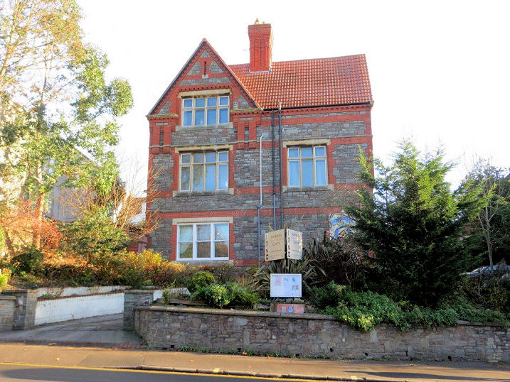
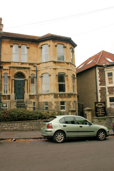
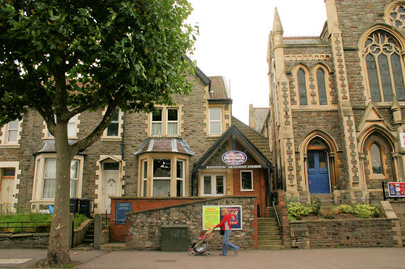
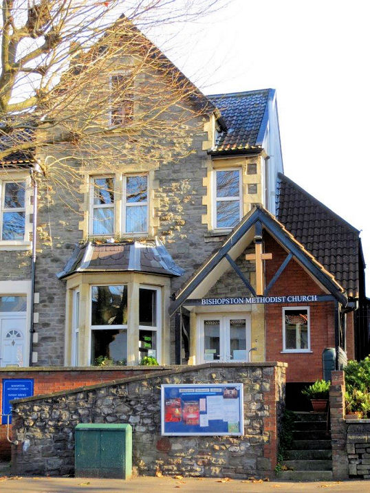
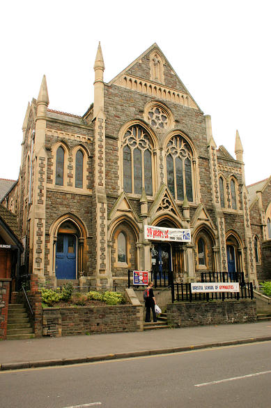
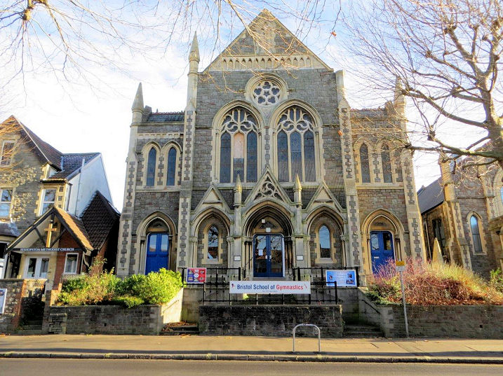
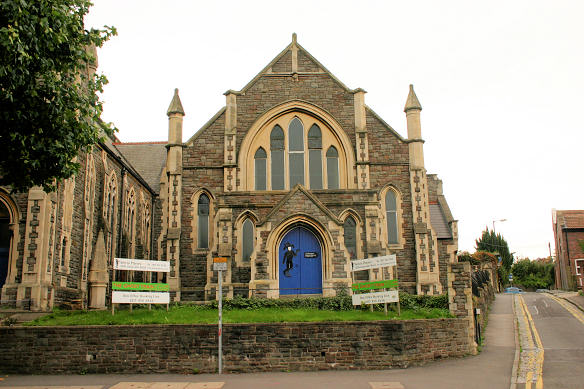
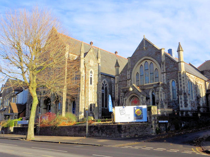
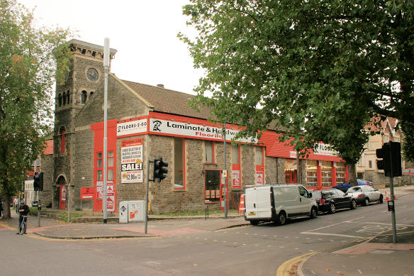
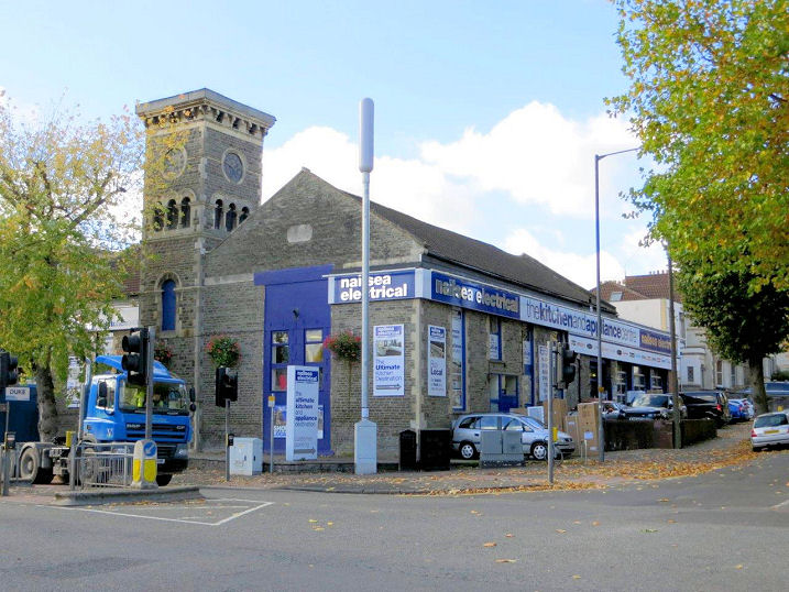
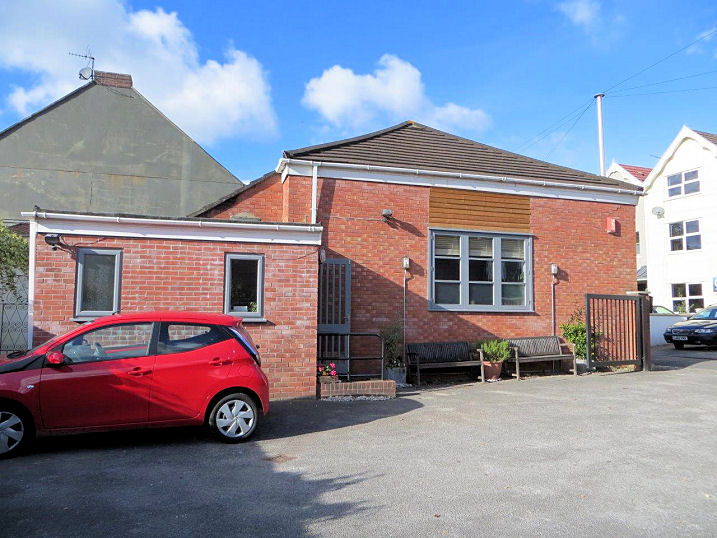
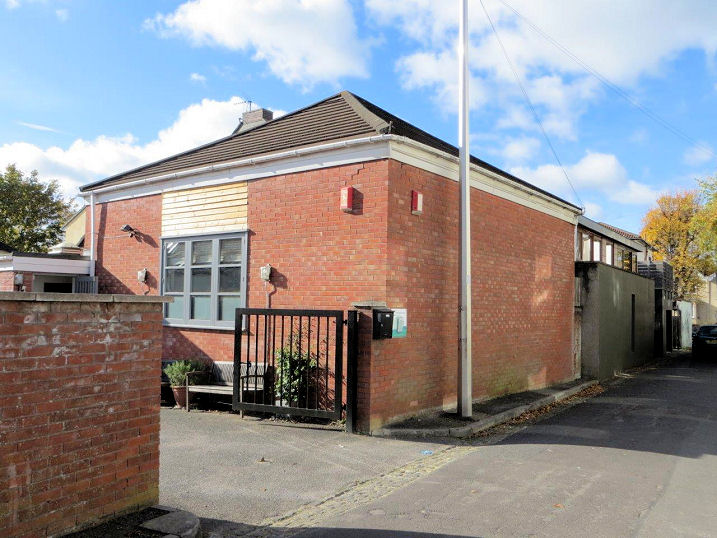
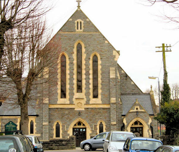
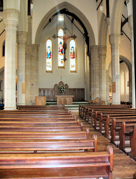
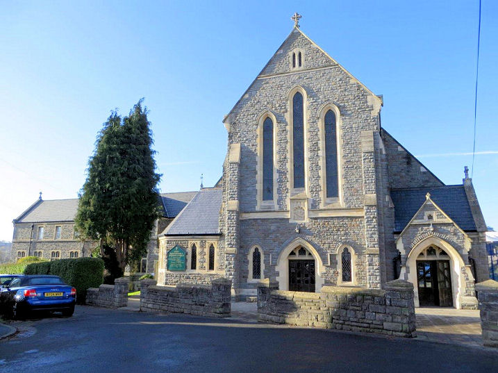
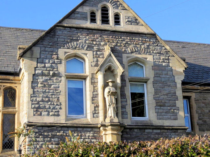
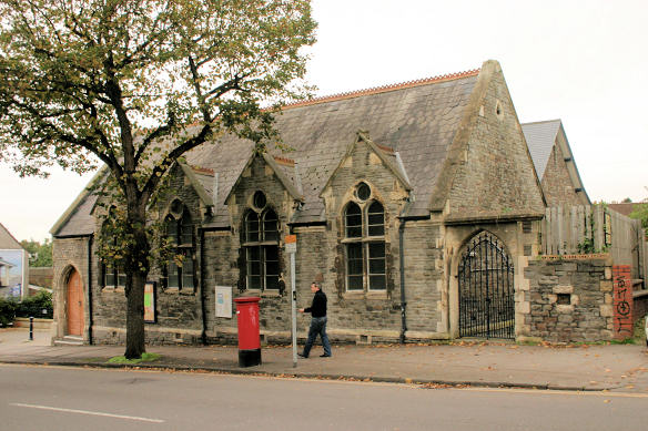
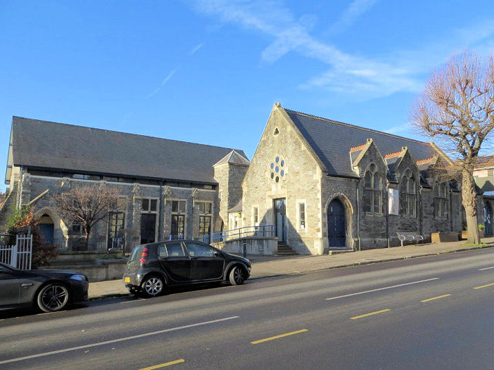
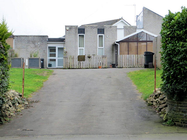
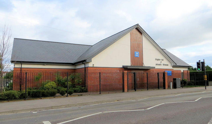
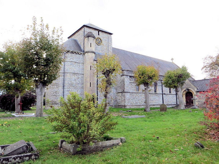
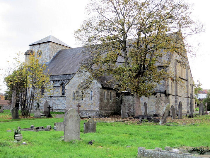
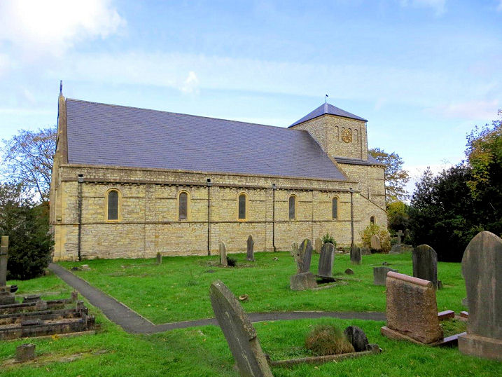
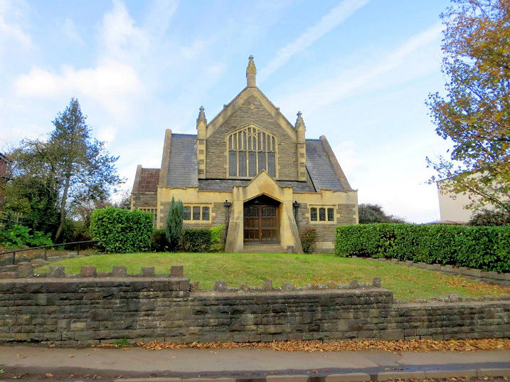
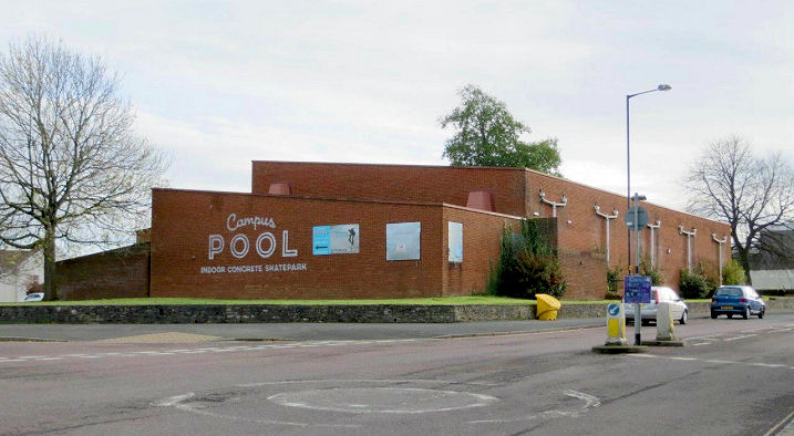
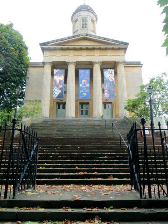
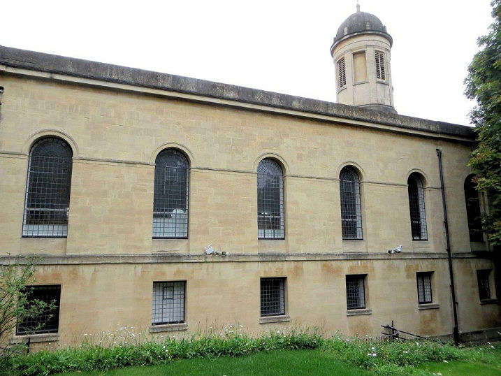
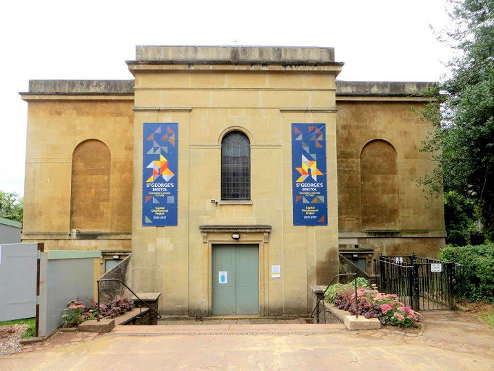
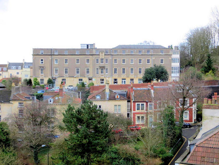
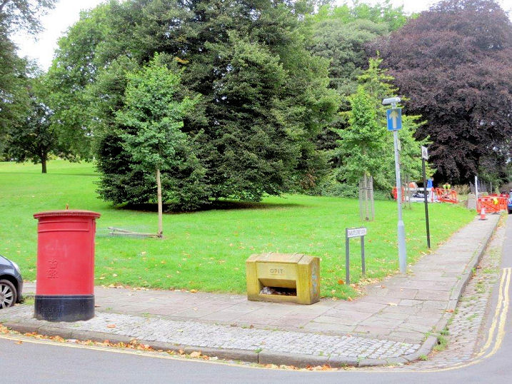
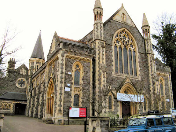
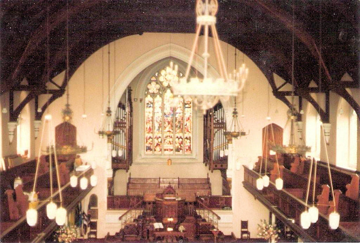
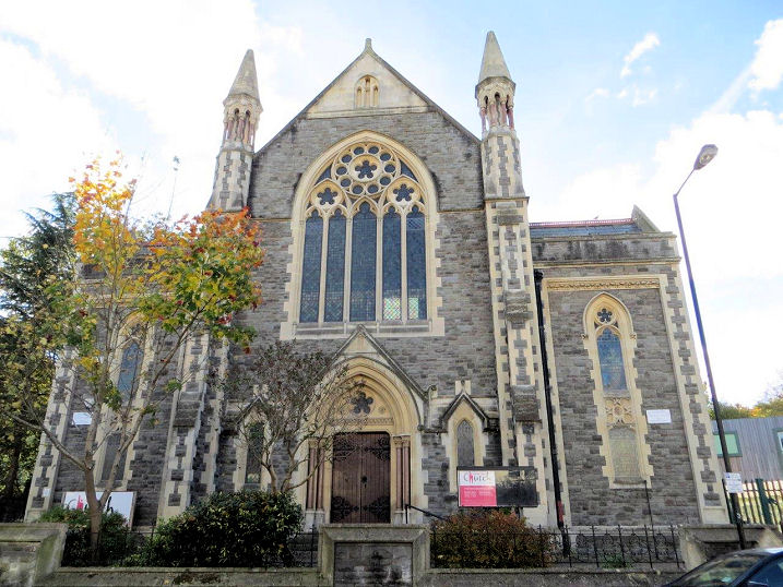
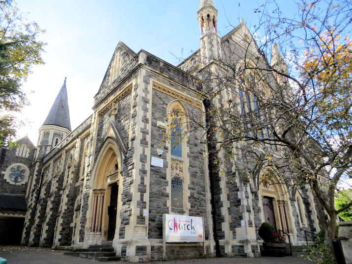
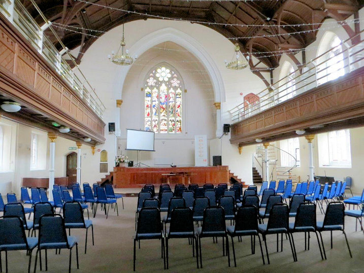
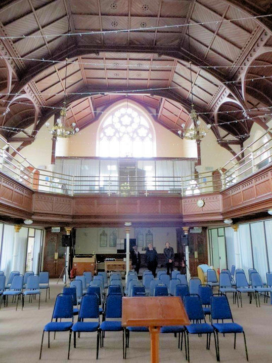
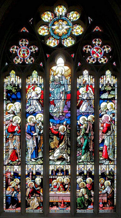
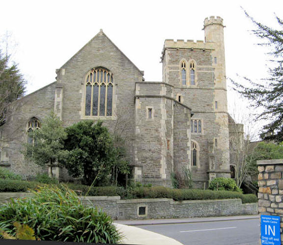
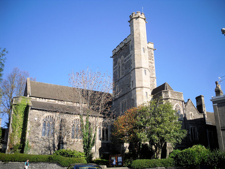
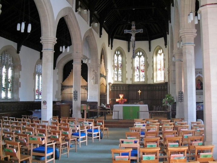
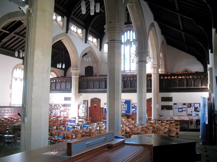
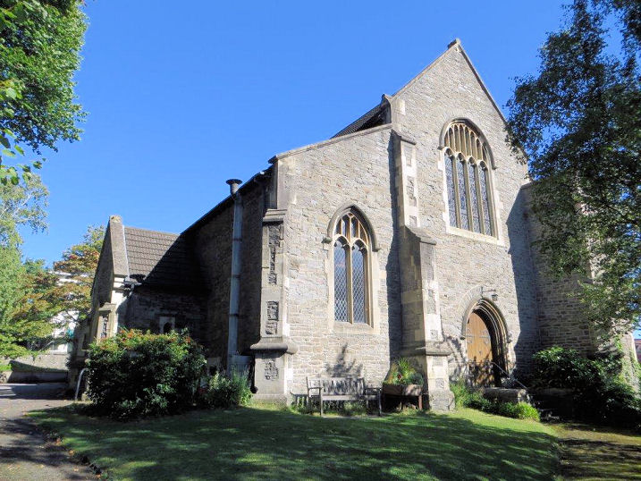
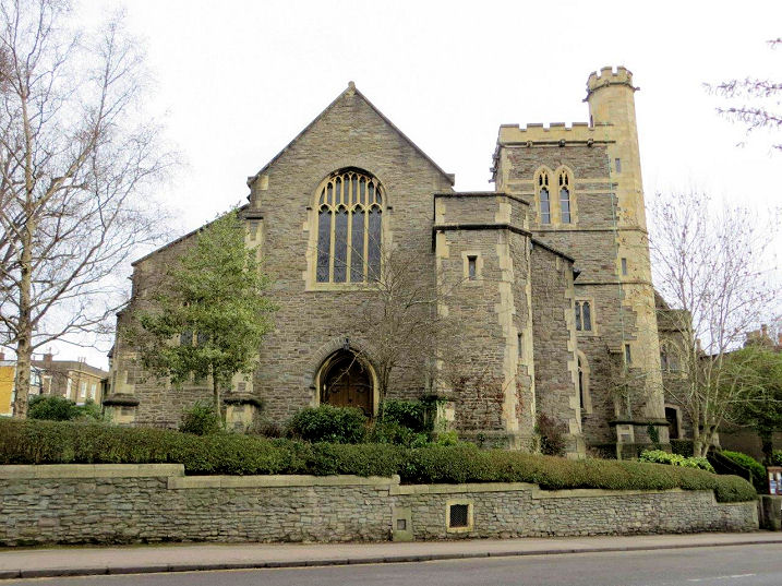
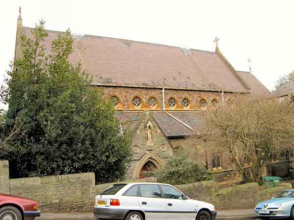
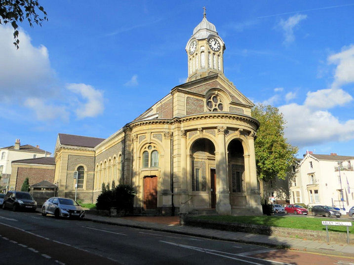
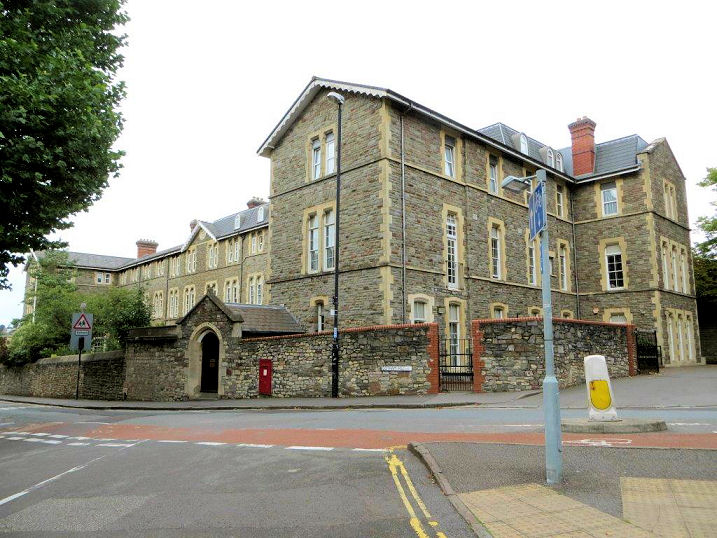
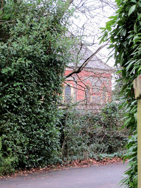
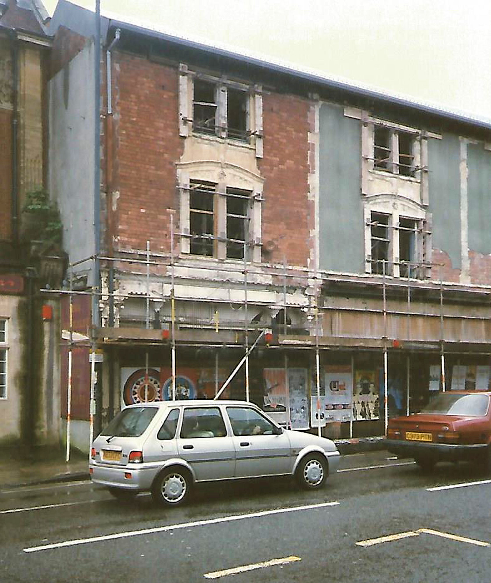
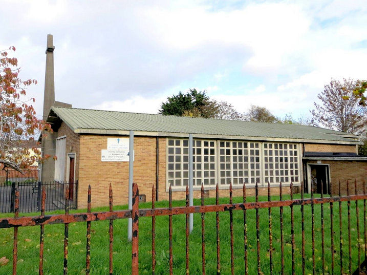
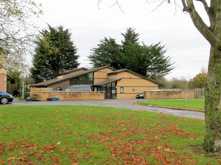
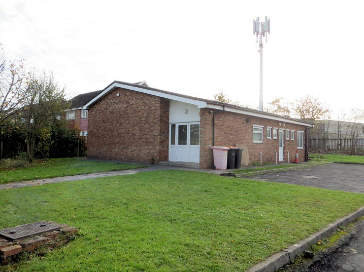
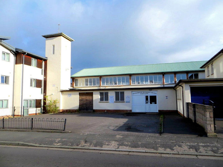
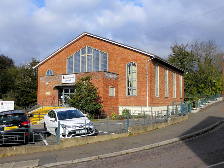
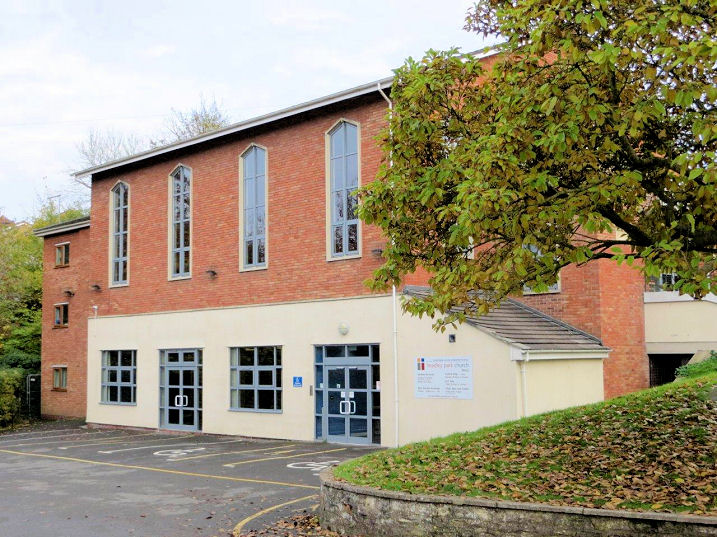
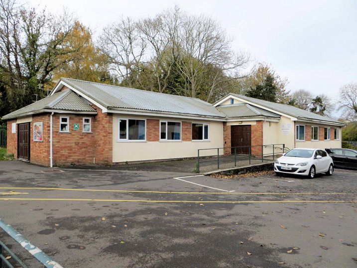
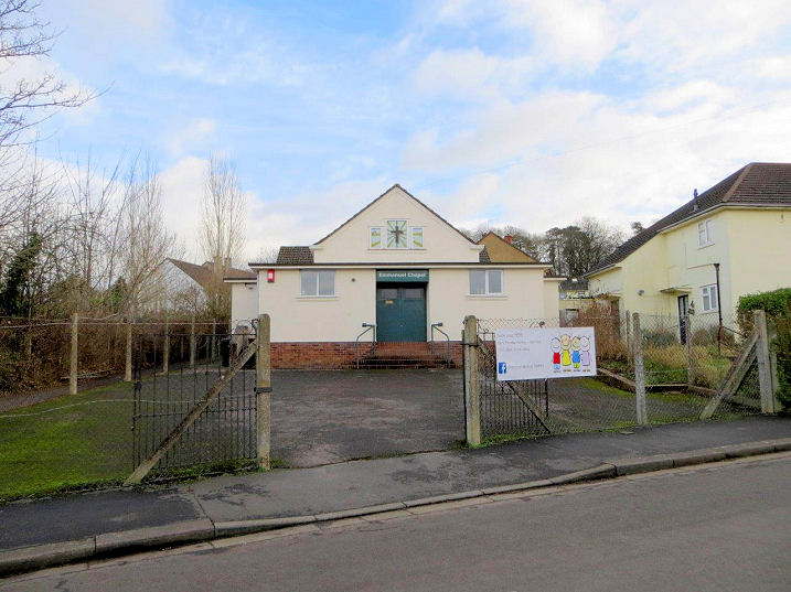
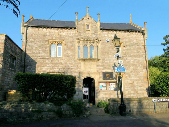
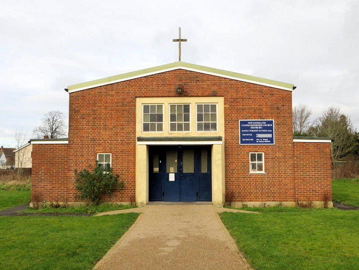
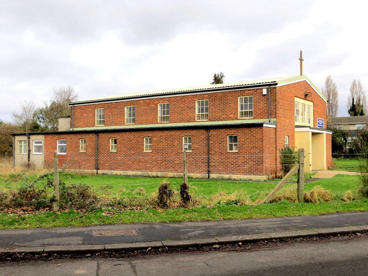
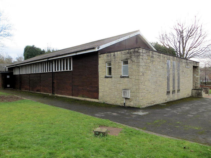
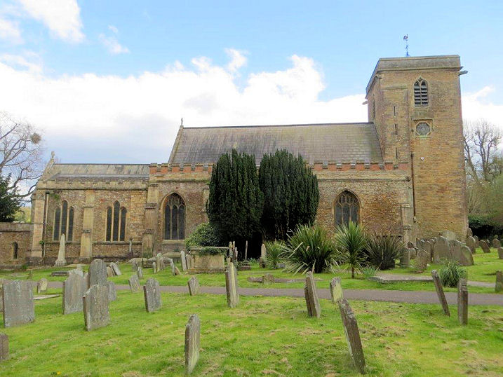
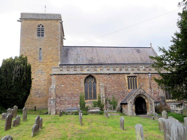
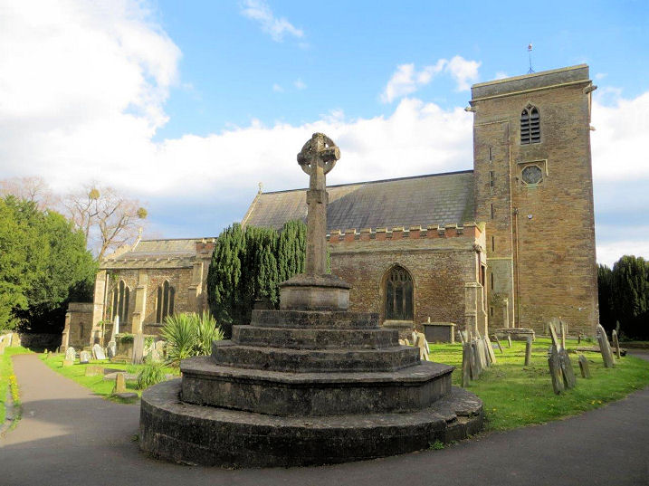
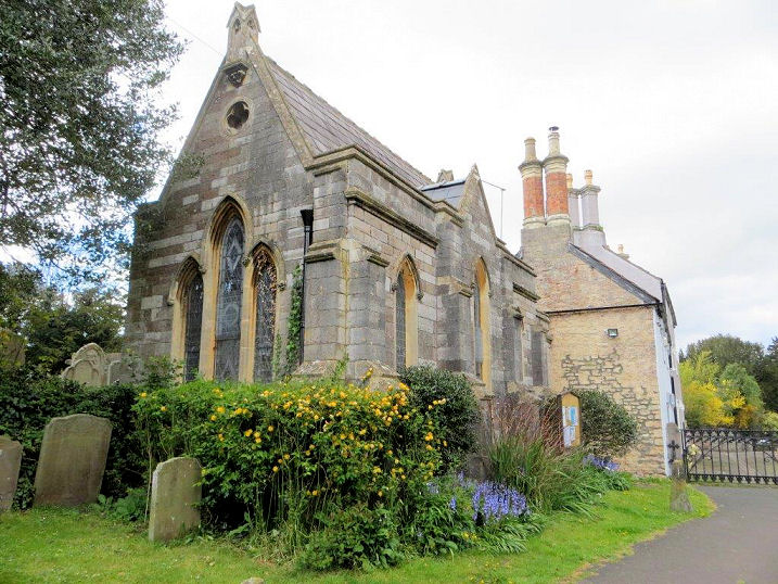
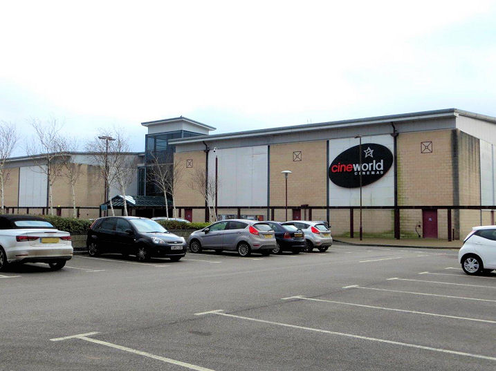
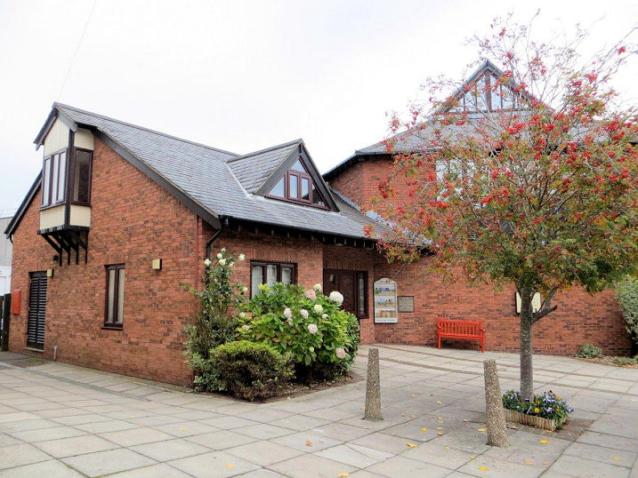
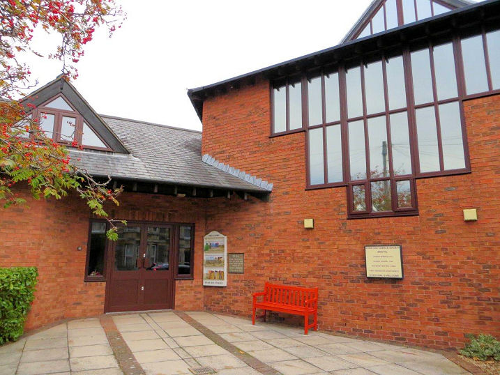
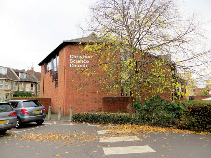
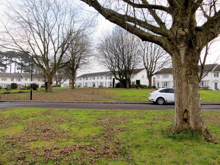
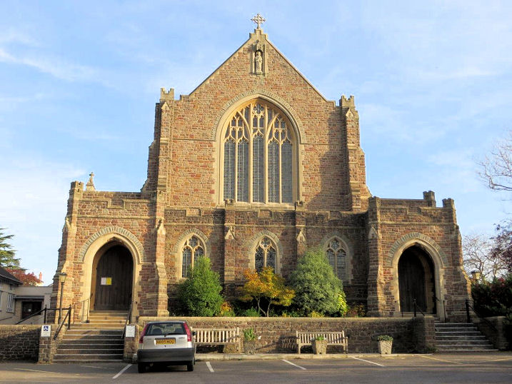
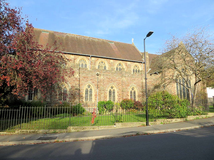
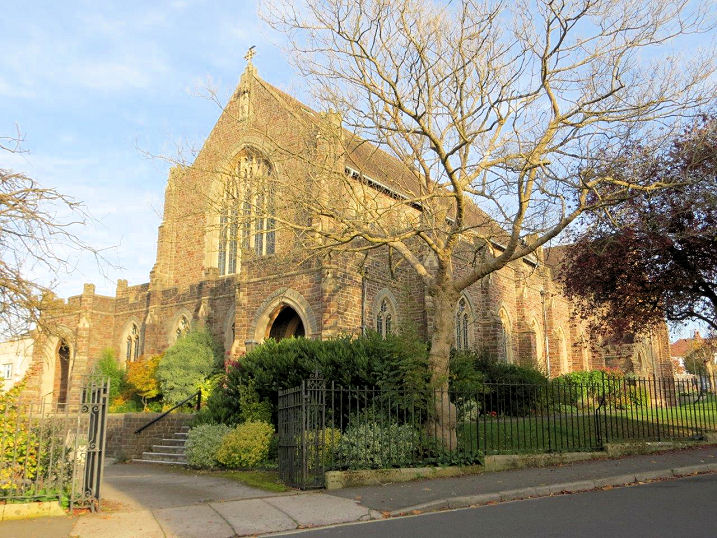
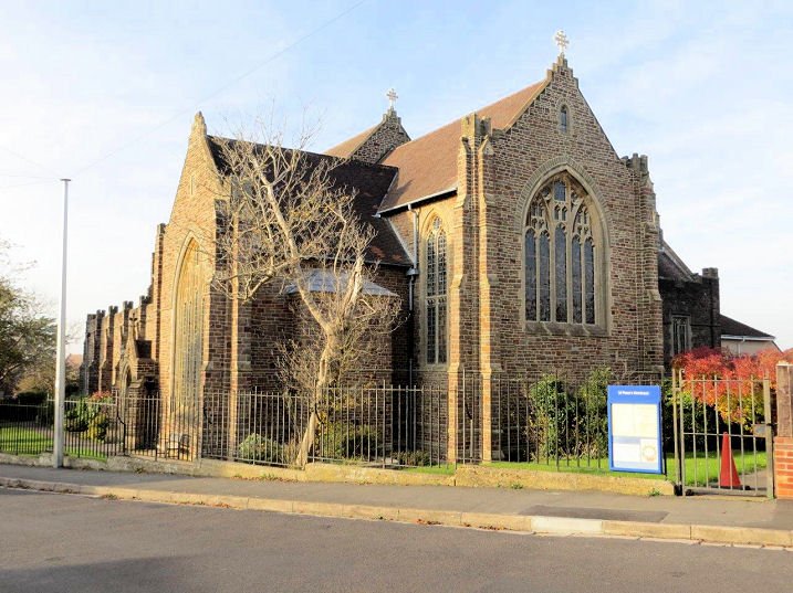
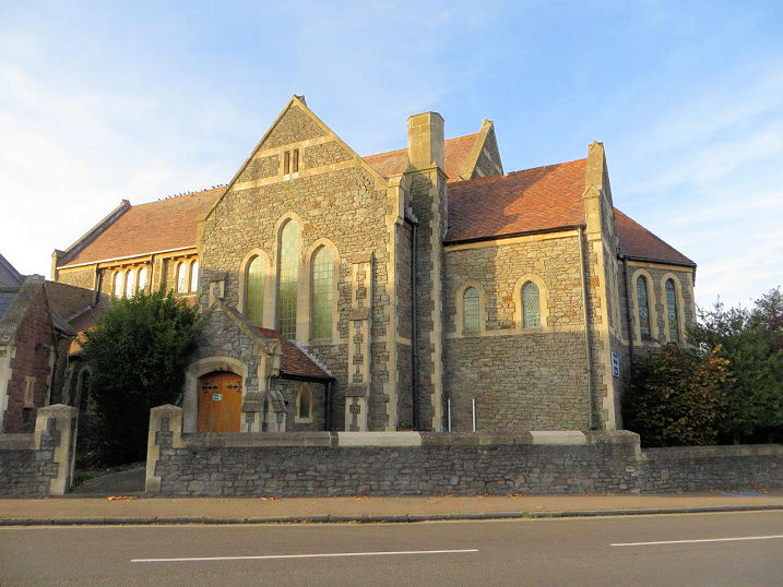
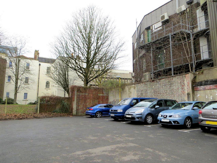
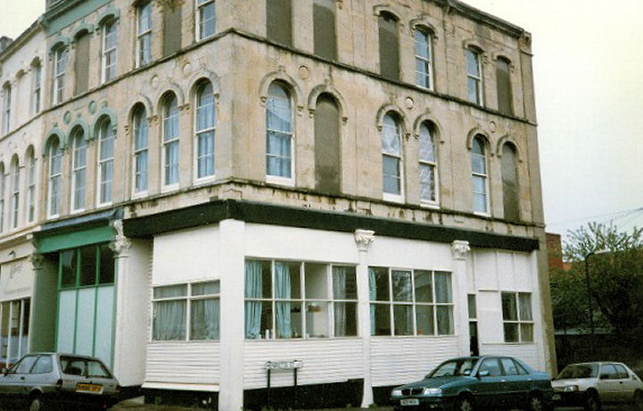
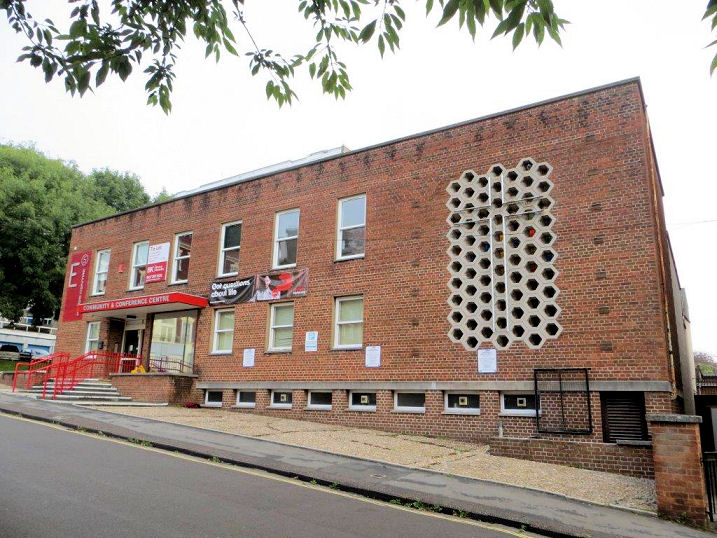
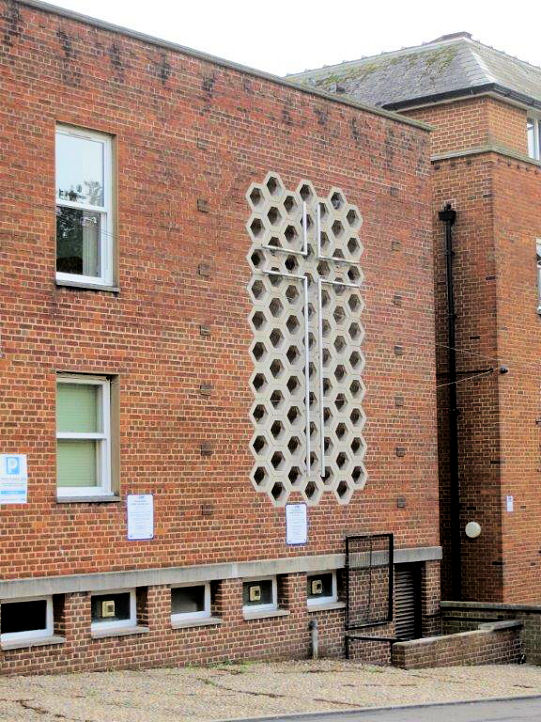
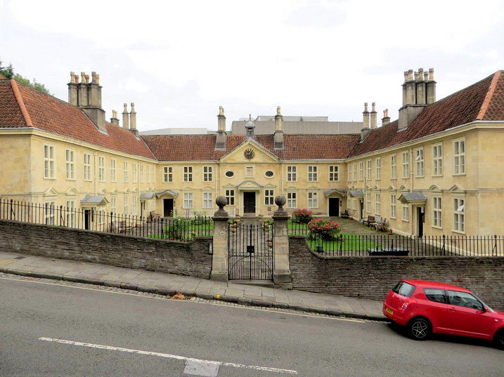
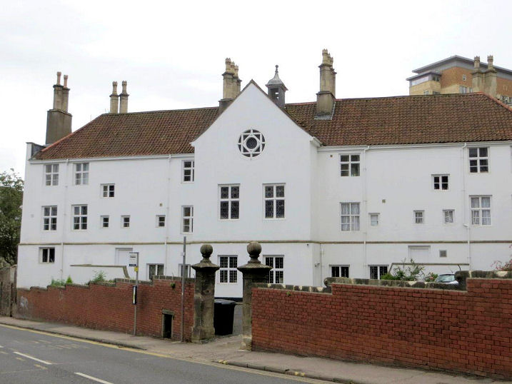
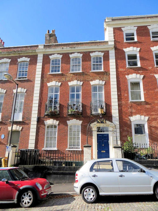
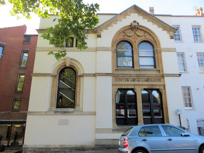
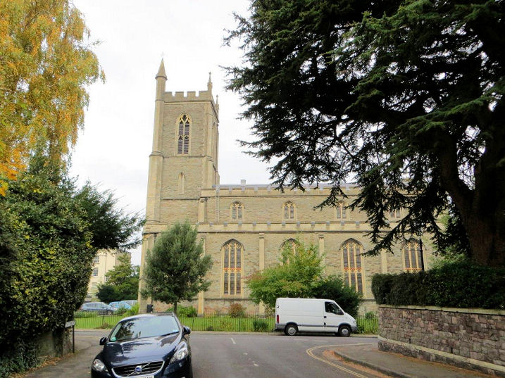
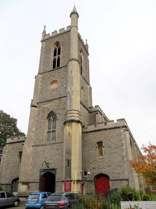
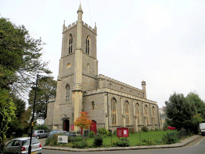
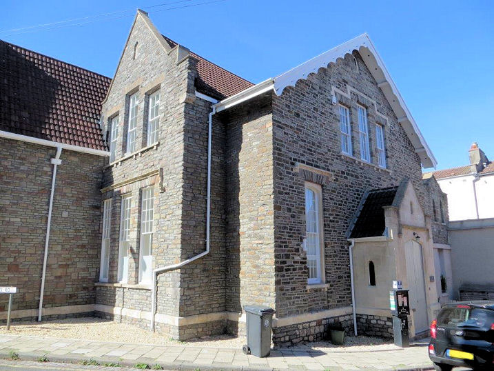
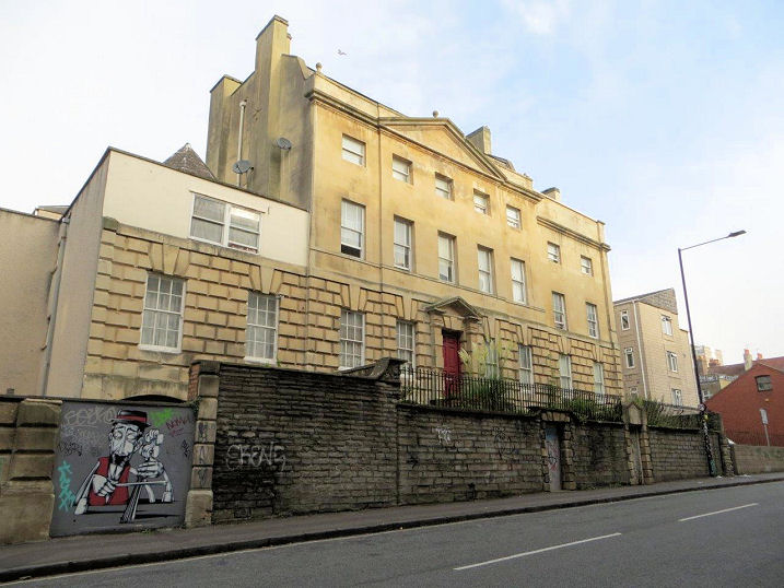
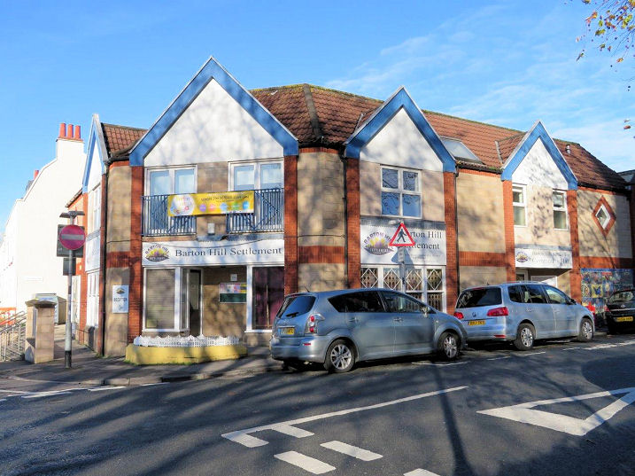
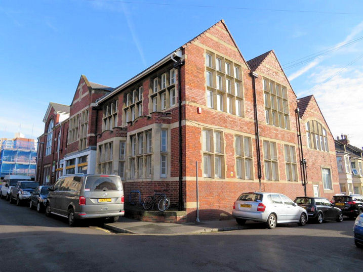
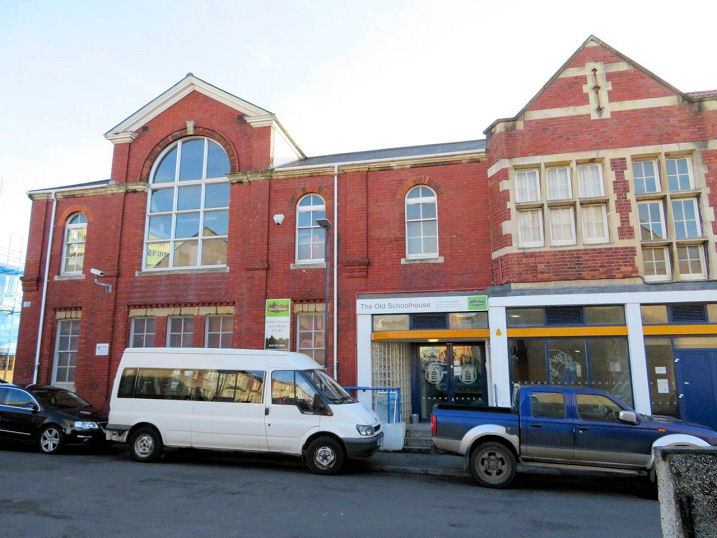
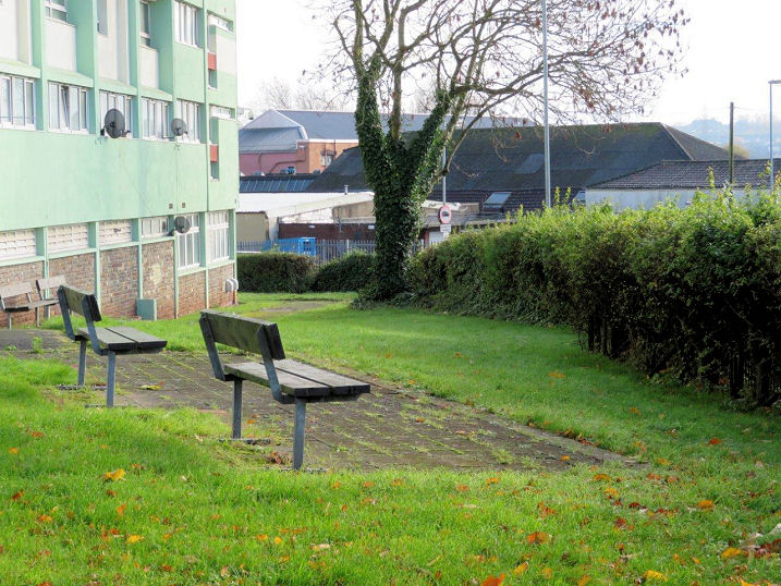
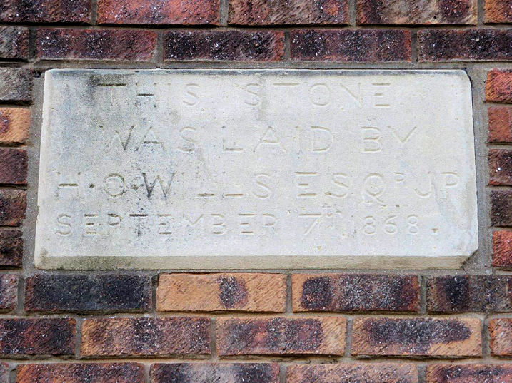
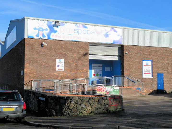
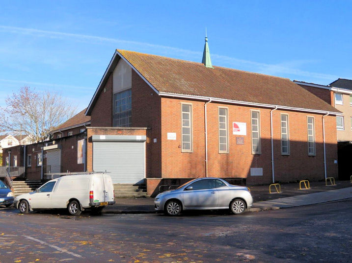
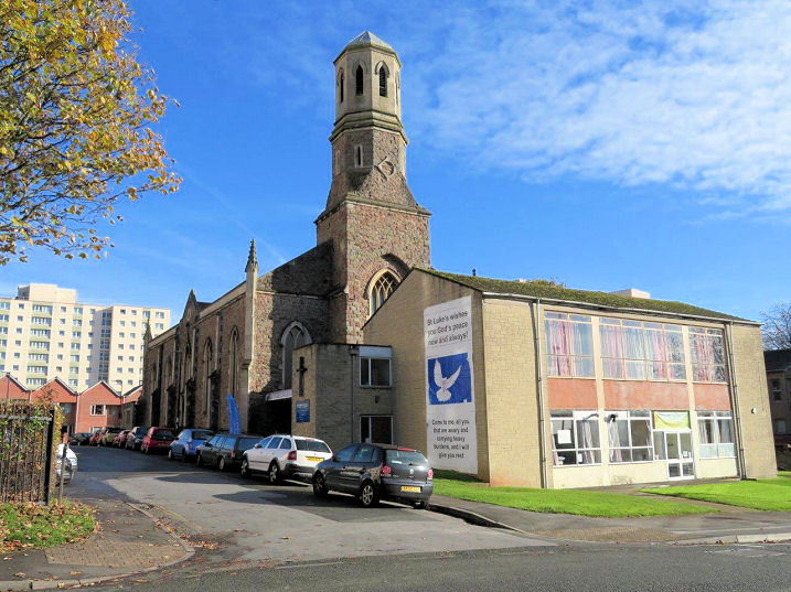
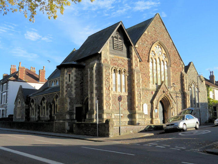
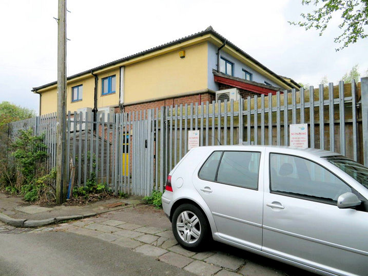
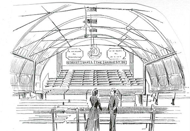
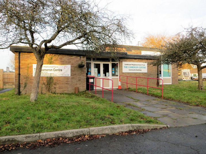
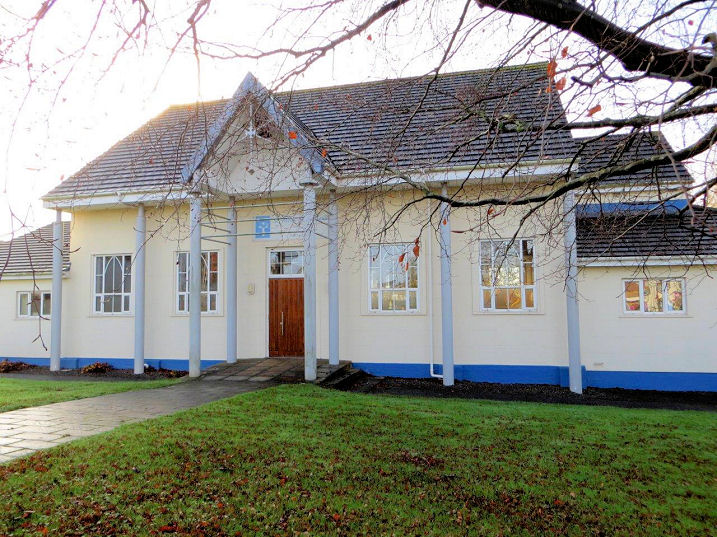
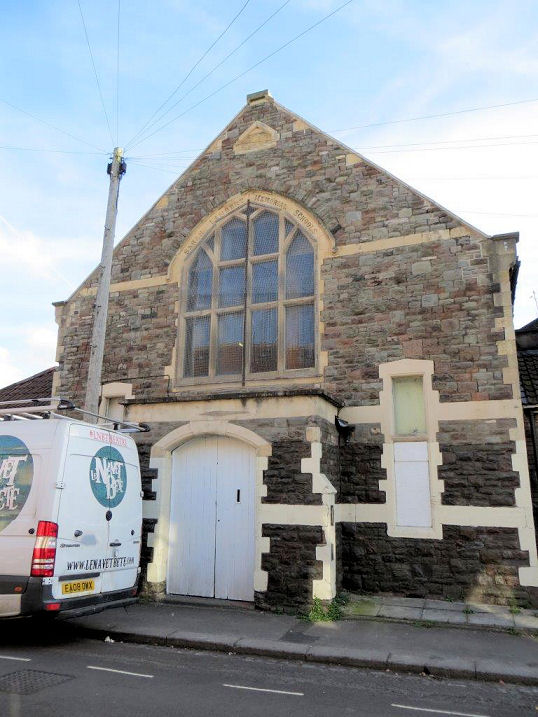
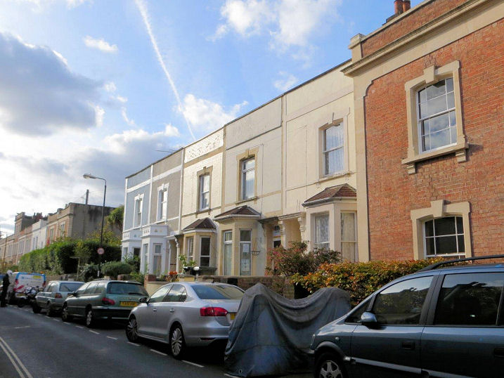
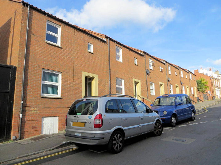
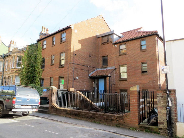
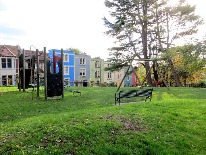
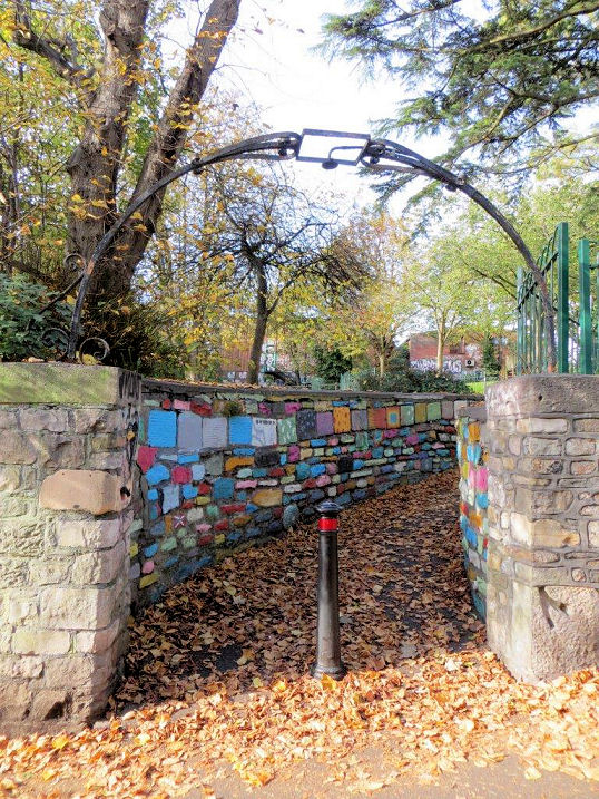
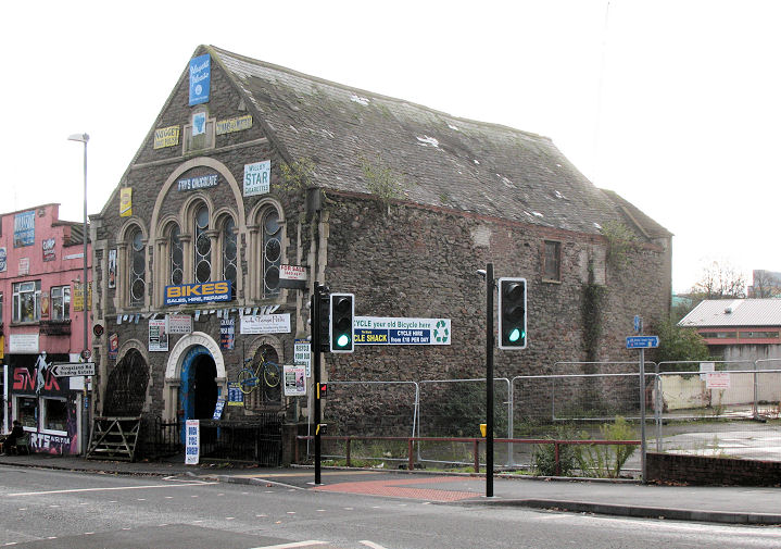
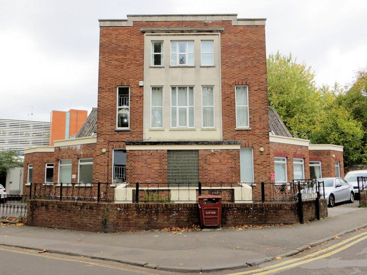
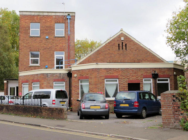
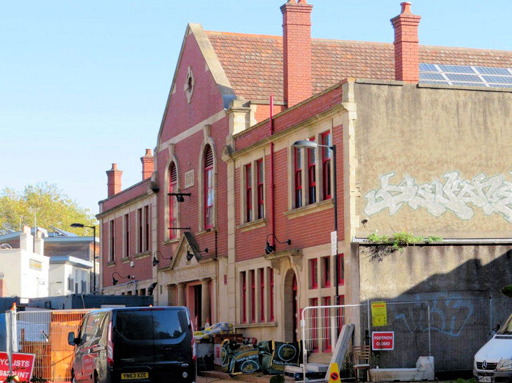
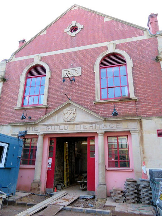
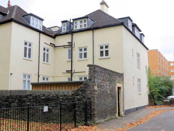
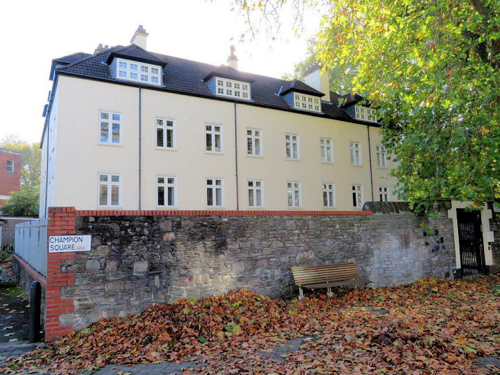
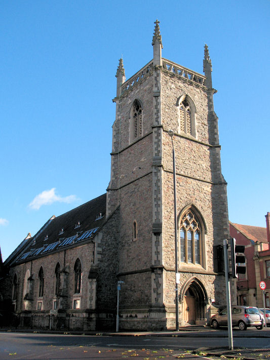
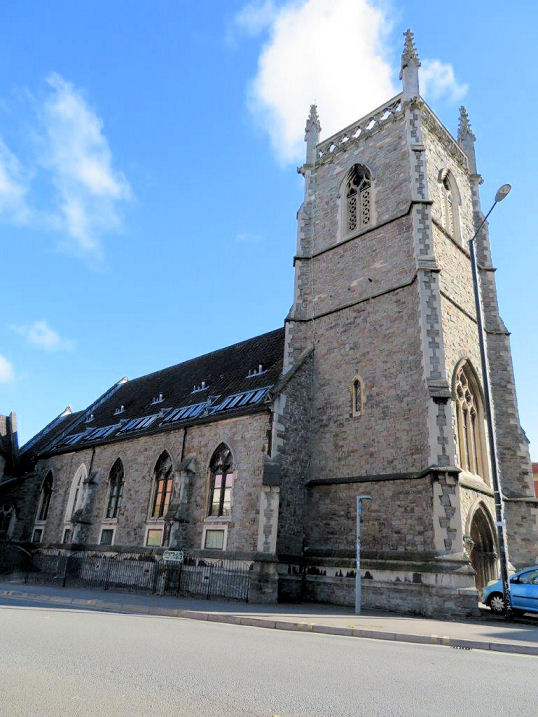
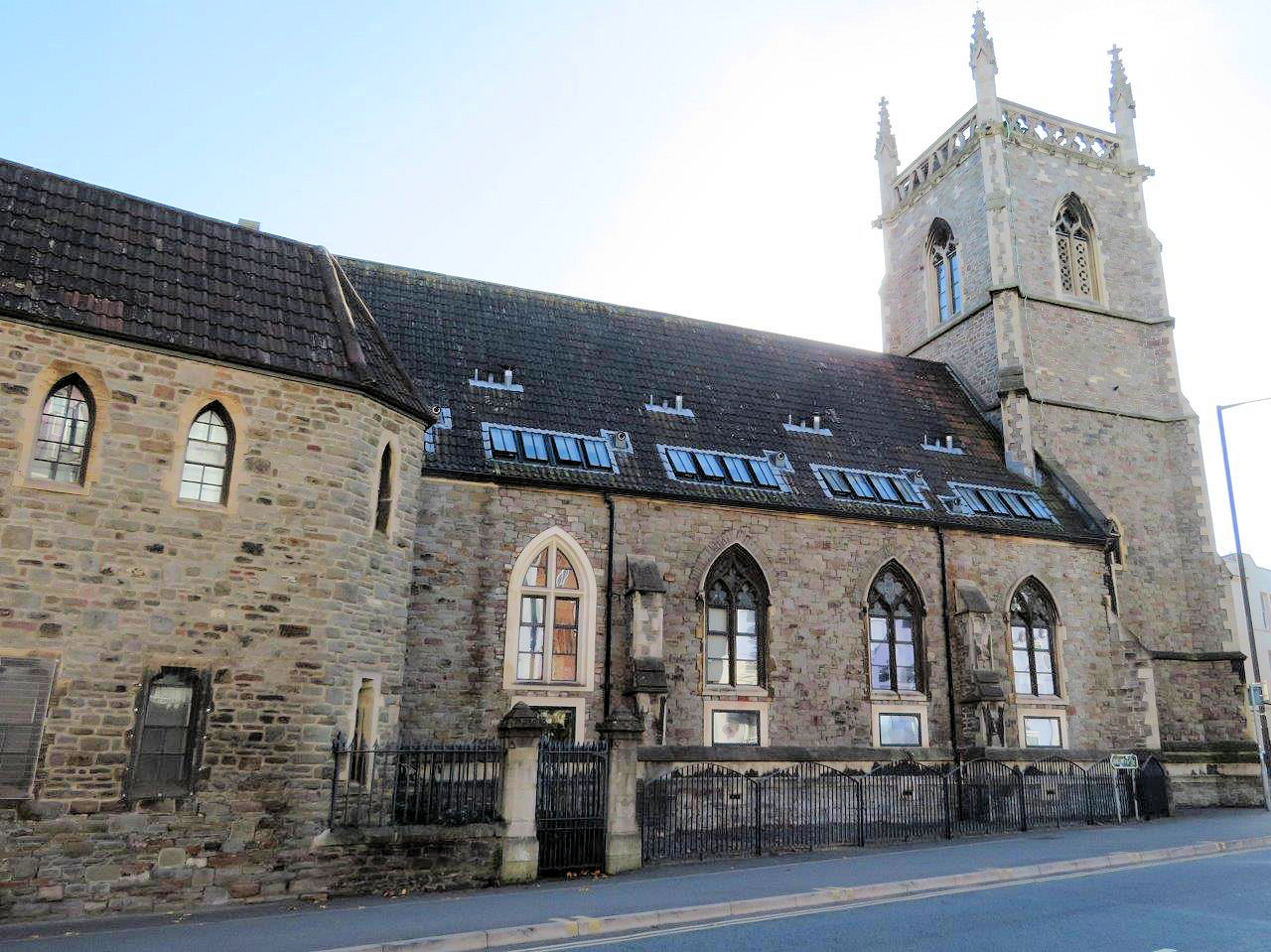
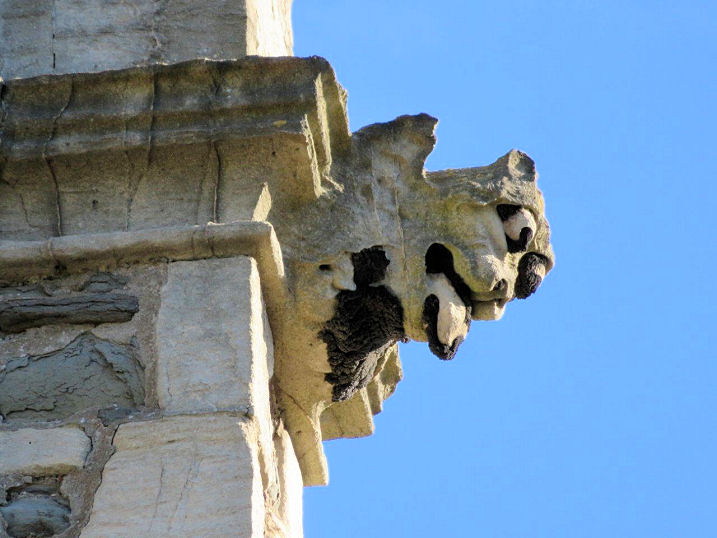
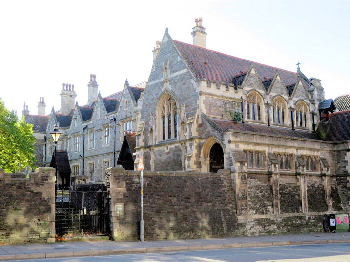
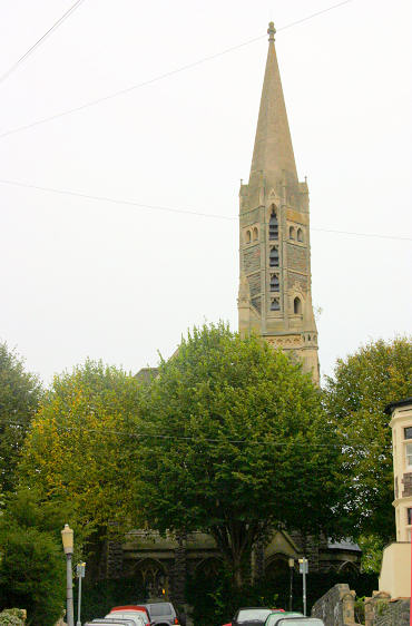
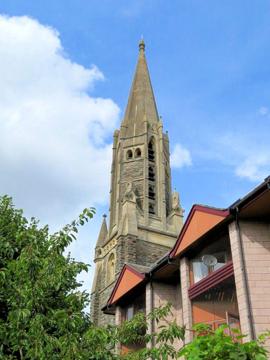
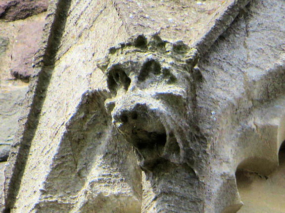
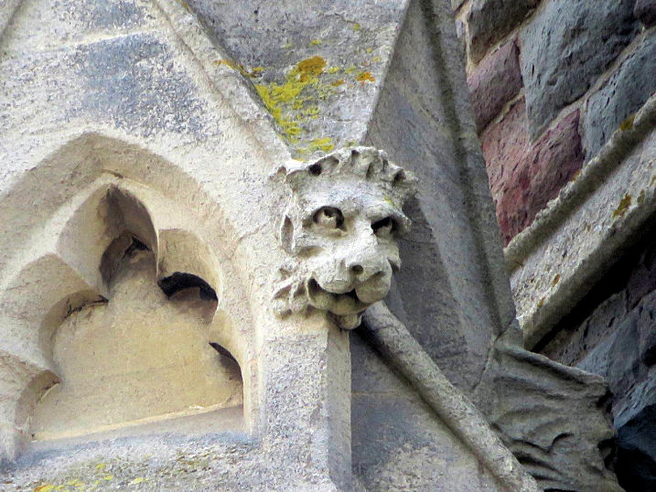
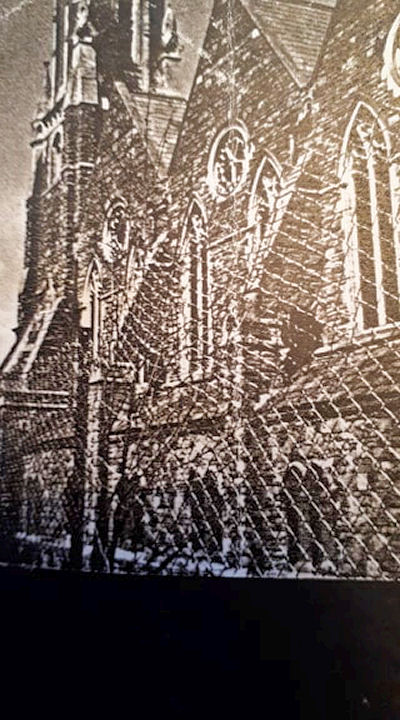
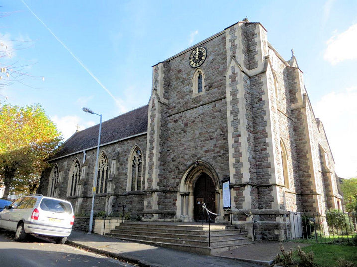
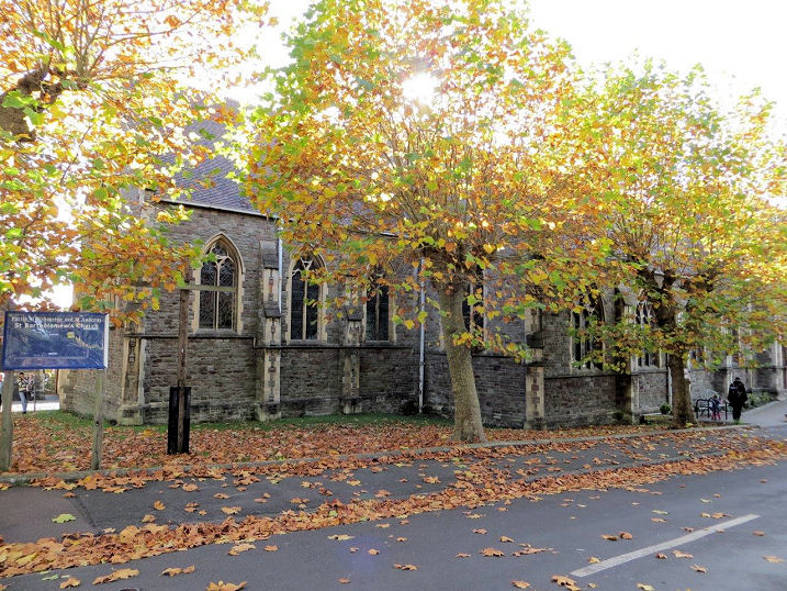
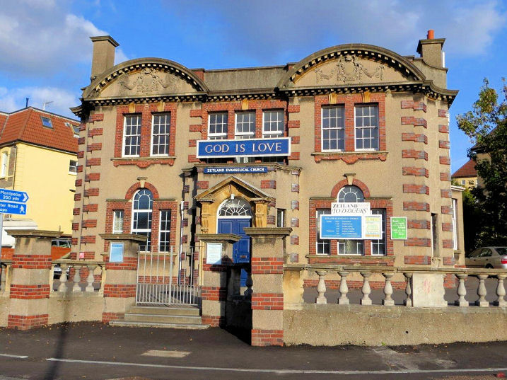
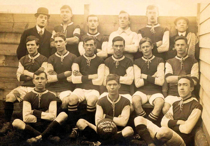
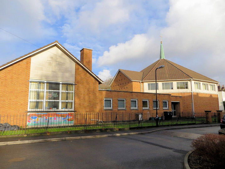
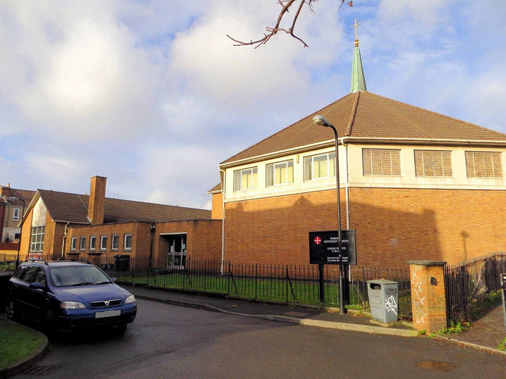
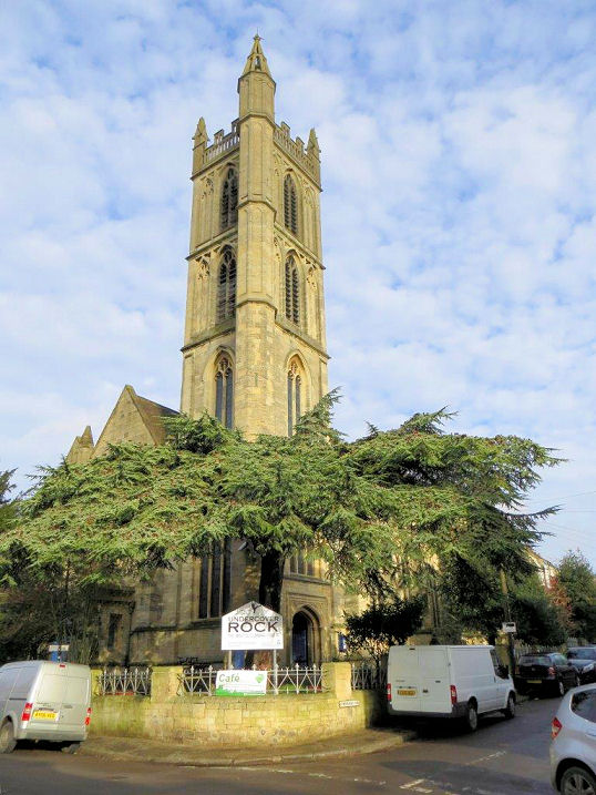
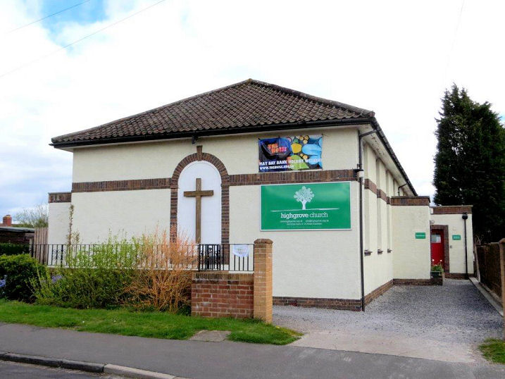
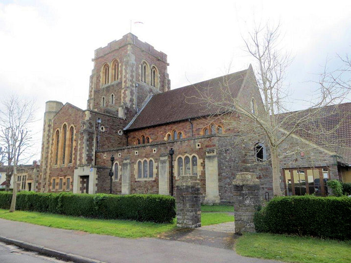
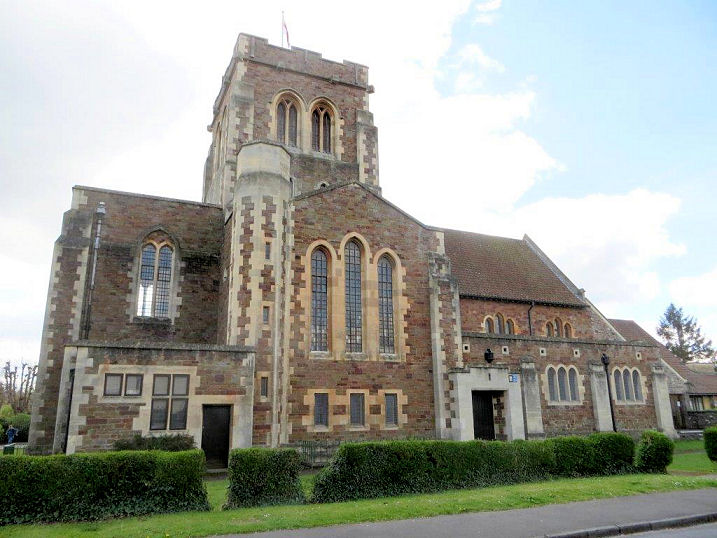
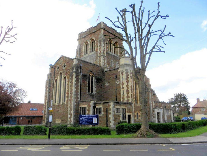
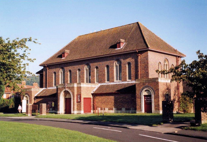
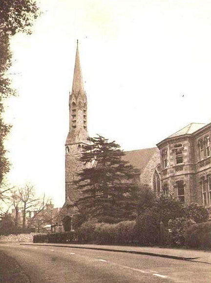
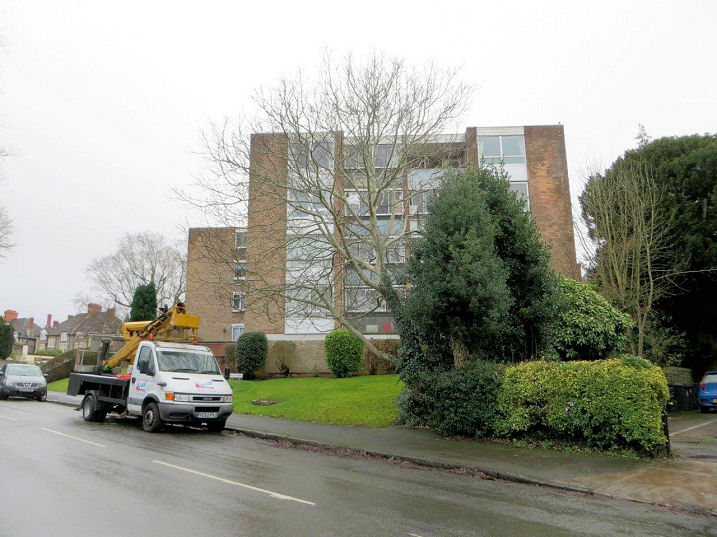
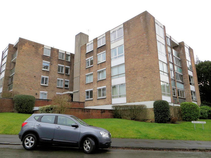
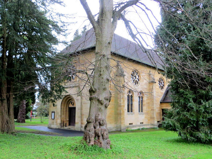
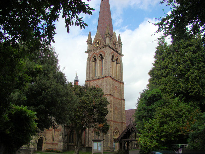
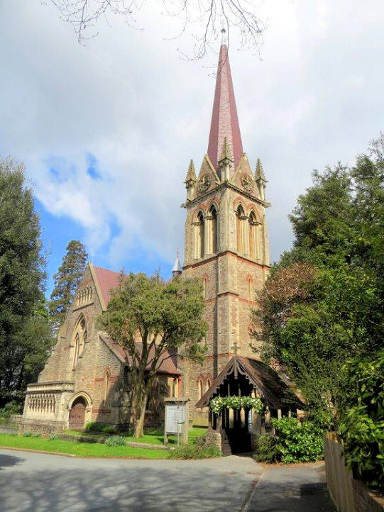
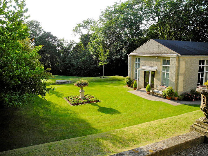
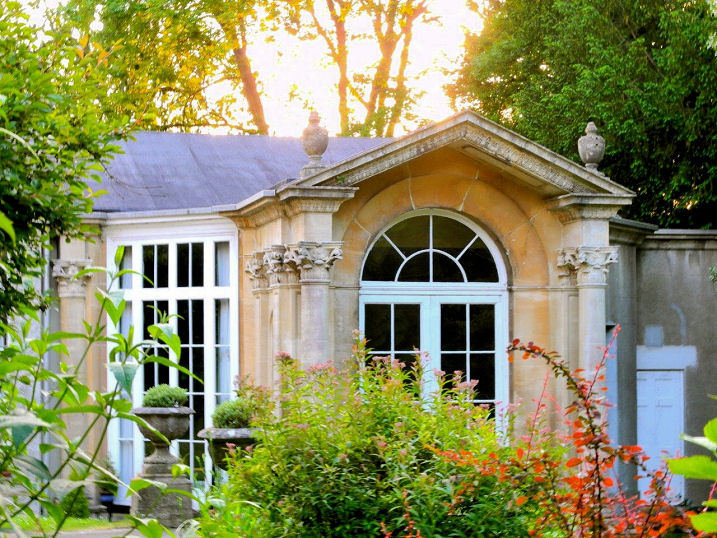
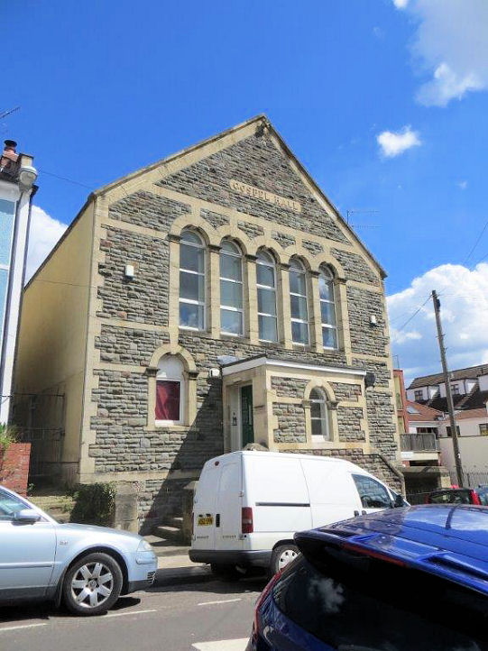
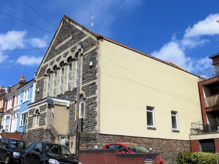
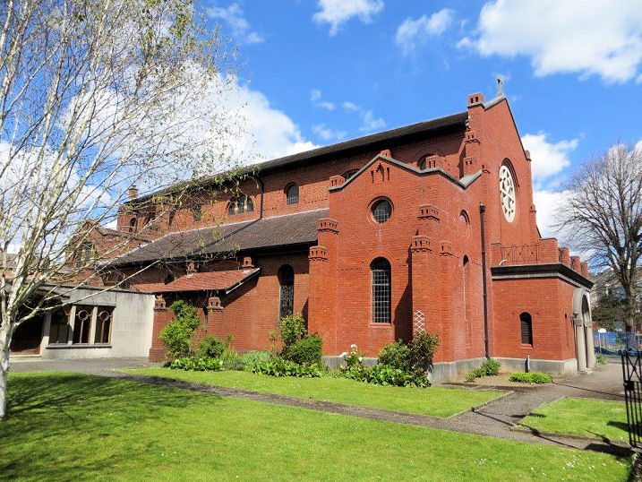
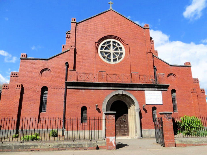
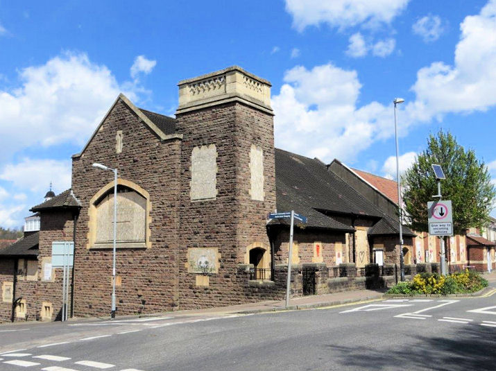
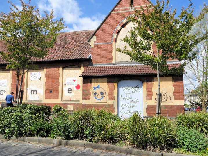
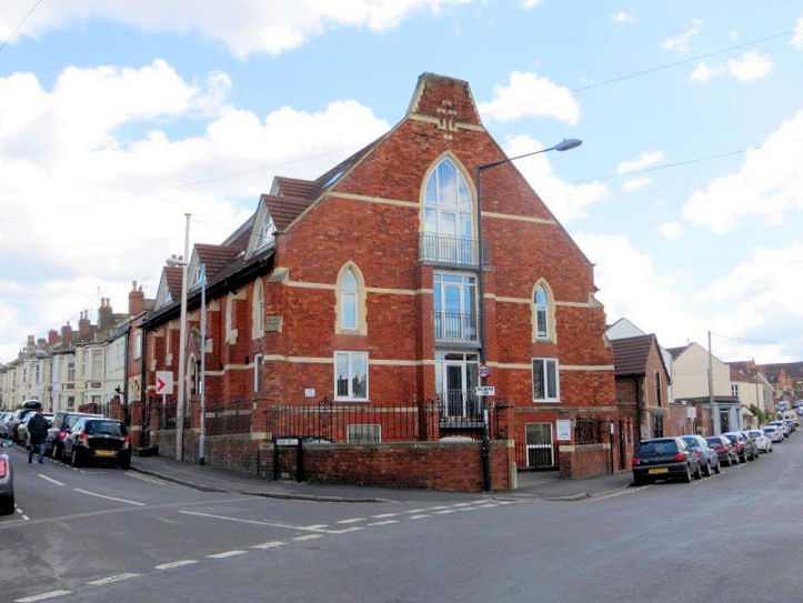
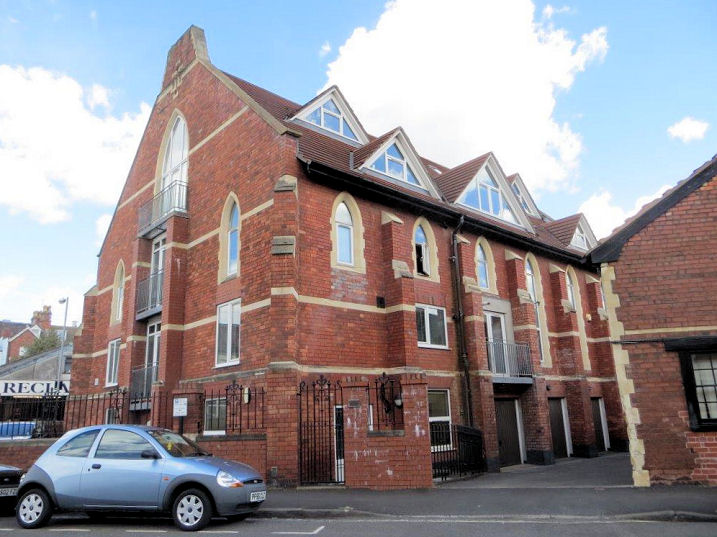
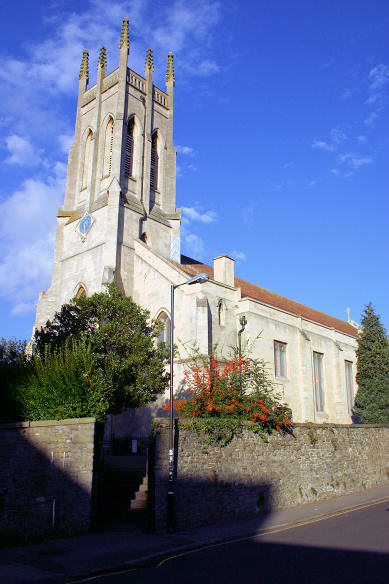
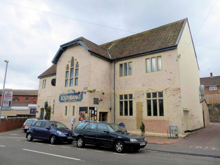
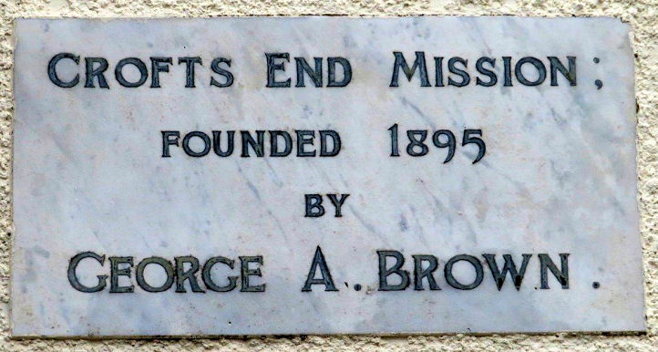
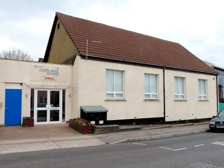
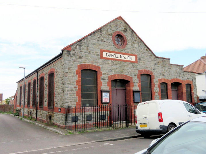
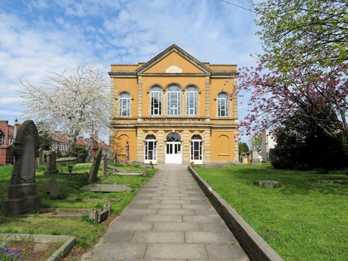
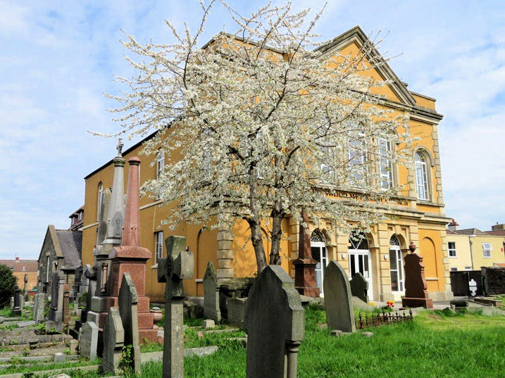
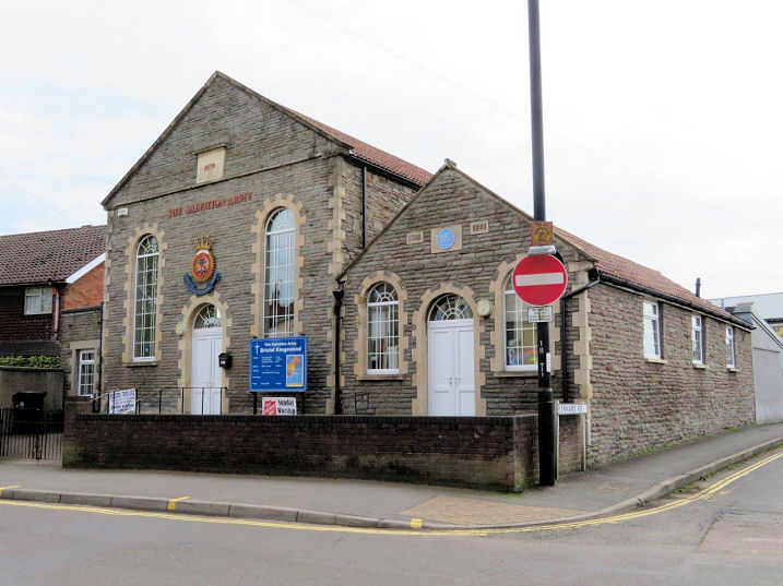
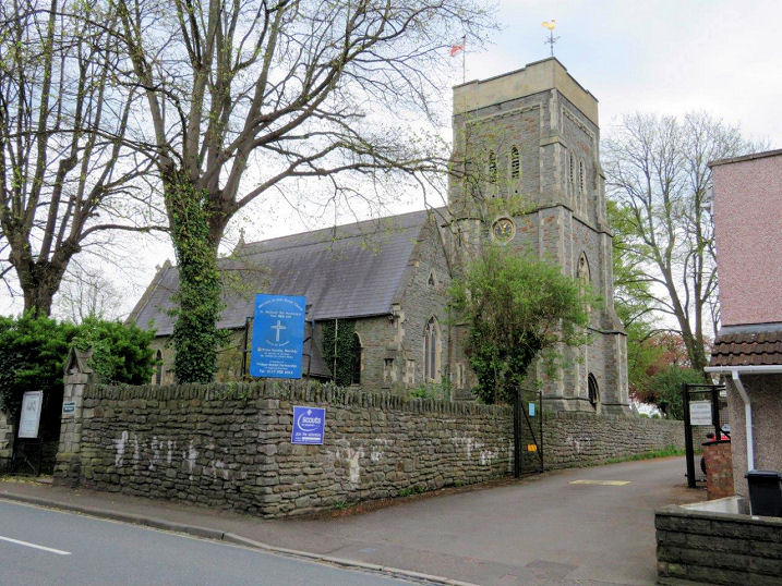
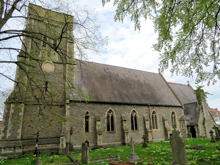
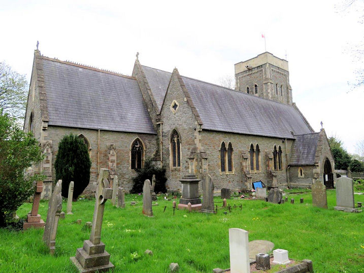
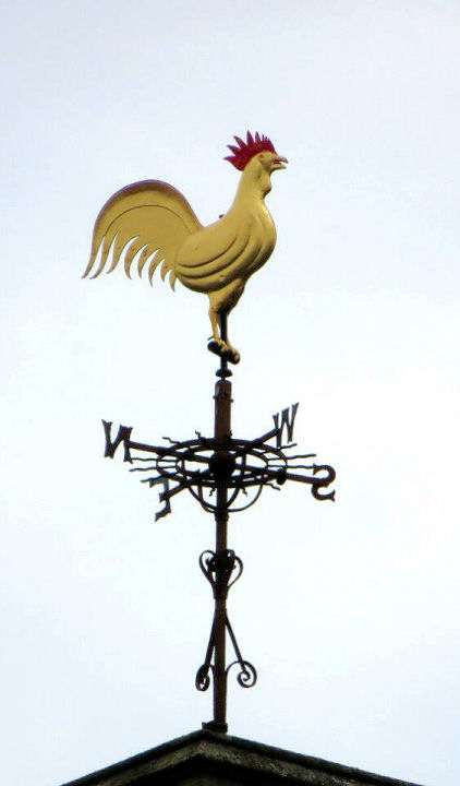
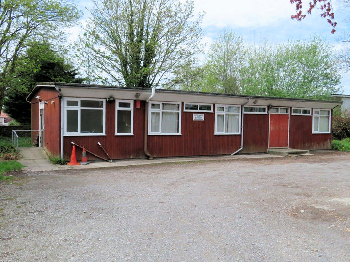
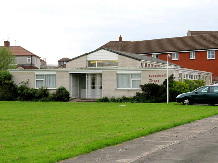
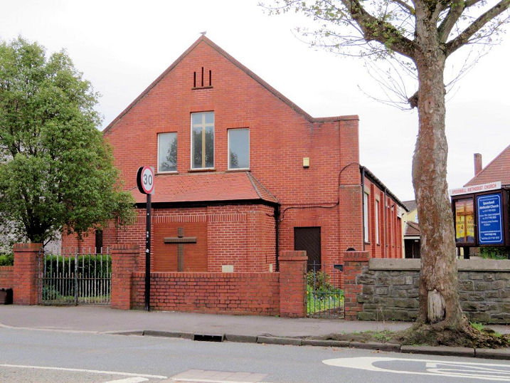
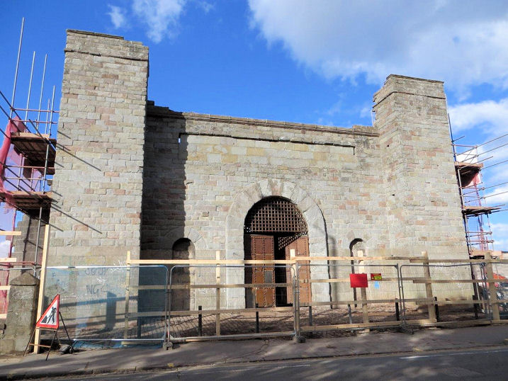
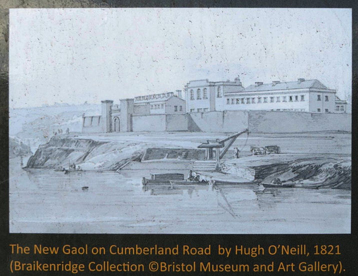
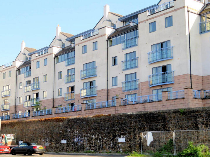
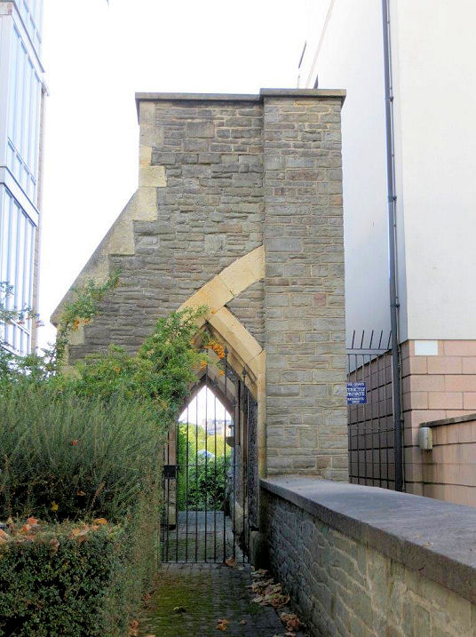
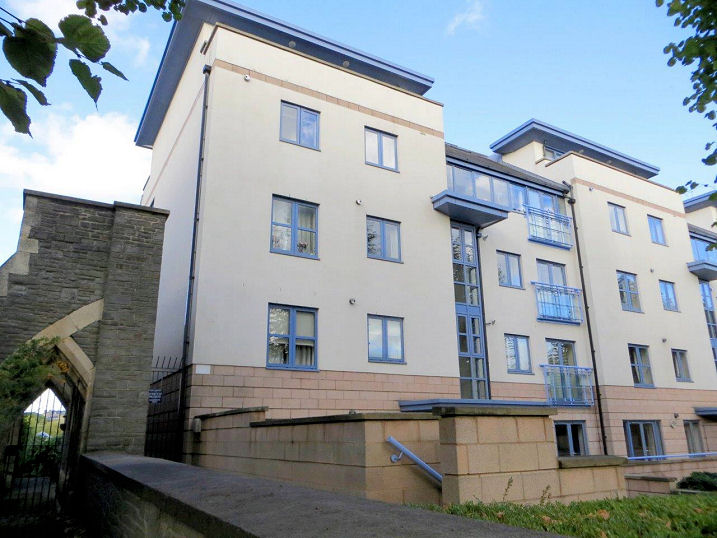
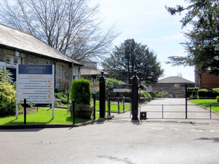
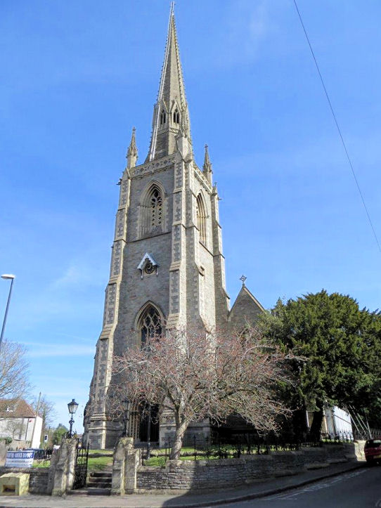
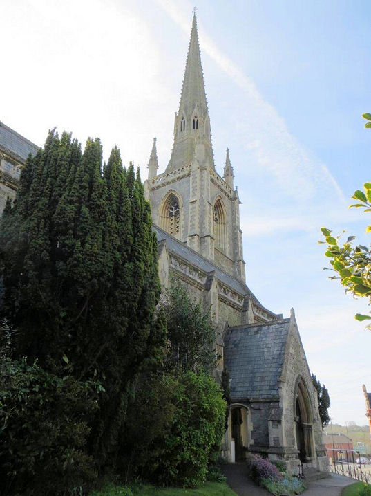
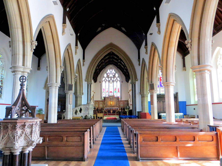
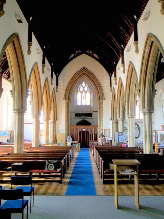
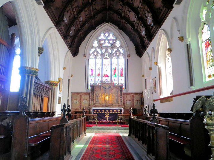
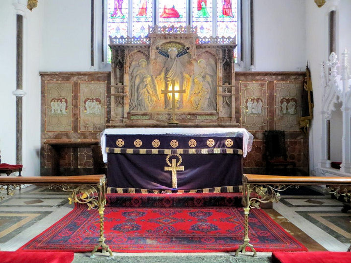
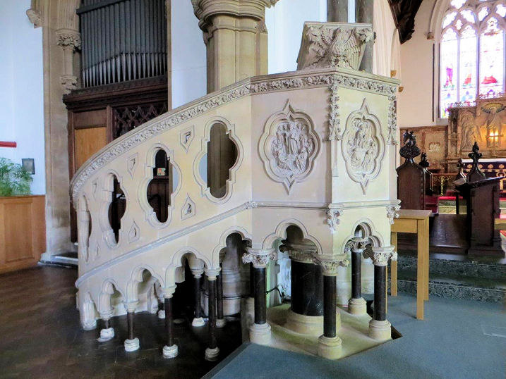
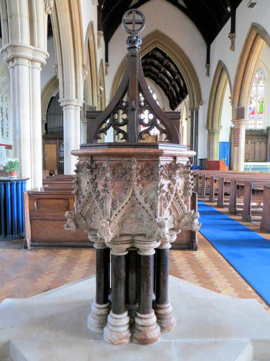
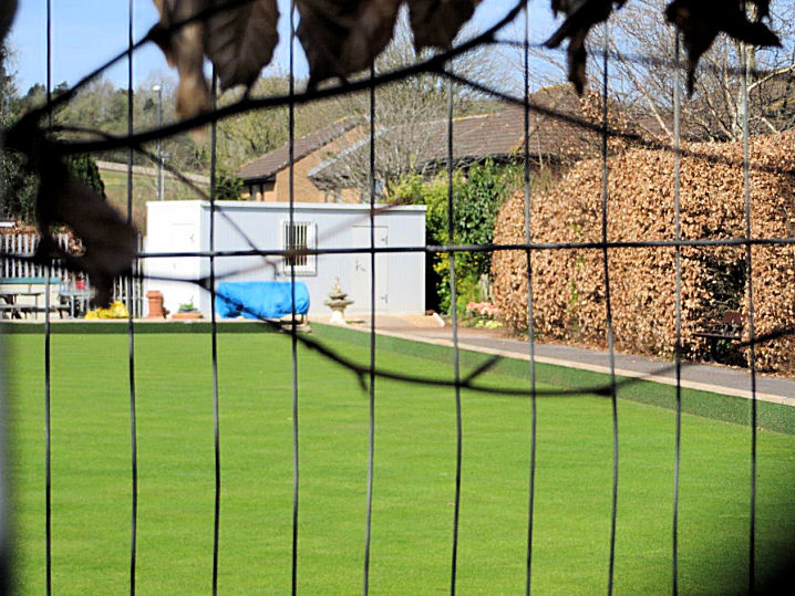
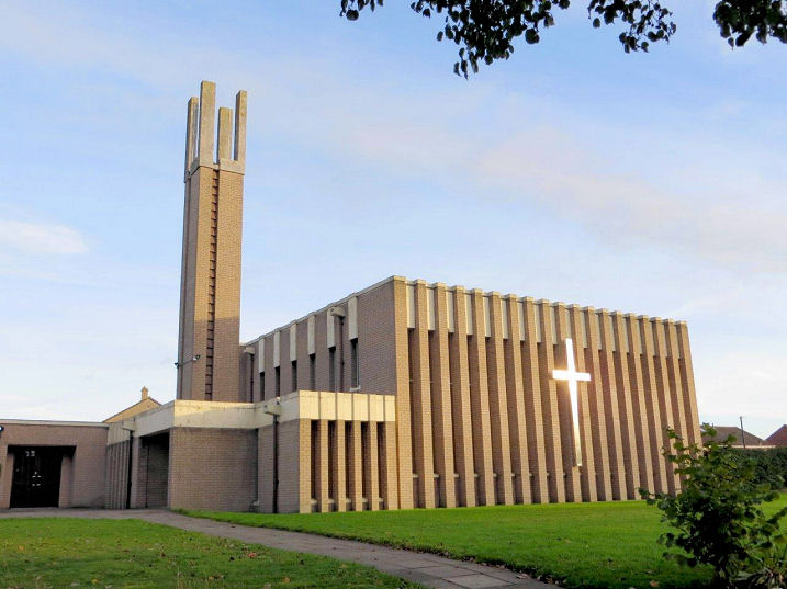
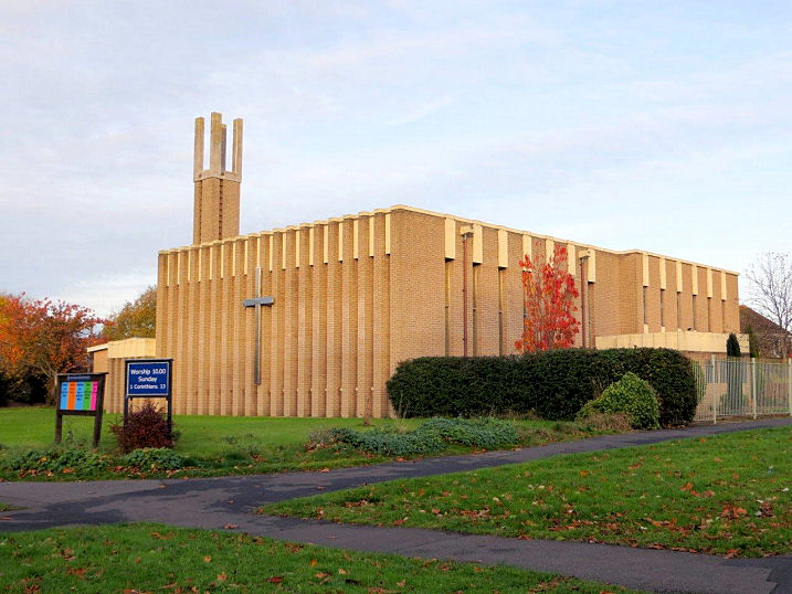
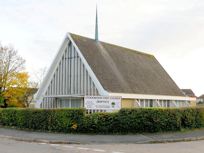
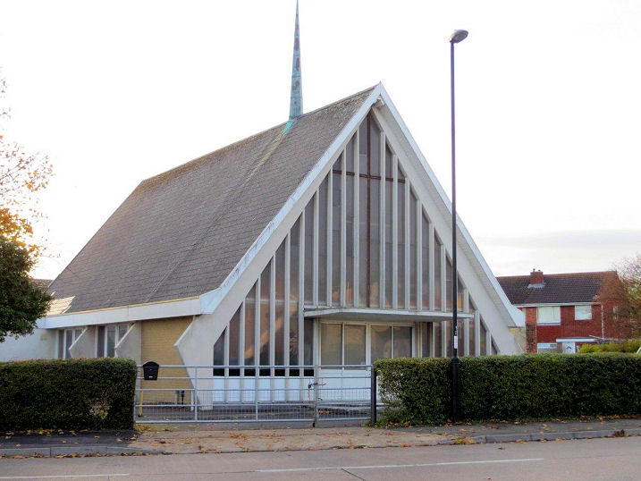
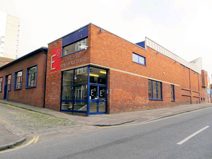
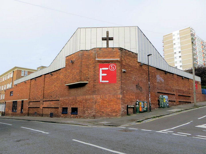
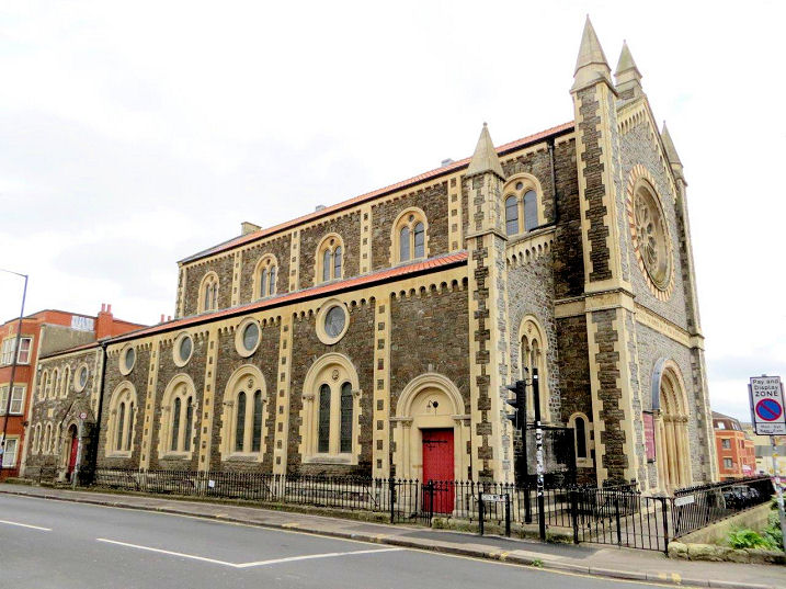
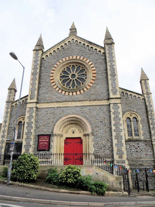
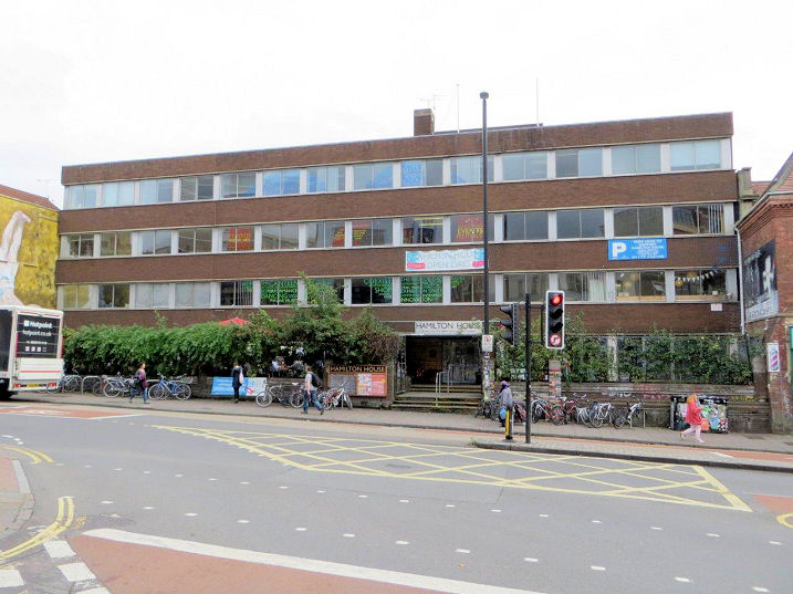
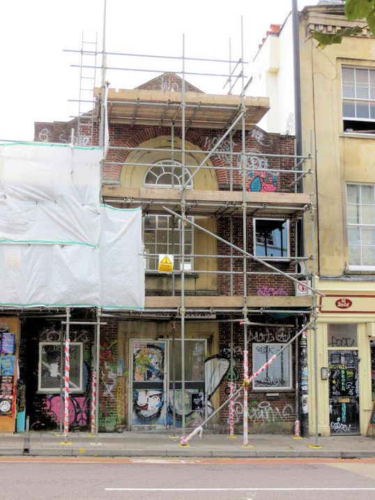
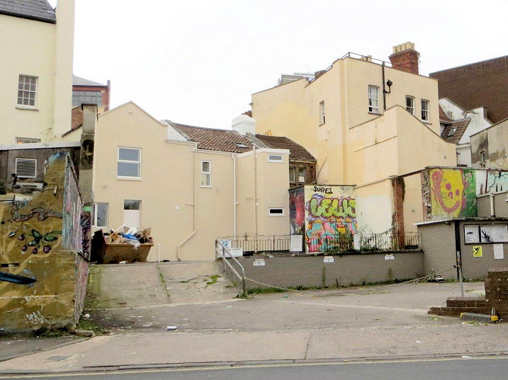
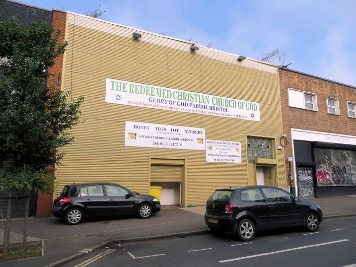
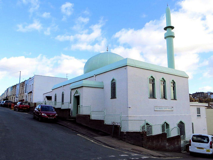
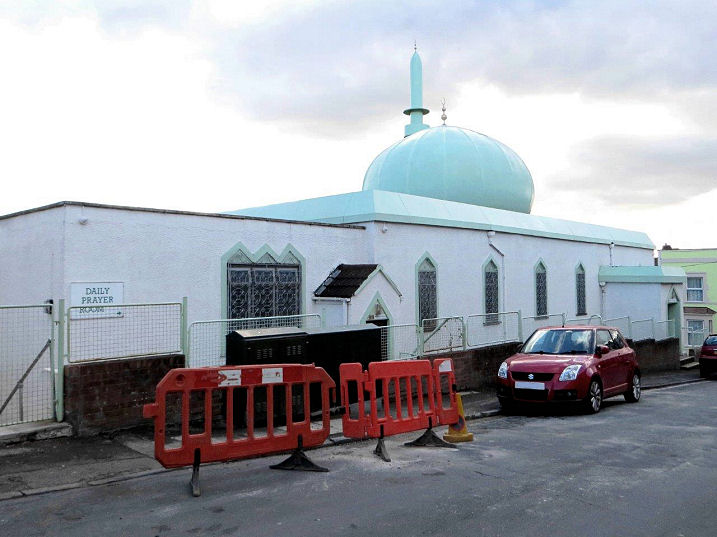
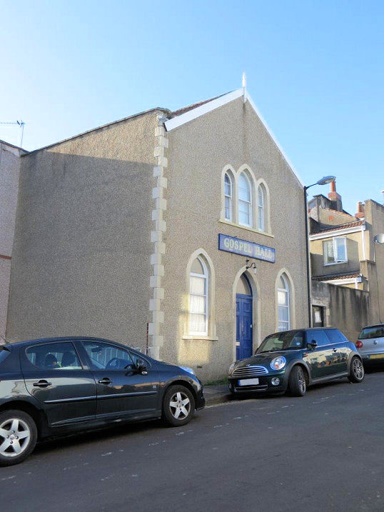
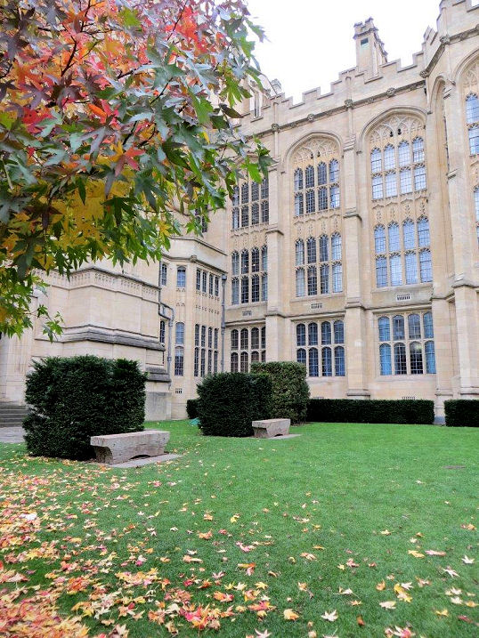
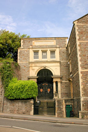
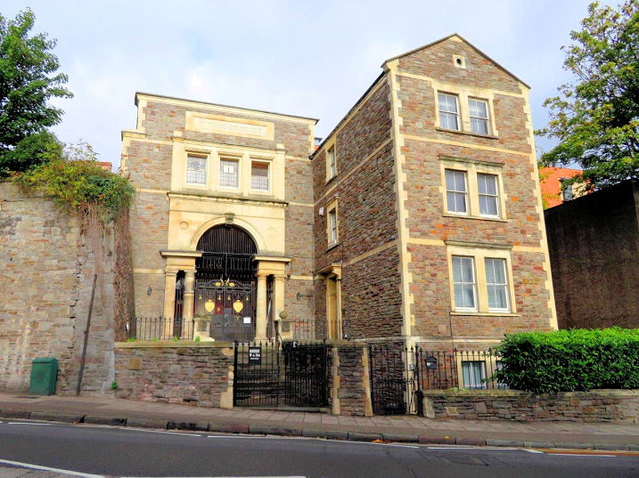
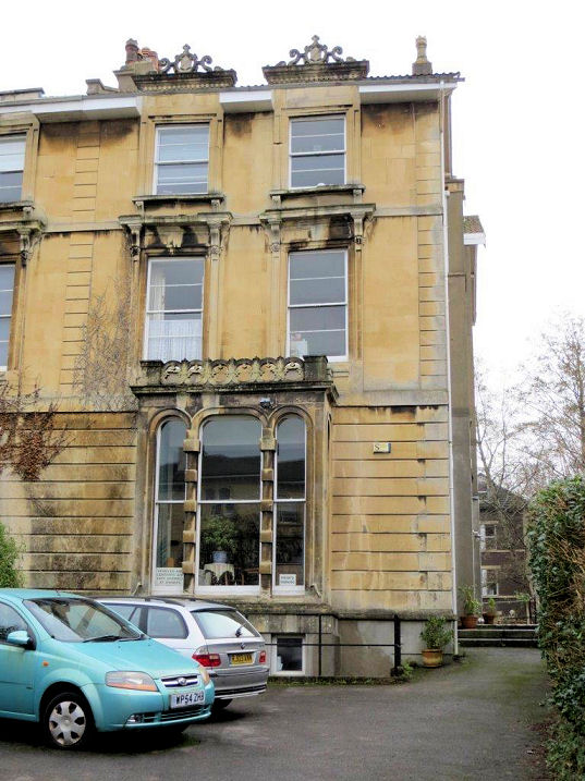
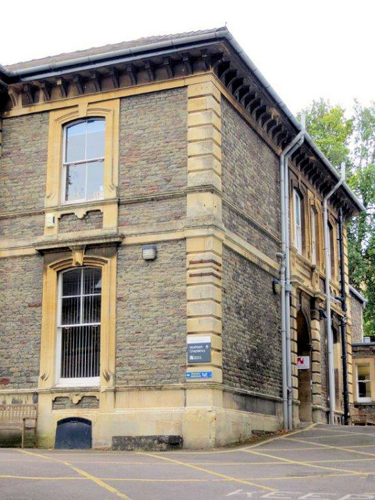
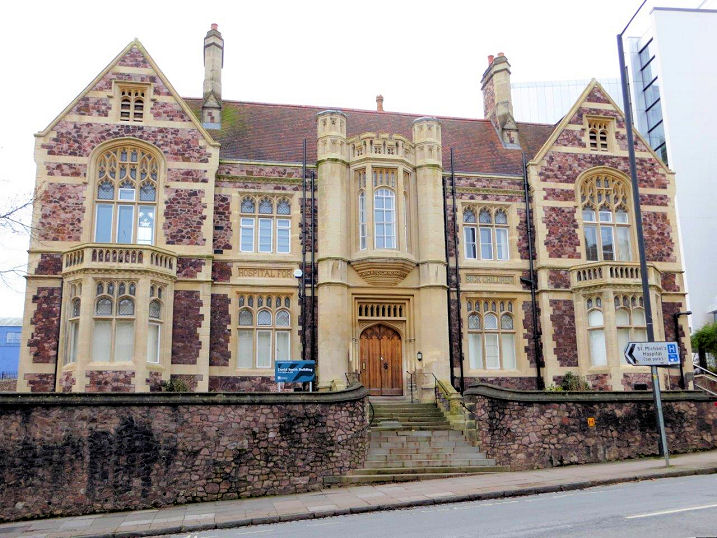
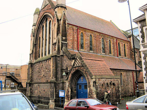
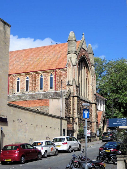
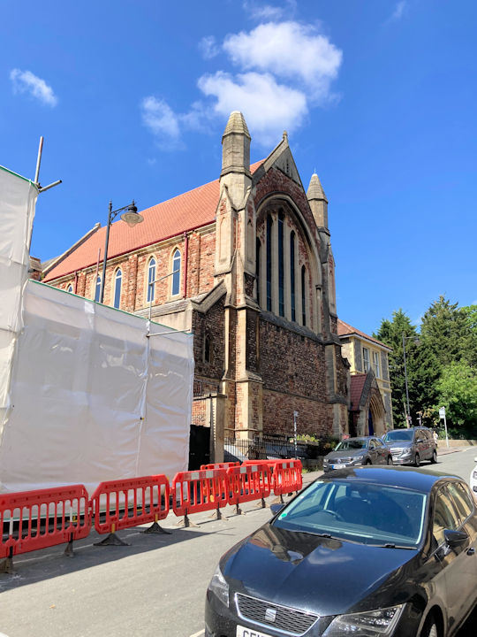
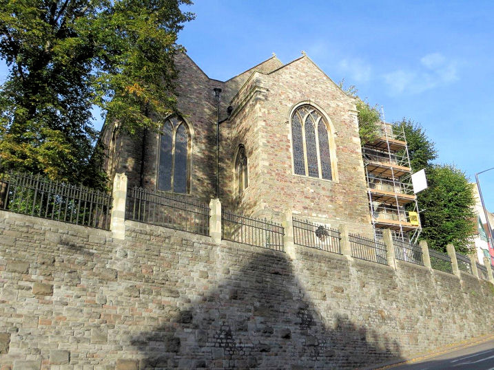
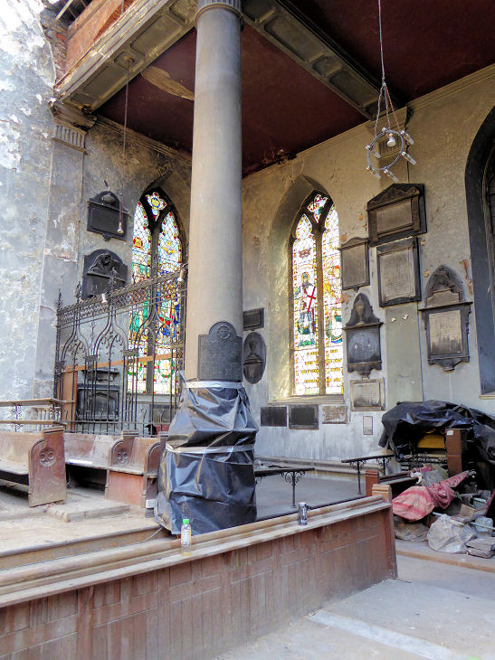
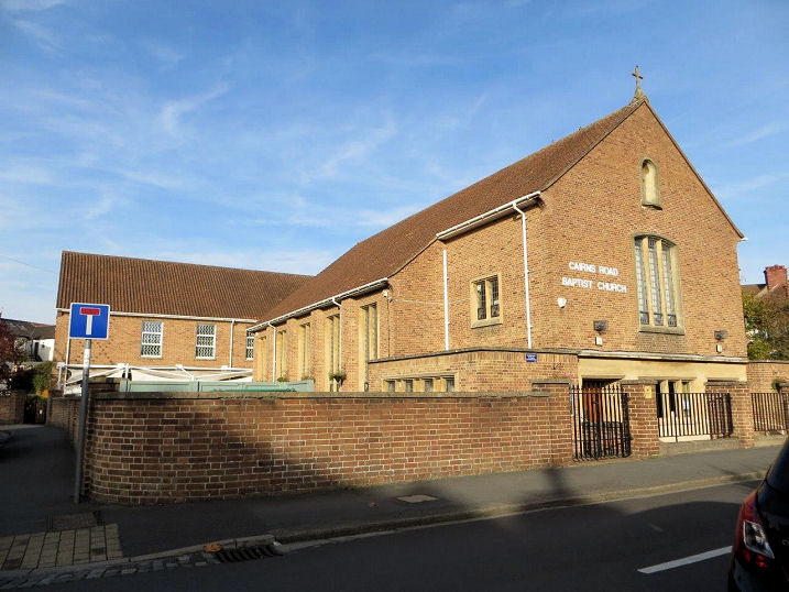
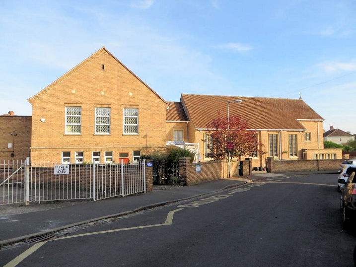
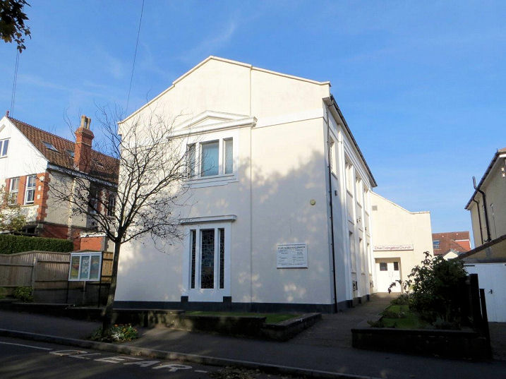
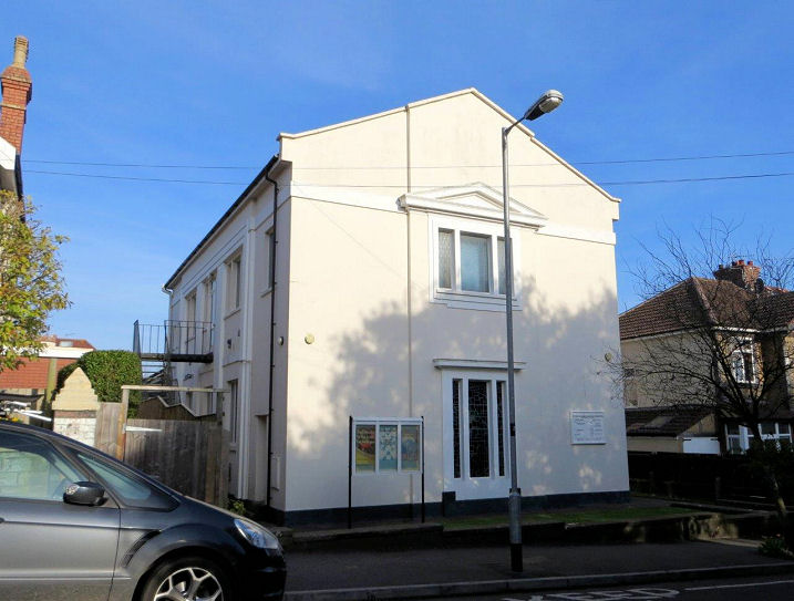
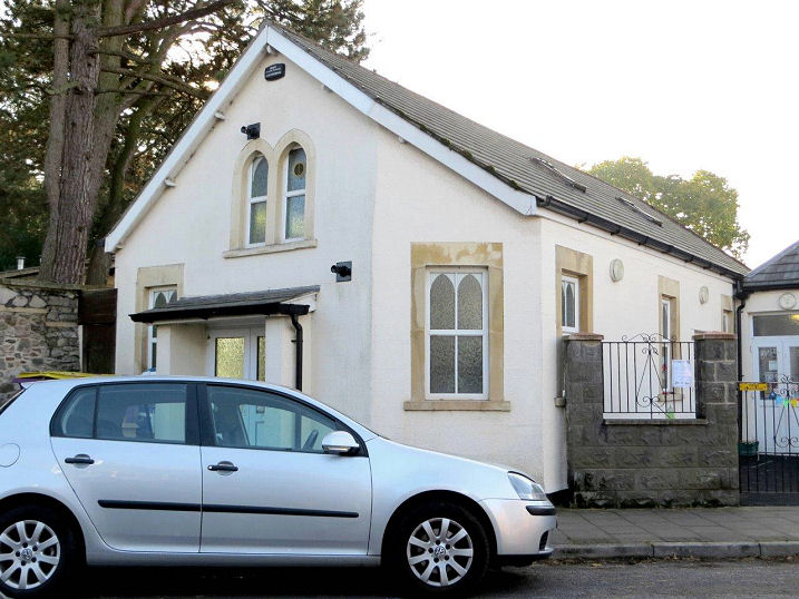
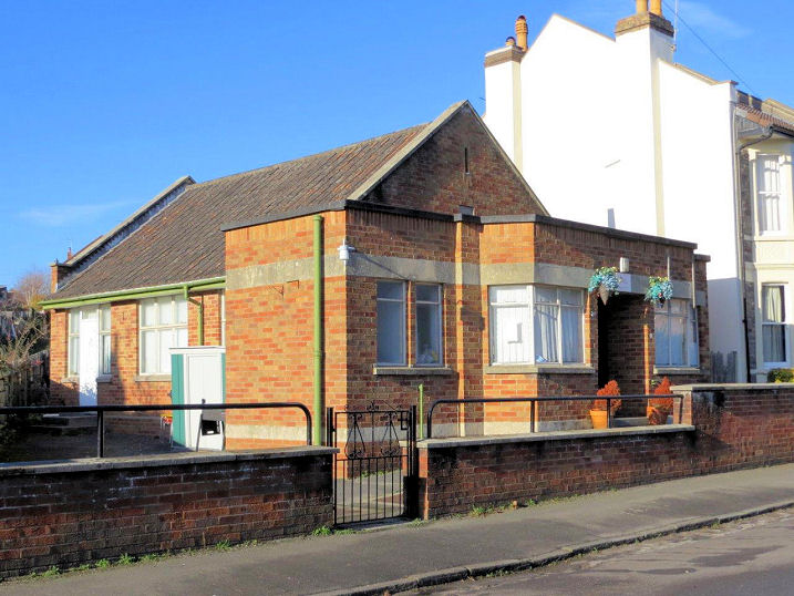
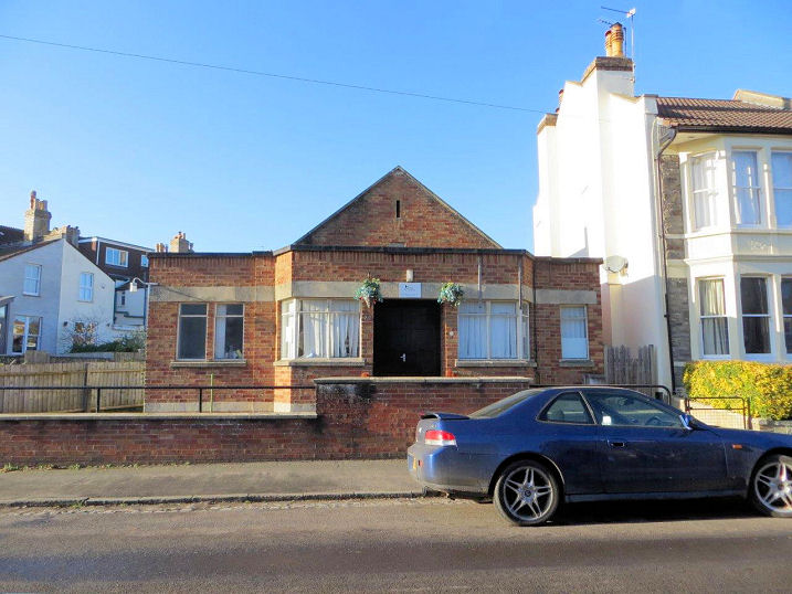
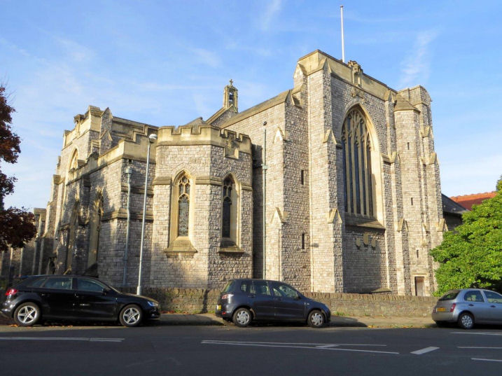
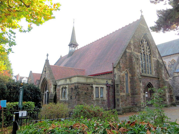
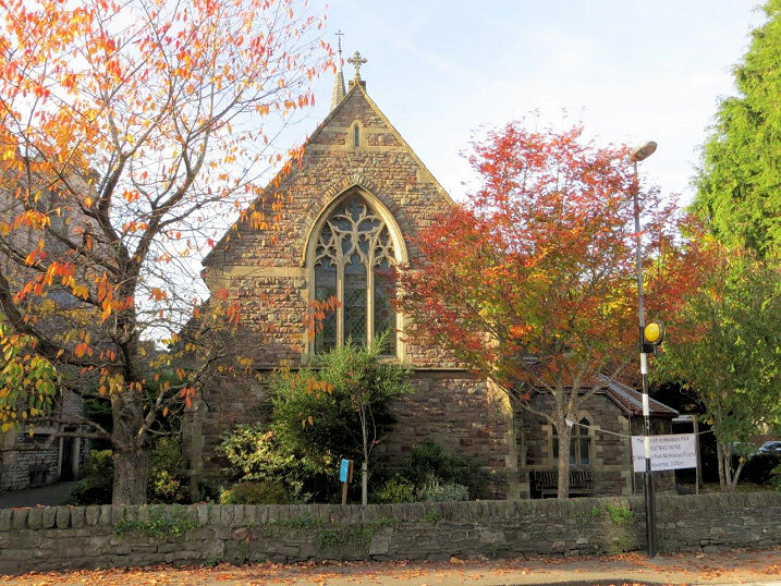
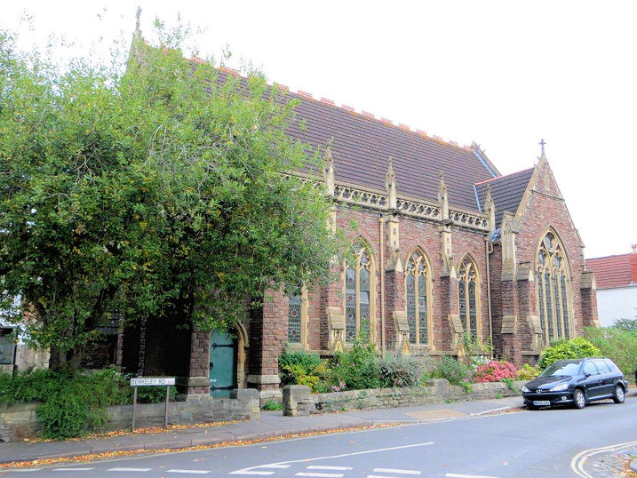
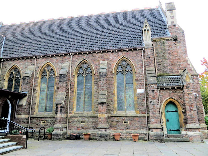
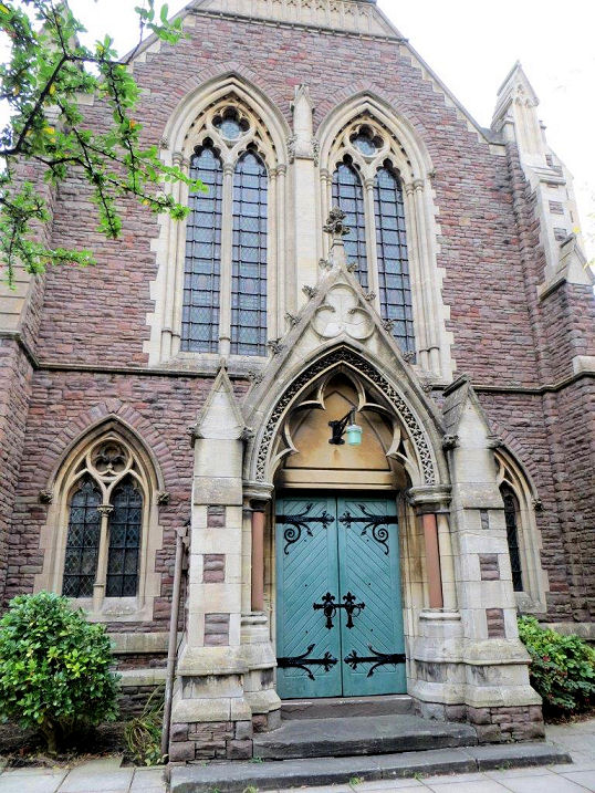
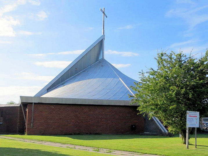
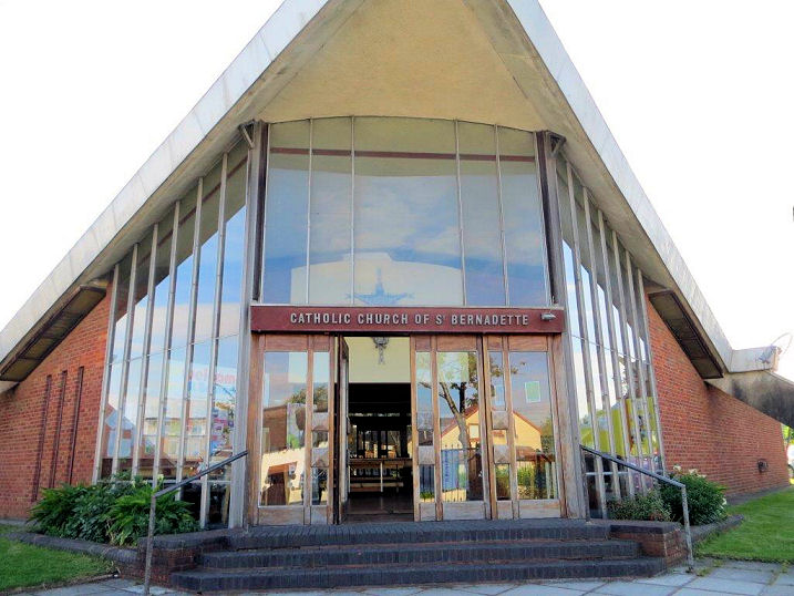
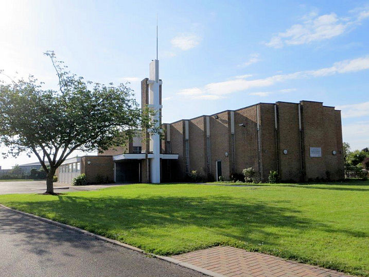
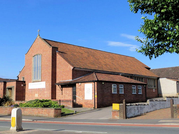
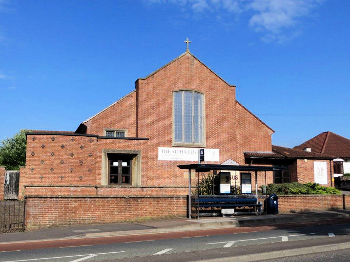
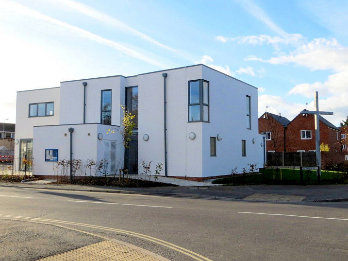
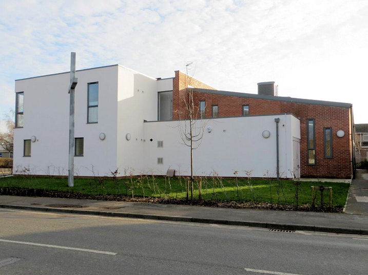
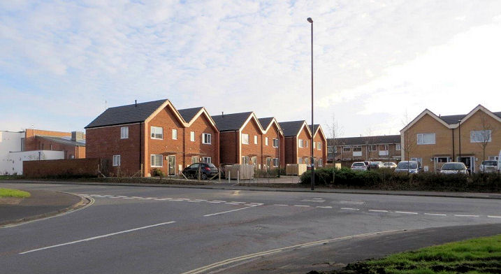
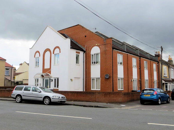
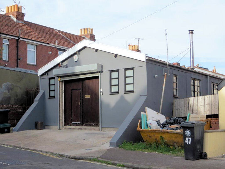
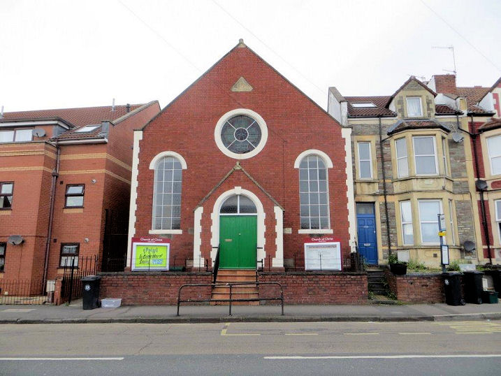
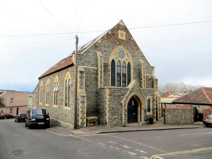
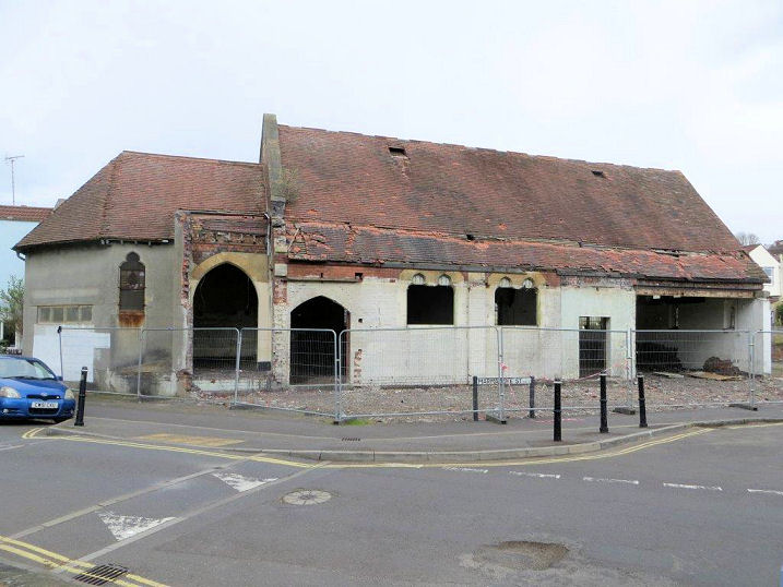
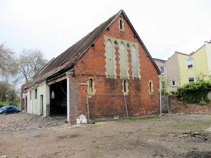
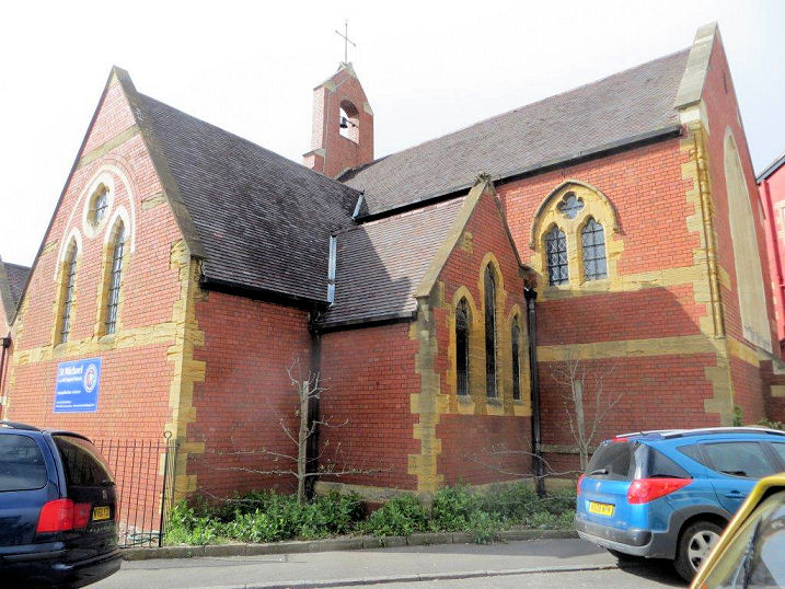
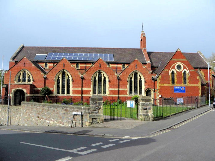
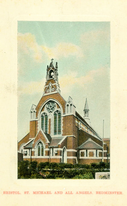