The Churches of Britain and Ireland
|
Horfield, Ashley Down and Ashley Vale, Bristol
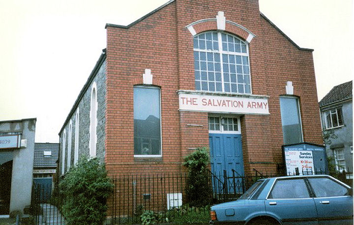
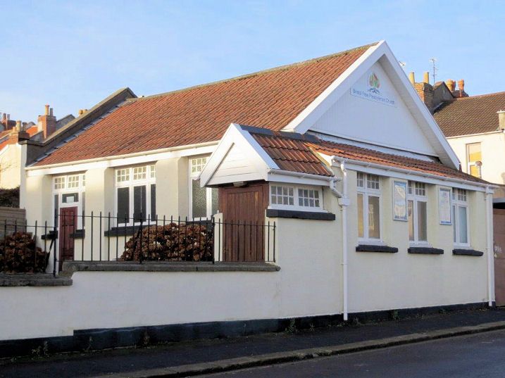
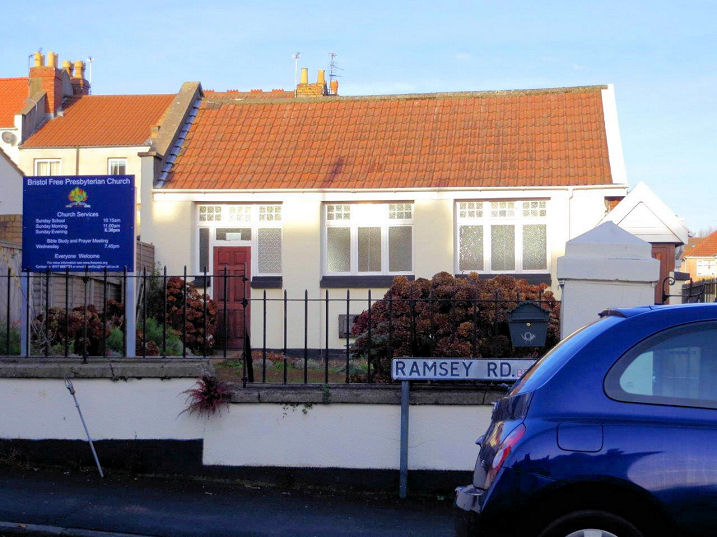
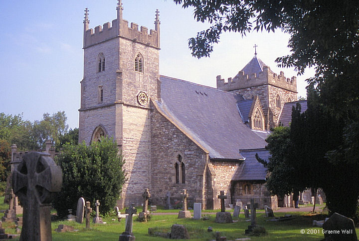
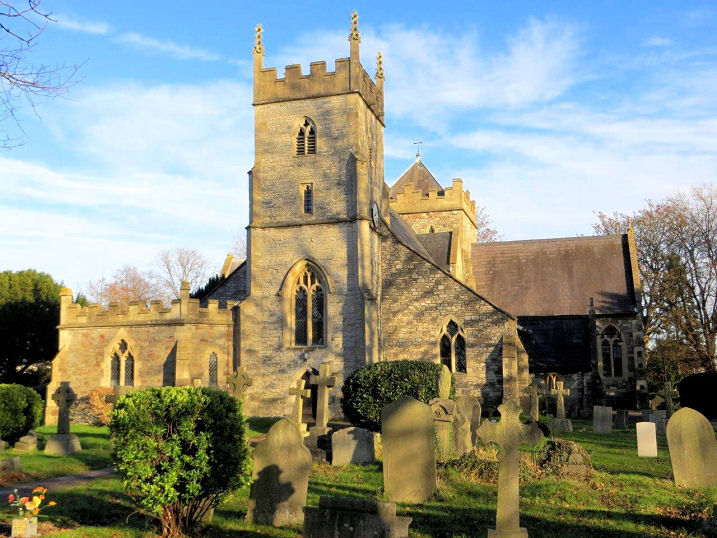
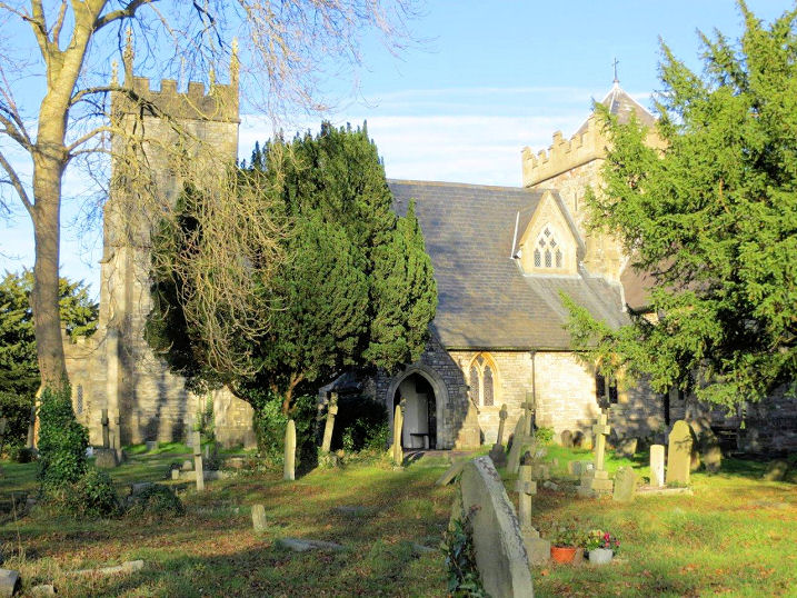
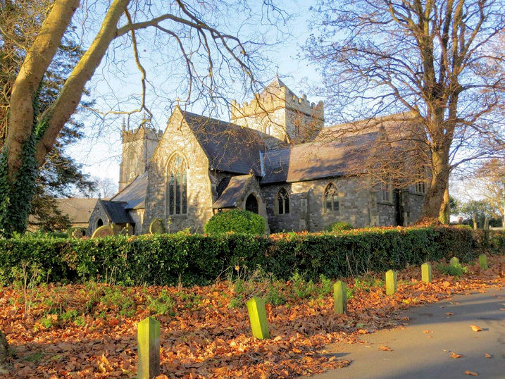
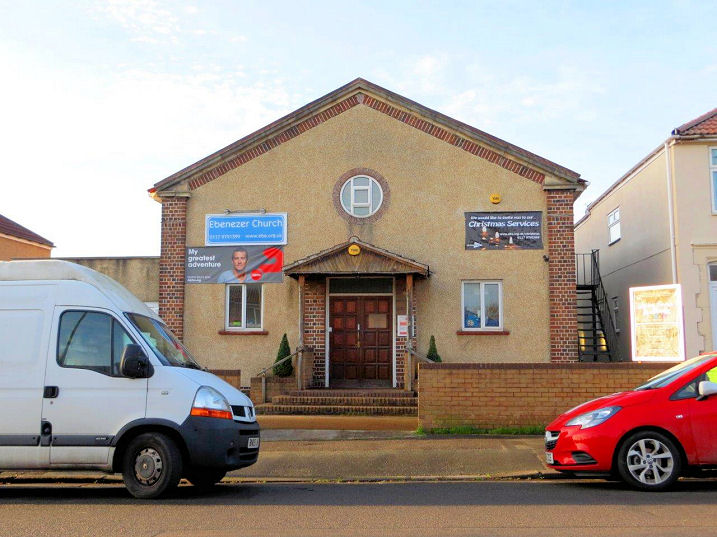
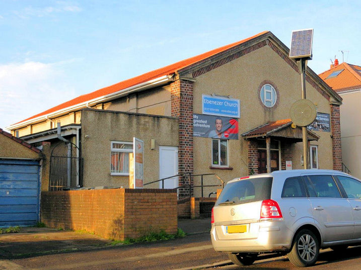
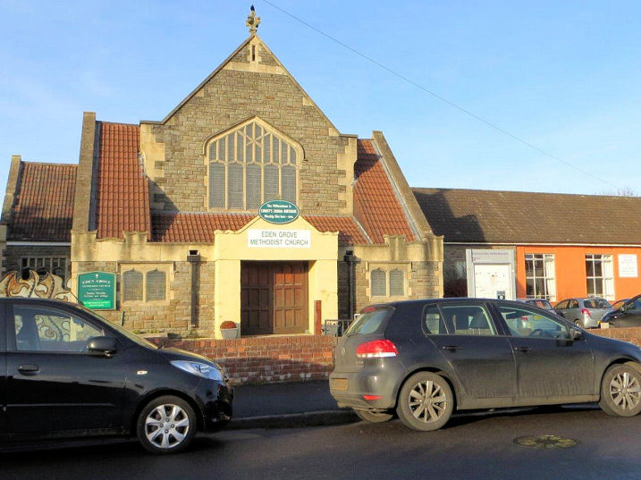
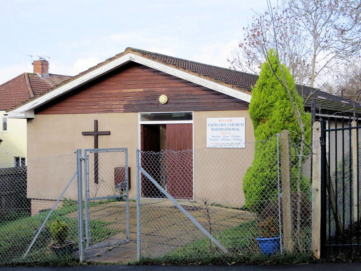
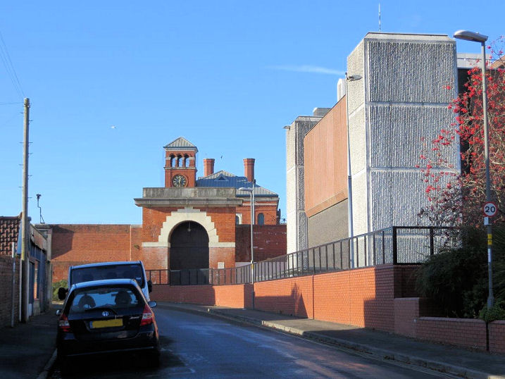
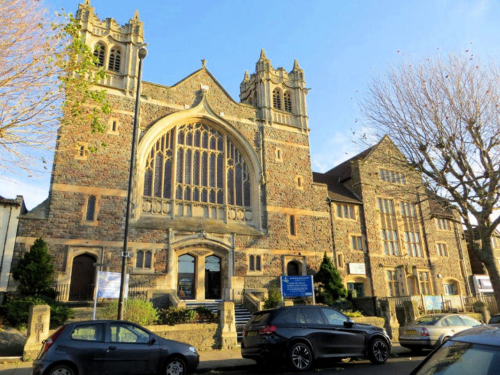
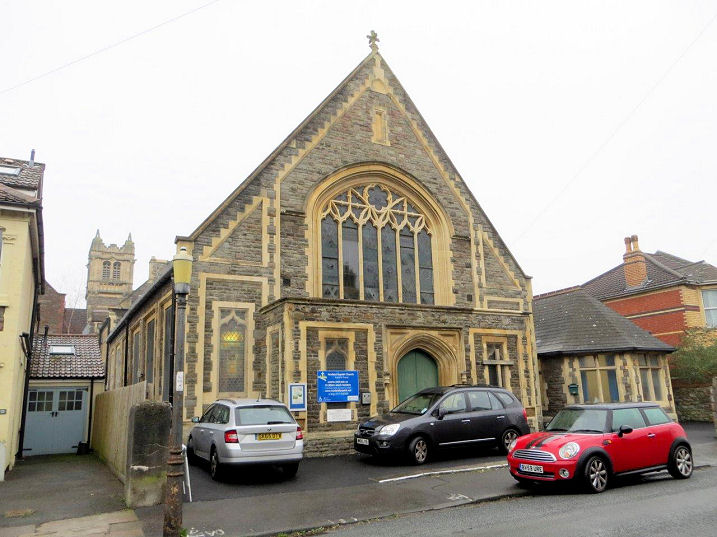
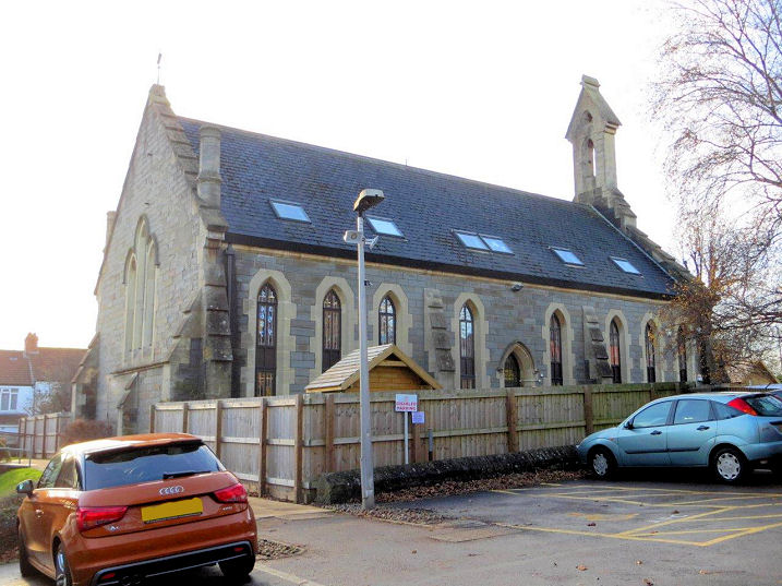
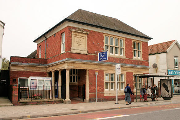
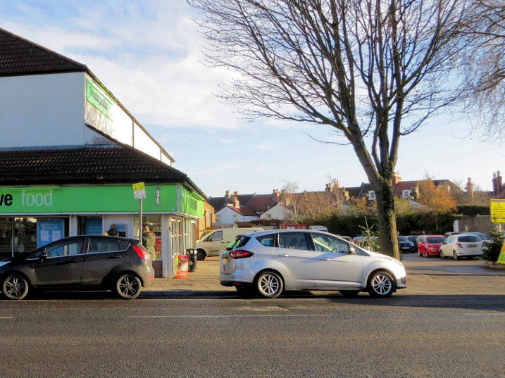
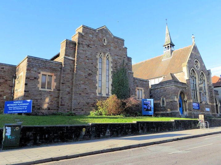
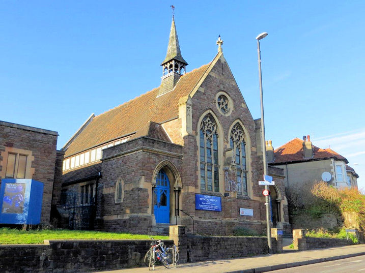
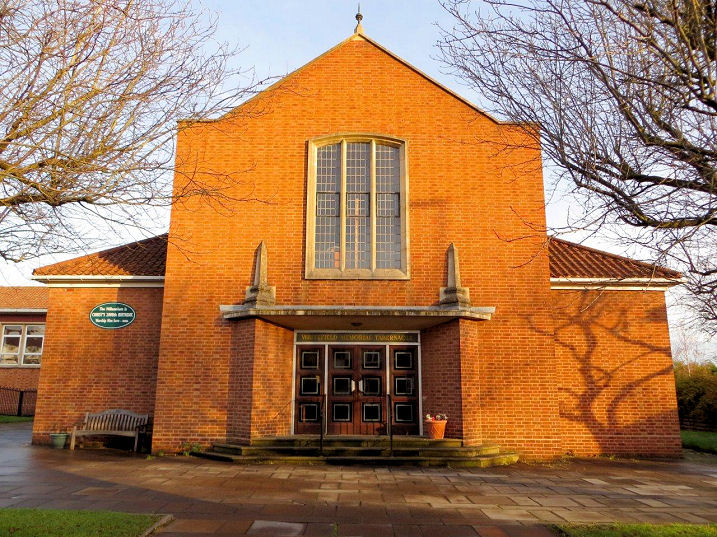
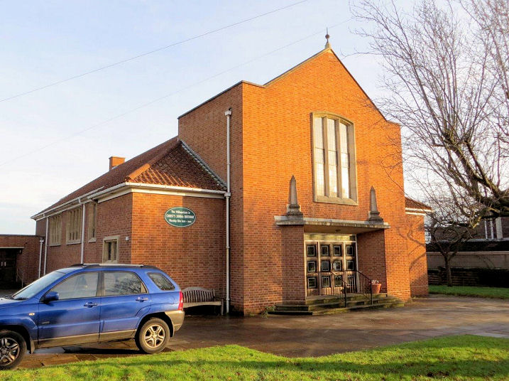
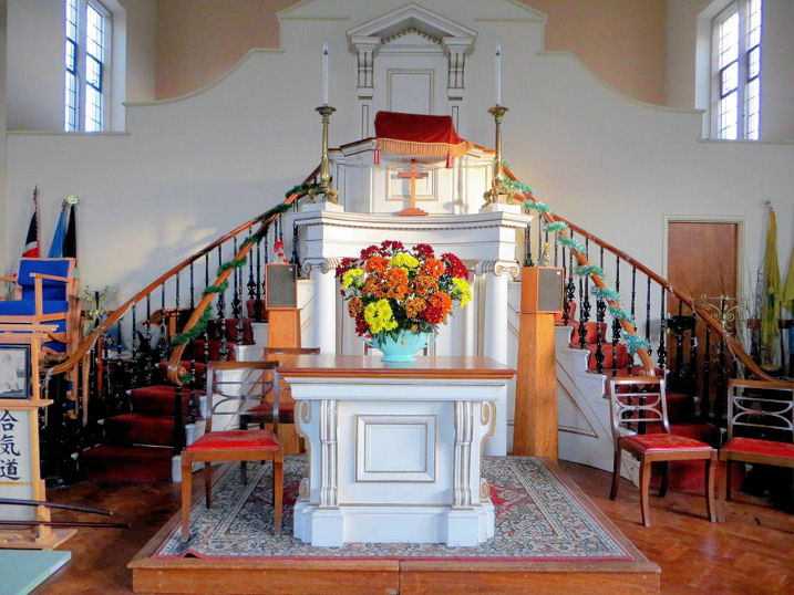
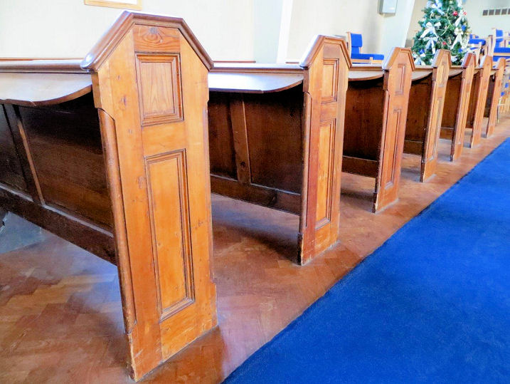
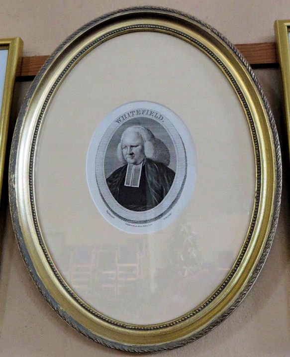
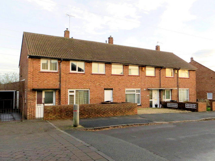
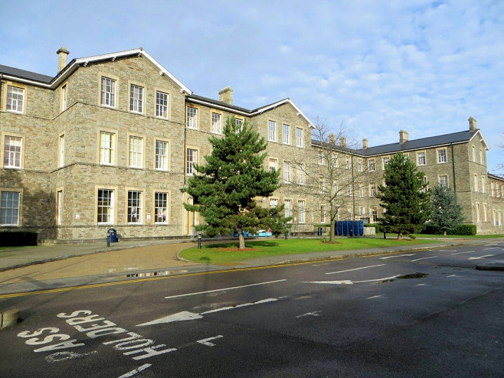
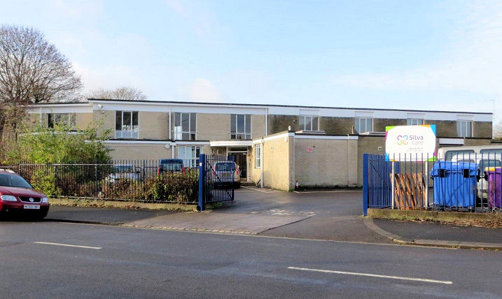
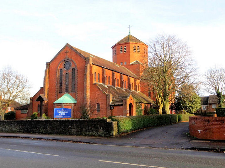
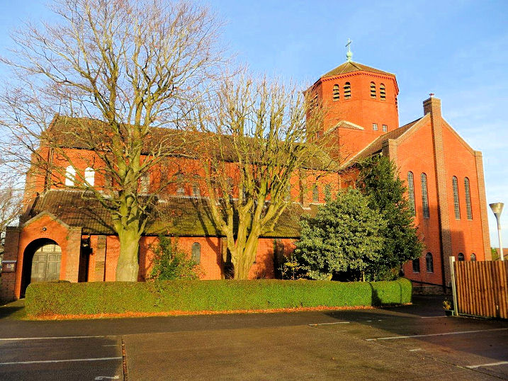
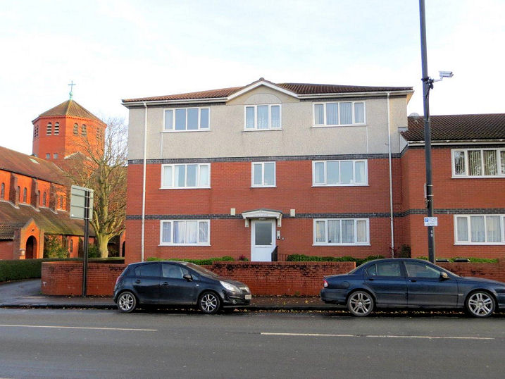
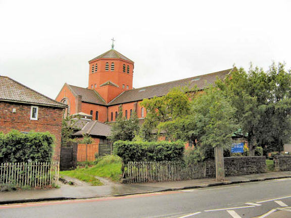
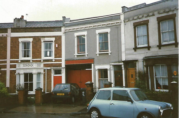
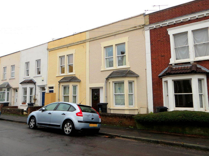
Ashley Down Wesleyan Methodist Church was built in 1839. The congregation moved out and into what became Horfield Methodist Church (for which, see below) in 1899. In 1901 the Horfield Corps of the Salvation Army moved in, who extended the building in 1916 - the brick frontage was added at this time. They vacated the building in 1999, and the building was subsequently converted into flats. The wording Ashley Hall was added into a pre-existing lintel. ST 59439 76147. © Carole Sage (2016). Link (scroll down to Horfield Methodist). This photo shows it when it was being used by the Salvation Army. © Rob Kinnon-Brettle. See also the Salvation Army No. 9 Corps entry below. Bristol Free Presbyterian Church on Ramsey Road and Manx Road. The church dates from 2002, but it occupies a former Gospel Hall. The building itself is of about 1915, and O.S. maps label it as Gospel Hall in that year, Chapel in 1935, 1949 and 1951, and Strict and Particular Baptist Chapel in 1970. Another view. ST 59879 77457. Both © Carole Sage (2016). A Loxton drawing. Church of the Holy Trinity with St. Edmund. The parish church, probably of Saxon foundation, was formerly known just as Holy Trinity. A daughter church on Gloucester Road was dedicated as St. Edmund, King and Martyr - this closed in 1978, and the parish church's dedication was subsequently changed to what it is now. ST 59174 76727. © Graeme Wall. Three further views - 1, 2, 3, all © Carole Sage (2016). Link. There are three Loxton drawings - 1, 2, 3. Grade II* listed. Ebenezer Church on Filton Avenue was originally Brethren, but is now Evangelical. It dates from circa 1936, and has a partnership with St. James Christian Fellowship in Lockleaze. Another view. ST 60178 77403. Both © Carole Sage (2016). Link. Eden Grove Methodist Church. Opened in 1931, it was founded by Brookland Chapel in St. Werburgh's, and it has the organ from the demolished Milk Street Methodist Chapel in central Bristol. Another view. ST 60001 78103. Both © Carole Sage (2016). Link. Faith Life Church (Pentecostal) on Allfoxton Road, Ashley Vale. This was built as a Catholic Church in 1982, originally with a dedication to St. Maximilian Kolbe. St. Edith Stein and the Holocaust Martyrs were later added to the dedication. Carole thinks that the change of hands happened relatively recently. The congregation had previously met in Easton Leisure Centre (for which, see the Easton page). ST 60336 75430. © Carole Sage (2016). H.M. Prison Bristol has a chapel with a dedication to Christ the Servant. For obvious reasons, Carole was unable to photograph it! ST 58975 75929. © Carole Sage (2016). Horfield Baptist Church on Gloucester Road. The first Baptist Church in the area was a tin tabernacle founded in 1892 from Broadmead Baptist Church (for which see the main Bristol section, above). A rather handsome small chapel followed in 1896 - this now stands behind the present church, facing Brynland Avenue, and serves as a hall. The equally striking present church soon followed in 1901. ST 59194 75773. Both © Carole Sage (2016). Link. An interior photo is available here. Grade II listed. The former Horfield Barracks Garrison Church (1857) on Gloucester Road served the Gloucestershire Regiment when it was stationed there. Closed in the 1920's, it was used as offices for some time, but is now in use as a nursery. Another view. ST 59672 77211. Both © Carole Sage (2016). Grade II listed. Horfield Friends Meeting House (1908, ST 59254 76019) on Gloucester Road replaced an earlier corrugated iron building which stood nearby, opposite the end of Thornleigh Road at ST 59290 76045. This is probably also the one referred to in the entry for the Salvation Army No. 9 Corps, below. © Andrew Ross. Link. The earlier building was erected circa 1900. In 1915 it was a Primitive Methodist Chapel, and in 1948 it was a Baptist Mission Hall (photo here). It had been demolished by the time the 1955 O.S. map had been published, and the site is now part of a supermarket car park. © Carole Sage (2016). Horfield Methodist Church (1899) stands at the junction of Gloucester Road and Churchways Avenue. It replaced a small chapel on Ashley Down Road, for which see the next entry. Another view. ST 59422 76580. Both © Carole Sage (2016). Link1 (with a good history). Link2. And here's a Loxton drawing. Horfield U.R.C. on Muller Road. Another view. ST 59890 76350. The congregation traces its origins back to 1930 when a group of Congregationalists bought a house on Downend Park to be used as a place of worship. A church (Horfield Congregational) was built on the corner of Downend Road and Muller Road in 1933 - this now serves as the church hall for the present building, which was built in the late 1950's. This was made possible by the council's acquisition of the Whitfield Tabernacle on Penn Street in central Bristol (see the main section, above), and funds, and some of the congregation of that church joined with the Horfield church. Some of the fittings from the Tabernacle were moved to the new Horfield church - including the handsome pulpit, which can also be seen in a Loxton drawing, in its original home, and the pews. It was also given the additional name of Whitefield Memorial Tabernacle, and an illustration of George Whitefield can also be seen in the church. All © Carole Sage (2016). Link1. Link2 (scroll down). Living God Gospel Church meet (or used to meet) in the Parish Hall of the church of St. Gregory the Great (for which, see below) on Filton Road. The church does have an on-line presence, but when I tried to look at it my security software warned that the website had been compromised, and blocked access to it. ST 59879 77865. © Carole Sage (2018). A Mission Church was built on Wordsworth Road in the 1930's, to serve a new housing development. The site is now occupied by housing. ST 60556 77556. © Carole Sage (2016). The former Muller Homes Orphanage occupies a huge site. Founded in the mid-19th century by the Rev George Müller, it consisted of five orphanage houses, which accommodated 2050 children. Included in the complex was a chapel, but curiously, considering it must have been a large building for this size of congregation, no references seem to exist describing it, or its exact location. The orphanage closed in the 1950's, and was sold to Bristol City Council. Three of the "houses" have subsequently been converted into flats, and the other two are being used by Bristol City College. The photo shows one of the "houses". ST 59708 75494. © Carole Sage (2016). A Loxton drawing, and another old illiustration. St. Edmund, King and Martyr used to stand on Gloucester road. It was a daughter church of Holy Trinity (for which, see the first entry on this page), and was converted from a school hall in 1930. It closed in 1978, and the building was used by a business for some years, but it was demolished in 2006. The site is now behind a row of shops, and not publicly accessible. Photos of the church are available here. ST 59224 75995. © Carole Sage (2016). St. Francis on Dovercourt Road was a mission from Holy Trinity in the 1930's. It was surplus to requirements when St. Mary Magdalene was built in Lockleaze in 1956, and was subsequently demolished. The site is now occupied by a day-care unit. ST60243 76676. © Carole Sage (2016). St. Gregory the Great (1936) on Filton Road (ST 59875 77850). Another view. It had been preceded by an earlier church (1911) of the same name on a nearby site (ST 59844 77828), now occupied by a block of flats. A Loxton drawing, and an old photo available here both show it. All © Carole Sage (2016). Another view, © Graeme Harvey. Link, which has some interior photos. The Salvation Army No. 9 Corps was founded in 1898, initially in the Friends Tin Mission, on Thornleigh Road. They next moved to a house on Falmouth Road, where meetings and the Sunday School met in the front room. They returned to Thornleigh Road (no. 14, with the red double-doors), where the ground floor was used as the hall, with accommodation for the officers upstairs. Finally, when the Methodists left their church on Ashley Down Road, the Salvation army bought it (see Methodist Church, above). It was closed in 1999, and is now in residential use. Information (as most information elsewhere on this website on Salvation Army matters) courtesy of Rob Kinnon-Brettle. Photo © Rob Kinnon-Brettle. Carole Sage has provided a general view of Falmouth Road, which has a grid reference of ST 59006 75719. © Carole Sage (2018). Two terraced houses on Oak Road were converted and used as a Wesleyan Mission Room in the late 1920's (1927-30). It was probably called Oakley Hall, as there are references to one such on Oak Road. At some later point it was in use as a Brethren Meeting Room. Still marked as a single "hall" on the 1970 O.S. map, they have since been converted back to two single houses. ST 59309 76283. © Carole Sage (2016).
|
||
04 March 2023
© Steve Bulman