|
|
Conwy
Conwy on Wikipedia.
Abergele.
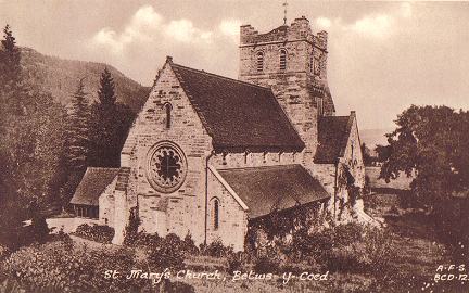
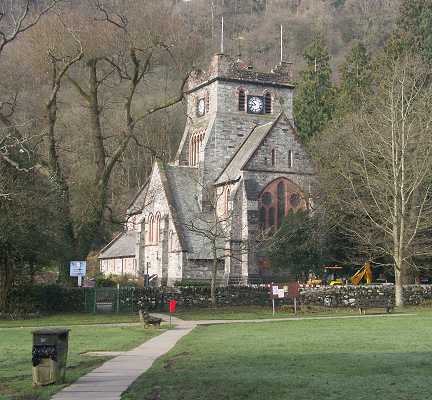
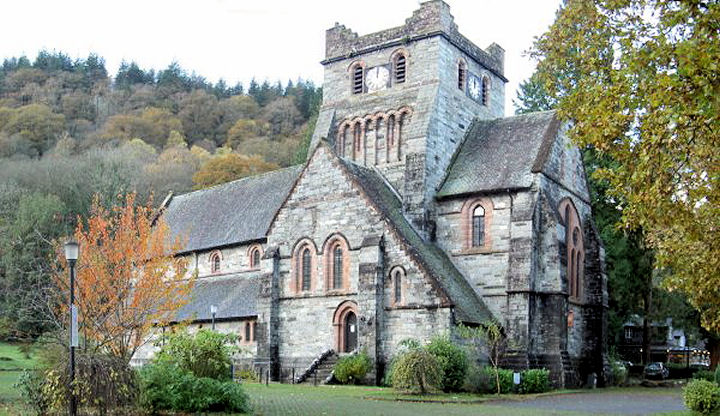
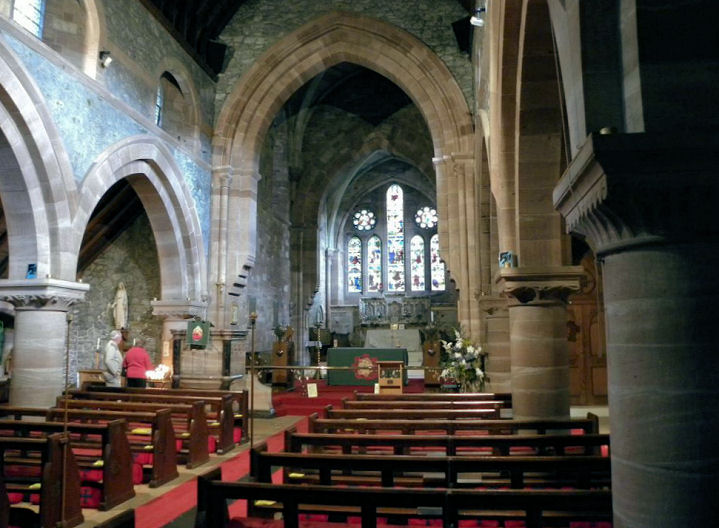
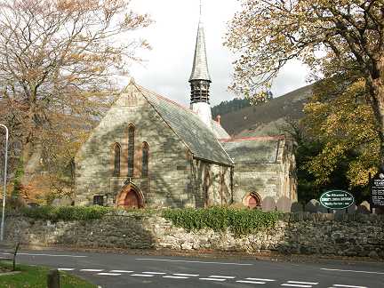
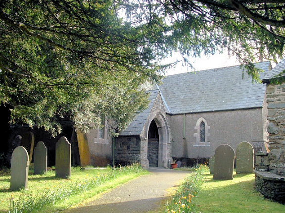
Betws-y-Coed,
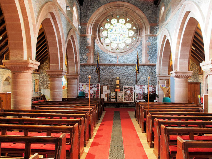
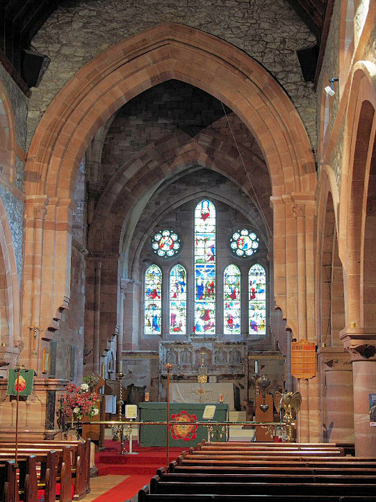
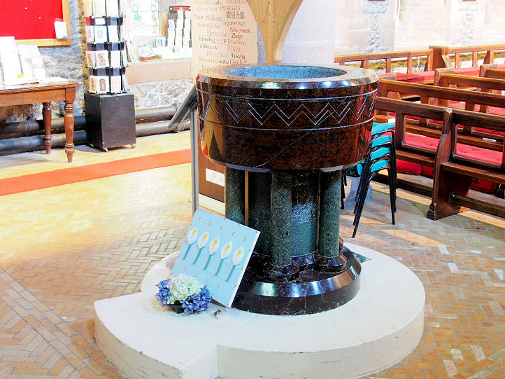
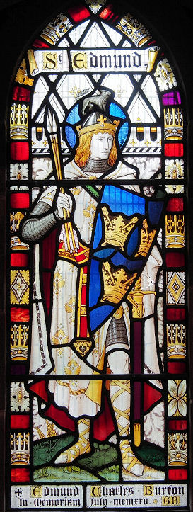
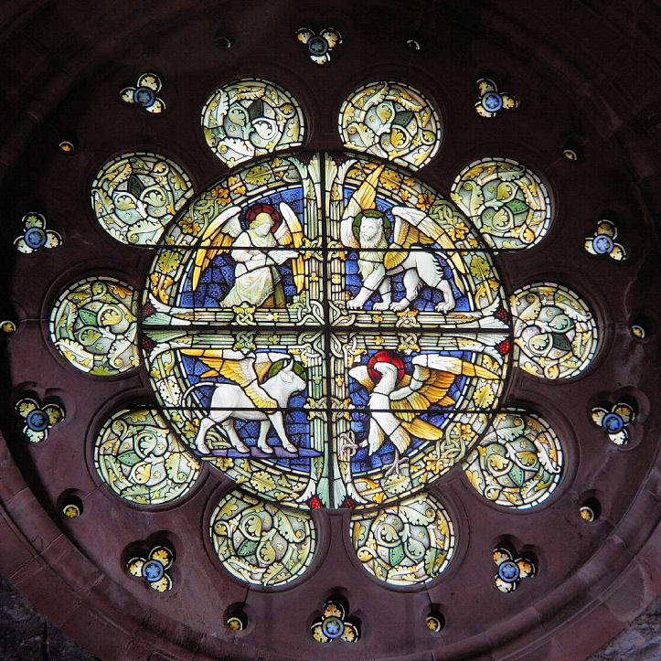
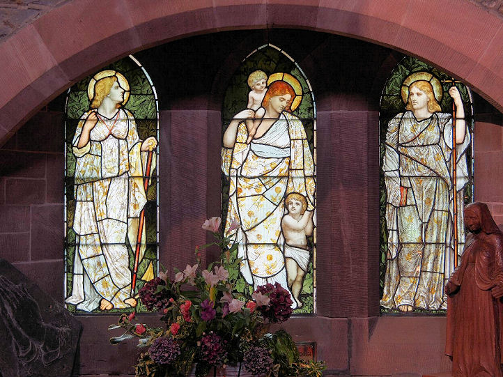
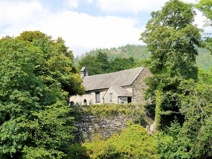
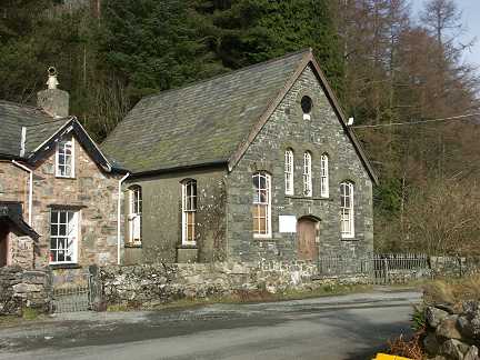
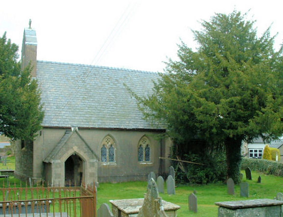
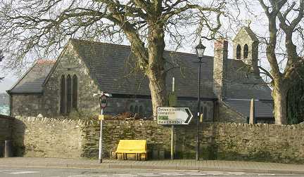
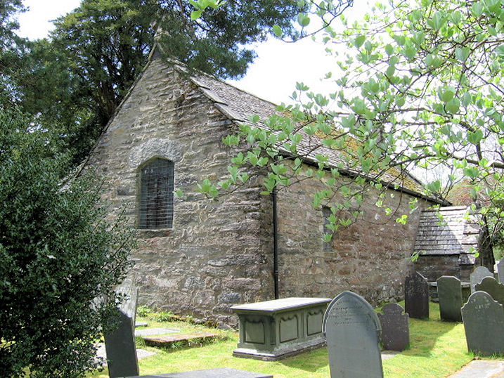
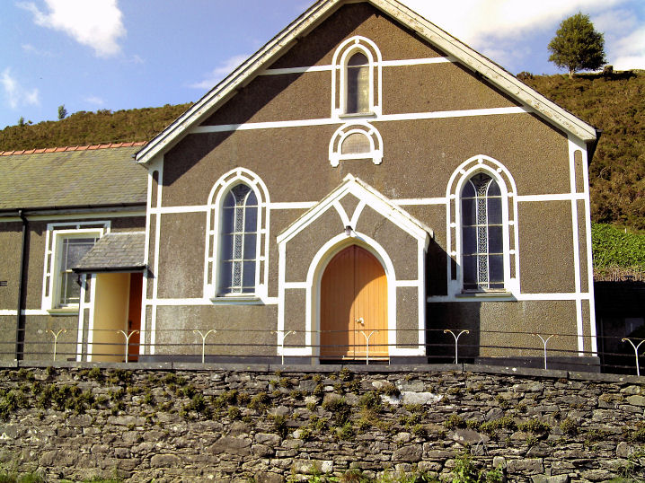
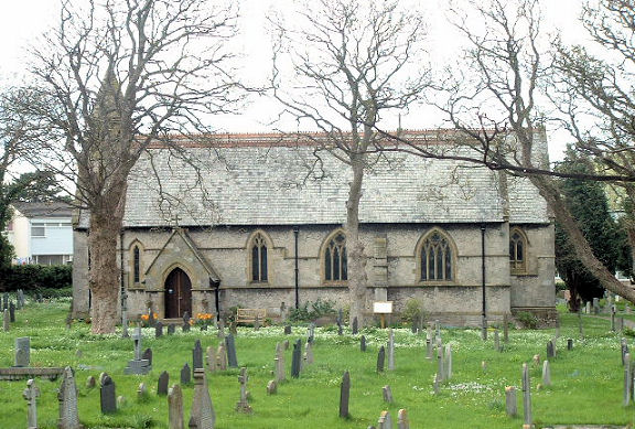
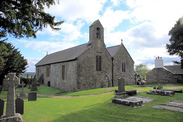
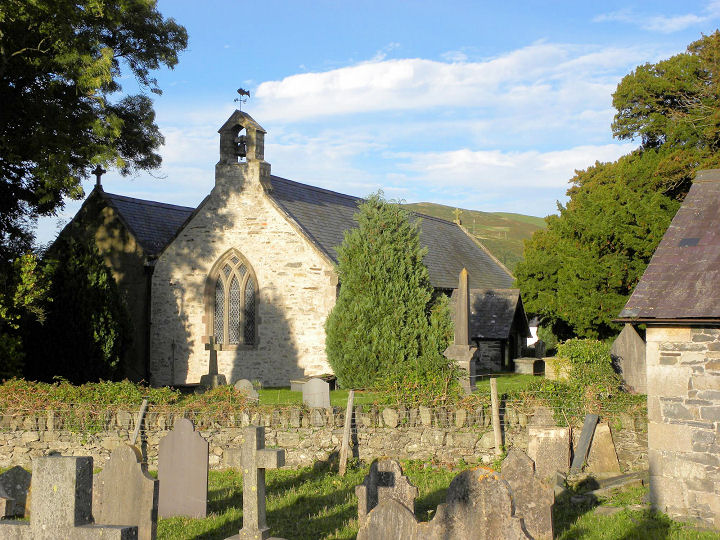
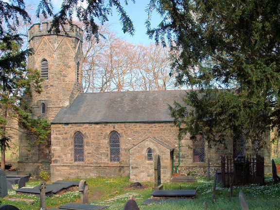
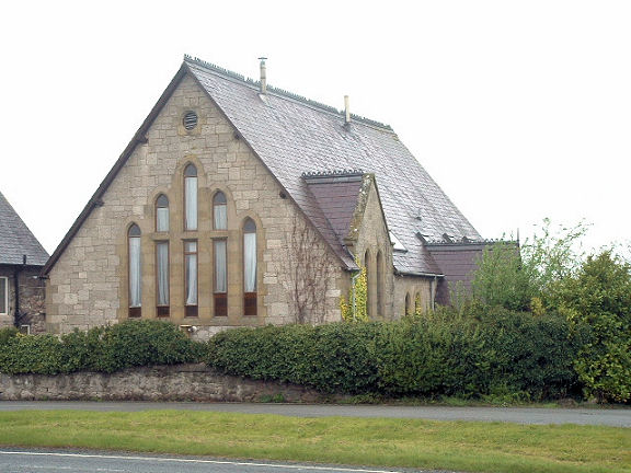
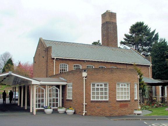
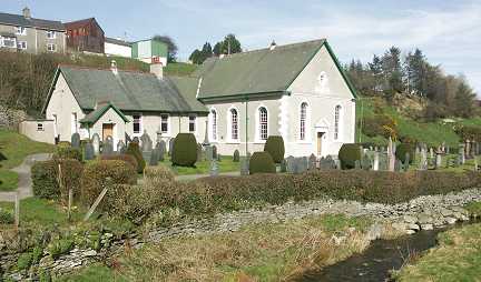
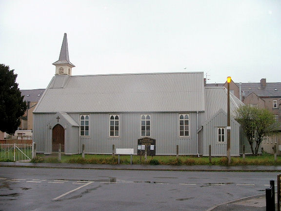
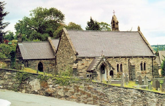
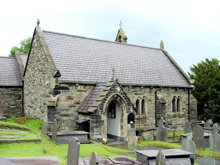
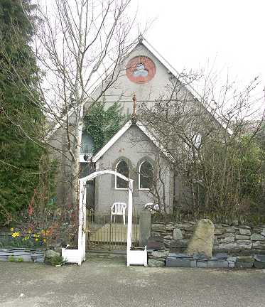
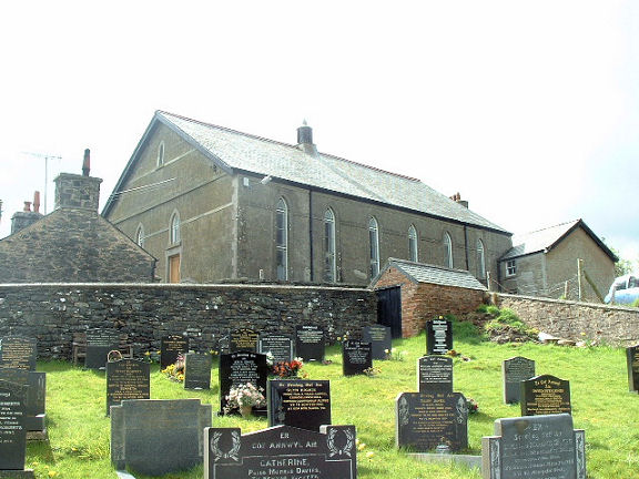
St. Mary.
St. Mary (O). SH 7937 5646. From an old postcard in Steve Bulman's Collection. A
modern view, © Martin Briscoe.
Another view, © Alan Blacklock (2010).
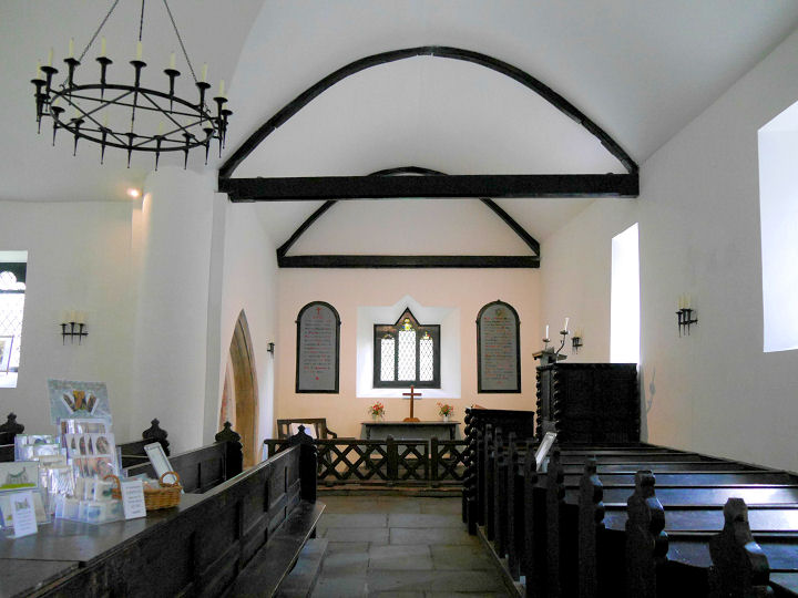
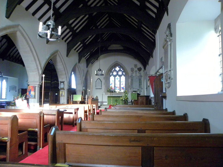
Interior view,
© John Balaam (2010).
Two more interior views -
1,
2, and the
font, and three examples of the
fine windows - 1,
2,
3, all
© Chris Stafford (2015).
Link.
Grade II* listed, wherein it's dated to 1873 (tower 1907).
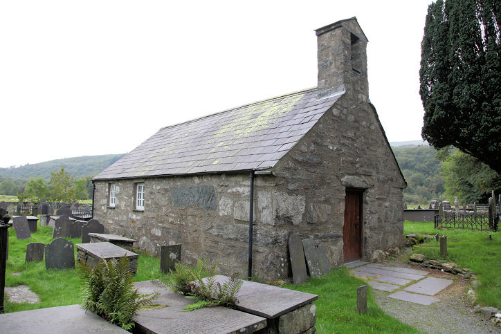
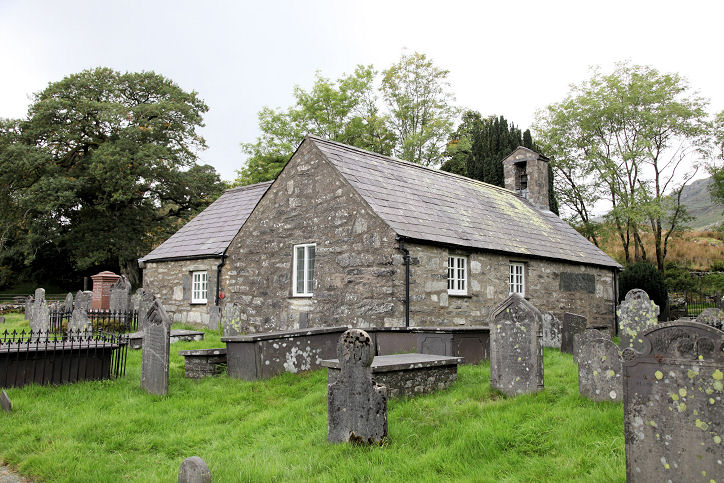
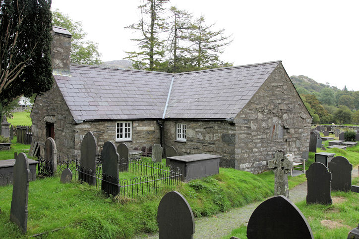
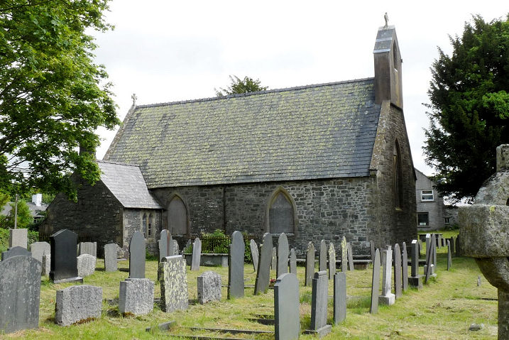
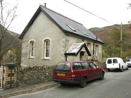
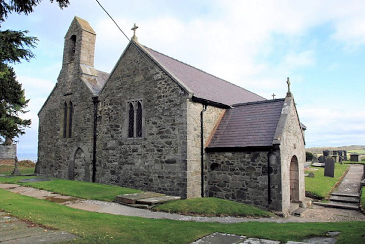
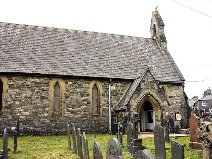
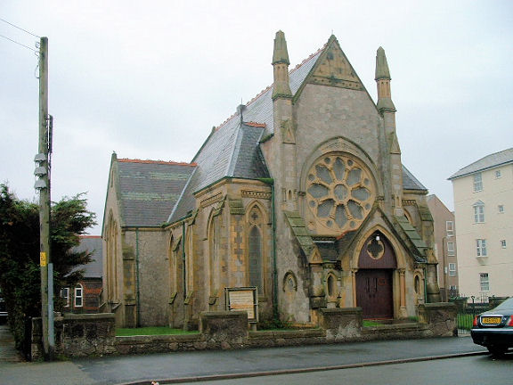
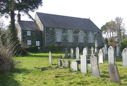
The former church of
St. Michael and All Angels. SH 7960 5656. © Martin
Briscoe. Another view, © Dave
Westrap. Dave advises that the church originally dates from the 14th century,
and was the original parish church. Replaced by St. Mary in 1873, it gradually
fell into disrepair, until efforts to repair and preserve it were undertaken
from 1994. Declared redundant in 2000, a trust now leases it from the Church in
Wales. Another view, and the
interior, both
© John Balaam (2017).
Link1.
Link2.
The church is listed as
grade II*, and its lych-gate as
grade II. The (presumably former)
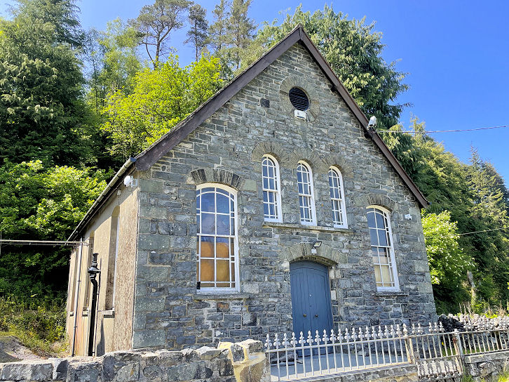
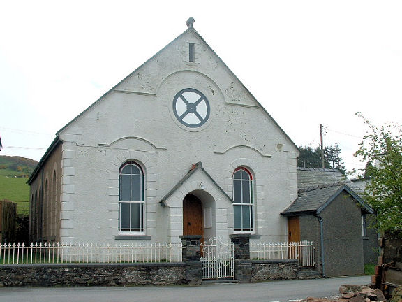
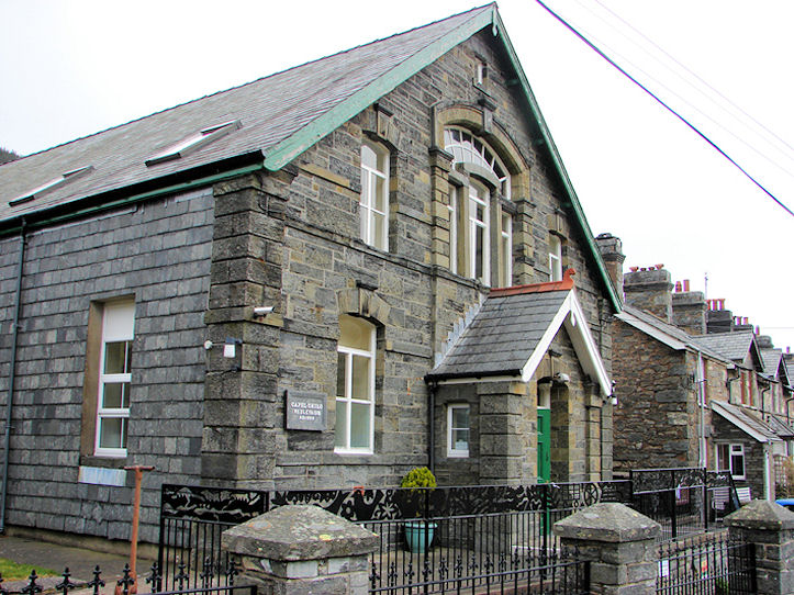
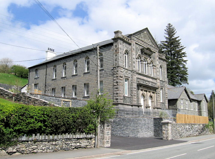
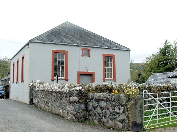
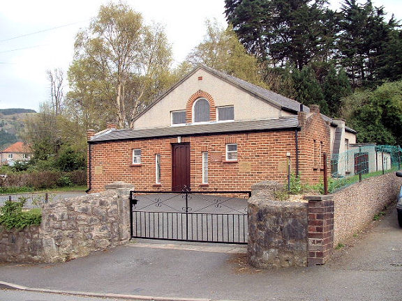
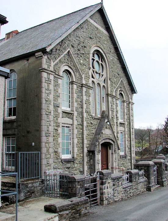
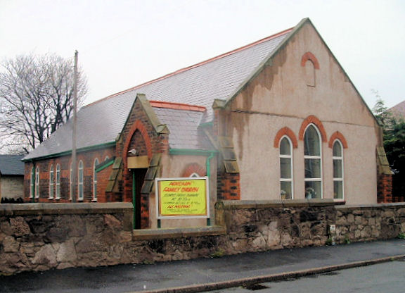
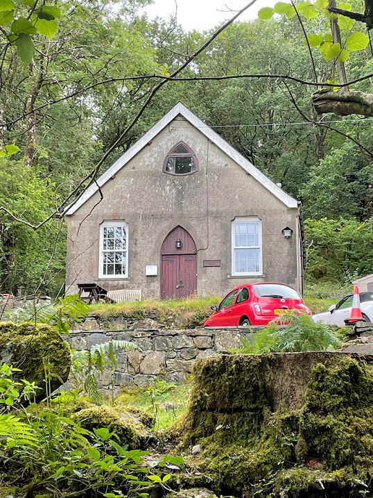
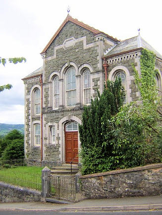
Capel Brynmawr (Calvinistic
Methodist) is dated by
Coflein to a re-build in 1872 of a chapel of 1808. SH 7904 5668. © Steve Bulman. Despite having walked right past it, I
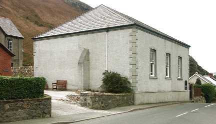
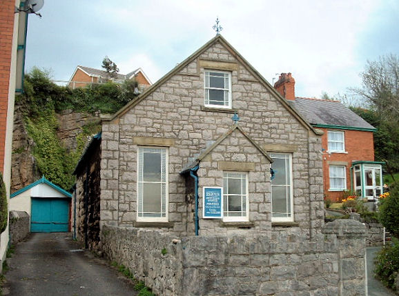
didn't spot that this shop
(seen on a Streetview from 2018) was a former chapel. The
side-view, also from 2018,
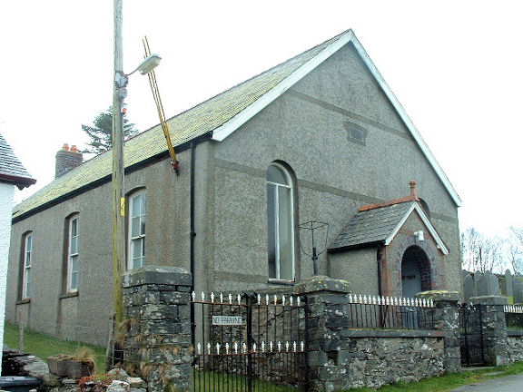
is slightly more suggestive. Tabernacl
Independent/Congregational was, according to
Coflein, built in 1870, a
re-build of an earlier chapel of 1842, and had been converted into the shop by
2002. SH 7901 5673.
Betws-yn-Rhos.
Bont-Newydd, the site of a demolished Welsh
Baptist Chapel stands about two miles east of Llanefydd. The Streetview
van got no closer in 2009 than the
road junction
leading to the site, which is about 100 meters along on the right. SJ
0134 7084. The
Coflein entry provides a building date of 1826, with demolition
"before 2002".
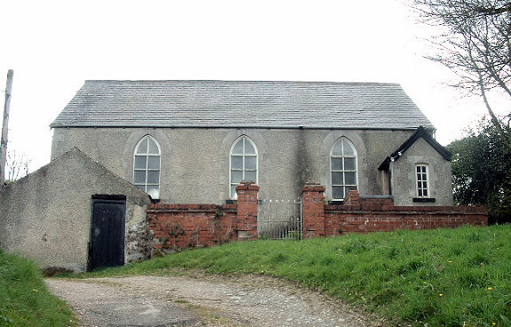
Bron Haul, former Chapel, dated 1878, now in secular use.
It stands in a very remote position about 1½ miles N.W. of Pentre-Foelas.
Pre-dating a map revised in 1899, it was at that time Congregational. SH 8573 5300. © Mike Berrell.
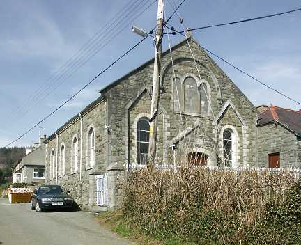
Brymbo, Capel Bryn Seion (Welsh Baptist).
SH 8043 7110. According to the
Coflein entry, it was built in 1839, and
it can be seen on a 2011 Streetview
here.
Bryn-daionyn, Capel Peniel (Calvinistic
Methodist). SH 8053 7185. The
Coflein entry advises that the chapel was built in 1822, and
re-built in 1888. It can be seen on a 2011 Streetview
here.
Bryn-Rhyd-yr-arian, Capel Horeb
(Calvinistic Methodist) can be seen in a 2009 Streetview
here. SH 9585 6687.
The
Coflein entry dates it to 1891, a re-build of the earlier 1841
chapel.
Bwlch yr Haiarn, an Outdoor Education Centre -
possibly a former chapel? SH 7783 5942. © Martin Briscoe. Janet Gimber advises that it was Capel Horeb (Calvinistic Methodist).
Its brief Coflein entry
dates it to 1852 - however, this
source says "A chapel was established here in 1852. In
1873 a new chapel was built to the designs of Richard Owens".
Another view, © Martin
Richter (2023).
Bylchau, St. Thomas, a G.G. Scott church
consecrated in 1857. SH 9765 6300. © Martin Briscoe.
Coflein entry. About half a mile west-south-west of Bylchau sits the
former Hebron Chapel (Calvinistic Methodist).
It hasn't so far been passed by the Google van - can you provide a
photo? SH 9700 6277. The
Coflein entry provides a date of 1852, when the chapel was built
adjacent to a Sunday School of 1812. It was in secular use by the
1980's. Coflein also
notices a Sunday School (pre-1900 at SH 9759 6293, but doesn't
mention its denomination. However it sits fairly close to St. Thomas. It
can be seen here.
Labelled on maps as Capel-y-Rhiw is where a former Ebeneser Independent
Chapel sits, in an isolated position over a mile north-north-east of Bylchau. It can be seen in a 2009 Streetview
here. The blue sign on the
gable end is a "For Sale" sign. SH 9803 6462. The
Coflein entry advises that the building is dated 1873, though this records
the enlargement of an earlier building of 1830.
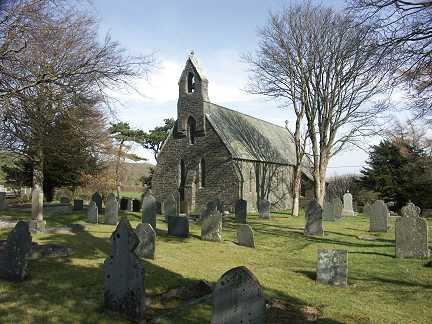
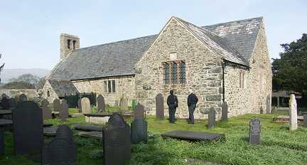
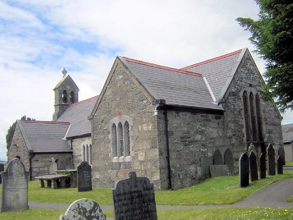
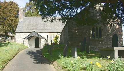
Caerhun, St. Mary.
SH 7768 7040. © Martin Briscoe.
Link.
Grade I listed. The lych-gate, churchyard wall, etc. share a
grade II listing.
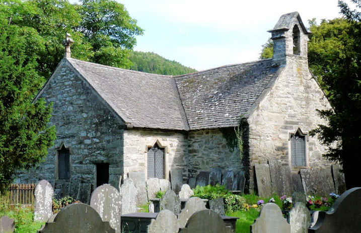
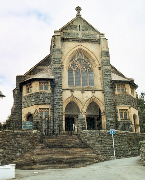
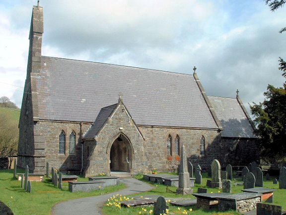
Capel Curig, St. Julitta. Dating from the decades either side of 1500, this was originally known as Capel
Curig, or Curig's Chapel, from which the village took its name. The chapel's name was changed in 1883 when a new church was built. Two additional views
- 1, 2. SH 7185 5797. All © Dennis Harper (2013).
Link.
Its
grade II* listing calls it St. Curig. The new church was St. Curig (1883), but which has since been closed,
and is now converted to a holiday let. © Paul Wood.
Link has numerous
photos - well worth looking at for a superb mosaic.
Grade II listed.
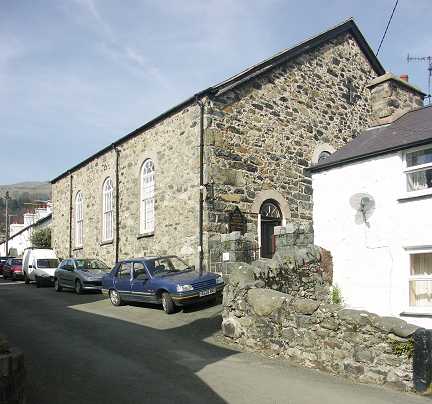
Capel Garmon, the former St. Garmon
(CiW) dating from 1862-3. Its
Coflein entry says it was a re-build at that time. SH
8155 5545. © Mike Berrell.
Another view, © Dave Westrap, who explains that this was originally a Chapel of
Ease to Llanwrst, and became a separate parish in 1927. The former Seion
Calvinistic Methodist Chapel.
Coflein dates it to a
re-build in the late 19th century of a chapel of 1798. SH 8160 5535. © Mike Berrell.
Bethania Wesleyan Methodist Chapel
stands north of the village at SH 8151 5565. Its
Coflein entry supplies dates of 1846, re-built 1878, and lists it as
Calvinistic Methodist, but, as Howard Richter has advised, this is erroneous. He
points out that Ordnance Survey maps consistently label the building as
Wesleyan, and this is supported by other sources. It can be seen on a 2010
Streetview here - the
building with the blue roller door.
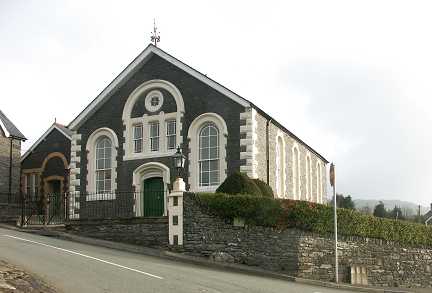
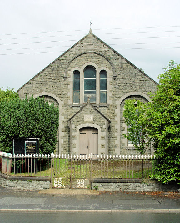
Capel Siloam, Siloam Chapel, dating from 1875.
A map of 1888 labels it as Seloam Chapel (Independent). SH 8334 5300. © Mike Berrell.
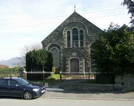
Cerrigydrudion, St. Mary Magdalen. SH 9532 4874. © Martin Briscoe. Another
view, © Dave Westrap. As of 2024, Google Streetview is saying that
it's "permanently closed".
Coflein. The former Moriah (Moreia)
Congregational Chapel (1876) now serves as part of a medical
practice. SH 9540 4861. © Martin
Briscoe.
Coflein.
The former Capel Seion
as seen by Streetview in 2022. Coflein dates it to a re-build in 1883 of a
chapel of 1840 - Wesleyan. SH 9545 4880. Previously listed as Capel
Jerwsalem (Calvinistic Methodist, 1899, © Martin Briscoe), while
revising these pages and comparing with the building on Streetview, it's
apparent that this identification is wrong - and I haven't been able to
establish where this chapel is. Old maps show that there was a
Capel Jerusalem in the village, at SH 9509 4848,
and the present building on the site was seen by
Streetview in 2021. It's
date-stone reads "Neuadd Uwchaled 1927", but this wasn't the first chapel here,
as a map of 1888 shows Jerusalem Chapel (Calvinistic) on the same site.
It seems to have long been out of use, as a mid-20th century map doesn't show it
as a place of worship.
Link.
Colwyn Bay.
Conwy.
Cwm Penmachno, Capel Shilo(h) Wesleyan Chapel,
of 1864.
SH 7596 4769. A 2011 Streetview.
© Colin Waters Collection.
Coflein entry. Howard Richter has
advised of some nearby chapels, as follows. Capel Rhyd-y-meirch (Calvinistic Methodist, 1864, re-built 1898) is at
SH 7631 4777. A 2011
Streetview. An earlier one of
2009 shows some
works being carried out.
Coflein entry. Capel Carmel (Wesleyan, 1882)
at Glan-aber stands at SH 7510 4735.
Not well seen on the
2009 Streetview - it's the white-gabled building in the distance.
Coflein entry. The former St. Enclydwyn's
Mission Church (converted from a National School in 1921) stands
just a short walk from Capel Shilo at SH 7588 4770. According to the
Coflein entry (which includes some architectural plans and illustrations),
it was converted to secular use in 1981. A
2009 Streetview.
Dawn, Capel Rehoboth,
which sits to the north-east of the village at SH 8701 7311. Its
Coflein entry dates it to 1837, as Wesleyan Methodist, and says that it was still a chapel
in 2000. It can be seen
here on a 2011 Streetview. However, available large scale O.S. maps
of the early 20th century label it as Baptist. To the west of the village, at SH 8521
7277 is Croes-engan Welsh Calvinistic Chapel. The
Coflein entry for it says it's a 1906 re-build on the site of an earlier chapel of 1840. The
now-converted chapel, visible
here on a 2011
Streetview, was at the far end of the building, originally (as old maps
show) with a small porch projecting from the corner towards the road.
Dinmael, the Welsh Calvinistic Methodist Chapel.
Coflein says it is
the third chapel (1868) on the site, following ones of 1826 and 1843. SJ 0057 4473. © Martin Briscoe.
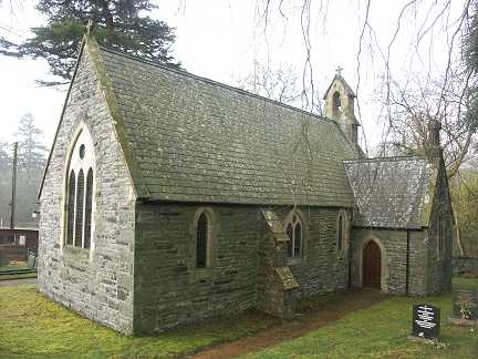
Dolwyddelan, St. Gwyddelan (CiW) on
Church Street.
Coflein dates it to circa 1500. SH 7359 5230. © John Balaam (2009).
Link.
Grade I listed. Nearby is the former
St. Elizabeth
(2016 Streetview), which is dated by
Coflein to 1886. SH 7341 8236. Capel Bethel
stands at the end of Church Street, at its junction with the main road,
at SH 7352 5240.
Coflein calls it an Independent Chapel, and dates it to 1905-12,
replacing Ganasarath. © John Balaam (2009). Over the railway line on
High Street, at SH 7378 5210, is the former
Ganasarath
Independent Chapel, aka Capel Isaf (2011 Streetview). It's dated by
Coflein to 1825, re-built in 1860. It also says that it was the
predecessor to Bethel.
Grade II listed. The village also has two former Methodist Chapels,
a Calvinistic and a Wesleyan, both on the main road through the village.
Moriah Calvinistic
Methodist Chapel stands at SH 7363 5247, and is dated in its
Coflein entry to
1880. © John
Balaam (2009).
Grade II listed. For the Wesleyan,
Coflein, which calls
it Capel Elen
(2010 Streetview) dates it to 1783 and 1880, though as Calvinistic,
contrary to the Ordnance Survey, which says Wesleyan. SH 7390 5252.
Dwygyfylchi, St. Gwynan. Coflein
says "Rebuilt
1760 and 1889", implying a yet earlier church. SH 7368
7730. © Martin Briscoe.
Link. Eglwys Gynulleidfaol Horeb
on Conwy Old Road.
It's dated by
Coflein to 1869, a re-build of a chapel originally of 1813. SH 7314
7689. © Martin Briscoe.
Grade II listed.
Converted chapel, at the east
end of Conwy Old Road at SH 7425 7661.
Coflein, which calls it Y Glyn (Calvinistic Methodist), dates
it to 1879. © Martin Briscoe.
Eglwysbach.
Gellioedd, Independent Chapel. Its
predecessor (ruinous) stands adjacent. SH 9389 4472. Both © Gervase N. E. Charmley (2011).
Coflein makes
no mention of the predecessor, however, the supplied dates (1845, re-built 1864)
don't tally with the
date-stone (1899) visible on the 2022 Streetview, so perhaps these dates are
for the earlier chapel. There is a date-stone on the old chapel, but the text
isn't visible on Streetview.
Groes, Capel Y Groes (Calvinistic Methodist)
can be seen in a 2009 Streetview
here. SJ 0078 6468. The
Coflein entry advises that it bears date 1862, which refers to enlargement
of the chapel, built in 1817.
Gwydir Uchaf,
Chapel. It's called Chapel of Holy Trinity on
Coflein,
which dates it to 1673 as a private chapel to the nearby Gwydyr Castle. SH 7948 6093. © Martin Briscoe.
Gwytherin, the former St. Winifred.
Streetview only managed a
distant view of the churchyard, some photos of the church (exterior and
interior) can be seen
here (the
history
page is also useful). More exterior photos can be seen on the
grade II listing. SH 8767 6146.
Coflein entry. Siloh Welsh Presbyterian Chapel
(1815, re-built 1855).
It can be seen on a 2009 Streetview
here. SH 8768 6175.
Coflein entry. About a mile and a half north-east stands
Capel Cae'r Graig (Welsh Presbyterian), at
SH 8902 6352. 2009 Streetview.
Coflein entry.
Grade II listed. Old maps from between the wars show a Sunday School in an
isolated position over a mile N.W. of the village, at circa SH 8606 6229. Some
maps name the building as Tyn-y-Pant. From an inspection of more recent maps,
and satellite images, Howard Richter suspects that the building no longer
exists, but it stood among the trees in the background of this
2011 Streetview.
Gyffin, St. Benedict on Henryd Road, is virtually
invisible to Streetview, but there's a photo on the
church website,
and there are more on its
grade I listing. SH 7764 7694.
Coflein.
For related listed features, see
here.
Siloh Methodist Chapel on Llanrwst Road.
Its Coflein
entry dates it to 1901, closing "by 1995". SH 77839 7693. © Mike Berrell.
The former Soar Methodist
Chapel (2009 Streetview) on New Street is dated by Coflein to 1905. SH 7779
7686. A map of 1901 shows a Meth. Chap. on Henryd
Road at SH 7771 7690. Streetview saw the
house on the site in
2014 - it isn't obvious whether anything survives of the chapel. As Coflein
makes no mention of it, one wonders if this might be a rare error on the part of
the Ordnance Survey.
Henryd, Independent Chapel (1822)
on the north side of Henryd Road at SH 7692 7471. © Mike Berrell.
Coflein.
According to the 1" O.S. map of 1950, at that time there was a chapel on
the south side of the road. This will be the property now called
Ty Capel,
which was seen by Streetview in 2023.
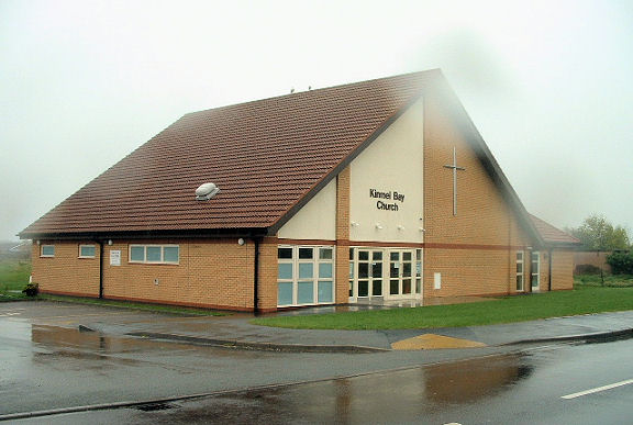
Kinmel Bay, Kinmel Bay Church on
St. Asaph Avenue. SH 9903 7951. © Mike Berrell.
Link.
Llanbedr-Y-Cennin,
St. Peter. SH 7607 6956. © Martin Briscoe.
Link.
Coflein.
Grade II* listed.
Salem Chapel is listed on old maps
as Independent. Coflein dates
it to 1872 when it was re-built, replacing a chapel originally of 1809. SH 7638
6929. © Martin Briscoe. A Calvinistic Methodist Chapel
is shown on O.S. maps at SH 7551 6986. There's an entry on
Coflein
for it, but it has no details. The chapel pre-dates a map of 1889, and was still
active in the mid-20th century. It seems to now be in residential use - the
building on the site was seen by
Streetview in 2009.
Whether anything of the chapel survives is unclear.
Llanddulas, St. Cynbryd, which
Coflein
dates to 1868. SH 9086 7821. © Mike Berrell.
Link.
Grade II* listed. For the listed lych-gate and cross in the churchyard, see
here. Methodist Church
(1951) on Minffordd Road.
Coflein
lists it as Salem Wesleyan. SH 9067 7809. © Mike Berrell.
Link.
O.S. maps show a Baptist
Chapel off Minffordd Road at SH 9056 7813. A building with the same
footprint can be seen on modern aerial views, but it can't be seen on
Streetviews. Whatever it is it stands behind the left half of the short terrace
seen by Streetview in
2011. Old maps also show an otherwise un-named Chap.
on Abergele Road at SH 8997 7831. A
Streetview from 2022
shows that it bears a sign saying Caersalem Chapel.
A 2020
news story includes interior views of the converted . chapel, and
Coflein dates it to 1890, on
the site of earlier chapels.
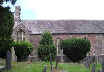
Llandrillo yn Rhos, St. Trillo. SH 8321 8064. © Mike Berrell.
Link.
Grade II* listed. For the listed sun-dial and numerous listed tombs in the
churchyard, see
here.
Llandudno.
Llandudno Junction.
Llanefydd, St. Nefydd and St. Mary,
can be seen on a 2009 Streetview
here. SH 9821 7060. The
Coflein entry dates it to circa 1500, but says there are documents referring
to the church (or a predecessor) as far back as 1291.
Grade I listed. Other structures associated with the church are also listed,
and these can be accessed
here. A short distance away at SH 9816
7067 is the 1867 Capel-y-Llan (Calvinistic
Methodist) - 2009 Streetview
here.
Coflein entry. Bryndeunydd Baptist stands at
SH 9928 6954, about a mile south-east of the village. A 2009 Streetview is
available here, and shows
the chapel (nearest to the camera), with its predecessor adjacent. The
Coflein entry dates it to 1877, and the older Scotch
Baptist Chapel (Coflein
entry) to 1823. The latter chapel is
grade II listed. Peniel Welsh Baptist Chapel is
at Pentre Isaf, about half a mile north of the village, and can be seen on
Streetview here. SH 9824
7161. Its
Coflein entry dates it to 1849, a re-build of its 1814 predecessor. About a
mile and a quarter south-east of the village stands
Cefn Berain (Calvinistic Methodist) at SH 9987
6929. Streetview. The
Coflein entry dates the original chapel to about
1854, with re-builds in 1864 and 1898.
Capel Ffynnonau
(also Calvinistic Methodist) is about a mile west
of the village, at SH 9660 7042.
Streetview, and its nearby
Church Hall. The Coflein entry dates it to 1861, a re-build following two
earlier chapels of 1795 and 1826.
Grade II listed.
Llanelian, St. Elian (CiW). Two
additional views - 1,
2. SH 8635 7643. All
© Martin Richter (2011).
Link, which has numerous interior photos, including the wall paintings.
Grade II* listing, which dates the church as medieval, with a mention in a
document of 1291, and on the site of an earlier church. Details of five tombs
and a sun-dial, all grade II listed, can be found
here.
Coflein entry.
Llanfair Talhaiarn, St. Mary
and St. Talhaiarn (CiW).
Interior view. SH 9271 7014. Both © John Balaam (2010).
Link.
Grade II* listed. The churchyard walls and a bierhouse share a
grade II listing. Salem
Baptist Chapel (2009 Streetview) stands off Denbigh Road at SH 9280 7009.
According to this source
it dates from 1862. Another Baptist Chapel shows on
a map of 1880 at SH 9279 7013. It hasn't survived, and the building on the site
(on the raised ground behind the wooden fence) was seen by
Streetview in 2022. The
former
Soar Calvinistic Methodist
Chapel (2009 Streetview) on Denbigh Road. SH 9279 7006.
Coflein dates it to 1833. The
village also had a Wesleyan
Methodist Chapel (2009 Streetview) on Allt-Y-Powls, which
Coflein dates to 1897, the
third on the site, having been preceded by chapels of 1839 and 1812. SH 9283
7006.
Llanfairfechan.
Llangelynin, the former New Church, now an arts studio. SH 7711 7355. © Mike Berrell.
Grade II listed. The
Coflein entry says that
it was a late-Georgian
replacement for an earlier church, "remodelled" in 1840. Another photo of it is
available here. The old
church, St. Celynin, stands about 1¼ miles almost
due west, at SH 7512 7373. A Streetview of it can be seen
here, from 2022.
Grade I listed.
Llangernyw, St. Digain, which can be seen on a 2009
Streetview here. It was much
restored in the nineteenth century, though substantial medieval work still
survives. SH 8750 6745.
Coflein entry.
Grade II* listed. Capel Bethabara (Welsh
Baptist) stands a little way south at SH 8745 6730. It is an 1871 re-build of an
1830 chapel. A 2009 Streetview is available
here.
Coflein entry. A short way further south again is
Capel-y-Cwm (Calvinistic Methodist), a 1909 re-build
of an 1838 chapel) at SH 8745 6720, visible on a
2009 Streetview.
The
Coflein entry has some external photos. About a mile E.S.E. of the village
stands the isolated former Capel Garnedd (Calvinistic
Methodist) at SH 8891 6698. The
2009 Streetview shows the chapel behind the car, with attached house at
right angles. Another Streetview.
Coflein entry.
Llangystenin, St. Cystenin. SH 8221 7922. © Noel Walley.
Link.
Grade II listed.
Llanrhos, Llandudno - see Llandudno.
Llanrwst.
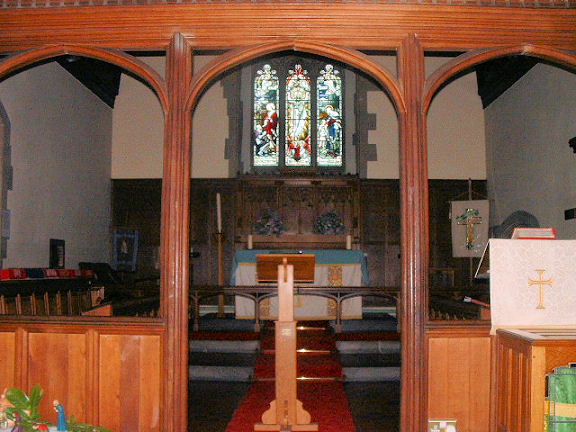
Llansan Sior (aka St. George), St. George. Interior view.
It's dated in its
grade II listing to 1887-94, successor to an earlier church which stood a
short distance away in the churchyard at SH 9735 7584. The present church is at SH 9739 7581.
Both © Mike Berrell. A mausoleum of 1835-6 in the churchyard is listed as
grade II. A former Independent Chapel
of 1866 stands some distance north of the village, at Bodoryn Cottages. It's now
in secular use. SH 9783 7725. © Mike Berrell.
Coflein entry. Howard Richter advises that the Independent Chapel had a
predecessor at SH 9747 7591, closer to the village, and now in use as a school.
It can be seen on Streeview here.
Coflein entry.
Llansannan.
Maerdy, St.
Catherine. SJ 0174 4445. © Martin Briscoe. Its entry
here says it's a former church.
Mochdre, the former St. Mary on Old
Conway Road, currently (2008) closed and awaiting sale and redevelopment. SH 8258 7842.
© Mike Berrell. It was subsequently demolished, and a house built on the site (2021
Streetview). St. David (R.C., Society of St. Pius X). SH 8305 7928.
© Mike Berrell.
Link. Bron-y-Nant Crematorium Chapel. SH 8293 7949.
Link. © Mike Berrell.
The village also has a former
Calvinistic Methodist Chapel,
on Chapel Street, seen by Streetview in 2021.
Coflein, which calls it Nasareth, says that it's the third chapel on the site, with building dates of
1780, 1832 and 1890. SH 8267 7829.
Moelfre (south of Abergale), Ty Capel.
It's labelled on a 25" O.S. map of 1913 as Independent. SH 9552 7428. © Mike Berrell.
Nebo, Chapel (1867). It's labelled
on older maps as Congregational. SH 8363 5612. © Mike Berrell. A recent
Streetview
suggest that it is now in residential use. A map of 1880 has a label for
a Calvinistic Methodist Chapel at about the same location, though it's
not clear which building is intended. It's interesting that the building
immediately north of the Congregational chapel has an inscribed stone
above the door, but its content isn't readable on
Streetview.
Old Colwyn.
Padog, Calvinistic Methodist Chapel.
It's dated here
to a re-build in 1896 of a chapel of 1871. SH 8392 5141. © Mike Berrell.
Pandy Tudur, St. David. The
Coflein entry dates it to the 1860's and has an interior and two
exterior photos. SH 8617 6472. Two 2009 Streetviews -
1,
2.
Capel Bethania (Calvinistic
Methodist)
is a re-build in 1907 of a chapel of 1826, as per the
Coflein entry. SH 8590
6433.
© Martin Briscoe.
Penmachno, St. Tudclud
(1857, replacing an earlier building). This
source says that it was closed between 1997 and 2009. SH 7899 5059.
A
2018 Streetview.
Coflein entry, which says that the churchyard once had another
church - St. Enclydwyn, but that it fell into ruin long ago, and all
above-ground traces have vanished.
Grade II listed.
Salem Chapel
(Calvinistic Methodist, 1853, re-built 1873) stands nearby at SH 7896
5065. A 2009 Streetview.
Coflein entry. Howard Richter has
advised of a nearby chapel, as follows - Bethania Wesleyan Methodist
(1867) stands at SH 7897 5051, and is
grade II listed. The
Coflein entry says that it closed in 2002. A
2017 Streetview.
Penmaen Rhos, Disgwylfa Addoldy yr Eglwys Fethodistraidd (Welsh
Wesleyan Methodist, 1901). SH 8791 7843. © Mike Berrell. The
Coflein entry has a good number of additional photos.
Bethel Congregational Chapel stands just a
short distance away, at SH 8782 7836. It can be seen
here on a 2009
Streetview. As Howard Richter has pointed out, the
Coflein entry for this is suspect. The grid reference is adrift
(they give
SH 8777 7830) and a date of 1881. There was another chapel nearby, shown
on O.S. maps as Presbyterian in 1900 but Congregational by 1913. This
has a grid reference of SH 8777 7834. Demolished for road widening by
1957, it stood roughly where the Streetview camera was to take this
view in 2009. Howard
suspects that this is the 1887 chapel, and which was replaced
following its demolition by Bethel.
Penmaenmawr.
Pensarn, St. David (CiW) on South Parade. SH 9481 7859.
© Mike Berrell. Chapel (closed) on
Towyn Road. SH 9491 7866. Mike thinks it might have been Presbyterian. Judy Flynn,
referencing Pevsner, and an old postcard, advises that it was indeed
Presbyterian, of the English speaking variety, and dating from 1877-8. It has a
grade II listing.
Coflein says it was closed "by 2008". © Mike Berrell.
Pensarn Family Church (Evangelical
Alliance, Presbyterian Church) on Y Berllan. SH 9492 7865. © Mike Berrell.
Link. Older O.S. maps mark a Calvinistic
Methodist Chapel on Ger-Y-Mor at SH 9479 7871. Its
Coflein entry dates it to 1858, closing in 1956. It also says that
the chapel was converted for residential use - if this is correct then
the housing was later demolished and new housing built on the site (2011
Streetview).
Pentre Isaf, Capel Cefn-Coch (Calvinistic
Methodist) can be seen in a 2009 Streetview
here. The
Coflein entry dates it to a mid 19th century re-build of an earlier
chapel of 1796, although curiously, its
grade II listing (which includes some photographs) says it
is
"little altered since its erection in 1796".
The former Capel Ainon (Baptist) stands
about 3/4 of a mile NE of Pentre, at SH 8825 6977, and is now in
residential use. Seen on a 2009 Streetview
here and
here, the
Coflein entry gives it dates of 1862-1986. Lastly, about a mile NW
of Pentre is the very isolated
Codau Baptist Chapel, at SH 8637 7074. The
Coflein entry dates it to 1832, with closure in the 1980's. It says
that it "stood disused in the 1990's", but the presence of tools and
ladders in the 2009
Streetview suggests it may have been undergoing conversion
at that time.
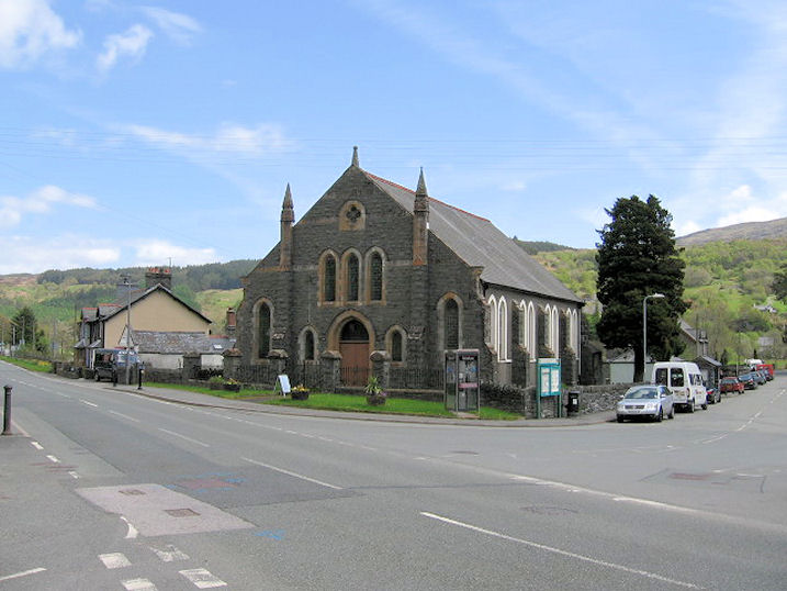
Pentrefoelas, the Parish Church (dedication lost). SH 8731 5158.
Standing
in relative isolation on the west side of the B5113, about a mile and a
half north-west of the village is the former
Capel Pisgah (1878), now in secular use.
It was active at least until 1953. SH 8573 5300.
Coflein entry. Both © Mike Berrell.
Pentre-Tafarn-y-Fedw,
the former Carmel Calvinistic Methodist/Presbyterian Chapel, which
stands in isolation some distance north-east of the settlement at
SH 8242 6297.
The link is to a 2009 Streetview. SH 8242 6297. The
Coflein entry provides a date of 1833.
Pont-Cyfyng, the former St. John the
Baptist Mission Church, as seen by Streetview in 2011. According
to its
Coflein entry it dates to circa 1875, and had closed by 1953.
SH 7345 5683. A little further to the S.E. is a former
Calvinistic Methodist Chapel.
SH 7367 5672. © Martin Richter (2022).
Coflein entry.
Rhos-on-Sea.
Rowen, Seion (or Zion) Calvinistic
Methodist Chapel on Gwynant. SH 7584 7202. © Martin Briscoe. A map of 1889 shows
a Baptist Chapel (Par.) on Gwynant at SH 7597 7194.
Coflein
may have got its story mixed up, saying that the Baptist Chapel, which it
dates to 1819 originally as Seion Methodist, was re-built in 1841 and
re-dedicated as Siloam. It was seen by
Streetview in 2023. A
Congregational Chapel shows on a map of 1889 a
little way south of the village at SH 7555 7176.
Genuki calls it Ebeneser. It was still active into the mid-20th
century, but has been demolished or altered beyond recognition -
2009 Streetview.
St.
George - see Llansan Sior above.
Tal-y-Bont, Calvinistic Methodist Chapel. It has a date-stone for 1889. Its
Coflein entry says 1818, re-built 1890. SH 7686 6840. © Martin Briscoe. Another view, © Steve Bulman
(2009).
Tan-y-Fron, Calvinistic Methodist Chapel, which
stands about two miles S.E. of Llansannen. The
Coflein entry dates it to 1903, a re-build of a chapel first built in 1772
and re-built in 1837. It can be seen on a 2009 Streetview
here. SH 9584 6417.
Towyn.
Trefriw, St. Mary (CiW), which seems
to be the only remaining active church or chapel in the village. SH 7808
6323. © Dave Westrap. Another view, © Steve Bulman
(2009). Link.
Coflein.
Grade II* listed.
Independent Chapel. SH 7804
6312. © Dave Westrap.
Link. Peniel Presbyterian Church. SH 7804 6321. © Dave Westrap.
Grade II listed, wherein it's dated to 1910. A
Calvinistic Methodist Chapel used to stand towards the southern end of
the village, at SH 7791 6301.
Coflein
calls it Aidda, but provides no details. It pre-dated a map of 1888 and
is still shown as a place of worship on a map of 1959. Aerial views suggest that
it hasn't survived, but Streetview hasn't seen its site, just the end of the
path that led to it - 2009
Streetview.
Trofarth, the former St.
John, which stands in an isolated position about 3 miles W.S.W. of Betws-yn-Rhos,
at SH 8574 7182.
A G. G. Scott church, it was built in 1873, and, according to the
Wikipedia
entry, planning permission for conversion to "domestic use" was granted in
2009. The link is to a 2009 Streetview, before its (presumed) conversion.
Coflein entry.
Grade II listed.
Ty-Nant, Bethesda Wesleyan Methodist Chapel dating from 1876.
However, it's dated in its
Coflein entry
to a re-build in 1884 of a chapel of 1839. SH 9902 4475.
© Martin Briscoe. A map of 1880 (which calls the hamlet Ty'n-y-nant) doesn't
show Bethesda, but does show a Wesleyan Chapel further west at SH 9876 4484.
Perhaps this was the 1839 chapel. A
2022 Streetview shows
the house on its site - it's not obviously apparent that anything survives of
the chapel.
Tyn-Y-Groes, Calvinistic Methodist Chapel.
Coflein dates it to 1872,
with predecessors of 1827 and 1836. SH 7746 7183. © Martin
Briscoe.
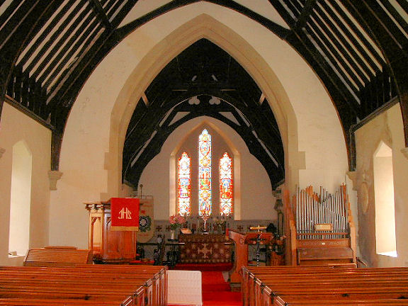
Ysbyty Ifan, St. John the Baptist. Interior view.
Coflein dates it to 1861, successor to a medieval church on the same
site of close by. SH 8433 4892.
Both © Mike Berrell.
Link. The former Seion Calvinistic Methodist Chapel, now disused.
It's dated to 1893 in its
Coflein entry, there having been previous chapels of 1803 and 1855. SH 8437 4867. © Mike Berrell.
There is a small isolated chapel just over a mile north-east of the
village. Standing
at SH 8590 4956, the former Calvinistic Methodist
Capel Saron can be seen on a 2011 Streetview
here. The
Coflein entry dates it to 1844.
|
|