|
Llanrwst, Conwy
Llanrwst on Wikipedia.
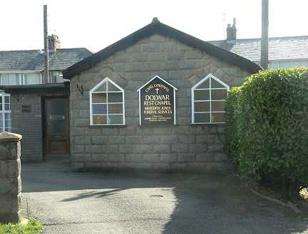
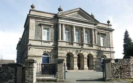
Dolwar Rest Chapel. SH 799 609.
© Martin Briscoe.
Eglwys Bresbyteraidd Cymru. SH 800 619. ©
Martin Briscoe.
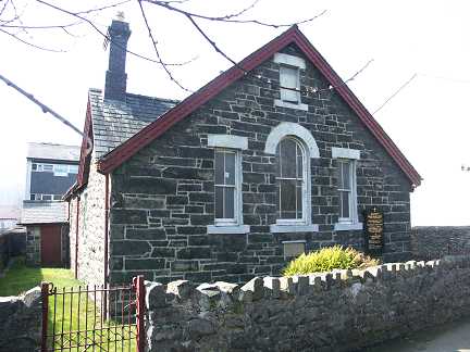
Penuel
Baptist Chapel (1881). SH 7968 6190. © Martin Briscoe.
Coflein entry.
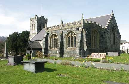
St. Grwst
(CiW). SH 798 616. © Martin Briscoe.
Link1. Link2.
Grade I Listed.
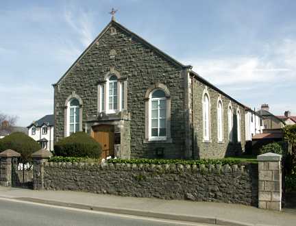
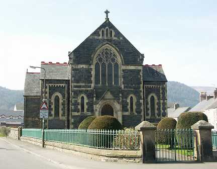
Seion Chapel (Calvinistic
Methodist/Presbyterian, 1895). SH 798 618. © Martin Briscoe. Interior view
here.
Tabernacl Chapel
(Independent/Congregational). SH 798 619. © Martin Briscoe.
Howard Richter has advised of some
other churches and chapels in the town.
Two are still active -
Good Shepherd (R.C.). SH 7997 6197. The
Coflein entry gives a building date of circa 1956.
Streetview.
Horeb (Wesleyan Methodist). SH 79695
61795. The
Coflein entry gives this a date of 1884, the fourth chapel on the site, the
earlier ones being of 1805, 1837, and 1866.
Streetview.
Three more chapels survive, in
secular use -
A Baptist
Chapel (1805) at SH 8002 6192.
Coflein entry. The 2016
Streetview shows it in use as a Guide's Hut. Note the line of slate
gravestones along the sides of the parking area.
Ebenezer Independent Chapel (1880-1939) was in use for some time as a Masonic Hall,
but was subsequently offered for sale. SH 7996 6151.
Coflein entry. Streetview.
About a mile north-east of the town at
Pentre-Tafarn-y-Fedw lies the converted Zion Welsh
Calvinistic Methodist Chapel. SH 8116 6245. Now in residential use, its
Coflein entry gives it a date of 1887, with conversion "by 1990". A 2018
Streetview.
Four chapels have been demolished
-
St. James
(English Wesleyan Methodist) stood at SH 79647 61968. The
Coflein entry
is a bit vague with dates - "between
1875-1900 and was demolished c.1980".
St. Tudwal (R.C.), and presumably the predecessor
of Good Shepherd) stood at SH 79655 61943. This
Coflein entry is also vague with dates, saying it was
"built pre-1913. Status (2002): unknown". The sites of both St. Tudwal and St.
James can be seen in this 2014
Streetview - St. James on the left corner, and St.
Tudwal
on the right corner. Two other chapels are also visible in this view - turn
right to look along the road, and Penuel is on the left (above the white car),
with Horeb on the opposite side of the road in the distance.
St. Mary (English Anglican, 1841-2) stood at SH
8015 6135. Although the church was demolished, some foundations remain in
situ, visible in the distance in this 2016
Streetview. An old postcard
of the church can be seen
here.
Coflein entry.
Tabernacl (presumably the predecessor of the
Tabernacl towards the top of this page) stood at SH 8003 6185. The
Coflein entry is, to say the least, uninformative. It had been replaced by
housing by the time the 2016
Streetview car drove past. Some manoeuvring and zooming will show that the piece
of land to the right of the wooden fence retains some headstones.
|