|
|
East Sussex
East Sussex on Wikipedia.
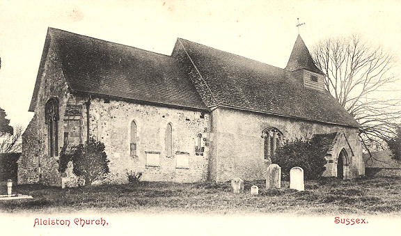
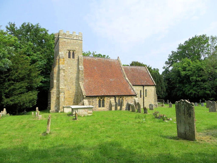
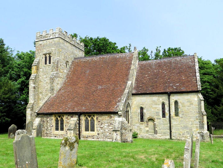
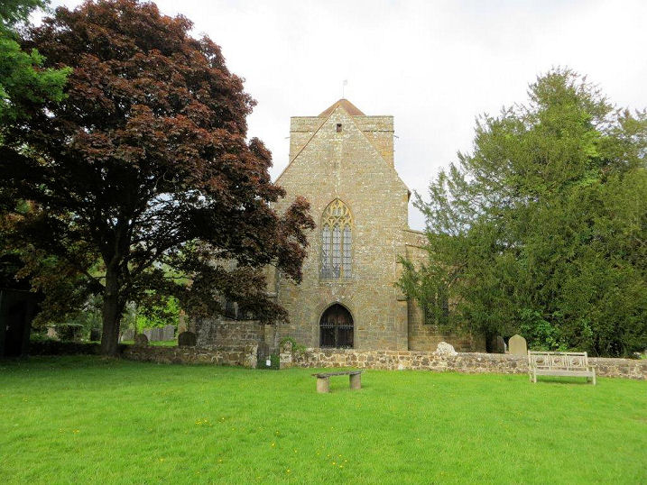
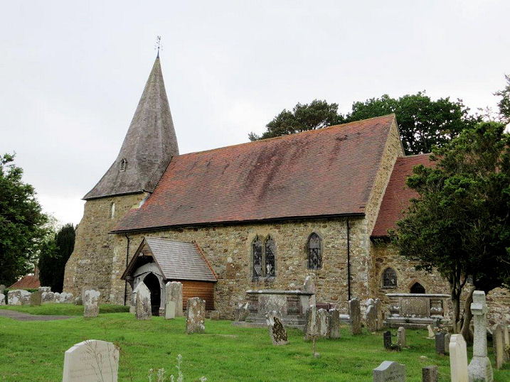
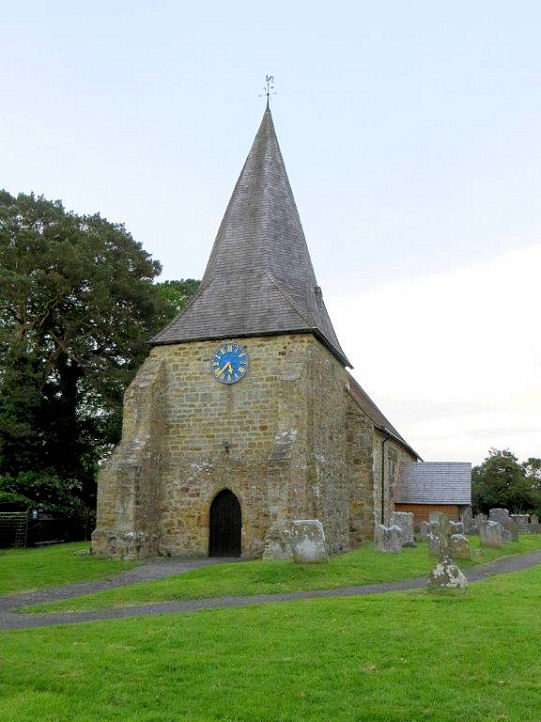
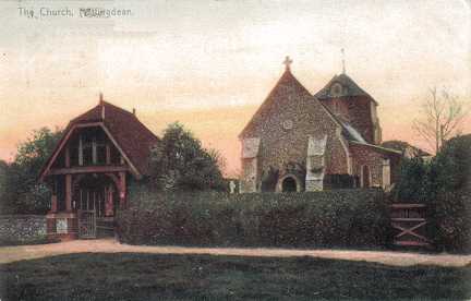
Alciston.
The dedication is lost. TQ 5058 0556. From an old postcard in Geoff Watt's Collection.
Link.
Grade I listed.
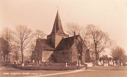
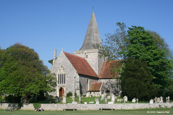
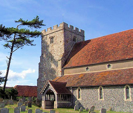
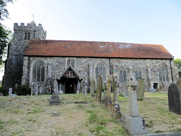
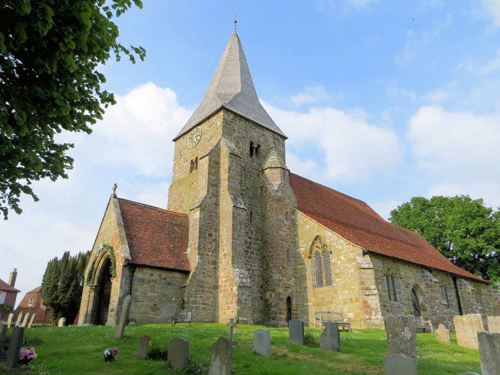
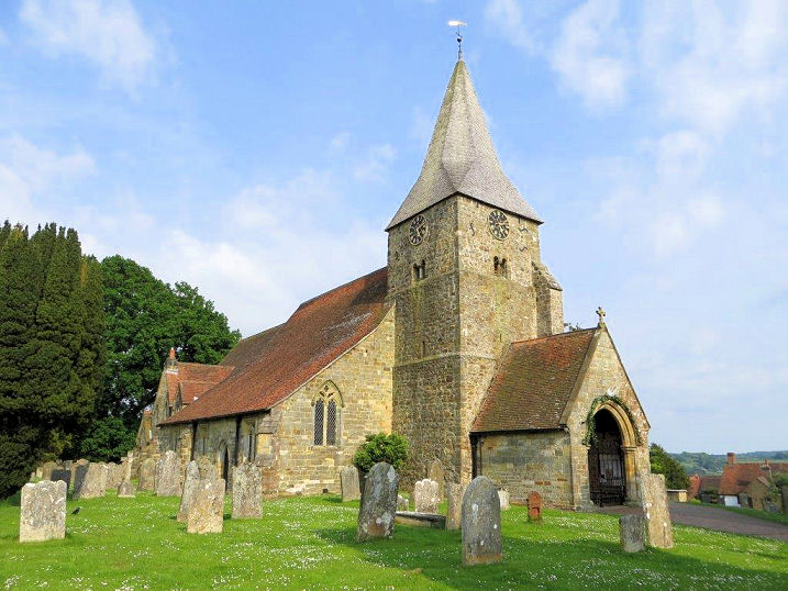
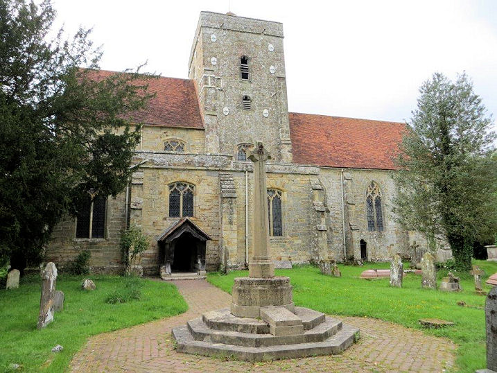
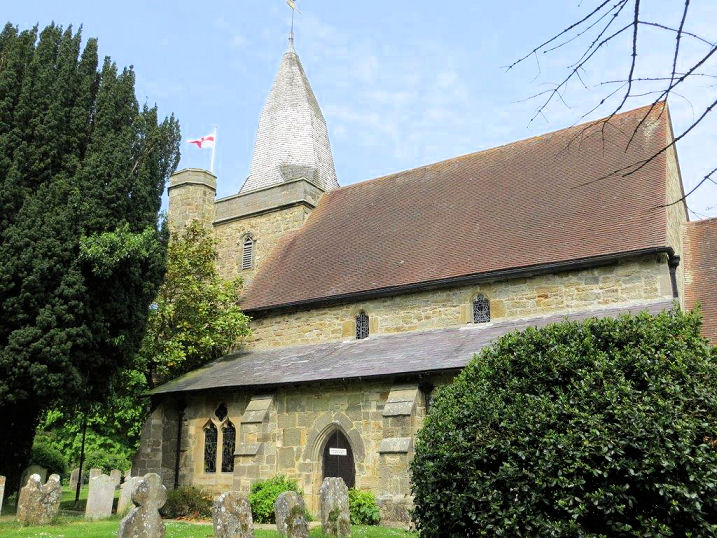
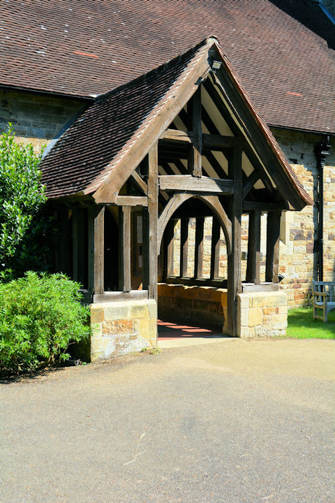
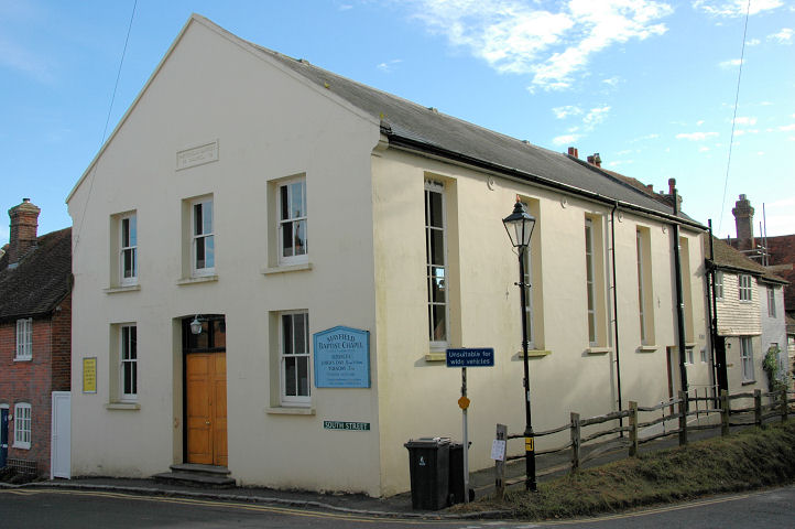
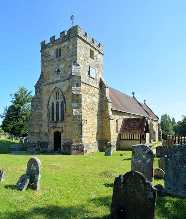
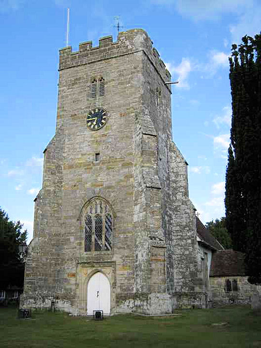
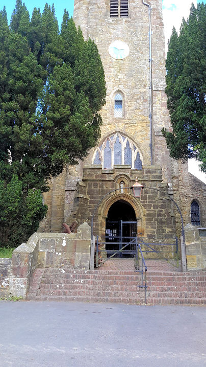
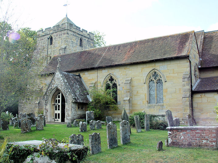
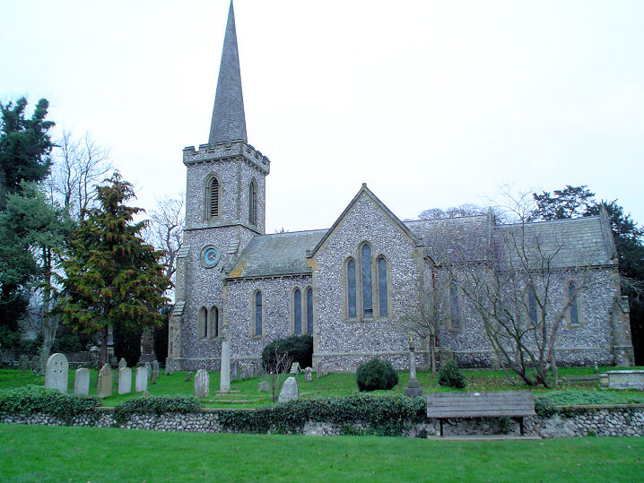
Alfriston,
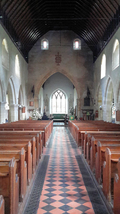
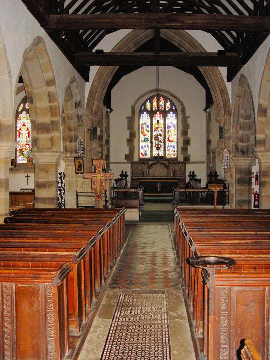
St. Andrew. TQ 5215 0301. From an old postcard in Steve Bulman's Collection.
A modern view, © Graeme Wall.
Link.
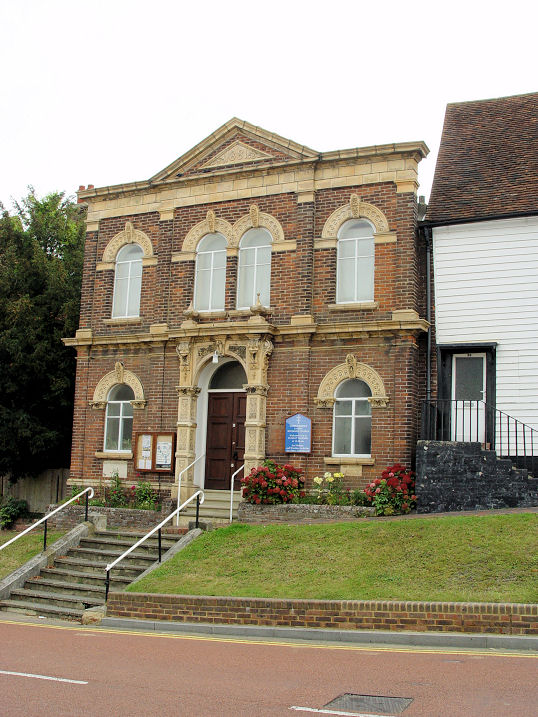
Grade I listed. The village also has a former
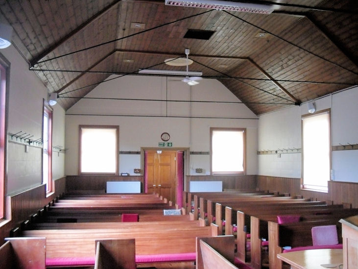
U.R.C. (2021 Streetview), originally a
Congregational Chapel, on High Street. Changes of signage seen on
Streetview suggest it was closed in the later 2010's. Its
grade II listing (which has more photos, including the interior)
dates it to 1801. It's now The Old Chapel Centre -
link. TS 5208 0309.
Battle.
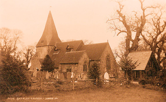
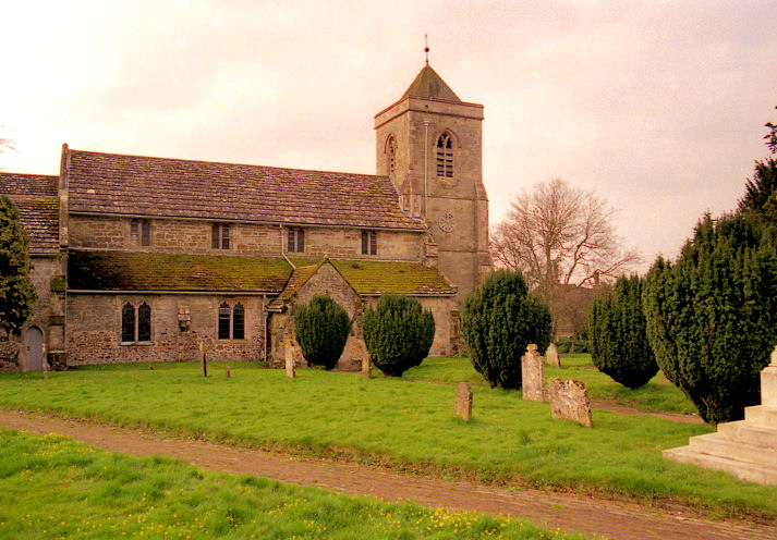
Beckley, All Saints. TQ 8426 2373. From a
postcard in the Kevin Gordon Collection. A modern
Streetview, from 2021.
Link.
Grade I listed. For the listed churchyard tombs see
here. The former Methodist Chapel (originally
Wesleyan, of 1840) is at TQ 8516 2395. It's
Genuki entry says it closed in 1900, though this is contradicted by the
Ordnance Survey who show it as still active at least as late as 1957. Genuki
also says that it had a predecessor. It has a brief
grade II listing.
Beddingham, St. Andrew. TQ 4449 0790. ©
Kevin Gordon. Link1.
Link2.
Grade I listed.
Bexhill.
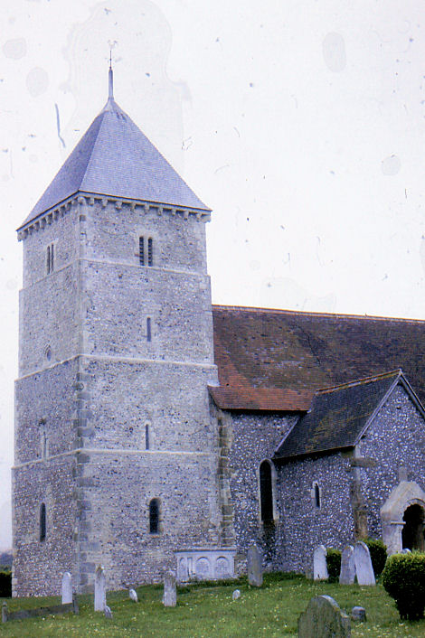
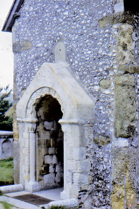
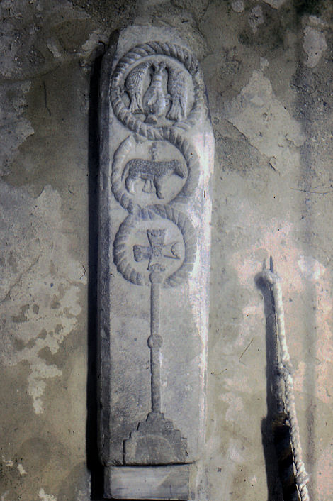
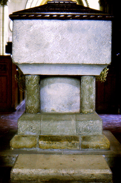
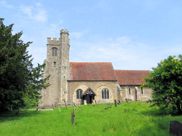
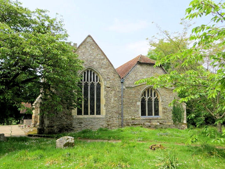
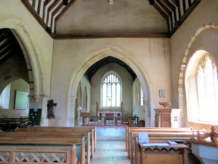
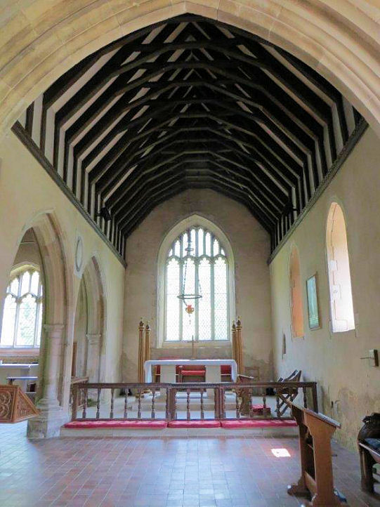
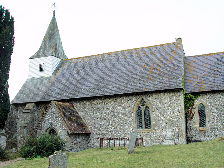
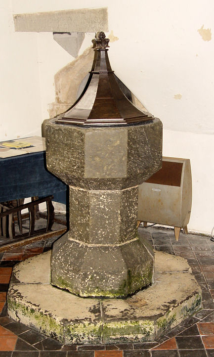
Bishopstone, St. Andrew. It
contains much of Saxon date including the
south porch. A 12th century
tomb slab, and the
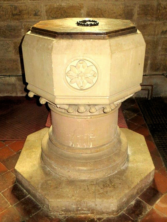
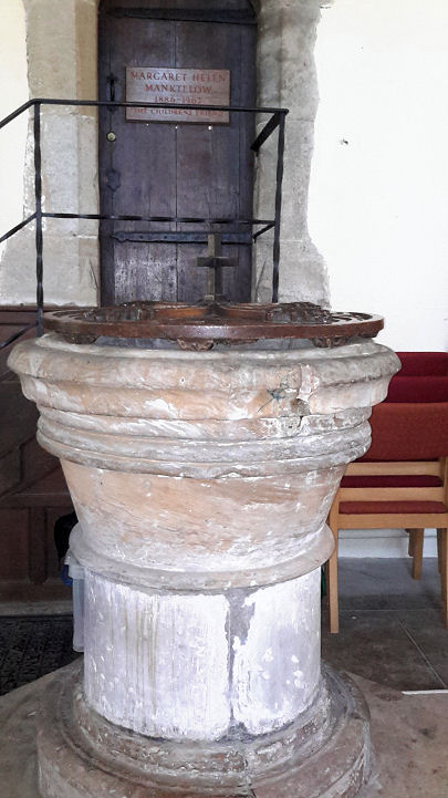
font. TQ 4724 0098. All
© Christopher Skottowe (1963).
Link1.
Link2.
The (very brief)
grade I listing. The churchyard wall is also listed, at
grade II.
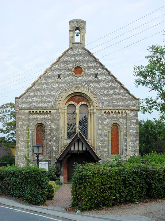
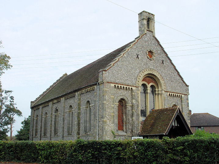
Blackboys, Hope Strict Baptist
Chapel on Lewes Road, to the S.W. of the village.
Genuki says it was founded in 1875.
Another view, and two
interiors - 1,
2. TQ 5155 1883. All © Gerard Charmley (2016).
The village proper has a converted (Wesleyan)
Methodist Chapel (2024
Streetview), on Chapel Lane at TQ 5264 2085. The white building has foundation
stones for 1924; the brick building is presumably earlier. This
source dates the foundation of teh church to 1883, closing in 2006.
Bodiam, St. Giles on Levetts Lane.
Originally a chapelry to St. James the Great at Ewhurst, most of the fabric
appears to be C13, though there may be earlier work.
Another view. TQ 7824 2619. Both © Carole
Sage (2016). Link.
A good history
here.
Grade II* listed.
Brede,
St. George on Brede Hill.
Another view, two interiors -
1,
2, the
pulpit and
font. A fine tomb is the resting place
of Sir Goddard Oxenbridge, reputedly 7 foot tall, and hence the "Brede Giant".
Two windows - 1,
2, the latter of St. George. TQ 8253
1827. All © Carole Sage (2016).
Link. A good history
here.
Grade I listed.
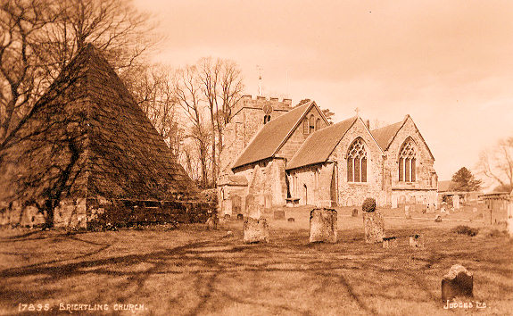
Brightling, St. Thomas ŕ Becket. The
pyramid is the tomb of the one-time M.P.
"Mad Jack" Fuller. TQ 6835
2101. From a postcard in Kevin Gordon's collection. A 2024 Streetview provides a
modern view.
Link.
Grade I listed. See
here for related listed features, including the pyramidal tomb.
Brighton.
Burwash, St. Bartholomew. Of Norman
foundation, the tower dates from C12, the rest of the church is largely C13, but
it was partly re-built and "restored" in the 19th. This was the parish church of
the Kipling family, and there is a plaque to Rudyard's son, killed in WW1.
Another view. TQ 6772 2475. Both ©
Carole Sage (2016). Link1.
Link2.
Grade II listed. Two chapels show on a map of 1878, both on the south side
of High Street. Providence Chapel (Calvinistic)
is/was set well back, accessed via a narrow alley. Aerial views suggest it
may survive, but Streetview hasn't seen it, though the alleyway has, (to the
right of the house with the blue door), in
2024.
Genuki (which calls it Providence Strict Baptist Chapel) dates it to
1829-1944. TQ 6748 2466. The Congregational Chapel
stood at TQ 6754 2472. It hasn't survived, and its
site (access road and
one adjacent house) was seen by Streetview in 2024. An old postcard of it can be
seen here, which
shows its date-stone for 1864.
Genuki says it was closed in 1967 and demolished three years later.
Burwash Common, St. Philip. Two
additional views - 1,
2, two interiors -
1,
2, the
pulpit and
font. TQ 6398 2365. All ©
Carole Sage (2016).
Link1.
Link2.
Burwash Weald, the
house built on the site of a Wesleyan Methodist Chapel.
The chapel shows on a map of 1878, and was still active into the 1950's, at
least. Genuki provides dates of 1843 to 1975, demolished about 20 years later.
There may be a photo of it
here, where it's just labelled as Burwash. TQ 6520 2322.
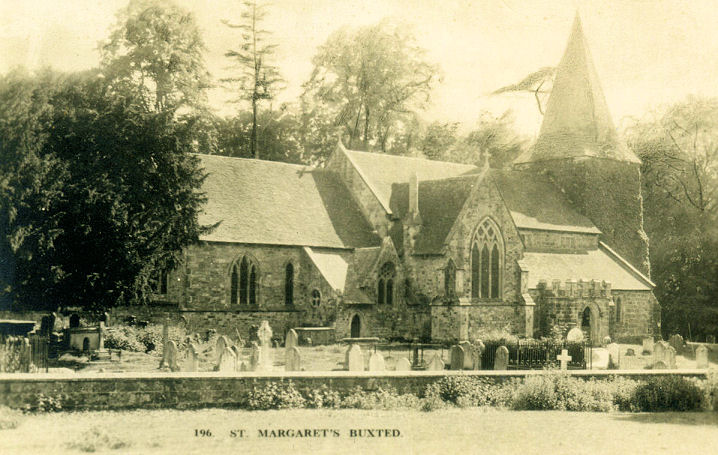
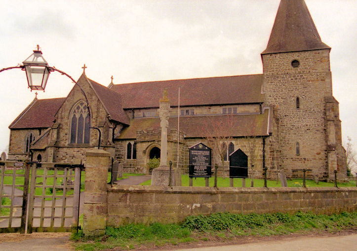
Buxted, St. Margaret the Queen, a
little way west of the village proper. TQ 4859 2305. From an old postcard in Peter Wenham's Collection. A
modern view, © Peter Wenham.
Link1.
Link2.
Grade I listed. The churchyard war memorial is also listed, as
grade II. In the village is
St. Mary the Virgin,
seen by Streetview in 2011. TQ 4997 2350.
Link1.
Link2.
Grade II listed - dates it to 1886. The
Methodist Church
(2022 Streetview) is on High Street at TQ 4997 2341.
Link. The
history page
dates it to 1907, and a map of 1931 labels it as Wesleyan.
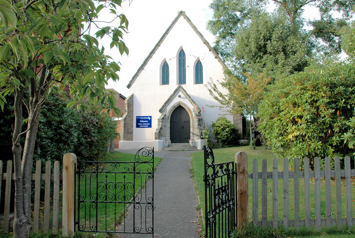
Chailey,
St. Peter, as seen by Streetview in 2024. TQ 3922 1934.
Link1.
Link2.
Grade II* listed. The Free Church at
South Chailey. TQ 3927 1717. © Geoff Watt.
Link. Older maps show a
Mission Hall standing by the road on what is now
the Free Church car park, on its left side as seen from the road, about where
the phone box is in a
Streetview from 2024. TQ 3925 1716. The
site (housing) of
St. John at South Common, as seen by Streetview in
2024. Genuki
dates it to 1895-1973, demolished 1970's - though the caption of a photo
here says it was a
conversion. TQ 3897 1747.
Cooper's Green, Five
Ash Down Chapel, as seen by Streetview in 2024. It pre-dates a map of 1878,
where it's labelled as Baptist Chapel (Calvinistic). It's dated
here
to 1784, re-fronted in 1896. TQ 4770 2370.
Link. A map of 1899 shows a
Mission Hall a little further north, at TQ 4767
2377. It (or perhaps the building which replaced it) is today used as the
village hall - 2024
Streetview.
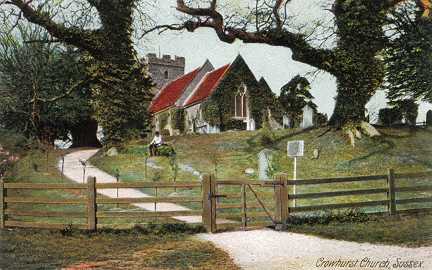
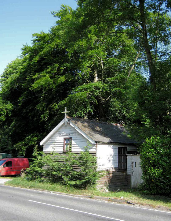
Crowhurst, St.
George. TQ 7573 1234. From an old postcard in Steve Bulman's Collection. A 2009
Streetview provides a modern
view. Link1.
Link2.
Grade I listed. About a mile to the south on Chapel Hill finds
Crowhurst Chapel (2023
Streetview) - it may have closed, as it doesn't seem to have an internet
presence.
Genuki
has it as Pentecostal, in a former Methodist Chapel from 1991. As Methodist, it
was originally Wesleyan, pre-dating a map of 1899.
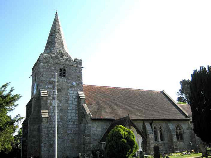
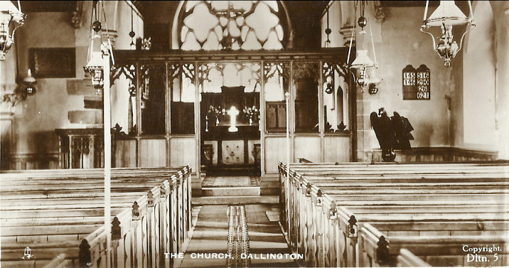
Dallington, St. Giles.
TQ 6577 1906. © Chris Emms (2011). An
interior view, from an old postcard in Judy Flynn's Collection.
Link1.
Link2.
Grade II* listed.
The former
Methodist Chapel to the north-west of the village, on Battle Road, has been disused for several decades
(Genuki
says since 1989). Older maps label it as Wesleyan. TQ 6542 1950. © Chris Emms (2011).
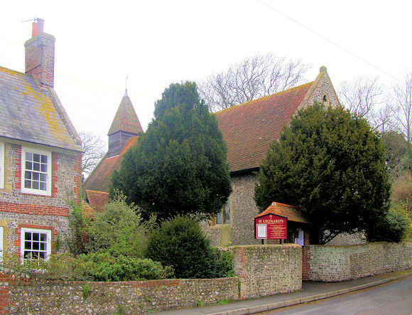
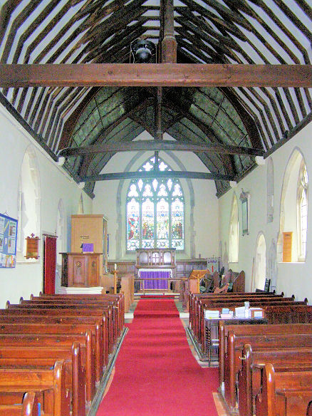
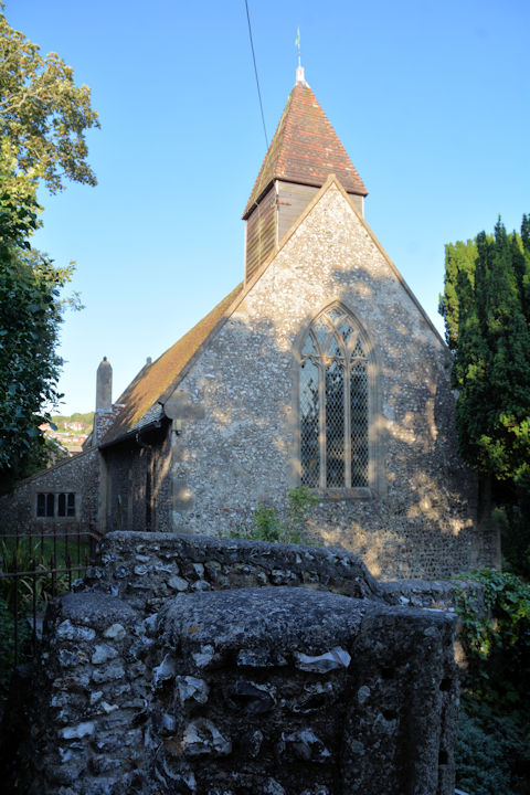
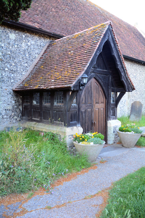
Denton, St. Leonard, and its
interior. TQ 4545
0258. Both © Kevin Gordon. Another view,
and the porch, both © Karel Kuča (2024).
Link1.
Link2.
Grade II* listed. For related listed features see
here.
Ditchling.
Eastbourne.
Etchingham, The Assumption of
Blessed Mary and St. Nicholas. A C14 church on an earlier site, it was
at one time surrounded by a moat. A further two views -
1,
2. TQ 7136 2621. All ©
Carole Sage (2016).
Link1.
Link2.
Grade I listed.
The war memorial is listed as
grade II. A large scale map of 1909 shows a
Wesleyan Methodist Chapel on the north side of High Street at TQ
7110 2610.
Genuki provides dates of 1900-1970. Whether the
house (2024
Streetview) on the site is the converted church, or a newer build, isn't
readily apparent.
Ewhurst Green, St. James the
Great, largely of the C12 and C14. Three more views -
1,
2,
3. TQ 7956 2457. All ©
Carole Sage (2016).
Link1.
Link2. The very brief
grade I listing, and for the war memorial,
grade II. A map of 1898 shows a Mission Chapel
(Congl.) set back from the north side of Ewhurst Lane at TQ 7945
2460. Its
Genuki entry dates it to 1895, which must be when it was converted
from a house into a chapel - its
grade II listing dates it to the 18th century, as a house. It was
still in active use at least as late as the later 1950's. It was seen by
Streetview in
2011 - note the roof of a porch at the right. This
source calls it Battle Congregational Chapel.
Exceat - see West Dean below.
Fairwarp,
Christ Church, and its porch. TQ
4659 2678. Both ©
Karel Kuča (2024).
Link.
Grade II listed. Two churchyard monuments are also listed - they can be
seen
here.
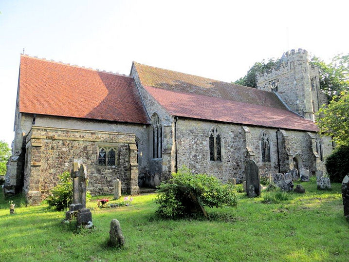
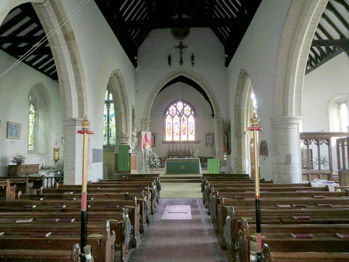
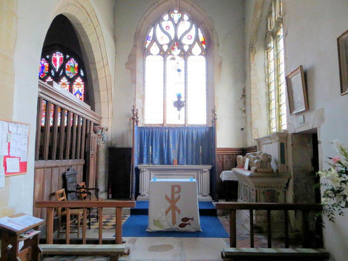
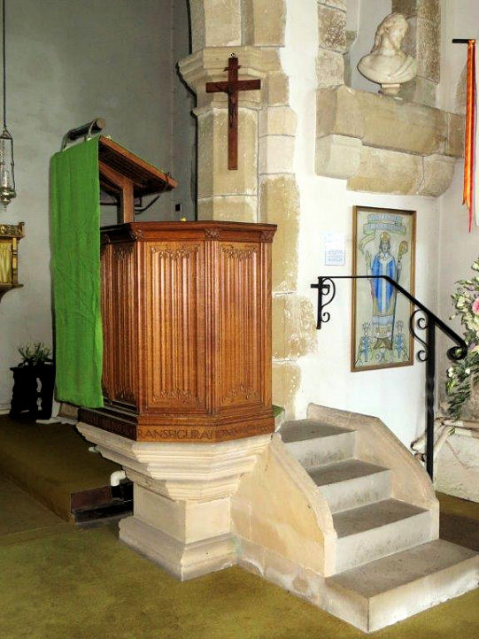
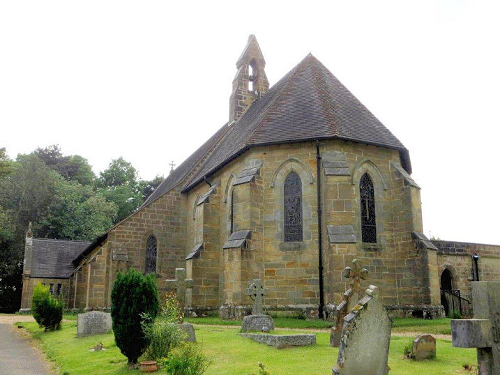
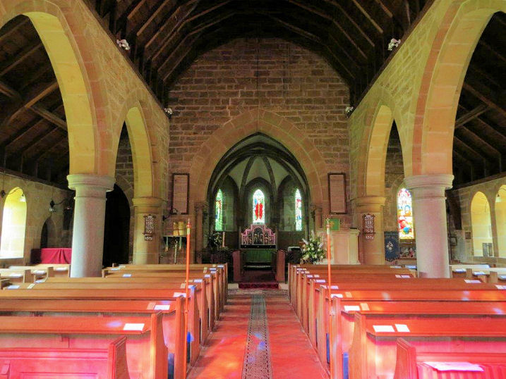
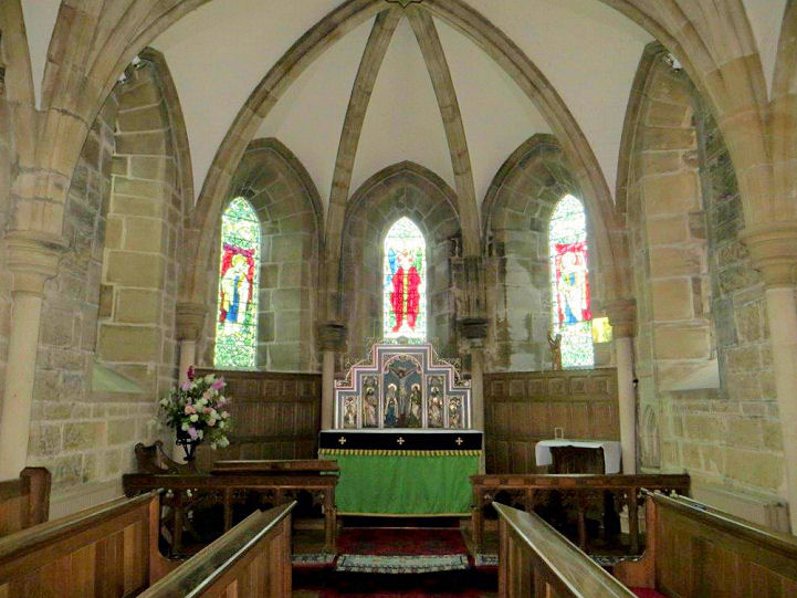
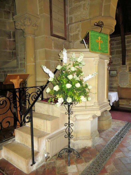
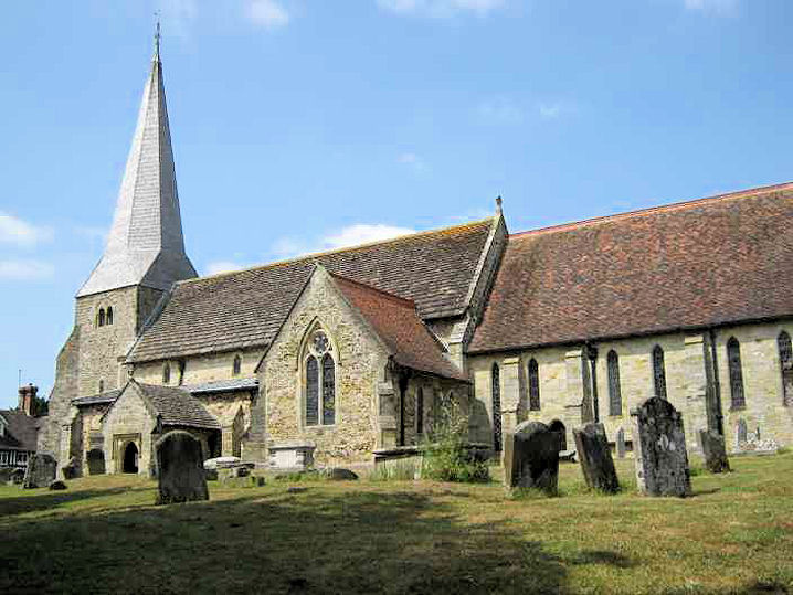
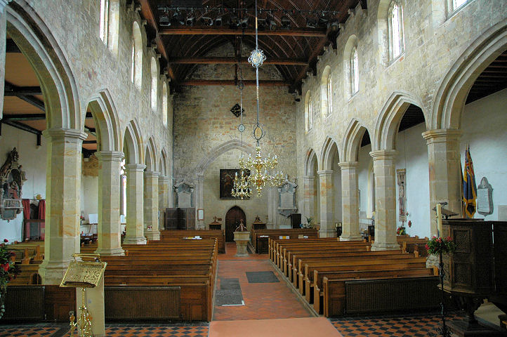
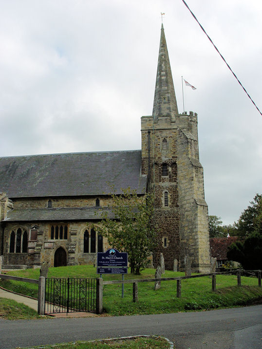
Fletching, St. Andrew and St. Mary the Virgin.
TQ 4290 2347. © Chris Emms (2011).
Link1.
Link2.
Grade I listed. See
here related listed features.
Folkington, St. Peter ad Vincula. TQ 5593 0381. © Kevin Gordon.
Another view,
© Karel Kuča (2024).
Link.
Grade I listed.
Framfield, St. Thomas ŕ Becket. TQ
4952 2030. © Peter Wenham.
Interior view, © Gerard Charmley (2016).
Link1.
Link2.
Grade II listed. Maps from 1899 to 1960 show a Mission
Hall on the south side of the main road through the village, at TQ 4973
2048.
Genuki advises that it was Congregational, supplies dates of circa 1895 to
1993, and that it was subsequently Bethel Gospel Mission. It survives,
apparently converted to residential use, and was seen by
Streetview in 2024.
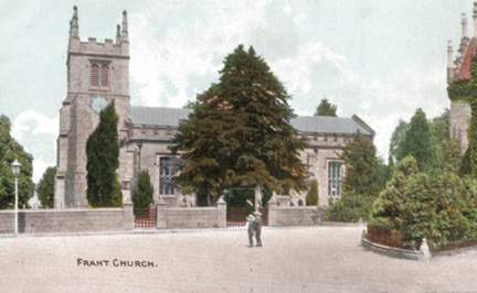
Frant, St. Alban. TQ 5903 3566. From an
old postcard in Steve Bulman's Collection. A 2021 Streetview provides a
modern view.
Link1.
Link2.
Grade II listed.
Friston, St. Mary the Virgin. Older
maps label it as St. James. TV 5517 9818.
From an old postcard in Kevin
Gordon's Collection. Two modern views -
1, 2,
both ©
Karel Kuča (2024).
Link.
Grade I listed.
Glynde,
St. Mary the Virgin. TQ 4564 0927. © Kevin Gordon.
Facebook.
Link.
Grade II* listed - dates it to 1763-5.
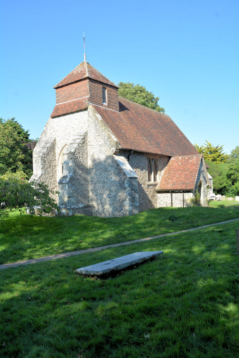
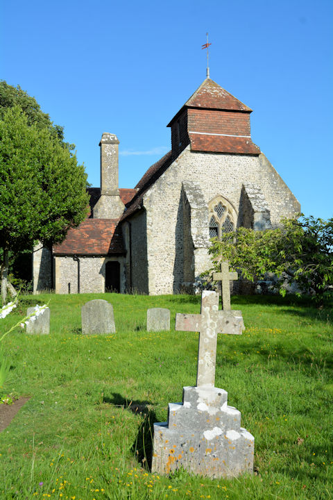
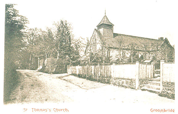
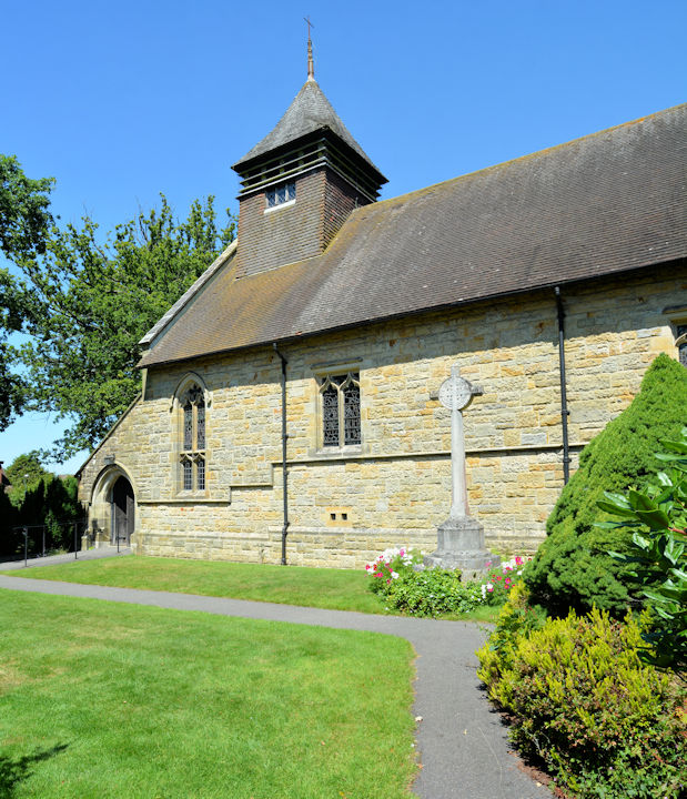
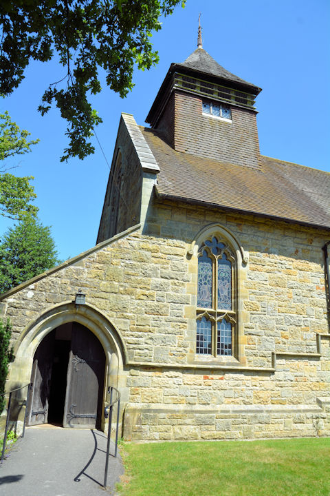
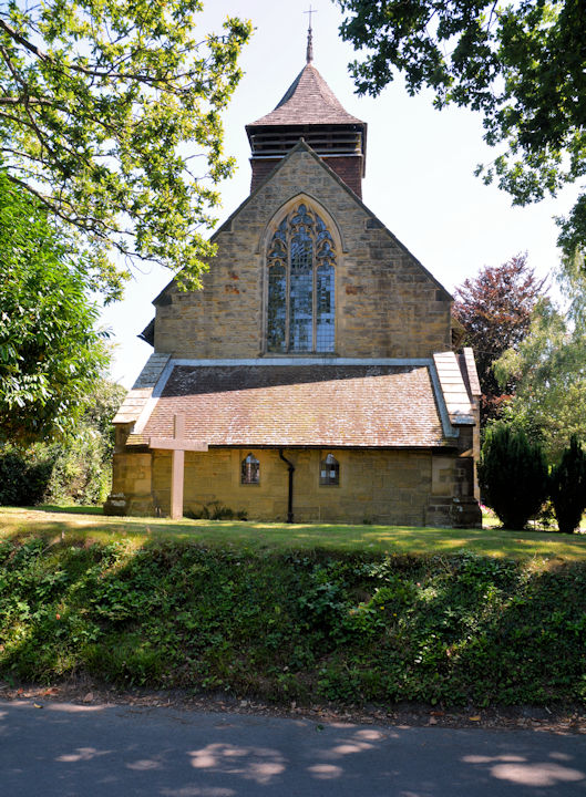
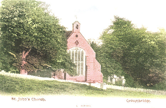
Groombridge, St. Thomas the Apostle.
TQ 5311 3685. From an old postcard in Geoff Watt's Collection. Three modern
views - 1,
2,
3, all ©
Karel Kuča (2024).
Link.
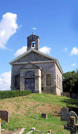
Grade II listed - dates it to 1883. St. John
the Evangelist. TQ 5306 3768. From an old postcard in Geoff Watt's Collection.
Link.
Catholic Church of St. Pius
V (R.C.) on Station Road is a former Wesleyan Methodist Chapel, dated 1857,
seen by Streetview in 2024.
Genuki
says it closed as Methodist in 1983. TQ 5306 3734.
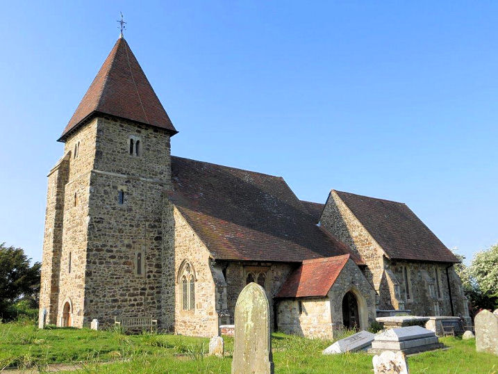
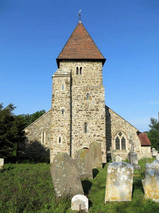
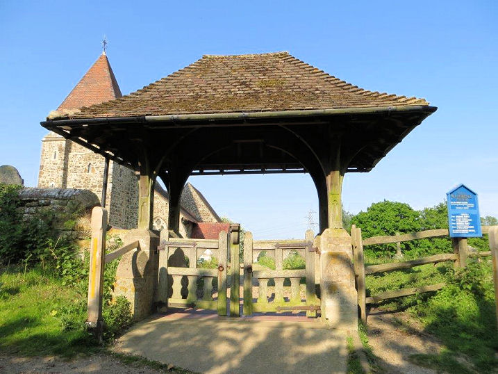
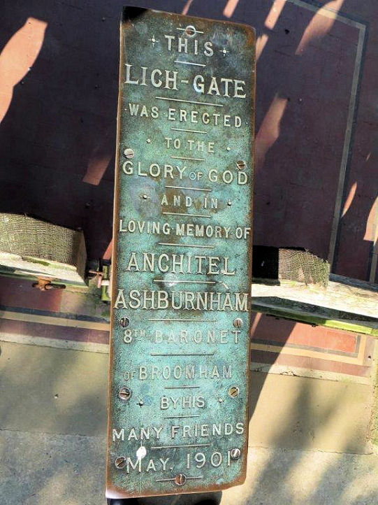
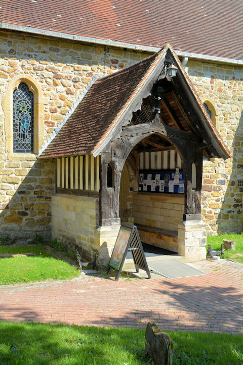
Guestling, St. Laurence on Church Lane.
Another view, the
lych-gate, and its
memorial plaque. TQ 8557 1448.
All © Carole Sage (2016). Link1.
Link2.
Grade I listed
(tower only, which is Norman). A map of 1878 shows a
Gospel Hall (Plymouth Brethren) near Guestling Green, at TQ 8547 1359. On
later maps it's shown as Wesleyan Methodist. Converted, it was seen by
Streetview in 2024.
Genuki says it closed in 1995.
Hastings.
Herstmonceux, All Saints. TQ 6426
1019. © Kevin Gordon.
Link1.
Link2.
Grade I listed.
High Hurstwood, Holy Trinity.
Two more views - 1,
2. TQ 4947 2649. All ©
Karel Kuča (2024).
Link.
Grade II listed.
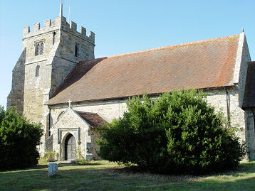
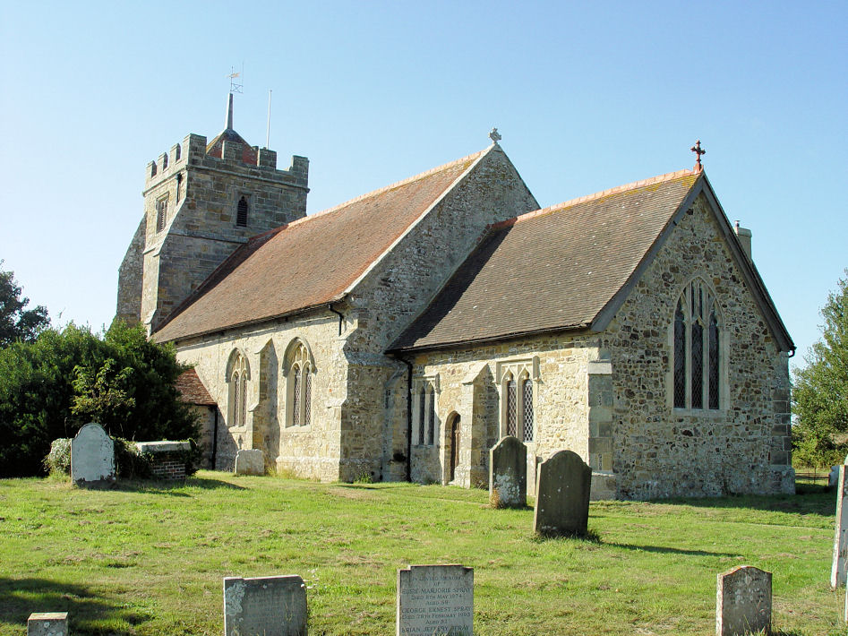
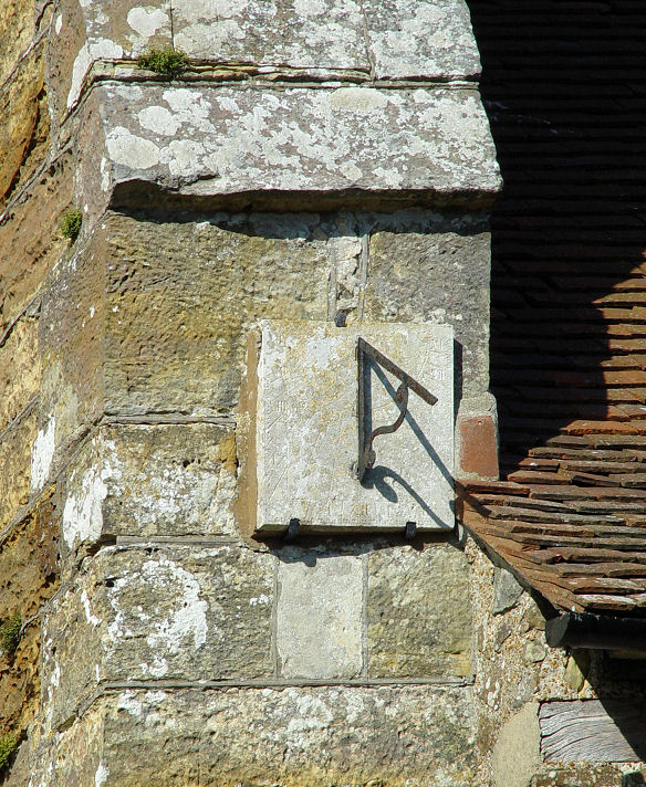
Hooe, St. Oswald. Another view,
and the sun-dial.
TQ 6827 0918. All © Steve Bulman (2009).
Link1.
Link2.
Grade I listed.
Hove.
Icklesham,
All Saints and St. Nicolas. TQ 8804 1648. © Geoff Watt.
Link1.
Link2.
Grade I listed. A map of 1878 shows a Wesleyan
Methodist Chapel on Main Road at TQ 8770 1638. By the time of a map of
1899 it had become Methodist Chapel (Bible Christian). Still active into
the 1950's at least (presumably just as Methodist), it had been replaced by a
domestic garage by the time of the first
Streetview visit in
2009.
Iden, All Saints, Norman, with C15 work.
Another view, and two interiors -
1,
2. TQ 9155 2375. All © Carole Sage (2016).
Link.
Grade I listed.
Mid-20th century O.S. maps show a place of worship
on Main Street, at TQ 9182 2380.
Genuki identifies it as a Methodist Church, dating from circa 1945
to 1966. It survives, converted, and was seen by
Streetview in
2016. The same source also mentions a predecessor on Grove Lane,
destroyed by enemy action in WWII. It was Wesleyan, at TQ 9209 2393, and
pre-dated a map of 1877. Its
Genuki entry dates it to 1848.
Iford, St.
Nicholas. TQ 4082 0734. From a postcard in the Kevin Gordon Collection.
Link.
Grade I listed.
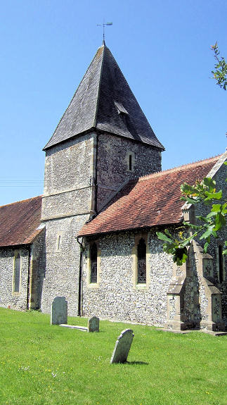
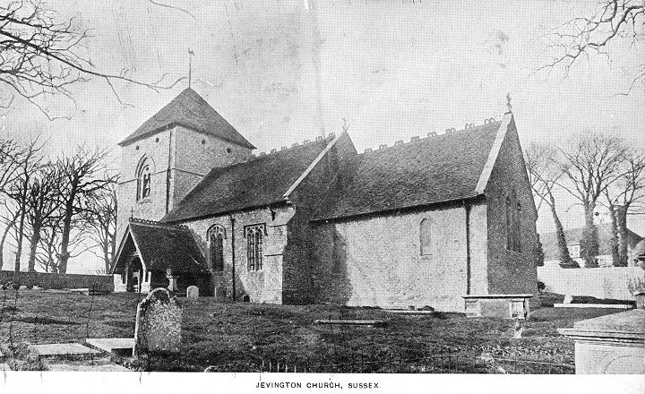
Jevington, St. Andrew.
TQ 5614 0152. From an old postcard (franked 1904) in Steve
Bulman's Collection. A
modern view,
from Streetview in 2014. Link1.
Link2.
Grade I listed.
Kingston, St. Pancras.
TQ 3914 0817. ©
Graham Parks (2012).
Link1.
Link2.
Grade II* listed.
Lewes.
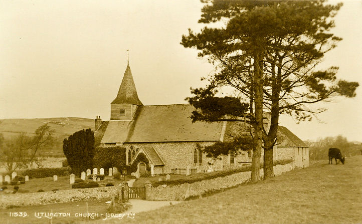
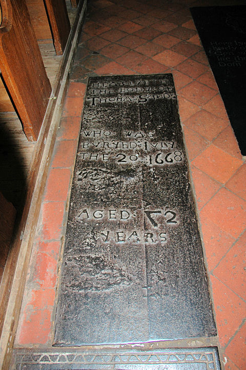
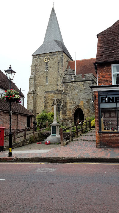
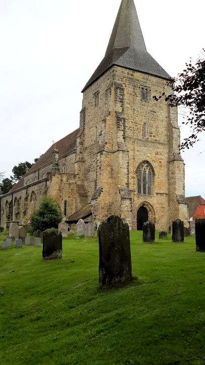
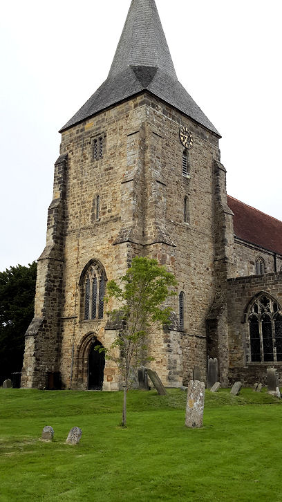
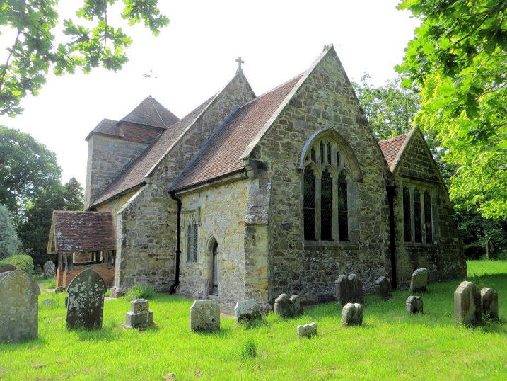
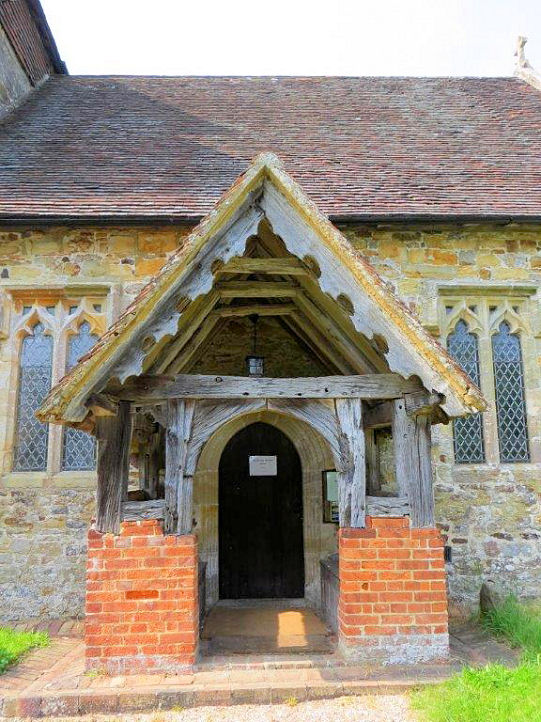
Litlington, St. Michael the Archangel
(O). Curiously, Pevsner and O.S. maps fail to give a dedication, so perhaps its
present name is recent. TQ 5233 0195. © Dave Westrap. An old postcard view, from Reg Dosell's Collection.
Another view, two interior view - 1,
2 - and the font, all © Steve Bulman (2009).
Another view, © Elaine Saunders
(2016).
Link1.
Link2.
Grade I listed.
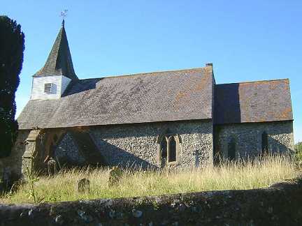
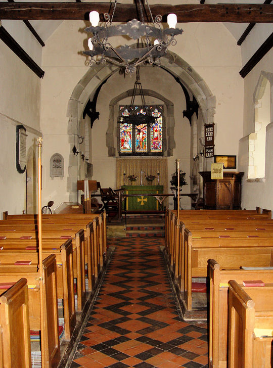
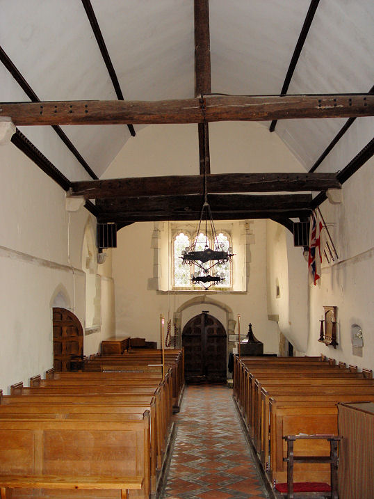
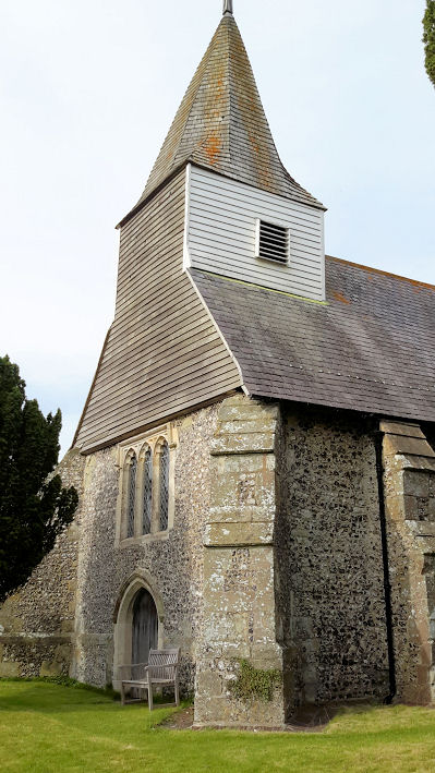
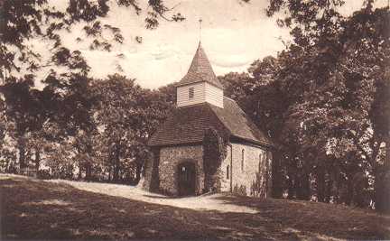
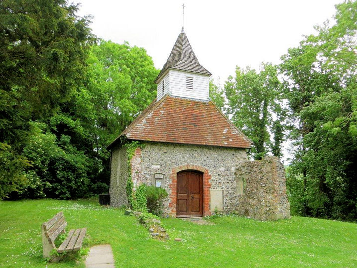
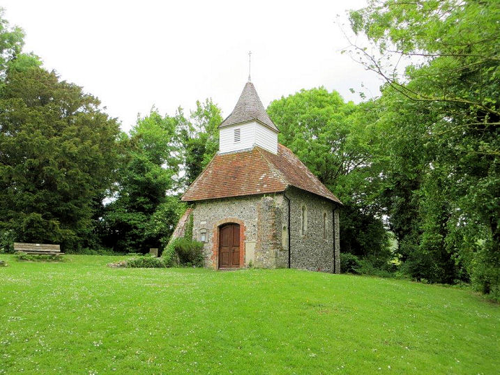
Lullington, Church of the Good Shepherd. One of the
smallest churches in Britain, though only the remaining portion of a once larger church.
TQ 5282 0306. From an old postcard in Steve Bulman's Collection. Two modern views
- 1, 2,
and the interior, all © Carole Sage
(2016).
Link1.
Link2
says the church was re-dedicated in 2000.
The very brief
Grade I listing.
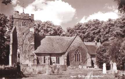
Maresfield, St.
Bartholomew. TQ 4659 2402. From an old postcard in Steve Bulman's Collection.
Link1.
Link2.
Grade I listed.
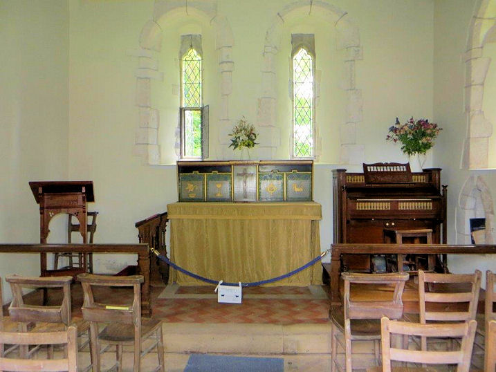
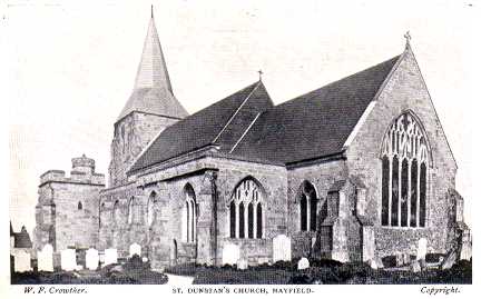
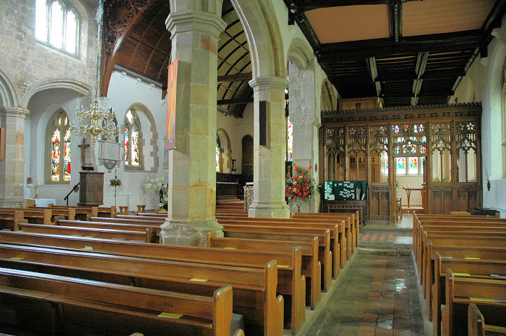
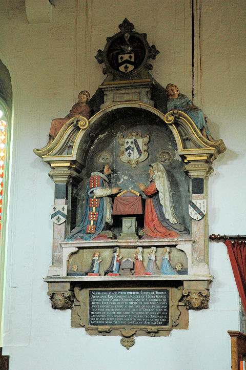
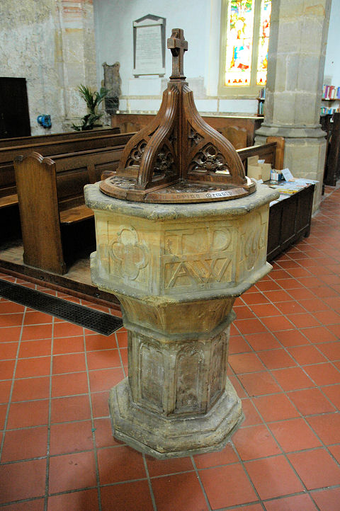
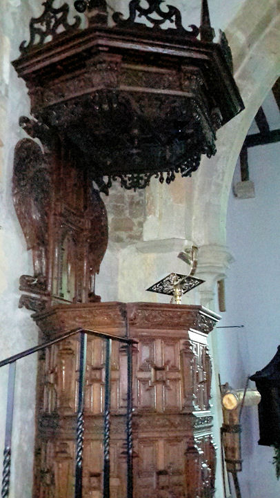
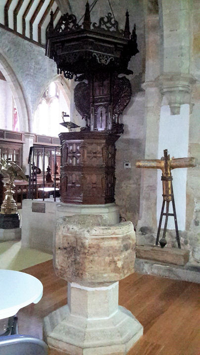
Mayfield, St. Dunstan (O). TQ 5865 2703. From an old postcard
in
Steve Bulman's Collection. Interior view, and an
iron tomb slab - note
the reversed "7" and the "N" towards the top. Both © Judith Anderson (2009).
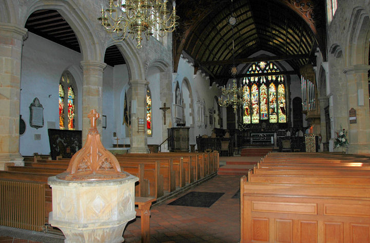
Three further views - 1,
2,
3, all © Elaine Sanders (2016).
Two more interior views - 1,
2, a
monument, and the
font, all © Karel Kuča (2007).
Link.
Grade I listed. Numerous tombs and headstones are listed separately - they
can be seen
here. Baptist Chapel on West
Street and South Street. TQ 5849 2690. © Judith Anderson (2009).
Link.
The history page dates it to
1873, on the site of a predecessor. Colkins Mill Church (Evangelical, previously Congregational)
on Station Road. According to its
Genuki entry it was originally Bible Christian, founded in 1825. TQ 5833 2696. © Judith Anderson (2009).
Link.
St. Thomas of Canterbury
(R.C.) on Station Road, as seen by Streetview in 2019. This
source dates it to 1957, replacing a predecessor of 1932. TQ 5814 2690.
St. Mary and the Angels (R.C.) on St. Mary in the Fields, at TQ 5854
2683. It's shown on maps from 1931 to 1976, the latest available to me.
A distant Streetview
from 2024 suggests that it survives. I haven't been
able to find a photo of it.
Mountfield, All Saints, mostly C12,
with a slightly later tower. Two additional views -
1,
2, and the
porch. TQ 7348 2028. All © Carole
Sage (2016).
Link1.
Link2.
Grade II* listed. Roughly half a mile to the S.E. is a former
Wesleyan Methodist Chapel, at TQ 7424 1980.
Pre-dating a map of 1898, it was seen by
Streetview in 2008.
Genuki dates it to 1894-1970.
Newhaven.
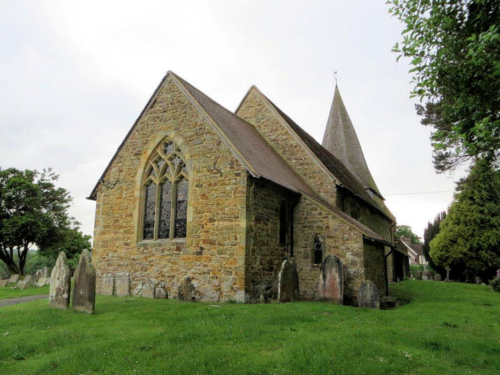
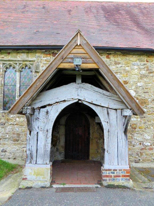
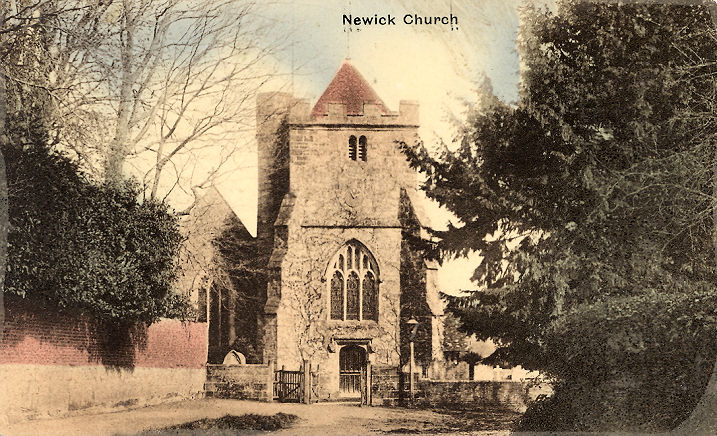
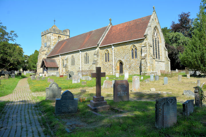
Newick, St. Mary. TQ 4216 2082. From an old postcard (franked 1911) in Steve Bulman's Collection.
Two modern views - 1,
2, and the
porch, all ©
Karel Kuča (2024).
Link.
Grade II* listed. A map of 1878 shows Zion
Baptist Chapel off Western Road, at TQ 4114 2138. It remained in active
use into the second half of the last century. It since seems to have been
converted to residential use, and was seen by
Streetview in 2021. A
map of 1899 shows a Mission Hall a short
distance to the S.W. of Zion, on Western Road at TQ 4101 2114. A map of 1959
doesn't show it to have been a place of worship at that time, but in a
Streetview from 2008 it
has signage as Newick Evangelical Free Church.
That signage was removed sometime after September 2015, and the building was
looking uncared for in 2024.
Northiam, St. Mary. Another view. TQ 8301 2452.
Both © Steve Bulman (2009).
Link1.
Link2.
Grade II* listed. Northiam Unitarian Chapel
on Dixter Road, identified
by Janet Gimber. Its very brief
grade II listing dates it to 1810. Its
Wikipedia
entry says that 1810 was a re-build replacing an earlier wooden building,
and has been closed and converted to residential use. TQ 8238 2502. ©
Steve Bulman (2009). The village also has a converted former
Wesleyan Methodist Chapel
(2019 Streetview) on Dixter Road at TQ 8253 2487.
Genuki says it was founded in 1814, closing in 1974. A little under a mile
to the south of the town at Millcorner is the
site (2009 Streetview)
of another Wesleyan Methodist Chapel, dated by
Genuki to 1882-1965. TQ 8242 2350. The cemetery off Ewhurst Lane is shown on
O.S. maps to have a double Mortuary Chapel (CoE and
Nonconformist) at TQ 8245 2469. It can't be seen on Streetview, but a photo is
available
here.
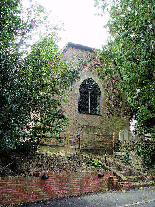
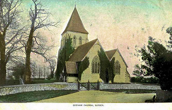
Offham,
St. Peter. TQ 4006 1216. From a postcard in Kevin Gordon's Collection. A 2024
Streetview provides a modern
view. Link1.
Link2.
Grade II listed - dates it to 1859, by Ewan Christian.
Peasmarsh, St.
Peter and St. Paul on Church Lane. TQ 8871 2185. © Bill McKenzie. Two additional views -
1,
2, two interiors -
1,
2, a
window, the
pulpit and the
font, all © Carole Sage (2016).
Link1.
Link2.
Grade I listed. Former
chapel (now a private residence).
TQ 8880 2279.
© Geoff Watt. Janet Gimber advises that this was Wesleyan Methodist. Early O.S.
maps show another Wesleyan Methodist Chapel on Main
Street, at TQ 8917 2247. It had been demolished by the middle of the last
century, and its site was seen by
Streetview in 2021.
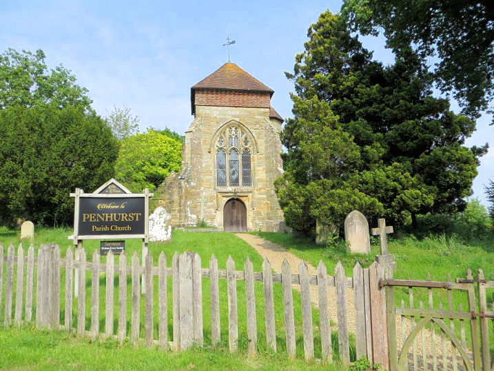
Penhurst, St. Michael the Archangel, on
Penhurst Lane. Another view, and the
porch. TQ 6943 1656. All © Carole Sage
(2016).
Link1.
Link2.
Grade I listed.
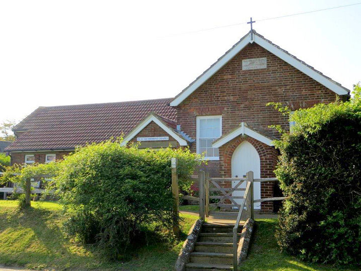
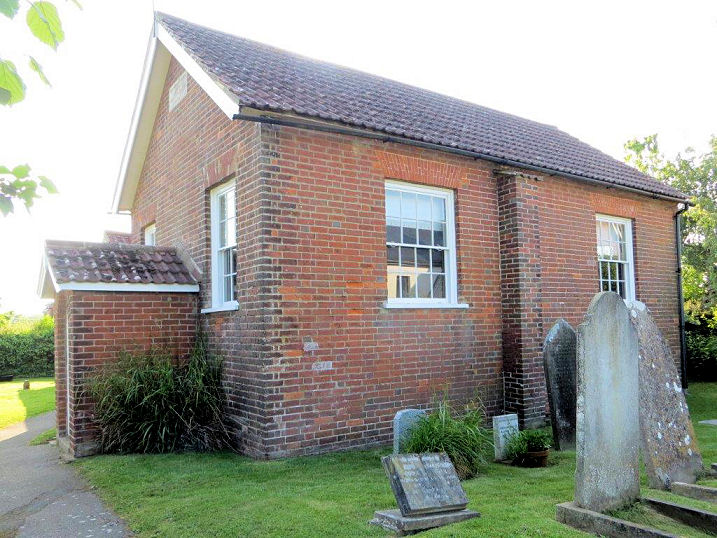
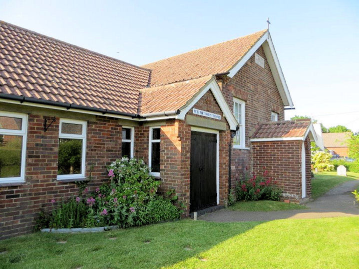
Pett, St. Mary and St. Peter (1864). TQ 8729
1391. From an old postcard, in Reg Dosell's Collection. A
modern view, © Carole Sage (2016).
Link1.
Link2.
Methodist Church (1848). It's labelled
on older maps as Mount Calvary Chapel (Bible Christian). Two further
views - 1,
2. TQ 8699 1394. All © Carole Sage
(2016). Link.
Grade II listed.
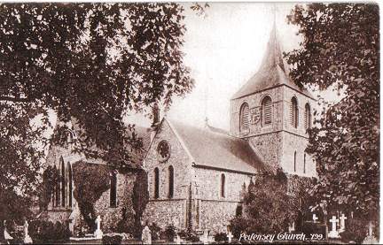
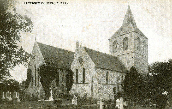
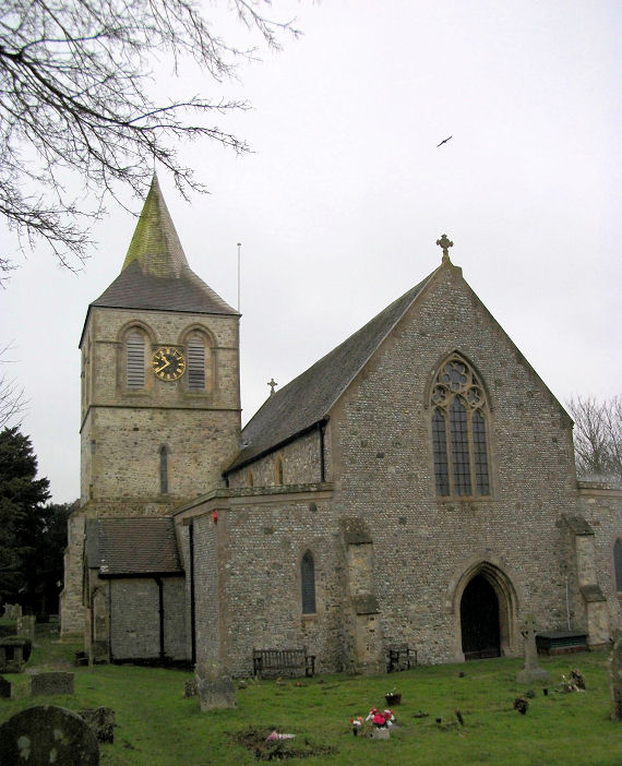
Pevensey, St. Nicolas. TQ 6469 0484. From an old postcard in Steve
Bulman's Collection. Another old postcard view, this one from Reg Dosell's Collection. A
modern view, © Stuart Mackrell.
Link1.
Link2.
Grade I listed.
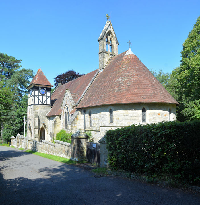
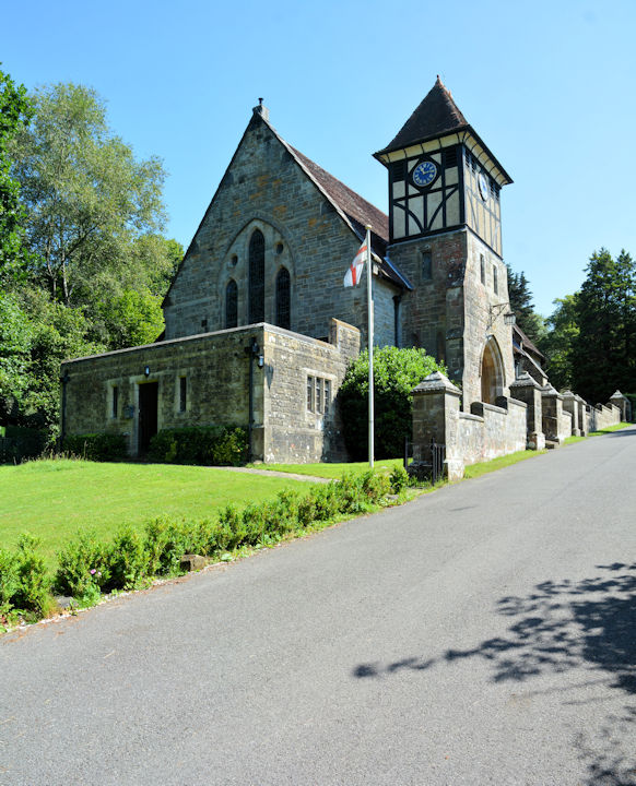
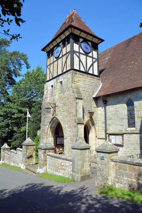
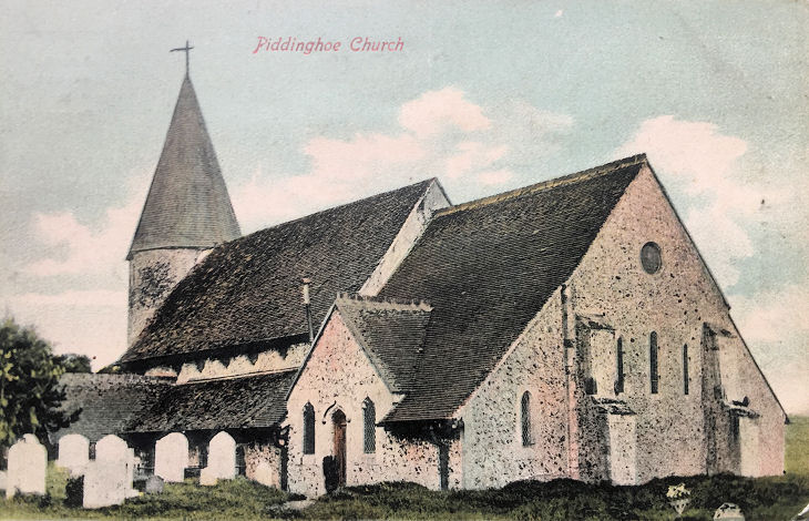
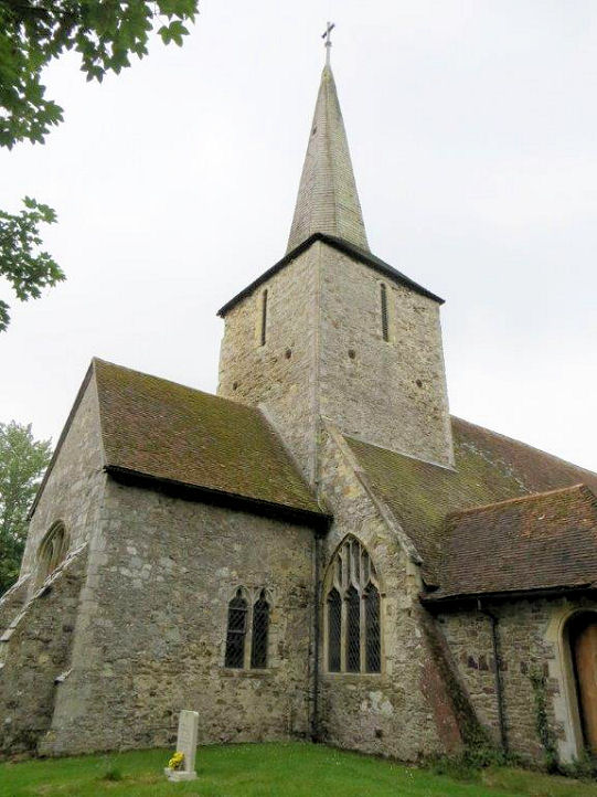
Piddinghoe, St. John the Evangelist.
TQ 4351. From an old postcard in Paul E. Barnett's Collection.
A 2011 Streetview provides a
modern view. Link1.
Link2.
Grade I listed.
Playden, St. Michael on Rectory Lane,
which dates from the late C12. Two further views -
1,
2, and the
interior. TQ 9202 2168. All © Carole
Sage (2016). Link1.
Link2.
Grade I listed.
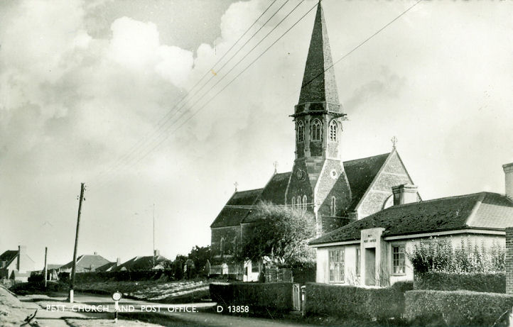
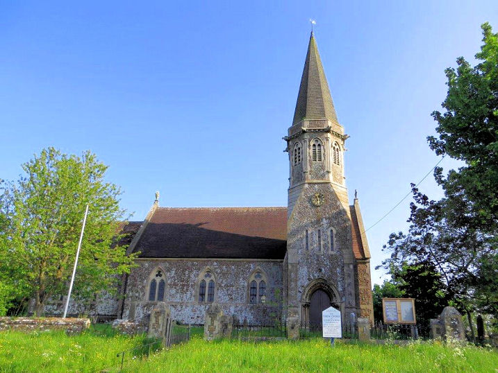
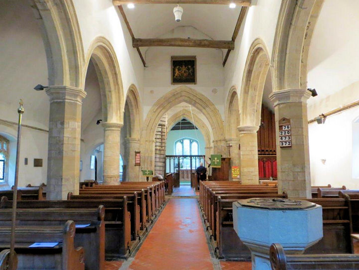
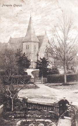
Polegate, St. John. TQ 5814 0464. From an old postcard
in Steve Bulman's Collection. Link1.
Link2.
U.R.C. on High Street, formerly the Congregational
Church. It seems to be the same building shown on a map of 1878, though it's
unlabelled. By the time of an 1899 map it shows it as a Mission Room.
Streetviews show it to have still been U.R.C. in 2011, but by 2012 the church
signboard was saying Polegate Free Church, as it does today. TQ 5815 0502. From a postcard in Kevin Gordon's Collection (posted
1907). Link.
Cornerstone Seventh-day
Adventist Church on Hailsham Road, as seen by Streetview in 2016.
Genuki says that it was originally a school, of 1850. TQ 5804 0515.
Link.
St. George (R.C.) on
Eastbourne Road, as
seen by Streetview in 2024. TQ 5808 0454.
Link. O.S. maps mark, just a
little way north of the town at TQ 5869 0571, Site of
Abbey (Premonstratensian), and just a short distance east,
Chapel (Rems. of), at circa TQ 5875 0571, both near
Otteham Court. Neither the site nor the
grade II* listed chapel can be seen by Streetview, but a photo of the chapel
can be seen
here.
Ringmer,
St. Mary the Virgin. TQ 4458 1251. © Kevin Gordon.
Link1.
Link2.
Grade I listed. The Baptist Church
meets in the
village hall
on Lewes Road, seen by Streetview in 2024. It appears to be the same
building as is marked on a map of 1899 as Parish Room. TQ 4471
1244. Link. The village
also has a former Congregational Chapel,
also on Lewes Road, at TQ 4494 1251.
Genuki, which has a photo, calls it Rehoboth, and dates it to
1914, closing in 1995.
Ripe, St. John the Baptist, previously
incorrectly listed as St. Andrew. TQ 5138 0987. © Chris Emms (2011).
Link1.
Link2.
Grade I listed. Older O.S. maps show a small
Baptist Chapel on Mill Lane at TQ 5087 0989.
Genuki,
which calls it Hebron, provides dates of 1830-1948, and says it
was demolished the same year as it was closed. It stood immediately to
the right of the roadside building seen in a
Streetview from
2024.
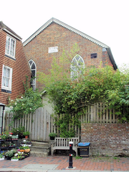
Robertsbridge, U.R.C. on
High Street, was originally Congregational of 1881, and which Pevsner records
as, rather unkindly, "truly
horrible".
Genuki dates its closure to 2015. TQ 7378 2360. © Steve Bulman
(2009). The former Bethel Chapel (1842)
on High Street.
Genuki has it as a Strict Baptist Chapel, 1843-1999. TQ 7379 2366. © Steve Bulman (2009).
Grade II listed.
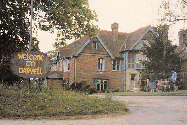
Darvell Bruderhof Community, on Brightling Road. TQ 7293 2304. © Alan K. Taylor.
Link. The village also
has a former Wesleyan Methodist Chapel on
Fair Lane. It was seen by
Streetview in
2024.
Genuki says
"founded in c.1795. It closed in 1960", presumably as Methodist. It also
says that after closure, the congregation shared the United Reformed
Church. TQ 7387 2361. A map of 1909 shows a
Mission Room just to the west of the Wesleyan Chapel on Fair
Lane, at TQ 7384 2361. Not well seen on Streetview (trees surround it),
Genuki has a decent photo, and dates it to 1904. It still has a
ACNY entry,
which says it has closed, but its closure must have been relatively
recent.
Link. The
grade II listed
Quaker Cottage (2024 Streetview) is on Northbridge Street at
TQ 7394 2415. I haven't been able to discover if this was a Friends'
Meeting House.
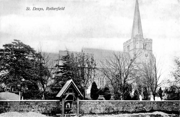
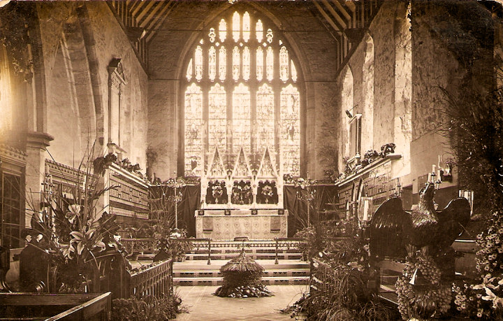
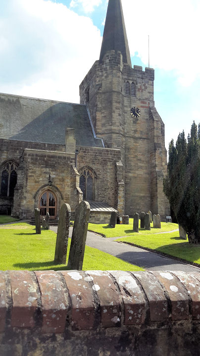
Rotherfield, St. Denys. TQ 5560 2976. From an old postcard (ca. 1910)
in Brett
Jeffrey's Collection. One of Judy Flynn's old postcards was previously in the Unknown
section - it was posted from Tunbridge Wells to
Boscombe in 1905, and written on the back is "This photo was taken the day after our harvest thanksgiving." Interiors are always difficult to identify, so my
thanks to Simon Davies for identifying this, and supplying the following confirmatory link.
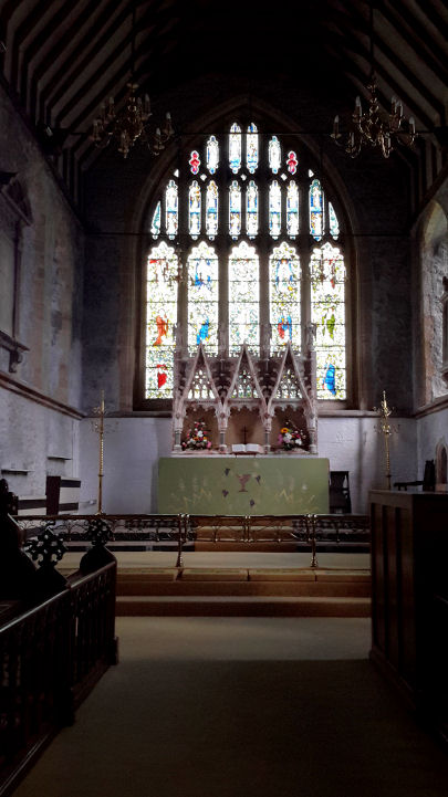
A modern view, the
interior,
pulpit and tester and the
font, all
© Elaine Sanders (2016). Justin Brice has told me that the church was burgled some years ago. One item
stolen was a 1711 painting of an old windmill by Humphrey Fowle. As part of his
researches into this mill, Justin is keen to find a photograph of this painting.
Can you oblige? Link.
Grade I listed. A map of 1879 shows Providence Chapel
(Par. Baptist) on South Street at TQ 5566 2966 is dated 1858.
Still seemingly active as Strict Baptist (its church signboard is still
in place), it was seen by
Streetview in
2024. It doesn't seem to have a web presence. The same map also shows
another Particular Baptist Chapel (Bethel)
on North Street, at about TQ 5568 2981. It's not clear which building is
meant. Its
Genuki entry has a photo of Providence, not Bethel. It has dates of
1792, re-built 1852-3, and closed 1875. Looking at the buildings on
Streetview, it doesn't seem to have survived. Looking south along North
Street, the chapel would have been visible in this
2021 Streetview.
North-east of the village, on Station Road, Town Row, is a former
Wesleyan Methodist
Chapel (2024 Streetview).
Genuki says 1879-2005. A map of 1879, surveyed no later than 1874
shows an earlier chapel on the same site. TQ 5637 3026.
St. Peter, Prince of
Apostles (R.C.) on St. Peter's Mead, as seen by Streetview in 2011.
Genuki dates it to 1963.
Its lack of a current web presence suggests it may have been closed. TQ
5548 2928.
Rottingdean, St.
Margaret of Antioch. TQ 3697 0260. From an old postcard (franked 1904), in Steve Bulman's Collection.
The church website has some
modern photos, and an old painting of the church can be seen
here.
Grade II* listed. See
here for related listed features. Our Lady Of
Lourdes Queen Of Peace (R.C.) is on Whiteway Lane, and was seen
by Streetview in
2024. TQ 3702 0247. Link.
Mid-20th century maps mark a place of worship on Park Road.
Genuki identifies it as a former
Congregational
Chapel (2024 Streetview), and dates it to circa 1895 (although it
isn't shown on early 20th century maps), closing in 1985, "latterly as
Independent". TQ 3693 0231.
Almost directly across the road is a former
Brethren Hall, which
Genuki
dates to circa 1935. It now serves as a hall available for hire, and was
seen by Streetview
in 2024. TQ 3693 0230.
Genuki also lists Winton Gospel Hall on
Falmer Road, which it dates to 1950-2003, with demolition in 2010.
Fortunately, the very first Streetview visit saw it in
2009,
and the house built on its site in
2024. TQ 3661
0324.
Rye.
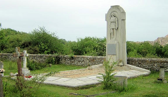
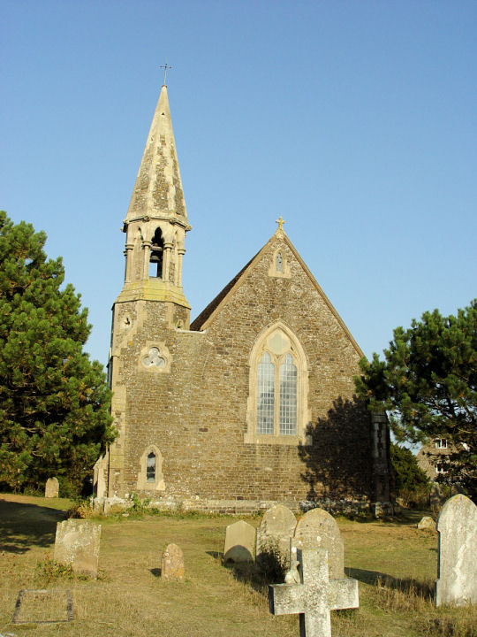
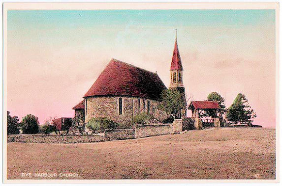
Rye Harbour, Church of the Holy
Spirit (CoE). Memorial to lifeboat
men. TQ 9378 1911. Both © Dave Westrap. Another view, © Steve Bulman (2009).
An old postcard view, from Kevin Gordon's Collection.
Link
dates it to 1849.
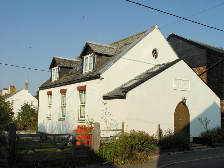
Grade II listed. The former Church Mission Room
on Harbour Road.
Genuki provides dates of "after 1900" to 1985. TQ 9405 1907. © Steve Bulman (2009).
It seems to be the same building (or is on the site of) a
Wesleyan Methodist Chapel shown on a map of
1909. Maps of 1929, 1941 and 1947 show it as
Mission Room.
St. Leonards-on-Sea.
Salehurst, St. Mary the Virgin. Another view.
TQ 7493 2424. Both © Steve Bulman (2009).
Another view, the
interior and
font. The font was a gift from
Richard I, in appreciation of the local abbot's involvement in the negotiations
for his release from captivity. All © Elaine Sanders (2016).
Link1.
Link2.
Grade I listed. A tomb in the churchyard is listed as
grade II. Some remains of Robertsbridge Abbey (Cistercian) are to be
found to the south-east of the village, at TQ 7547 2384. Nothing can be
seen on Streetview.
Link.
Grade II* listed (Abbey ruins),
Grade I listed (The Abbey, house incorporating Abbey fabric).
Seaford.
Sedlescombe
and Sedlescombe Street, St. John the Baptist (O). Interior view, and an
angel. TQ 7770 1881. All © Steve Bulman (2009).
Link1.
Link2.
Grade II* listed. South of the villages is
Chapel on the Hill (U.R.C.), on Chapel Hill at TQ 7837 1731. It
was seen by
Streetview in 2024. It pre-dates a map of 1900, where it's labelled
as Congl. Mission Ch. The same map shows just a few yards further
south, Congl. Ch., at TQ 7837 1728.
Why there would be two congregational chapels so close together is not
apparent, but
Genuki, which dates it to circa 1884-1907, says it was a splinter
from the other chapel. This second chapel survives as Woodland Cottage,
and was seen by
Streetview in 2024. There is also a former
Wesleyan Methodist
Chapel (2024 Streetview) in Sedlescombe Street, at TQ 7824 1782.
Long closed (Genuki
provides dates of 1812-1924), it's hardly recognisable as a former
chapel, but it's called The Old Chapel, and note the arched
window on the side wall.
South Heighton,
the former Congregational Chapel on Heighton Road, as seen by Streetview in
2024.
Genuki dates it to 1891-1950. TQ 4508 0289. What is probably its predecessor
(Independent Chapel) shows on a map of 1879 further
south in the village. It's unclear exactly which building the label should apply
to - it could be either of two buildings standing across the road from each
other. This grid reference is for the road between them - TQ 4507 0273. A
2022 Streetview shows
the view north along the road, and the building to the right seems of sufficient
age to be the former chapel, and it has a porch.
Genuki also tells of the vanished medieval parish church,
St. Martin, which was closed in 1769, and later
burned down after being hit by lightning. A new church of St. Martin had to wait
until 1894, and lasted until 1950 - a tin tabernacle. O.S. maps show that the
second church was at TQ 4509 0278, set back a little from the road. Older maps
also show that there were still visible remains of the first St. Martin, at
least into the later 19th century. The house on the site today was seen by
Streetview in 2009.
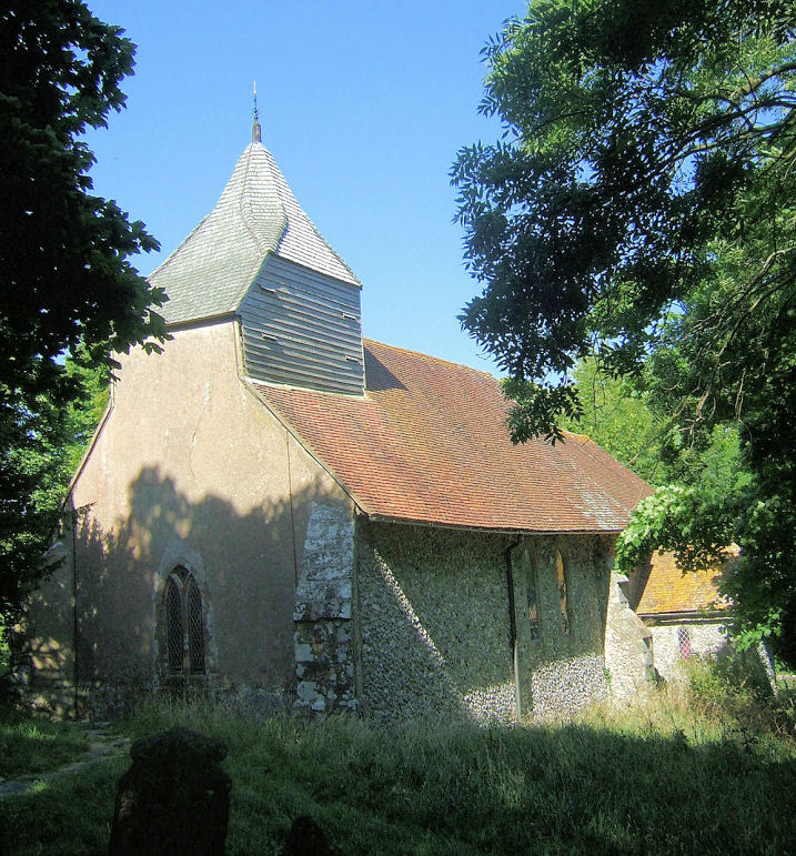
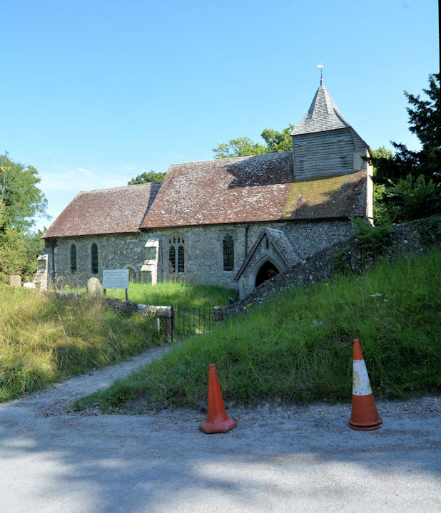
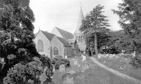
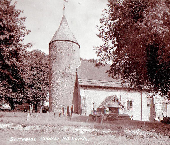
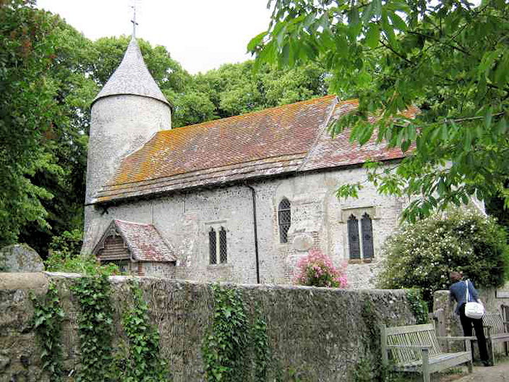
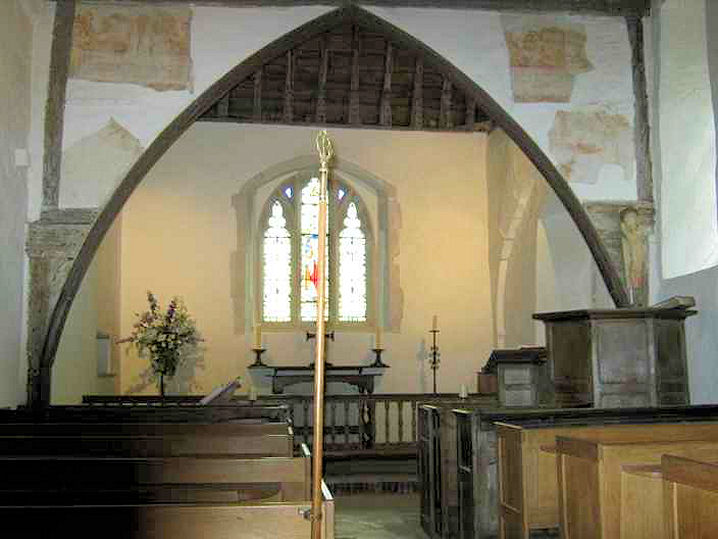
Southease, St. Peter. The dedication
is modern, as the medieval one was lost. TQ 4230 0527.
From a postcard in Kevin Gordon's Collection. A modern view, and an
interior view, both © Chris Emms (2011).
Link1.
Link2.
Grade I listed.
Stanmer, no dedication (CoE). TQ 3365
0958. © Bernard Hylands.
Link1 says it
was closed in 2008.
Link2.
Grade II listed. See
here for related listed features.
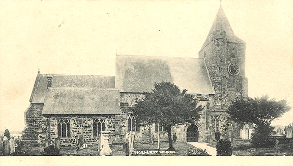
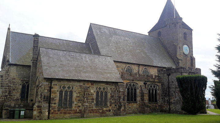
Staplecross, St. Mark. TQ 7839
2250. © Steve Bulman (2009).
Link1.
Link2 has interior photos, and dates it to 1895, by Streatfeild. The
village also used to have a Wesleyan Methodist
Chapel, just north of the
crossroads, at TQ 7816 2247.
Genuki dates it to 1812, closed and demolished in 1970. The houses
built on its site were seen by
Streetview in
2024. I haven't been able to find a photo.
Stone Cross, St. Luke. It
post-dates a map of 1899. Another view.
Both ©
Karel Kuča (2024).
Link. A short
distance north, in the hamlet of Blackness, is the site of a vanished
Wesleyan Methodist Chapel, shown on on-line maps
from 1899 until the latest available (1960). It has been replaced by
housing (2021
Streetview). The National Archives
references documents pertaining to the chapel for the years 1921-1982. TQ
6142 0476.
Streat,
the Parish Church (dedication unknown). TQ 3508 1518. © Graham Parks (2012).
Link1.
Link2.
Grade II* listed.
Tarring
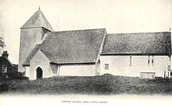
Neville, St. Mary TQ 4440 0379. © Kevin Gordon. An old
postcard view (card franked 1905),
from Steve Bulman's Collection.
Link1.
Link2.
Grade I listed.
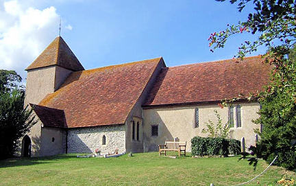
Ticehurst, St. Mary the Virgin on
Church Street is largely of C14, but there is some fabric from the preceding
century. TQ 6887 3010. From an
old postcard in Steve Bulman's Collection. Two modern views -
1,
2, the
pulpit,
font and
East window, all © Elaine Saunders
(2016).
Another view (showing the recently
added St. Mary's Room), and two interiors -
1,
2, all © Carole Sage (2016).
Link1.
Link2.
Grade II* listed. The village also has a former
Wesleyan Methodist Chapel (now The Pulpit) east of St. Mary, at TQ 6918
3012. 2024 Streetview.
It pre-dates a map of 1878 and still shows as a place of worship on a map of
1960. The map of 1878 also shows a Baptist Chapel
(Calvinistic) adjoining the Wesleyan at the rear. Although not mentioned
on later maps, it may survive, the roof seen in a
Streetview of 2024.
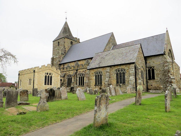
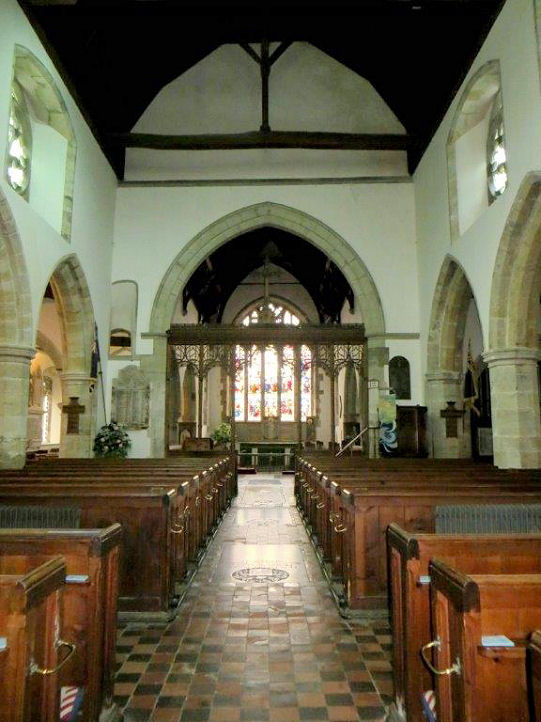
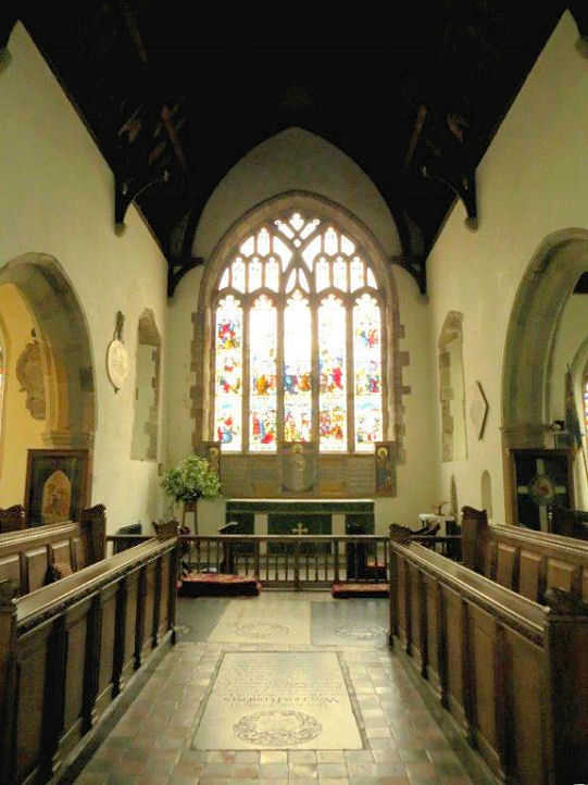
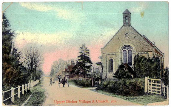
Upper
Dicker, Holy Trinity. TQ 5518 0980. From a postcard in Kevin Gordon's
Collection. Compare with these modern views -
1,
2 - note that the triangular "hat" on the bellcote has gone.
Both © Steve Bulman (2009).
Link1.
Link2 dates it to the 1840's. The
village hall (2024
Streetview) was previously a place of worship (or stands on the site of one),
marked as such on a map of the late 1950's. Can you advise what it was? TQ 5554
1007. A little way south-east of the village are the remains of
Michelham Augustinian Priory, at TQ 5587 0935, the
bridge and gateway to which were seen by
Streetview in 2016.
Link1.
Link2.
Grade I listed. See
here for related listed features.
Wadhurst,
St. Peter and St. Paul. TQ 6406 3186. From an old postcard in Geoff Watt's Collection. A
modern view, the
interior, and the
font, all © Elaine Sanders (2016).
Link1.
Link2.
Grade I listed. The former
Methodist Church, built as Wesleyan in 1874. It is presently (2016) for sale.
TQ 6418 3173. ©
Elaine Sanders (2016). A map of 1878 shows a Calvinistic
Methodist Chapel on High Street and Church Street, at TQ 6407 3178. Later
maps have it as Baptist, and
Genuki says it was closed in 1935. Whether the
shop (2024 Streetview)
on the site today is the converted chapel, or its replacement is unclear.
The Sacred Heart (R.C.)
on Mayfield Lane, as seen by Streetview in 2021.
Genuki
has
"founded in 1928".
TQ 6297 3209.
Link has interior
photos. A map of 1951 shows a Salvation Army Hall
on Sparrow's Green Road at TQ 6361 3222.
Genuki, which has a photo of the hall, dates it to 1892-1975. It has since
been demolished.
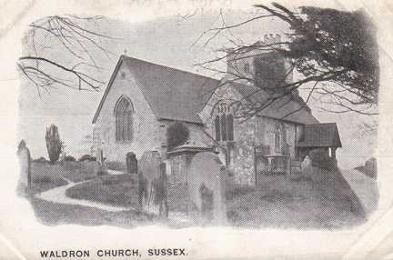
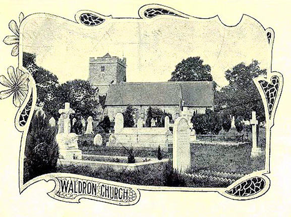
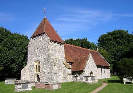
Waldron, All
Saints. TQ 5490 1923. From an old postcard in Steve Bulman's Collection.
Another view, from a postcard in Kevin Gordon's Collection. Kevin advises that this church is also known as All
Hallows. A 2008 Streetview provides a
modern view.
Link1.
Link2.
Grade I listed.
Wartling, St. Mary Magdalene. TQ 6578
0917. From a postcard in Kevin Gordon's Collection. Three modern views -
1,
2, 3, and three of the interior -
1,
2,
3, all ©
Karel Kuča (2024).
Link1.
Link2.
Grade I listed.
West Dean (sometimes Westdean), near
Seaford, All
Saints. TV 5250 9969. © Dave Westrap.
Link1.
Link2.
Grade I listed. About ˝ a mile to the S.S.W., on Exceat Hill, is the
site of Exceat Church. A photo of the site can be
seen here, where it says
that the site had been "lost for hundreds of years". Nevertheless, the 1879 O.S.
map marks it as Church (Site of) at TV 5234 9886.
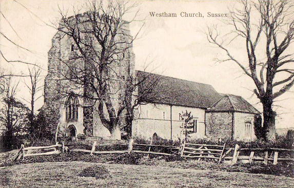
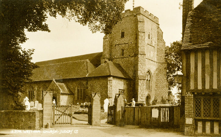
Westham, St. Mary, situated beneath the
walls of Pevensey Castle. TQ 6417 0460. From a postcard in Kevin Gordon's collection, and another from Reg Dosell's Collection.
A modern view, from a
2024 Streetview. Link.
Grade I listed.
Westmeston, St. Martin.
Another view, and the
porch. TQ 3388 1364. All ©
Karel Kuča (2023).
Link.
Grade II* listed.
Whatlington, St. Mary Magdalene. Another view.
TQ 7605 1822. Both © Steve Bulman
(2009). Link1.
Link2.
Grade II* listed.
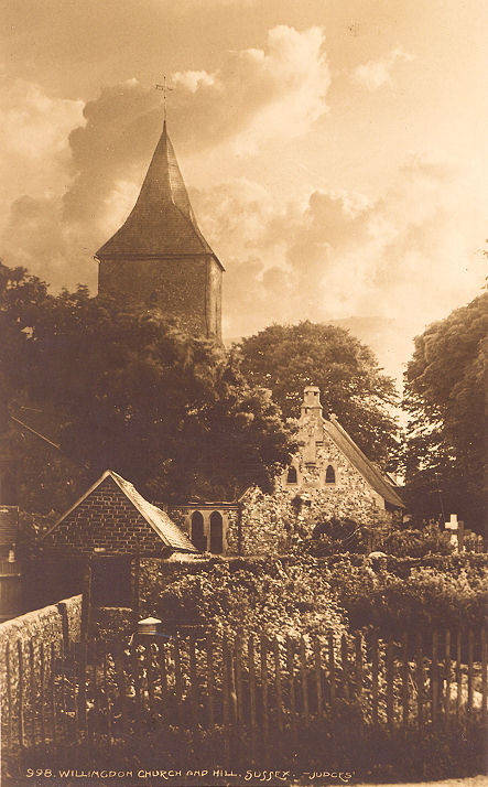
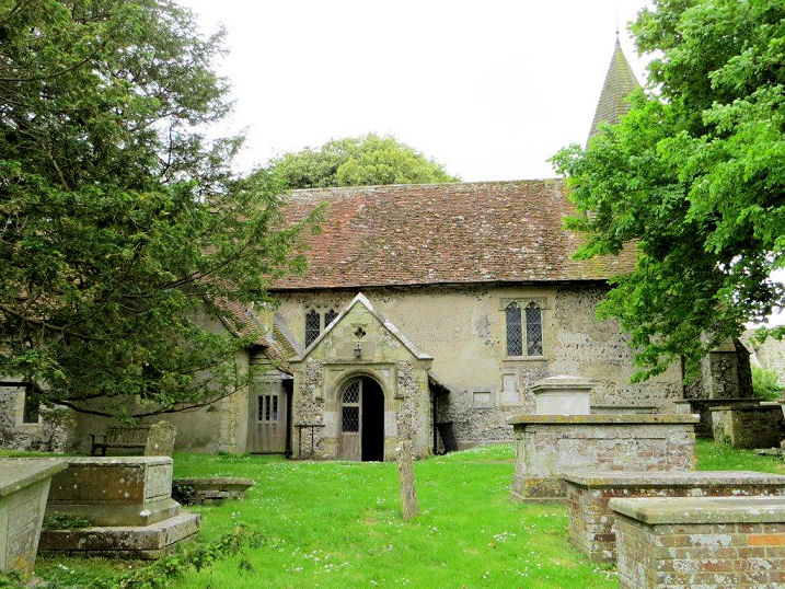
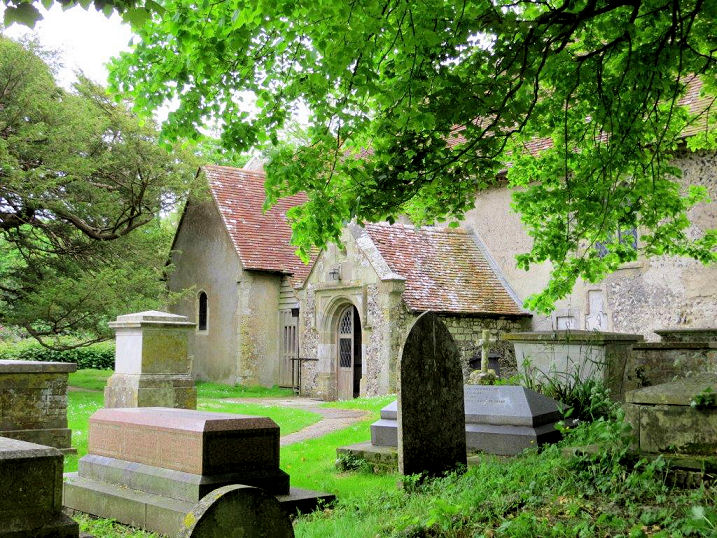
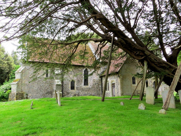
Willingdon, St. Mary the Virgin.
TQ 5894 0246. From
an old postcard in Steve Bulman's
Collection. A 2024 Streetview provides a
modern view.
Link.
Grade I listed. The village also has a former
Methodist Chapel (originally Wesleyan) on Wish Hill and Spring Close,
dated 1894 - seen by
Streetview in 2024, apparently in residential use. It was still active at
least to the later 1960's. Other Streetviews show that the church had changed
hands no later than 2009, when it was Christ Church of Healing and Counsel,
but they had gone by the time of the next Streetview visit in late 2010. TQ 5886
0208. A map of 1879 shows a Baptist Chapel on
Wannock Lane at Lower Willingdon, at TQ 5823 0324.
Genuki identifies it as Wannock Baptist Chapel, and dates it to 1851,
closing in 1972. It survives, in residential use, and was seen by
Streetview in 2024.
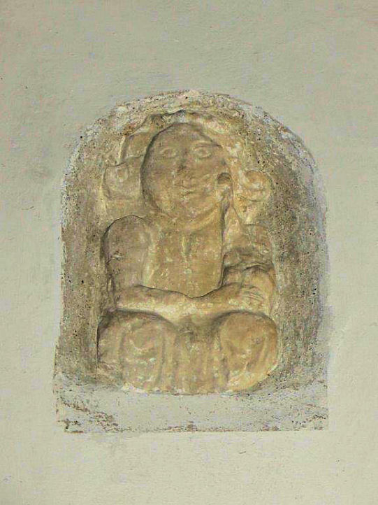
Wilmington, St. Mary and St. Peter.
Founded circa 1000 A.D., the first church was replaced by the present one in the
twelfth century, the chancel of which served as the church for the monks of the
priory. Two further views - 1,
2, the
interior,
altar,
pulpit and tester, and the
font. The modern
window by Paul San Casciani
incorporates some glass from one destroyed in a fire in 2002, as well as a
phoenix rising from the ashes. He also designed the
Millenium window. An early and
rather crude carving is built into
the chancel wall. Removed here from the outside wall of the church, it has been
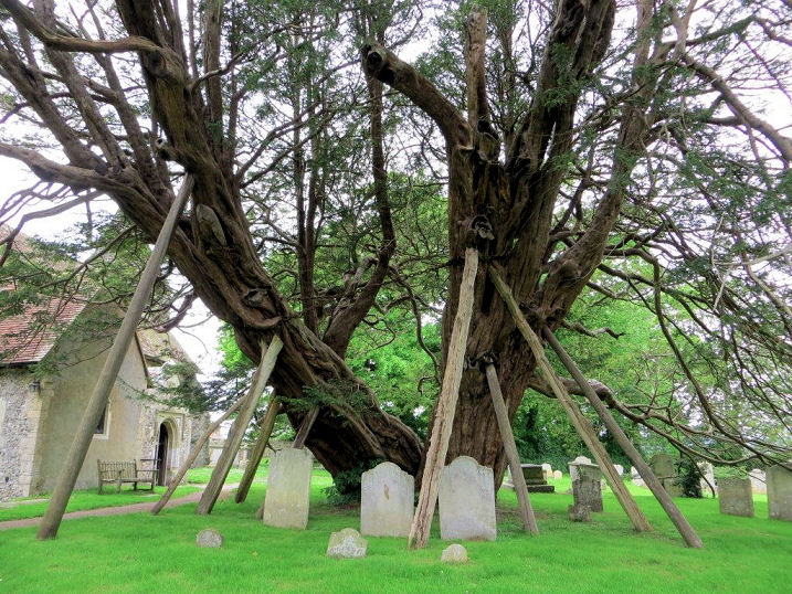
plausibly suggested that it represents the Madonna and child. The churchyard has a famous old
yew tree, claimed to be over 1500 years old. TQ 5441 0428. All © Carole Sage
(2016).
Link1.
Link2. The very brief
grade I listing. The remains
of the priory (C12). TQ 5438 0426. © Carole Sage (2016).
Link.
Grade I listed. Near the north of the village is the site of
Congregational Chapel, at TQ 5458 0471. O.S. maps
show it to have been built between 1878 and 1898, and was still active into the
second half of the last century, but has since been demolished. Its
site (the garage) was
seen by Streetview in 2024.
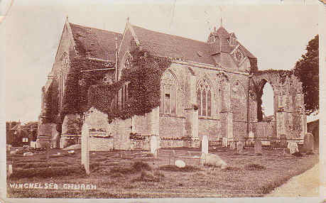
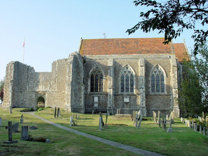
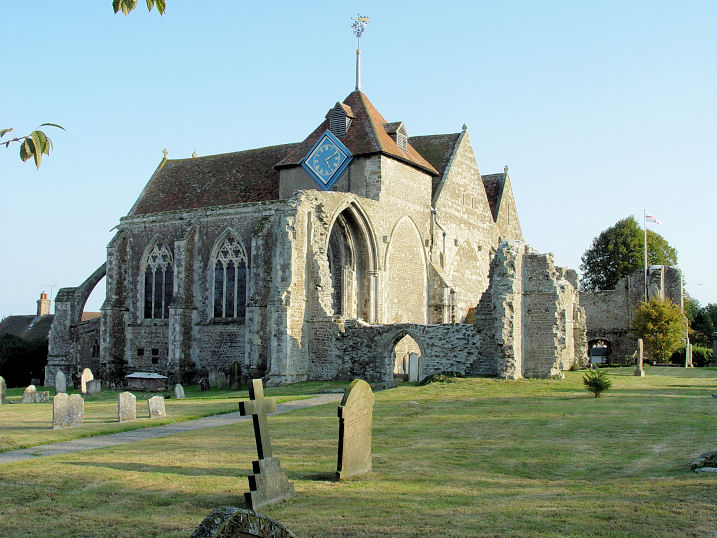
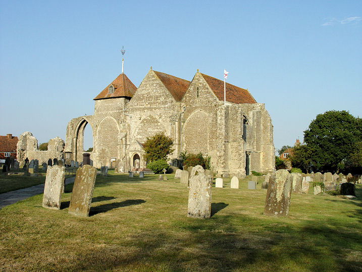
Winchelsea, St. Thomas the Martyr.
TQ 9050 1736. From an old
postcard in Steve Bulman's Collection. Three modern views- 1, 2,
3, all © Steve Bulman (2009).
Link1.
Link2.
Grade I listed.
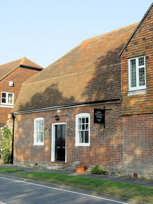
Wesley Chapel (Methodist) on
Rectory Lane.
Winchelsea was the last place where John Wesley delivered an outdoor sermon, beneath a
large ash tree beside the St. Thomas. TQ 9035 1737. © Steve Bulman (2009).
Link.
Grade II listed - dates it to 1785. There used to be a
Wesleyan Methodist Chapel on Hiham Green at TQ 9045 1747. Pre-dating a
map of 1875, it was still in active use at least up to 1957, but has since been
demolished - its site was seen by
Streetview in 2024. A
photo of it can be seen
here where it's dated to 1867-1969. O.S. maps show St.
Giles's Church (Site of) off Rectory Lane, at TQ 9028 1719. Its site can
't be seen on Streetview, though the access road,
St. Giles Close (2009
Streetview) can. I assume that the un-captioned photo
here
shows its
site, where it says that the church was "derelict soon after 1500", and that the
ruins survived until 1777 when the masonry was sold off. Also shown on O.S. maps
is St. Leonard's Church (Site of) at TQ 9010 1753.
The site (2011
Streetview) was later home to a windmill, now also gone. An illustration from
1794 can be seen
here, a comprehensive discussion of the church and windmill. Remains survive
of Greyfriars Franciscan Monastery, particularly of
its church, the Chapel of the Virgin Mary, at TQ
9059 1709. A photo can be seen
here,
where it says the site is not open to the public.
Grade I listed.
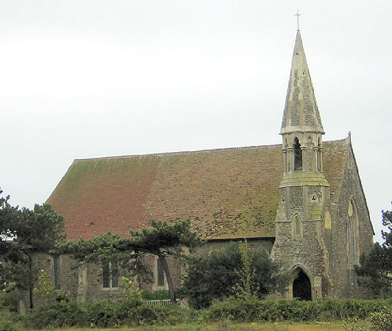
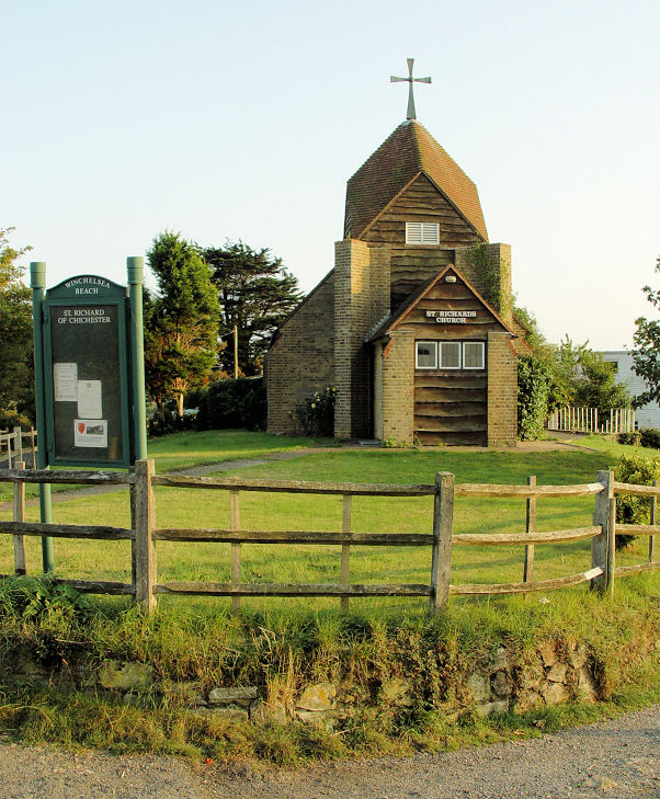
Winchelsea Beach, St. Richard of Chichester (1935). Another view.
The "Rhenish Helm" roof is unusual - see also Sompting in West Sussex.
TQ 9157 1643. Both © Steve Bulman (2009).
Link1.
Link2 dates it to 1961-2, and mentions a predecessor church (a
garage converted in 1935). This will be the place of worship shown on
O.S. maps further south on Dogs Hill Road at TQ 9169 1624. All trace of
it has gone - it stood to the right of the road seen
here in a
Streetview from 2024.
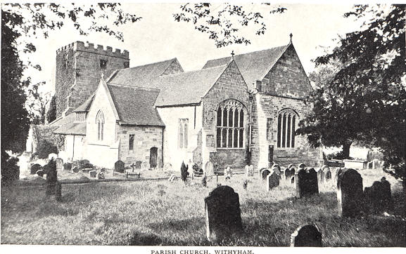
Withyham, St. Michael and All Angels.
TQ 4940 3557. From an old postcard, Steve Bulman's Collection.
Link. The
history page contains some
modern photos.
Grade I listed.
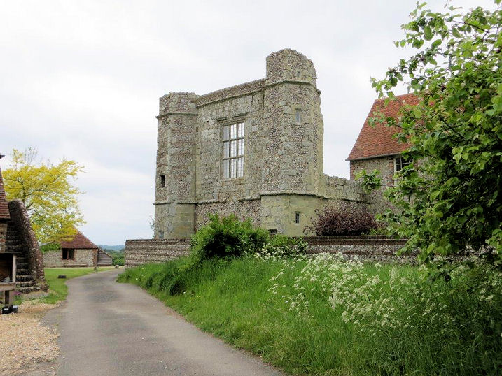
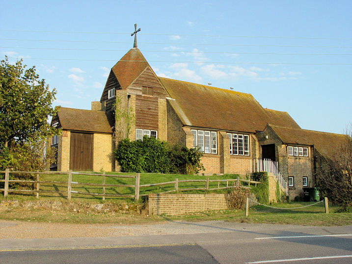
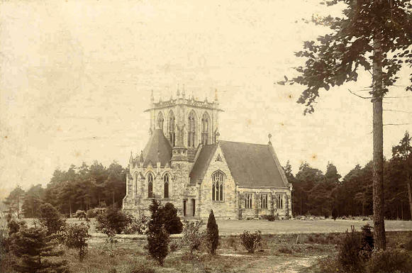
Wych Cross. At first glance this
church looks a bit like Whippingham on the
Isle of Wight, but it isn't. Diana Bond had asked for help in identifying it.
Paul Smith has advised that Wych Cross Church, which was dedicated to St.
Richard de Wych, although never consecrated, was built in 1866 and demolished in
1975. TQ 4365 3199.
Link.
|
|
_(5).JPG)
.JPG)