The Churches of Britain and Ireland
|
Stockton-on-Tees, County Durham Stockton-on-Tees on Wikipedia.
The
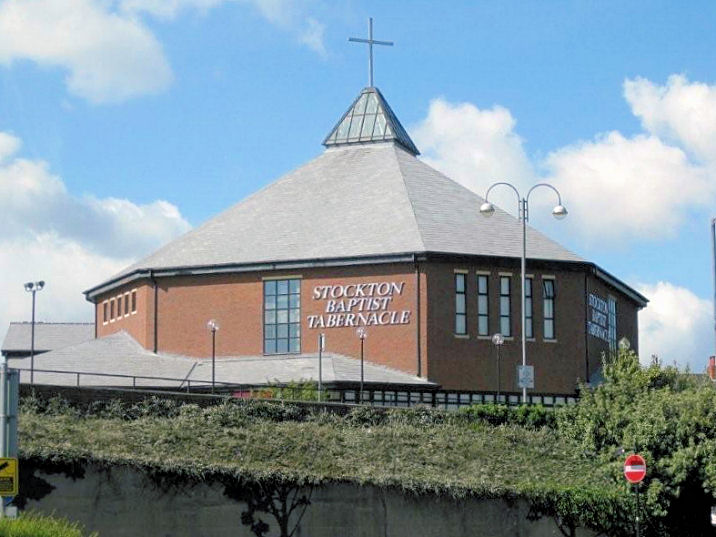
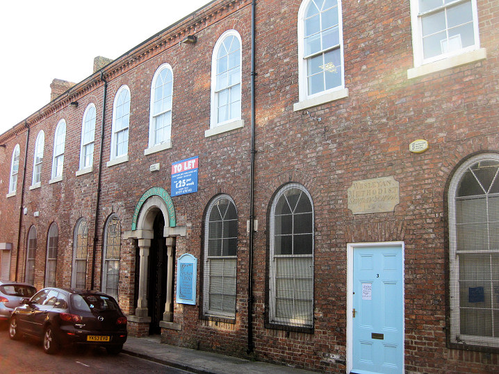
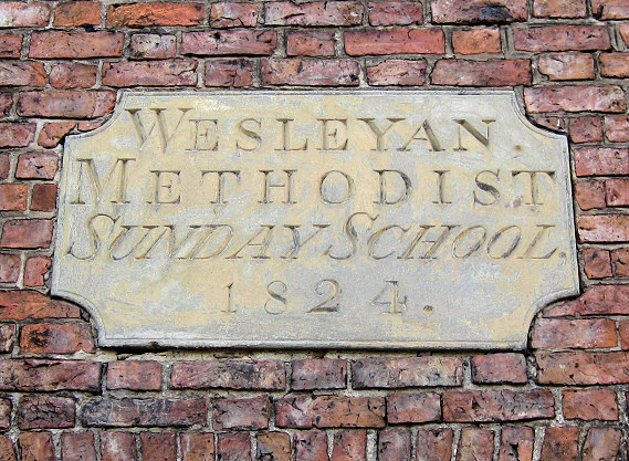
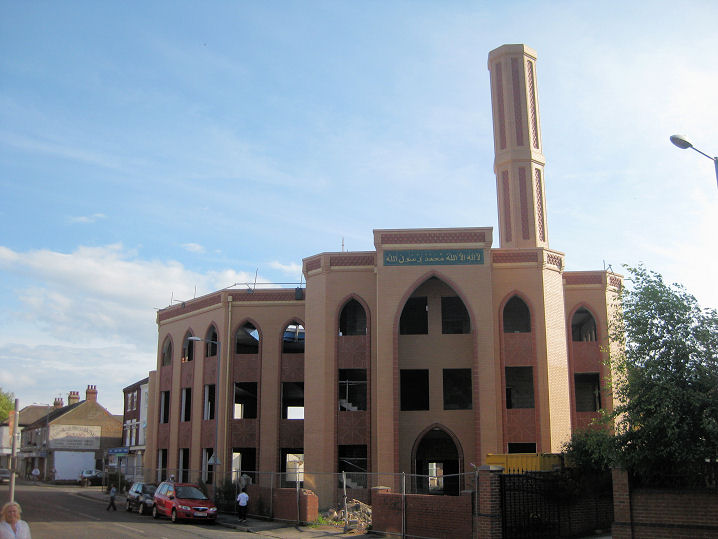
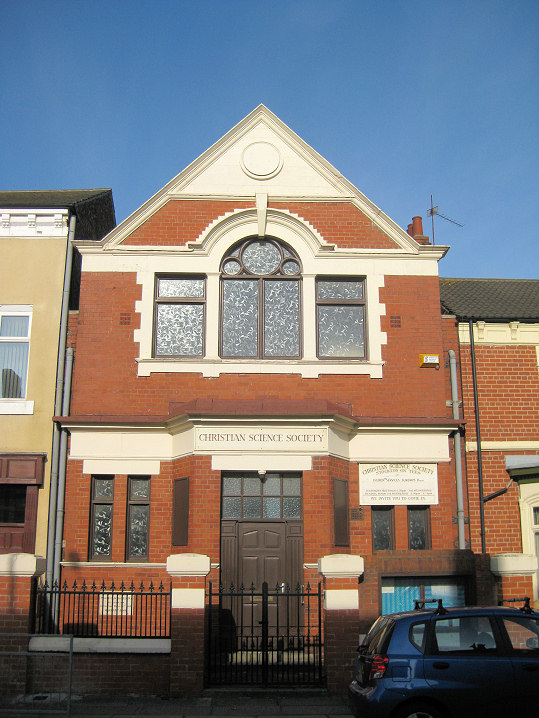
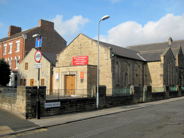
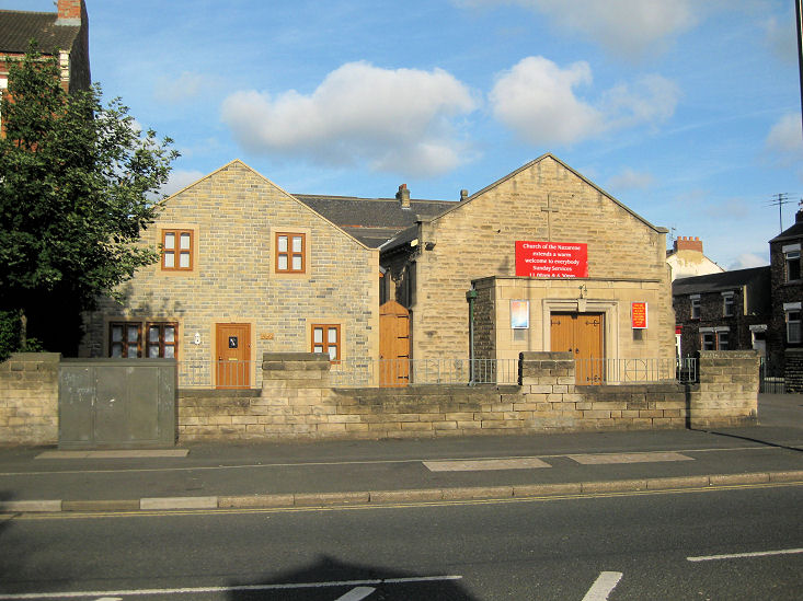
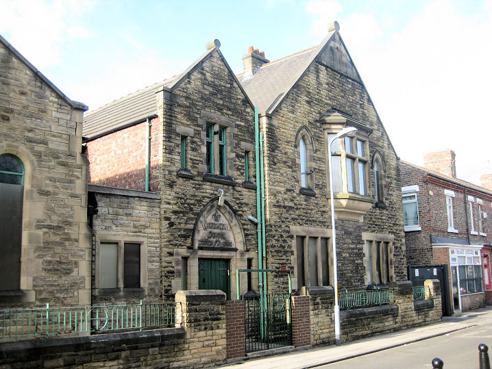
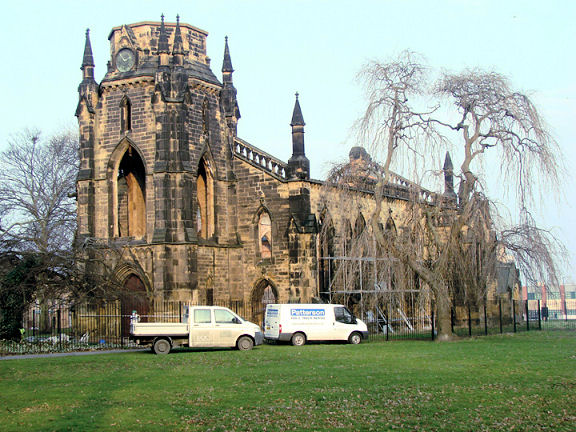
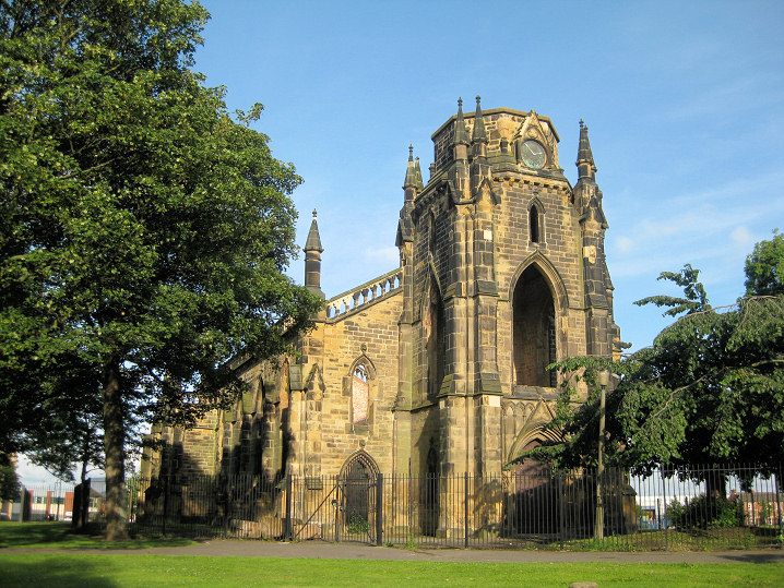
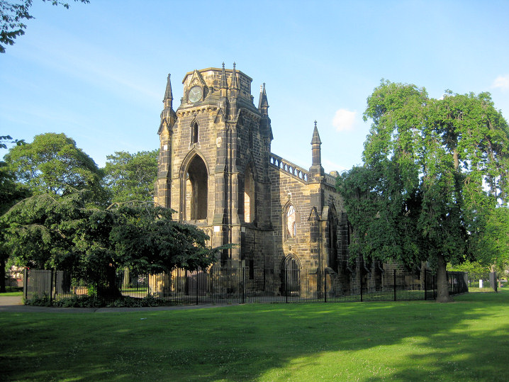
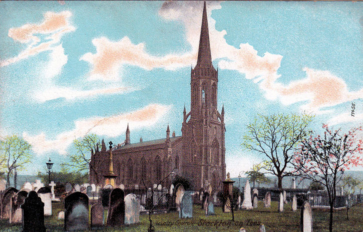
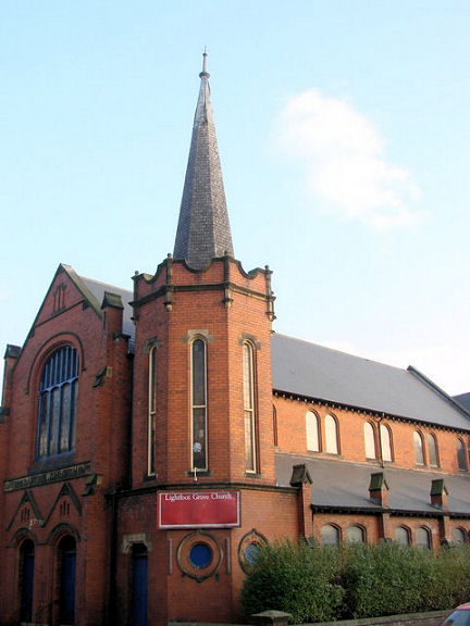
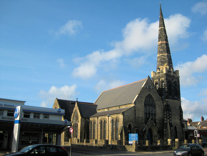
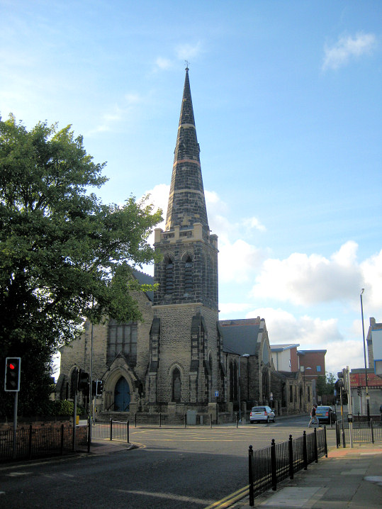
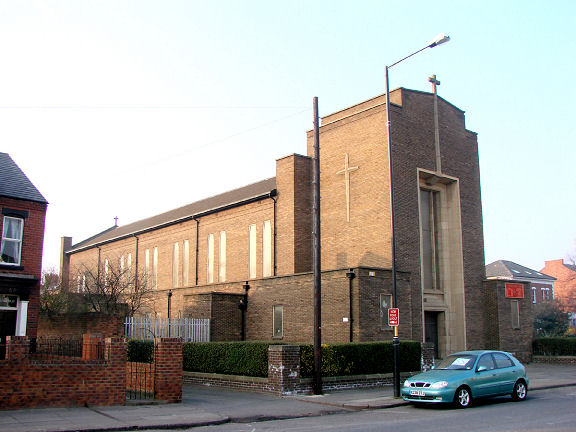
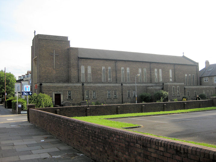
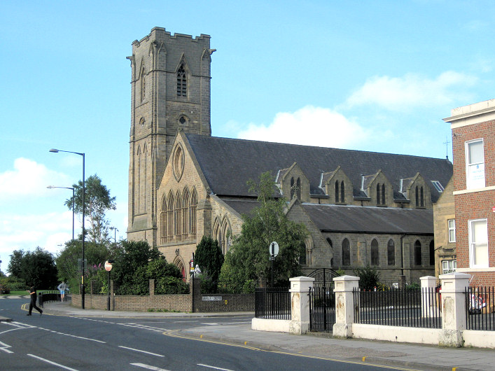
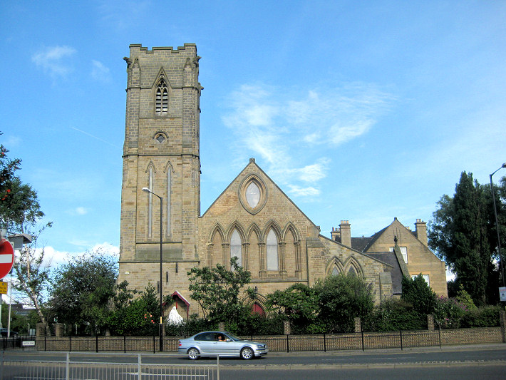
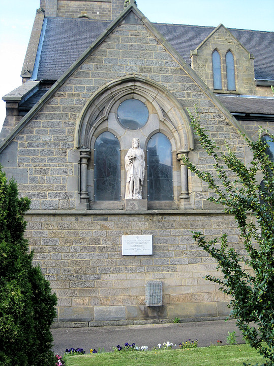
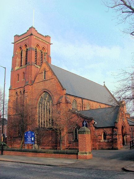
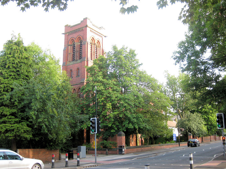
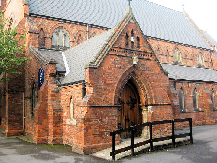
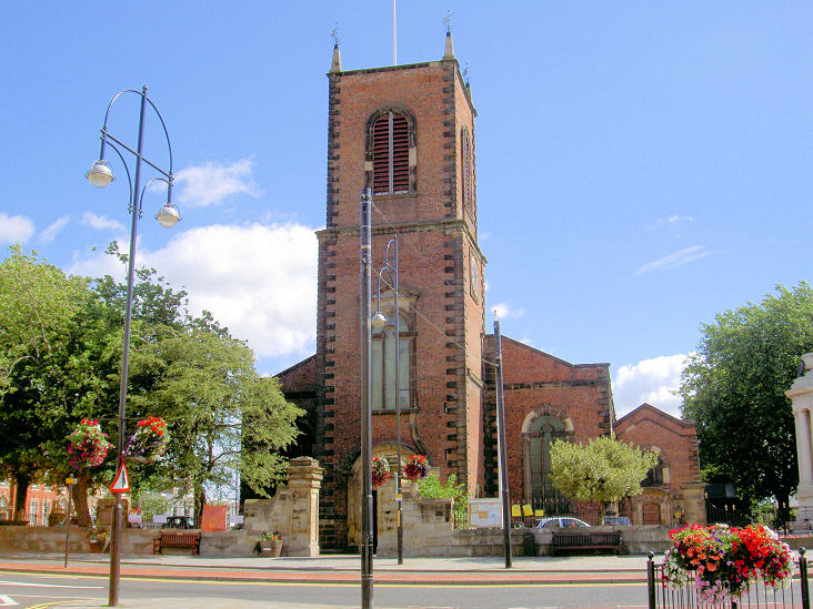
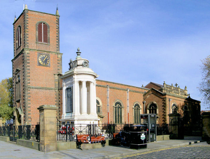
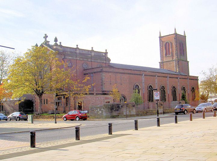
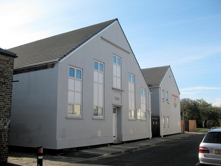
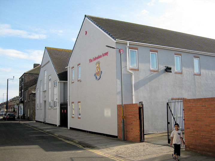
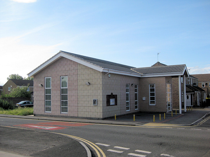
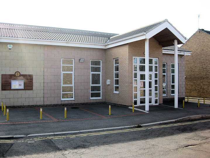
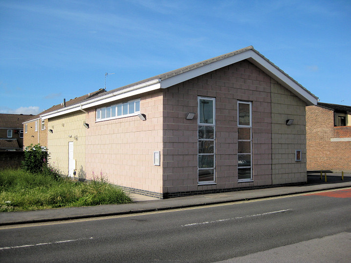
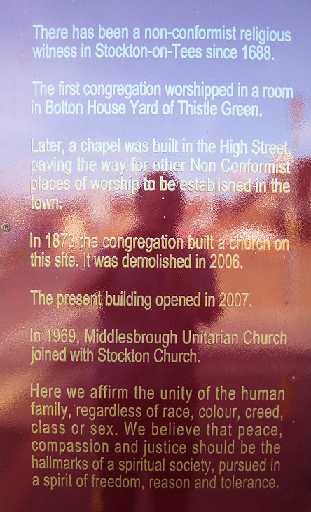
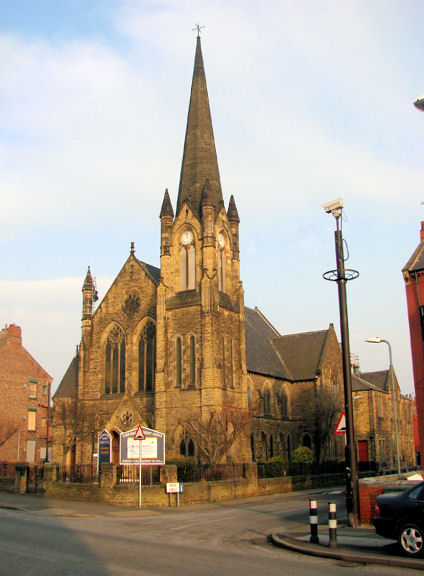
Picture Stockton website has numerous church photos. Acts of Love International used to meet in what is now Rhema House, and had previously been a pub, the Cricketers' Arms. Streetview saw it when it was a pub, in 2009, and Rhema House in 2020. NZ 4492 1964. This source mentions another place where they meet or have met, Portrack Community Centre on Portrack Lane, seen here on a Streetview from 2014. It's also marked as a church on the 1" O.S. map of 1953, and other old maps label it as Sacred Heart (R.C.). NZ 4531 1972. Baptist Tabernacle Church on The Square. Another view. NZ 448 193. An earlier church (1902) stood on Wellington Street, at about NZ 444 193, photos here and here. This in turn was preceded by a yet earlier church on almost the same site. The Wellington Street Church was subsequently used as a Sunday School, and later listed as Grade 2. Both © Martin Richter (2011). Link1. Link2. The site of the demolished Brunswick Methodist Church, bounded by Dovecot Street, William Street, and Brunswick Street, at NZ 443 190. Built in 1823, it closed in 1871. Although grade II listed, the church was demolished fairly recently, following a roof collapse. The listing link has a tab (Bing Map.....) which shows the church in an aerial view, and also here, on Google Streetview (select the Satellite view). It had been in use as a carpet warehouse. Another view. The Sunday School (also grade II listed) on William Street survives. A close-up of the date-stone. All © Martin Richter (2011). Here's a selection of Picture Stockton images -1, 2, 3, 4 (compare with the first photo in this entry), 5 (has interior view), 6 (windows), and 7 (Sunday School). The Central Mosque stands on Bowesfield Lane and Westbourne Street, on the site of a Primitive Methodist Chapel which is shown on the 1893 OS map. Date of building and demolition uncertain. NZ 442 185. © Martin Richter (2011). Fully open by 2017, it can be seen here on Google Maps. It has taken the name Farook-e-Azam from its predecessor on Hartington Street (see the Masjid entry below). Link. Christ Church Mission on Victoria Avenue was originally Primitive Methodist. NZ 4460 2076. It was seen by Streetview in 2009, church to the left, Sunday School to the right. Another Streetview from 2020. Link. Christian Science Centre on Hartington Road. NZ 443 188. © Martin Richter (2011). Howard Richter advises that this was formerly a synagogue. Link. This link shows the premises when it was in use by the Church of the Nazarene in ca, 1985. Note the still-visible Star of David. Church of the Nazarene on Yarm Road. Built as Christ Church Congregational in 1878, it shows as U.R.C. on the 1981 map. Some time after this the congregation moved to what is now St. Andrew and St. George (see below). The current occupants moved here from what is now the Christian Science Centre (above). Another view. The Congregational School (1905) stands adjacent, and is also visible at the extreme right in the first photo. NZ 439 184. All © Martin Richter (2011). Link. The former Church Road Primitive Methodist Chapel, later Methodist. Built on or before 1893, it still shows as a "Meth. Ch." on a 1939 map. It went out of use before the 1959-70 edition map, where it is shown as a "Warehouse". It replaced an earlier chapel on a different site, which doesn't survive. NZ 418 193. © Martin Richter (2011). Holy Trinity Church (undergoing partial demolition) on High Street. NZ 444 186. © Bill Henderson. Two further views - 1, 2, both © Martin Richter (2011). Howard Richter has advised that the church was built 1837-8 and closed in September 1982. It was subsequently used by the Greek Orthodox congregation until it was destroyed by a fire in 1991. The PictureStockton site has lots of old photographs and drawings. The first is at http://www.picturestockton.co.uk/viewpage.aspx?id=68; edit the final number to read 62, 59, 61, 21, 2413, 1782, 56, 434, 64, 4859, 55,1964, 5509, 3917, 90429, 17, 16, 1778, 1986, 3012, 1445, 3952 or 90459 for others. An old postcard view, from Alan Blacklock's Collection. Link. Grade II* listed. Lightfoot Grove Church on Lightfoot Grove and Bowesfield Lane. It was formerly a Baptist Church, dating from 1903. © Bill Henderson. The most recent Streetview shows the church now as Rivers of Life Fellowship. The Masjid Farook-e-Azam on Hartington Street was converted from terraced houses. A new Central Mosque (see above) is being built nearby, so this building will presumably be converted to some other use. The Christian Science Centre can be seen immediately to the right of the mosque. NZ 442 188. © Martin Richter (2011). Link. See also the Central Mosque entry above. Since that was opened, the signage has been removed from the Masjid, and its current use is not apparent. It can be seen here on Google Maps. The site of a demolished Mission Hall on Clarence Street, as seen by Streetview in 2020. NZ 4463 1993. A former Mission Room stands at the junction of Edgar Street and Butler Street, at NZ 4472 2082. Seen by Streetview in 2009 when it was St. Michael's Centre, by 2012 it was in use as a dance studio. Photos of the demolished Norton Road Congregational Church can be seen here and here. Built in 1845, it was closed in 1973 (by which time it was presumably U.R.C.). The site of the church is at NZ 4452 1947, and is now a small garden, seen here by Streetview in 2020. According to this source, it is to be the subject of an archaeological investigation prior to landscaping. Portrack Baptist Church stands on Portrack Lane and St. Ann's Terrace at NZ 4523 1973. Seen here on a Streetview from 2020, older maps show a smaller building roughly where the further (northerly) part of the present building now stands. The earliest available map to show a church on the original site is from 1893, and it's labelled Bethesda Chapel (Welsh Baptist). Link. Presbyterian Reformed Church on Frederick Street, opened 6 April 2012. NZ 444 197. © Kevin Price (2012). Link1. Link2. A Primitive Methodist Chapel once stood on Norton Road, at NZ 4468 2016. Housing has been built on the site, as seen here by Streetview in 2020. The demolished St. Andrew's Presbyterian Church (1861) stood on Tower Street at about NZ 4459 1862. A photo is available here, showing the rear of the chapel. From map evidence, Howard Richter advises that demolition was between 1984 and 1988. St. Andrew and St. George (U.R.C.) on Yarm Lane. Another view. This building was originally St. George's Presbyterian Church (1876). The congregations combined in 1934. The demolished St. Andrew (Presbyterian, 1861, see also previous entry) stood on Tower Street, and was the successor to a Scotch Presbyterian Church (1818) on West Row (link). A group seceded from the West Row congregation in 1842, and initially met in Tennant Street, before building the Norton Road Congregational Church (see above). NZ 442 186. Both © Martin Richter (2011). Link1, 2, 3, 4. Grade II listed - link. St. Cuthbert (R.C., 1958) on Yarm Road. NZ 438 183. © Bill Henderson. Another view, © Martin Richter (2011). According to this source, a previous church of St. Cuthbert stood on the same site from 1920 until it was demolished in 1956. A yet earlier St. Cuthbert's was a school chapel (1884) which stood on what is now St. Cuthbert's Road, at NZ 440 181. Apparently this was demolished relatively recently. The former St. Gerard's Convent stands (or stood?) on Norton Road and Prospect Place. NZ 4463 2076. It was seen by Streetview in 2009. Old maps suggest it was a post-war foundation, and had gone out of use no later than the early 1980's. I'm not sure if anything of the convent survives, as old maps show it to have been a single building, while today there are two. The site (roughly left from the further lamp post) of the demolished St. James's Mission Hall on Canning Street was seen by Streetview in 2014. NZ 4487 2006. For the demolished St. John the Baptist which stood west of Alma Street, see St. John the Baptist in the Gilpin Brown section, below. St. Mary (R.C., 1842) on Major Street. Two further views - 1, 2. NZ 446 197. All © Martin Richter (2011). Link. Grade II listed. For the demolished St. Paul on Wellington Street - see St. Paul at Newham Grange. St. Peter on Yarm Road, dedicated in 1881. NZ 4386 1819. © Bill Henderson. Another view, and the porch, both © Martin Richter (2011). Link. Grade II* listed. St. Thomas (1710-12). Two further views - 1, 2. NZ 4455 1925. All © Alan Blacklock (2010). Grade I listed. Salvation Army on Palmerston Street. Another view. The building has evidently undergone some major work in the last 3 decades - see the photo (external website) from the 1980's. Is the current building refurbished, or is it a new build incorporating the old date-stone of 1901? In a similar vein, there was a building on the same site in 1893 (evident from old maps); whether the date-stone records a new build in that year, or records the change of use to the Army is unclear. NZ 442 190. Both © Martin Richter (2011). Link. Synagogue on Hartington Street. The photo (on an external website) shows the building in about 1985, when it was the Church of the Nazarene, but it does show the Star of David at the top, later removed or obscured. Apparently built as a synagogue in 1906, it was preceded by a building in Skinner Street, which had been in use since about 1885. The Hartington Street premises closed as a synagogue in 1971. Unitarian Church on Wellington Street. Two further views - 1, 2. The church displays an information board with a little history. NZ 4424 1923. All © Martin Richter (2011). Link. The previous building (1873) stood on the same site, and a photo can be found by following "The Old Church" link on this page, on the church website. This in turn was preceded by another of about 1699 on the High Street, just north of St. Thomas, at about NZ 445 193, and is seen here, and here. These last two links are to the Picture Stockton website. Foundation House on Alma Street is a former U.R.C. NZ 4430 1950. Howard Richter speculates that it might have been built as a replacement for Norton Road Congregational (for which, see above) which stood nearby, in which case it would date from the early 1970's. It was still a church when the Streetview passed by in 2010, but it was subsequently closed and is now home to The Moses Project. The most recent Streetview is from 2018 - here. A Wesleyan Methodist Chapel stood on what was then Tilery Road, at NZ 4509 2017, yards from its junction with Routledge Road (then Routledge Street). There's a reference to it in 1940 as being an "iron church". Its site was seen by Streetview in 2014, the corner of today's building at almost exactly the same position as the corner of the chapel. Yarm Road Methodist Church. © Bill Henderson. The demolished Zion Chapel (New Connexion) stood on Oxford Terrace (now Clarence Street) at NZ 4461 1989. Streetview saw its site in 2020 (behind the brick boundary wall at left). Another Streetview, also from 2020, with St. Mary (R.C.) in the background.
Fairfield
Gilpin Brown
Hartburn
Newham Grange
Newtown
Oxbridge
Roseworth
|
||
04 March 2023
© Steve Bulman
Contact Details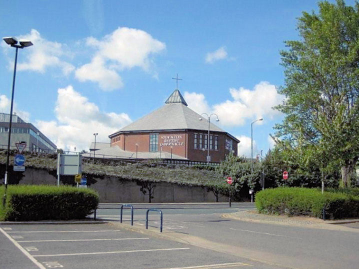