The Churches of Britain and Ireland
| Bromsgrove, Worcestershire
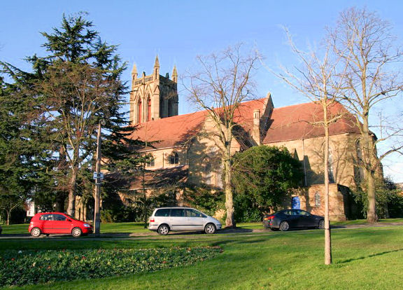
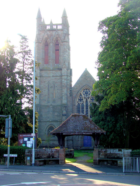
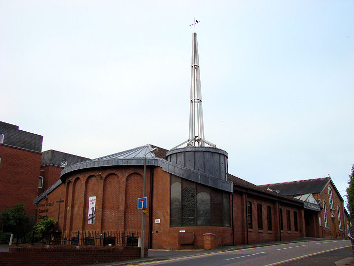
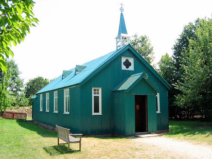
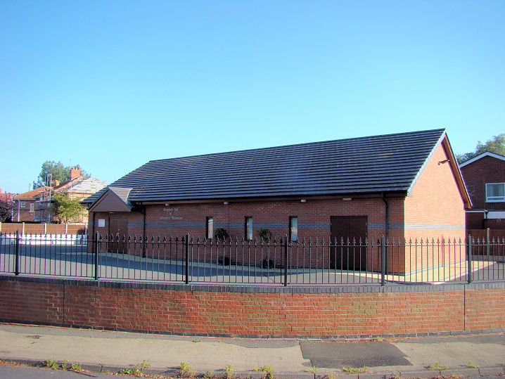
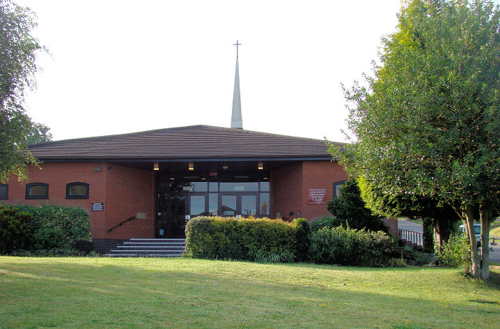
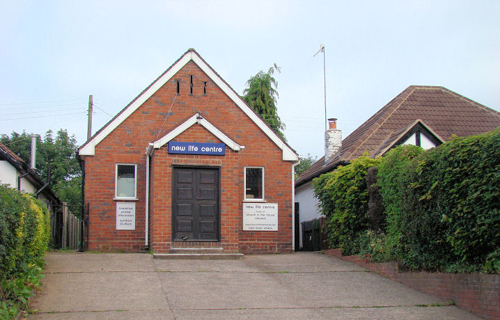
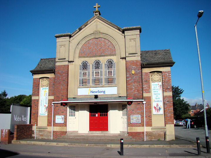
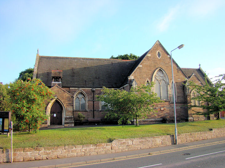
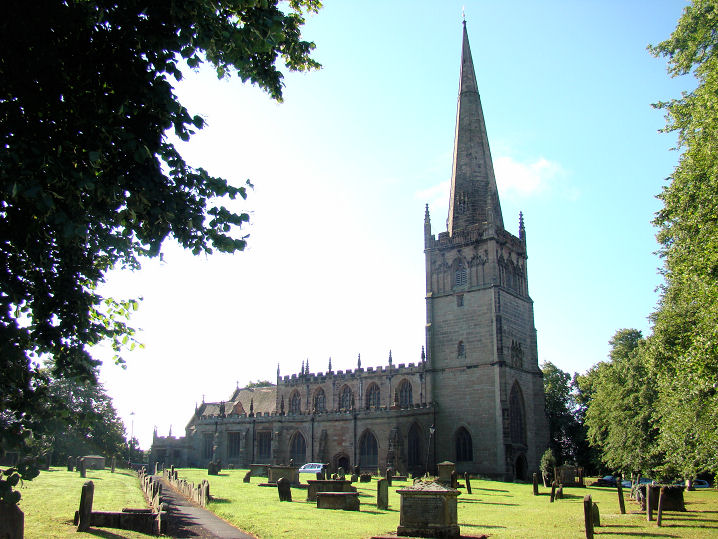
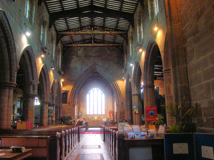
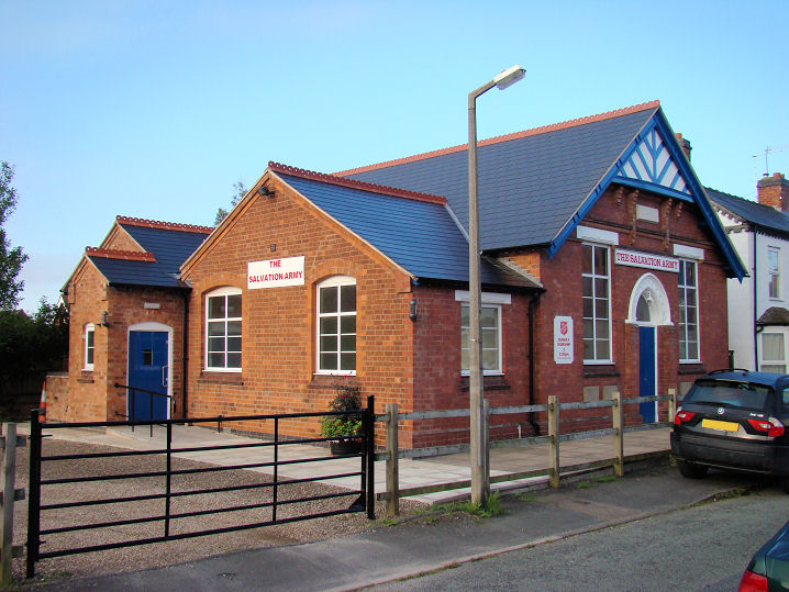
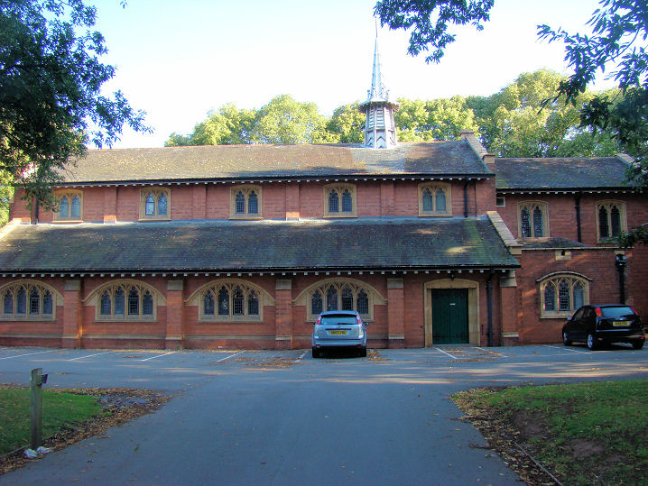
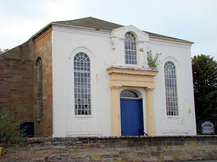
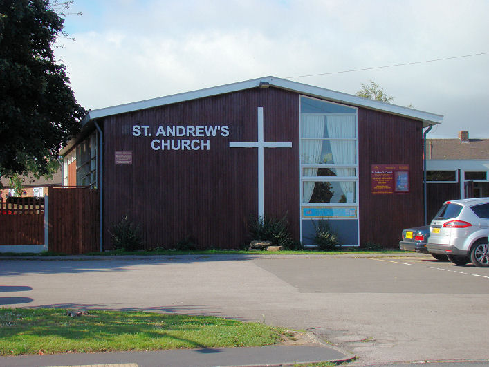
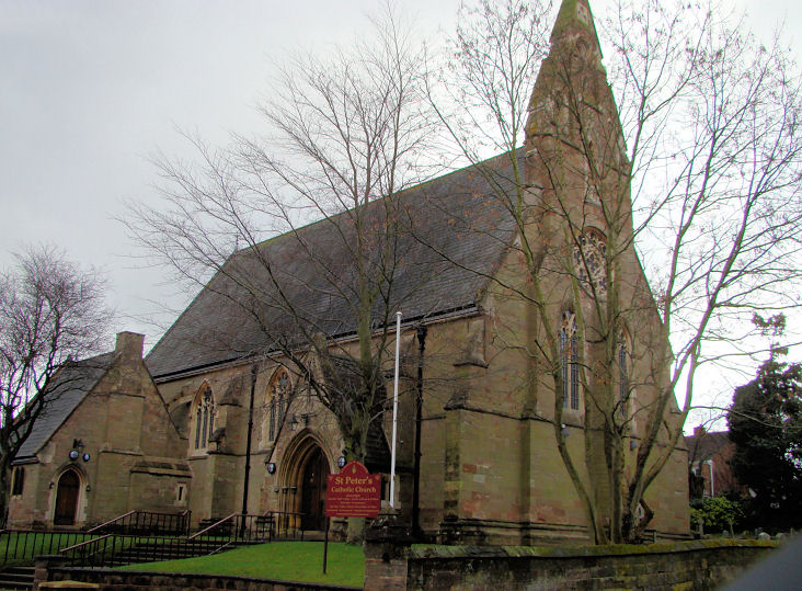
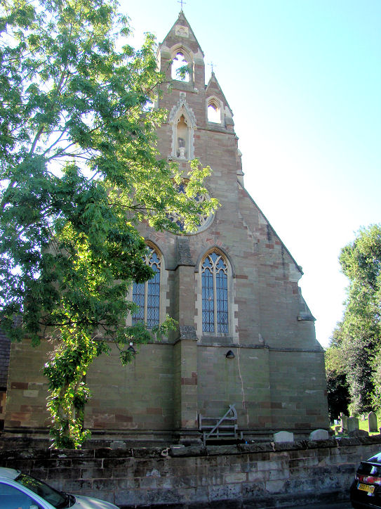
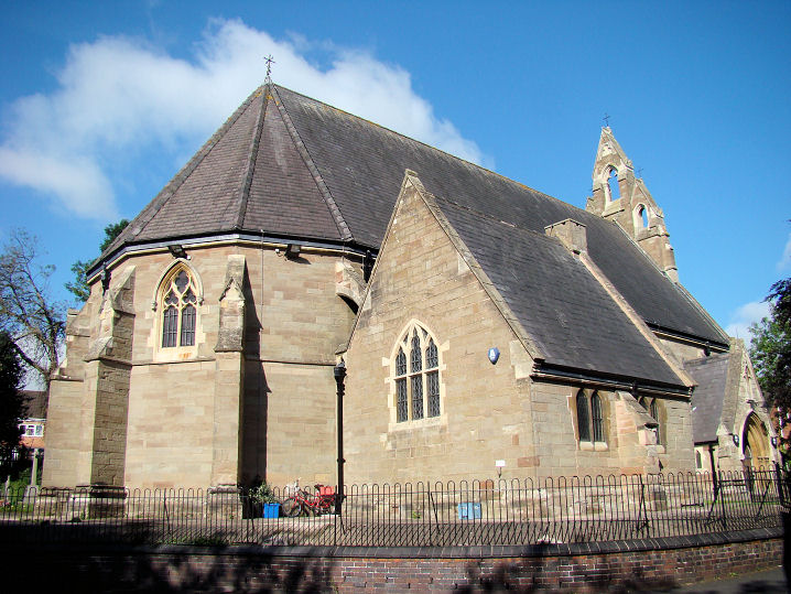
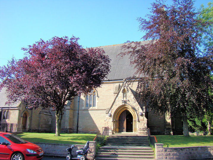
Churches in Charford. All Saints on Birmingham Road and Burcot Lane. Its grade II listing dates it to 1872-4, with the tower added in 1888. SO 9658 7147. © Tudorbarlow (Flickr). Another view, © Peter Morgan (2011). Link. The Baptist Church on New Road is dated in an old directory to 1867. SO 9603 7055. © Peter Morgan (2011). Link. Originally the Bringsty Common Mission Church (Herefordshire), the Avoncroft Museum now houses this building. SO 955 683. © Roy Graham. Interior view, © Janet Gimber (2023). Bromsgrove School Chapel is dated to 1931 by G.G. Scott in its grade II listing. There's a photo here. SO 9582 7018. An earlier chapel, dated to 1850 in an old directory, stands at SO 9572 7032. A photo of it can be seen here (scroll down, and wait for the photos to cycle). The former Hephzibah Primitive Methodist Chapel (2021 Streetview) survives on Birmingham Road, at SO 9637 7128. It has a date-stone for 1861, and this source dates its closure to "around 1980". Kingdom Hall of Jehovah's Witnesses on York Avenue and York Road. SO 9553 7169. © Peter Morgan (2011). Methodist Church on Stratford Road. SO 9622 7090. © Peter Morgan (2011). Link. A Mission Room used to stand on the east side of Broad Street. Pre-dating a map of 1903, it appears to be the same building (i.e. with the same footprint) as shown on a map of 1884, where it's labelled as School. It had evidently gone out of use by the time of the 1952 1" O.S. map. The housing built on the site was seen by Streetview in 2014. SO 9547 7121. Another Mission Room stood off Worcester Road at SO 9549 7005. It also pre-dates a map of 1903, and had been demolished before the 1952 map was compiled. A 2009 Streetview shows its site, now wooded. New Life Centre on Finstall Road, Aston Fields. Circa SO 9733 6980. © Peter Morgan (2011). It was closed at some point before the Streetview van visited in 2021, by which time it was undergoing conversion to residential use. New Song Community Church (on Broad Street) are evidently not the first occupiers of this building. Who preceded them? SO 9551 7136. © Peter Morgan (2011). Howard Richter has being doing some research on this building. The present church is of 1933 (according to Pevsner, also by this photo showing date-stone), and appears to be the second church on the site. The previous one may be of 1833. Independent Methodist in 1851 (pdf. document, see p. 47), the first edition OS map of 1885-6 has it as Nonconformist Chapel, as it is also on the 1902-3. Kelly's directory of 1900 has it as Primitive Methodist, and the 1927 OS map shows it as Ebenezer Methodist Church. Link - in which the date of 1833 for the present church is clearly wrong. A Particular Baptist Chapel, dated in an old directory to 1850, used to stand on Worcester Road at SO 9579 7050. The former cinema (now 57 Monkeys) built on its site was seen by Streetview in 2022. This source dates the cinema to the 1930's. St. Godwald at Finstall. Its grade II listing dates it to 1883-4. SO 9694 6957. © Peter Morgan (2011). Link. St. John the Baptist on St. John Street. Interior view. SO 9569 7066. Both © Peter Morgan (2011). Link. Grade I listed. The lych-gate is also listed, as grade II. The surviving tower and spire of St. Paul in the Avoncroft Museum. It originally stood at Smethwick, where it was also known as West Smethwick Working Men's Church. An information board includes an old illustration of the church as it was in Smethwick, and explains that it was built in 1857, the original wooden spire replaced by fibreglass when it became unsafe in 1961, but the church burnt down only two years later (photo), and the remaining tower and spire later moved to its present position. All © Janet Gimber (2023). See also the Smethwick page for details of its original position, and the site as it is today. Link (for the museum). Salvation Army on Carlyle Road, Aston Fields. This former Sunday School dates from 1801. SO 9674 6957. © Peter Morgan (2011). Link. This building is "The Chapel", on Barnsley Hall Road. SO 9612 7269. © Peter Morgan (2011). Janet Gimber advises that this was the chapel for Barnsley Hall Mental Hospital (demolished), but is now in use as offices. U.R.C. on Chapel Street. A rather elegant building, from circa 1833. It looks as though it could do with a little T.L.C. SO 9608 7080. © Peter Morgan (2011). Grade II listed. Howard Richter has advised that this church closed in 2013 (news item). This, and the adjoining Grade II listed Sunday School have since been bought by the same firm which occupies The Chapel (see above). Another news item mentions plans to turn it into offices. The latest (2022) Streetview shows no signs of improvement in its condition. The
site of a
Wesleyan Methodist Chapel on Kidderminster
Road. SO 9557
7067. It pre-dates a map of 1886, but had gone out of use by 1927, when
a map marks it as a Salvation Army Hall.
Another Wesleyan Chapel stood on New Road
at SO
9612 7046. It's dated in an old directory to 1883, and shows as still
active on a map of 1959. The
housing on its
site was seen by Streetview in 2022.
|
||
07 March 2024
© Steve Bulman