The Churches of Britain and Ireland
| Bridgnorth, Shropshire
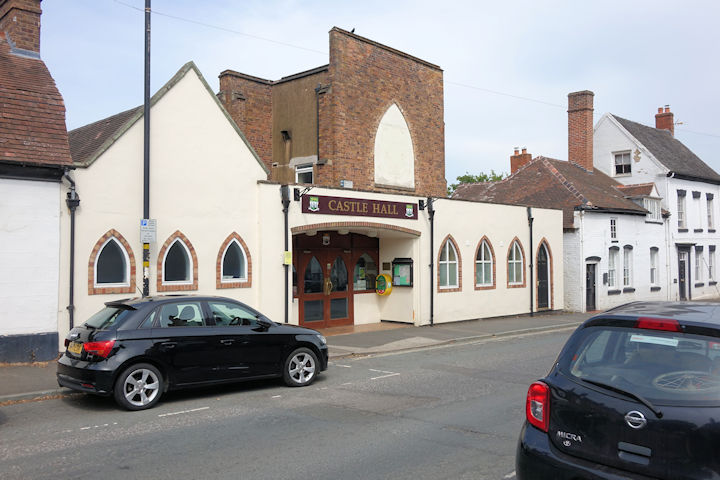
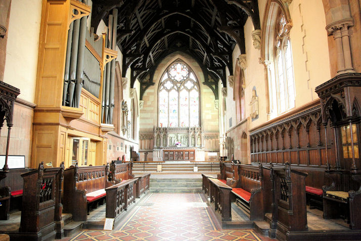
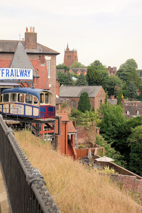
Baptist Church on West Castle Street. SO 7161 9298. © John French. Link. Grade II listed, wherein it's dated to circa 1842. Cartway Church (U.R.C. and Methodist), on Cartway. On a Streetview I can read that the date-stone says "Wesley Chapel", but not the date. I think a close-up photo here shows it to be 1853, though its grade II listing says 1843. SO 7172 9311. © John French. Link. A Catholic Apostolic Church shows on a map of 1903 on West Castle Street, a short way south of the Baptist Church, at SO 7161 9291. O.S. maps suggest it survived in active use at least to the mid-20th century. Assuming it has survived, it's now known as Castle Hall. © Steve Bulman (2025). Kingdom Hall of Jehovah's Witnesses (or rather the access drive and gateway to it) on Oldbury Road, as seen by Streetview in 2024. SO 7161 9229. The cemetery has two Mortuary Chapels - 1, 2. One was Anglican, the other Catholic, though which is which is uncertain. Built to similar designs, there are nevertheless differences in the details. SO 7255 9351 marks a point about halfway between them. Both © Dennis Harper (2013). There's a former Wesleyan Methodist Chapel on St. Mary's Steps, at SO 7176 9289. Not usefully seen by Streetview, some photos can be seen here, where it's dated to 1832, initially as Wesleyan, and sold by them in 1854 to a Primitive Methodist congregation, closing in 1933. Link. St. James (2021 Streetview) on Lodge Lane and St. Nicholas Road. SO 7247 9284. Link. Large scale O.S. maps show, on the east side of the river, St. James's Priory (Remains of) at SO 7218 9248, and nearby to the north, Chapel (Remains of). A photo of the surviving fragments can be seen here. Link. St. John the Evangelist (R.C.) on Northgate. SO 7156 9342. © Dennis Harper (2013). Link. St. Leonard is still used for occasional services - regular services are held at St. Mary's. St. Leonard is now mainly used as a venue for artistic events. SO 7170 9334. © John French. Interior view, © Graeme Harvey (2010). Another view, two interiors (1, 2), the altar, a fine pulpit, and font, all © Dennis Harper (2013). Link. Grade II* listed. St. Mary Magdalene (1792) on East Castle Street. Another view. SO 7170 9282. Both © John French. Another view, three interior views - 1, 2, 3, and the unusual wooden font, all © Dennis Harper (2013). Link. Grade II* listed. The bridge over the River Severn used to have a bridge chapel dedicated to St. Osyth, shown on O.S. maps as having stood at the centre of the bridge at SO 7187 9301. A 2024 Streetview shows the bridge, with (on the skyline) St. Mary Magdalene at left, and St. Nicholas at right. Grade II listed. The People's Hall Evangelical Church off St. John's Street. SO 7204 9295. © Dennis Harper (2011). The Theatre on the Steps (in the middle distance, St. Nicholas further back) on Stoneway Steps is a former Congregational Church. Pre-dating a map of 1903, and probably one of 1883, the theatre history page says it was closed and sold in about 1960, the congregation then joining with Methodists at what became Cartway Church. SO 7176 9304.
|
||
05 July 2025
© Steve Bulman
Contact Details