The Churches of Britain and Ireland
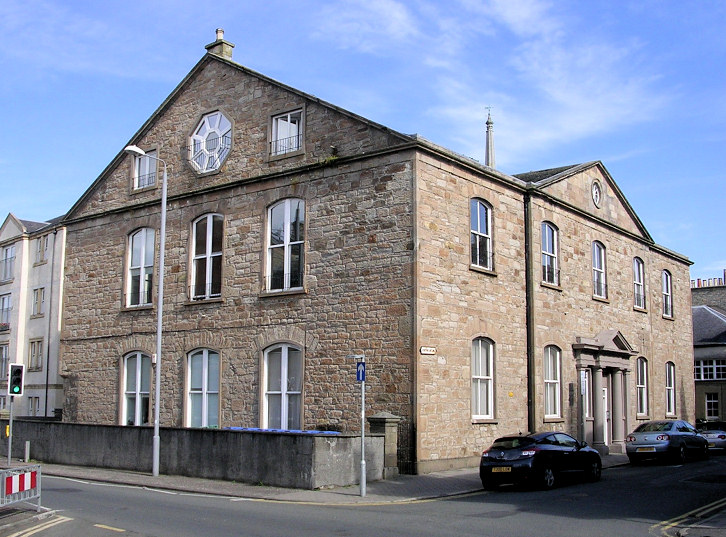
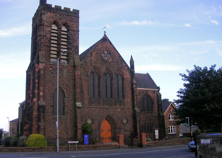
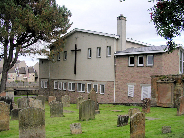
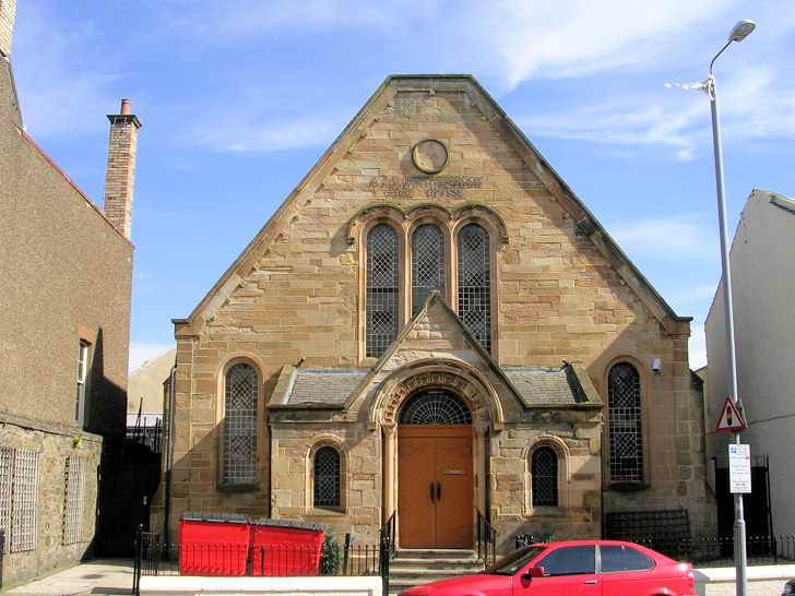
| Ayr, South Ayrshire Auld Kirk of Ayr (CoS) on Blackfriars Walk. Another view. A plaque explains that this was the site of the Franciscan Monastery of Grey Friars, founded 1472. NS 3389 2194. All © Jim Parker (2012). Link. Category A listed. The burial ground has a B listing, and the lych-gate an A listing. Ayr Baptist Church Centre on Fort Street and Mews Lane. The building was previously the Theatre Royal, and as such it pre-dates a map of NS 3348 2185. © Jim Parker (2012). Link. Ayr Community Church (Salvation Army) on John Street, Wallacetown, was previously Wallacetown Parish Church (CoS, 1836), for which see below. NS 3413 2202. © Jim Parker (2012). Link. Ayrshire and Arran Quaker Meeting meet at the Citadel Leisure Centre on South Harbour Street. NS 3331 2231. © Jim Parker (2012). Link. As of 2024 the Ayr meeting seems to no longer be active. Ayrshire Community Baptist Church on Lindsay Street, previously Bethel Mission Church. NS 3540 2290. © Jim Parker (2012). By 2021 this had become Bethel Free Church (Streetview). Link. Of the Burgh Kirk of St. John the Baptist, all that remains is the tower on Eglinton Terrace. A plaque gives some of its interesting history. NS 3338 2202. Both © Jim Parker (2012). Link. Castlehill Parish Church (CoS) on Old Hillfoot Road. NS 3472 2031. © Jim Parker (2012). Link. The former Cathcart Church (United Free), on Cathcart Street and Fort Street. A Victorian map labels it as United Presbyterian, and its category B listing describes it as "former relief church", and dates it to 1816. NS 3357 2208. © Jim Parker (2012). The former Cathcart Parish Church (CoS), on Fort Street. The congregations of Cathcart, Sandgate and Trinity churches united in 1981 to become Ayr St. Columba Church (see below). The Cathcart church hall (on Cathcart Street) now serves the same purpose for St. Columba. NS 3351 2207. © Jim Parker (2012). Cathedral Church of St. Margaret (R.C.) on John Street. This has been the cathedral since the Good Shepherd (see below) was closed in 2007. NS 3407 2211. © Jim Parker (2012). Link1. Link2. Church of God Assembly Hall on Queen Street. NS 3438 2229. © Jim Parker (2012). Link. Church of Jesus Christ of Latter-day Saints on Mossgeil Road. NS 3448 2070. © Jim Parker (2012). Link. The former Darlington Place Church, on North Harbour Street (previously Darlington Road), and now a theatre. © Jim Parker (2012). Category B listed, wherein it's dated to 1860, with later additions. It also says it was United Presbyterian, and converted into a theatre in 1986. Free Church (1832) on John Street. NS 3398 2217. © Jim Parker (2012). Link. The former Good Shepherd Roman Catholic Cathedral (1957-2007), on Dalmilling Cresent, now being converted into flats. NS 3581 2263. © Jim Parker (2012). Link. Gospel Hall on Prestwick Road. NS 3449 2387. © Jim Parker (2012). The former Gospel Hall on Waterloo Road and Fernbank. NS 3477 2437. © Jim Parker (2012). By 2023 it was in commercial use (Streetview). Holy Trinity Episcopal Church on Fullarton Street. Another view. NS 3364 2177. Both © Jim Parker (2012). Link. Category A listed, wherein it's dated to 1888. Lochside Parish Church (CoS) on Lochside Road. Another view. NS 3503 2282. Both © Jim Parker (2012). By 2021 it had closed, and was in use as Lochside Community Centre (Streetview). The former Methodist Church on Fort Street is marked on older maps as Wesleyan. It's dated 1813. NS 3348 2189. © Jim Parker (2012). New Prestwick Baptist Church on Prestwick Road. Older maps show a predecessor which stood closer to the road. NS 3464 2401. © Jim Parker (2012). Link. Newton on Ayr Church (CoS) on Main Street. Older maps label it as a Free Church. NS 3391 2241. © Jim Parker (2012). Link. The About Us page informs us that the congregations of Newton on Ayr Church and Wallacetown Church merged in 2010, and now meet here in the church re-named as Newton Wallacetown Church. Riverside Evangelical Church on John Street. It's marked on old maps as a Free Church. NS 3406 2203. © Jim Parker (2012). Link. St. Andrew's Parish Church (CoS) on Park Circus. It's dated to 1893 in its category B listing. NS 3377 2125. © Jim Parker (2012). Link. St. Columba's Parish Church (CoS) on Midton Road was previously Trinity Church (CoS) - see also Cathcart Parish Church (above), and Sandgate Church (below). Another view. NS 3373 2086. Both © Jim Parker (2012). Link. St. James' Parish Church (CoS) on Prestwick Road and Falkland Park Road. Its category C listing dates it to 1882. NS 3418 2315. © James Murray (2009). Another view, © Jim Parker (2012). Link. St. Leonard's Parish Church (CoS, 1886) on St. Leonard's Road and Monument Road. NS 3385 2050. © Jim Parker (2012). Link. Category B listed, wherein it's dated to 1886. The adjacent parish hall (2021 Streetview), on St. Leonard's Road, is also listed as category B. St. Paul (R.C.) on Peggieshill Road. NS 3478 2001. © Jim Parker (2012). Link, according to which the church celebrated 50 years in 2017. St. Quivox Parish Church on Dalmilling Road, Dalmilling. Another view. NS 3632 2297. Both © Jim Parker (2012). Link. Salvation Army on Blackfriars Walk. Another view. Jim advises that this was previously the Auld Kirk of Ayr Church Hall, and temporarily used by the S.A. until their premises on John Street, Wallacetown had been renovated. See also Ayr Community Church (above). NS 3397 2189. Both © Jim Parker (2012). The former Salvation Army Citadel on New Road. NS 3391 2259. © Jim Parker (2012). In 2024 it's a "Wetherspoon's", known as The West Kirk. The former Sandgate Church (CoS, 1845) on Sandgate was built as Ayr Free Church, and from 1929 until it's closure in 1981 it was Sandgate Church. Another view. See also Cathcart Parish Church and St. Columba. NS 3356 2193. Both © Jim Parker (2012). Category B listed. In 2024 it appears to be a "Wetherspoons". Link (includes interior views). Spiritualist Church on Alloway Place. NS 3346 2153. © Jim Parker (2012). Link. Touch the World Ministries on Alloway Place and Wellington Square. NS 3347 2169. © Jim Parker (2012). United Free Church on Kirkholm Avenue. NS 3438 2372. © Jim Parker (2012). Link. Wallacetown Parish Church (CoS, 1836) on John Street. Interior view at Christmas. NS 3414 2199. Both © Revd. Norman L. Faulds. It's now Ayr Community Church (Salvation Army), for which see above. See also the entry for Newton on Ayr Church, above. West Coast Church meet at the Mercure Hotel on Dalblair Street. NS 3370 2168. © Jim Parker (2012). Facebook. Woodpark Evangelical Church on Wood Park was previously Wood Park Gospel Hall. NS 3474 1984. © Jim Parker (2012). Possible former church on James Street and Elba Street. Jim suspects that it may have been St. Margaret's R.C. Church hall. NS 3421 2216. © Jim Parker (2012).
|
||
13 May 2024
© Steve Bulman
Contact Details