|
|
Perth & Kinross
Perth & Kinross on Wikipedia.
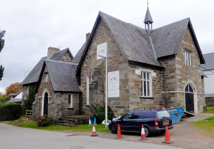
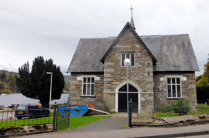
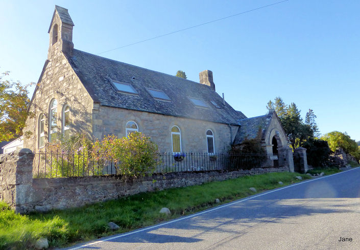
Aberfeldy, the former
Congregational Church of 1877, on The Square. The congregation dates from 1790, and
they moved into a newly-built church on Chapel Street in 1820, which
they used until 1878. The present church building was gifted to the town
in the 1987, and is now known as The Locus Centre (link).
NN 85619 49091. © Jane Scott. The former
Free Church on Chapel
Street. The first service was held in 1907, and the building was sold in
1994. Another view. NN
85669 49147. Both © Jane Scott.
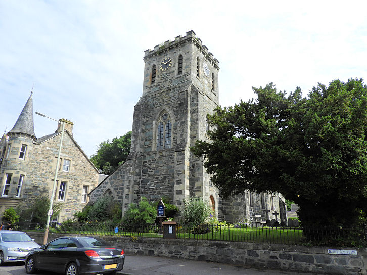
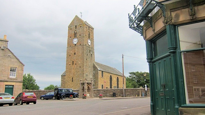
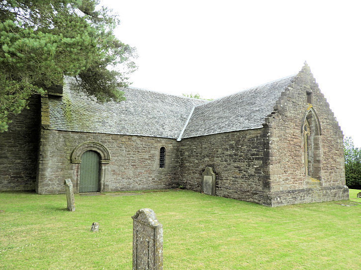
Abernethy, Kirk of St. Bride (the Parish Church) on School Wynd.
Link. The former South United
Free Church on Kirk Wynd. Both photos taken from the adjacent Round Tower, © Alex Parker.
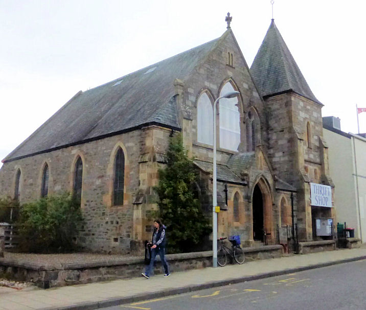
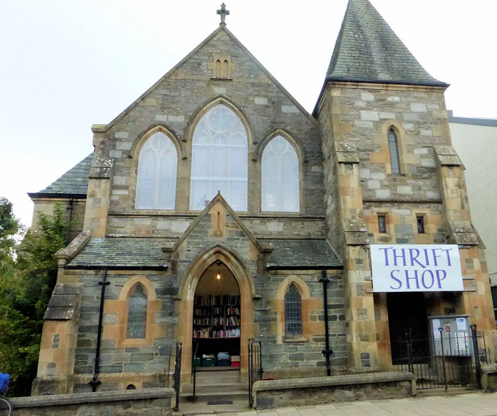
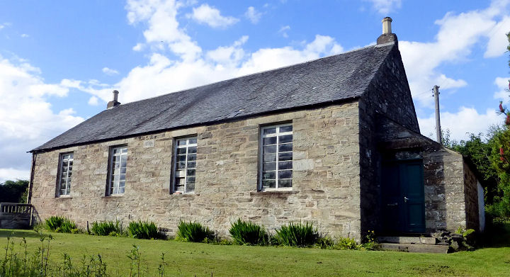
Alyth, the former South United Free Church, which now serves as the parish halls. © Kevin Price (2012).
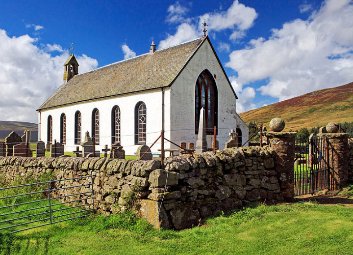
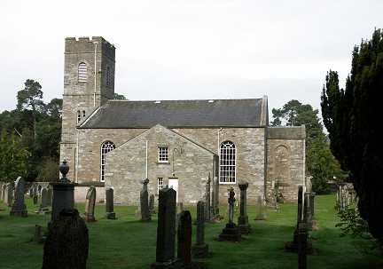
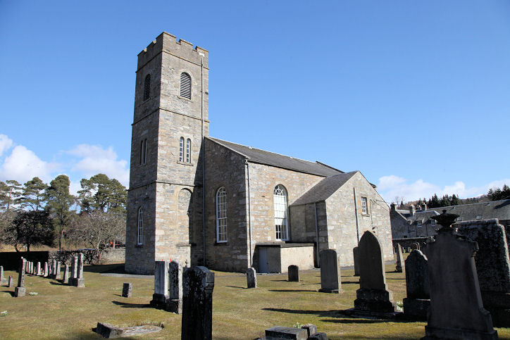
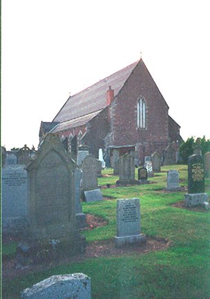
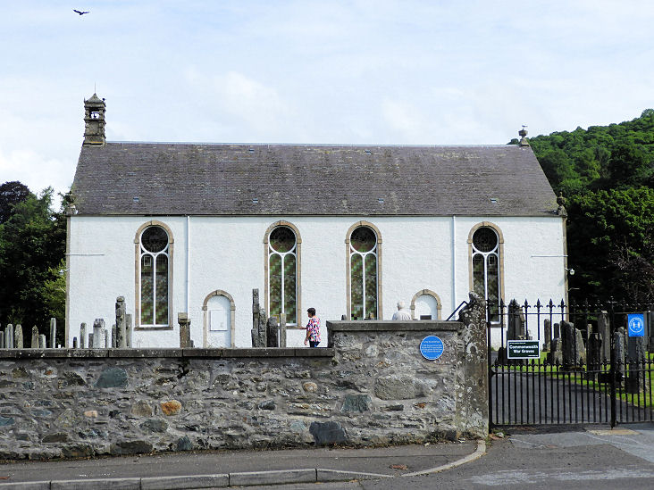
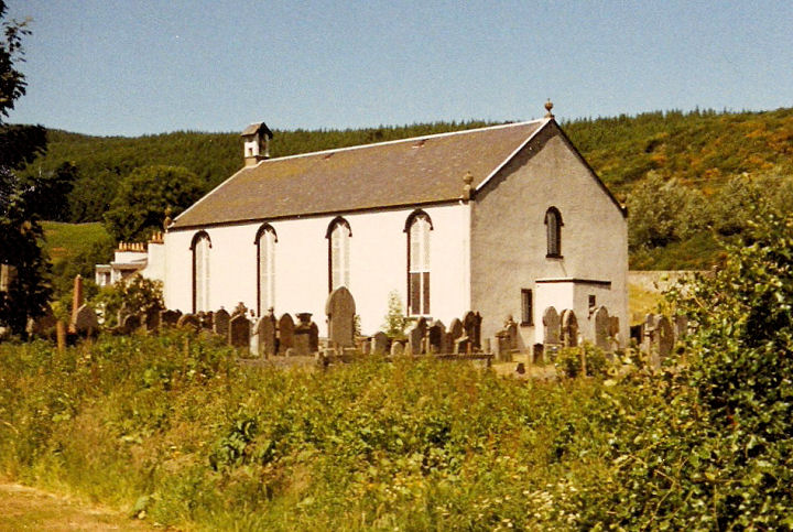
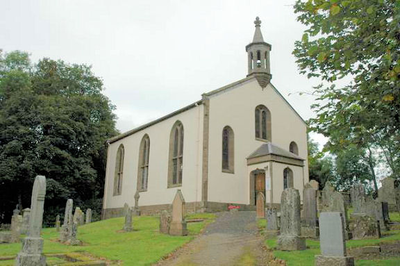
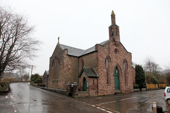
Amulree, the Amulree and Strathbraan Parish Church (CoS, 1743). NN 899 366. © John Cannon.
Link1. Link2.
Grade B listed.
Auchterarder.
Bankfoot,
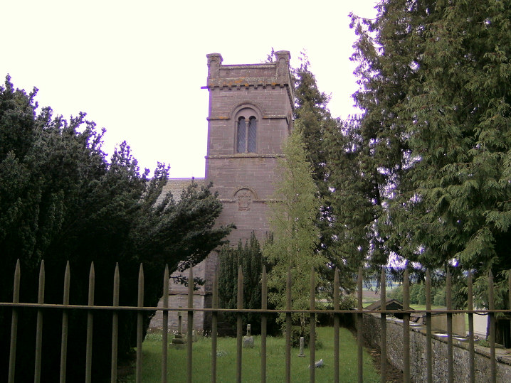
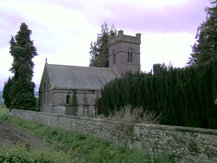
the ruins of Auchtergaven and Moneydie Parish Church (aka Bankfoot Church) on
Cairneyhill Road. It was destroyed by fire in 2004, and has since been replaced
by a new church on Tulliebelton Road - photos can be found on their
website. A local informant told Tony
that there were plans to demolish the old church. NO 069 353. © Tony Preston.
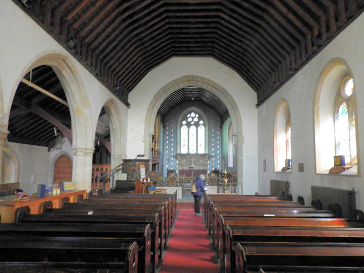
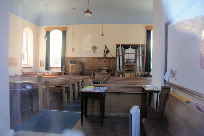
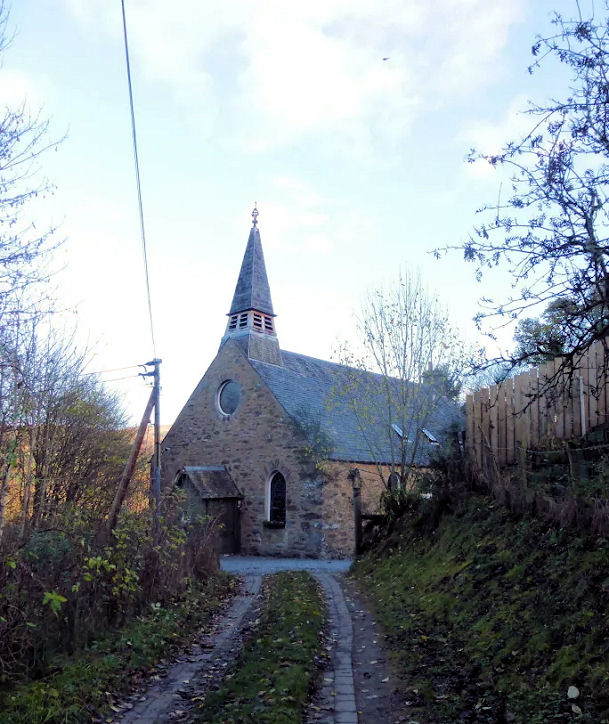
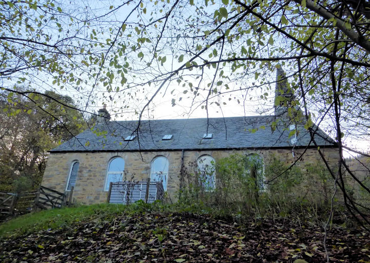
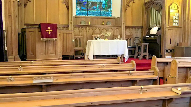
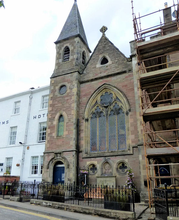
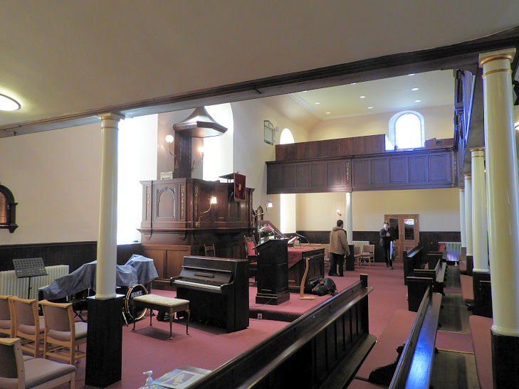
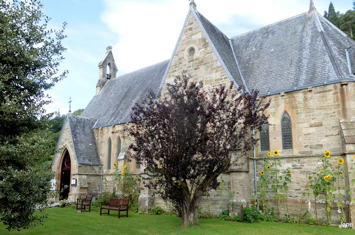
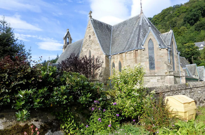
Birnam, St. Mary (Episcopal).
Two interior views - 1,
2. NO 0327 4182. All © Peter
Morgan (2021 and 2022). Link.
St. Columba (R.C.) is on St. Mary's Road at NO 0342
4160. It post-dates a map of 1901. Completely hidden by trees, a photo is
available on the
church website.
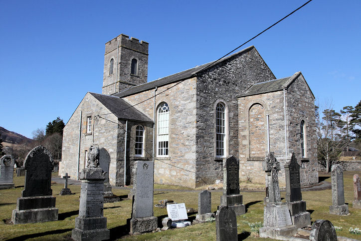
Blackford, the parish church (1859) on
Moray Street. Another view. NN 8988 0911. © Peter
Morgan (2021). It was successor to an earlier church of 1574 (from the
information plaque at the present parish church), now ruinous, which stands a
little way further north within a cemetery. Its
grade B listing dates it to 1738-9. The church history
here (several photo) clarifies the dating question. It was distantly seen by
Streetview in 2009. The former
Free Church stands on Moray
Street and Moray Place. An information board dates it to 1844-1950. It's now
in secular use. NN 8976 0902. © Peter Morgan (2021).
Blairgowrie.
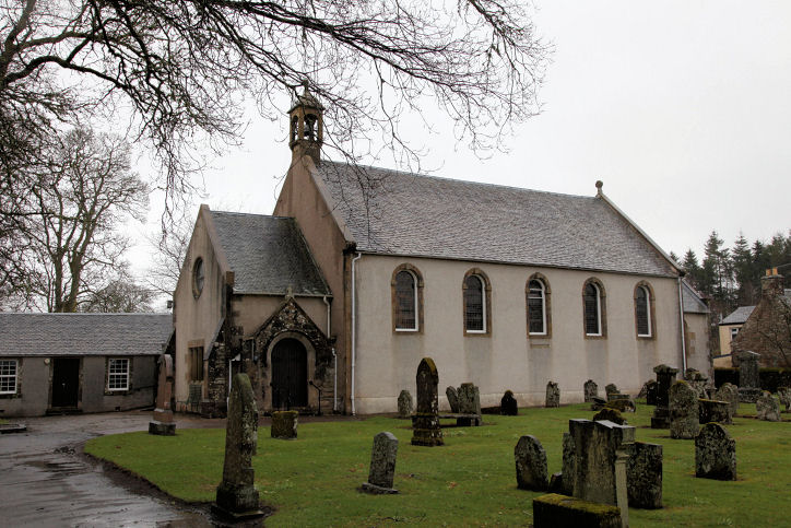
Blair Atholl,
the parish church (CoS). NN 8743 6543. © Bill
Henderson. Another view,
© Martin Briscoe. Three additional views - 1, 2,
3, and an interior view (taken through a window), all © Dennis
Harper (2013). St. Bride's Auld Kirk
at Old Blair. NN 8675 6650. © Bill Henderson.
Link.
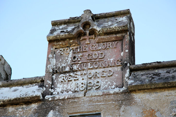
Category B listed. St. Adamnan (Kilmaveonaig Episcopal Church, 1794, on the site of an earlier church) which
stands just outside the town at NN 8795 6574. Another view, and a
stone recording restoration in 1899. All © Dennis Harper (2013).
Link.
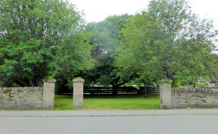
Category B listed. The site of the demolished
Free
Church at NN 8782 6539. Originally dating from the mid-1850's, it became United
Free in 1900, and St. Andrew's Church of Scotland in 1929. Demolished in the
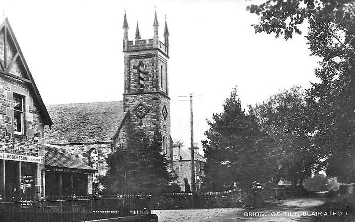
late 1960's, only the gateposts survive. © Jane Scott. The church itself is seen
in this old postcard, from
Jane Scott's Collection.
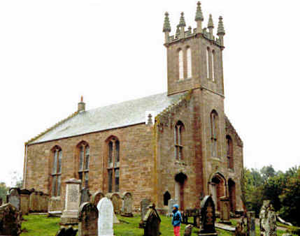
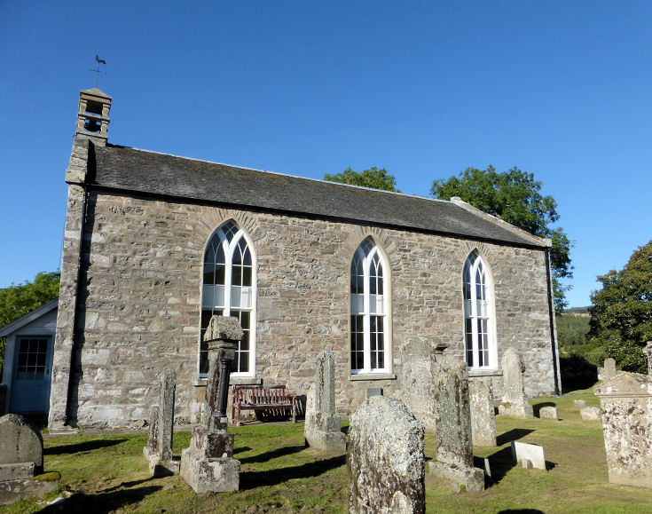
Braco, Ardoch Parish Church (CoS). NN 8371 0981. © Dennis Harper (2013).
Link1. Link2
- dates it to 1781, with later additions.
Category C listed. Older O.S. maps show a Free Church (later United Free) on
a site between Church Street and Fedda Road. Only its tower survives -
2023 Streetview. NN 8360
0968.
Category C listed - dates it to 1844-5. O.S. maps also mark the site
of a Chapel, at NN 8389 0979. It stood just outside
of the southern gateway to the impressive Ardoch Roman fort. Its site hasn't
been seen by Streetview, but a photo
here shows
the fort - the chapel will have stood between the trees close to the ramparts at
right, and the cottages a little further right. Note however, that the
Wikipedia article
about the fort says the chapel stood at its centre.
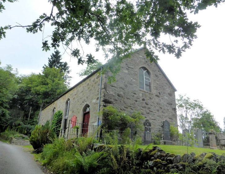
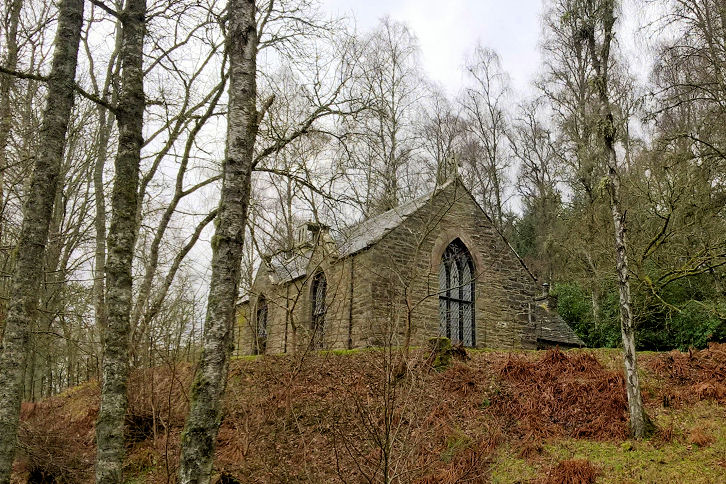
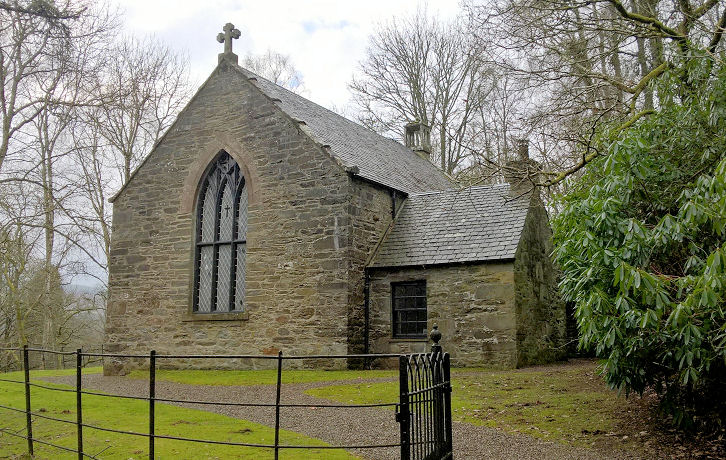
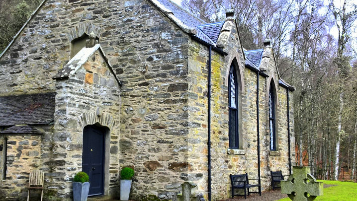
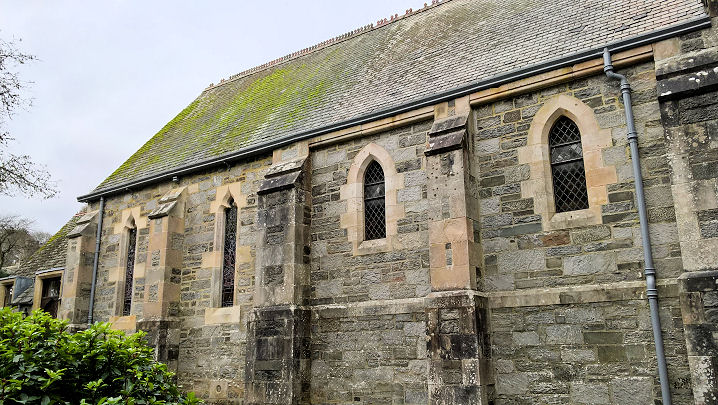
Clunie,
the Kirk. © Gill Gaiser.
Link.
Coupar Angus.
© Helen D'Ali.
Cray, the former United Free Church, now in private ownership. Another view. Both ©
Kevin Price (2012).
Crieff.
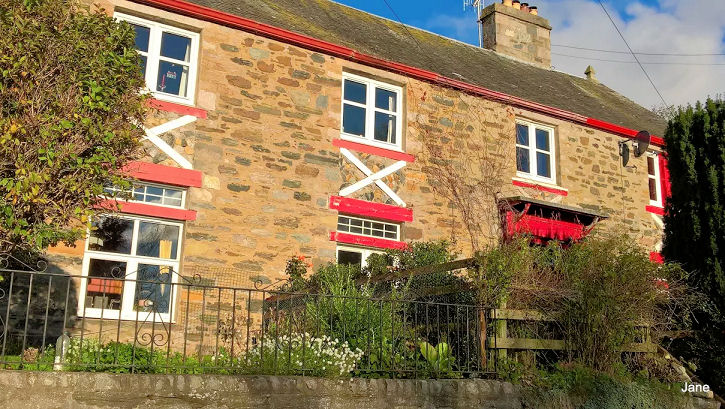
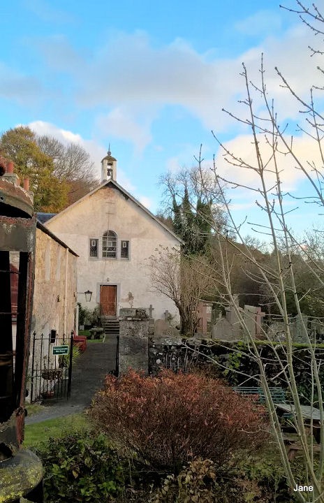
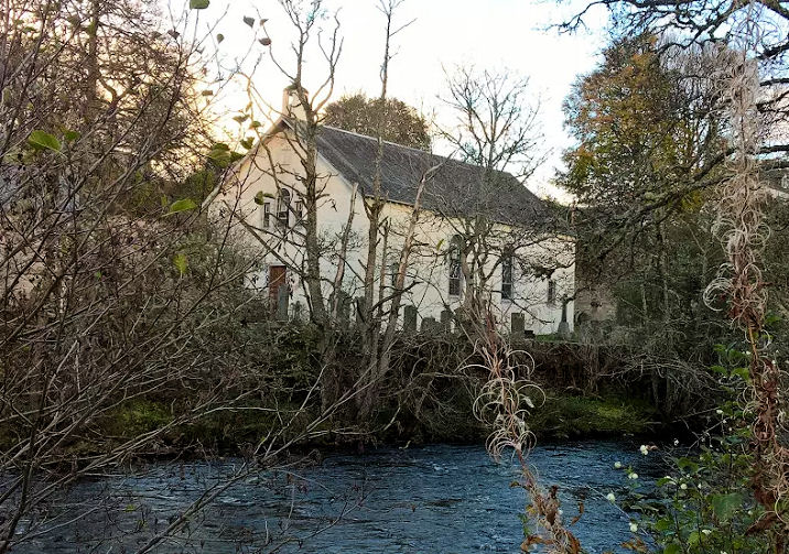
Dalguise, the
former Free Church, now a holiday let. Built in 1843 by some of the congregation
from Little Dunkeld (following the Disruption), it was renovated in 1878. Church
of Scotland from 1929, it became a joint charge with Little Dunkeld parish
church in 1947, and was closed in the 1980's.
Another view. NN 99324 46927. Both ©
Jane Scott. Link.
Grade B
listed.
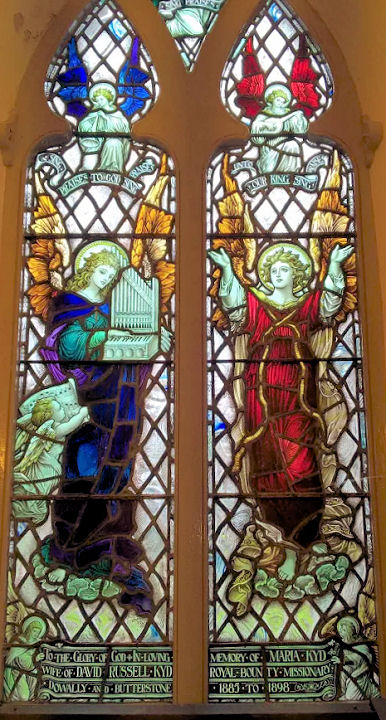
Dowally,
St. Anne (CoS). Built on an ancient site, the present church dates from 1818. It
was closed in 2017. NO 00135 48025. © Bill Henderson.
Interior view, and a
window, both © Jane Scott. Some more
photos are available
here.
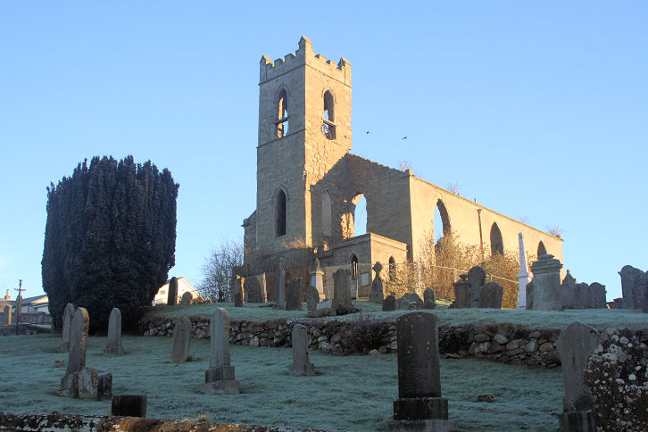
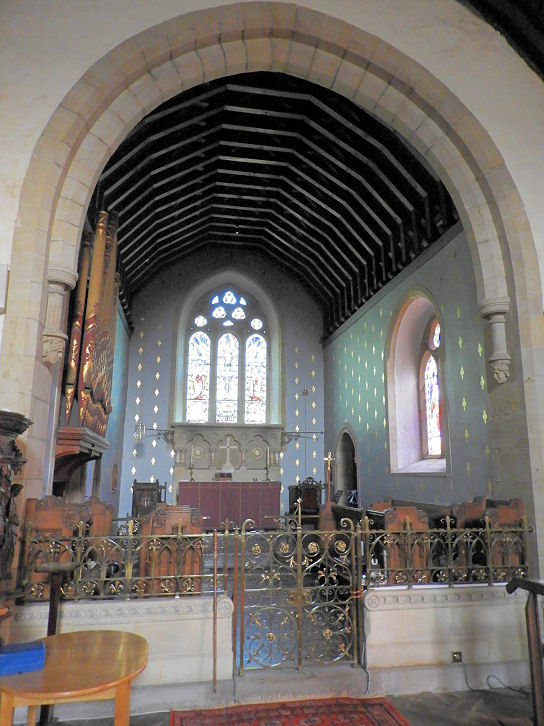
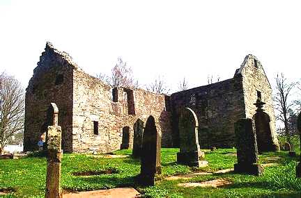
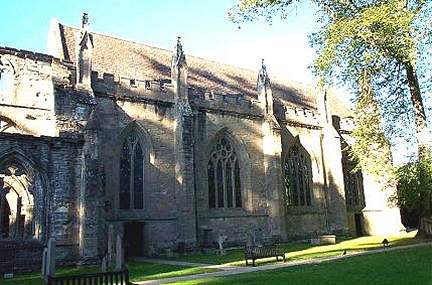
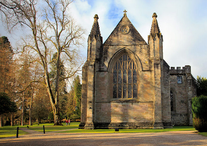
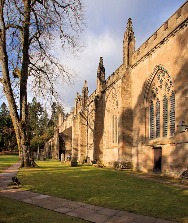
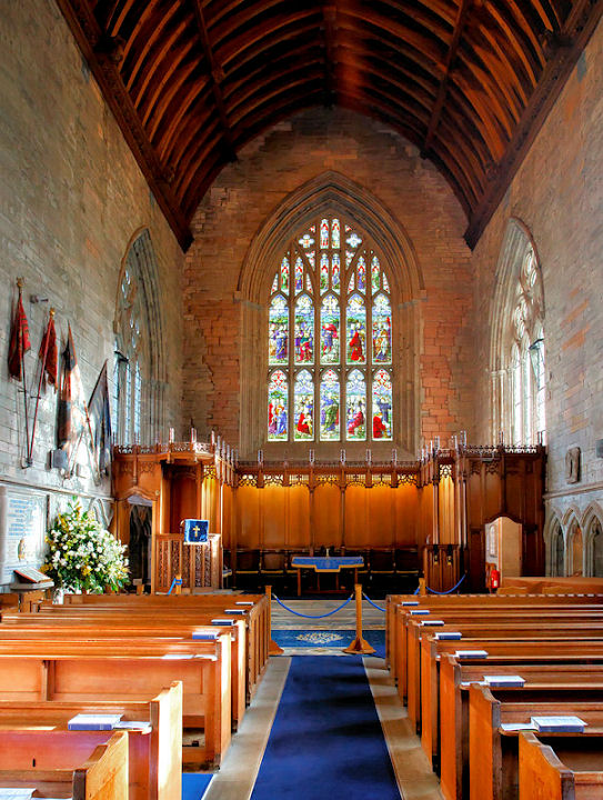
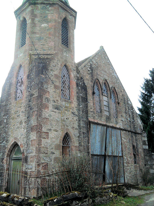
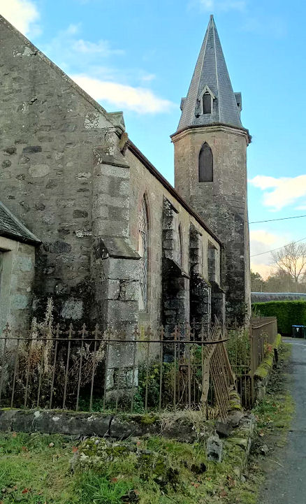
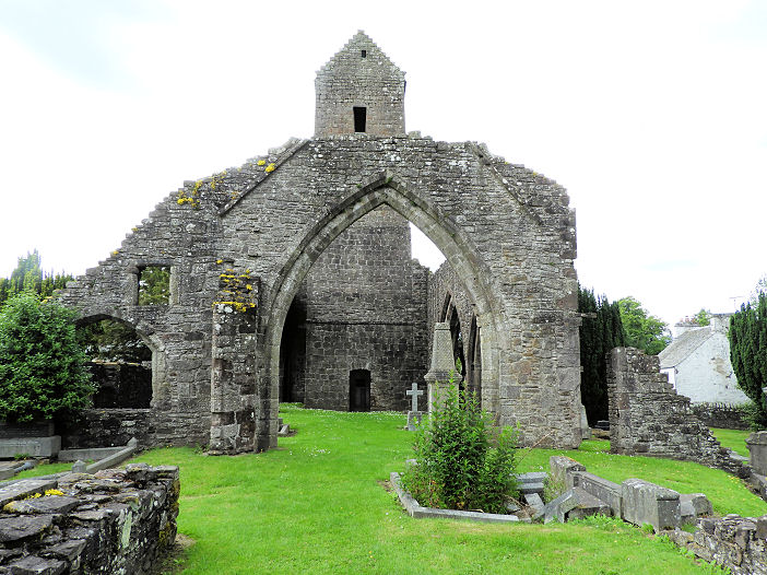
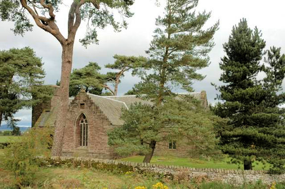
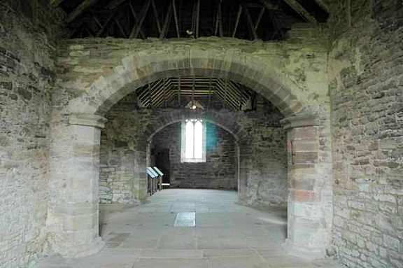
Dunkeld, the
ruins of the cathedral, and the east end, which now serves as the
parish church. NO 024 426. Both © Bill Henderson. Two
additional views - 1, 2, and an
interior view, all © John Cannon. Link.
The former Dunkeld Free Church has a date-stone for 1874. It became a Masonic
Temple in 1974. NO 02701 42599. © Jane Scott.
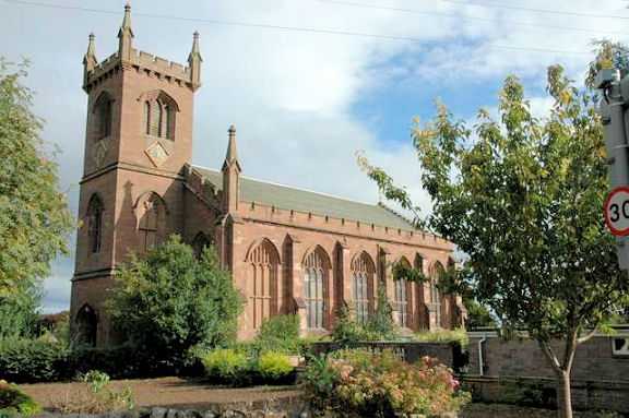
Dunning, St. Serf. NO 019 145. © Martin Briscoe. Two further views - 1,
2, both © Martin Richter (2011). Link1, which says
the church ceased to be used for worship in 1978. Link2.
Link3.
Link4.
Dunning Church, serving the Stewartry of
Strathearn. © Martin Briscoe.
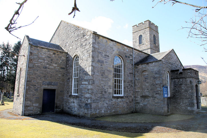
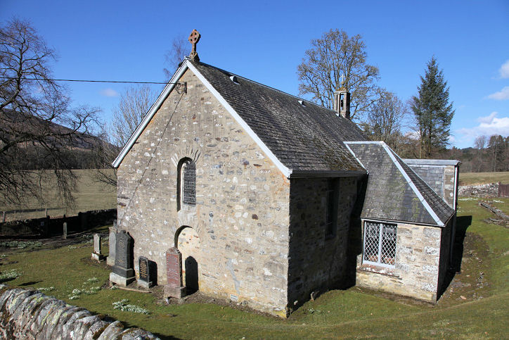
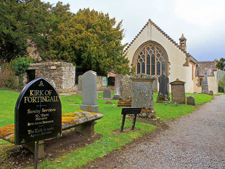
Fortingall, Church of Scotland. It was built
1900-2, on the site of earlier churches. The belfry of the previous 18th century church survives in the churchyard. A yew tree here is said to be about
5000 years old. NN 742 470. © John Cannon. Link1.
Link2.
Link3.
Gilmerton, the former
Free Church, now a private residence. ©
Alan Craxford. The
Link shows an old postcard view.
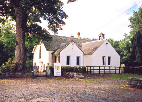
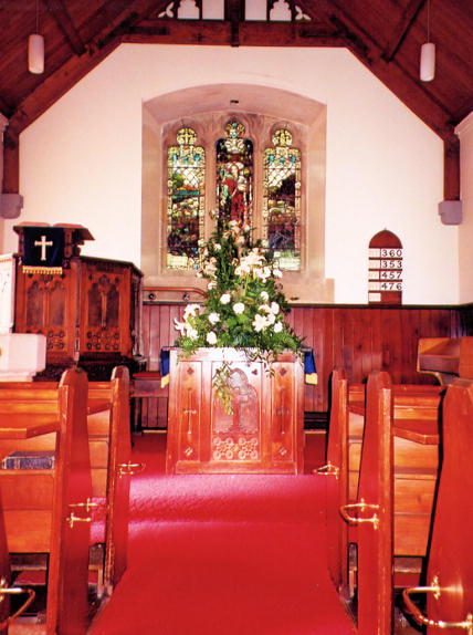
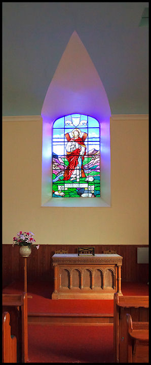
Glendevon,
the Parish Church (CoS). Interior view. Both © Ian
White. Another view, © Jim Parker (2012). Link.
Glenshee, Parish
Church. © Bill Henderson.
Grandtully, St. Mary, built in 1533 as
successor to an older church which stood nearby. Enlarged in 1636, it was
divided into two parts in 1892, one part becoming a farm building.
Another view. NN 886 506. Both © Bill
Henderson (2017).
Link1.
Link2.
Innerwick, Church of Scotland (1828, on the site
of an earlier church). Interior
view. NN 588 475. Both © John Cannon. Link.
Grade B listed.
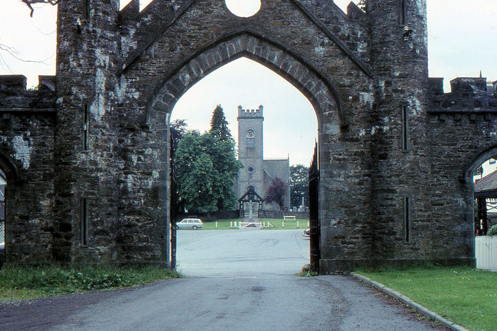
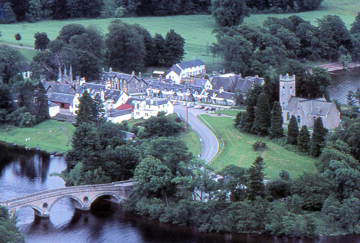
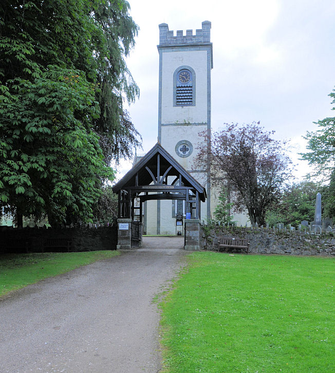
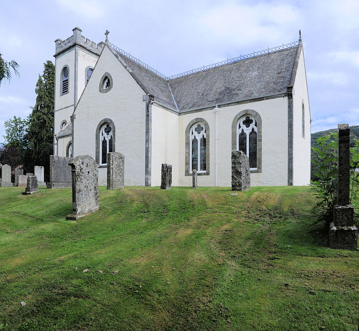
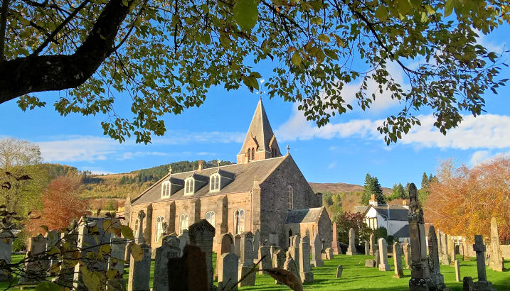
Kenmore,
the Parish Church (1760, CoS), on the site of an earlier church of 1669.
Another view. NN 7722 4542. Both from Jim Parker's
Collection. More recent photos show that the church has been painted -
1, 2,
3, all © Karel
Kuča (2019). Link1.
Link2.
The former Kenmore Free Church,
built in 1844. Following unification with the Presbyterians in 1900, it's name
changed to Kenmore United Free Church. It was closed towards the end of the last
century and was subsequently in commercial use, but it is currently not in use.
Another view. Both © Jane Scott.
Killiecrankie, Tenandry Kirk. Built as a
chapel of ease in 1836, this church stands in an isolated position south of the
village. NN 91115 61499. © Jane Scott.
Link.
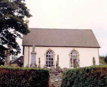
Kinloch,
the Kirk. © Gill Gaiser.
Kinnaird, the short-lived Moulin Free
Church (1843-1863). The congregation relocated to a new church in Pitlochry (see
the Pitlochry page). The building is now in
residential use (and known as Kirk Lodge).
NN 95288 59245. ©
Jane Scott.
Kinross.
Kirkmichael, the former Alexander Duff Memorial Free Church.
Alan thinks that it may have been in
commercial use (fire station?) since the church closed, but doesn't appear to be being used now.
NO 07918 59991. © Alan Mathew. Another
view, © Jane Scott, who advises that it dates from 1891, replacing an
earlier church, that it united with CoS in 1929, and was closed in 1955. This
link
has an illustration of the preceding church (scroll down).
Church of Scotland
(1791). Two additional views 1,
2. NO 08066 60090. All © Jane
Scott. Link.
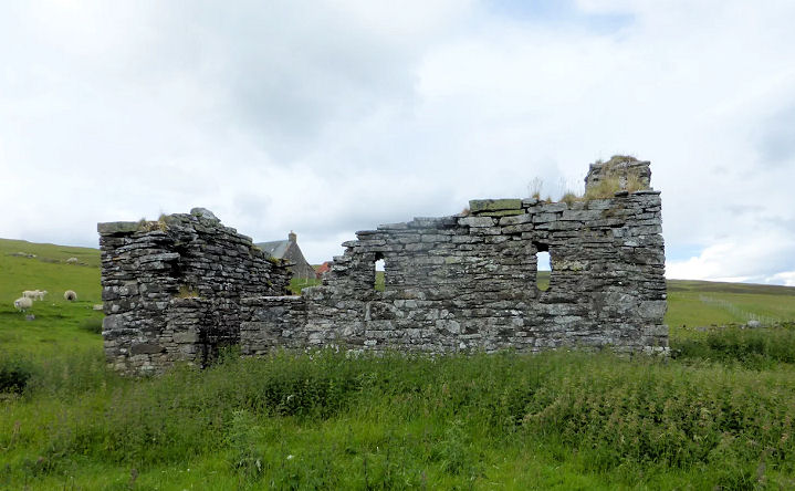
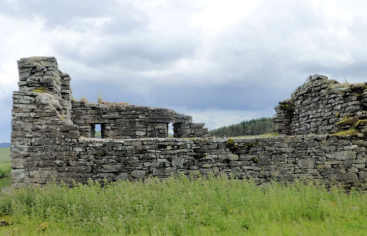
Kirkton of Lude, the remains of St. Lude.
Standing in an isolated position north-east of Blair Atholl, this medieval
church was ruinous by 1800. Another view.
NN 90316 68778. Both © Jane Scott.
Link.
Little
Dunkeld, Church of Scotland. It's dated
here to 1798, and had several predecessors on the same site. The
interior. NO 0285
4227. Both © Peter Morgan (2021 and 2022).
Link.
Logierait, Parish Church. NN 967 520. © Jim Parker.
Link.
Longleys, Kinloch Mausoleum (1861). Previously in the "Unknown"
section, what was assumed to be a church was identified as the mausoleum by Simon Davies, Greg Mishevski, and Brian Curtis. Two further views -
1, 2. All © Kevin Price (2012).
Link. Grade B listed -
link, which also says that the mausoleum stands on the
site of St. Mary's Chapel.
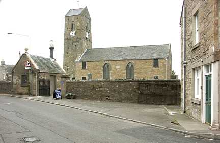
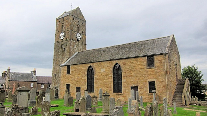
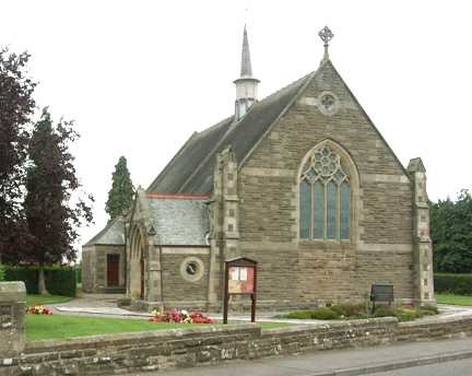
Milnathort, the
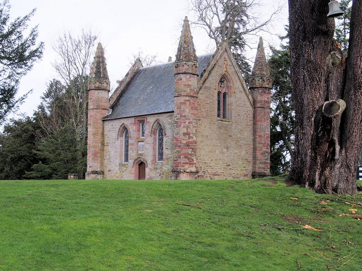
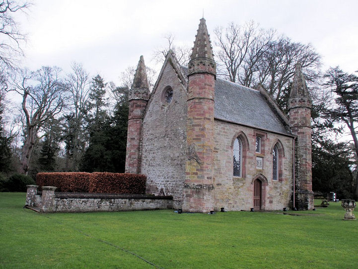
Orwell Parish Church on Ba' Hill. NO 1205 0512. © Shona Murdoch.
Link1.
Link2, which dates it to 1729, from stone taken from the Old Kirk.
Category B listed. The Old Kirk stood on the
banks of the nearby loch at NO 1468 0386. Not visible to Streetview, I haven't
been able to find a photo of the site. The former
Orwell and Portmoak Parish Church
on Church Street and South Street. Older maps label it as United Presbyterian.
Peter advises that it's been converted into flats. NO 1199 0464. © Peter Morgan
(2022).
Category B listed, which dates it to 1867-9. A former
Free Church stands on Old Perth Road. It was seen by
Streetview in 2009. NO 1226
0484.
Category C listed, wherein it's dated to 1821 on the site of a 1741
predecessor.
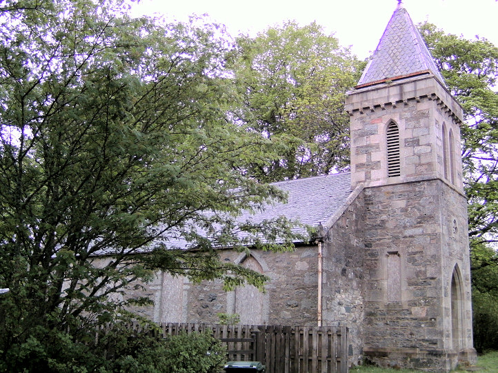
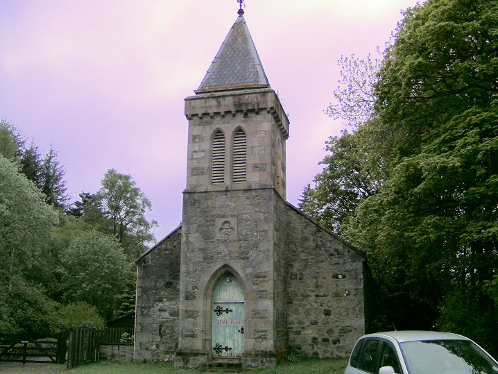
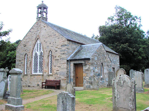
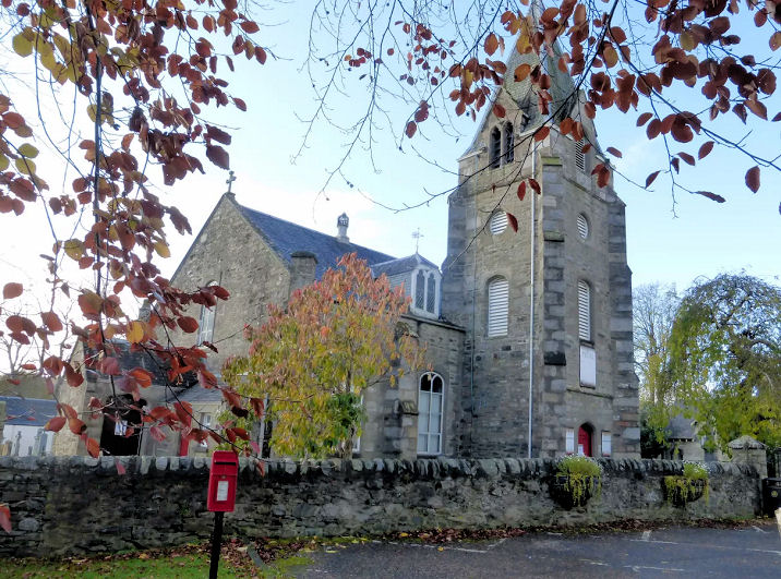
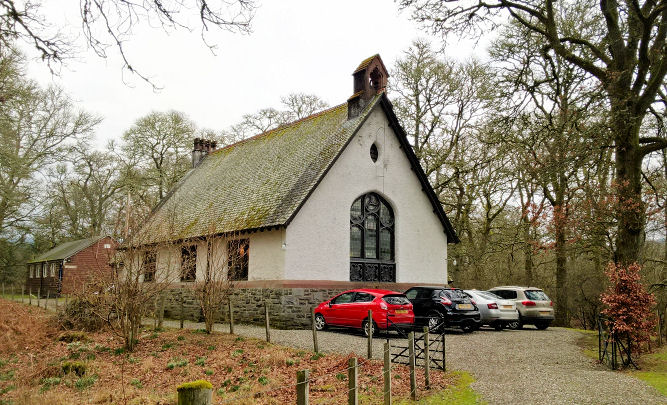
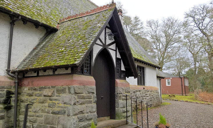
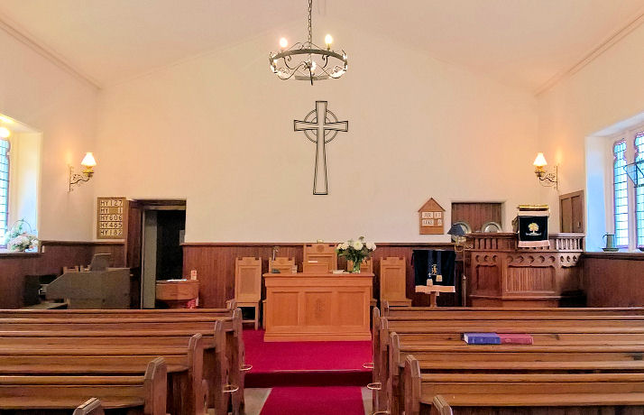
Monzie, the Kirk (CoS). According to the
Link,
the church is believed to have been dedicated to St. Lawrence. © Alan Craxford.
Moulin, the former Parish Church. Of
medieval foundation, the present building (now used as a heritage centre) is
largely of the 19th century. It was closed in 1989.
Another view. NN 9442 5923. © Jane
Scott.
Muthill, the New Parish Church (CoS) on
Main Street. NN 8695 1704. © Alan Craxford. Another view, © Dennis Harper (2013).
Link1. Link2.
St. James (Episcopal)
on Station Road. NN 8687 1700. © Alan Craxford. Another view, © Dennis Harper (2013).
Link.
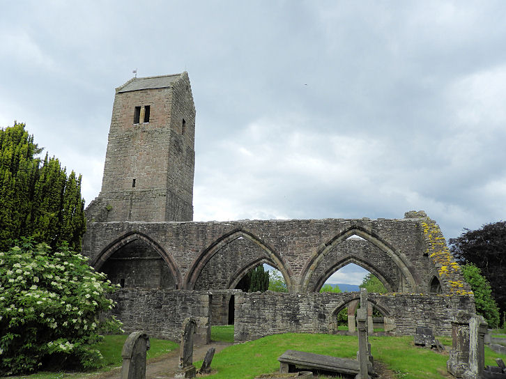
The remains of the Old Parish Church.
Another view. The tower is dated
here to the 12th century. NN 8679 1707. Both © Peter Morgan (2021).
Link. Many more photos
here.
Grade A listed. Old maps mark a Free Church at
the western end of Drummond Street, at NN 8657 1700. Now demolished, a photo of
it in 1899 is available
here. It was active at least into the mid-1950's. The building on the site
in 2011 can be seen here, on
Streetview.
Old Scone -
see Scone, below.
Perth.
Pitlochry.
Scone, Scone Palace Chapel. It's
reputedly the remaining fragment of the medieval parish church,
re-worked as a mausoleum. NO
1142 2664. © Jim Parker. Two more views -
1,
2, both
©
Chris Stafford (2014).
Link.
Category A listed. O.S. maps show Church (Site
of) 300 yards to the NE, at NO 1170 2678. Its site hasn't been
seen by Streetview, but very close to it is the Tomb of the Minister
of Scone, a photo of which can be seen
here.
Scone and St. Martin's Parish Church
(CoS) is on Angus Road.
Older O.S. maps label it as Free Church, and later U.F. Church. NO 1387 2622. © Bill Henderson (2017).
Link.
Category B listed. Maps also mark Abbey U.F.
Church on Abbey Road, at NO 1356 2616. Its dated in its
category C listing to 1885. Evidently now converted, it was seen by
Streetview in 2009.
Old Parish Church,
on Burnside, as seen by Streetview in 2009. Its
category B listing dates it to 1804. Another
source says 1806, adding that it was built from stone transported
from an older demolished church near Scone Palace - presumably from what
is now Scone Palace Chapel. NO 1321 2559.
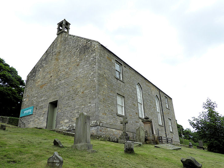
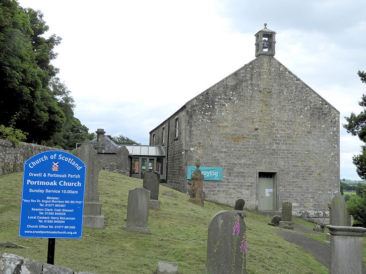
Scotlandwell, Portmoak
Parish Church. Another view.
NO 1833 0194. An information board dates the church to 1659-61.
Both © Peter Morgan (2021). The board referred to
earlier also says that the church was successor to an earlier church
which stood by the loch. This is probably a reference to a Monastery,
which O.S. maps mark as Monastery (Site of) at Portmoak Farm, at
NO 1736 0087. A little history is available
here.
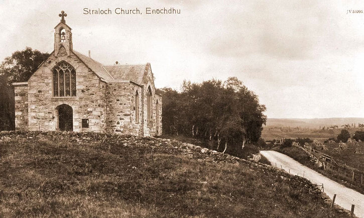
Straloch, Church of Scotland
(1846). Before it was built, services were held in the open air. NO
04596 63914. © Jane Scott. An old
postcard view, from Jane Scott's Collection.
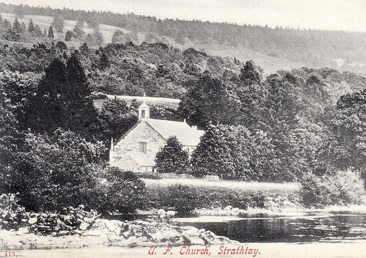
Strathtay, the demolished
Free Church. Built in 1834, it became a United Free Church in about
1900. Following the union with the Church of Scotland in 1929 it went
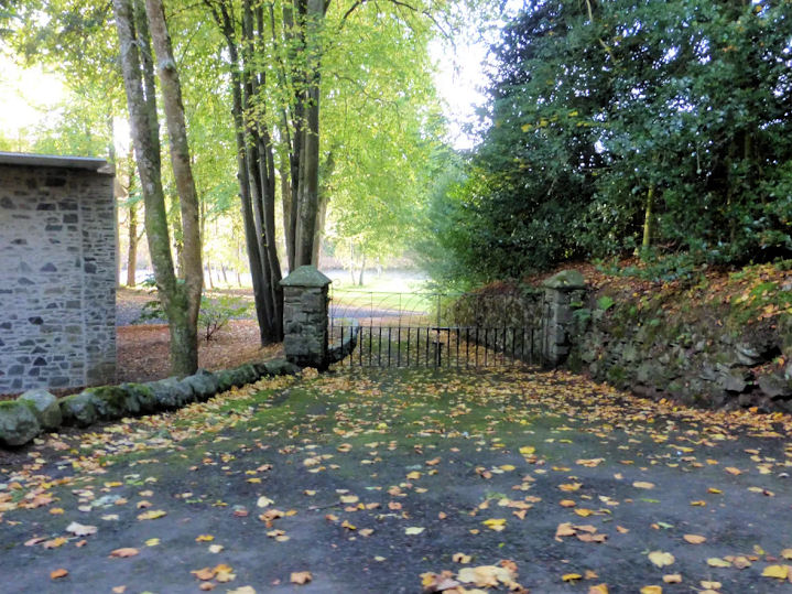
out of use, and was demolished by 1960. A house was built on the site. NN 9168 5350.
From an old postcard in Jane Scott's Collection. The entrance
gate-posts survive, © Jane Scott.
The former Roman Catholic Church
of the Holy Cross dates from 1876. Two additional views -
1,
2. NN 91616 53693.
St. Andrew's Episcopal Church.
Another view. NN 91055
53442.
Link. Church of Scotland
(1899), originally a Mission Church from Logierait.
The porch and the
interior. NN 9089 5319.
Link. All ©
Jane Scott (2019).
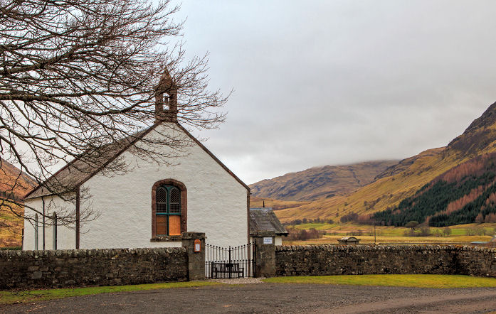
Struan (or Strowan), Church of
Scotland (1828-9), which stands on (or nearby to) the site of an ancient
church. Another view. NN 80891
65353. Link1.
Link2 (scroll down).
The
former Free Church, now in residential use. The building dates from
1879, though the congregation is older (1855), and it had gone out of
use by 1937, when it was sold. NN 8022 6534. All © Jane Scott (2019).
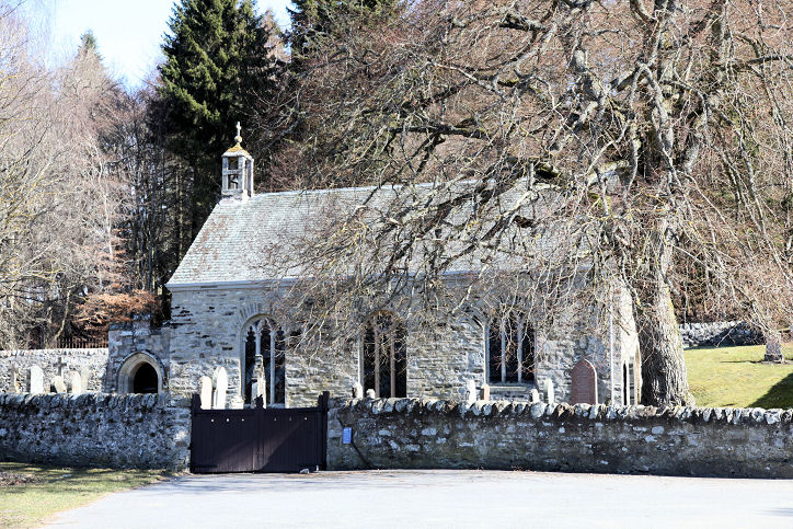
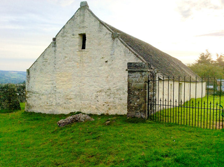
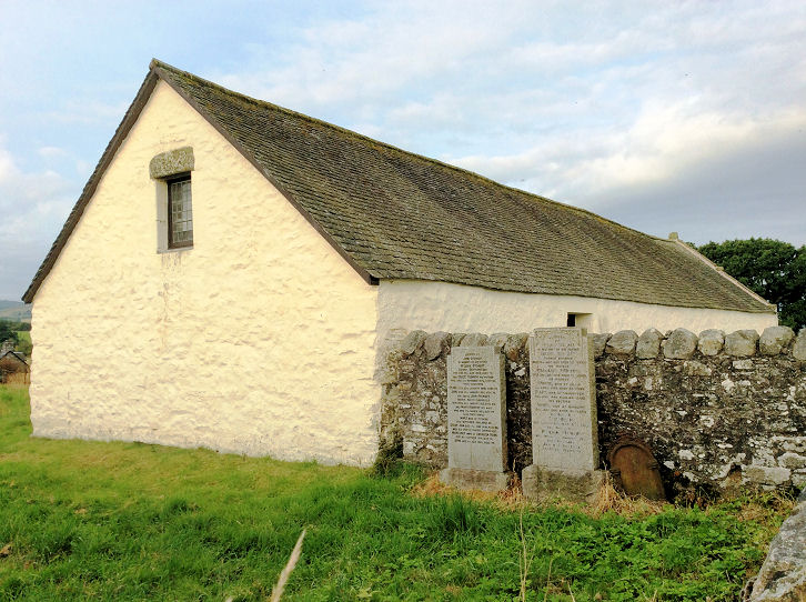
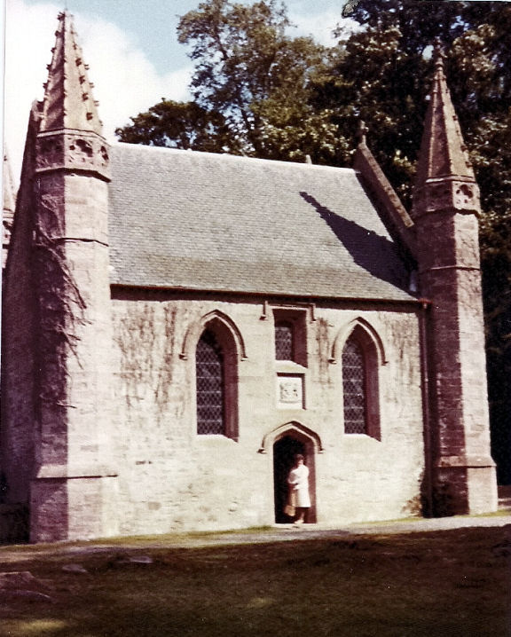
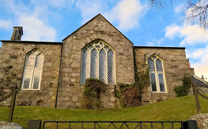
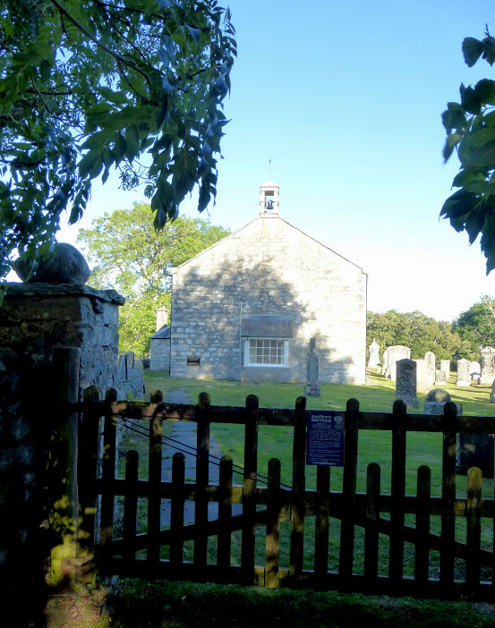
Tullibardine, the Chapel.
Interior view. NN 9095 1347. An important medieval survival, largely dating
from a re-build of about 1500. Both © Alan Craxford.
Another view, © Peter Morgan (2021).
Link.
Tullymet, the site of the Chapel of
Our. Good Lady of Good Aid (R.C.). The church was built in 1855, and demolished
in the 1930's. The graveyard
survives. NN 99901 52852. Both © Jane Scott. A 1910 photo of the chapel is
available here,
and another
here. The former Baptist Church
(1847) stands on the site of an earlier church. The final service was held in
September 1973. More photos (including the interior) are available
here and
here. NN 98196 53740. © Jane Scott.
Weem,
Church of Scotland. This was previously in the "Unknown" section, as
follows - "George Duchow has
a family film clip made in Scotland in 1967. There is a church at 1 minute 32
seconds into the clip, which can be viewed on Youtube
here. Can you advise
the location?". My appreciation to Greg Mishevski for the identification.
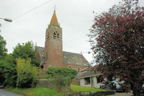
The church was built as St. David's Episcopal Church in 1875, and
given to the CoS in 1921 as the new parish church, when the former CoS
building was converted to be used as a clan society hall. NN 84349
49810. Two additional views - 1,
2, both © Jane Scott.
Link1.
Link2. The
Auld Kirk, dedicated to St.
Cuthbert, is 13th-15th century. In 1839 it was taken over as the
mausoleum for the Menzies family, who also gave land for the building of
a new Parish Church. NN 84296 49798. © Jane
Scott. The new Parish Church, of 1839, ceased to be used as the Parish
Church in 1921, when it became the Menzies clan society hall. This
eventually fell into ruin, and was rebuilt as a
house in 1978. NN 84595 49821. ©
Jane Scott. An old postcard
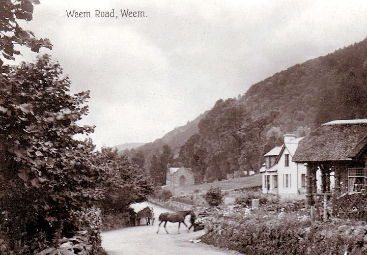
has a distant view of the church. From Jane Scott's Collection.
|
|