The Churches of Britain and Ireland
| Redruth, Cornwall
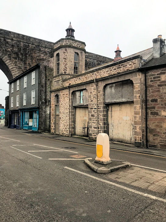
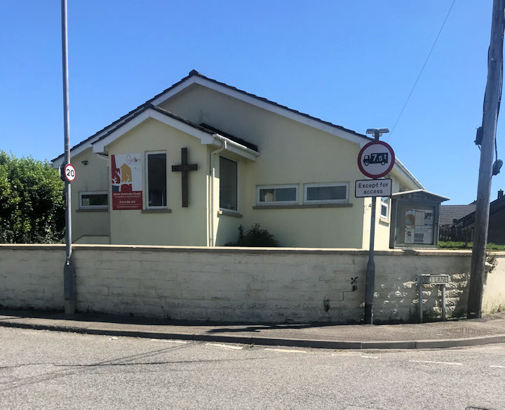
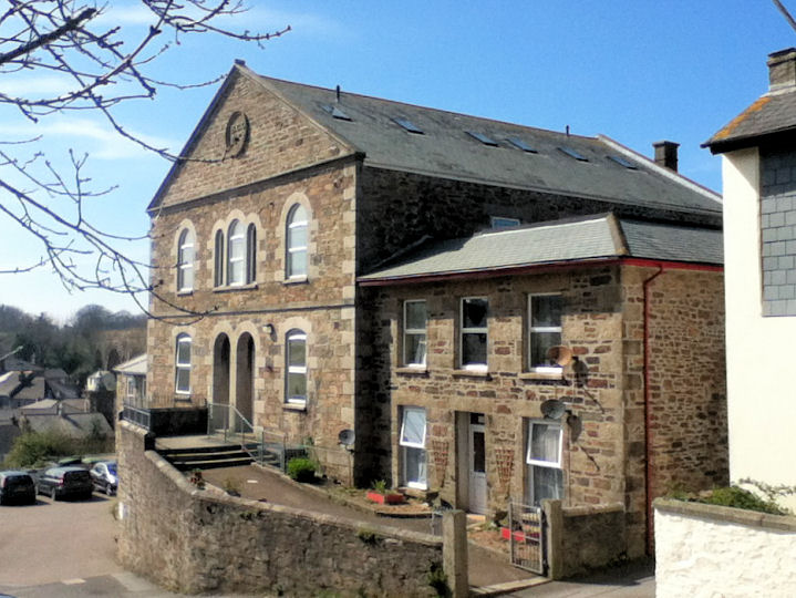
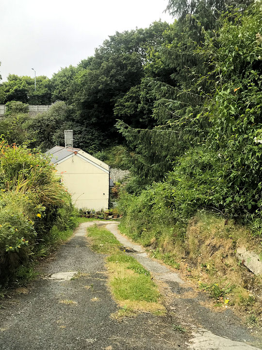
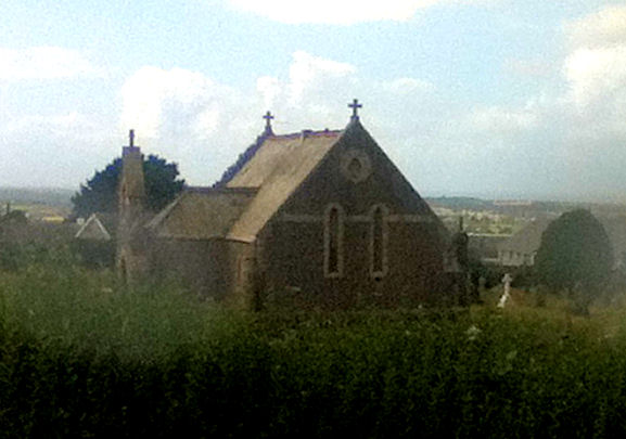
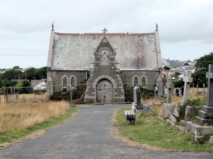
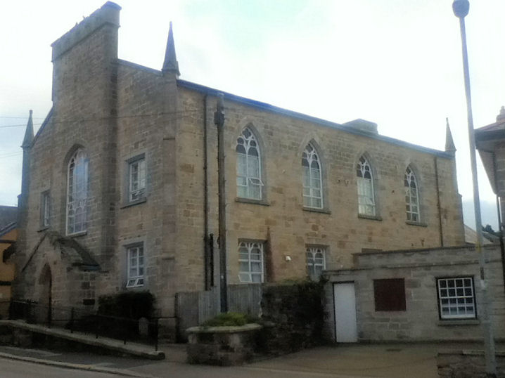
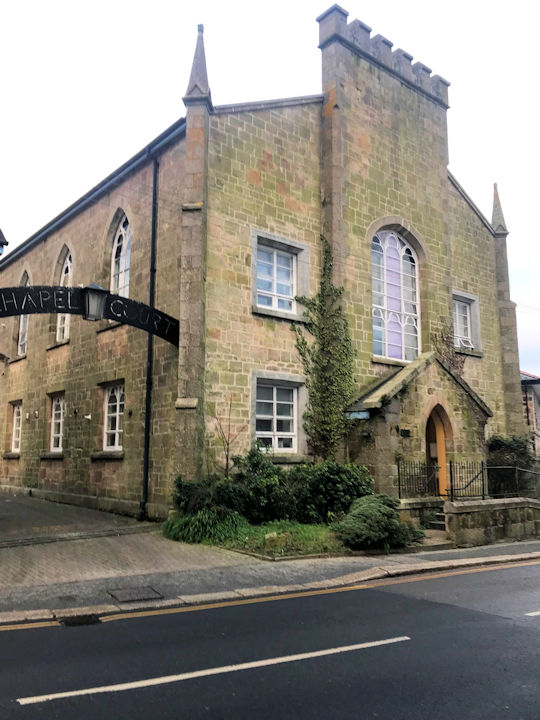
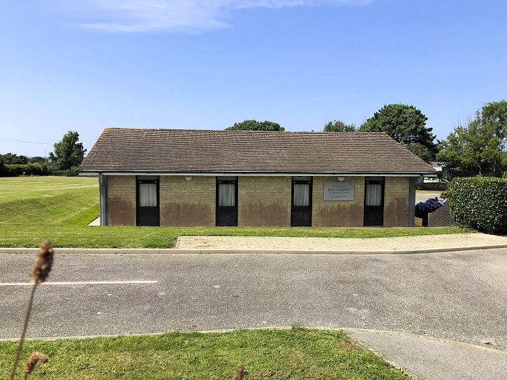
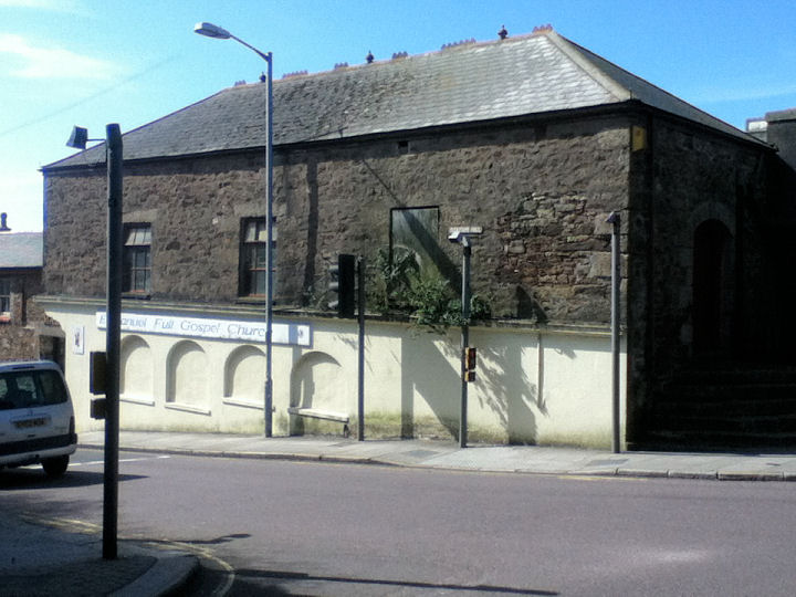
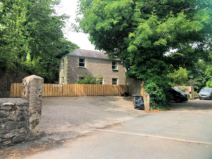
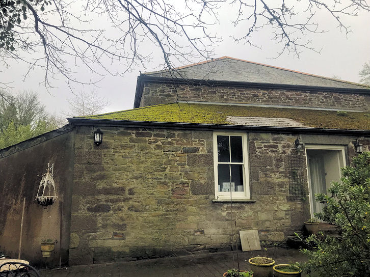
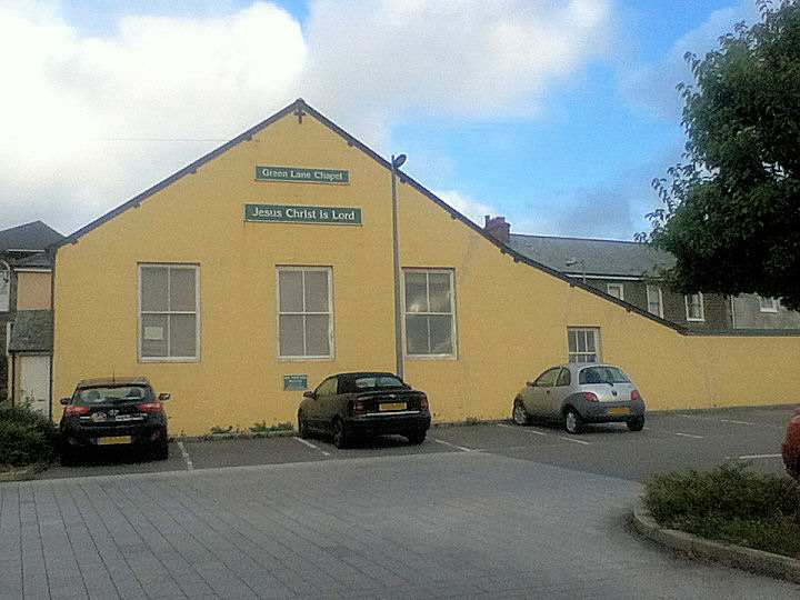
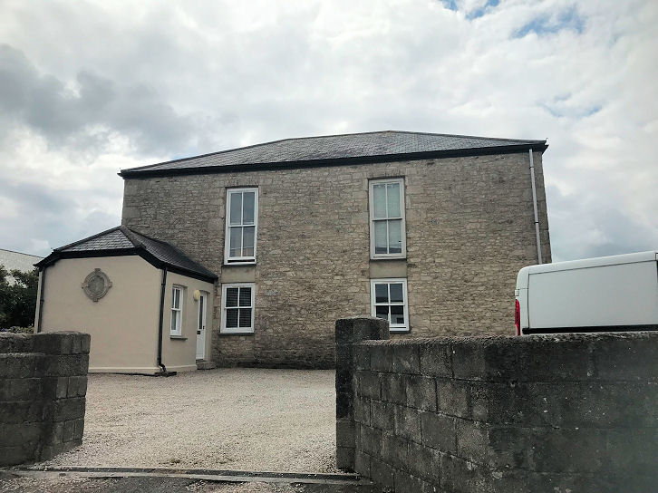
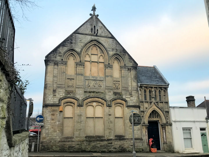
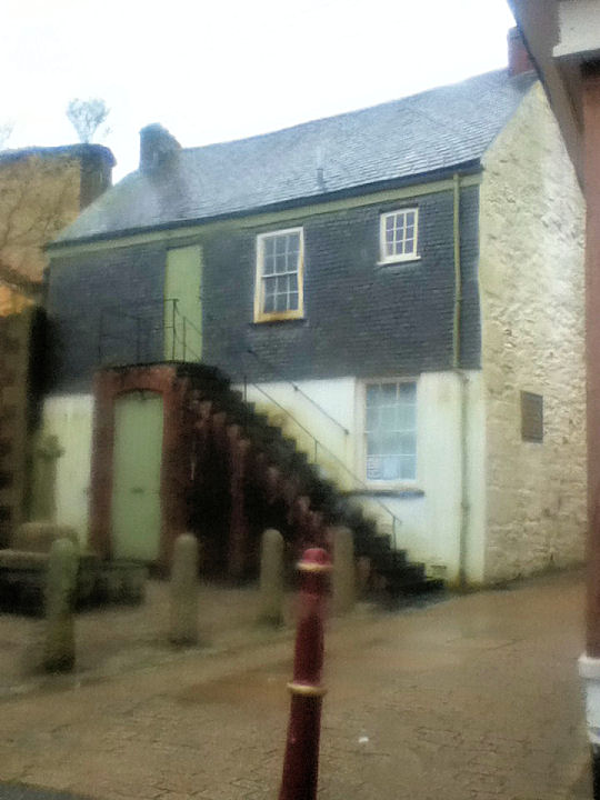
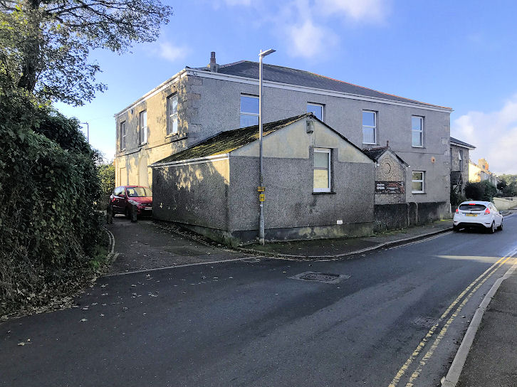
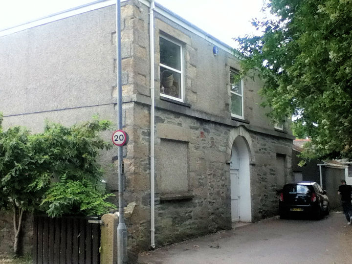
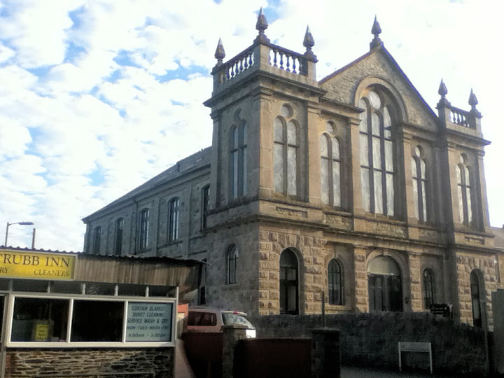
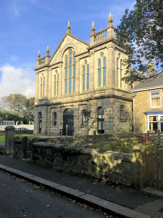
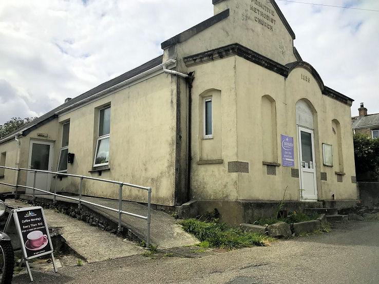
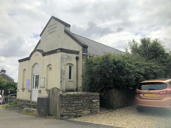
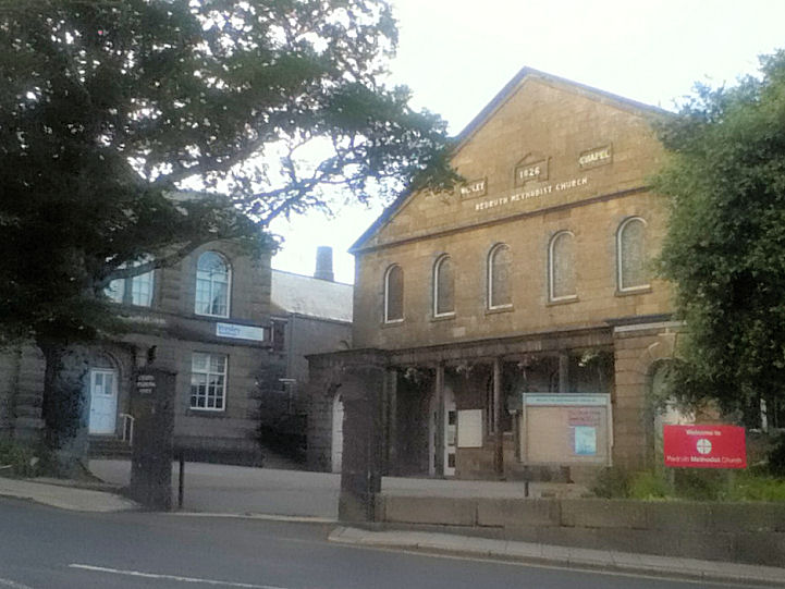
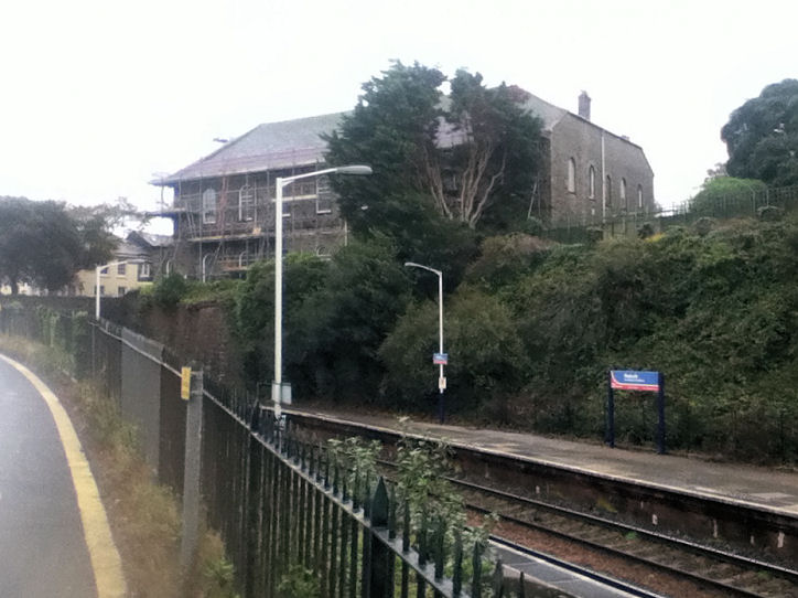
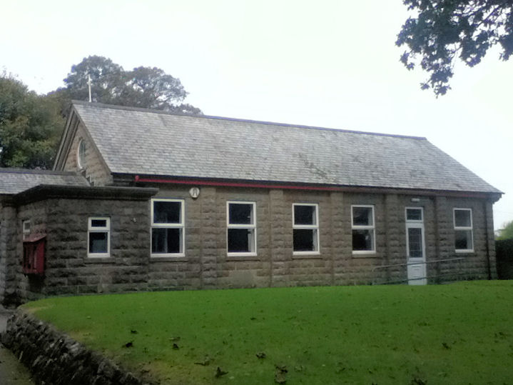
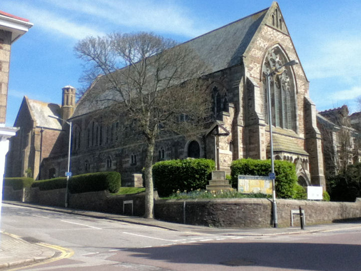
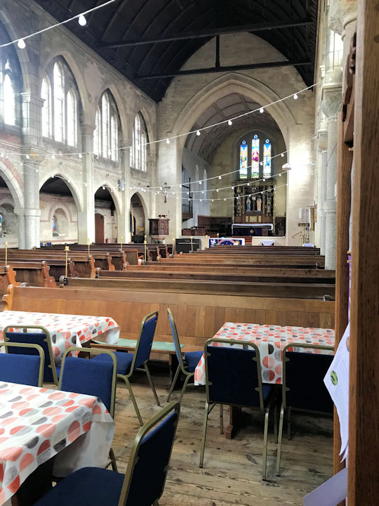
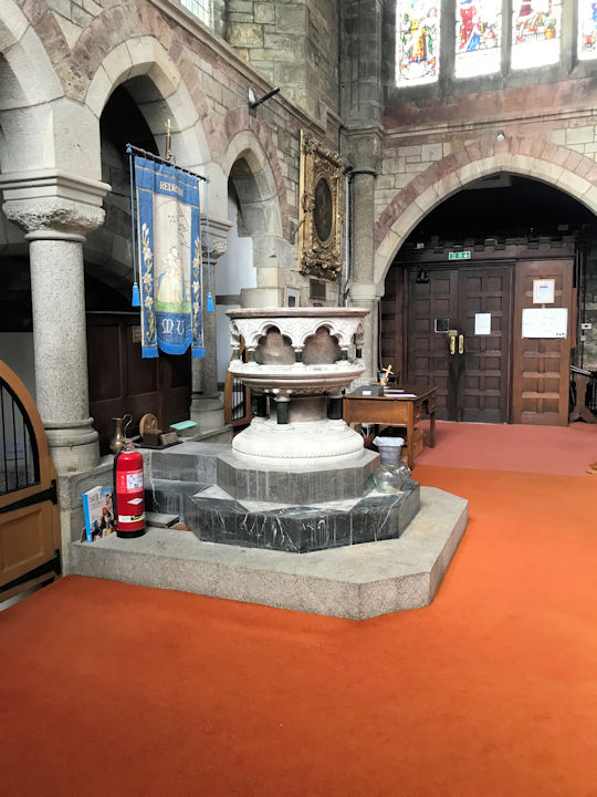
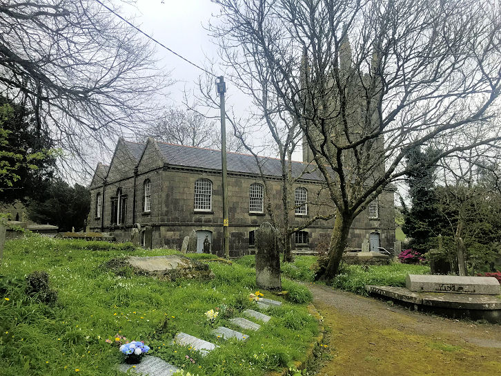
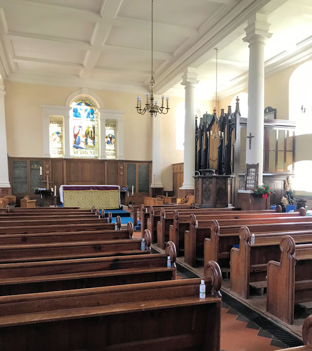
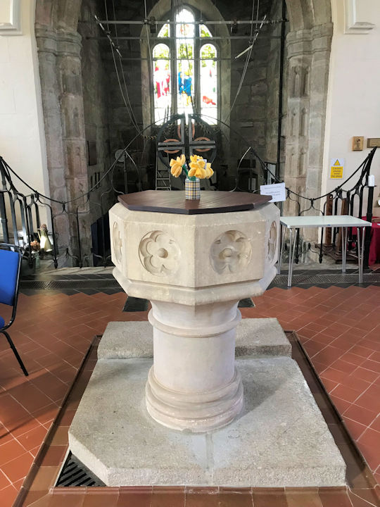
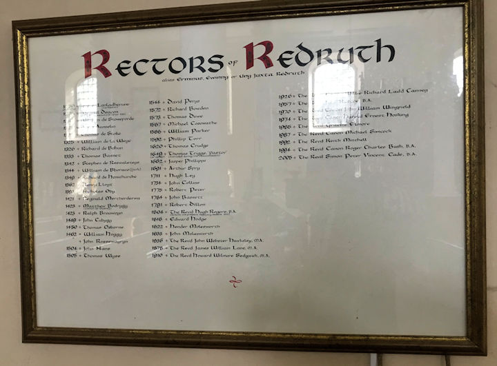
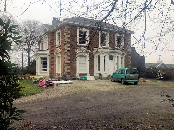
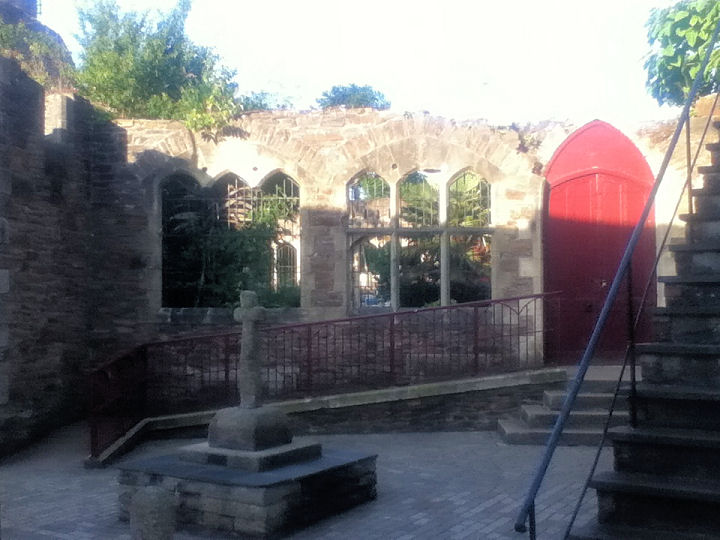
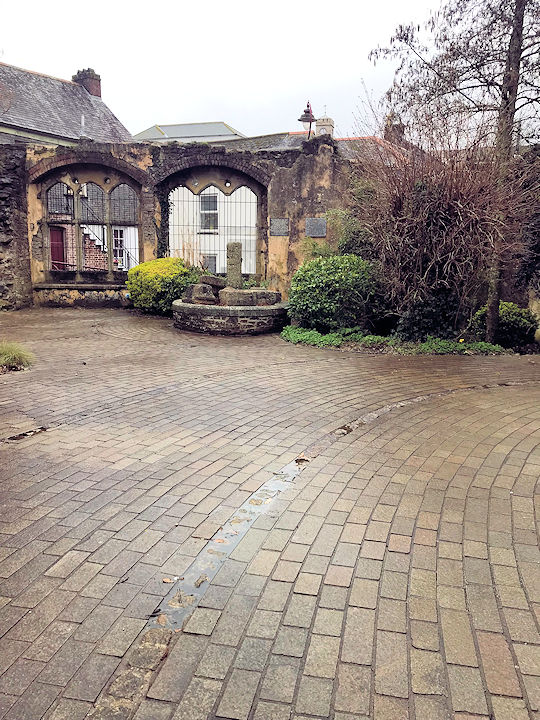
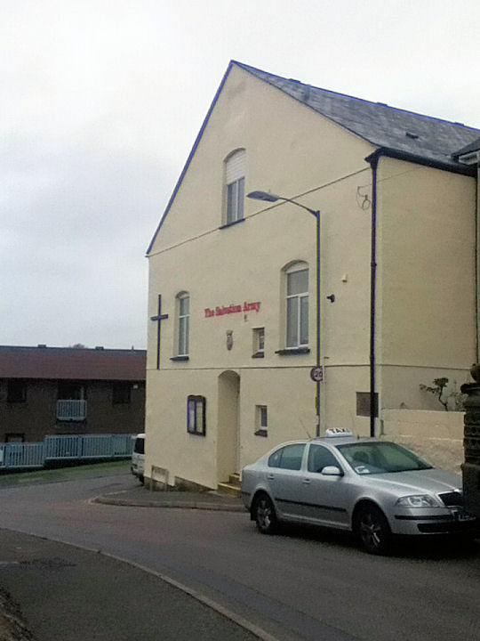
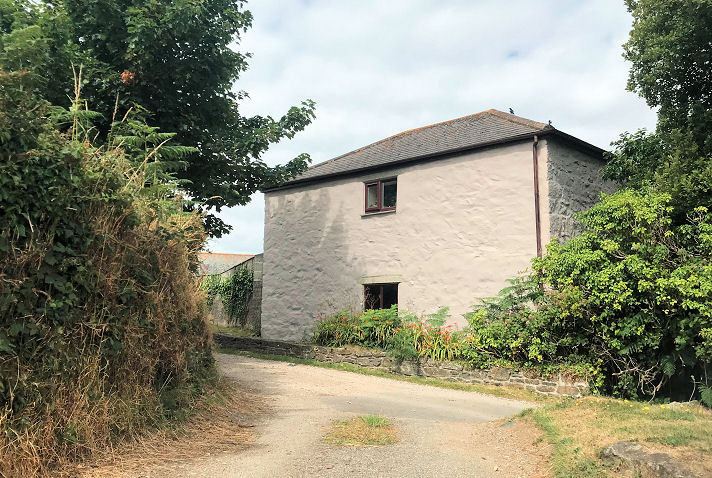
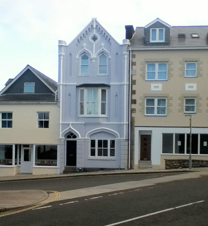
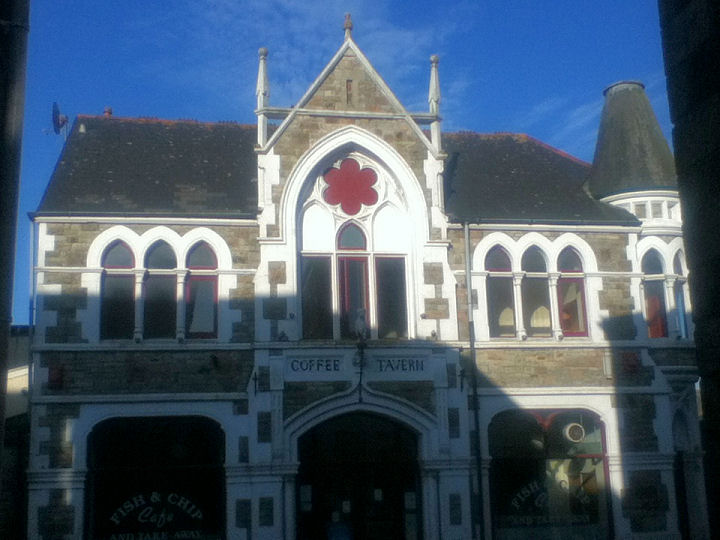
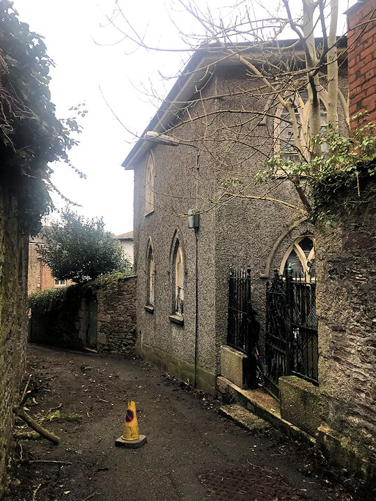
Baptist Church (1877) on Penryn Street. SW 697 419. © Paul E. Barnett (2014). Link. A tourist's walking guide to the town says that the old fire station (1913) on Falmouth Road stands on the site of Bethesda Chapel, but it doesn't say which denomination it was. Was it the Bethesda mentioned here on Genuki as being Wesleyan, from 1840? SW 6986 4181. © Paul E. Barnett (2023). Bethel Community Church on Pond Lane. SW 6946 4254. © Paul E. Barnett (2024). Link. Bible Christian Chapel (1865) on Treruffe Hill. SW 6995 4183. © Paul E. Barnett (2015). Blowinghouse Primitive Methodist Chapel, was, according to this source, located close to a row of houses on Railway Villas, Blowinghouse. It also dates it to 1850. The oldest available map shows that it was closed by 1906, when the revision took place for the map published in 1908. In a 2023 Streetview, its site is immediately behind the concrete roadside barrier. The house in Paul's photo can be seen by turning to the left. SW 6878 4171. © Paul E. Barnett (2022). Cemetery Chapel in the cemetery on St. Day Road. SW 7060 4221. © Paul E. Barnett (2014). Another view, © Chris Kippin (2022). Church of England Chapel of Ease (1828) on Church Street, and now known as Church Court. It was converted into flats in 2004. SW 6972 4204. © Paul E. Barnett (2014). Another view, © Paul E. Barnett (2024). Grade II listed. Church of Jesus Christ of Latter-day Saints on Mount Ambrose. SW 7112 4350. © Paul E. Barnett (2023). Link. Emmanuel Full Gospel Church. SW 699 419. © Paul E. Barnett (2015). The access to the site of the demolished Flowerpot Chapel off Fore Street, as seen by Streetview in 2023. The frontage of the chapel itself would have stood about where the black car is. It was built as United Free Methodist in 1865. According to this source (which has exterior and interior photos), it was closed in the 1960's. SW 7001 4214. The former Friends Meeting House off Trengweath Lane. Another view. SW 6965 4182. Both © Paul E. Barnett (2022 and 2023). Grade II listed. Green Lane Chapel (Elim Church). SW 697 421. © Paul E. Barnett (2014). Link. The former Highway Methodist Church on Treskerby and College Lane was originally Wesleyan, of 1824. SW 7128 4329. © Paul E. Barnett (2022). Link. The site of the demolished Kingdom Hall of Jehovah's Witnesses on East End, as seen by Streetview in 2023. It shows on a map of 1968. SW 7034 4223. A building which could easily be mistaken for a church is the Masonic Hall on Green Lane. Their website describes it as "purpose-built". SW 6986 4216. © Paul E. Barnett (2024). A map of 1968 shows a Mission Hall on King Street at SW 6955 4236. It's likely to be Redruth Town Mission mentioned here (see no. 6) where it's dated to 1868. Aerial views suggest that it survives, but it hasn't been visited by the Streetview camera. And despite numerous mentions of it on-line, particularly in relation to its brass band, I haven't been able to find a photo. Originally built as a chapel in circa 1660, Murdoch (or Murdock) House has in its time been a prison, the residence of William Murdoch, a tea room, and from 1931 a Friends' Meeting Room. It is now used for educational purposes. SW 698 419. © Paul E. Barnett (2016). Link. The former Primitive Methodist Chapel on Plain-an-Gwarry, now owned by the local amateur operatic society. It's dated here to 1825. Another view. SW 6965 4244. Both © Paul E. Barnett (2023 & 2015). Link. Opposite stands its handsome successor P.M. Chapel. Now converted into flats, it's dated here to 1884. Another view. SW 6968 4250. Both © Paul E. Barnett (2015 & 2023). Grade II listed. The former Primitive Methodist Chapel on Redruth Highway, Mount Ambrose. It's dated here to 1835-1948, and it's now in use by the local scouts. Another view. SW 7110 4322. Both © Paul E. Barnett (2022). Redruth Methodist Church, built as Wesley Chapel in 1826. SW 701 420. © Paul E. Barnett (2015). Another view. © Paul E. Barnett (2014). Link. Roman Catholic Church on Penventon Road. SW 693 418. © Paul E. Barnett (2014). St. Andrew (1883) on Clinton Road and Heanton Villas. Interior view and the font. SW 7005 4183. © Paul E. Barnett (2015 and 2025). Link. Grade II listed, wherein it's dated to 1883-4. The war memorial is also listed at grade II. St. Euny (sometimes Uny) at Churchtown. SW 6912 4123. © Paul E. Barnett (2023). Interior view, the font, and the list of rectors, which commences in 1259, all © Paul E. Barnett (2025). Link. Grade II* listed. The lych-gate is listed in its own right, as grade II. St. Joseph's Convent. Its grade II listing dates it to the mid-19th century, originally as a house. SW 6923 4192. © Paul E. Barnett (2023). The remains of St. Rumon on Penryn Street. Another view. SW 6980 4194. Both © Paul E. Barnett (2014 and 2023). Salvation Army on Miners Row and Middletons Row. The building post-dates a map of 1888, and one of 1908 labels it as Hall. SW 7018 4219. © Paul E. Barnett (2014). The former Wesleyan Methodist Chapel on Falmouth Road. SW 7069 4080. It's date-stone is for 1887, and O.S. maps indicate that it was closed between 1946 and 1960. © Paul E. Barnett (2014). The former Wesleyan Methodist Chapel on Trewirgie Hill. I've been unable to discover any information about it on the web, or indeed to confirm that it was a chapel. There may possibly have been some confusion here as there is a mining remnant nearby called Chappel's Shaft. SW 6971 4111. © Paul E. Barnett (2022). Possible former chapel on Higher Fore Street, at SW 7009 4212. © Paul E. Barnett (2015). None of the available O.S. maps suggest that this was ever used for services. Streetview from 2023. Possible former church on Alma Place, now in commercial use. SW 6994 4200. Old maps show that it was built as a Coffee Tavern/ Temperance Hall in 1880. Grade II listed - includes a brief history of its later uses which suggest that it was never used for religious purposes. © Paul E. Barnett (2015). Streetview from 2023. Another possible former church stands on Church Lane, which is a footpath running south from near the eastern end of West End. It isn't shown as a place of worship on any available maps - can you advise if it was a church? © Paul E. Barnett (2015).
|
||
19 March 2025
© Steve Bulman
Contact Details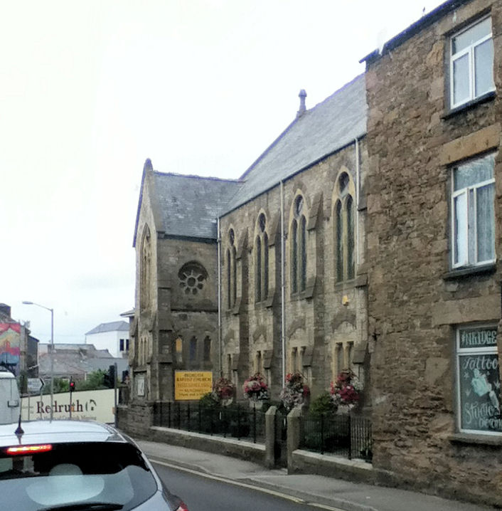