The Churches of Britain and Ireland
| Leek, Staffordshire
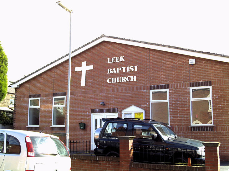
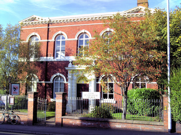
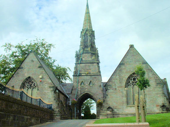
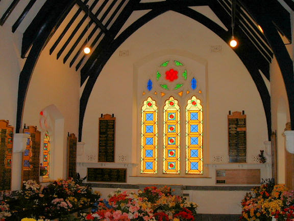
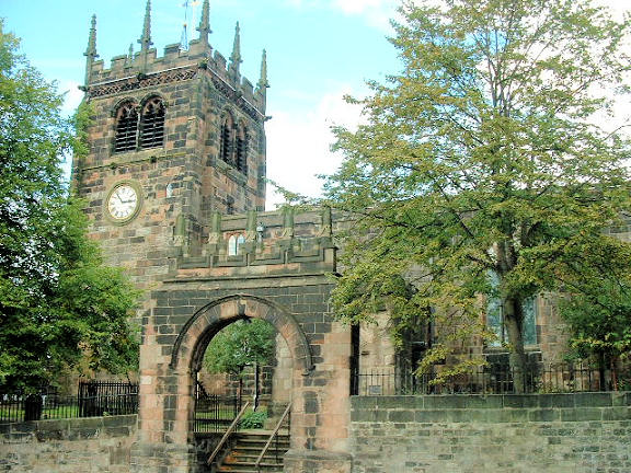
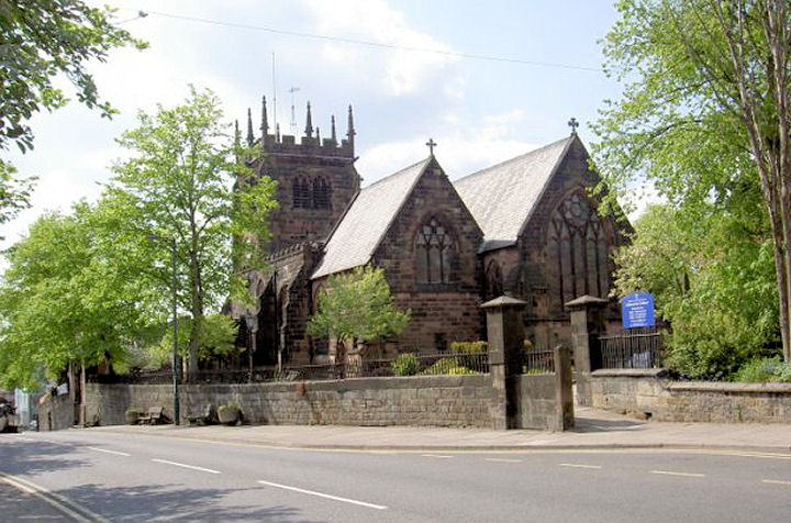
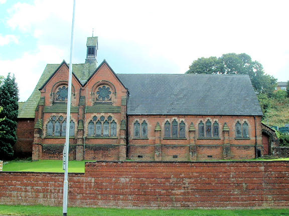
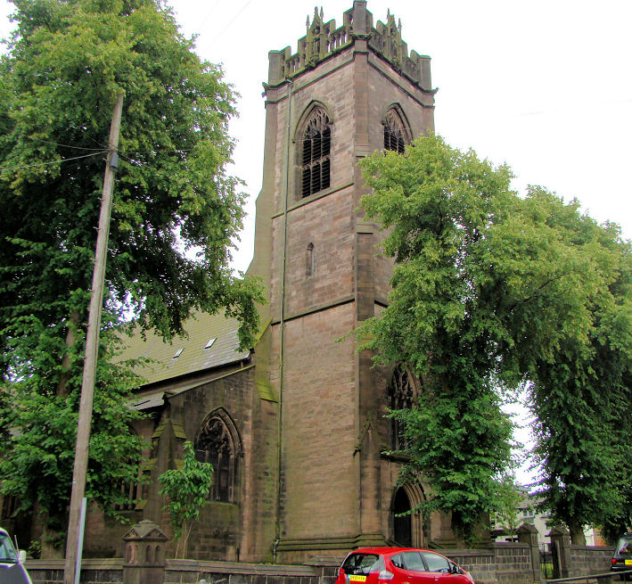
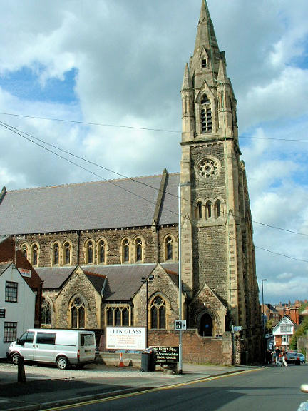
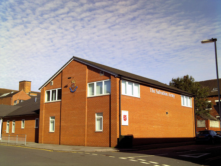
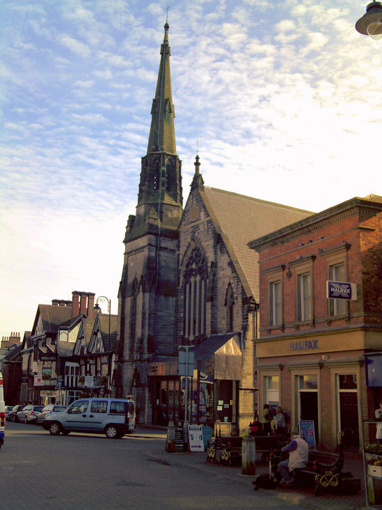
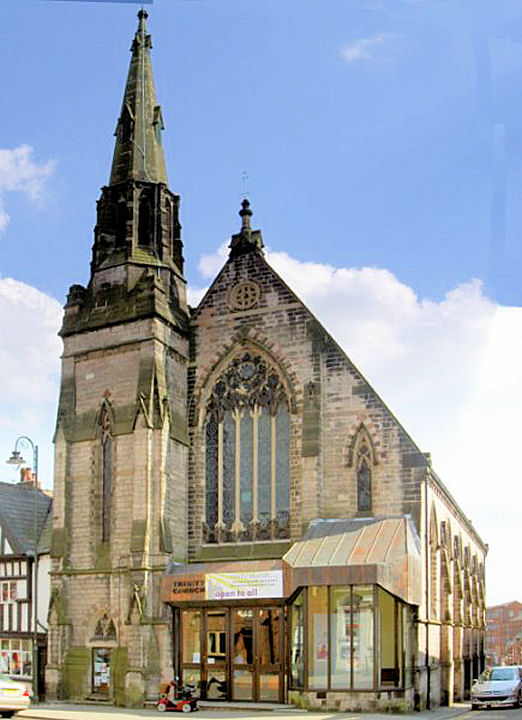
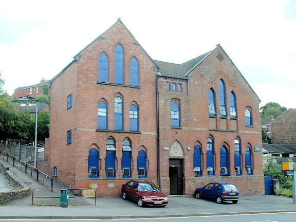
All Saints on Compton and Southbank Street. The church website opens with an interior view. SJ 9850 5613. © Mike Berrell. Grade I listed. The former Ball Haye Green Wesleyan Methodist Chapel (now residential) stands between Milk Street and Prince Street, seen by the Streetview van in 2009 and 2017. SJ 9893 5706. The Friends' Meeting House (as seen by Streetview in 2009, behind the tall tree) stands on Overton Bank at SJ 9819 5656. Grade II listed. The boundary wall is listed separately, also as grade II. The Kingdom Hall of Jehovah's Witnesses on Nelson Street was seen by the Streetview van in 2009. SJ 9884 5712. Leek Baptist Church on Rose Bank Street. SJ 9875 5674. © Gervase N. E. Charmley (2009). Leek Pentecostal Church on West Street. The building was formerly The Mount Wesleyan Methodist School (old photos here and here). SJ 9807 5661. © Gervase N. E. Charmley (2009). Link. A Methodist New Connexion Chapel once stood on Ball Haye Street and Queen Street, at SJ 9870 5655. Later Bethesda United Methodist, it seems to have been demolished by the mid-1970's, though it had ceased to be a chapel 10 or 15 years earlier. When the Streetview van passed the site in 2009 it was in use as a car park. There are two Mortuary Chapels in Leek Cemetery, Condlyffe Road. In the photo, the chapel to the left of the entrance is Anglican, the other is Nonconformist. Interior view of one of the chapels. SJ 9844 5587. © Mike Berrell. Grade II listed. The entrance gates and gate piers are listed separately, also as grade II. A Primitive Methodist Chapel stood on Fountain Street at SJ 9875 5651. Dating detail is available here, as is a photo of the chapel - built 1836, re-built 1884, closed 1949 (when the congregation moved to the New Connexion Chapel; see above), and was subsequently used as offices and was demolished in the early 1970's. Another photo can be seen here. Its My Primitive Methodists entry has a contradictory date for it of 1861. The building which replaced it (hardly an improvement....) can be seen here, from the Streetview van in 2009. St. Chad is a retreat house (a converted terrace property) with its own chapel, at SJ 9875 5620. Link, dates it to 1998. Streetview only saw the rear of the terrace in 2011; St. Chad possesses the middle of the three parallel chimneys. St. Edward the Confessor on Church Street, the only medieval church in the town. SJ 9832 5662. © Mike Berrell. Another view, © Alan Blacklock (2010). Link. Grade II* listed. St. John on Mill Street. Strangely, all available maps show it as a school. SJ 9775 5690. © Mike Berrell. Another view, from Streetview in 2017. Since Mike's photo was taken, the church has been forced to close - news story. Closure announcement in 2020. A photo of the church choir in 1893 is available here. St. Luke on Fountain Street. SJ 9882 5654. © Graeme Harvey (2010). Link. Grade II* listed. St. Mary (R.C., 1886-7) on Compton Road. SJ 9840 5626. © Mike Berrell. Grade II listed. A short history of modern Catholicism in Leek can be found here, wherein it says that a chapel existed on Fountain Street by 1860, when the arrival of a new priest is noted for that year. He soon established a Convent, also on Fountain Street. Whether anything survives of these, and their exact location, is so far unclear. A new Convent was established on King Street in 1862 in a pre-existing house (now a B&B - it's website says the convent was closed in 1978), followed by a new Chapel, also on King Street, in 1864. The former convent stands at SJ 9837 5620, immediately west of St. Mary, and it can (just) be seen in a 2015 Streetview. The chapel - St. Mary and St. Joseph, stood at SJ 9837 5620. Following the opening of St. Mary, it continued in use as the church hall, but was ultimately demolished and replaced by the building seen in this 2015 Streetview. St. Paul on Novi Lane, as seen by Streetview in 2011. SJ 9953 5715. Link. Salvation Army Hall on Salisbury Street. SJ 981 564. © Gervase N. E. Charmley (2009). Trinity United Church (Methodist and U.R.C., originally Congregational). SJ 9847 5655. © Gervase N. E. Charmley (2009). Another view, © Alan Blacklock (2010). The former Wesleyan Chapel and Ragged School on Mill Street dates from 1876, and is now in secular use. Earlier maps show it only as a school. SJ 9788 5684. © Mike Berrell. A now demolished Wesleyan Methodist Chapel stood on Mount Pleasant at SJ 9820 5670. It pre-dates a map of 1879, and seems to have survived until at least the mid-1970's. Streetview saw the block of flats which now occupies the site in 2011. Another Wesleyan Methodist Chapel (later Brunswick Methodist) stood on Market Street at SJ 9855 5655. It also pre-dates a map of 1879, but had been demolished before the revision of a map dated 1975-93. A map of 1975-1993 (and no other) marks a PW (place of worship) on the south side of Buxton Road at SJ 9912 5670. Its affiliations are so far unknown. The building was seen by Streetview in 2016.
|
||
04 March 2023
© Steve Bulman
Contact Details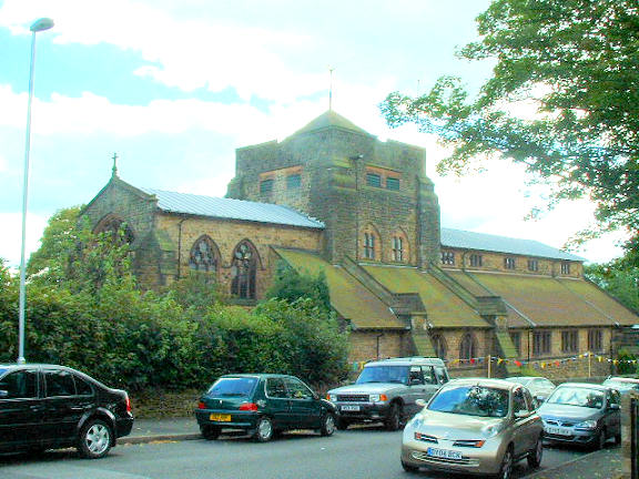