The Churches of Britain and Ireland
| Kendal, Cumbria
This
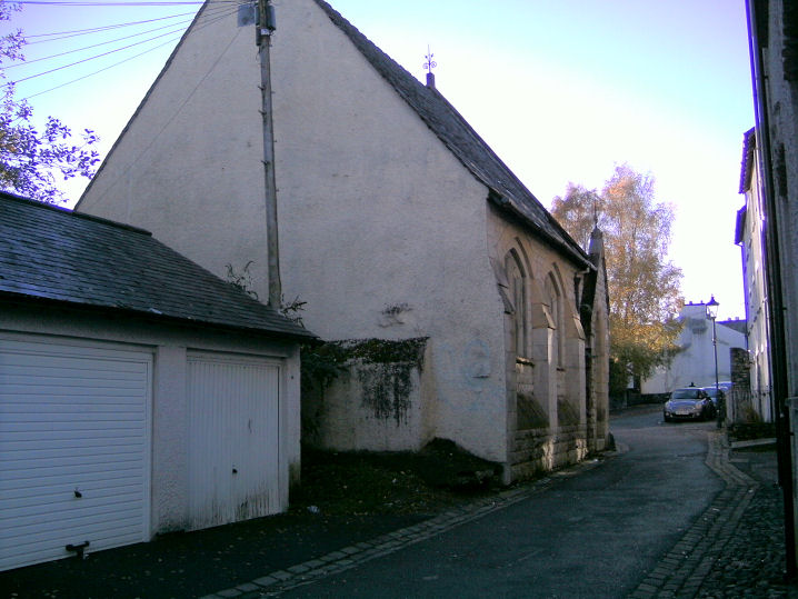
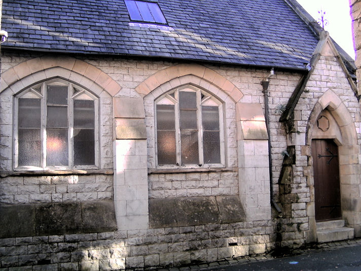
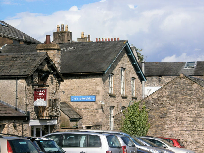
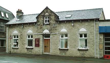
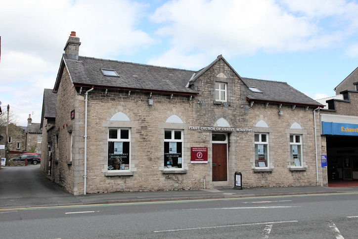
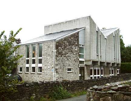
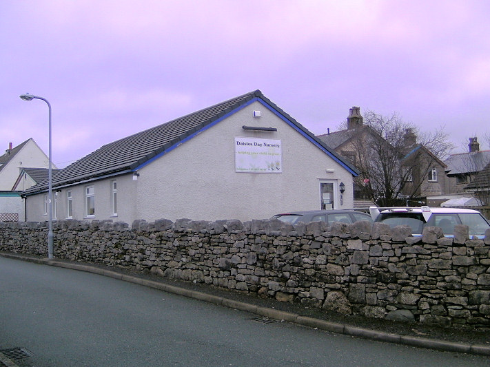
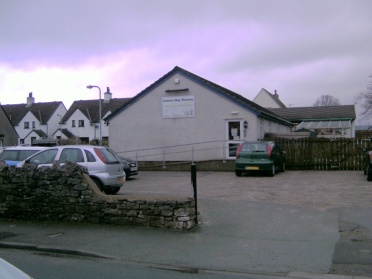
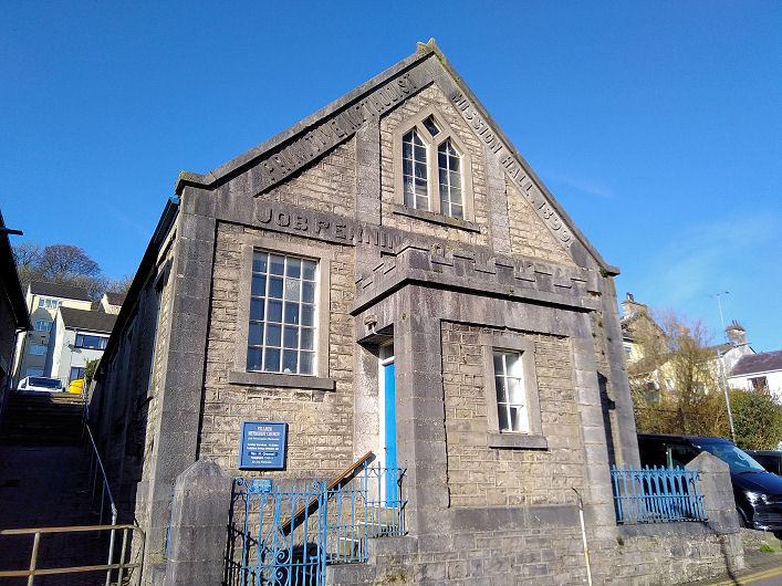
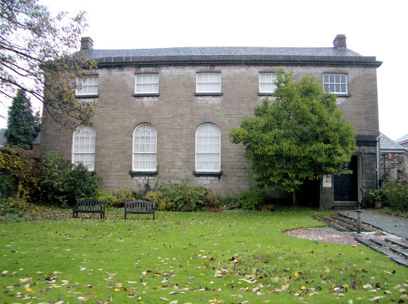
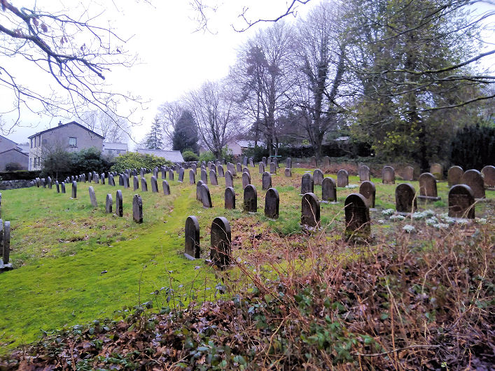
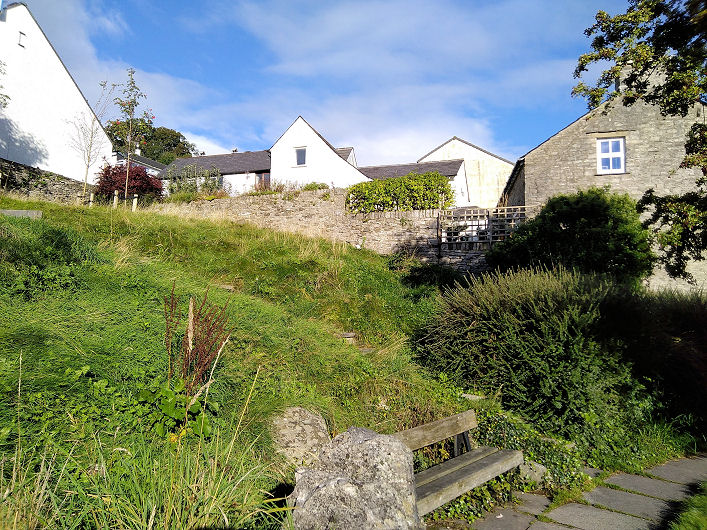
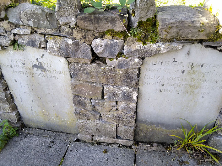
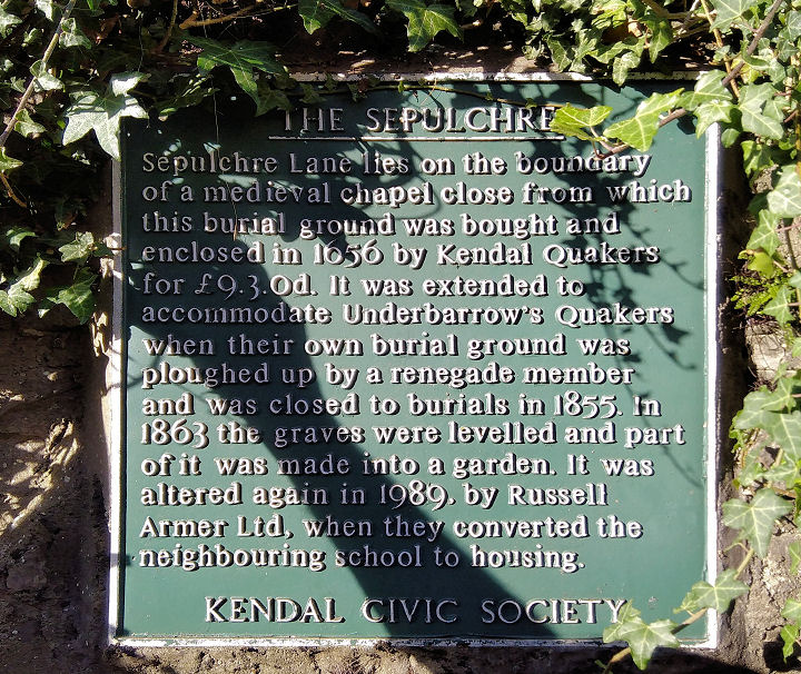
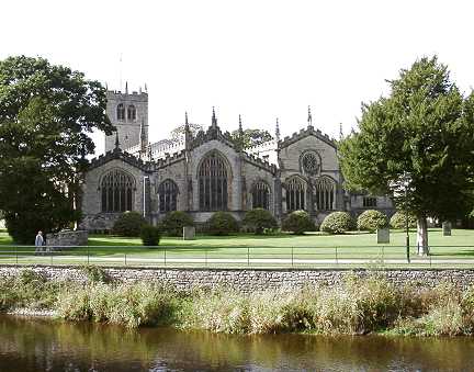
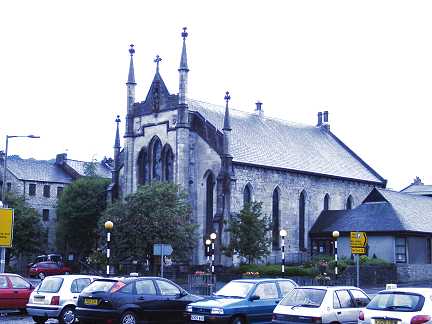
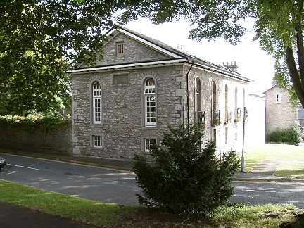
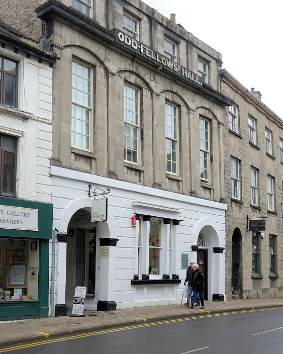
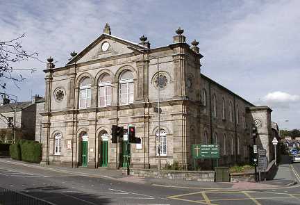
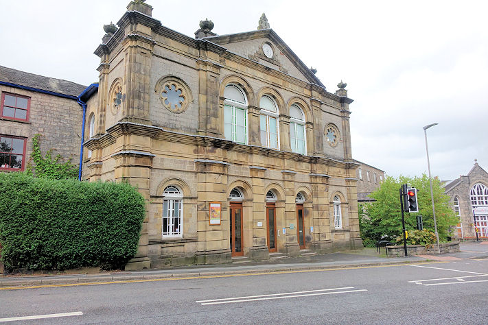
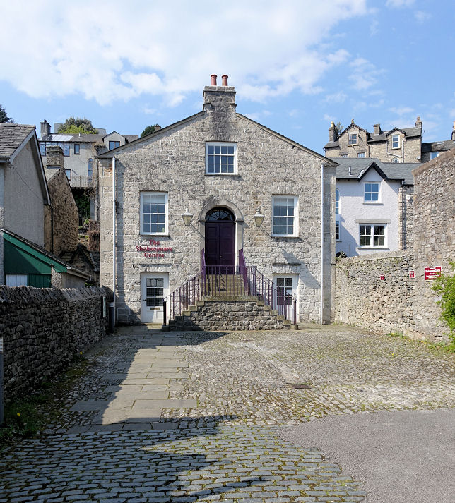
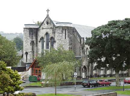
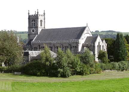
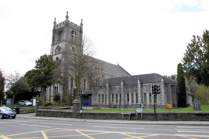
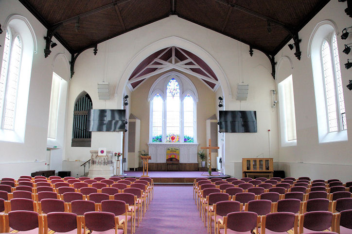
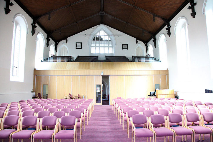
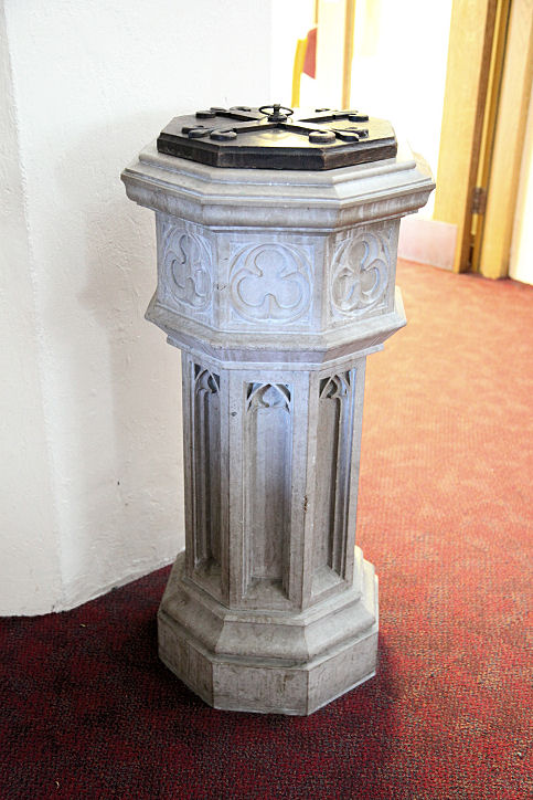
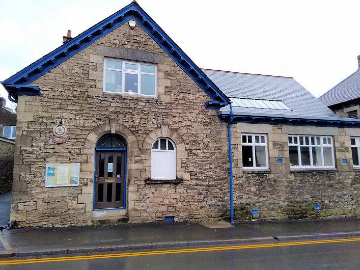
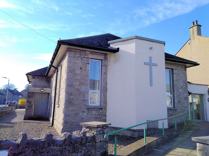
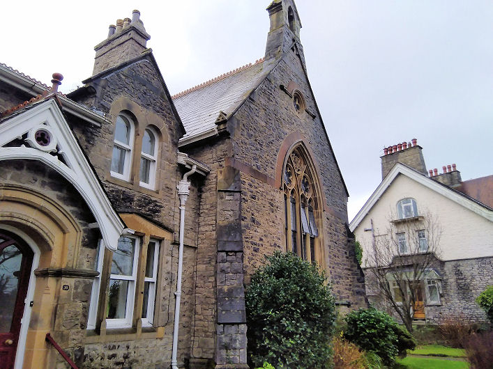
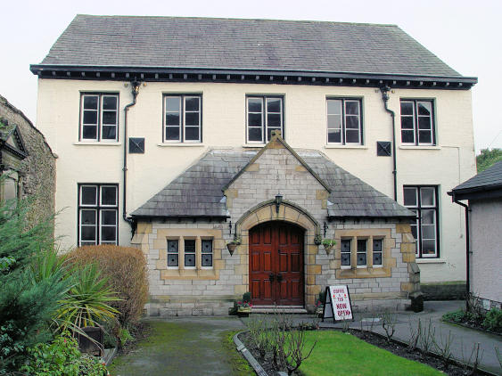
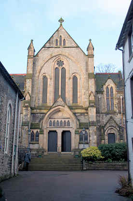
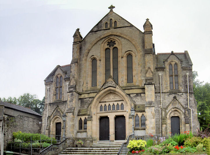
source has provided many of the dates below. The former All Hallows, now a private residence. Its Genuki entry dates it to 1864-2002. SD 5126 9272. © George Weston. Bethel Pentecostal Church (Assemblies of God) on Chapel Lane was originally a private house (1790-1872). There followed several decades as Kirkland Methodist Chapel (1872-1919), and a return to secular use from 1919 until 1964, when the current occupiers took over. Another view. Both © Kevin Price (2013). The Cemetery which straddles Parkside Road has two Mortuary Chapels. The cemetery opened in 1955, and presumably the chapels are of roughly the same date. The Church of England Chapel sits to the north of the road at SD 5206 9197, and the Nonconformist Chapel is to the south, at SD 5206 9194. Both chapels as seen by the Streetview van in 2018. Link. Christadelphian Church on Lowther Street. This is the rear of the building. The front is probably visible here (note cross in window) on Google Maps. The building is certainly older than their occupancy - the 1975 OS map shows it as a bakery. SD 5217 9261. © Howard Richter (2014). First Church of Christ, Scientist on Sandes Avenue. SD 5157 9305. © George Weston. Another view, © Dennis Harper (2016). Evangelical Church. © George Weston. The former Exclusive Brethren Meeting Room on Crescent Green. It had quite a short life - built in 1967 (it superseded a former chapel in Bluecoats School Yard off Highgate) it later closed, and was sold in 1980. It has since been in commercial use, and is presently a nursery. The congregation joined with the Lancaster Meeting, on Powderhouse Lane. Another view. Both © Kevin Price (2012). Fellside Methodist Church on Low Fellside. The gable displays the text "Primitive Methodist Mission Hall 1899" and "Job Pennington Memorial Chapel". SD 5130 9274. © Alan Marsden (2022). Link1. Link2. Friends Meeting House (1816) on Stramongate. There had been an earlier meeting on Sepulchre Lane of 1688, but I haven't been able to locate its site exactly. SD 5177 9280. © George Weston. Link. Grade II* listed. A Friends Burial Ground stands on Sedbergh Road at SD 5273 9275. © Alan Marsden (2022). The site of Sepulchre Lane Burial Ground. Some headstones survive, and a plaque gives a little history. All © Alan Marsden (2022). Holy Trinity. From an old postcard (franked 190?) in Steve Bulman's Collection. A modern view, from across the river. © George Weston. Link. Grade I listed. Holy Trinity & St. George (R.C., 1835). SD 517 928. © George Weston. Grade II* listed. Howard Richter advises that there was an Independent Chapel on Lowther Street, mentioned as such on the 1859 OS map, and Ch. on the 1898 and 1914. By the time of the 1938 edition it was in use as offices. What may be the building is visible here on Google Maps. Inghamite Chapel - dates 1842-1969, now converted to flats. SD 511 924. © George Weston. Oddfellows Hall on Highgate has a plaque saying that it was for a time a Kingdom Hall of Jehovah's Witnesses. Circa SD 5150 9238. © Steve Bulman (2023). The present Kingdom Hall (2021 Streetview) stands on Gilthwaiterigg Lane at SD 5212 9439. Methodist Church on Windermere Road. Older maps label it as Wesleyan. It's dated here to 1882-3, built on the site of its predecessor of 1808 (there's also a reference to a book containing an image of the earlier chapel). SD 5135 9322. © George Weston. Another view, © Steve Bulman (2023). Link. New Life Community Church on Shakespeare Yard, off Highgate. Built as a theatre in 1829, it didn't last very long, and had a variety of uses until it became the church in 1994. SD 514 924. © Steve Bulman (2014). St. George (built 1838-41) on Castle Street. © George Weston. Link. Its predecessor of the same name stood on Market Place, and is dated here to 1755-1855 (demolished). It also says it stood near the present war memorial, which can be seen here on a 2018 Streetview. A photo is available here (where it says it was built in 1754). Circa SD 515 928. St. Thomas on Stricklandgate. SD 5137 9315. © George Weston. Another view, two interiors - 1, 2, and the font, all © Dennis Harper (2016). Link. Grade II listed. The Salvation Army Church on Gillinggate. Originally a Friends' Meeting House of 1834 (one of two in Kendal at that time), was Methodist 1939-66. After a secular spell as a youth club, it became S.A. in the 1980's. SD 5141 9225. © Alan Marsden (2022). Link. Sandylands Methodist Church (1937) stands at the junction of Sandylands Road and Sandgate. SD 52331 9324. © Alan Marsden (2022). Link. The former Sleddall Chapel on Aynam Road is attached to a row of almshouses, built in 1887 by John Sleddall. Services were held here, serviced from Holy Trinity, until 1986, whereafter it was converted into housing. © Alan Marsden (2022). Unitarian Chapel. SD 5163 9282. © Steve Bulman. Link. Grade II* listed. A United Presbyterian Church (St. John) stood at one time on Sandes Avenue. This source (for which see for the complicated and splintering Presbyterian presence in Kendal) provides a date of 1897, with demolition in the 1980's. SD 5164 9308. Its site - the corner plot - can be seen here on a 2018 Streetview. U.R.C (1898) built as Zion Congregational. SD 514 924. © George Weston. Another view, © Alan Blacklock (2011). Grade II listed.
|
||
22 January 2024
© Steve Bulman
Contact Details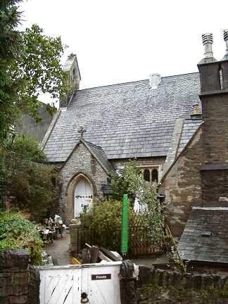