The Churches of Britain and Ireland
| Forest Gate, Greater London
Barclay Hall, on Green Street and St. George's Road, was built for the Society of Friends in circa 1906. It was sold in 1948 to the local council. Its Wikipedia entry says it was used for "various religious, social, and educational activities". © P. L. Kessler (2013) / The History Files. Emmanuel Church stands on Upton Lane and Romford Road. It predates the 6" O.S. map of 1898, and was seen by Streetview in 2020. TQ 4061 8499. Link. Ridley Community Church on Upton Lane pre-dates a map of 1897. Streetview saw it in 2021. The earliest Streetview, of 2008, shows that it was Ridley Christian Centre (London City Mission) at that time. TQ 4058 8466. St. Anthony of Padua (R.C.) on St. Anthony's Road and Lancaster Road. The Restoration Project page of the church website dates it to the 1880's. TQ 4054 8424. The site of
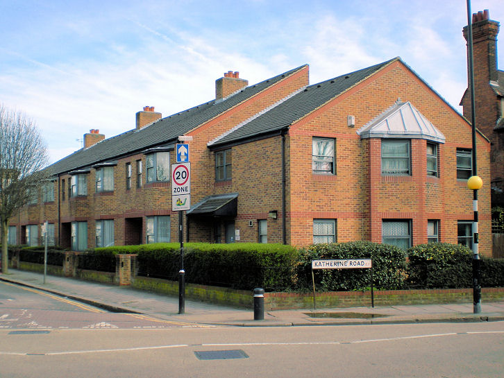
St. Edmund, King and
Martyr. It stood at the junction of
Katherine Road and Halley Road. Built in 1901, it closed in 1988 and was
subsequently demolished, since when the adjacent vicarage (seen at the
extreme right of the photo) has been used for services. © P. L. Kessler / The History
Files.
Link. A small photo of the demolished church can be seen
here. A little way east of Emmanuel is Woodgrange Baptist Church, seen here by Streetview in 2021. TQ 4074 8507. Link, wherein it's dated to 1882.
|
||
04 March 2023
© Steve Bulman
Contact Details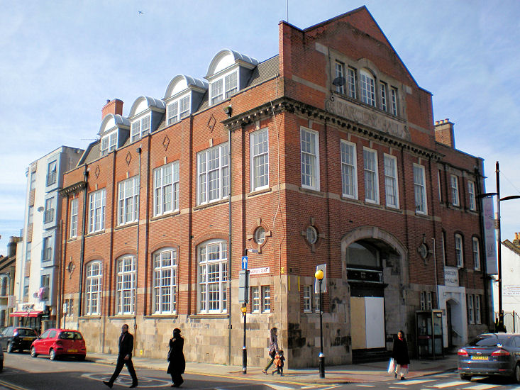