The Churches of Britain and Ireland
| Edinburgh:
Old Town Edinburgh Old Town on Wikipedia.
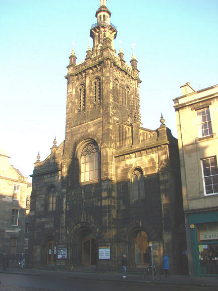
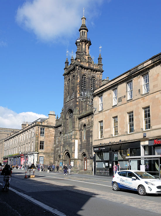
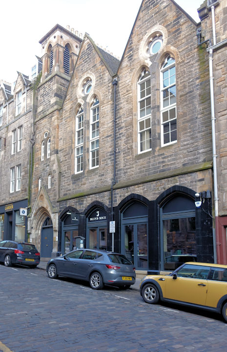
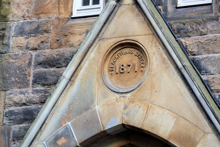
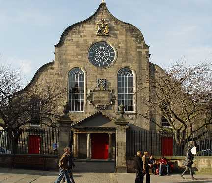
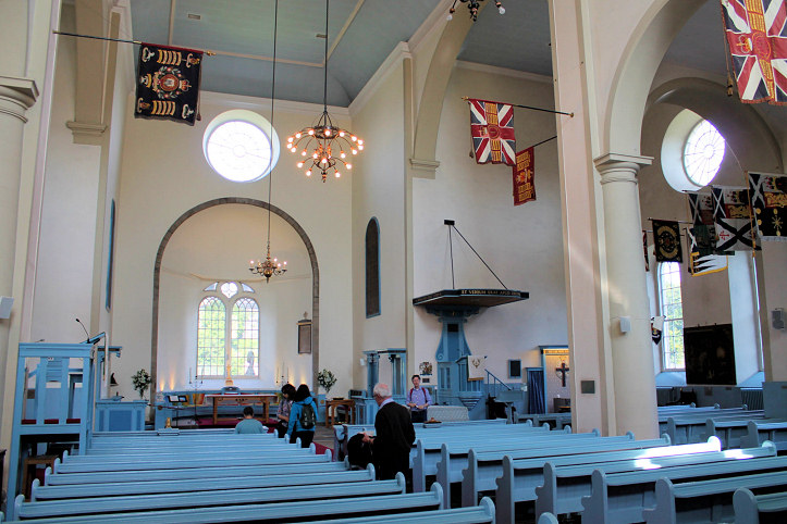
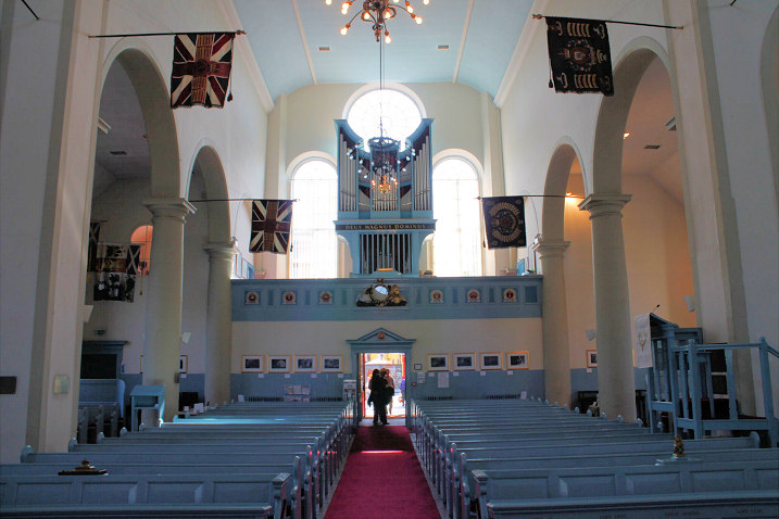
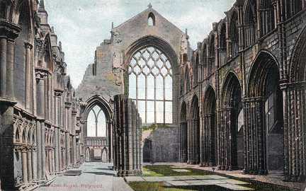
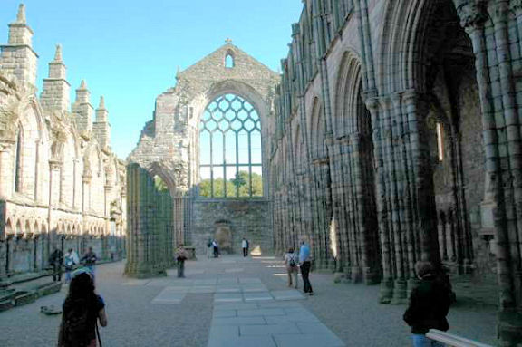
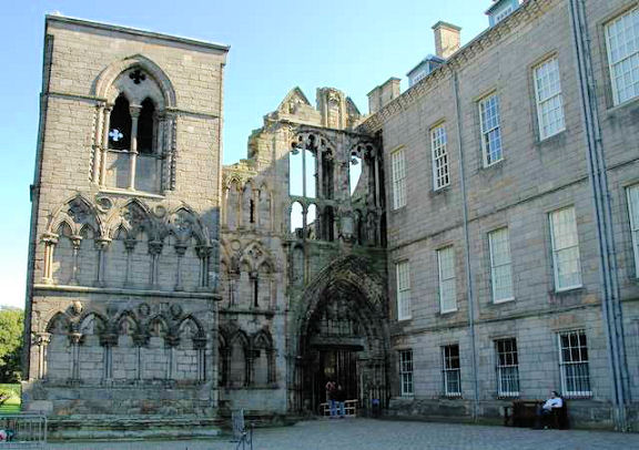
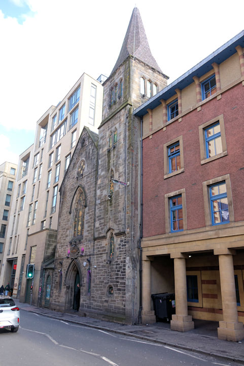
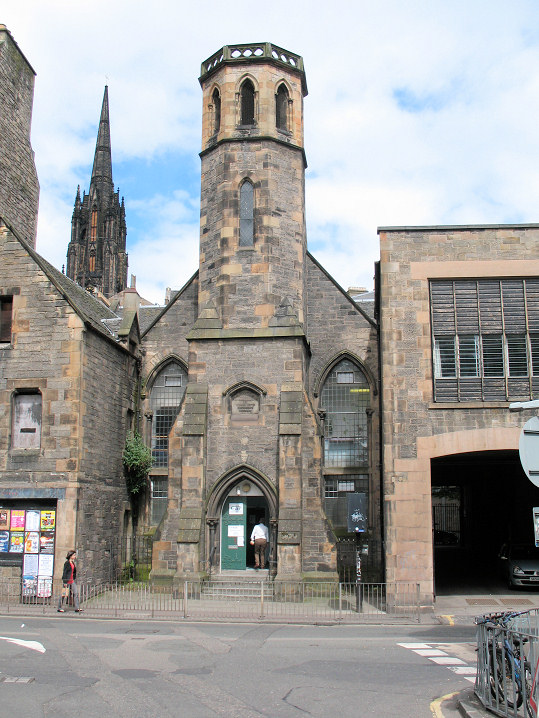
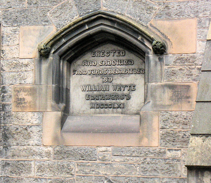
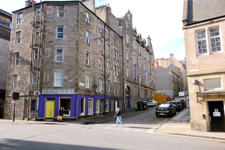
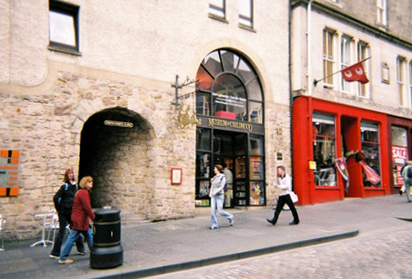
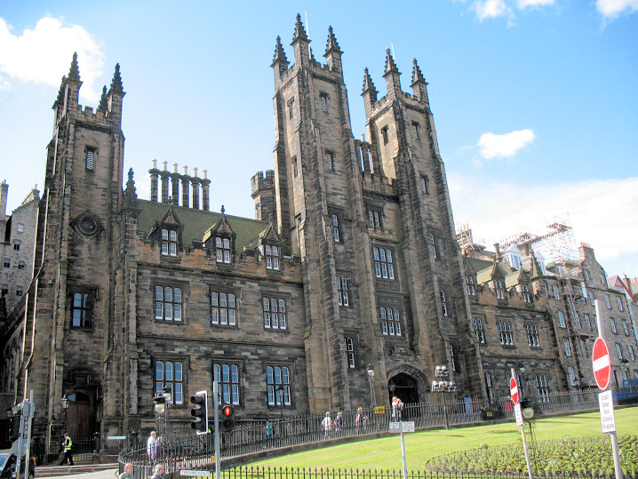
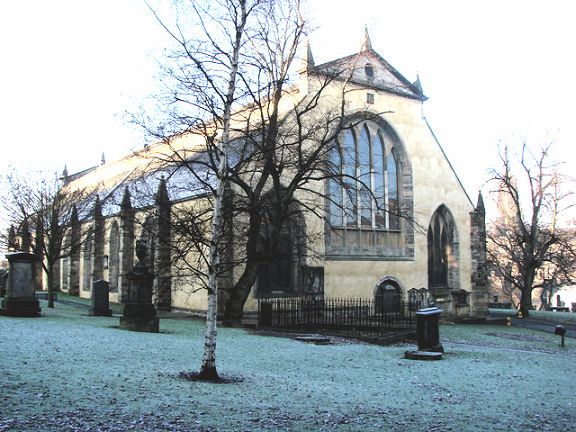
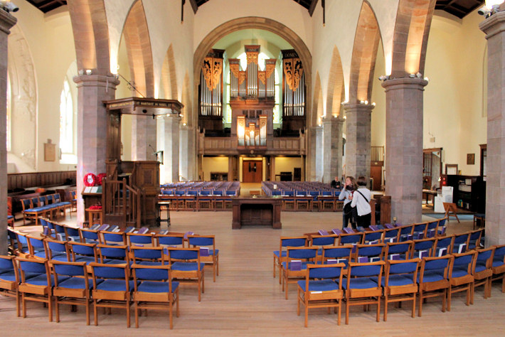
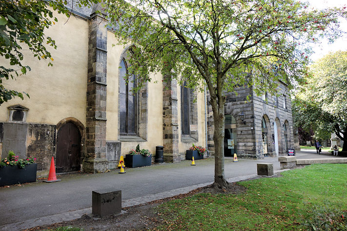
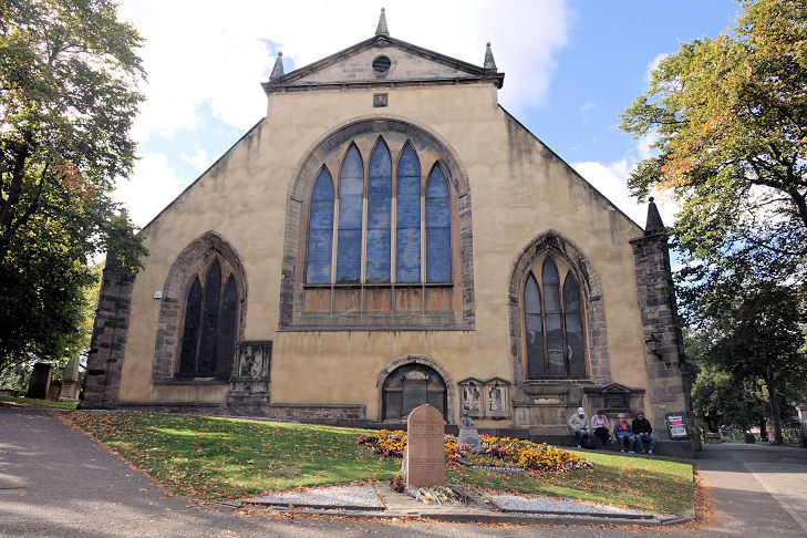
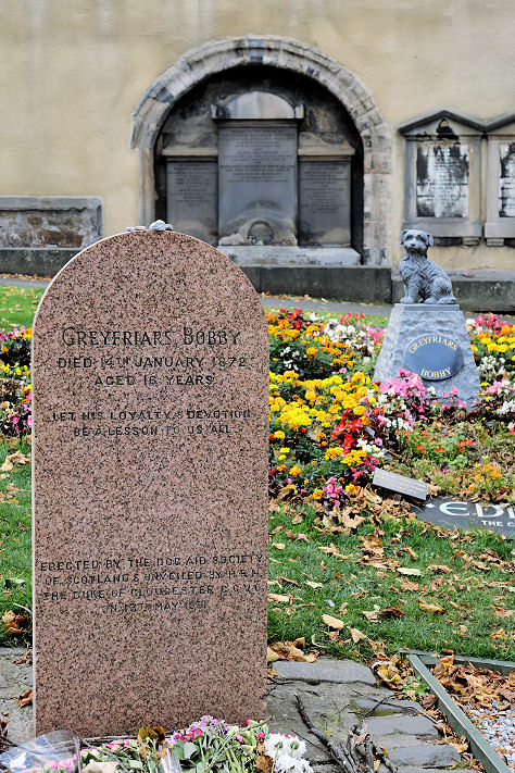
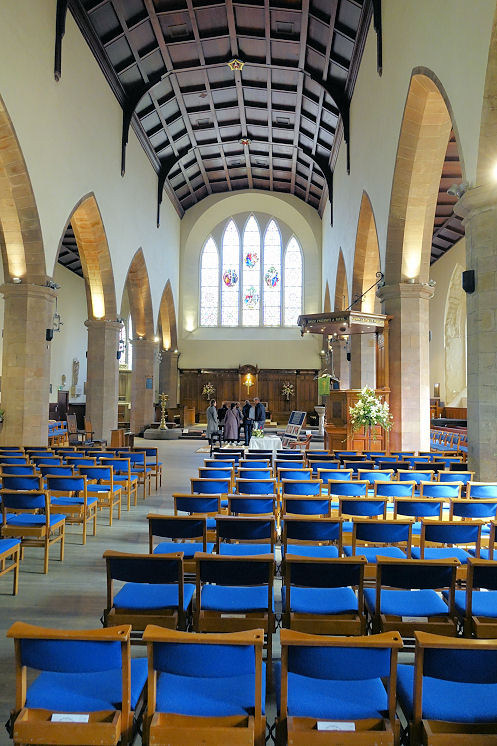
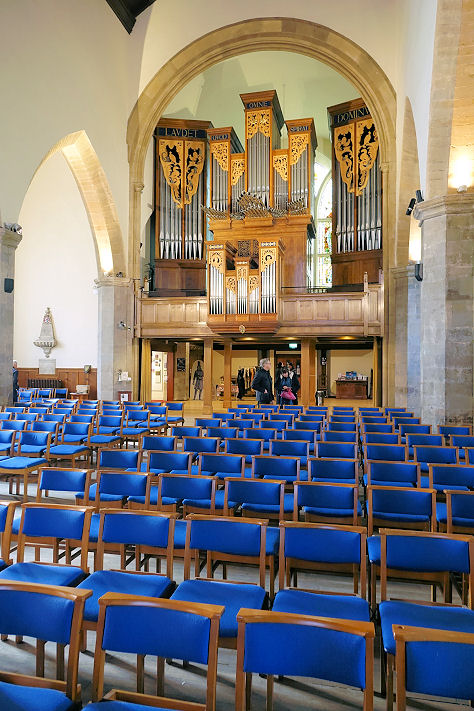
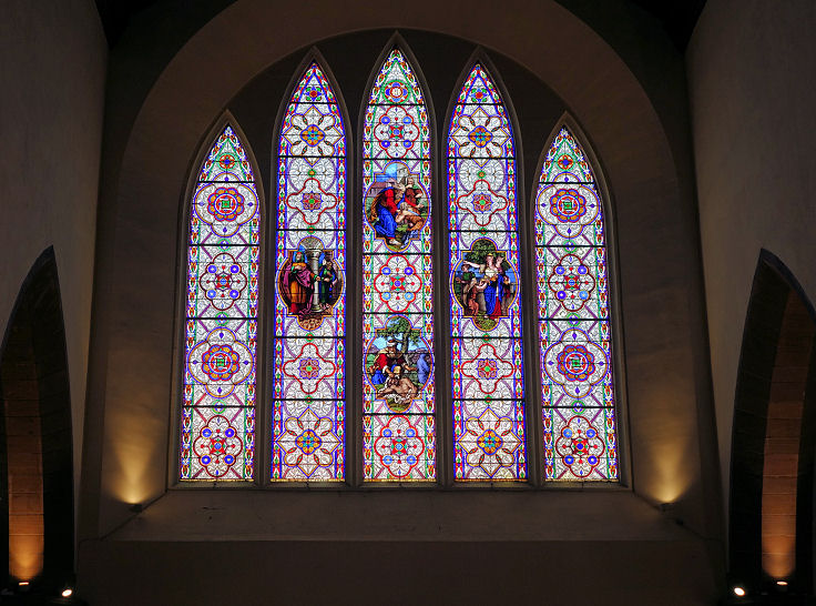
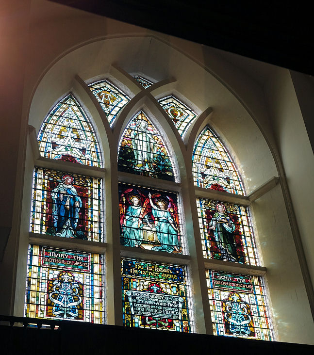
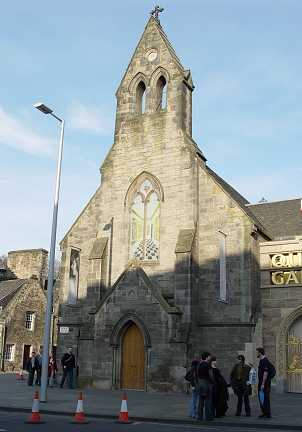
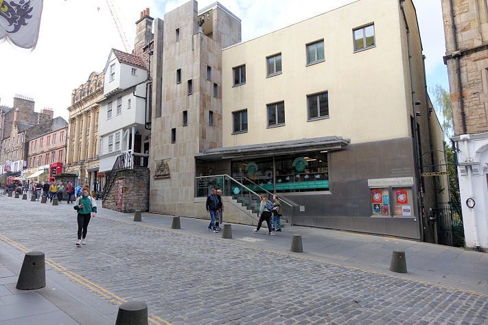
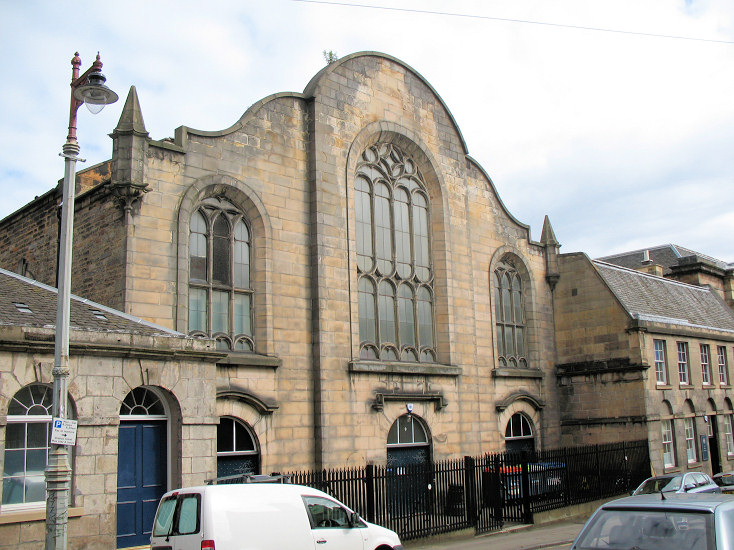
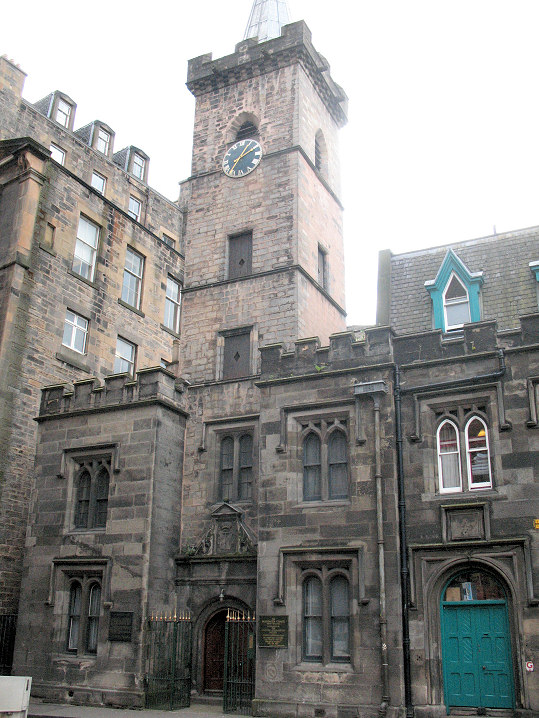
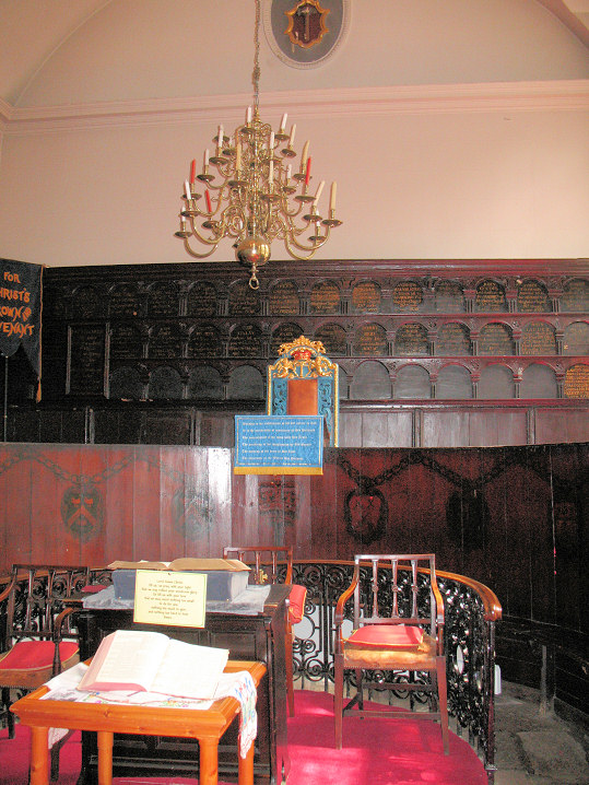
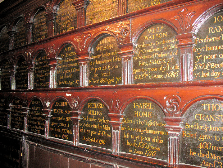
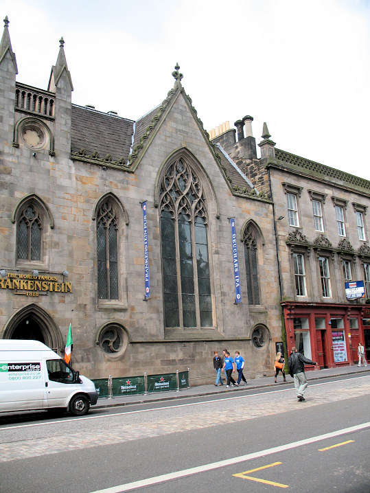
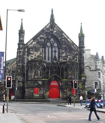
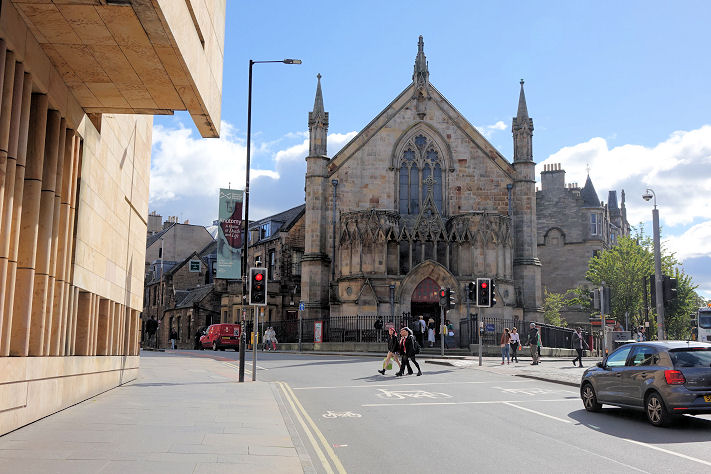
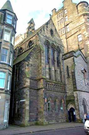
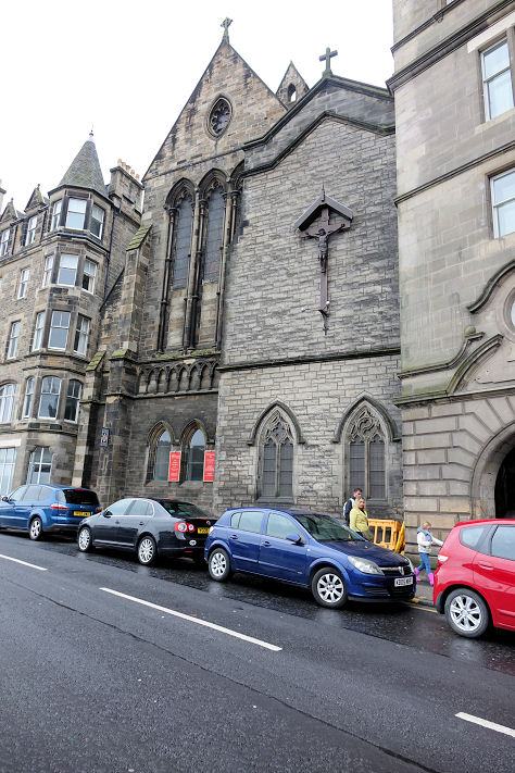
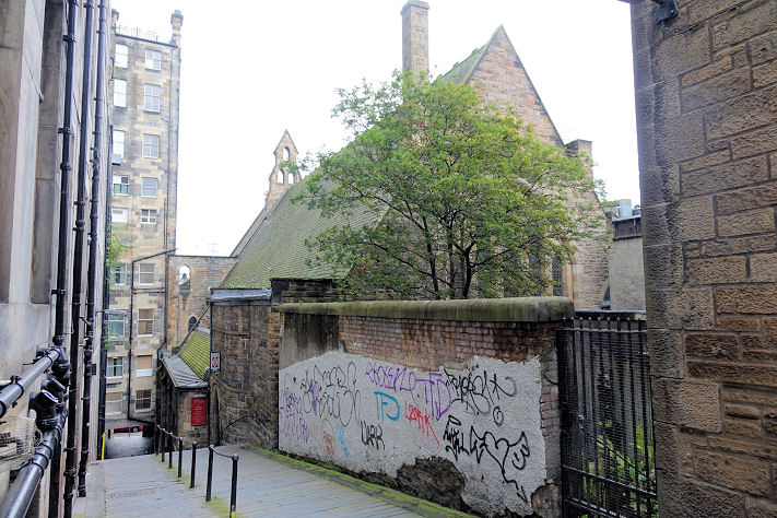
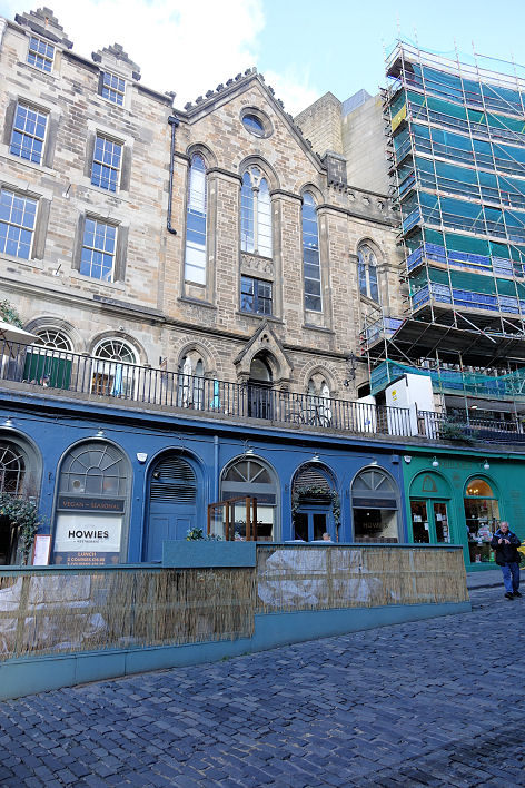
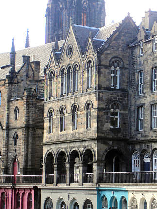
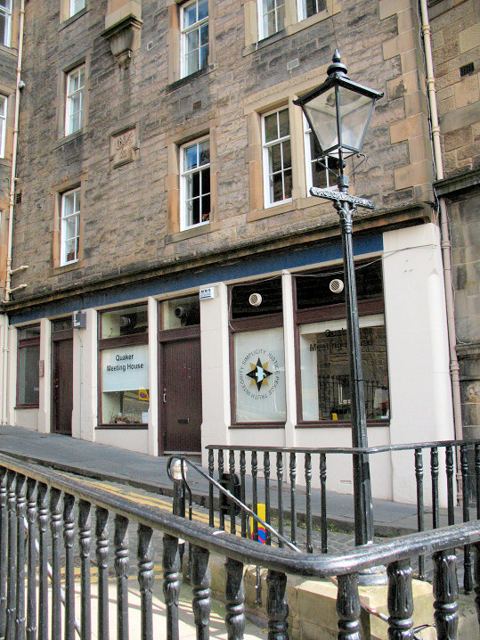
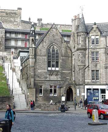
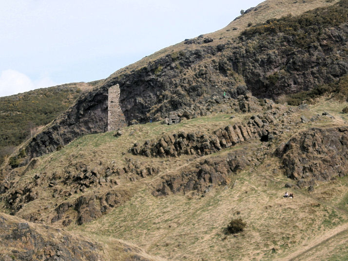
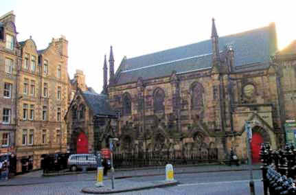
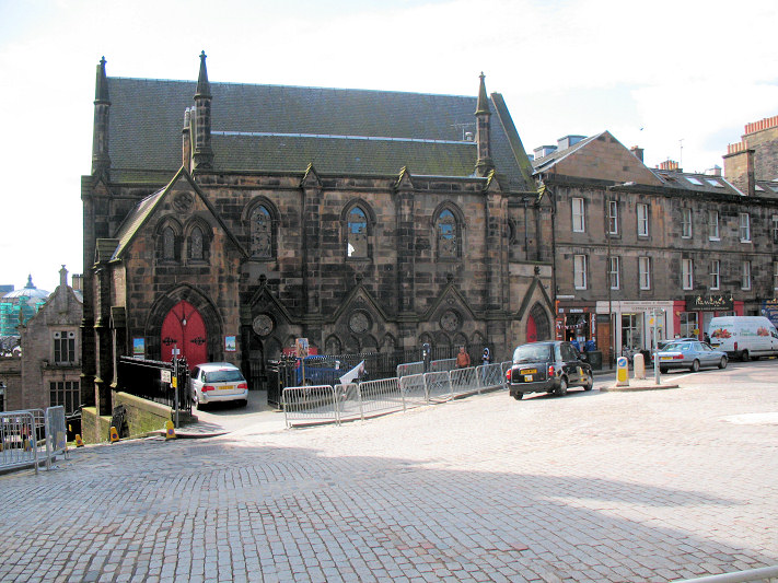
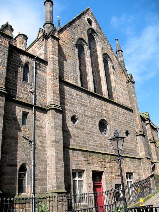
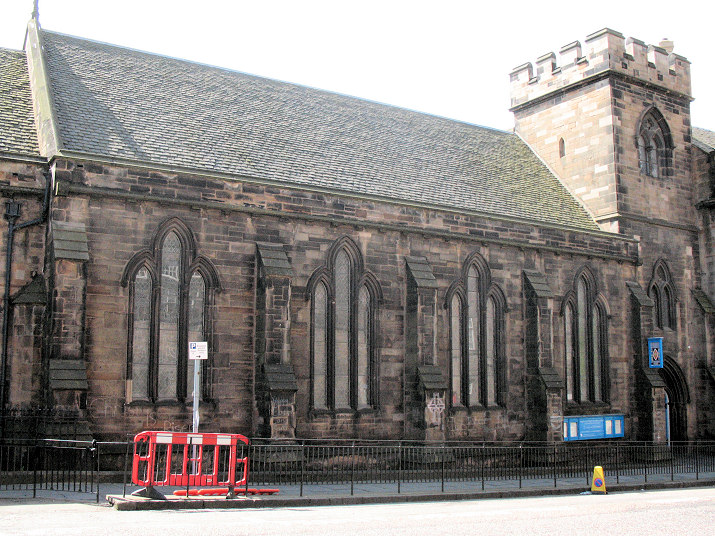
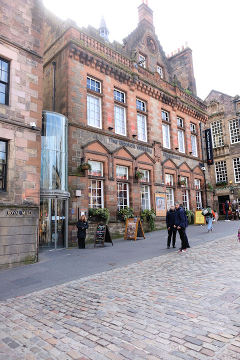
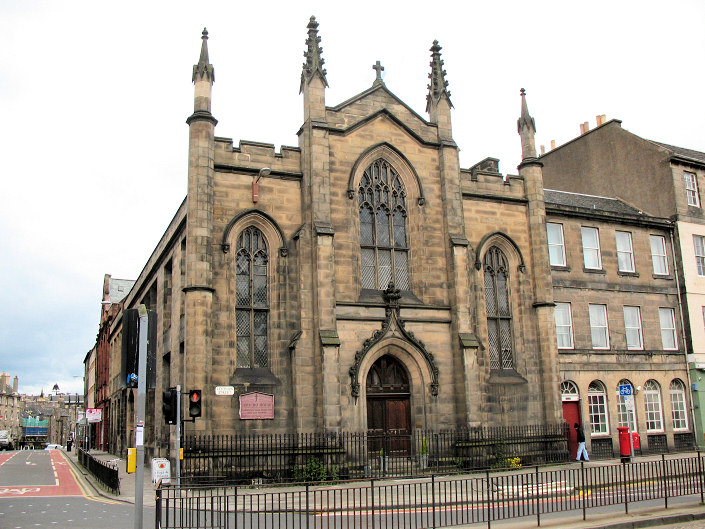
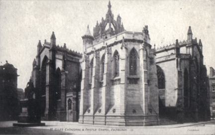
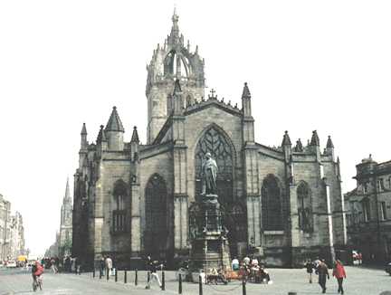
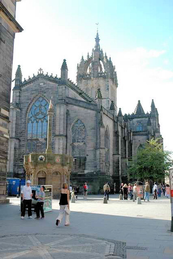
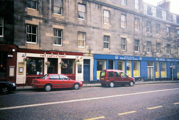
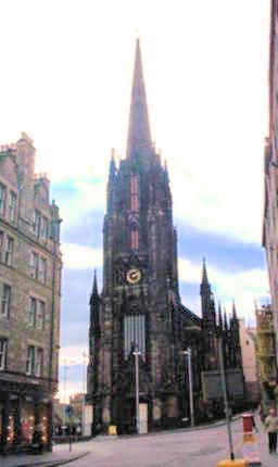
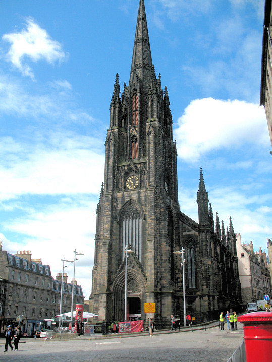
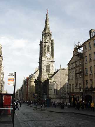
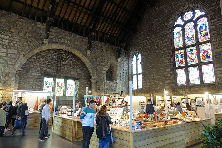
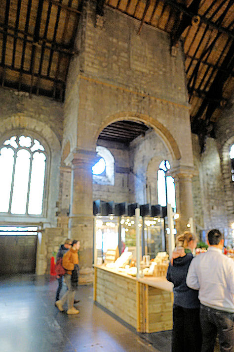
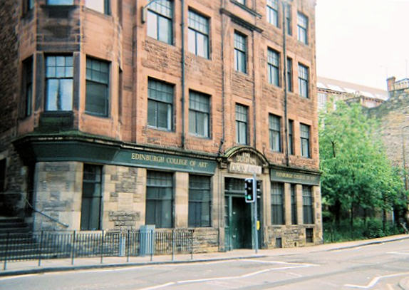
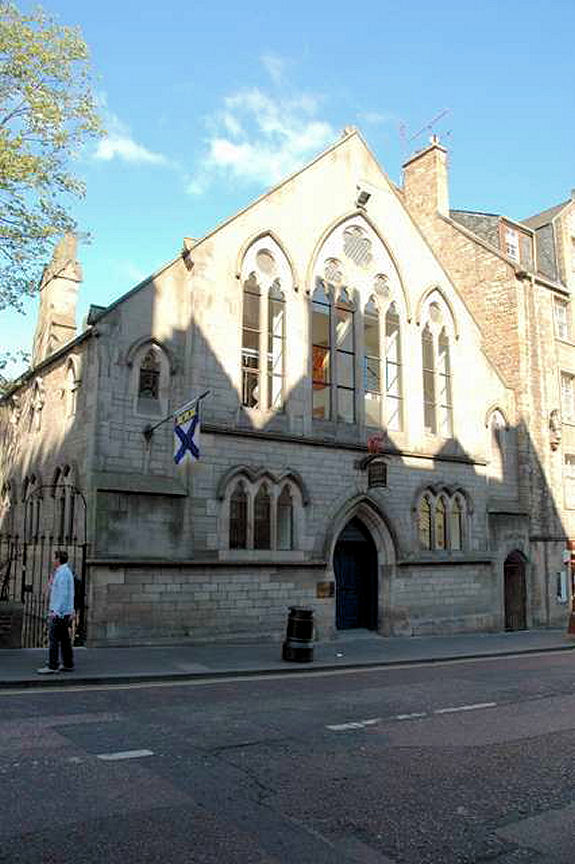
The former Blackfriars Street United Presbyterian Church has a date-stone for 1871. NT 2605 7363. Both © Steve Bulman (2024). More photos (including interiors) are available on its Canmore entry. Old maps show, attached to the south-eastern corner of the U.P. Church, a Mission Hall. This Streetview from 2020 shows the rear of the U.P. Church right of centre. The ghost roofline about half way up the church wall may be from the Mission Hall - the hall stretched from the U.P. church to the modern wall at the left. NT 2606 7361. Just yards away stood another Mission Hall, fronting on to South Grays Close. In a 2020 Streetview it stretched from the white building at the centre of the view towards the camera, ending roughly where the ambulance is. NT 2607 7364. Canongate Church (1691, CoS, open daily in summer). © Steve Bulman. Two interior view - 1, 2, both © Charles Clegg (2012). Link. Carrubbers Christian Centre (non-denominational) on High Street. Older O.S. maps label it as a Mission Hall. NT 2606 7371. © Alan Craxford. Link. The ruins of the Chapel Royal, better known today as Holyrood Abbey. From an old postcard in Steve Bulman's Collection. A modern view, and another view, both © Alan Craxford. The former Cowgate Free Church (1859-60), now a nightclub. It has also been a theatre. NT 2592 7347. © Janet Gimber (2012). Another view, © Steve Bulman (2024). The former Cowgatehead Free Church (1861- date-stone) on Cowgate, now in use as a clinic. NT 2557 7342. Both © Janet Gimber (2012). Link. A map of 1854 marks Site of Episcopal Chapel (1722) on the west side of Blackfriars Street (then Blackfriars Wynd) at NT 2605 7354. In a modern photo of Blackfriars Street from Cowgate, the site of the church stretches along the left side, not including the corner building, and about as far as the yellow skip. © Steve Bulman (2024). The former Edinburgh Canongate Salvation Army Hall, now the Museum of Childhood, on the Royal Mile. © Rob Brettle. Old large-scale O.S. maps show Free Breakfast Mission Hall on Old Fishmarket Close at NT 2583 7350. The dark sandstone building at the right in this 2015 Streetview, Pevsner calls it Edinburgh Sabbath Free Breakfast Mission, of 1888. Built as the Free High Church (1845-50), the building on Mound Place is now the General Assembly Hall of the Church of Scotland, and Theological College. © Janet Gimber (2012). Link. George Heriot's School on Lauriston Place has a Chapel. Streetview doesn't provide a satisfactory view, but a photo can (at the time of writing this) be seen here - scroll down. NT 2551 7317. The schools category A listing, which includes the chapel, dates the chapel to 1837 "probably .... by Pugin". Greyfriars Church (1614 and 1718, CoS, open daily) on Candlemaker Row. NT 2564 7327. © Bill Henderson. Interior view, © Charles Clegg (2012). Two more views - 1, 2, the grave marker of Greyfriars Bobby, two interiors - 1, 2, and two windows - 1, 2, all © Steve Bulman (2022). Link. The former Holy Trinity (2018 Streetview) on Chalmers Close, off High Street. Re-built in 1872 from stones taken from the medieval Collegiate Church of the Holy Trinity, which was demolished to make way for Waverley Station in 1848. An interesting BBC story, with illustrations of the old church, can be seen here. NT 2606 7375. The BBC story says that platform 1 of Waverley Station is where the medieval church stood. This grid. ref. is just a general one for the station - NT 258 739. Canmore entry. Holyrood Free Church (now a gallery) on Horse Wynd and Abbey Strand. NT 2680 7391. © Steve Bulman. Old maps show John Knox's Free Church, which used to stand immediately to the east of the surviving John Knox House on High Street. This source says it was demolished in the late 1960's. In this photo [© Steve Bulman (2023)], John Knox House is the projecting white building - the church stood to its right. The building on its site was seen by Streetview in 2023. The church itself can be seen (obliquely) here. Surely there must be a better photo somewhere? NT 2610 7370. The former Lady Yester's Church (1805) on Infirmary Street, now used by the university as its carpentry division. It stands near to the site of the original church (1647) which was built on the site of the Blackfriar's Monastery. The 1647 building was damaged by Cromwell's army in 1650. Janet suspects that the building at the left of the photo was a New Jerusalem Church - can you confirm? © Janet Gimber (2012). Link. Magdalen Chapel on Cowgate. Built in 1541 as an almshouse and guild chapel, it is now the HQ of the Scottish Reformation Society (link). Restored in 1992-3. Interior view. The panels around the walls records gifts of charity. NT 2562 7342. All © Janet Gimber (2012). The 1895 O.S. map shows it as St. Mary Magdalene's Chapel on Site of Hospital A.D. 1508. It's set further back from the road, and presumably now forms the rear part of Magdalen Chapel. NT 2563 7341. Link1. Link2. The former Martyr's United Free Church on George IV Bridge, now a pub. Pevsner in 1984 lists it as Elim Pentecostal Church, originally Reformed Presbyterian of 1859. NT 2567 7335. © Janet Gimber (2012). Moray Free Church is shown on old O.S. maps on Holyrood Road (then South Back of Canongate), at NT 2645 7363. An old photo of it can be seen here, and the site today on a Streetview from New College and Assembley Hall (as listed in Pevsner) on The Mound is the former Free High Church of 1845-50. It was seen by Streetview in 2023. NT 2546 7362. Category A listed. New North Free Church (now a theatre) stands at the junction of Bristo Place and Forrest Road. NT 2574 7322. © Steve Bulman. By 2022 it had benefitted from a clean, © Steve Bulman (2022). Old St. Paul's (Episcopal), Jeffrey Street. NT 25966 73767. © Bill Henderson. Two additional views - 1, 2, both © Steve Bulman (2019). Link1. Link2. Baden Powell House on Victoria Street is a former Primitive Methodist Chapel, of 1866 (source). The same source mentions that the congregation had previously met in Phoenix Hall, but I haven't been able to locate it. Circa NT 2560 7351. © Steve Bulman (2022). Quaker Meeting House on Victoria Terrace, © Alastair Cameron. Another view, taken from West Bow. © Janet Gimber (2012). Link. The former Robertson Memorial Church on Grassmarket, now in secular use. NT 2529 7335. © Steve Bulman. Category B listed, wherein it's dated to 1884. Old O.S. maps show St. Andrew's Chapel (Episcopal) on Holyrood Road (then South Back of Canongate), at NT 2644 7356. The university building on the site today was seen by Streetview in 2023. A distant view of the long ruinous St. Anthony's Chapel at NT 2755 7370, above St. Margaret's Loch. © Howard Richter (2013). Link1. Link2. A sketch (on the Tate website) by Turner dated 1834 shows it little different to how it appears today. St. Columba (Free Church,1845) on Johnston Terrace. © Bill Henderson. Two further views - 1, 2, both © Janet Gimber (2012). Link. St. Columba's-by-the-Castle on Johnston Terrace (Scottish Episcopal) is dated to 1846-7 by Pevsner. NT 2546 7346. © Janet Gimber (2012). Link. What was presumably its predecessor shows on a map of 1854 as St. Columba's Chap. & Sch. on Castlehill at NT 2544 7345. Replaced by Castlehill School (dated by Pevsner to 1896), it's now The Scotch Whisky Experience, © Steve Bulman (2024). The former St. Francis (R.C.) on Lothian Street. Now Jericho House, a care home run by the Jericho Benedictine Society. According to Pevsner, the frontage dates from 1834, though the church itself dates from a re-build of 1937. © Janet Gimber (2012). St. Giles on High Street. NT 2573 7358. From an old postcard in Steve Bulman's Collection. A modern view, © David Nicholson, and another, © Alan Craxford. A seemingly very old stone carved head is built into an interior wall. I haven't been able to find anything about it. © Steve Bulman (2026). The former St. John (CoS, 1838-40) on Victoria Street, now in commercial use. Severely damaged in a fire in 2009 (link). NT 2555 7348. © Janet Gimber (2012). Another view, © Steve Bulman (2019). Link. Canmore entry. Grade B listed. St. Margaret's Chapel in Edinburgh Castle. A video tour can be seen here. NT 2515 7350. Link, wherein it's dated to about 1130. A map of 1895 marks St. Mary's Chapel (Congregational) on Bell's Wynd at NT 2586 7359. I haven't been able to find anything further about it, and Streetview hasn't been down to see the building, or where it stood. St. Patrick (R.C.) on Cowgate. NT 2613 7359. © Steve Bulman. Category B listed, wherein it's dated to 1772-4. Old O.S. maps show St. Thomas's Chapel (Episcopal) bounded by Gibb's Close, Gullan's Close and Boyd's Entry, off St. Mary's Street. Demolished, it's now a parking area, seen by Streetview in 2020. NT 2621 7366. Former Salvation Army Slum Post on Johnston Terrace (the blue door and the floor above the Castle Arms). © Rob Brettle. Rob advises that this is a rare survival - most Slum Posts having been demolished along with the slums they were intended to serve. Seventh-day Adventist Church on Bristo Place, as seen by Streetview in 2023. Pevsner advises that it was originally Evangelical Union, of 1900, with the church on the first floor. The plaque above the round-arched doorway reads Bristo Place Adventist Church. Pre-1900 maps show that a Baptist Chapel had occupied the same site. NT 2579 7321. The former Tolbooth Church (1842-5) on Castlehill. Designed by J. G. Graham, and A. W. N. Pugin, it was built as Victoria Hall to house the General Assembly of the Church of Scotland meetings, and as a church for the Tolbooth congregation. It ceased to be used by the General Assembly in 1929 but continued in use as a church. From 1956 until the 1980's it was known as the Highland Tolbooth St. John's Church. Now used as offices and a cafe, and for performances during the Edinburgh Festival, it was re-named "The Hub" in 1999. © Bill Henderson. Another view, © Janet Gimber (2012). Link. A (poor) view of the former Trinity College Church (2018 Streetview) on Chalmers Close, off High Street. Its category A listing has a better photo. Its original site lies beneath Waverley Station. It was demolished in 1848 to make way for the station, with the intention of re-erecting it on another site. However, before work began in 1872(!) much of the stone was stolen, and the present building built (in part) with what was left. Its informative Wikipedia article has several old illustrations of it in its original position. NT 2605 7375. Tron Church on High Street, now disused and serving as a visitor's information centre. NT 2593 7363. © Steve Bulman (2006). By 2022 it was housing a number of art and craft stalls. Two interior views - 1, 2, both © Steve Bulman (2022). Link. The Vennel, the former Salvation Army Hall in Grassmarket, is now part of the Edinburgh School of Art. © Rob Brettle. Victory Hill Church meets at 86 Candlemaker Row (2019 Streetview). NY 2557 7339. Link. This former church building is on Holyrood Road, at the corner of St. John's Street. Jean Walker advised that it has a plaque on it identifying it as the "Old Kirk". Glen Jones has further added that it is also known as the Great Kirk, and was built in 1881 for a congregation which had previously used St. Giles. It ceased being used as a church in 1944, when the church and its adjacent hall were purchased by Moray House (part of Edinburgh University) who converted it to use as the Music and Educational Handwork departments in 1949. It has also served to house Moray House's Building Services, but has stood empty for some years. NT 2637 7360. The 25" O.S. map of 1896 shows a Chap. near the northern end of St. John's Street at NT 2631 7370. An 1895 map labels it as St. John's Chapel (Masonic Lodge). It seems to have been purpose built as a Masonic Lodge, so the appellation Chapel seems to be erroneous. The former United Presbyterian Church on Canongate, now Cranston House, is dated in Pevsner to 1869. NT 2619 7373. © Steve Bulman (2023). Link. The adjacent building on Cranston Street is labelled on a map of 1895 as Christian Institute and Mission Hall. 2021 Streetview, with Cranston House on the right. NT 2618 7374.
|
||
17 March 2026
© Steve Bulman