The Churches of Britain and Ireland
|
Coalville, Leicestershire
Coalville on Wikipedia
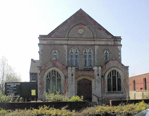
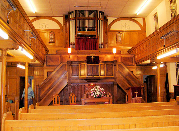
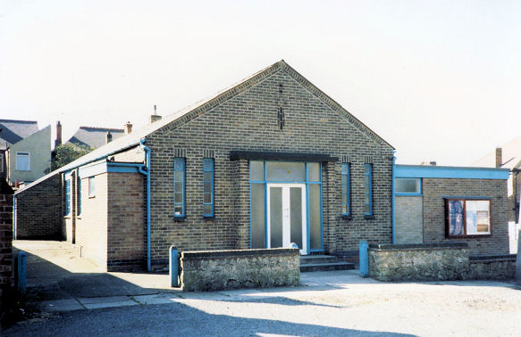
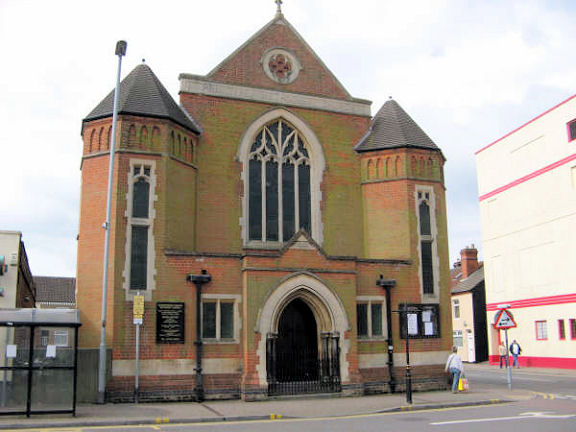
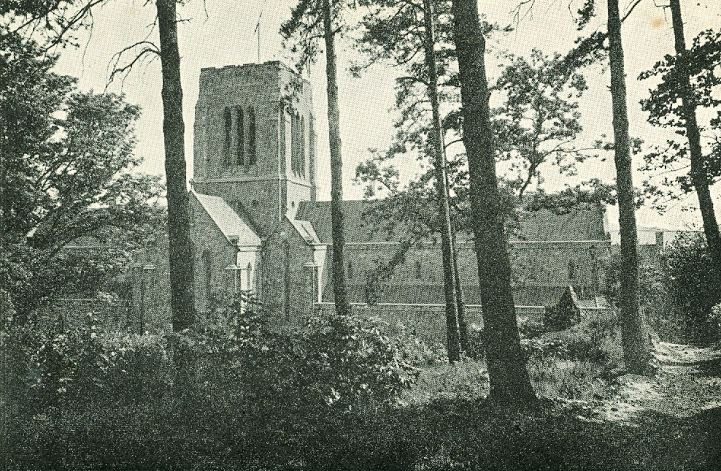
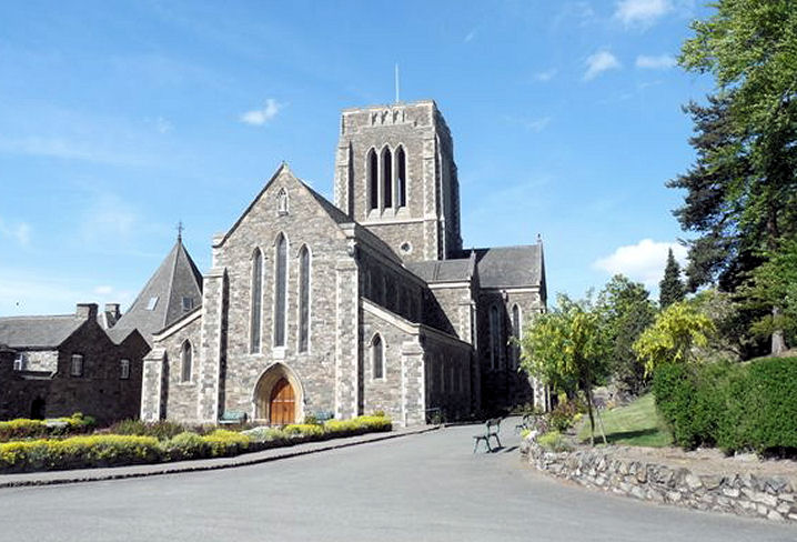
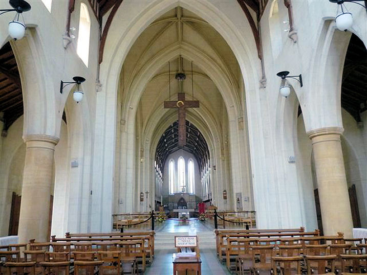
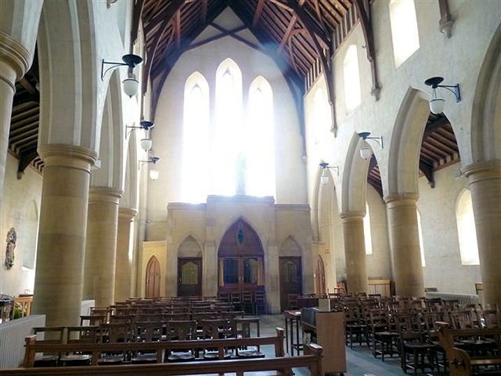
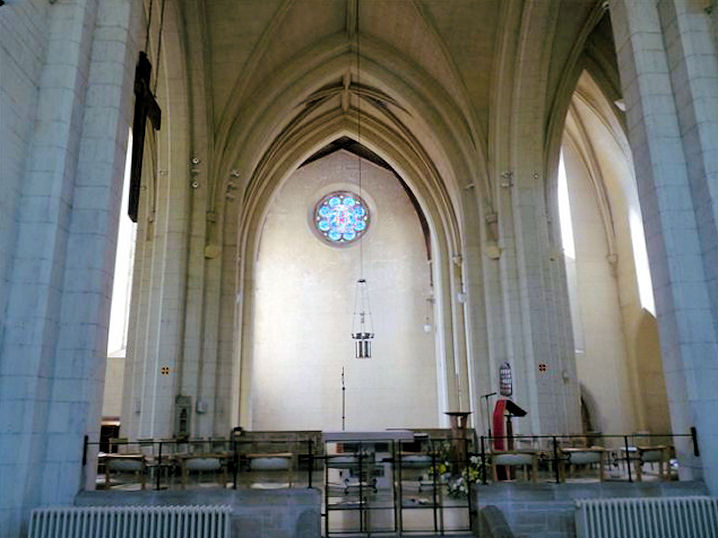
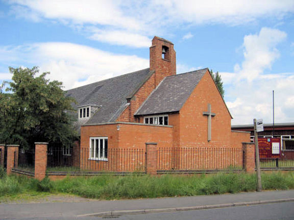
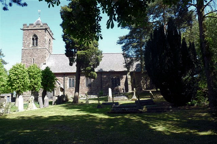
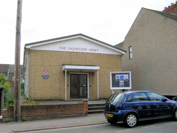
- has a useful section on the town places of worship. Christ Church on London Road, as seen by Streetview in 2023. Its grade II listing dates it to 1836-8, with the chancel added in 1894-5. SK 4283 1411. Link. Coalville Evangelical Church (2023 Streetview) on Belvoir Road. Wikipedia says it was previously an Open Brethren hall. SK 4253 1439. Link. A short-lived Congregational Chapel (a tin tabernacle) used to stand set back from London Road at SK 4336 1386. Wikipedia says it stood on a piece of land at the corner of London Road and Broom Leys Road now used as a flower bed (2023 Streetview). Old maps show that it stood a few yards further east under this house (2023 Streetview). The Wikipedia article dates the chapel to "around 1900" to 1909, and says the house to its right was the home of the Minister. Ebenezer Baptist Church (1881) on Ashby Road. According to the town Wikipedia article, it was originally Particular Baptist, and it stands on the site of a Primitive Methodist Chapel in use from 1832-61. Interior view. SK 4221 1440. Both © Christine Denton. Link. Full Gospel Mission Church on James Street. SK 4220 1394. © Alan Taylor. Link. The site (the nearest patch of grass plus adjacent roadways; 2015 Streetview) of a demolished General Baptist Chapel on London Road. The Wikipedia article dates it to 1836. SK 4271 1422. Greenhill Community Church (Baptist) on Charnborough Road, Broom Leys, as seen by Streetview in 2023. SK 4491 1389. Link. Kingdom Hall of Jehovah's Witnesses on Albert Road, as seen by Streetview in 2023. SK 4296 1447. Wikipedia says that they had earlier premises on Ashby Road, but I haven't been able to discover where this was. Marlborough Square Methodist Church was originally Primitive Methodist, which Wikipedia dates to 1903. SK 4229 1415. © Graeme Harvey. Link. Its predecessor, of 1862 (source, with old photo, chapel to left, schoolroom to the right) stood on Belvoir Road at SK 4235 1427. When the congregation moved into their new premises, the 1862 chapel was re-built as Central Chambers (2023 Streetview), but evidently some of the original fabric was retained - see for example the roundel in the gable end of the schoolroom, and features at the rear of the building discussed in the Wikipedia article. See also the Ebenezer entry, above. Allegedly of Ashby-de-la-Zouch, this old postcard (previously in the "Unknown" section) from Reg Dosell's Collection is in fact of Mount St. Bernard Abbey (R.C., Cistercian Order of the Strict Observance [Trappists]) on Oaks Road, Charnwood Forest, Coalville. Thanks to Bill Davison for the identification. SK 458 162. A modern view, and three interior views - 1, 2, 3, all © Mike Berrell (2011). Link. New Life Church on Margaret Street, as seen by Streetview in 2019. Wikipedia advises that it was previously a working men's club. SK 4225 1425. Link. St. David stands at the junction of Meadow Lane and Greenhill Road, Broom Leys. It was seen by Streetview in 2021 - 1, 2, and in 2023. SK4434 1415. Link, wherein it's dated to 1965. St. Faith's Mission Church used to stand on Highfield Street. It post-dates a map of 1884, was present by 1903, and was still showing as active on a map of 1959. An old photo can be seen here, and its site today in a Streetview (the car park for the former St. James's Church) from 2019. SK 4214 1335. St. James on Highfield Street. SK 4212 1335. © Graeme Harvey. It was closed at some point between 2009 and 2011 (Streetviews). The next Streetview of 2019 shows it in commercial use. St. James the Greater on Oaks Road, Oaks-in-Charnwood. SK 473 164. © Mike Berrell (2011). The site (2023 Streetview) of St. Saviour (R.C.) on Highfield Street. The old photo of it here shows that it was a tin tabernacle. SK 4224 1351. It was succeeded by St. Wilfrid on London Road in 1961. Two Streetviews show it in 2023 and 2010. SK 4298 1408. Link. Salvation Army Hall on Gutteridge Street. SK 4232 1404. © Graeme Harvey. Since Graeme took his photo the building has changed hands and it is now Yesterday Tomorrow and Forever Church. Streetviews show it as still S.A. in 2010, and under the present ownership in 2015 and 2019. Link. Spiritualist National Union (2016 Streetview) stands at the corner of Avenue Road and Bridge Road. SK 4252 1375. Link. The vacant site of the vanished Standard Hill Wesleyan Methodist Chapel, seen in 2009 by Streetview. Still vacant in 2011, housing had been built by 2019. Its brief entry here dates it to between 1901 and 1911. A Methodist document from 1940 lists it as a tin tabernacle. O.S. maps show it to have still been active in 1955, but not in 1959. SK 4193 1319. Directly across the road from the site of the demolished General Baptist Chapel (see above) on London Road stands the well-disguised former Strict Baptist Chapel (2021 Streetview), now in use as a shop. The top part of what is presumably a date-stone (Streetview) shows the chapel's name as Cave Adullam. Wikipedia dates it to 1852. SK 4271 1419. The Wikipedia article mentioned at the top of this page mentions a United Methodist Chapel of 1910 on London Road. Curiously, it isn't shown on O.S. maps of 1930, 1948 or 1959. The article says however, that it stood "was served by a minister who lived opposite, at No. 76 London Road". This would mean that the church stood about here (2023 Streetview). However, the suspicion remains that this information is suspect because of the lack of support from the O.S. maps. The chapel is also mentioned here, though without an exact location. Emporium (2023 Streetview) on Belvoir Road is a former Wesleyan Methodist Chapel, dated here to "between 1851 and 1873". It had a short active life, being sold to the local council by 1881. SK 4237 1417. The congregation moved to a new chapel in 1882, also on Belvoir Road, at SK 4238 1408. It's now the Melanie Reed Centre, and it was seen by Streetview in 2023 - 1, 2. Link.
|
|
02 September 2023
© Steve Bulman