The Churches of Britain and Ireland
|
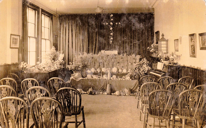
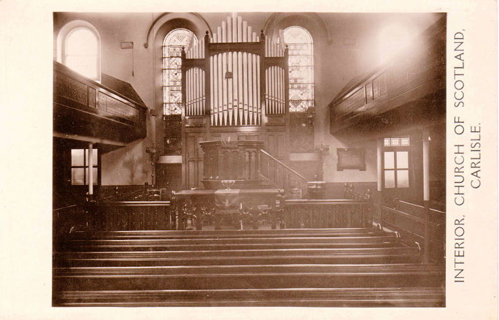
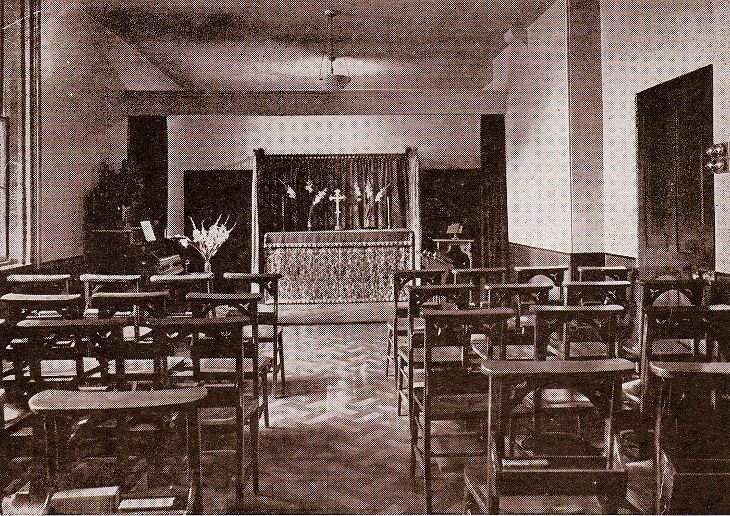
Carlisle, Cumbria I'd like to be able to add some lost Carlisle churches to the website - the Wesleyan Chapel on Union Street; Etterby Mission Hall; Denton Street Chapel (Church of Christ, later known as Atlas Hall); Cecil Street Primitive Methodist Chapel; Milbourne Street Mission; St. James Mission Church on Blencowe Street; the chapel of St. Joseph's Home in Botcherby (demolished only relatively recently); Willowholme Mission (outside), and the chapel attached to Strathclyde House on Wigton Road. Can you oblige? There are photographs of the sites of some of these, below. One chapel which I've been unable to place is the Deaf and Dumb Association Chapel, the interior of which is shown here, from an old postcard in Chester Foster's Collection. Can you supply any additional information? Churches in North Carlisle (north of the River Eden), West Carlisle (West of the River Caldew).
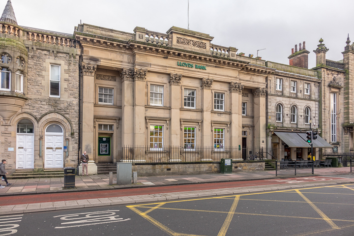
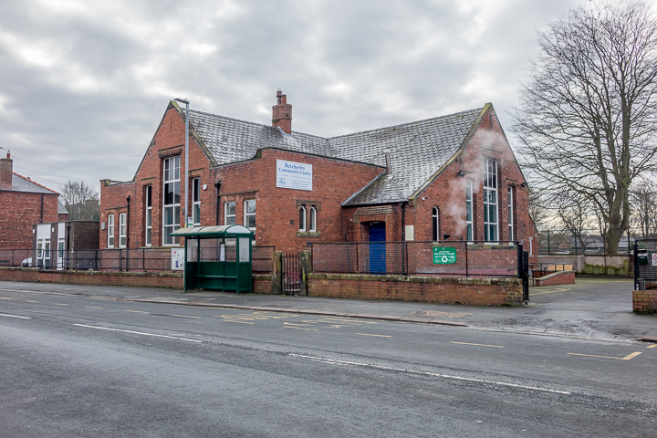
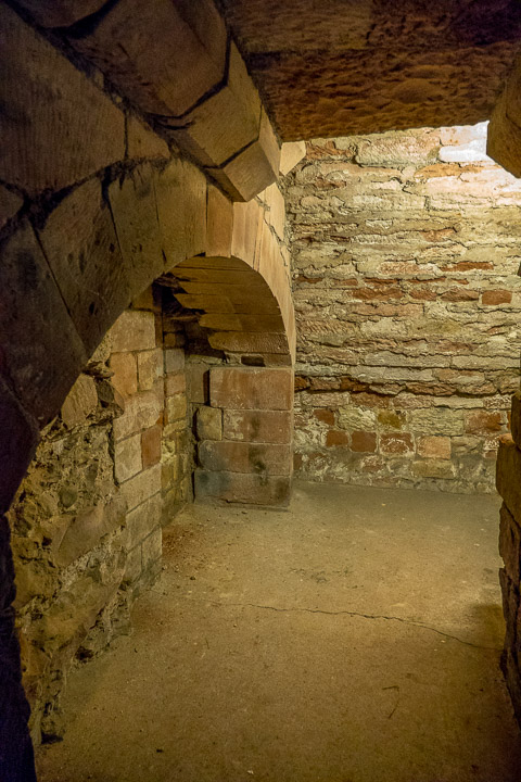
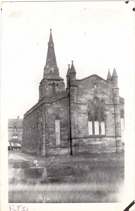
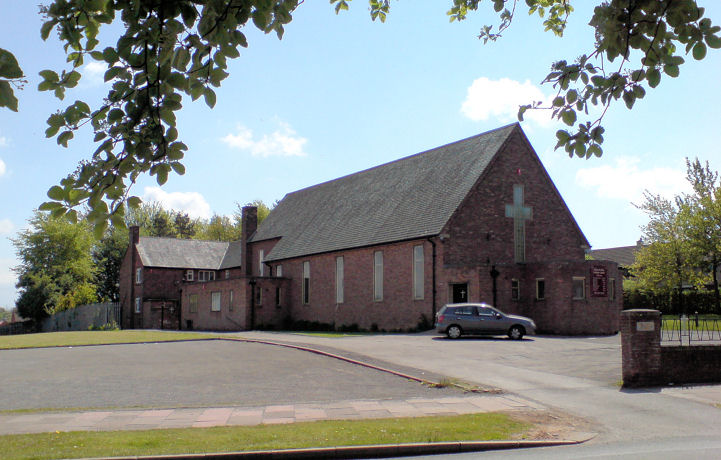
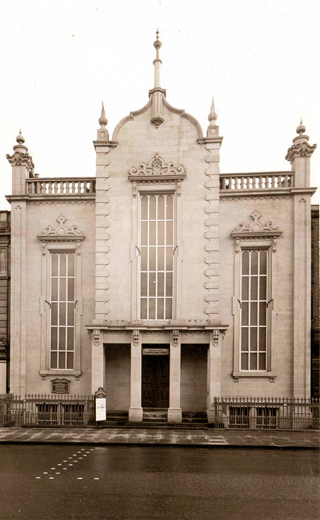
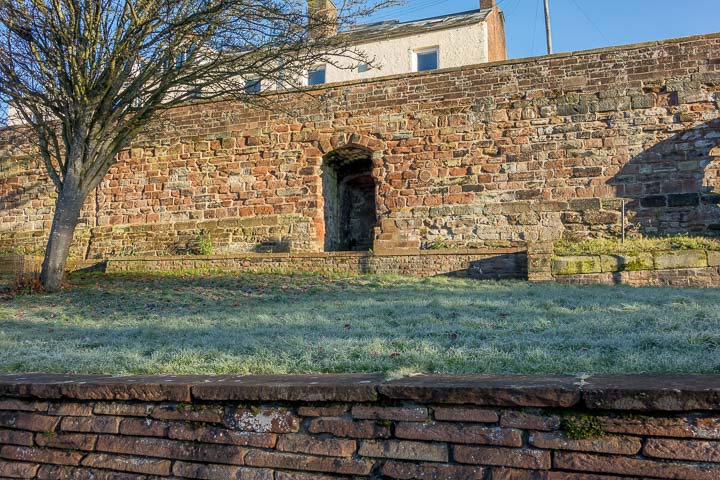
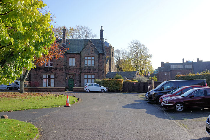
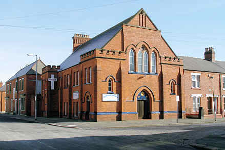
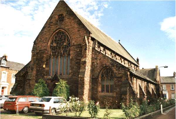
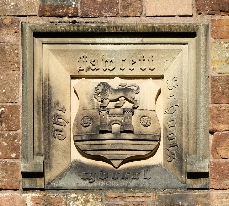
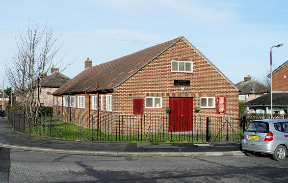
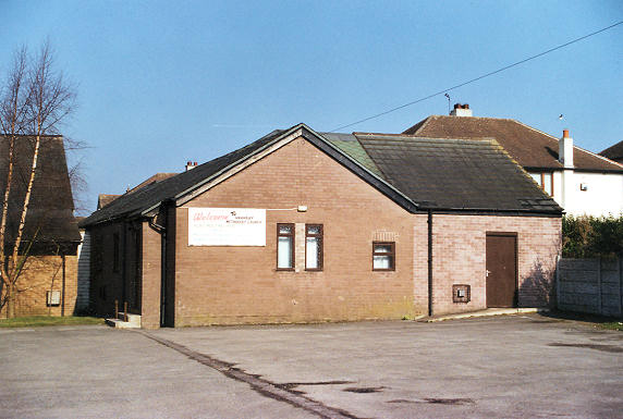
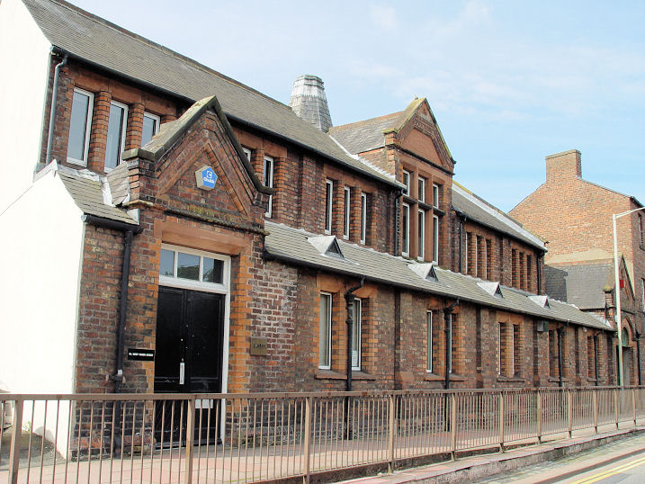
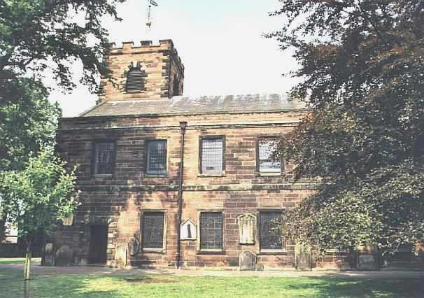
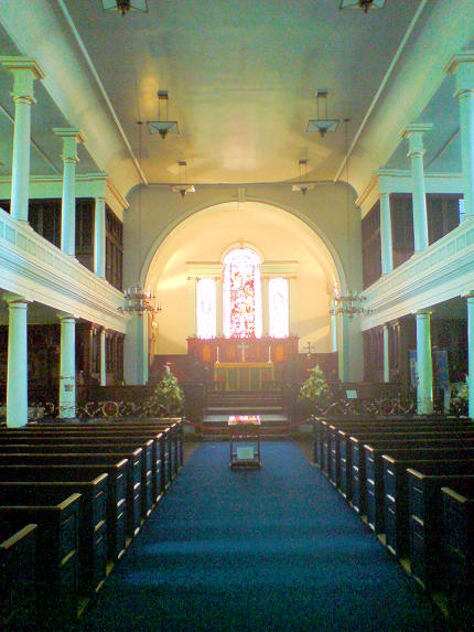
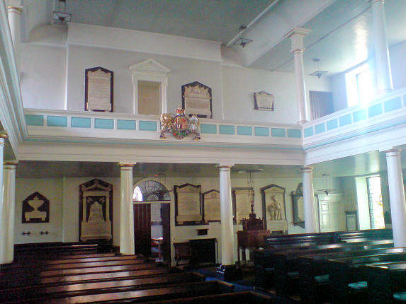
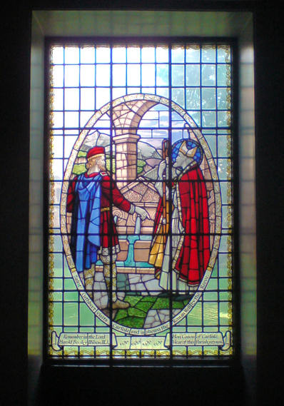
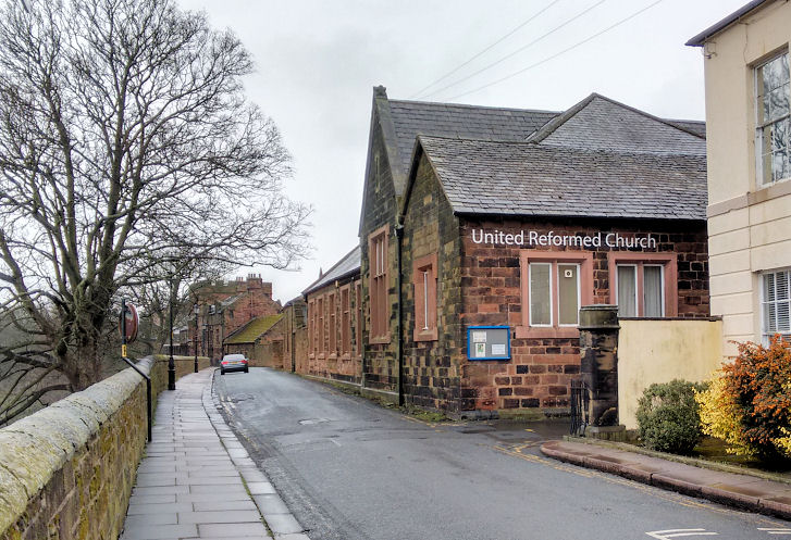
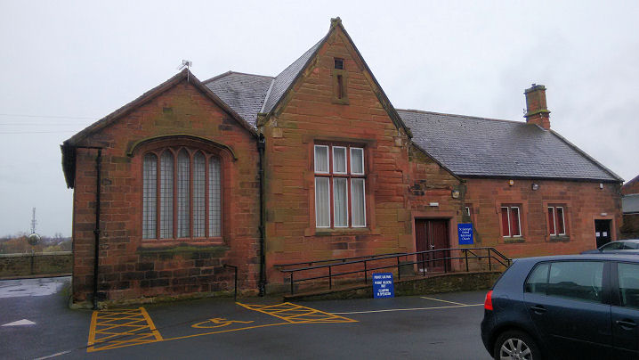
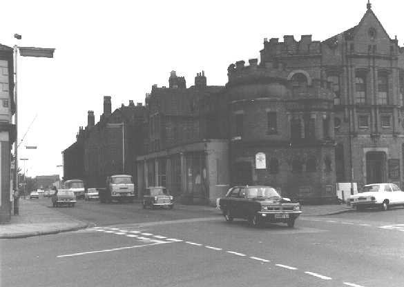
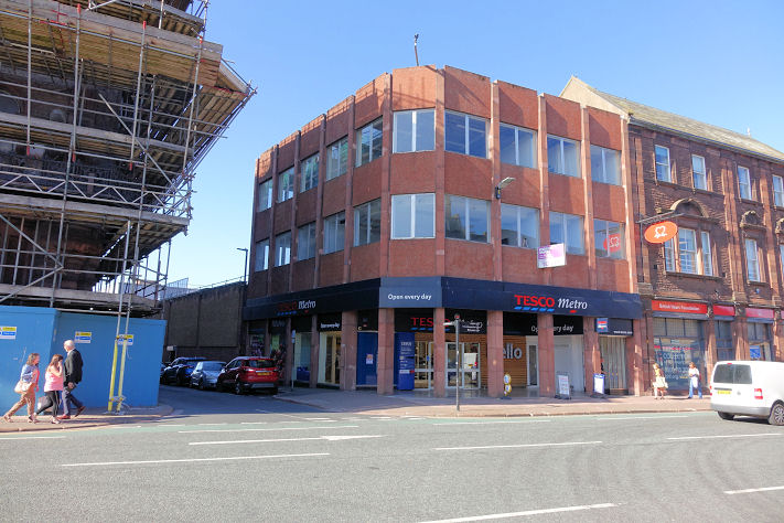
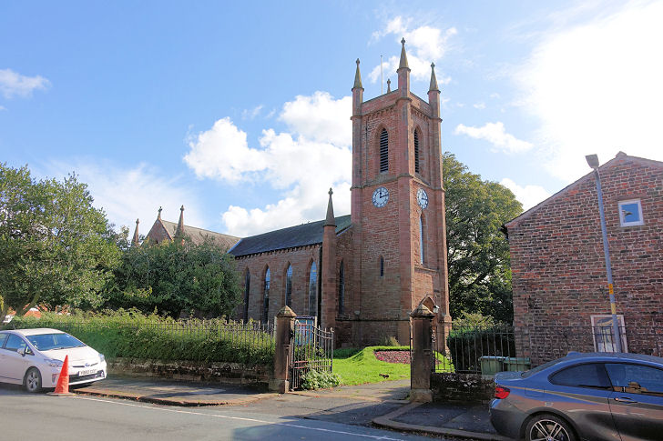
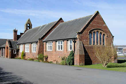
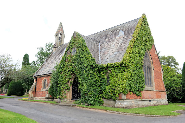
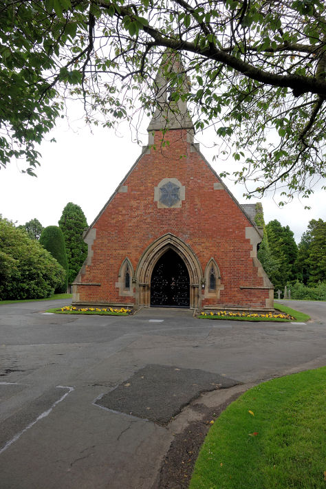
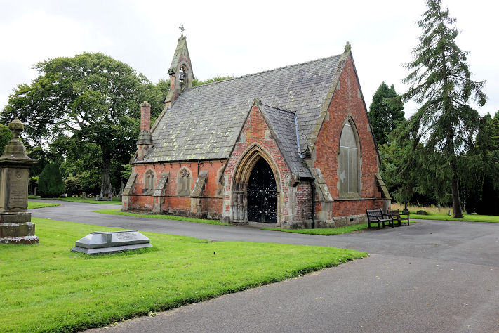
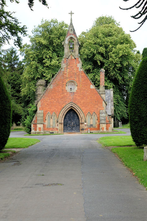
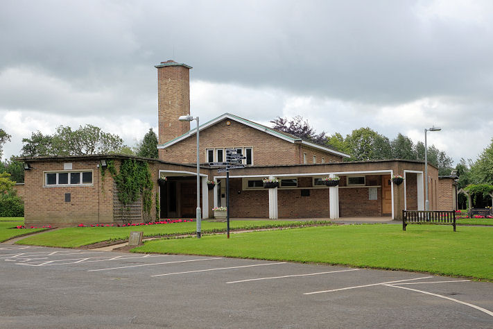
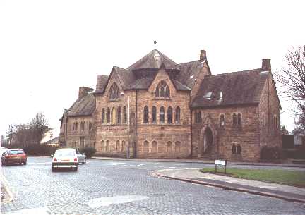
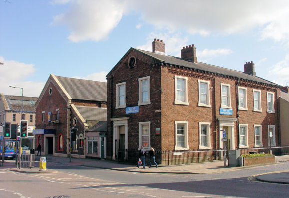
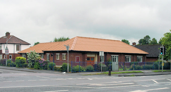
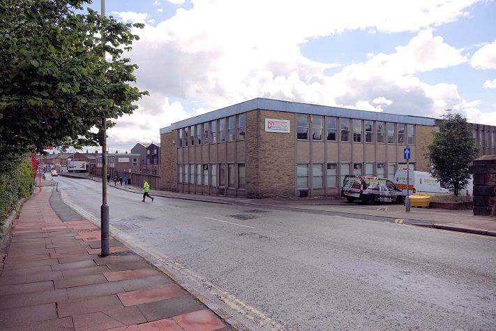
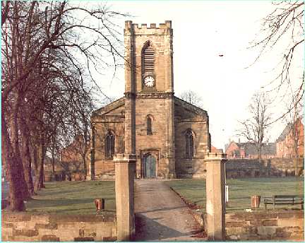
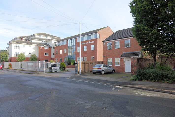
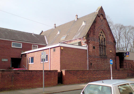
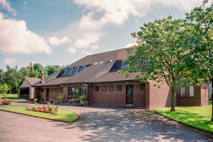
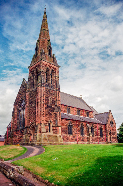
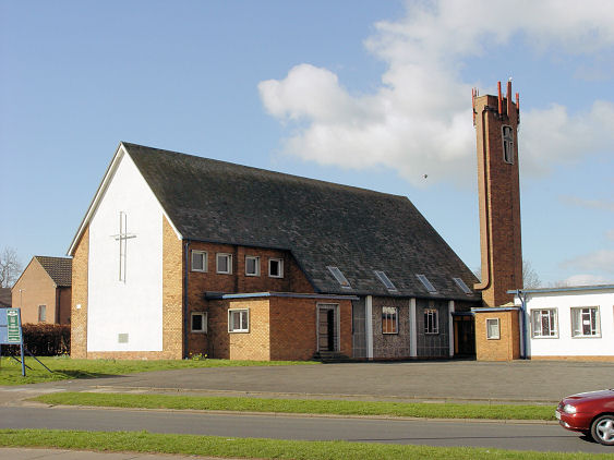
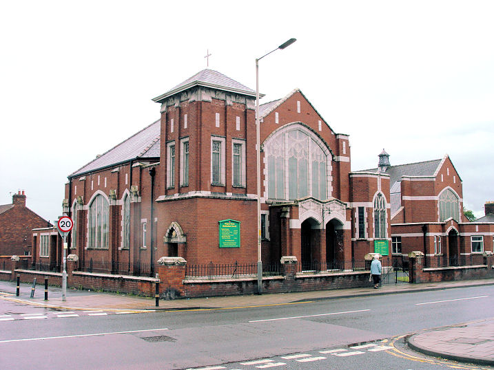
Annetwell Street Congregational Church (1781). This website has an image of this chapel but I may not reproduce it or even link to it. So I'm afraid it's a case of DIY!. Also known as Lady Glenorchy's Chapel, it was succeeded by the Lowther Street Chapel (see Congregational Church below). The demolition date is not known to me at the moment, but presumably post-dates the move to the Lowther Street Church (1843). Circa NY 397 561. More on Lady Glenorchy on Wikipedia. Austin Friars School Chapel on Etterby Scaur. It pre-dates the 1901 O.S. map, on which it is marked as "Convent of the Sacred Heart". NY 3919 5732. © Steve Bulman (2018). An interior view, from an old postcard in Chester Foster's Collection. Baptist Church (1888) on Aglionby Street. NY 4069 5574. © Steve Bulman. This resource (scroll down to "Baptist Church") lists several other Baptist Meetings in Carlisle, the earliest noted being in a room on Abbey Street in 1809. A few years later they are noted meeting in the Wesleyan Methodist Chapel on Fisher Street (for which see the first Wesleyan Methodist entry, below), and in 1847 in a room in the Athenaeum (NY 4026 5578, © Steve Bulman (2019)) on Lowther Street. What is likely a separate meeting is that of the Berian Baptists, who met in a small chapel built in 1818 on West Tower Street. This is probably the Baptist Chapel shown on the 1821 Woods map of Carlisle, adjacent to the Quaker Burial Ground between West Tower Street and Fisher Street, just east of where the modern Society of Friends building stands, for which see below. Link. In early 2025 planning permission was granted for the Baptist Church to convert Fairview House (2021 Streetview) on Victoria Place from an office to a church. Whether they plan to close the Aglionby Street church is as yet unclear. The former Baptist Church on Briar Bank is now in use as Belah Community Centre. It can be seen on a Streetview here. The community centre website dates the church to 1951. NY 3857 5801. The former Beacon Hall (Church of God), on Beaconsfield Street, formerly Presbyterian Church of England. An inscribed stone above the middle window reads "Howie Boyd Hall 1901". Demolished in 2005/6, housing has been built on the site (2019 Streetview). NY 4050 5455. © Steve Bulman. Botcherby Community Centre stands on Victoria Road. Eden Spiritualist Church meets here, as does a Buddhist Meditation Group. Carlisle Vineyard Church has also met here on a temporary basis, as their website (for the moment) explains. NY 4203 5586. © Steve Bulman (2018). Links for the Community Centre, Eden Spiritualist Church, and the Buddhists. The former Bramerton Lodge Chapel on Bramerton Orchard. Were it not for "Botcherby - A Garden Village" by Patricia M. Hitchon (P3 Publications, 2017, ISBN-13:978-0-9931835 -2-2), I wouldn't have known about this chapel. Originally a barn, it seems to have first been used for worship in 1867. The book says that many of the fittings in St. Andrew's (see below) were moved there from Bramerton Lodge Chapel, which implies that it went out of use around the time St. Andrew opened (1890), or perhaps a very few years earlier, as the book also explains that a small wooden church was erected in 1888 or 1889, and that this was probably moved elsewhere when St. Andrew opened. It's unclear how much of the old chapel survives, but the book implies that some fabric remains of the rear wall, not visible in my photo. NY 4237 5564. © Steve Bulman (2018). Carlisle Castle has a tiny oratory (not normally open to the public) built into the keep walls. This is where the Scottish King David I is said to have died. I must express my appreciation to the staff at the castle for permitting me to visit the oratory. NY 3971 5622. © Steve Bulman (2017). Carlisle Gaol is known to have had a chapel, but no maps available to me shows its position. Can you advise exactly where it was? Carlisle S.N.U. Church met in a room on the top floor of Tower Buildings on Scotch Street. It is mentioned in this document, recording the cancellation of a certificate in 1971, the church having been granted it in 1956. The building can be seen here in a 2018 Streetview. Circa NY 4008 5607.
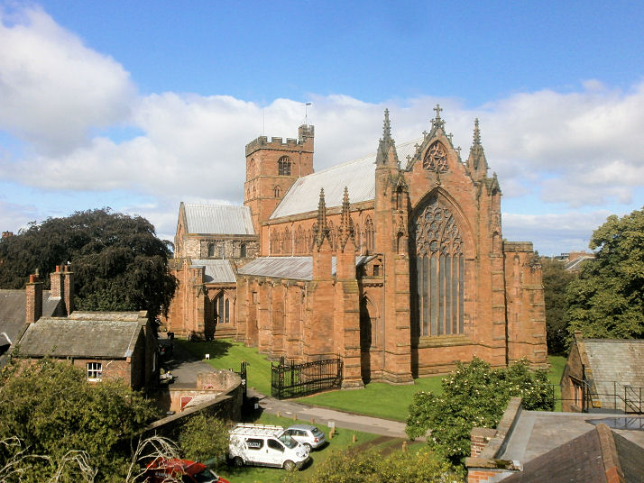
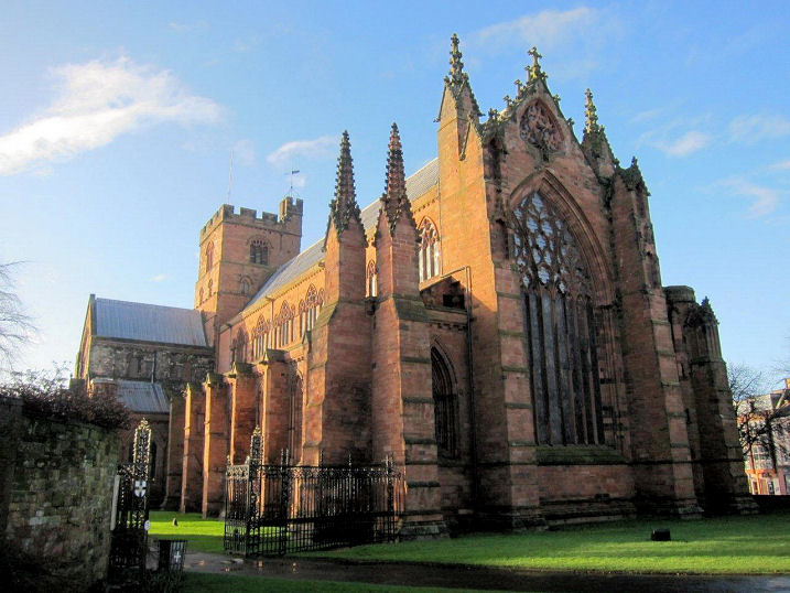
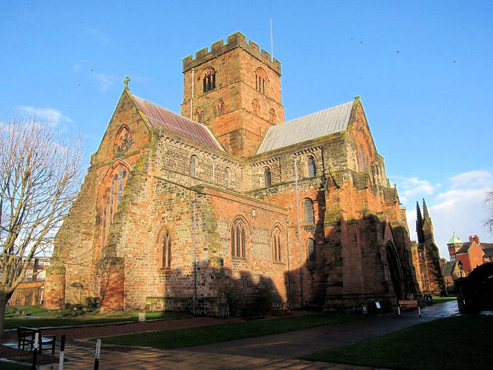
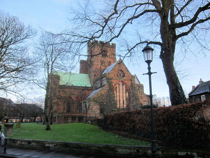
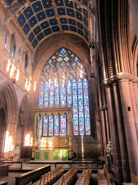
The
Cathedral
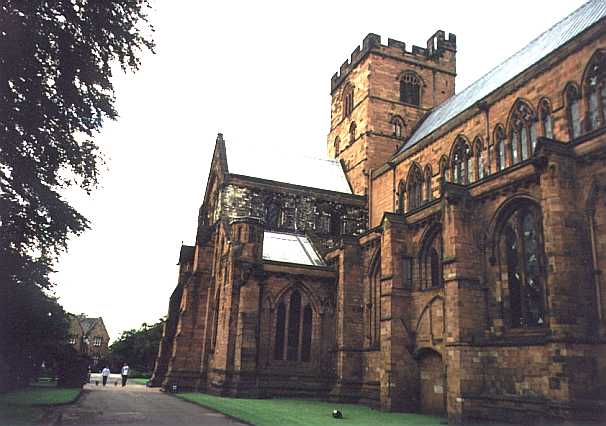
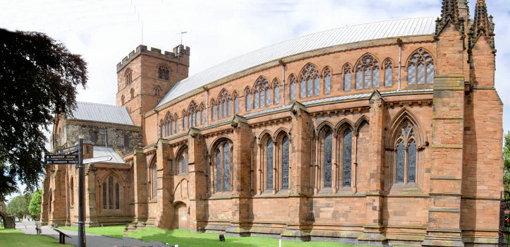
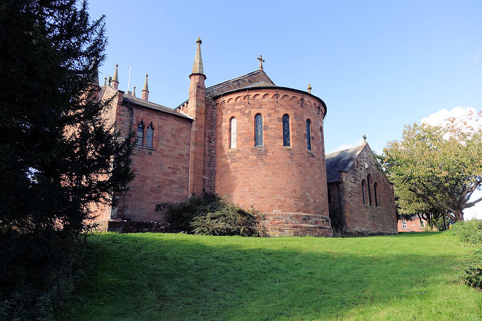
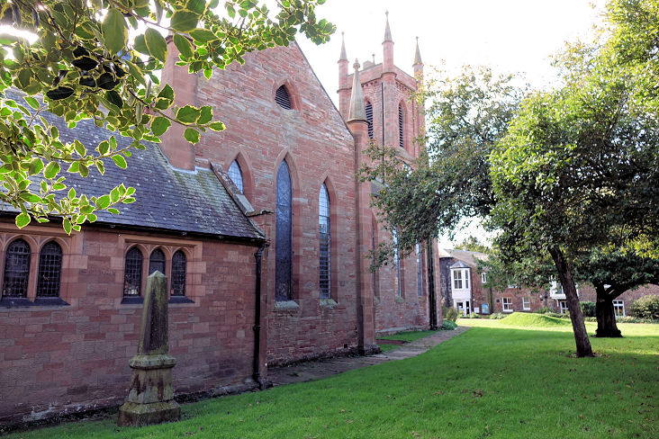
Church of the Holy and Undivided Trinity is of Norman
foundation. NY 3989 5594. © Steve Bulman.
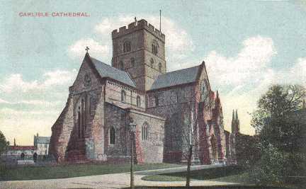
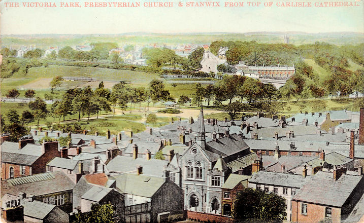
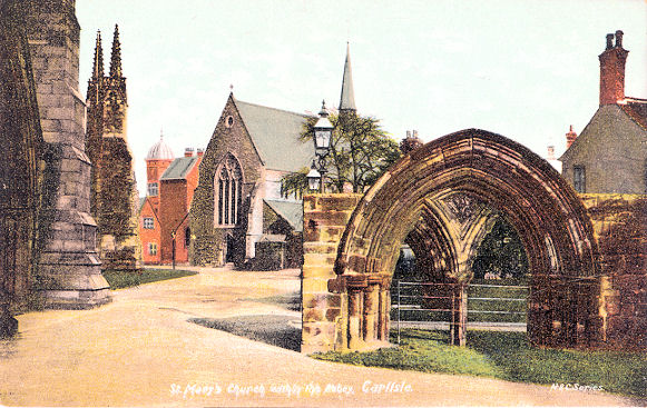
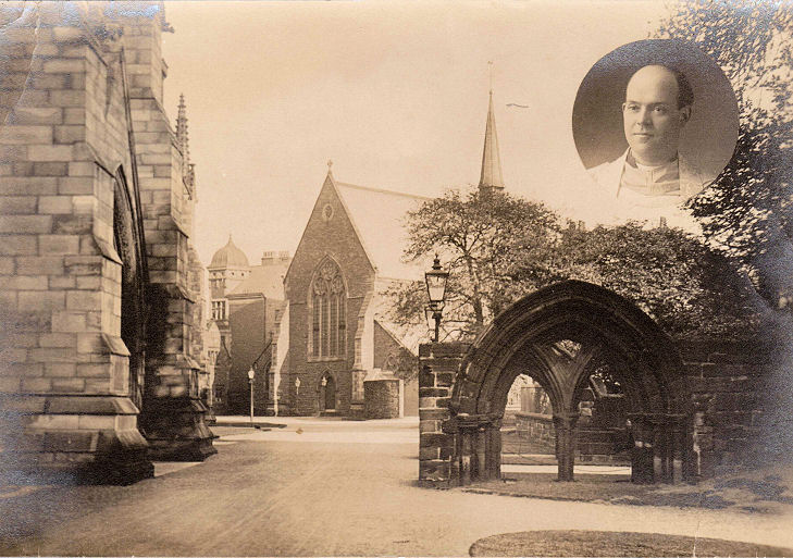
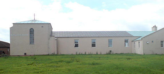
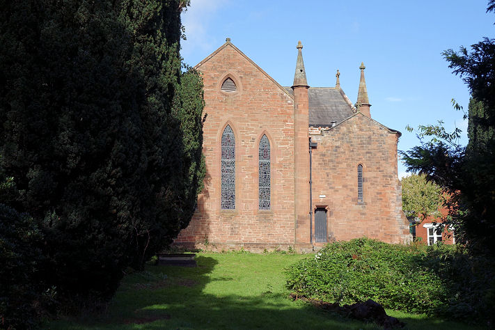
Another view, © Alan Blacklock (2011). Carlisle originally consisted of two parishes - St. Cuthbert and St. Mary. The
church of the latter was originally the nave of the cathedral, but a separate church was
built in 1870. The parish was joined with that of St. Paul's in 1932, and St. Mary's
church was demolished in 1954. The site is now a garden on the left when entering the
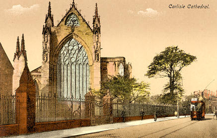
cathedral from the city centre (NY 3997 5593). In this old postcard view
(Steve Bulman's Collection), the nave - St. Mary - can be seen, and just visible
at the extreme right, behind the tree, is the spire of St. Mary's church. A fine
view, obtained by Howard
Richter in 2019, from the Crown & Mitre hotel. The white van is parked on the
site of St. Mary's church. In this
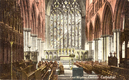
old postcard (courtesy
of Alan Bulman's Collection) the marvellous east window of the cathedral is
shown. As Howard Richter has pointed out, although un-dated, the postcard
must be pre-1932, by which time the tram service had ceased. It's style is
suggestive of a pre-WW1 date. Also from Alan, another
postcard (franked in 1906)
shows the east window
from inside the cathedral. The
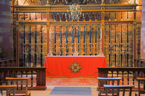
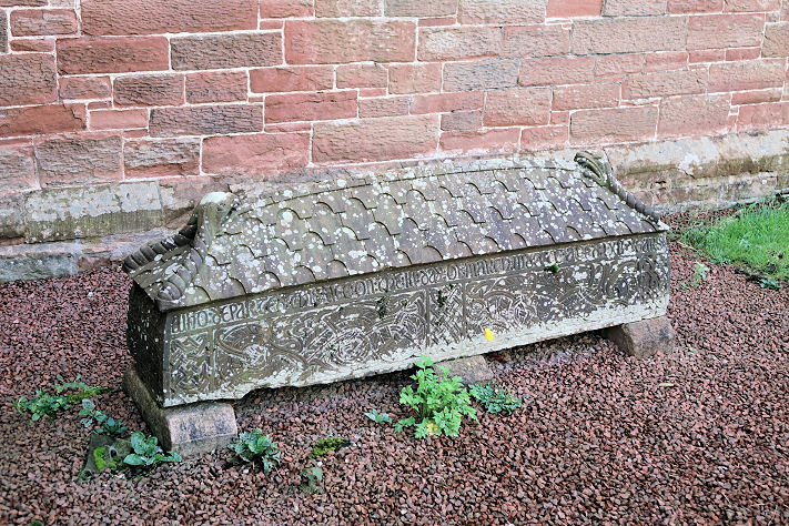
Border Regiment Chapel
in the Cathedral, © Ian Thirlwell. Three additional views -
1,
2,
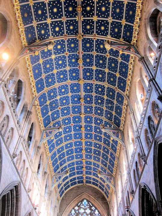
3, the lovely
ceiling,
altar and East window,
organ and font, all ©
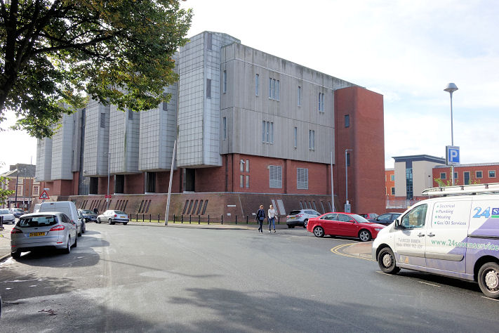
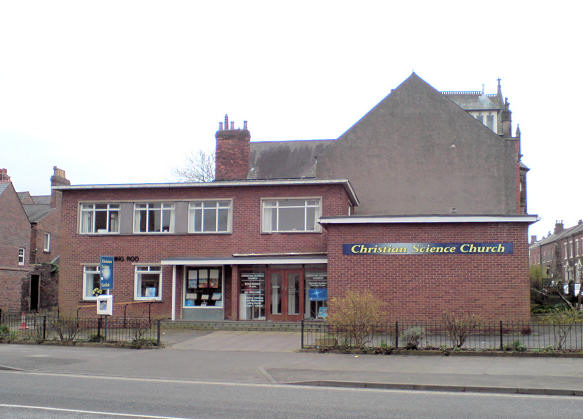
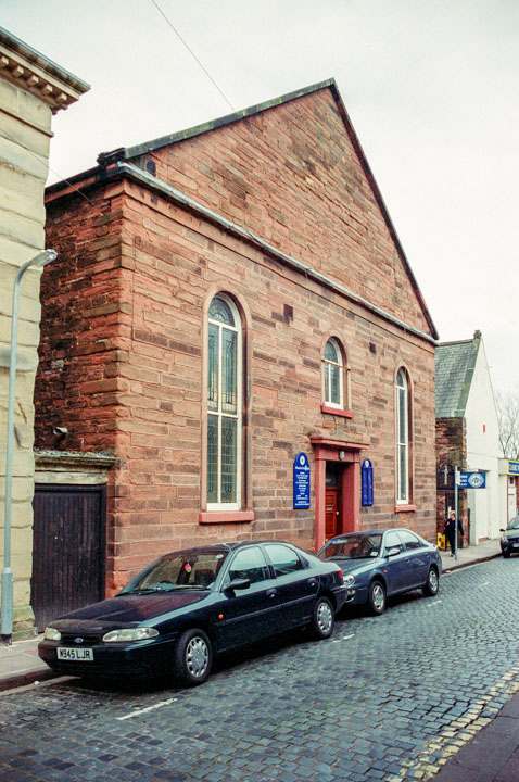
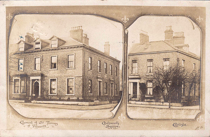
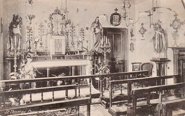
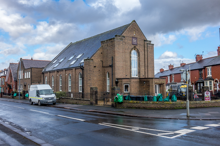
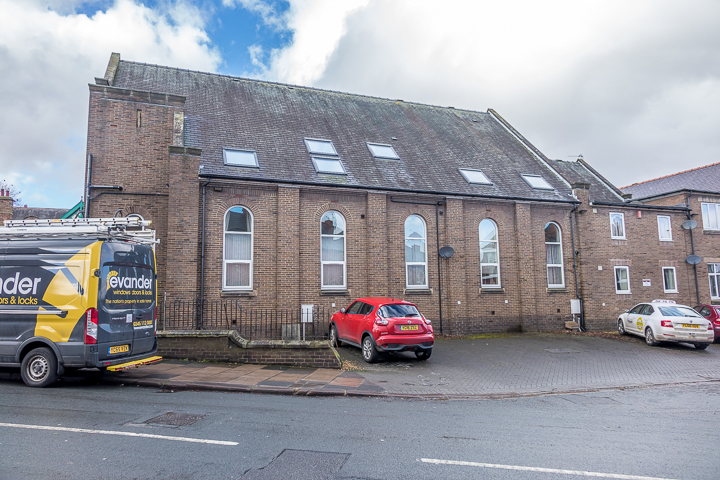
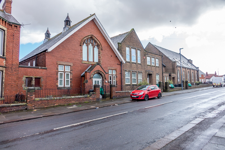
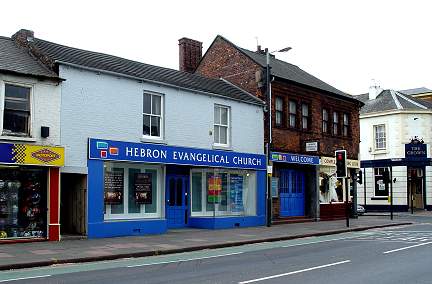
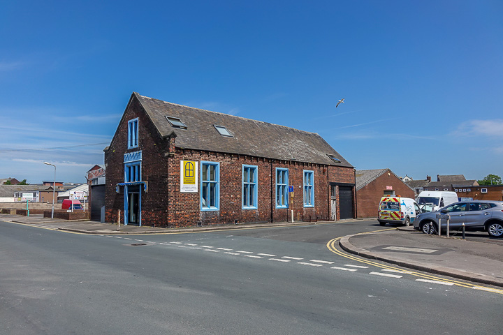
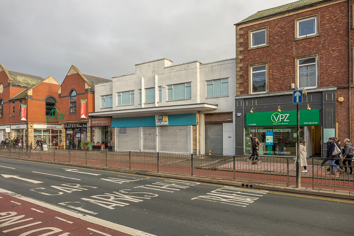
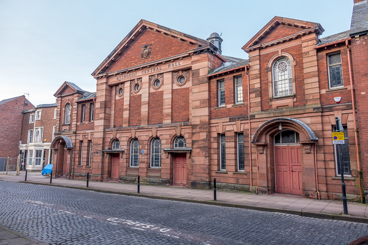
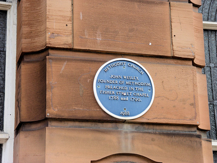
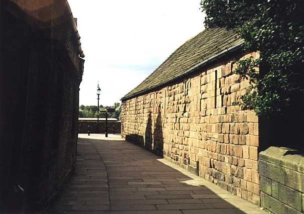
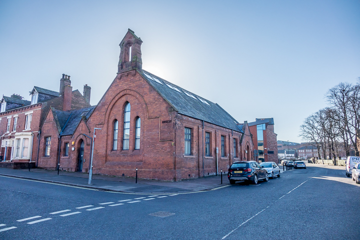
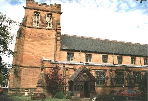
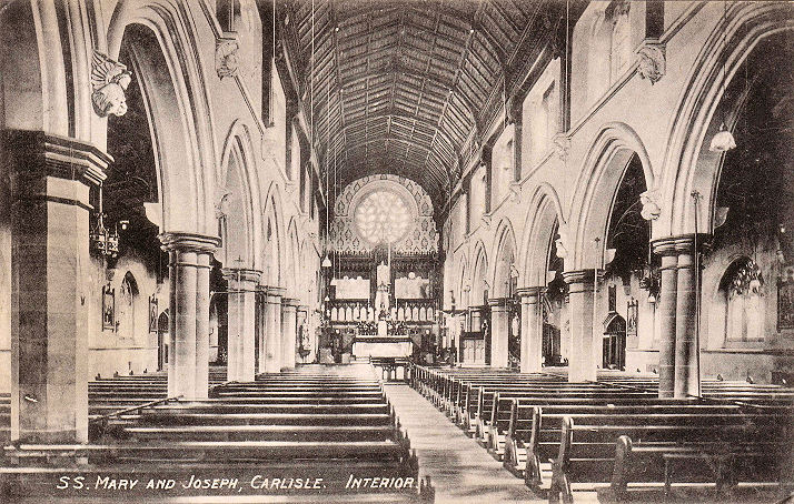
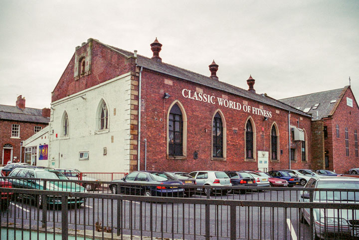
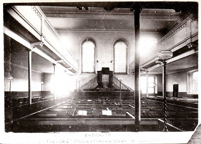
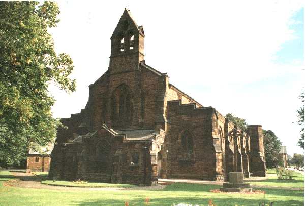
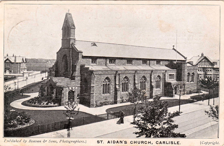
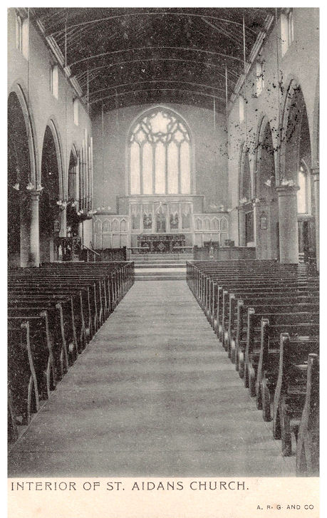
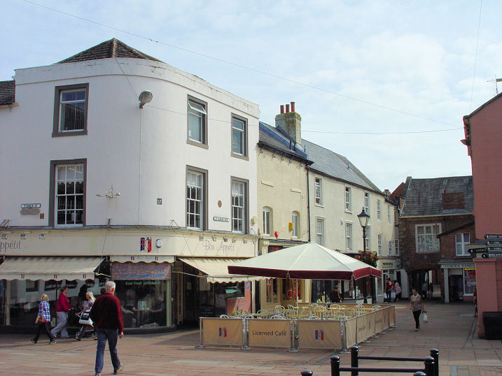
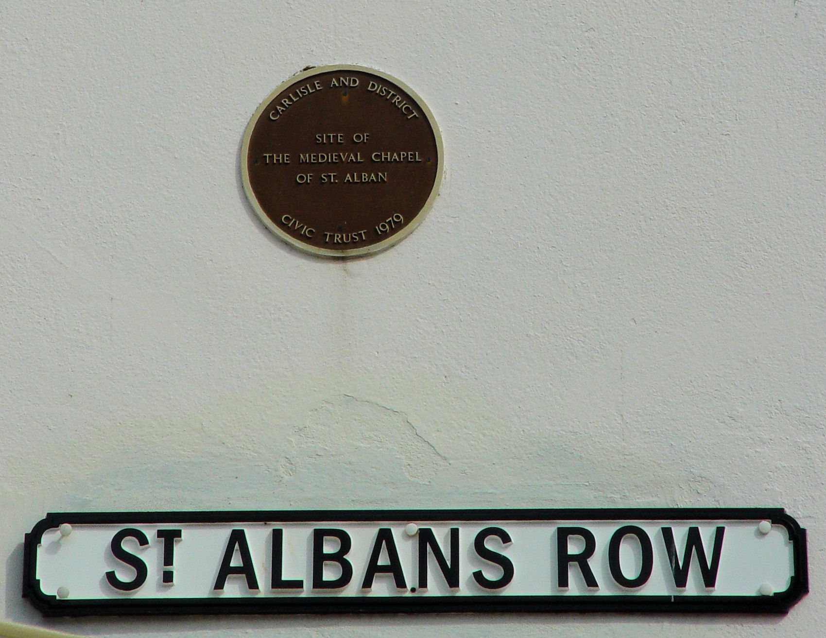
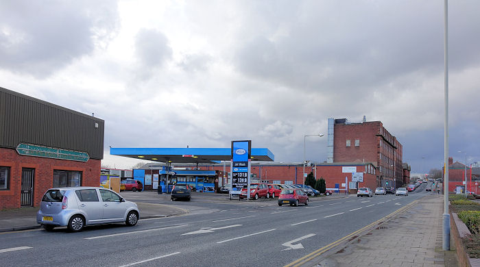
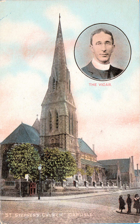
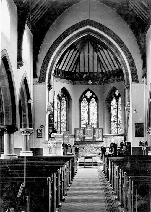
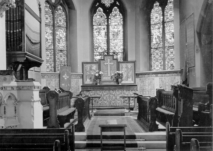
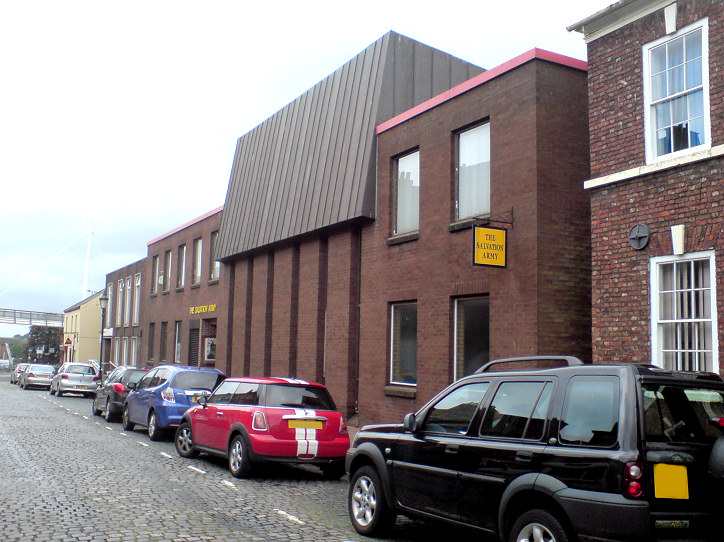
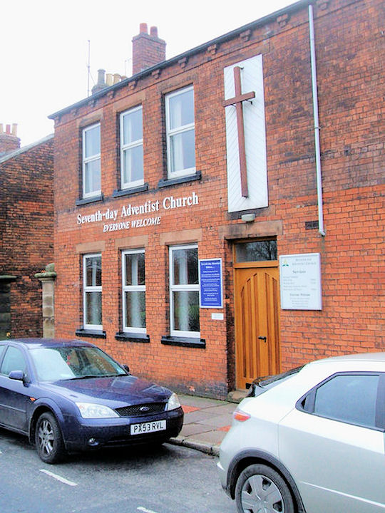
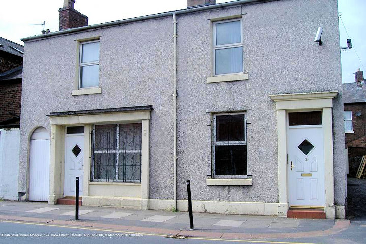
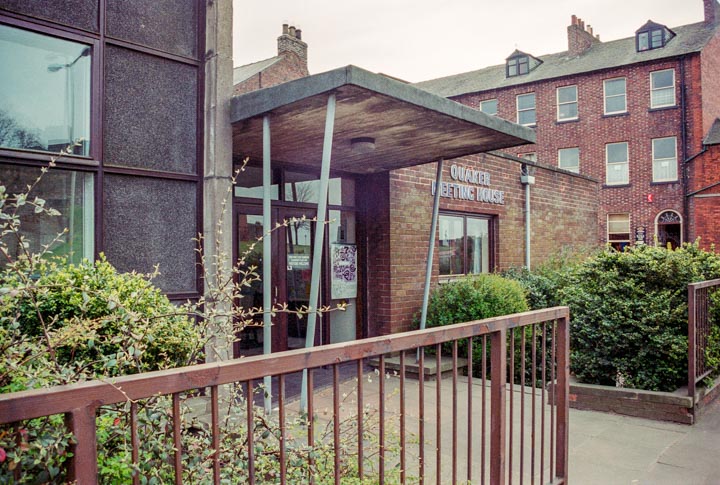
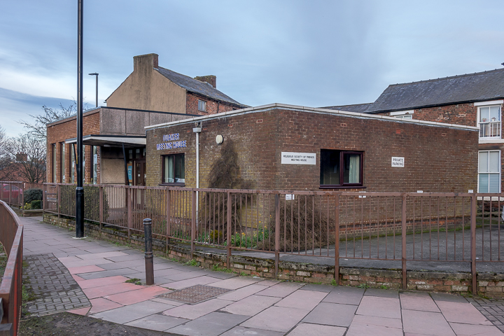
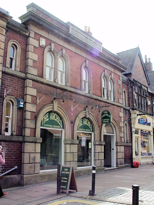
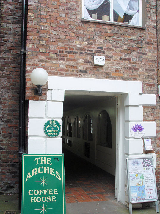
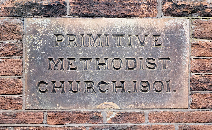
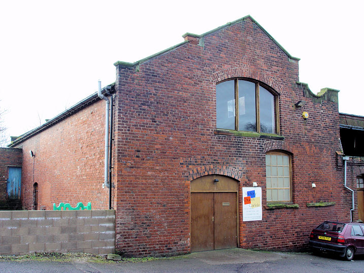
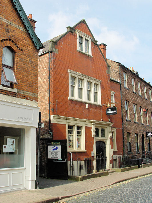
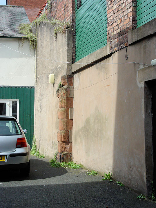
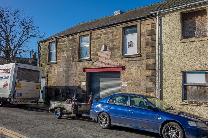
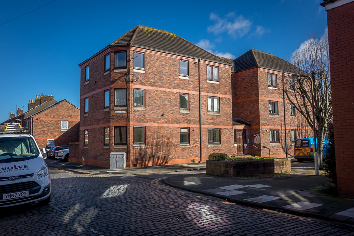
Martin Richter (2013). The site of Cecil Street Primitive Methodist Chapel. Built in the mid-nineteenth century, it was closed in 1965, and demolished to make way for the telephone exchange which now stands on the site. The nearest corner of the exchange coincides with the corner of the chapel. NY 4041 5567. © Steve Bulman (2016). Exterior and interior photos and history are available here. Former chapel on Chapel Brow, Durranhill (now a private residence). NY 428 552. © Steve Bulman. Janet Gimber has advised that this was the chapel to the attached Sacred Heart Convent, which was originally Durranhill House. Grade II listed. The long-vanished Chapel of St. Wilfrid is mentioned in one of Denis Perriam's excellent "History Man" articles in the Cumberland News of 20 March 2020. It was apparently on an upper floor of a building which stood at what is now the corner of English Street and the Viaduct, where the Nat. West bank now stands. The site can be seen on Streetview here. NY 4014 5575. Of Christ Church (1830-1938, demolished 1953) on Botchergate nothing remains, though the site has been left as a small park. The design was identical to Holy Trinity Church (see below). NY 4051 5537. © Steve Bulman (2011). Another view, from an old postcard in Chester Foster's Collection. An old engraving is available here, and two old postcards showing the spire of the church here. Christ the King (1954-5, R.C.) on Edgehill Road, Harraby. NY 4234 5418. © Steve Bulman (2010). Christian Science Church. NY 4062 5606. © Steve Bulman. Church of Scotland (1834) on Chapel Street. NY 4028 5605. © Steve Bulman. An interior view, from an old postcard in Chester Foster's Collection. It may be on the same site as the "Rattler's Chapel", recorded on Chapel Street in a will in 1773. Whether the chapel was named for an otherwise obscure sect, or after someone called Rattler, is unknown. The former Congregational Chapel on Cecil Street, now an antiques centre. This was built as an Evangelical Union Church in 1859. NY 4052 5558. © Steve Bulman. Congregational Church (1843) on Lowther Street. NY 4027 5577. © Steve Bulman. This is also home to Carlisle City Church, which also has another entrance on Crosby Street - entry beneath the church sign on the drainpipe. Link. © Steve Bulman (2010). Another view, from an old postcard in Chester Foster's Collection. Grade II* listed. The former Convent of St. Thomas of Villanova on Chatsworth Square. Although no maps I have available to me indicate which property this is, I'm as certain as I can be that it is the building seen here, in a 2018 Streetview, which is at the comer of Chatsworth Square and Victoria Place. Some minor changes are apparent. The interior of the Chapel. Both from old postcards in Chester Foster's Collection. I've been unable to find any additional information about this convent. Cumbria University Chapel just off Fusehill Street was built as the chapel for the Workhouse, opening in 1894. Prior to this, the congregation met in the canteen building. NY 4097 5555. © Steve Bulman (2013). Link. The former Currock Methodist Church at the junction of Currock Road and Blackwell Road. Built as Wesleyan in the later 1930's, it was closed in 2006 and converted to residential use. Another view. NY 4032 5425. The predecessor church (1908) stands adjacent on Currock Road, at circa NY 4032 5429. All © Steve Bulman (2018). Link. Of the Dominican Friary, nothing remains above ground. Their property stretched from the boundary with St. Cuthbert's and the city's West Walls, and extended southwards towards the Citadel. A chamber built behind the city's walls, and exposed by removing stonework from the wall, is said to have been a part of the Friary buildings sewage collection system. © Steve Bulman (2016). See this article (the appendix, particularly). Keen students of old maps may come across Eaglesfield (or Egglesfield) Abbey, the site of which is marked adjacent to the Cathedral. This seems to be spurious, as mentioned in a footnote on a page of my website Images of Cumbria - to quote, "Egglesfield, or Eaglesfield, Abbey was a tiny extra-parochial district, later a Civil Parish, near the cathedral, which existed from 1858 till 1904. (Personal communication, Philip Bingham). Roughly, it appears to have consisted of the S.E. corner of the Abbey precinct, and the land between St. Cuthbert's Church and the West Walls of the city, including the Tithe Barn. On a large scale OS map of 1901, that corner of the Abbey grounds shows "Eaglesfield Abbey (site of)". Lists of monastic establishments in Cumberland fail to mention Eaglesfield Abbey (e.g. Wikipedia here). I tentatively suggest (and I haven't seen this proposed elsewhere) that Eaglesfield/Egglesfield is a distant memory of Robert Ecclesfield, mentioned in "Architectural Illustrations, History and Description of Carlisle Cathedral", by Robert William Billings (1840) - ".... Bishop Gilbert de Welton, with the assistance of some of the Priors, and help of money, as I presume, left by Robert Ecclesfield, founder of Queen's College, Oxon, began the foundation of a new choir about the year 1354....". His Wikipedia entry (where he's called Robert de Eglesfield or d'Eglesfield) says that he was a native of Cumberland, where his family had property at Eaglesfield near Cockermouth. It's also worth mentioning here that there was an Ecclesfield Priory near Sheffield, but there is no obvious link to Carlisle (Wikipedia entry). If any experts can confirm or refute any of this I'd love to hear from you. The corner of the Abbey precinct (with the tower of St. Cuthbert in the background) can be seen here - © Steve Bulman (2019). Elim Free Church, on Grey Street. NY 408 553. © Steve Bulman. Link. Elim Community Church on Lonsdale Street, previously St. Paul's Elim (Pentecostal) Church, and prior to that St. Paul (CoE) which closed in 1979. NY 406 558. © Steve Bulman. Thanks to Kevin Price for the update. © Steve Bulman (2016). Grade II listed. Before moving into St. Paul in 1979, the Elim Church was on West Walls, meeting in what had been the Fawcett Schools. This website has an image, but I may not reproduce it or even link to it (search for Fawcett Schools, image number ct51849). The site can be seen from the other side here, in West Walls car park. The recessed carving in the wall is a plaque from the school, and marks the site - it can just be seen in its original position at the extreme right of the building in the photo on the external website already mentioned. The plaque can be seen more closely here. NY 3987 5586. Both © Steve Bulman (2019). The Franciscan Friary has no above-ground remains to show. Their property is said to have been bounded on the east by the city walls (where Lowther Street now runs), Devonshire Street on the south, Bank Street on the north, and English Street to the West. Note that there is at least one on-line reference to it having been on or about Fisher Street, which is almost certainly incorrect. It used to be commemorated by the pub called The Friars Tavern on Devonshire Street, seen here in a 2019 Streetview in it's re-named guise as Thin White Duke. There are on-line claims that there are architectural remains from the friary buildings built into the pub (presumably in the cellars), but I've not been able to substantiate this yet. NY 4019 5575 for the pub. Harraby Family Church, at the corner of Meade Road and Burnett Road. When I took the photo, the church sign must have been prominent for me to have labelled it as such, but the building itself is now Petteril Bank Community Centre (and may have been when I took the photo). A map of 1981 shows it as Petteril Bank Gospel Hall. As of August 2019, the Community Centre website doesn't list any churches amongst its users. NY 418 535. © Steve Bulman. Harraby Methodist Church. NY 421 539. © Steve Bulman. My appreciation to Kevin Price who has advised (June 2010) that this has been demolished and the site is being re-developed for housing. Hebron Evangelical Church, Botchergate. NY 404 554. © Steve Bulman. Kingdom Hall of Jehovah's Witnesses (2002) on Pasture Walk, Durranhill. According to the Carlisle Encyclopedia, the J.W.'s previously had premises in Harraby (mentioned for 1966 - and for which see the Seventh Day Adventist entry below) and on Fisher Street (1971). Can you advise where the Fisher Street premises were? NY 427 551. © Steve Bulman (2016). King's Church has met at the Currock Community Centre on Lediard Avenue, which can be seen on a 2012 Streetview. A church revealed through Denis Perriam's excellent "History Man" column of the Cumberland News is the former Lord Street Reading Room. Built in 1851 on the corner of Lord Street and Lancaster Street, it had become a Mission Room by 1913, and appears to have been connected with Christ Church (for which, see above). In 1950 it became a warehouse, and today it is in industrial use. © Steve Bulman (2017). The site of the Lowther Street Methodist Church. This was until recently the Argos shop. According to the My Methodist History entry, a wooden tabernacle was first erected here, replaced by a permanent building in 1836. The congregation had also used a room in the Town Hall, and the Baptist (formerly Wesleyan) Chapel on Fisher Street. NY 40242 55927. © Steve Bulman (2019). The former Methodist Central Hall (1922-3) on Fisher Street closed in late 2005. NY 39960 56095. © Steve Bulman (2018). Some interior views are available here. A plaque records the preaching of John Wesley in 1788 and 1790. As the Central Hall long post-dates Wesley, I'm unsure whether this refers to the previous church which stood on the same site, or to the earlier church which stood further north along Fisher Street, where "The Brickyard" now stands (for The Brickyard, see the first Wesleyan Methodist entry below). © Steve Bulman (2011). Proposals for the Central Hall has included conversion to a theatre. Since the closure, the congregation has met in the ancient Tithe Barn on West Walls. NY 39960 55785. © Steve Bulman. Grade II listed (church). Grade I listed (Tithe Barn). The former Mission Church on Strand Road and Compton Street dates from the later 19th century (not present on a map of 1866/7, present on one of 1900). The Geograph entry refers to this as St. Paul's Hall, implying a former connection with St. Paul's Church, for which see Elim Community Church, above. It also says that it's now used by Carlisle College. NY 4043 5612. © Steve Bulman (2017). The 25" O.S. map of 1901 shows a Mission Room on Lancaster Street, at NY 4048 5533. It stood set back somewhat from the road, in what is now a car park. Immediately behind it was Christ Church, which fronted onto Botchergate. It's possible that it is linked with Christ Church, as there was another mission (see Lord Street Reading Room, above) which was so linked. Perhaps it was predecessor or successor to that. Our Lady and St. Joseph (R.C.) on Warwick Square (NY 40655 55850). Building commenced in 1891. © Steve Bulman. An interior view, from an old postcard in Chester Foster's Collection. Grade II listed. The previous Catholic Chapel was built on Chapel Street (NY 40300 56067). It was also dedicated to Sts. Mary and Joseph, and was built beginning in 1822, and is now in use as a gym. © Steve Bulman. The first post-Reformation Catholic Church in Carlisle had been built in 1799 "behind the Bush Hotel", but since the hotel was demolished to make way for the Victoria Viaduct, it's unlikely that any trace of the church survives. A Presbyterian Church stood on Fisher Street - the site is now a block of apartments. Originally built in 1730 or 1737 depending on the source consulted, it was replaced on the same site in 1894, and demolished in 1986. NY 399 561. © Steve Bulman (2018). Its Sunday School (1883) still survives, on West Tower Street. NY 399 561. © Steve Bulman (2011). Phil Draper has advised of this link, which shows the church in the main 4-photo block, bottom left. And Chester Foster has kindly sent in a scans of old postcards showing the church as seen from the top of the cathedral, and the interior. The Railway Mission Hall on East Tower Street opened in 1910, the congregation having previously met in a waiting room in Carlisle Station. Demolished to make way for the Debenham's extension to the Lanes Shopping centre, it was latterly Grace Evangelical Church, which was forced to re-locate, and is now in a former shop on Kingmoor Road (see the North Carlisle section, below). A photo of the East Tower Street church is available here. My appreciation to Richard Roberts who drew my attention to it. Revive City Church meets at the Richard Rose Central Academy on Victoria Place. It can be seen on a 2019 Streetview here. Link. St. Aidan (1901) on Warwick Road. NY 411 560. © Steve Bulman. Two old postcards, from Chester Foster's Collection show the church, and the interior. Grade II listed. The medieval chapel of St. Alban has long been demolished, though it is commemorated in St. Alban's Row, beside the Old Town Hall. A plaque marks the spot. ca. NY 400 559. Both © Steve Bulman (2011). St. Andrew on Wood Street, Botcherby, opened in 1890. Another view. NY 42326 55674. Both © Steve Bulman (2018). Grade II listed (curiously, without any descriptive text). St. Cuthbert (CoE and Methodist), St. Cuthbert's Lane. Although of ancient foundation, the present church dates from a re-build of 1778. Interior view. The gallery runs round three sides of the church. Stained glass window. NY 399 558. All © Steve Bulman. Link. Grade II* listed. Although I'd long understood there to be no illustrations of the pre-1778 church, I've recently happened across the earliest known painting of a view of Carlisle, by a painter called Matthias Read (1669-1747). Available here on the Art UK website, St. Cuthbert can be seen to the right of the cathedral. St. Elizabeth (1967), on Arnside Road, Harraby. Two additional views - 1, 2. The bells were previously in St. Stephen (see below). It was announced in 2016 that the tower was to be demolished (news item), but as of 2020 it's still standing. NT 4214 5444. All © Steve Bulman (2016). Link. St. George (U.R.C.) on Warwick Road closed in 2014. It was built as Presbyterian in 1862-3. NY 404 558. © Steve Bulman. News item on closure. Following the closure of the church, the congregation temporarily moved into the old Tithe Barn on West Walls (for which see the Methodist Central Hall entry, above), before moving into their new home a little further along West Walls, which is now also called St. George's. Another view. NY 399 558. Both © Steve Bulman (2016). St. John, Upperby. NY 412 537. © Steve Bulman. St. John the Evangelist on London Road. NY 407 552. © Steve Bulman. Link. St. Mary. NY 3997 5593. From an old postcard in Steve Bulman's Collection. Another old postcard view, from Chester Foster's Collection. For further details see the cathedral, above. St. Paul - see Elim Community Church, above. The site of St. Stephen (1865-1963), which stood on James Street, and is now occupied by a garage. Illustrations seem few and far between, but Phil Draper has supplied this photo, which was on eBay some years ago, and is assumed to be out of copyright. And a small engraving can be seen here. The interior is shown here, on the Historic England website. The bells were transferred to St. Elizabeth (see above). Another view. NY 4014 5528. Both © Steve Bulman (2014). Old postcards are always a useful source as these, from Chester Foster's Collection, show - the church, interior and chancel. Salvation Army (Carlisle Temple Corps) on St. Nicholas. There is a date over the right hand door of 1931. NY 406 551. © Steve Bulman. Rob Brettle advises that though this was built in 1931, the corps itself dates from 1890. The Salvation Army building on Annetwell Street was demolished in 1972, and the site now lies beneath the dual-carriageway outside the castle. It had been occupied from about 1894. Circa NY 397 561. © Ian Carswell. It was preceded by the Salvation Army Barracks which occupied the former Matchbox Theatre on the Sands from 1880, when the Army first arrived in Carlisle. It stood (very approximately) at NY 400 564. From Rob Brettle's Collection. Salvation Army Citadel on Abbey Street. NY 397 560. © Steve Bulman (2012). Seventh-day Adventist Church on Finkle Street, where the church has met since 1982. NY 398 561. © Bill Henderson. Link, and their history page, which advises that they had originally met in a room in a hotel (since demolished) on West Walls, and later in a former Jehovah's Witness meeting place (also now demolished). The likely candidate for the hotel is Viaduct Hotel, which stood at the junction of West Walls and Victoria Viaduct, and where a Tesco supermarket now stands. A photo of the hotel is available here. The Jehovah's Witness meeting place stood on the corner of Meade Road and Lightfoot Drive, in Harraby. The building was erected circa 1966 and demolished at some point subsequent to the J.W.'s relocating to Durranhill in 2002. Housing has since been built on the site, which can be seen on a 2016 Streetview here. Shah Jalal (Jamea) Mosque on Brook Street. NY 410 552. © Mehmood Naqshbandi, and reproduced from his website Muslims in Britain. Society of Friends, a modern building (1963) stands opposite the castle, on the former Quaker Burial ground which dates from 1681. NY 3988 5618. © Steve Bulman. Another view, © Steve Bulman (2018). An earlier building, on Fisher Street, collapsed in 1775, and was rebuilt on the same site the following year. This still stands, now The Arches Coffee House. An 1860's facade hides the 1776 building, and some of the original fabric can be seen at the rear, including a date-stone. Ca. NY 400 559. Both © Steve Bulman (2011). Another Friends Meeting House is listed on the Historic England website. Unfortunately, no location details seem to be available, but to judge by appearances, it might have been in the warren of lanes between Scotch Street and Lowther Street. Woods map of Carlisle from 1821 shows a Baptist Chapel immediately to the East of the Quaker burial ground, the site probably now covered by the Quaker building, or its immediate neighbours. This is likely to be the Berian Baptist Chapel, mentioned as being on West Tower Street from 1818. The former Unitarian Church on the corner of the Viaduct and James Street. If it wasn't for a local history article in the Cumberland News of 3 Jan 2014 (not apparently available on-line), I wouldn't have known that this had ever been a church. Built by the Unitarians with work commencing in 1889, it was successor to the Caldewgate Temperance Hall, where they had met (see Carlisle Christian Spiritualist Church below), and continued until 1913/14 when it was sold to provide additional premises for the local electricity company. Although extensively altered, much of the original fabric remains, and it now forms part of the Enterprise Centre. NY 400 554. © Steve Bulman (2014). Upperby Methodist Church on Upperby Road, built as Primitive Methodist in 1901 (date-stone). NT 409 536. Both © Steve Bulman (2014). Victory Church on Tyne Street. NY 410 548. © Steve Bulman (2011). A Wesleyan Methodist Chapel once stood towards the north end of Fisher Street. Later used as a Baptist Chapel, the site is now occupied by "The Brickyard". There's a small piece of sandstone wall visible in the narrow gap to the left of the Brickyard - could this be a fragment of the old church? NY 398 561. © Steve Bulman (2011). The former Wesleyan Methodist Chapel on South John Street. Almost unrecognizable as a former church, the My Wesleyan Ancestors website entry gives dates for the foundation of the congregation in 1885 in a hired room of the building they later bought, and for closure and sale in circa 1943. The building is now in commercial use. NY 4024 5523. © Steve Bulman (2018). The site of the Wesleyan Chapel (1891) which stood on Union (later Rydal) Street. Despite only closing in 1990, the My Wesleyan Ancestors website entry says that no photos are known to exist. Can you supply one? The site was redeveloped as Church Close, a small block of flats. NY 40783 55517. © Steve Bulman (2018).
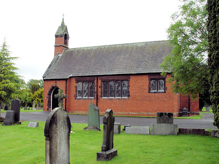
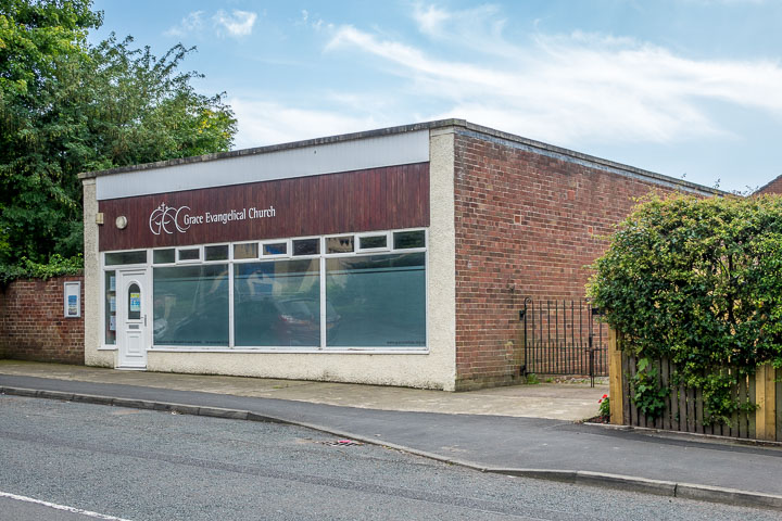
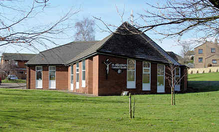
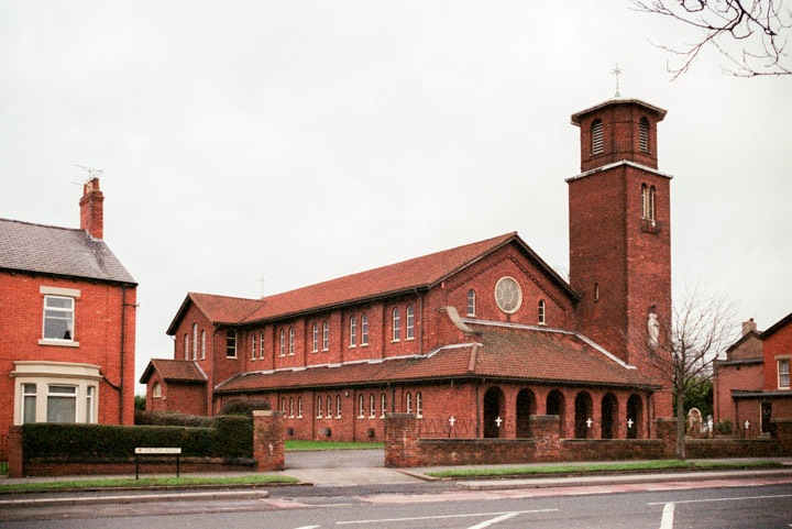
The site of Etterby Presbyterian Mission Hall (1881-1947). Demolished in the late 1960's or after 1971 (according to source consulted). A photo of this vanished building was included in a history article in the 6 Nov 2015 edition of the Cumberland News. Unfortunately it doesn't appear to be available on-line. A little history here (scroll down). It stood at NY 3898 5722. © Steve Bulman (2016). Grace Evangelical Church on Kingmoor Road. For more on the history of this church, see the Railway Mission Hall in the main section, above. NY 38986 57412. © Steve Bulman (2017). Link. St. Augustine (R.C.). NY 39774 57916. © Steve Bulman. St. Mark, at Belah. NY 39526 57894. © Steve Bulman. Link. St. Michael on Church Street at Stanwix was built in 1841, on the site of older churches, and stands within the site of the Roman fort of Petriana (aka Uxellodunum). Three additional views - 1, 2, 3. An unusual curiosity is a hogsback-style grave marker or tomb dated 1900, where lies Richard Saul Ferguson. NY 4015 5704. All © Steve Bulman (2020). Link. Grade II listed.
St. Peter at Kingmoor.
NY 39524 58914. © Steve Bulman.
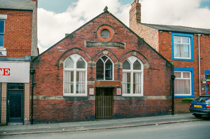
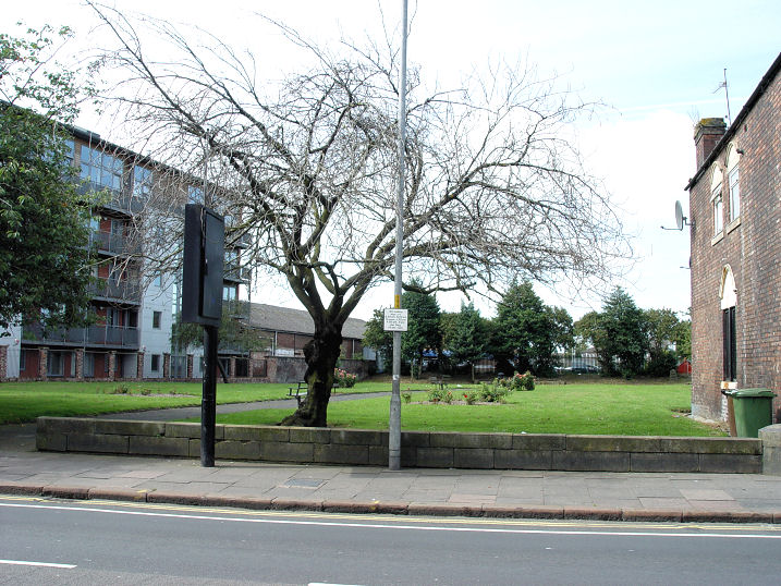
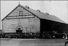
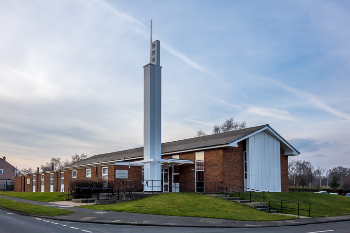
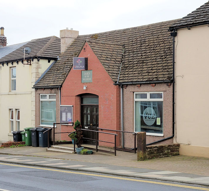
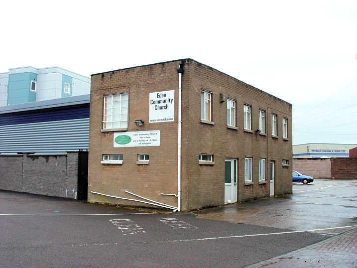
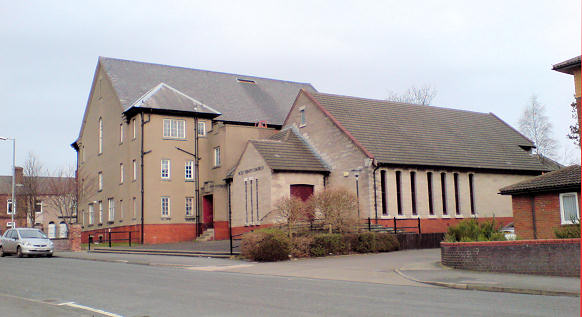
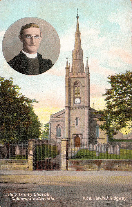
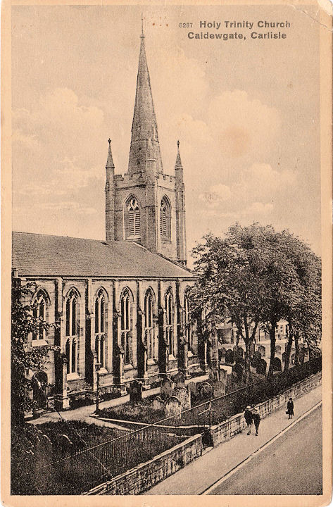
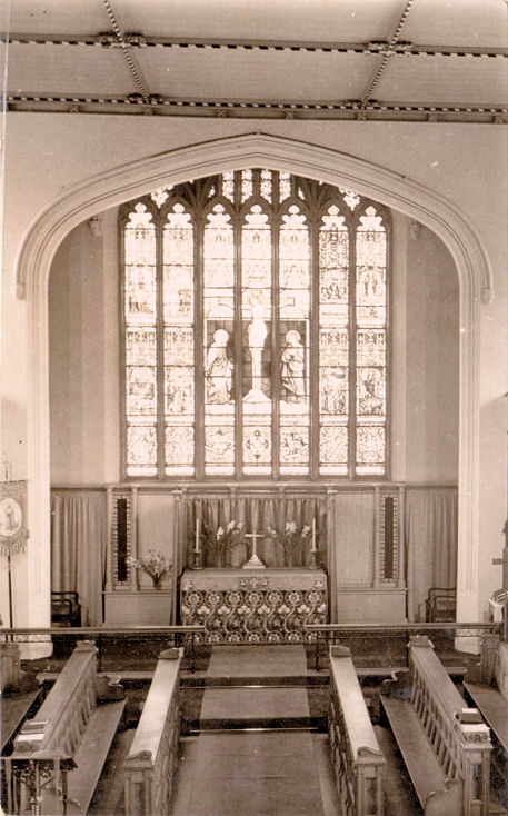
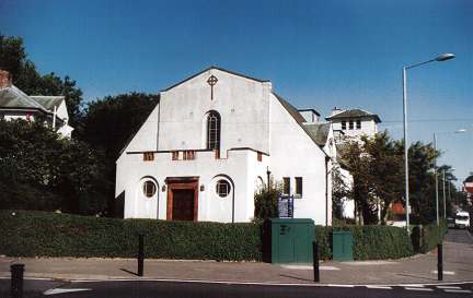
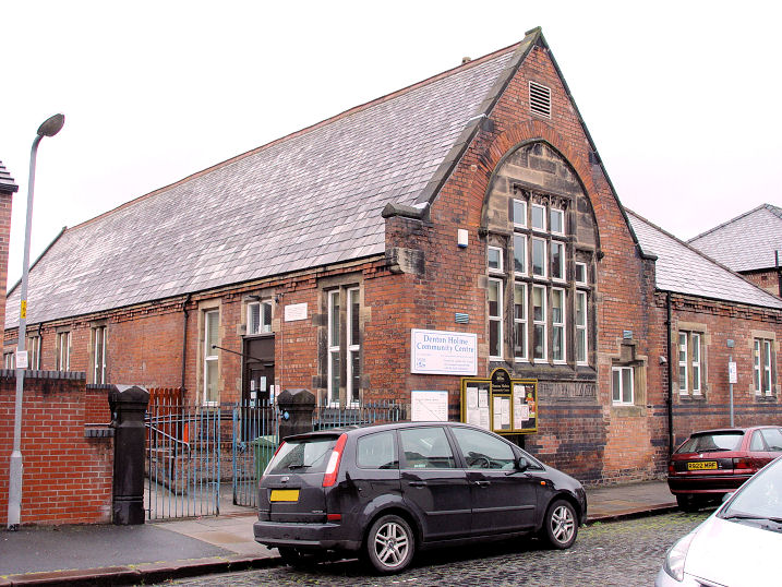
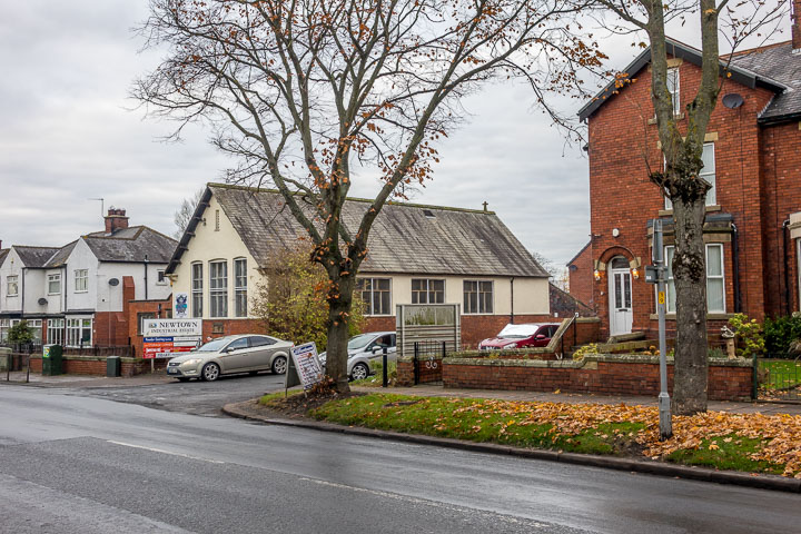
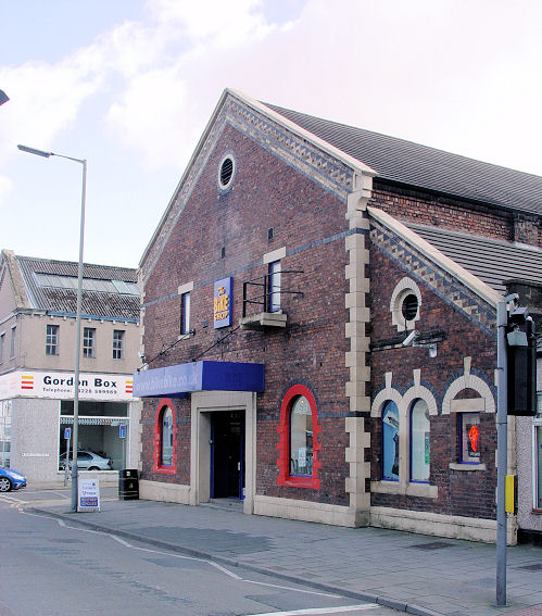
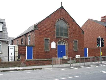
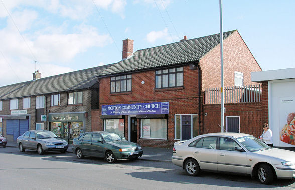
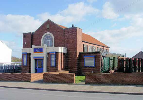
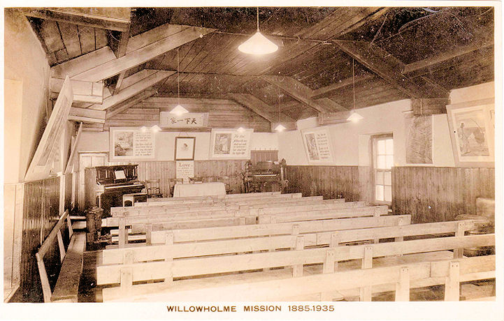
Carlisle West of the Caldew and South of the Eden. Carlisle Christian Fellowship, formerly Congregational Church (1860-1, extended 1878) on Charlotte Street. It was sold in 1976 by which time it was U.R.C. NY 396 556. © Steve Bulman. Link. Grade II listed (which also shows that it was a Kingdom Hall at some point). Carlisle Christian Spiritualist Church, in the former Temperance Hall, Caldewgate. The former Methodist Church can also be seen in this shot. Between 1883 and 1889, the Unitarians met here. NY 392 558. © Steve Bulman. What may have been an earlier meeting place is mentioned here, where a place of worship registration was cancelled in 1971 for Spiritualist Meeting Room at 16A West Walls, it having originally been granted in 1908. Christian Brethren Church meet in Morton Park Hall, Wigton Road. © Steve Bulman (2011). Link. The demolished Church of Christ stood on the corner of Denton Street and Lorne Street. The site is now occupied by offices. Originally built as Denton Street Christian Meeting House, it opened in 1872, but was known as Church of Christ by 1893. They didn't survive for very long, and the building was converted to industrial use. It was known as Atlas Hall between the wars, serving as a recreational hall for the nearby Atlas Works. In 1939 the hall was bought by the Unitarians, who continued here until 1956. It reverted to industrial use and was demolished in 1966. © Steve Bulman (2015). Church of Jesus Christ of Latter-day Saints (dedicated in 1967) on Langrigg Road. NY 3861 5474. © Steve Bulman (2018). Church of the Nazarene on Moorhouse Road - a former Presbyterian Mission Hall. NY 374 561. © Steve Bulman (2014). Link. Cumberland Infirmary on Newtown Road has (had?) a chapel, the interior of which is seen here in an old postcard from Chester Foster's Collection. This grid reference (NY 3883 5609) is just a general one for the old part of the present complex. Denton Holme (Graham Street) Primitive Methodist Chapel was built in 1881. Shown on maps as "Chap." in 1901, "P.M. Church" in 1925 and "Meth Ch." in 1938. It seems to have been sold sometime in the 1940's, and an Elim congregation was in occupancy by 1958. A 1966 map marks it as "Elim Free Church". They too relinquished the building, and it has since been demolished and flats built on the site. The Carlisle Encyclopaedia entry for Graham Street Methodist Chapel says that the proposal for demolition was mentioned in a local paper as recently as 2007. The My Primitive Methodists entry says that they have been unable to find a photo, and I have met with the same success on-line, though I find it hard to believe that a building still standing as recently as 2007 has gone un-photographed. NY 3979 5501. The site can be seen on Streetview, here. Added 2019 - I have now found a photo, in a book published in 2019 - "Denton Holme" by Dennis Perriam, P3 Publications, ISBN 978-0-9931835-7-7, page 43. Eden Community Church meets in an unprepossessing office building off Caldewgate. ca. NY 393 559. © Steve Bulman (2011). According to their website, the church was subsequently flooded, and the congregation no longer meet here, meeting instead in each others houses. The building (as of 2017) is a pilates studio. The Exclusive (Taylorite) Brethren used to meet in a private house on St. James Avenue. A general view of the avenue can be seen here, in a 2012 Streetview. Holy Trinity on Wigton Road (building commenced 1828). Demolished in 1982, though the foundations have been left in situ. NY 395 559. © George Ganley. It had originally possessed a spire which was removed in 1947. It was a distant successor to an earlier church, which stood approximately where Paddy's Market car park is today. It was replaced by this church nearby, on Wigton Road and Stanhope Road. NY 390 556. © Steve Bulman. The church with spire can be seen in two old postcards - 1, 2, and another shows the interior, all from Chester Foster's Collection. Holy Trinity and St. Barnabas (1935) on Brookside, more usually known just as St. Barnabas. NY 380 558. © Steve Bulman. Link. Grade II listed. Lighthouse Baptist Church meet at Denton Holme Community Centre on Morley Street. ca. NY 396 550. © Steve Bulman (2011). A Mission Chapel is marked on the 1901 and 1954 O.S. maps. It was the predecessor of St. Barnabas (see Holy Trinity and St. Barnabas, above), and was consecrated in 1899. It now serves as the church hall. © Steve Bulman (2016). Former Methodist Church on Caldewgate, on the corner of Morton Street, now a cycle shop. Originally Wesleyan, it was built in 1865, and closed in 1929, when it was succeeded by the Wigton Road (Wesleyan) Methodist Church (see below). NY 39267 55838. © Steve Bulman. Link. Methodist Chapel on Newtown Road. This source says it was built as a Presbyterian Mission Hall in 1911. NY 374 561. © Steve Bulman. The site of Milbourne Street Mission is now occupied by a house, although the mission stood closer to the road, covering the present parking area. Other than a brief reference here which mentions "Approval for corrugated iron mission hall" in the 1893-4 City Council Minutes, I can find no additional information about the mission. NY 3962 5579. © Steve Bulman (2016). The Carlisle maps on the Old Maps website include a 1:2500 map of 1901 vintage. On Shaddongate, about opposite the end of Broadguards, is shown a Mission Hall. I have been unable to discover anything else about this Mission, and it doesn't seem to be labelled on earlier or later maps, so was probably quite short-lived. Even its exact position is unclear, as which building the label is referring to is not obvious. A 2019 Streetview gives a general view of the area. Circa NY 3950 5575. Morton Community Church on Stonegarth, Morton Park, previously a shop. NY 382 546. © Steve Bulman. The relatively short-lived Morton Methodist Church, which stood at the junction of Newlaithes Avenue and Westrigg Road, was built (according to the My Methodist History entry) in 1963 to serve the recently built housing estates, and closed in 1990. Subsequently demolished, housing was built on the site. NY 3826 5422. © Steve Bulman (2020). There was at one time a Primitive Methodist Chapel in Willowholme. It's dated here to 1826-1852. Not marked on any maps I have access to, its exact location appears to be lost. However, the 25" 1892-1914 map shows a Chapel Street running off Willow Holme (not to be confused with the Chapel Street in the city centre). Surely it's a reasonable assumption that the chapel stood somewhere along here. Chapel Street was demolished before the 1:25,000 1937-1961 O.S. map was issued, and the whole area was recently redeveloped to enable the building of the Sainsbury supermarket, which opened in 2012. In this photo, I was standing a few yards east of where Chapel Street joined Willow Holme (circa NY 394 561), and it ran towards the supermarket entrance. It was succeeded by the Cecil Street P. M. Chapel (for which, see above, [link]). If anyone can locate this chapel more accurately, I'd be very appreciative. © Steve Bulman (2018). Raffles Community Church, on Shadygrove Road, Raffles. NY 380 554. © Steve Bulman. Rob Brettle advises that this was opened in 1939 as the Carlisle Raffles Salvation Army Hall. A place of worship (Meeting Room) was registered at 63 Rigg Street in 1964, and the registration cancelled in 1971 (see here for the document). If we assume that the house numbering further up the street has remained the same, then the church will have been where the Indian restaurant or its car park are now, as seen in this 2018 Streetview. Kevin Price speculates that this may have been an Exclusive Brethren Meeting, as many folded in the early 1970's following the "Aberdeen Scandal" - more on this here. The site of the Roman Catholic Chapel on Levens Drive. Other than a map which shows this on the Old Maps website (the 1975 edition only), and the 2009 Streetview image (the church is the low building behind the traffic sign), I can find absolutely nothing on-line about this church. Evidently closed by 2009, as a "For Sale" sign can be seen by "driving" down Newlaithes Avenue and taking the first right. It seems at least possible that this was the predecessor to St. Edmund, for which see below. NY 3829 5413. © Steve Bulman (2020). St. Bede, on Wigton Road (R.C.). NY 385 553. © Steve Bulman. The statue on the campanile is of St. Bede - more on it here. The previous church on Silloth Street was founded in 1866, and enlarged in 1883. It's now in use as part of the Ukrainian Social Club. NY 392 557. © Steve Bulman. St. Edmund (R.C.) on St. Edmund's Park, off Orton Road. NY 3710 5492. © Steve Bulman. Link. St. James, St. James Road. NY 393 549. © Steve Bulman. Link. Grade II listed. St. Luke the Evangelist, on Stonegarth, Morton Park. NY 381 547. © Steve Bulman. Sandsfield Community Church meets at the Yewdale Community Centre at the northern end of Hutton Way. It can be seen on a 2012 Streetview here. Link. Strathclyde House on Wigton Road was built as a "Home for Incurables", opening in 1885. It had its own chapel, added in 1894. The building and chapel were demolished in the early 1990's to make way for a supermarket. The site of the chapel is now under the supermarket's car park, and can be seen in this 2017 Streetview. The chapel stood back from the road, roughly in line with the telephone mast, with its short axis parallel to the road. NY 3876 5548. Link. Wigton Road Methodist Church (1928-9), also sometimes referred to as Solway Methodist Church, was successor to the Caldewgate Chapel (see above). NY 39029 55665. © Steve Bulman (2011). Link1. Link2. The interior of Willowholme Mission, from an old postcard in Chester Foster's Collection, which helpfully provides dates of 1885-1935. I've not been able to find any map which marks it.
|
||
28 January 2026
© Steve Bulman