The Churches of Britain and Ireland
|
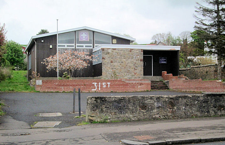
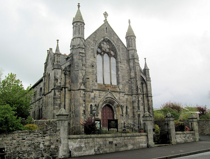
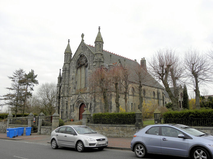
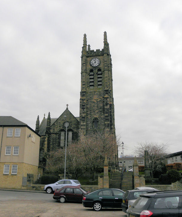
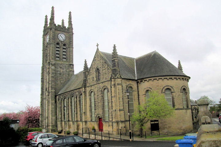
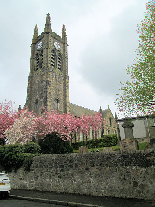
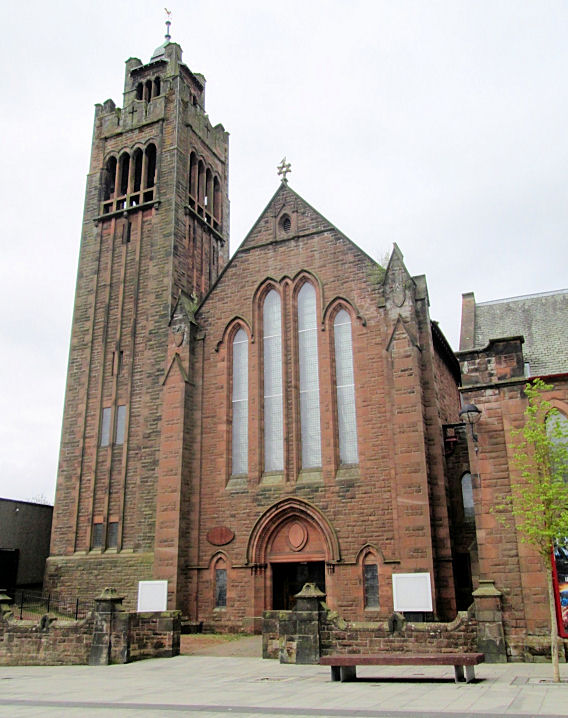
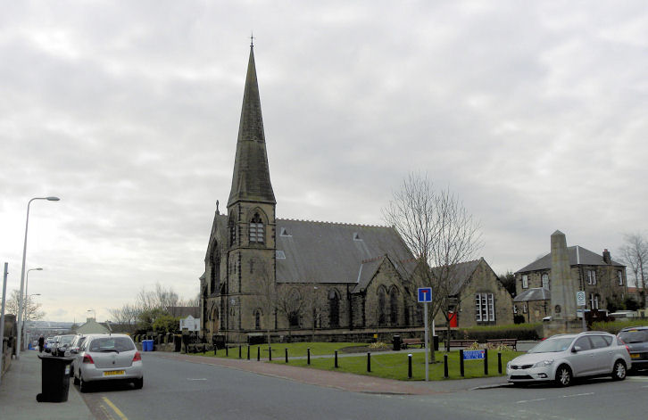
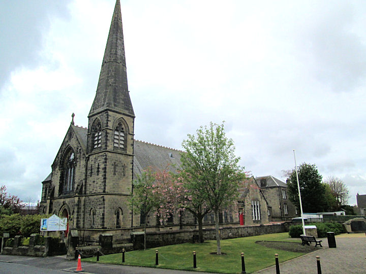
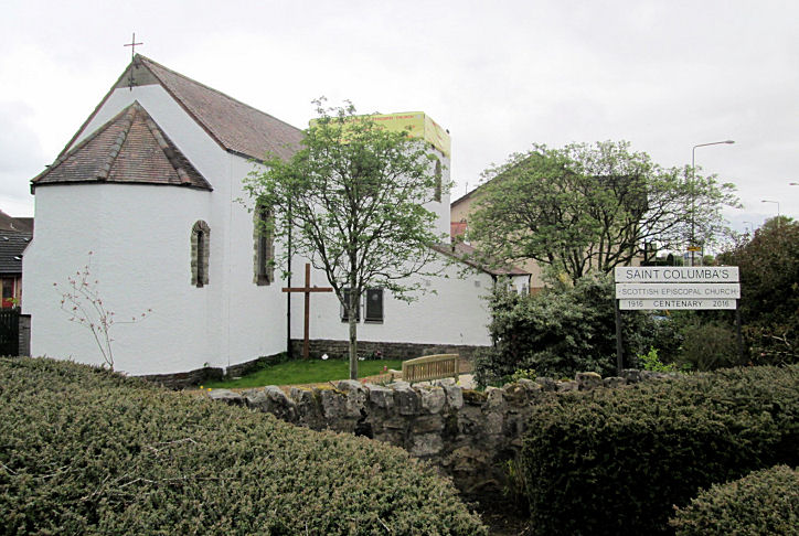
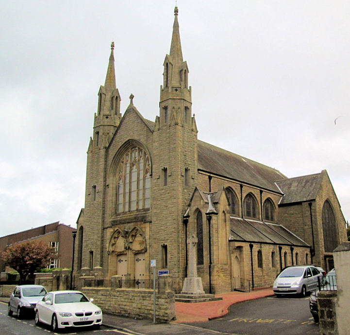
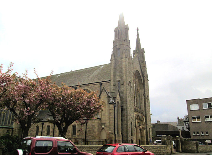
Bathgate, West Lothian Bathgate Christian Spiritualist Church meet in the Scout Hall on Marjoribanks Street. NS 9778 6894. © Jim Parker (2016). As of 2025, Google labels it as "permanently closed", presumably meaning the church rather than the scouts. Just a few yards further north is Bathgate Evangelical Union U.R.C. on Marjoribanks Street. This is the former Bathgate Congregational Church, and the earliest available map (of 1856) to show it labels it as Chapel (Evangelical Union), though this seems to have been an earlier and smaller building. Another view. NS 9774 6897. Both © Jim Parker (2016). Link. The history page dates it originally to the early years of the 19th century as an Antiburgher Secession Church, the present building dating from 1894-5. Jim advises that Bathgate Baptist Church meets in the church hall. The Category C listing for the U.R.C. includes mention of attached halls, so presumably one of the buildings attached to the rear of the church, seen here in a Streetview from 2021 is the hall in question. Bathgate Mosque is in St. David's House (2025 Streetview) on South Bridge Street. NS 9737 6882. Link. Boghall Parish Church on Elizabeth Drive, as seen by Streetview in 2025. NS 9957 6856. Link. The history page dates it to 1964-5. Category C listed. O.S. maps mark, Chapel (Site of), or Chapel, in the script used to denote an ancient building or site, between the east side of Marjoribanks Street and Balbardie Road, at NS 9786 6681. Different map editions seem to move the site of the chapel around a little, but it will have stood somewhere to the right of the road in a Streetview from 2025. I haven't been able to discover anything about it. Encounter Church meets in Lindsay House (2025 Streetview) on South Bridge Street. NS 9731 6880. Link. High Church (CoS) on Gideon Street, High Street and Jarvey Street. NS 9755 6911. © John Balaam (2011). Two additional views - 1, 2, both © Jim Parker (2016). Link. Category B listed - dates it to 1882-4, though it's on an older site. The Buildings of Scotland says that its predecessor was of 1737, on a then-new site. Its predecessor will have been what is now known as the Old Parish Church (2025 Streetview), the remains of which stand on Edinburgh Road within a graveyard at NS 9899 6816. Strangely, it appears to not be listed. Link. The former St. David on George Street (previously Engine Street). Its category B listing dates it to 1904 - earlier maps show a Free church with a different footprint on the site. NS 9743 6886. © Jim Parker (2016). Centrepoint Church has recently bought the building and intends to restore it and return it to religious use - link. Until the move in, they continue to meet in Simpson Primary School on Leyland Road - 2025 Streetview. St. John (CoS) on Mid Street. It's labelled on older maps as a U.P. Church. NS 9766 6875. © John Balaam (2011). Another view, © Jim Parker (2016). Link. St. Columba (1916, Scottish Episcopal) on Glasgow Road. NS 9666 6876. © Jim Parker (2016). Link. St. Mary and St. Columba (R.C.) on Livery Street. The Buildings of Scotland dates it to 1858, with alterations in 1908. Another view. NS 9744 6901. Both © Jim Parker (2016). Link.
|
||
27 October 2025
© Steve Bulman