The Churches of Britain and Ireland
| Barrow-in-Furness, Cumbria Barrow-in-Furness on Wikipedia. Cumbria County History - Barrow provided many of the dates.
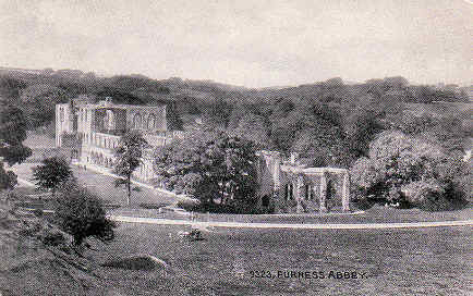
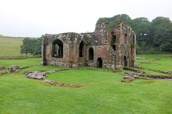
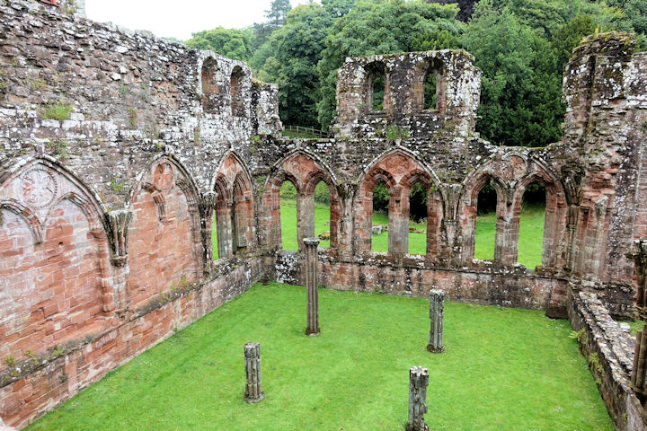
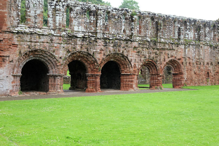
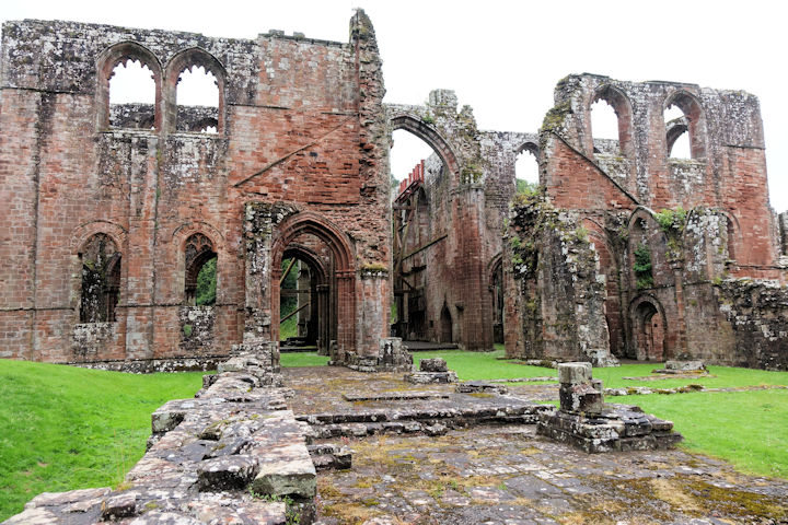
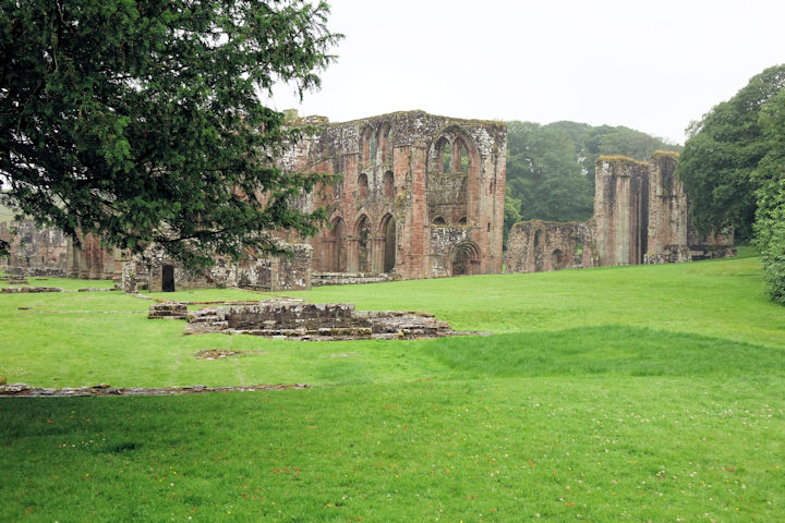
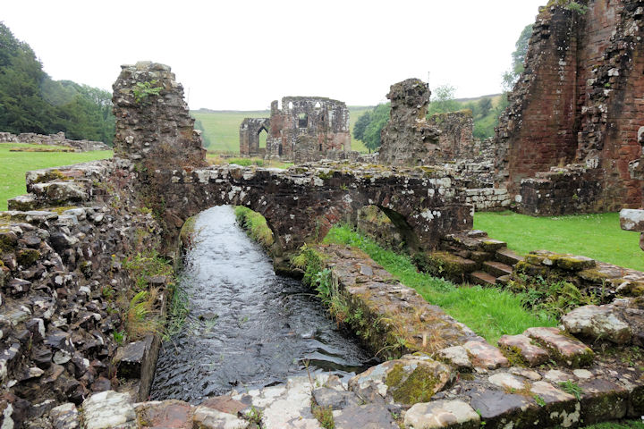
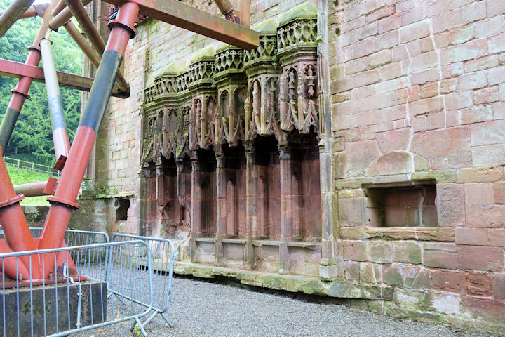
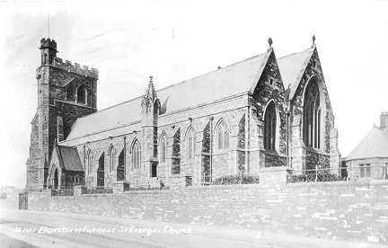
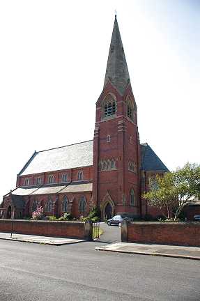
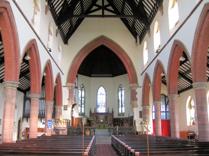
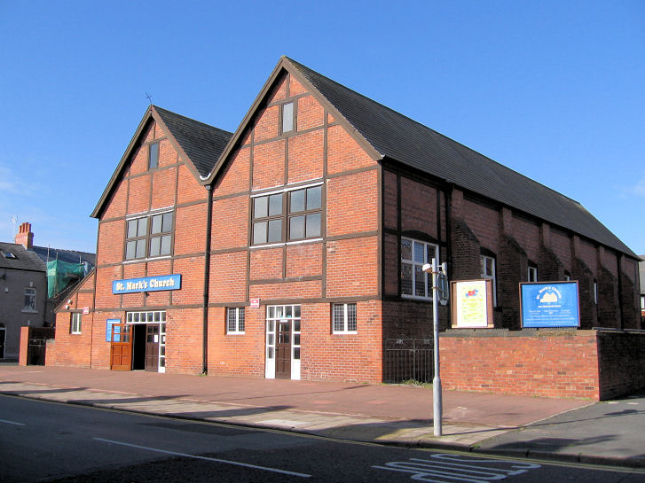
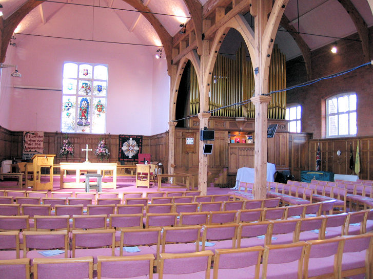
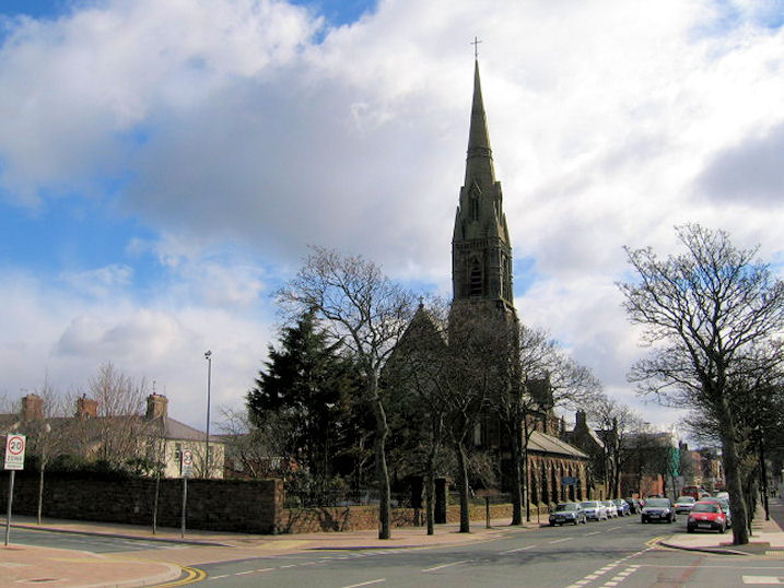
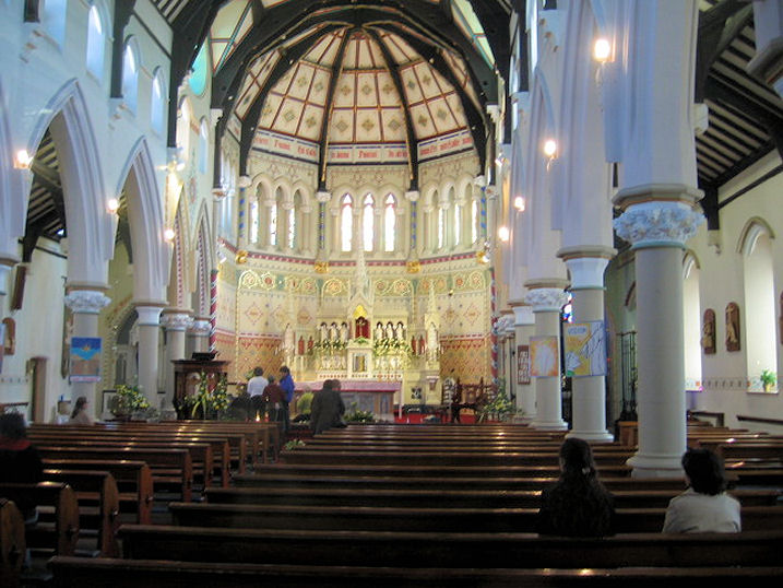
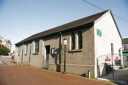
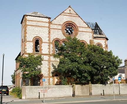
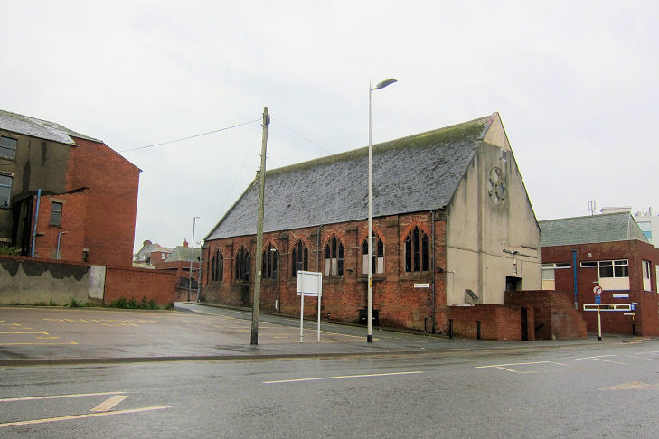
A Christadelphian Hall stands on Hibbert Street and Longreins Road, seen here in a 2014 Streetview. A date-stone for (presumably) 1914 can be seen by zooming in. SD 2007 7000. They had another hall at 32 Strand, as is evident from this document which records the cancellation of a permit in 1971, it having first been granted in 1927. I've not been able to find any maps which show this hall. Link. Church of Jesus Christ of Latter-day Saints on Abbey Road. Google indicates the building at the centre of a 2022 Streetview as the church. SD 2092 7119. Link. The remains of Furness Abbey. SD 2180 718. From an old postcard (franked 1915) in Steve Bulman's Collection. Some views taken on a visit on a very wet day - 1, 2, 3, 4, 5, 6. The fine sedilia, and the ugly but necessary engineering works recently installed to prevent collapse. All © Steve Bulman (2024). Link1. Link2. Several structures associated with the abbey complex are listed - they can be found here. Holy Family (2022 Streetview) on Ostley Bank. Link - dates it to 1975, successor to an earlier church of 1951, which still stands adjacent to the present church. An old photo of it can be seen on the link already provided, and it survives as the hall seen in the Streetview. SD 2121 7057. King's Hall (Wes. Misn.) is shown on older O.S. maps on Hartington Street and Nelson Street at SD 1966 6977. It's dated in this source to 1874-1951. It survived as a gym in 2018 (Streetview). A Mission Room is marked on old maps on Elm Road, opposite the end of Maple Street. Seen here, on a 2009 Streetview, it may be the church described here as Cemetry [sic] Cottages Unsectarian Mission, and having had its license cancelled in 1971, it having been granted in 1964. SD 1977 7087. Barrow Cemetery (off Devonshire Road) had three Mortuary Chapels, listed on the above C.C.H. link as Episcopalian, Dissenting and Roman Catholic, and all dating from 1873. The 25" O.S. map of 1913 labels the chapels as follows - Roman Catholic at SD 1995 7140, Nonconformist at SD 1999 7119, and Church of England at SD 2000 7116, the latter two forming a double chapel. There's also a later Crematorium. I don't know if any or all of these chapels have survived, as the view from the Streetview van is obscured by vegetation, but the entrance to the cemetery (SD 2000 7073) can be seen here, on a 2018 Streetview. The WWII blitz took its toll on Barrow; a Particular Baptist Church of 1873 on Abbey Road was destroyed in 1941. Its site can be seen in this 2017 Streetview - the piece of grass in the middle of the view. An illustration of the church is available here, and assuming it's accurate, it was a rather fine building. SD 1989 6969. Its successor was built at the junction of Abbey Road and Park Drive in 1953. Here's its Streetview from 2017. SD 2037 7010. Link. A Primitive Methodist Church (1875-1953) once stood between Marsh Street and Pottery Street at SD 2065 6891. Still derelict and standing in 2009, the site had been cleared by 2014, as seen by the Streetview van. Link. Sacred Heart (R.C.) stands on Pottery Street and Lumley Street, at circa SD 2068 6895. Seen here by the Streetview van in 2014, moving round the corner onto Lumley Street the adjacent Catholic School can be seen. Older maps (from before the present church was built) label it as R.C. Church and School, as seen in 2014. SD 2072 6895. The church website dates the church to 1930. St. George on St. George's Square (consecrated in 1861). SD 2028 6875. From an old postcard in Steve Bulman's Collection. A 2014 Streetview. Link. Grade II listed. St. James the Great (1867-9) on Blake Street and Hartington Street. SD 1946 6995. © Philip Kapp. Interior view, © John Balaam (2008). Link. Grade II* listed. St. John the Evangelist on Island Road, Barrow Island, as seen by the Streetview van in 2018. The C.C.H. website only says "re-built 1934-5"; this source dates the original church to 1878. SD 1973 6826. Link. Grade II listed. St. Luke on Road and St. Luke's Avenue was originally built in 1878, and re-built in 1963-4. SD 2132 6901. Link has a photo, but Streetviews show that it has been demolished, and housing built on the site - present in 2009, gone by 2017, and replaced by housing in 2018. St. Mark (1878) on Buccleuch Street and Rawlinson Street. Interior view. SD 2005 6956. Both © John Balaam (2008). Link. St. Mary of Furness (R.C., 1866-7) on Duke Street. Interior view. SD 1951 6951. Both © John Balaam (2008). Link. The former St. Matthew (1967-2015) on Harrogate Street can be seen in this 2014 Streetview. The church website has photos of its predecessor, of 1878-1964. The site of St. Patrick (R.C.) on St. Patrick's Road, Barrow Island, as seen on a 2014 Streetview. It stood on the nearer half of today's car park, and at the far end was a school. Built in 1877, by the time of a map of 1958-9 it was labelled as St. Patrick's Hall, having presumably been closed as a church in 1933, and by 1971 had been demolished. SD 1924 6862. Today's St. Patrick (1933) on Michaelson Road, as seen by the 2018 Streeview van. SD 1977 6953. Link. St. Paul (1871) on Abbey Road and Hawcoat Lane, can be seen here in a 2014 Streetview. Link. The house (2022 Streetview) on the site of St. Perran, on North Row and Rampside Road at Roose, is dated on the Roose Wikipedia page to 1967 (a re-build following a fire) to 2014 and demolished two years later, initially as Anglican, latterly as Anglican and Methodist. Genuki, which has a potted history, includes photos of two of the churches on the site. SD 2223 6928. St. Pius X (R.C.) on Schneider Road at Ormsgill, as seen by Streetview in 2009. Other Streetviews show that it went out of use by 2016, when it was being advertised as a "large hall to rent". Genuki says it was founded in 1955. SD 1944 7143. The Salvation Army building (1910) on Abbey Road is rather handsome! It can be seen here on a 2018 Streetview. It appears not to be listed. Circa SD 1980 6961. Link. Spiritualist Church. Older maps mark it as School. SD 2003 6918. © Philip Kapp. This source lists three Synagogues in Barrow - on Abbey Road (1901 to circa 1917), 29 Crellin Street (circa 1917 to circa 1925), and 62 School Street (circa 1925 to circa 1974). Unfortunately none of these synagogues are indicated on available O.S. maps, and there are no guarantees that the house numbering hasn't changed over the years, so there seems little point in providing Streetviews. Can you identify the buildings, or sites of buildings? Trinity Church (Presbyterian), destroyed in a fire March 2005. At the most recent Streetview van visit in 2018, the site was still vacant. SD 2011 6922. © Philip Kapp. Link. Trinity Church Centre (U.R.C.) on Abbey Road and Brighton Street, as seen by Streetview in 2022. It was originally Wesleyan Methodist. SD 2041 7025. The former Wesleyan Methodist Church between Hindpool Road and Lawson Street. Built and opened in 1862, it was enlarged in 1870, and closed in 1935. More recently it has been in use as a nightclub. SD 1974 6898. © Martin Richter (2015). The now-derelict Stonedyke (Wesleyan) Methodist Chapel (2024 Streetview) stands on Leece Lane, Roose, at SD 2290 6958. It's dated here to 1877-1991. O.S. maps show another Wesleyan Methodist Chapel on Greengate Street at SD 2041 6925. Built by 1911 from maps, it will be the W.M. Chapel mentioned here as dating from 1876, rebuilt 1904, known from 1953 as Central Methodist Church, closed circa 1996 and since demolished. Its site was seen by Streetview in 2022 - the Sunday School stood on the corner, church to its left. Genuki has a photo, exterior and interior.
|
||
16 July 2025
© Steve Bulman