The Churches of Britain and Ireland
| Ashington, Northumberland
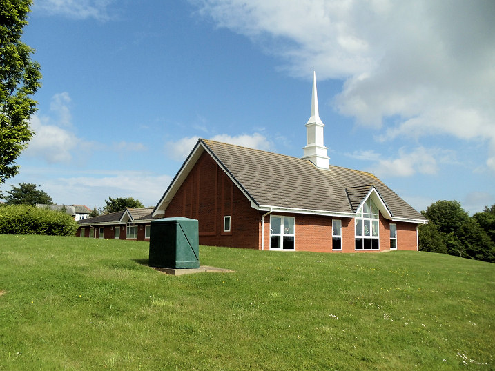
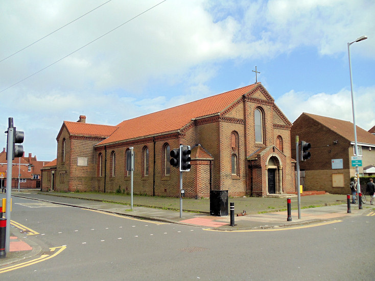
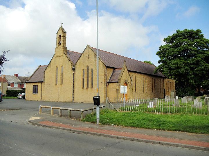
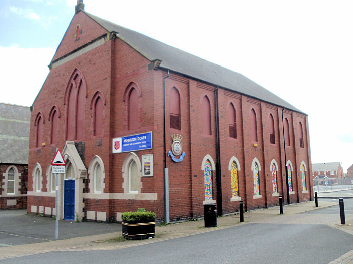
Ashington Family Church (Lakeshore Christian Ministries) meets at The Old Court House (2023 Streetview) on Park Road. NZ 2698 8769. Link. Ashington Spiritualist Church (2023 Streetview) on Hawthorn Road. NZ 2824 8697. Link. Church of Jesus Christ of Latter-day Saints on Remscheid Way. NZ 2758 8607. © Bill Henderson (2012). Link. Holy Sepulchre on Booths Road, as seen by Streetview in 2023. NZ 2642 8766. Link. An Independent Methodist Church is shown on a map of 1923 on Station Road. The housing built on its site can be seen in a 2009 Streetview. NZ 2670 8769. The same map also shows, on the same street, a large Primitive Methodist Chapel, St. Aidan (R.C.), and a Presbyterian Church, now Trinity Church. With Holy Sepulchre, which stands opposite the western end of Station Road, this makes five churches in about 600 yards. Link. A Methodist Chapel shows on a map of 1898 on First Row at NZ 2623 8779. It survived in active use until at least the mid-20th century but has since been demolished. Its site is now a parking area with garages, seen by Streetview in 2009. The row of housing running along the street behind the garages is the site of a Hall, perhaps associated with the chapel. Another Meth. Chap. shows on the same map on Sixth Row (which no longer exists) at NZ 2614 8798. The building also shows on a later map of 1923, but with no indication of it being a place of worship, so perhaps had gone out of use by then. It stood to the left of the path, just beyond the trees in this 2023 Streetview. I haven't been able to discover what flavour of Methodism either of these were. North Seaton Road Church, on North Seaton Road, as seen by Streetview in 2023. It's home to Word of Life Church. Link. An otherwise unidentified place of worship shows on a map of 1948 on Woodhorn Road, at NZ 2782 8785. However, it's almost certainly Ashington Central (Methodist) Hall of 1923 mentioned here as standing on the site of a Wesleyan Chapel. It too has been demolished, and in 2023 a care home stood on the site - 2023 Streetview. A Presbyterian Church, now Trinity Church (CoE, Methodist and U.R.C.) stands on Station Road at NZ 2702 8771 - 2020 Streetview. Link. A large Primitive Methodist Chapel used to stand on Station Road at NZ 2680 8769. Photos of it may be seen here, where it's dated to "probably around 1892". 2023 Streetview. Revival Centre Christian Church, on Park Road, as seen by Streetview in 2023. NZ 2672 8762. St. Aidan (R.C.) on Station Road at NZ 2695 8771. 2023 Streetview. Link. St. Andrew on Hawthorn Road. NZ 2808 8738. © Bill Henderson (2012). Link. St. John the Evangelist on Newbiggin Road. NZ 2808 8666. © Bill Henderson (2012). Link. Salvation Army Hall on Second Avenue. This is the former Primitive Methodist Chapel identified here as New Hirst P.M. Chapel, dateable to 1903. It also (with some hesitation) identifies the building to its left (seen in a Streetview from 2018) as its predecessor of 1898. NZ 2781 8744. © Bill Henderson (2012). Link. The 25" O.S. map of 1897 shows a U(nited) M(ethodist) Ch(apel) on Milburn Mews. It was still active in the mid-20th century, but has since been demolished and replaced by housing, seen by Streetview in 2020.
|
||
29 April 2006
© Steve Bulman