The Churches of Britain and Ireland
| Acton, Greater London
On Wikipedia -
Acton Green,
East Acton,
North Acton,
South Acton,
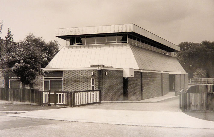
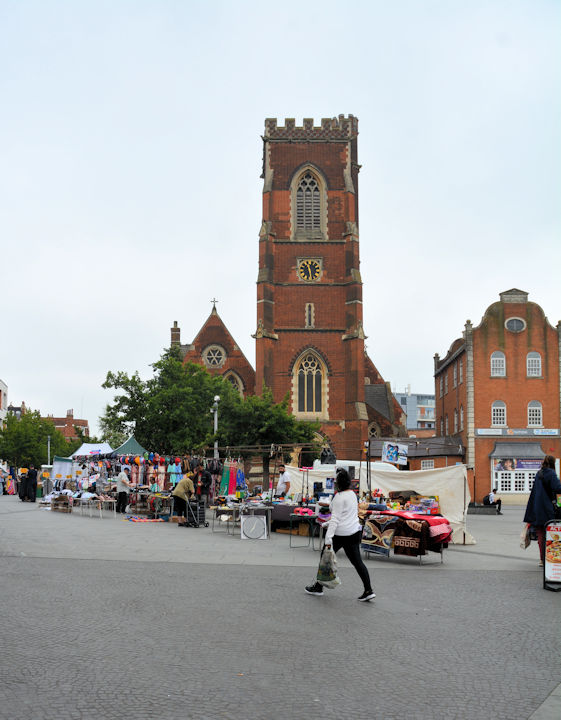
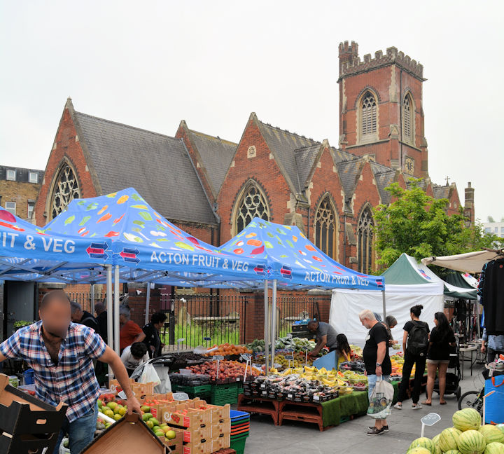
West Acton. Acton Baptist Church (2025 Streetview) on Church Road is dated in Pevsner to 1864. TQ 2007 8006. Link. Acton Hill Church, on High Street, as seen by Streetview in 2024. TQ 1977 8020. Grade II listed. Link. The About Us page dates it to 1907, replacing an earlier church on Gunnersbury Lane. This is in all likelihood the Chapel shown on a map of 1896 just a few yards away , at TQ 1971 8019, seen by Streetview in 2022. The same chapel is marked as Wes. Meth. Chapel on a map of 1874. Acton Spiritualist Centre (2024 Streetview) is set well back from Woodhurst Road, at TQ 2023 8060. Link. All Saints, on Bollo Bridge Road, as seen by Streetview in 2025. TQ 2026 7954. Link. Older O.S. maps show an earlier All Saints a little way further west on Bollo Bridge Road at its junction with Strafford Road, at TQ 2013 7954. Housing stands on the site today (2020 Streetview). Some photos can be seen here. Holy Family (R.C.) on Vale Lane. It's dated in Pevsner to 1967. TQ 1916 8162. © Christopher Skottowe (1968). A 2020 Streetview. Link. Kingdom Hall of Jehovah's Witnesses (2020 Streetview) on Acton Lane and Leythe Road. Older O.S. maps show that it stands on the site of a Baptist Chapel, built between 1866 and 1894. TQ 2038 7973. An 1896 map shows a Mission Church on Osborne Road at TQ 1966 7951. The building still seems to be present on a map of 1937, but it's unlabelled so may have been closed. A block of flats and adjacent pavement now stands on its site (2022 Streetview). Another Mission Church stood on Stanley Street at TQ 2003 7937. Also shown on the 1896 map, it seemingly didn't survive into the 1920. Its site lies beneath the flats seen by Streetview in 2022. The 25" 1896 map also shows a Mission Hall on Palmerston Road at TQ 2011 7941, just one street east from the Stanley Street Mission. Not shown on later maps, its site was seen by Streetview in 2022. An 1896 map shows a Mission Church on Salisbury Street and Acton Lane, at TQ 2040 7998. It seems to have gone out of use by the late 1950's and has since been demolished. Its site was seen by Streetview in 2012. There used to be a Methodist Chapel (no maps label it more closely than this) set back from Bollo Bridge Road. Showing on maps from 1896 to the mid-20th century, it has since been demolished. It site is marked by the nearest portion of the warehouse seen by Streetview in 2024. This source has dates of 1880-1955. TQ 1995 7943. Our Lady of Lourdes (R.C.) on High Street, seen by Streetview in 2025. TQ 2018 8006. Link1. Link2 - dates it to 1902. Pentecostal Missionary Church of Christ, as seen by Streetview in 2025. It stands on The Vale and Birkbeck Grove. TQ 2066 8003. Facebook. St. Alban the Martyr is on South Parade, and was seen by Streetview in 2022. Pevsner dates it to 1887-8. Judging by the present aerial view, and early large scale O.S. maps, the church was extended at some point. TQ 2066 7887. Link explains that the church was closed between 2000 and 2014. St. Dunstan on Friars Place Lane was seen by Streetview in 2020. TQ 2096 8078. Link. The history page dates it to 1878-9. St. Gabriel on Noel Road and Balfour Road, as seen by Streetview in 2018. TQ 2036 8152. Link. The About page dates it to 1930-1. St. Martin is on Hale Gardens and Stanway Gardens, and was seen by Streetview in 2018. Link. The About Us page says it was consecrated in 1906. St. Mary on High Street. Another view. TQ 2002 8018. Both © Karel Kuča (2024). Link. Grade II listed - dates it to 1865, with tower added in 1877. A churchyard monument is also listed as grade II. St. Peter is on Southfield Road and St. Alban's Avenue, and was seen by Streetview in 2020. TQ 2076 7959. Link. St. Thomas used to stand on an island on Bromyard Avenue. It's dated here to 1915, demolished in 1995. A rather distant aerial view of it can be found here. Modern buildings stand on its site (2024 Streetview). TQ 2141 8042. St. Thomas Syriac Orthodox Cathedral (2019 Streetview) on Old Oak Road and Armstrong Road is the former St. Saviour, a church for the deaf. It's dated in Pevsner to 1924-7, "to replace a church of 1873 by Blomfield, in Oxford Street". It hasn't survived. TK 2183 8029. Link. Have I mised any? - please let me know!
|
||
10 December 2025
© Steve Bulman