The Churches of Britain and Ireland
| Abingdon, Oxfordshire
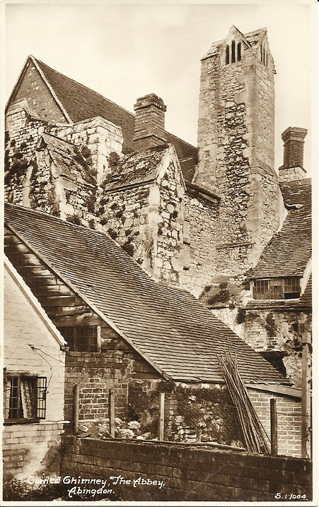
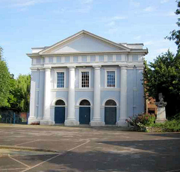
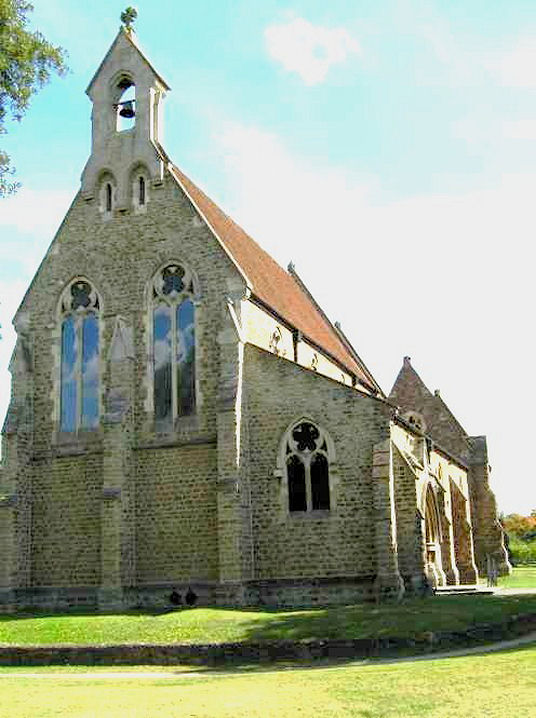
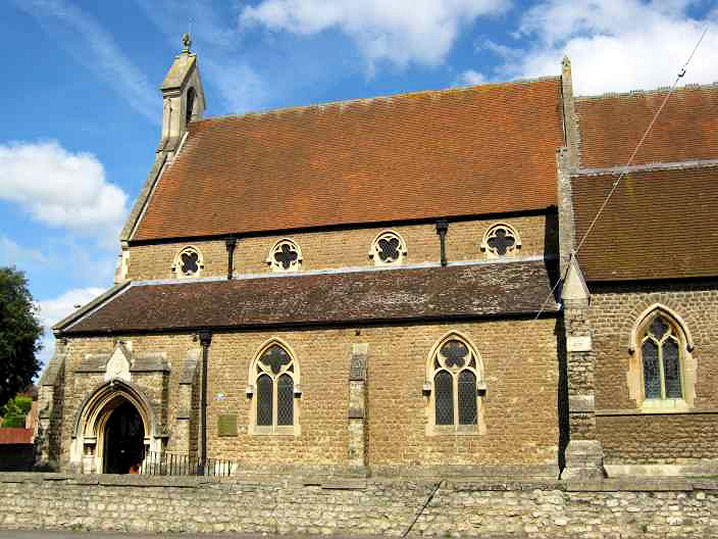
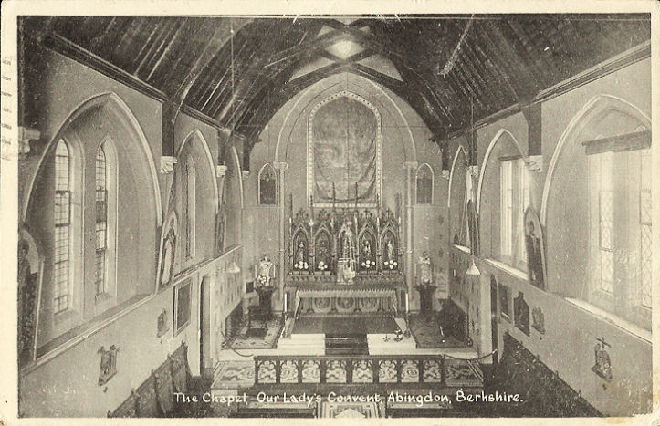
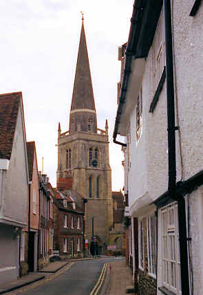
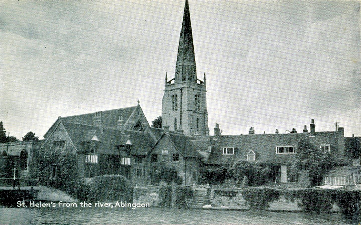
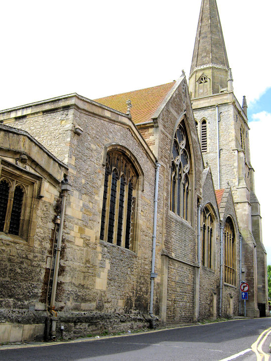
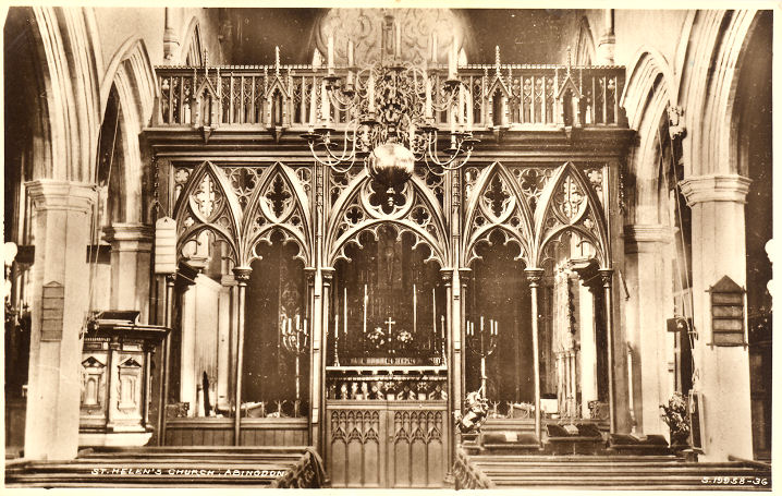
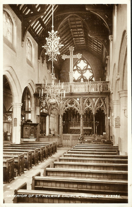
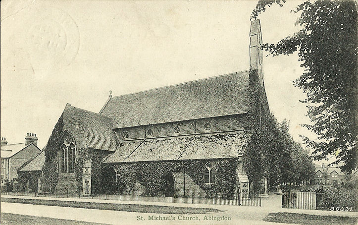
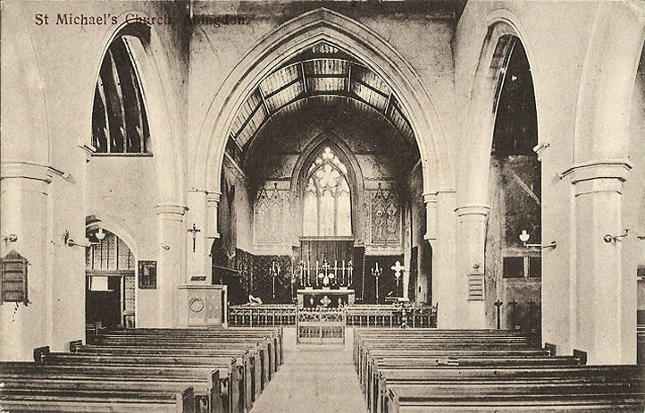
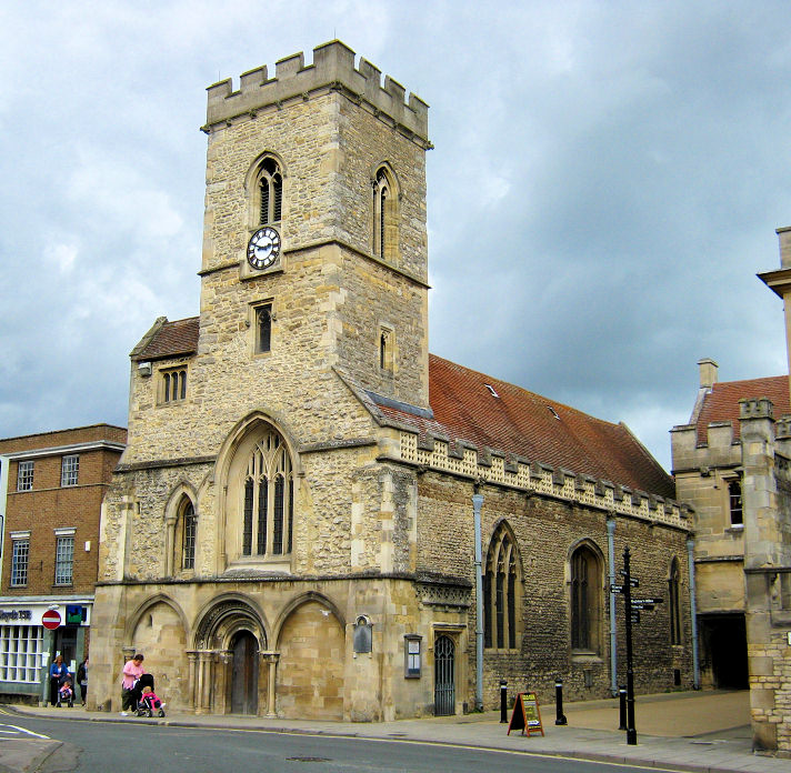
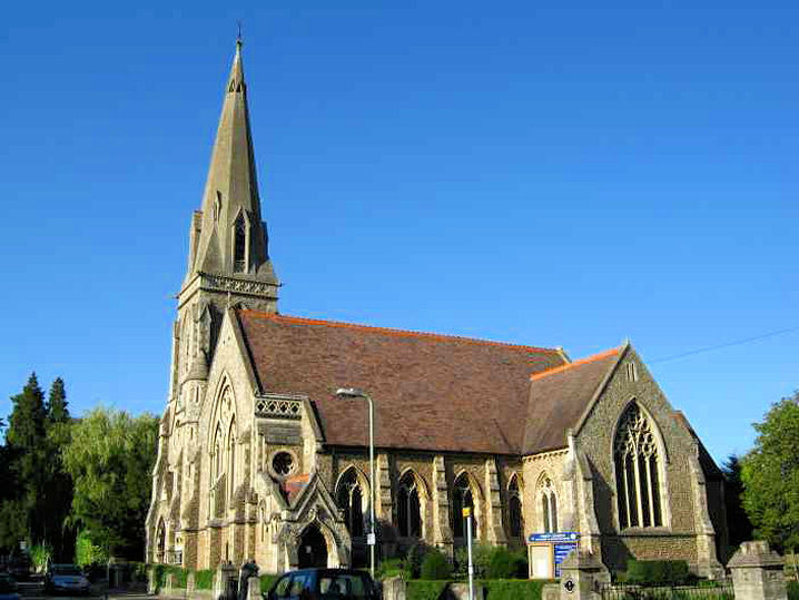
Abbey Baptist Church (2020 Streetview) is on Checker Walk. SU 4995 9704. Link. Abingdon Benedictine Abbey, showing a C13 chimney. SU 5003 9701. From an old postcard in Judy Flynn's Collection. Link. Abingdon Baptist Church, off Ock Street. Its grade II listing dates it to 1841, and says it's the third chapel on the site. SU 4945 9710. © Chris Emms (2011). Link. Abingdon Community Church meets in Thameside Primary School, seen by Streetview in 2018. Link. Abingdon Quakers meet in Abingdon Community Support Service (2022 Streetview) on Crabtree Place. Link. All Saints Methodist Church is on Appleford Drive and Dorchester Crescent. It was seen by Streetview in 2023. SU 5015 9834. Link. The history page dates the foundation of the church to 1959. An otherwise unidentified Chapel shows on old maps, on the south side of Ock Street at SU 4936 9699. Pre-dating a map of 1900, it remained in active use at least until the mid-20th century, but was demolished at some point, and its site now lies beneath an access road, seen here in a Streetview from 2023. Can you advise what it was? Christ Church on Northcourt Road, as seen by Streetview in 2023. Link.SU 4993 9827. A former Congregational Chapel stands on The Square. It was seen by Streetview in 2023. SU 4959 9710. Grade II listed, wherein it's dated to 1862. The cemetery at the western side of the town has two Mortuary Chapels, identified on large scale O.S. maps as Nonconformist at SU 4880 9733, and Church of England at SU 4874 9729. In this 2023 Streetview from Spring Road, both can be seen, the Nonconformist is the closer one. A better view of one of the chapels can be seen here, where they are dated to 1860. Our Lady and St. Edmund (R.C.) on Radley Road. Another view. SU 5004 9757. Both © Chris Emms (2009). Link. Just a short distance north lies the former Our Lady's Convent (R.C.) on Oxford Road, now a school. A 2023 Streetview provides an exterior view. SU 5013 9770. From an old postcard in Judy Flynn's Collection. Link. Peachcroft Christian Centre on Lindsay Drive, as seen by Streetview in 2023. SU 5082 9863. Link. Pearly Gates Church shows On Google Maps as meeting in Fitzharrys School on Saxon Court. Streetview hasn't seen the school, but a photo of it can be seen here. Facebook. St. Helen, on St. Helen's Wharf. SU 4969 9677. © Roy Graham. An old postcard view, from Reg Dosell's Collection. Another view, showing the five aisles, © Chris Emms (2009), who advises that St. Helen is the second widest parish church in the country. Interior view, from an old postcard in Steve Bulman's Collection. Another interior view, from an old postcard in Judy Flynn's Collection. Link. Grade I listed. An unusual feature in the churchyard is an organ blowing chamber, which is grade II listed (it includes a photo). St. Michael and All Angels (1867) on Park Road. Interior view. SU 4911 9719. Both from old postcards in Judy Flynn's Collection. Link. Grade II listed. St. Nicolas on Market Place. © Chris Emms (2009). Chris advises that the official spelling is "Nicolas". SU 4984 9708. Link. Grade I listed. The Salvation Army Church on West St. Helen Street, as seen by Streetview in 2023. SU 4968 9699. Link. Trinity Church (Methodist and U.R.C.) on Conduit Road. Older maps label it as Wesleyan. SU 4929 9718. © Chris Emms (2009). Link. The history page says it was opened in 1875.
|
||
15 December 2023
© Steve Bulman