|
|
Caerphilly
Caerphilly on Wikipedia.
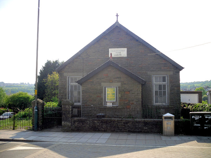
Aberbargoed,
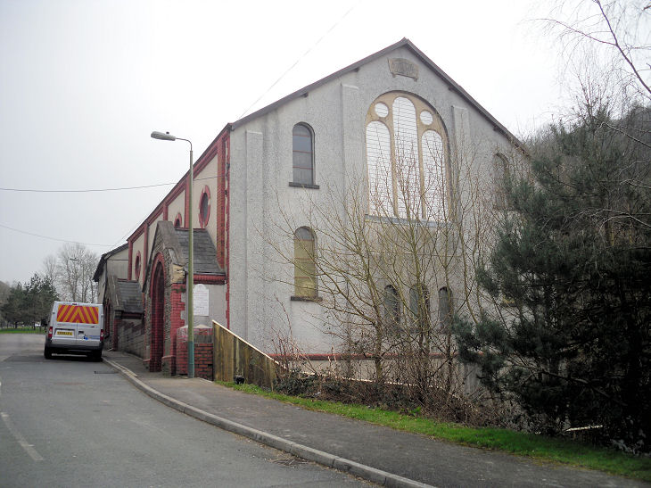
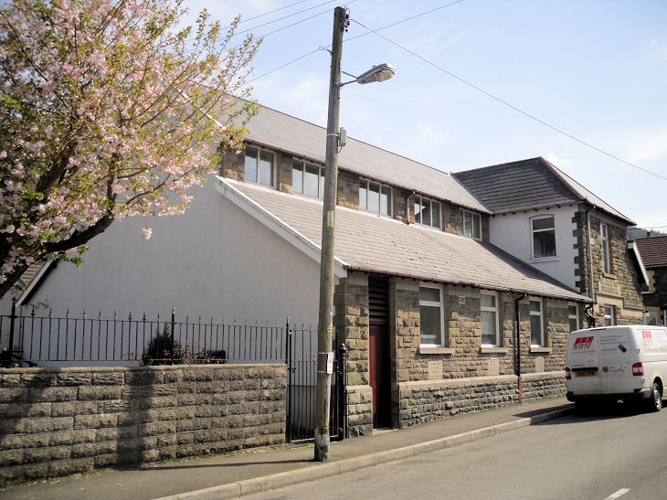
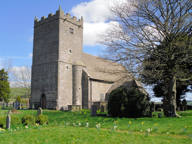
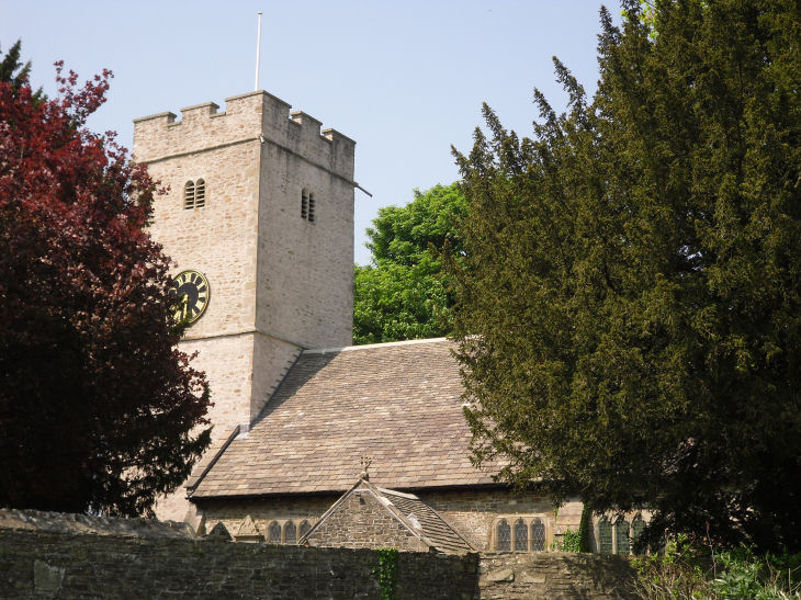
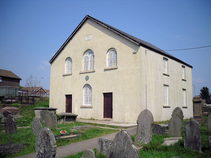
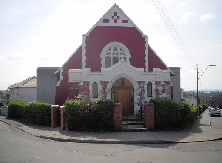
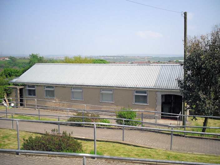
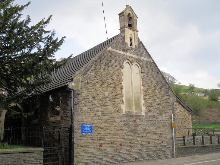
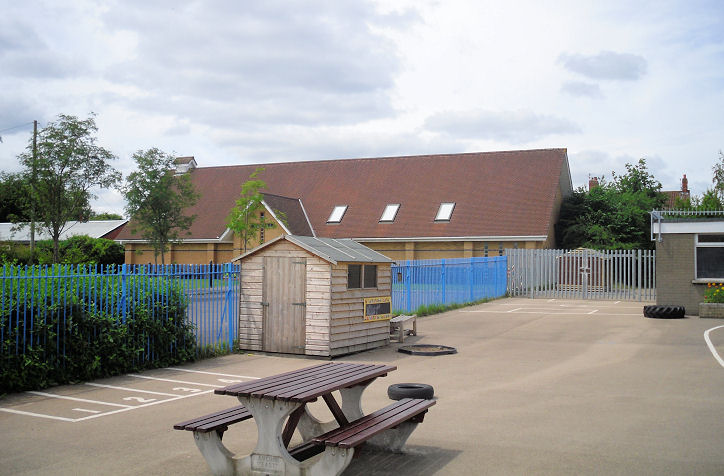
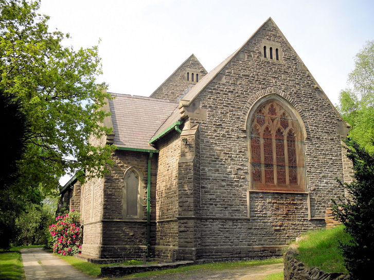
St. Peter on Commercial Street and Church Street, as seen by Streetview
in 2021. SO 1569 9985. Link.
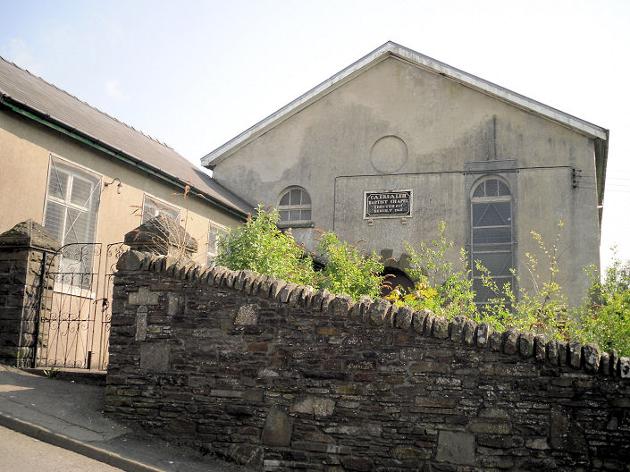
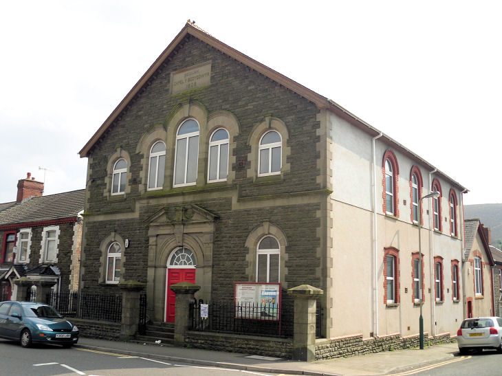
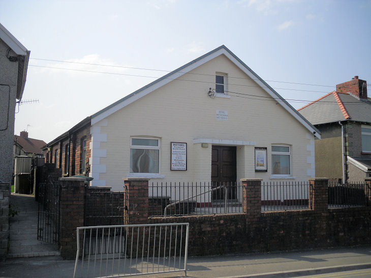
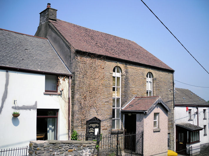
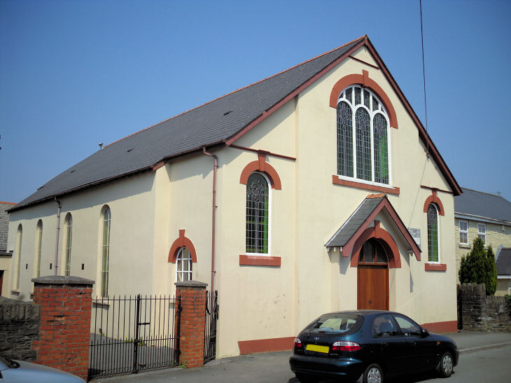
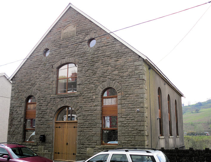
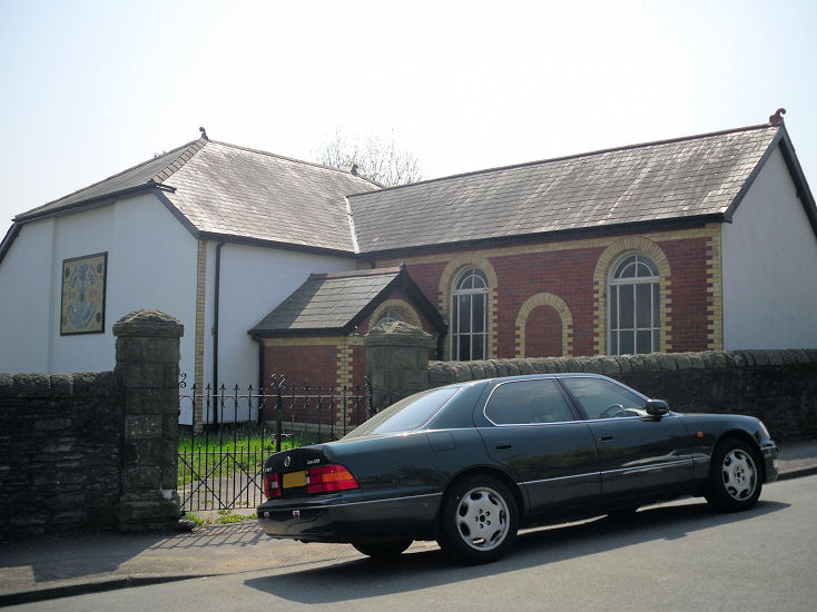
Caersalem Baptist Chapel
on Bedwellty Road has dates 1839 and 1860 (re-built). SO 1525 0030.
© Gerard Charmley (2011).
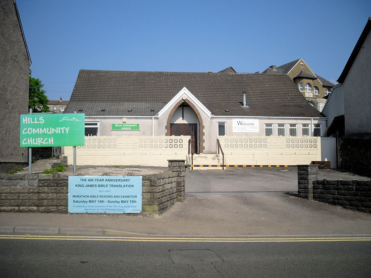
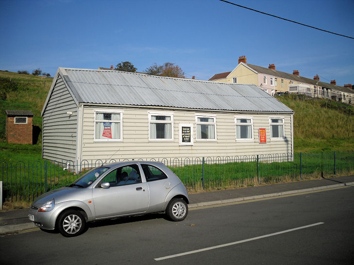
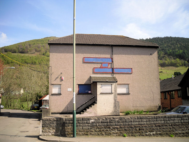
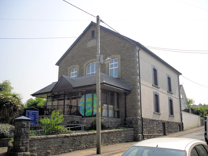
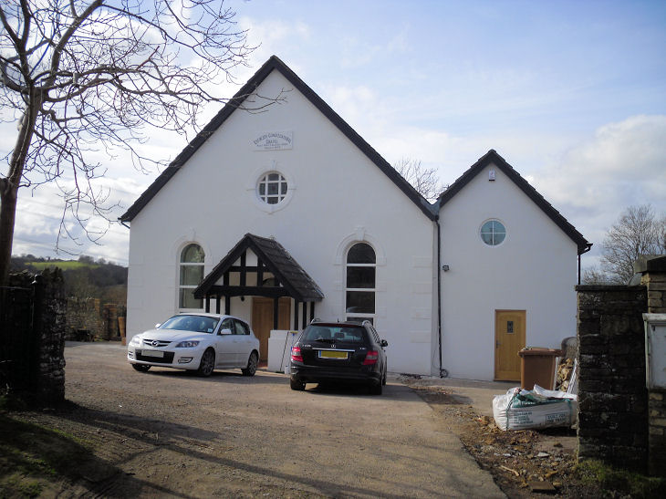
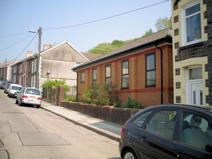
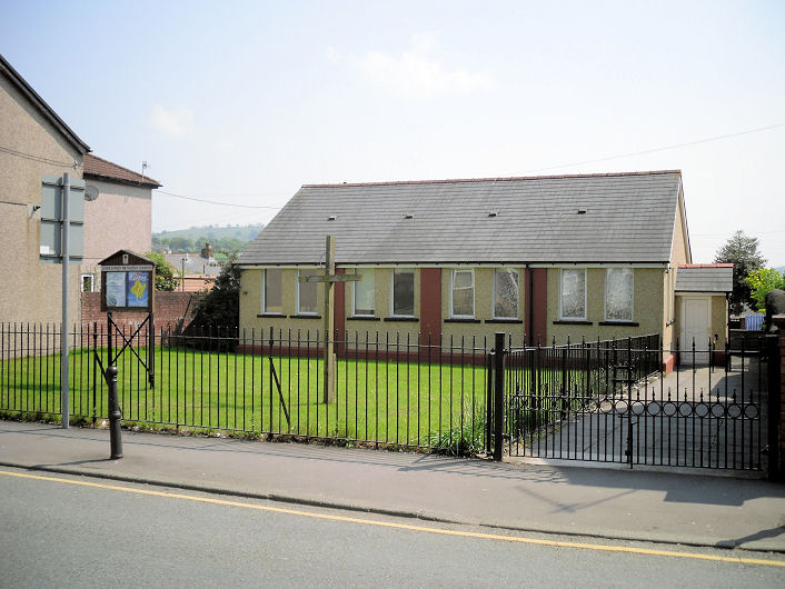
Hills Community Church
on the A4049.
Between mid-2021 and late 2022 this had become Awaken House of Prayer
(2022 Streetview).
SO 1550 0015.
© Gerard Charmley (2011).
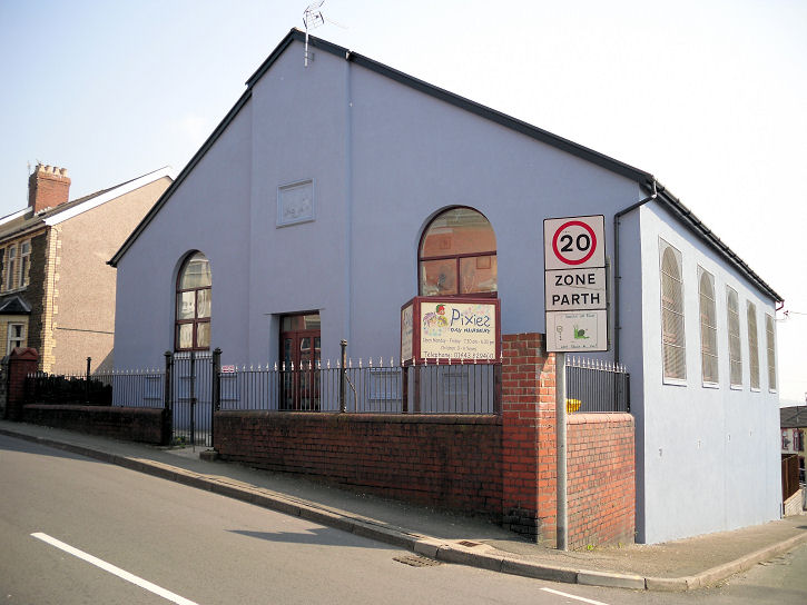
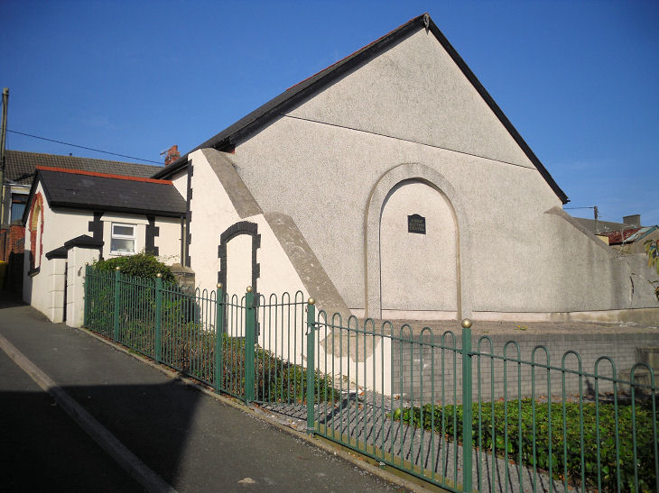
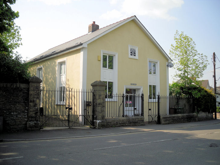
The former Moriah Baptist Church, now a nursery,
stands at the junction of the B4511 and Pant Street. It's dated
here to 1923. SO 1551 0030.
© Gerard Charmley (2011). A mid-20th century 1" O.S. map shows a
place of worship on
Heol Ysgol
Newydd, but what it was is unknown. It will have stood on the right of
the road seen in a 2009
Streetview. SO 1542 0009.
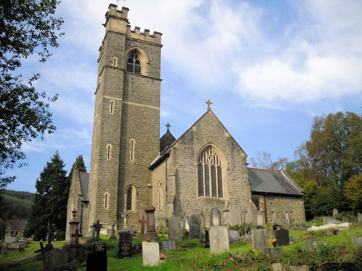
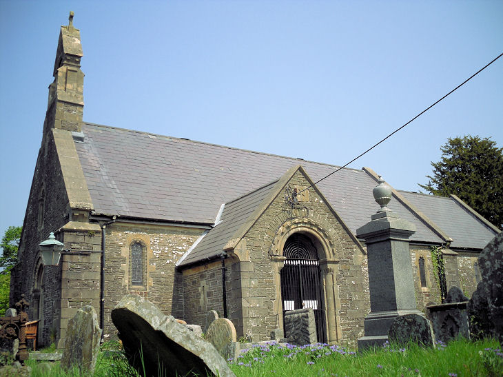
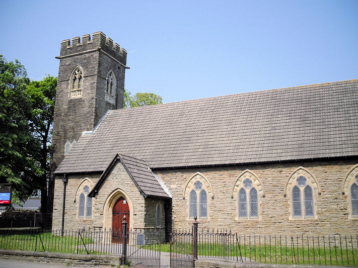
Aberbeeg, Christchurch.
Coflein dates it to
1907-9, successor as parish church to St. Illtyd. A
2012 news item, discussing its proposed closure, states that it was
then 102 years old. Its lack of internet presence suggests that it did
indeed close. SO 2075 0160. © Gerard Charmley (2011).
Grade II listed. Aberbeeg straddles the county boundary, so for St.
Illtyd and the Methodist
Church, see Blaenau Gwent.
Abercarn.
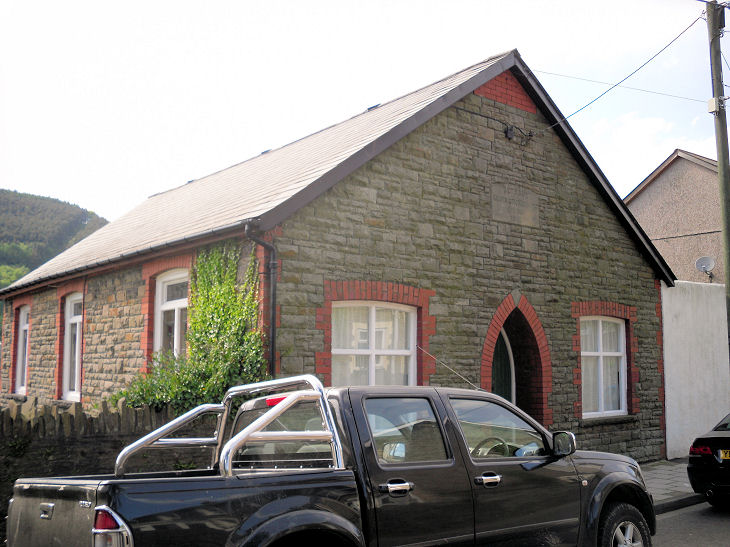
Abertridwr, Beulah Baptist Church,
which stands on Thomas Street and Cross Street. It bears a date-stone
for 1905, but its Coflein
entry says that it was built in 1902 and modified in 1905. ST 1226
8927. © Gerard Charmley. The signage to the left of the entrance shows
that Abertridwr Community Church also meets
here (2023 Streetview). The former
Nazareth Calvinistic Methodist Chapel
on Thomas Street, now a community centre. Its
Coflein entry dates it to 1898, re-built in 1908, and closed "by
1998". ST 1209 8937. © Gerard Charmley. The former Gospel Hall
off Lower Francis Street, now a
private residence. ST 1181 8921. © Gerard Charmley.
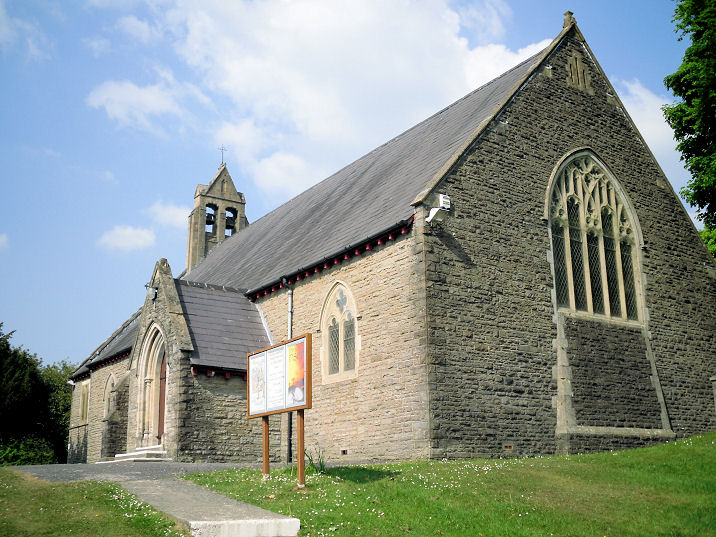
Abertysswg, St. Paul (CiW).
SO 1302 0556. © Gerard Charmley (2011).
Older O.S. maps mark, immediately south of the church at SO 1301 0553 on
Alfred Street, a former Chapel. So far
unidentified, it, or the building which replaced it, was seen by
Streetview in 2009.
Its
Coflein entry also doesn't identify it. St. Paul can be seen in the
background.
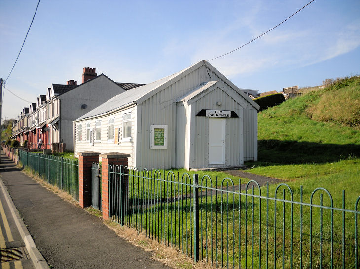
Elim Tabernacle on
Warn's Terrace.
Streetviews show that it had been closed and demolished between 2011 and
mid 2021.
Another view.
SO 1281 0568. Both © Gerard Charmley (2011).
Ainon Baptist Chapel has been demolished, but the congregation meet in the
vestry. According
to its
Colflein entry, the chapel was built in 1906, and demolished by
1997.
SO 1296 0563. © Gerard Charmley (2011).
Jerusalem Calvinistic Methodist Chapel
on Alexander Street bears the date 1903.
Another view. SO 1305 0567. Both
© Gerard Charmley (2011).
Link. The former
Bethania Welsh Independent Chapel stood on
Walter Street at SO 1309 0557, and is dated by Coflein to 1902. It, or
the building which replaced it, was seen by
Streetview in 2009.
Bargoed.
Bedwas.
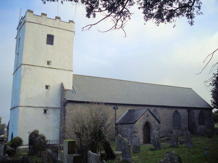
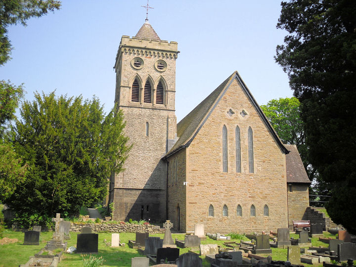
Bedwellty, St. Sannan.
SO 1666 0031. © David
Gallimore. Another view,
© Gerard Charmley (2011). Link.
Grade II* listed.
Coflein entry.
Blackwood.
Brithdir,
St. David (CiW, blue sign at left edge of photo), on Station Road. SO 1522 0199. © Gerard Charmley (2011).
A 2025 Streetview
shows it for sale. A map of 1901 shows two chapels and a Mission Church
within very easy walking distance of each other, with a map of 1956
showing another place of worship just a little further south, and a map
of 1919 showing another chapel to the north of them all. Working from
north to south these were Beulah Chapel (Baptist)
at SO 1514 0192, a Meth. Chap. at SO 1518
0189, the un-named Chapel at SO 1522 0183, Mission Church at SO 1527
0172 and the place of worship at SO 1529 0162. Beulah survived at least
to 2025, though derelict. At the time of the first Streetview visit in
2009 its signage was still visible -
Streetview. The
Methodist has gone, replaced by a parking area -
2025 Streetview.
The un-named Chapel stood where the red brick house is in a
Streetview from
2025. The Mission Church has also gone, its site now occupied by the
left part of the house seen in a
Streetview from
2025. The last one, the place of worship - the small scale of the map
which shows it makes it unclear which building is meant, but nothing can
be seen on Streetview. Above the town are the remains of
Capel y Brithdir, at SO 1387 0253.
Link says it was medieval, demolished in 1960. A
video includes
modern views of the churchyard, and old photos of the chapel.
Caerphilly.
Cefn Fforest
- see
Blackwood.
Cefn Hengoed, St. Anne,
on Hengoed Road. Its
Wikipedia article dates it to 1939, with closure during or before
2015. Coflein has it
as Cefn Hengoed Mission Church. ST 1463 9621. © Gerard Charmley
(2011). Bethel Baptist Chapel
(1933) on Gelligaer Road. Visible in a
2022 Streetview,
signage added since Gerard's visit now calls the church Hope Church.
ST 1467 9580. © Gerard Charmley (2011).
Link.
Craig-y-Raca. Marked on
maps as a church, can you give it a name?
© Gerard Charmley (2010).
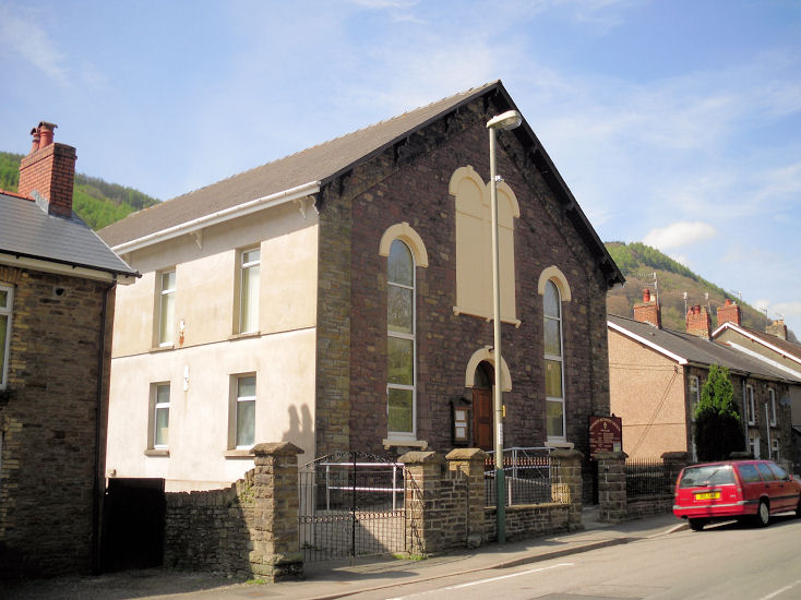
Crosskeys, St. Catherine (CiW)
stands at the junction of Gladstone Street and Woodward Road. Gerard advises that there wasn't a notice board, so is this church closed?
Added in 2023 - this
source confirms that it is closed. ST 2205 9190. © Gerard Charmley
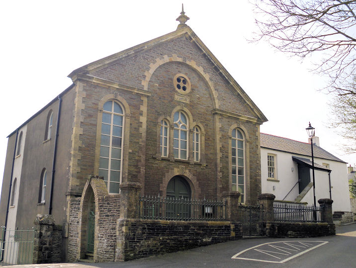
(2011). Hope Baptist Chapel (1880)
on High Street and Oak Terrace at ST 2208 9211. Its
Coflein entry dates
it to the late C19. © Gerard Charmley (2011).
Crosskeys Methodist Church
on High Street.
Coflein dates it to the late C19, as Wesleyan. ST 2204 9235.
© Gerard Charmley (2011).
Link.
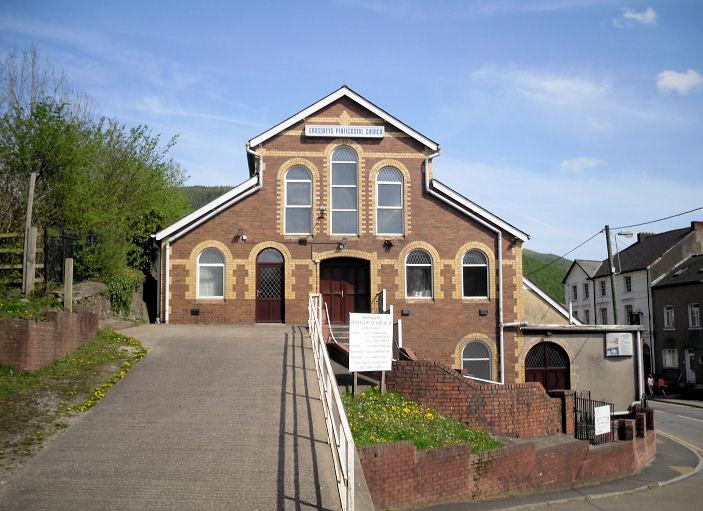
Crosskeys Pentecostal Church
on Gladstone Street. ST 2180 9167. © Gerard Charmley (2011).
Link. The
Pentecostal Church stands immediately adjacent to a roadside building,
marked as Chapel on an O.S. map of
1902. it seems to have survived as the building seen
here in a Streetview
from 2011. Presumably now part of the Pentecostal church, what was it
originally? A Primitive Methodist Chapel
used to stands just a few yards west of St. Catherine at ST 2202 9188.
Coflein says it was "likely built in 1893". Now demolished, the
car park on its site can be seen in the earliest available
Streetview from
2009. An old postcard of the chapel can be seen
here.
Pontywaun Christian
Spiritual Church on Hall's Road Terrace, as seen by Streetview in
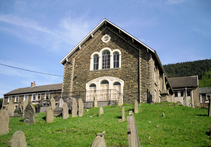
2021. ST 2205 9251. The former
Trinity Congregational
Chapel is on Trinity Hill. Its
grade II listing dates it to 1870. ST 2210 9254.
©
Gerard Charmley (2011).
Coflein entry.
Crumlin, the former St. Mary
(CiW) on
Hafodyrynys Road, at ST 2143 9848.
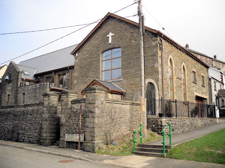
© Gerard Charmley (2011). Bethel Baptist Church
on
Hafodyrynys Road at ST 2148 9846.
Coflein has an
entry
for this chapel (photos
here), but calls it Jerusalem, and Bethel. I haven't been
able to determine if it was known by both names, or if this is an error.
It dates it to 1906, a re-build of an earlier chapel of 1897. © Gerard
Charmley (2011). The former Hillside Methodist Church,
on Hillside.
Coflein, which calls it Whitethorn Street Calvinistic Methodist
Chapel, dates it to "after 1910" to circa 1980. ST 2119 9837. © Gerard
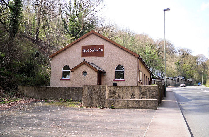
Charmley (2011). Rock
Fellowship Gospel Hall on Kendon Road.
This became Elevate Church in 2022 (link).
Circa ST 2098 9851. © Gerard Charmley (2011). Standing just east of Crumlin at ST 2291
9897 lies
Hafodyrynys
Congregational Chapel.
Another view. Both
© Martin Richter (2012). The
Coflein entry (which includes two photos) dates it to 1894.
Cwmcarn, St. John the
Evangelist on Park Street. A 2022
news article says it was closed "seven years ago", so about 2015. ST
2218 9363. © Gerard Charmley (2011).
Coflein dates St. John to "about 1925", and says it was successor to
an earlier church "on the opposite side of the road". This seems to be
incorrect as a map of 1902 shows St. John's Church in exactly the
same location as the surviving church. The former St. Winefride
(R.C.). © Gerard Charmley (2011).
Zion Baptist Church was started in 1912, but never finished - only the school buildings were
built. © Gerard Charmley (2011). The former Kingdom Hall of Jehovah's Witnesses, closed
in 2003. © Gerard Charmley (2011).
Cwmfelinfach, the
former Bethany Calvinistic Methodist Chapel (1912) on Commercial Road.
ST 1849 9184. © Gerard Charmley (2011). The 1951 1" O.S. map shows a
place of worship on an apparently
un-named narrow road at ST 1863 9170. It survived long enough to allow
the first Streetview
to see it in 2009, and enough of the date-stone can be seen to read that
it was called Noddfa, and possibly from 1911. The next
Streetview visit was
in 2021, by which time it had been demolished. Its
Coflein entry (written in 2011) says that
it "appears to
be the Sunday School built at the rear of a now-demolished chapel". This
would imply that the chapel stood on the grassy area seen in
2009. Buildings were
being built on the site in
2021.
Capel y Babel, where lies the poet William Thomas,
otherwise known as Islwyn. Its dated
here to 1827, as Presbyterian. ST 1857 9141. © Gerard Charmley (2011).
Eglwysilan, St. Ilan. Of 6th century origin, the church served the valley before industry developed, and
now stands alone. ST 1066 8900. © Gerard Charmley.
Link.
Coflein.
Grade II listed.
Fleur de Lys, St. David (CiW)
on Commercial Street.
ST 1546 9703. © Gerard
Charmley (2011).
Link. English
Congregational Chapel (1903) on High Street.
ST 1548 9683. © Gerard Charmley (2011).
Mount Zion Methodist Chapel (originally Primitive Methodist,
of 1870) on Gellihaf Road. ST 1564 9656.
© Gerard Charmley (2011). A
1920 map shows a Misn. Rm. just a
few yards further south at ST 1565 9653. The
2009 Streetview
shows the house on the site, possibly the converted hall. A 1919 O.S.
map shows a S.A. Hall with adjacent
Burl. Gd. on Ivor Street, at ST 1555
9683. Demolished by the mid-20th century, its now grassy site was seen
by Streetview in
2022. The 25" O.S. map of 1920 shows a so far unidentified
Capel on High Street, at ST 1556
9674. The housing built on the site was seen by
Streetview in 2021.
The Wesleyans also had a Chapel in the
town, set back on the west side of Victoria Road at ST 1557 9640. It
site is behind the bungalow seen here in a
Streetview from
2021.
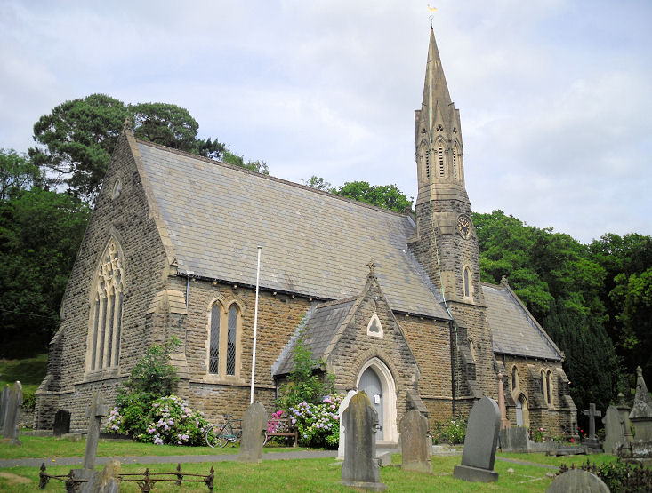
Gelligaer, St. Catwg.
ST 1356 9693. © Gerard Charmley (2011).
Link1.
Link2.
Coflein.
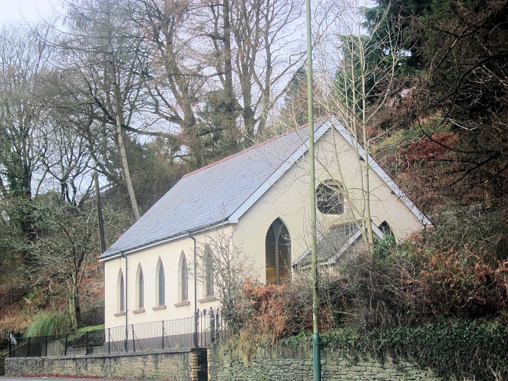
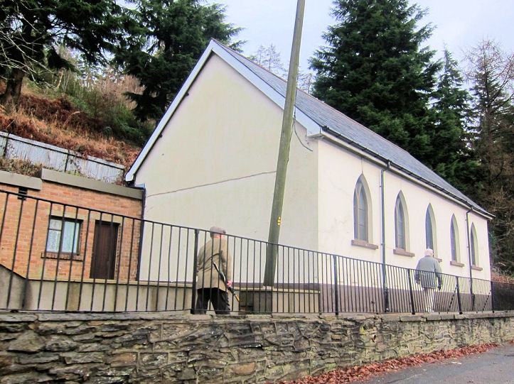
Grade II listed. Horeb
Welsh Baptist Chapel (founded 1848) on Castle Hill.
It now seems to
be closed - see the boarded-up windows in a
2021 Streetview. ST
1364 9698. © Gerard Charmley (2011).
Coflein.
Grade II listed, wherein it's dated to 1848.
Mount Zion Pentecostal
Church on South View Houses, as seen by Streetview in 2021. ST 1365
9683. Somewhat over 1˝ miles to the N.N.W. of the village are the scant
remains of Capel
Gwladys,
which its
Coflein entry (photos
here) states dates from circa 450.
ST 1248 9928.
Gilfach, St. Margaret
of Antioch (dedicated in 1933), as seen by Streetview in 2022. ST 1509
9863.
Link. This
source says that this is the third St. Margaret, the other two both
stood nearby, and both have been demolished. One of these can be located
on older O.S. maps a short distance to the N.E. at ST 1512 9865. The
housing on the site was seen by
Streetview in 2022.
Ainon Baptist Church is on Maes-Y-Graig
Street, and was seen by
Streetview in 2021. It has a date-stone for 1902. ST 1518 9851. A
Congregational Chapel used to stand on
Gwerthonor Road. Map evidence shows it was built between 1901 and 1919.
Its Coflein entry calls it Tabernacl Independent Chapel, and says
it was closed "by 1997", but I suspect several decades earlier, as it
isn't labelled as a place of worship on a map of 1965.
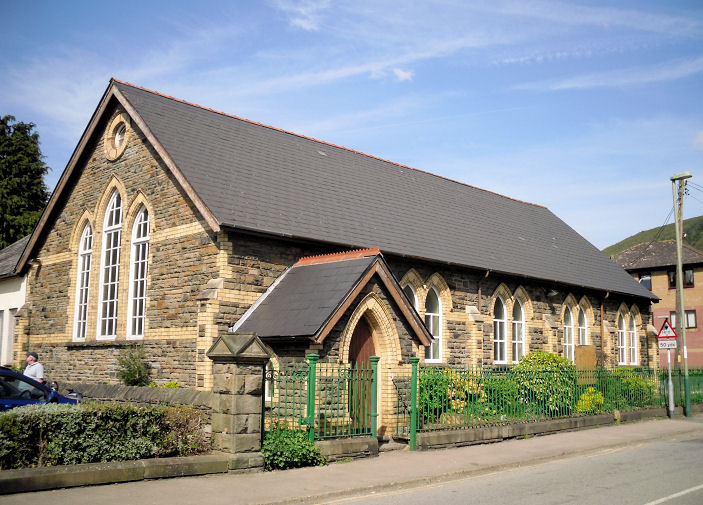
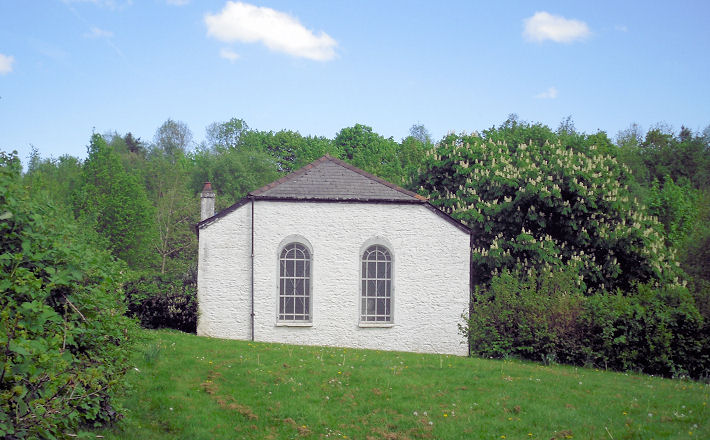
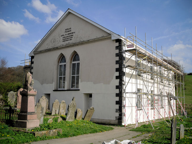
Groes-Wen, Groeswen Independent Chapel. Gerard advises that it is one of the oldest Non-Conformist chapels
in South Wales. Coflein says it was "first built in 1742", with
subsequent re-builds and enlargements. Another view. The white building is part of the original structure.
ST 1280 8700. Both © Gerard
Charmley.
Grade II* listed.
Hengoed,
Baptist Chapel, set well back from Hengoed Road. It bears the dates 1710 and 1829.
ST 1482 9540.
© Gerard Charmley (2011).
Coflein.
Grade II listed.
Llanbradach.
Llanfabon, St. Mabon.
Coflein
describes it as a
re-build of 1847 of a medieval predecessor. ST
1084 9384. © Gerard Charmley (2011).
Grade II listed. A
grade II listed memorial in the churchyard commemorates the nearly
300 who perished in the
Albion Colliery disaster in 1894.
Machen, St. John the Baptist
(CiW).
Its
Coflein entry dates it to 1854-5. ST 2126 8930. © Gerard Charmley
(2010).
Link.
Grade II listed. The war memorial in the churchyard is also listed,
as
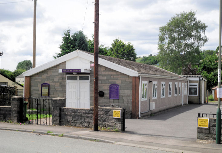
grade II. Emmanuel Church
(Assemblies of God) on Forge Road. ST 2102 8912.
© Gerard Charmley (2010).
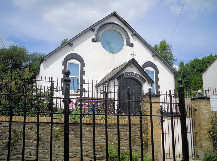
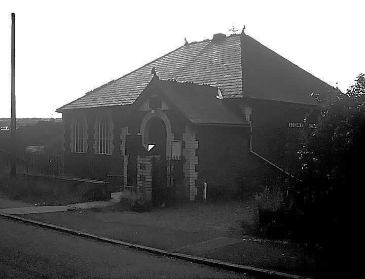
Ebenezer
Evangelical Baptist Church on Wyndham Street.
According to
Coflein, the first chapel on the site dates from 1820, but was
re-built in 1851 and again in circa 1900, with closure and conversion
"by 1997". ST 2107 8930.
© Gerard Charmley (2010). Of the demolished Siloam Chapel, nothing remains except the vestry. © Gerard
Charmley (2011). Siloam Chapel itself stood
on Commercial Road at ST 2098 8921. The car park on its site was seen by
Streetview in 2023.
A Methodist Chapel used to stand in the
interior corner of a corner plot on Crown Street and Commercial Road.
I've been unable to discover which flavour of Methodism it was, but it
pre-dated a map of 1901 and remained active until the mid-20th century
at least.
Coflein dates it to 1882. Demolished, it stood about where the
middle house is of the three seen
here in a Streetview
from 2023. ST 2171 8898. Also marked on older O.S. maps is an
Independent Chapel at the corner of Wyndham
Road and Lewis Street. Other than the map evidence which shows that it
was built before 1901, and was probably still active in 1964, I've been
unable to discover any material pertaining to this chapel. The middle
and right hand houses seen in a
Streetview of 2023
stand on the site. ST 2114 8931.
Maesycwmmer.
Mynyddislwyn, St. Tudor
(CiW).
Coflein says it was severely damaged in a fire in 1800, and was
"largely rebuilt
and expanded in 1819-20".
ST 1934 9391. © Gerard Charmley (2011).
Link.
Grade II* listed. The lych-gate is also listed, as
grade II. New Bethel (U.R.C.),
about a mile north of St. Tudor.
Coflein
dates it to 1765, but its
grade II listing agrees that the first chapel was of 1765, but it
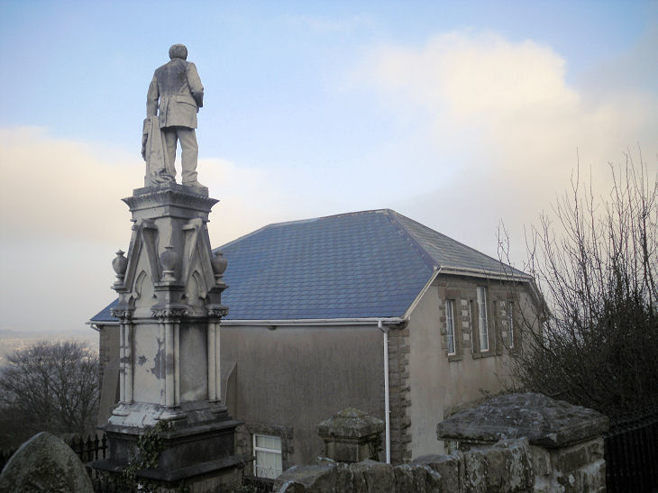
was re-built in 1855. Another view. The
statue looking down is of James Thomas, a local mine-owner, who attended
this chapel. ST 1922 9542. Both
© Gerard Charmley (2011). Numerous churchyard monuments are also listed
- see
here.
Nelson, the Parish Church,
St. John the Baptist.
Coflein dates it to 1887-9, with the tower added in 1904. ST 1105 9554. © Gerard Charmley (2011). Link.
Bethel Evangelical Church
on Heol Fawr.
Coflein,
which calls it Ebenezer (as do older O.S. maps), says it's the third
chapel on the site, dating from 1874, with predecessors of 1831 and
1796. However, the current church website
history
page says that the first chapel of 1832 still survives as the
adjacent Sunday school and vestry (2021
Streetview, Bethel at the right). ST 1149 9520. © Gerard Charmley (2011). Link.
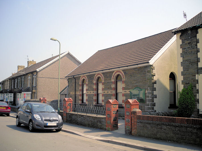
Salem Methodist Church
on High Street.
Older maps show it to have been Primitive Methodist.
It's dated by
Coflein
to 1894, a re-build of an earlier chapel of 1859. Streetviews show that between 2016 and 2021 it was closed, and
became the premises of a funeral director. ST 1119 9557. © Gerard
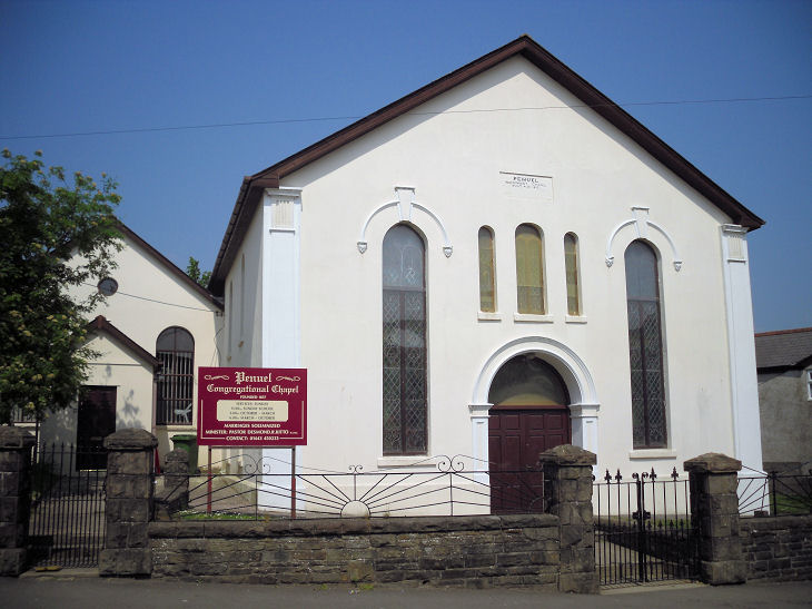
Charmley (2011). Penuel Congregational
Church (1857) on High Street has a date-stone for 1857. ST 1112 9553. © Gerard Charmley
(2011).
Coflein. Calfaria
Baptist Church on Wern Crescent.
Coflein
gives a date of 1878. ST 1141 9552. © Gerard Charmley (2011).
New Tredegar.
Newbridge.
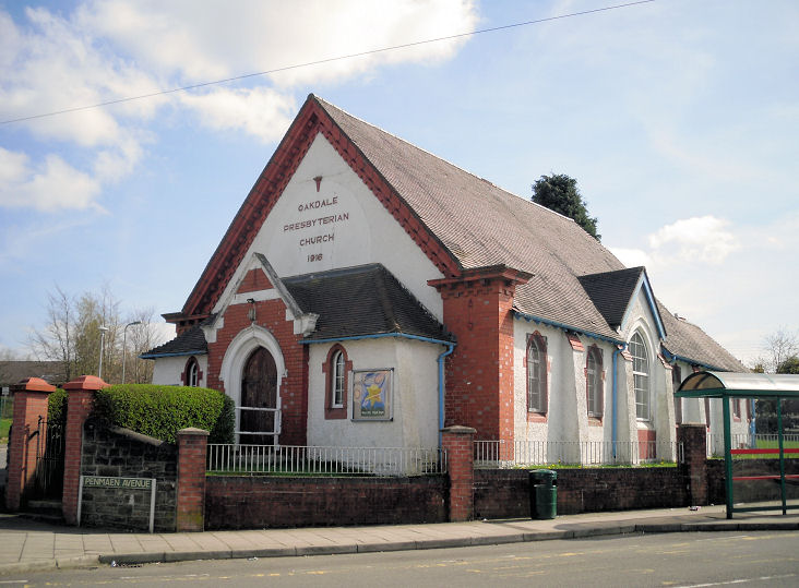
Oakdale (including
Penmaen), St. David (CiW)
on Central Avenue, Penmaen, as seen by Streetview in 2021. ST 1837 9820.
Link.
Coflein. The Presbyterian Church (1916)
on Penmaen Avenue and Maesygarn Road. ST 1882 9861. © Gerard Charmley
(2011).
Link.
Coflein. Baptist Church
on Markham Crescent. Its brief
Coflein entry dates it to the early 20th century. ST 1847 9849.
© Gerard Charmley (2011).
Methodist Church on
Central Avenue and Kincoed Road. At some point before 2021 (Streetview)
it had become Oakdale Christian Centre. ST 1850 9826.
Coflein says it was built as Wesleyan in the early 20th century. © Gerard Charmley (2011).
Link.
Penamen Independent Chapel
on Oakdale Terrace. Its
Coflein entry dates it to a re-build in 1828 of an earlier chapel of
1694. ST 1817 9773. © Gerard Charmley (2011).
Pengam, the
former Capel y Bont Baptist
Chapel (now a private residence) on Commercial Street has dates 1857 and 1865.
ST 1551 9730. © Gerard Charmley (2011). The chapel had been re-painted a
rather fetching blue by 2022 (Streetview).
Ebenezer English Baptist
Chapel (1907) on River Terrace.
ST 1543 9751. © Gerard Charmley (2011).
Link. The chapel has been considerably extended and refurbished as
this photo of 1988 (©
Bruce Cunningham) shows. A former chapel on Station Road, Glan Y Nant - Janet Gimber advises that this was Nazareth
Methodist Chapel.
ST 1507 9751. © Gerard Charmley (2011).
Penmaen - see Oakdale,
above.
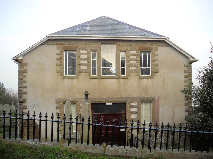
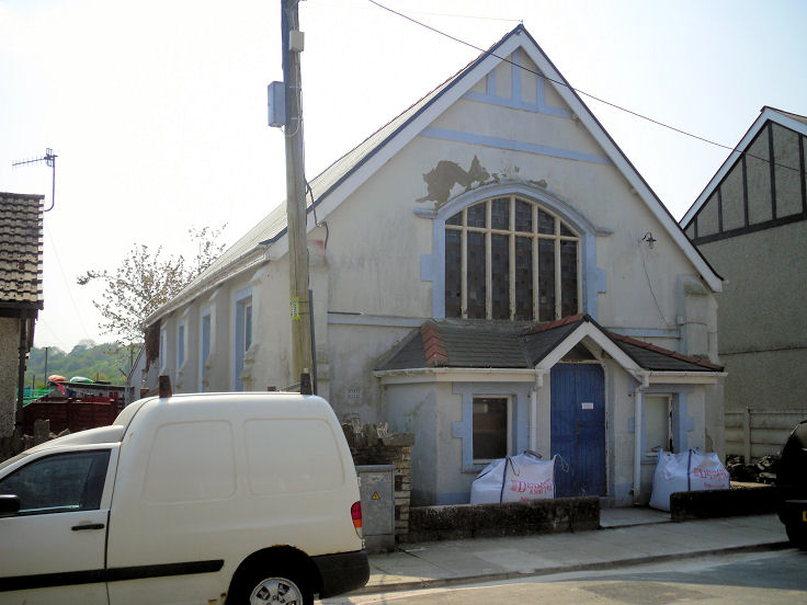
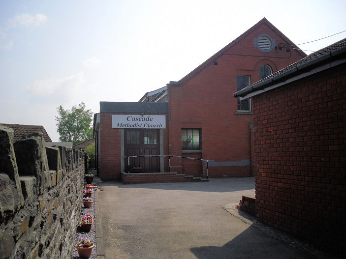
Penpedairheol, Cascade Methodist Church,
off Pengam Road. ST 1429 9752. © Gerard Charmley (2011).
Link.
Penybryn, Calvary
Evangelical Church. © Gerard Charmley (2011).
Pontllanfraith.
Pontlottyn.
Pont-y-mister - see the
Risca and Pont-y-mister page.
Rhudry - see Rudry.
Rhymney.
Risca and Pont-y-mister.
Rudry (or Rhudry), St. James. © David Gallimore. Another view. © Gerard
Charmley (2010). Link. Former Ebenezer English
Congregational Church, now in residential use. © Gerard Charmley (2010).
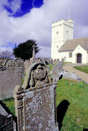
Senghenydd, St.
Peter and St. Cenydd (CiW, originally St. Peter) on Commercial Street.
ST 1182 9045. © Gerard Charmley.
Link. Older O.S. maps show a church of St.
Genydd (with a "G") on the Caerphilly Road at ST 1192 9033. Built
between 1898 and 1915 (from the revision dates of maps of 1901 and
1920), it remained active at least into the mid-20th century.
Genuki mentions baptism records for 1909-1947. Demolished at some
point, flats now stand on the site, seen by
Streetview in 2023.
U.R.C. on Commercial
Street, marked on older maps as Congregational. ST 1176 9049. © Gerard Charmley. The former
Ebenezer Baptist Church
on Caerphilly Road,
now flats. ST 1201 9011. © Gerard Charmley (2011). The former Seion Wesleyan Chapel
on Caerphilly Road, now a private residence. ST 1196 9017. © Gerard Charmley.
Salvation Army Hall on
High Street. Old maps show that Capel Salem used to stand here. ST 1168
9078. © Gerard Charmley (2011). An earlier S.A.
Hall stood just east of the southern end of Clive Street. So
marked on the 25" O.S. map of 1920, the 6" map of 1901 labels it as
Chapel. The house
on the site today was seen by Streetview in 2021. ST 1177 9070. The former
St. Peter on Gelli
Terrace. The 25" O.S. map of 1920 labels it as R.C. Ch. Other
maps suggest it was active at least into the mid-20th century. ST 1205
9005. © Gerard Charmley.
Gerard believes
this
site, on a small piece of land bounded by Cross Street, High Street
and Stanley Street,
is where
the demolished Noddfa
Welsh Congregational Chapel
stood. ST 1163 9088. © Gerard Charmley (2011). There
was certainly a Capel here, though otherwise unidentified on
available maps, but Noddfa's
Coflein entry (which
provides dates of 1898 to mid-20th century) locates it on a different
site, at ST 1171 9066, on Commercial Street and Caerphilly Road. There
was also certainly a Capel here, again unidentified on available
maps, and this site was seen by
Streetview in 2023.
Can you clarify this confusion? Another so far unidentified
Chapel stood on Stanley Street at ST 1163
9083. In this 2023
Streetview, the chapel stood at the left hand side of the car park.
Trethomas, St. Thomas' Christian Centre (CiW)
on Heol Yr Ysgol. ST 1797 8878. © Gerard Charmley (2010).
Link. Trethomas Christian
Fellowship on Standard Street. ST 1820 8899. © Gerard Charmley
(2010). Link. Unidentified
church on
Navigation Street - Howard Richter has advised that this church (at ST 1808 8879) was Bethany (Assemblies of God) Pentecostal in 1960-2, and Pentecostal
in 1970-3. It seems to be the same building marked as Meth Chap
on a map of 1960, and called by Coflein Roman Catholic (here),
Primitive Methodist (here),
and Pentecostal (here). © Gerard Charmley (2010). Howard has also advised that this former
chapel
at ST 1818 8872 (now a nursery), was Penuel Welsh Congregational Chapel. © Gerard Charmley (2010).
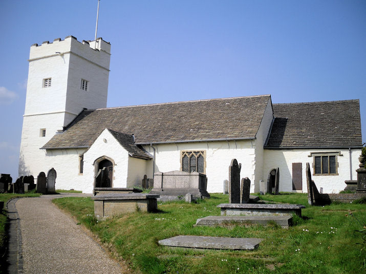
Ynysddu, St. Theodore (CiW).
It's dated by Coflein
to 1925. ST 1823 9220. © Gerard Charmley (2011).
Link. An otherwise unidentified Chap.
shows on the 6" O.S. map of 1901 at ST 1792 9282. In a
2023 Streetview, its
site lies beneath the parked vehicles behind the "Select" sign.
Coflein identifies it
as Methodist, of 1895, and
says that in 2002 it "appeared to be in use as a chapel".
Capel Twyn-gwyn shows on old maps at ST
1827 9273. Converted to residential use,
Streetview saw it,
and the attached burial ground, in 2023.
Its
Coflein entry dates it to 1829, with conversion "by 1997".
Sardis Chapel, which has a date-stone for
1909, stands on an apparently un-named side road off High Street, at ST
1801 9241. A
news article says it was U.R.C. in 2000.
Streetview saw it in
2023.
Ystrad Mynach, Holy Trinity
(CiW, on Cedar Way), which
Coflein dates to 1855-6. ST 1439 9416. © Gerard Charmley (2011).
Link.
Grade II listed. Shiloh
Bapist Chapel on Oakfield Street. ST 1460 9438. © Gerard Charmley
(2011).
Coflein.
Bethany U.R.C. on Lisburn Road. ST 1442 9430. © Gerard Charmley
(2011). Bryn
Seion Baptist Chapel on Lisburn Road.
Coflein dates it to the mid-19th century, but it doesn't appear on a
map of 1901. ST 1450 9431. © Gerard Charmley (2011).
Lewis Street Methodist Church. ST 1443 9443. © Gerard Charmley (2011).
Link.
The former
Moriah Independent
Chapel (2010 Streetview). ST 1471 9449.
Link.
English Baptist Mission
(2021 Streetview) is on Central Street. ST 1447 9424.
Link.
|
|